
City of Burlington Comprehensive Development Ordinance
Article 1General Provisions
§ 1Introduction
This Article of the Burlington Comprehensive Development Ordinance explains the City’s authority to enact zoning and other development bylaws, and describes the process by which these regulations are prepared and modified.
Part 1General Provisions
§ 1.1.1Title
This Appendix shall be known, and may be cited, as the Burlington Comprehensive Development Ordinance and/or the Burlington Zoning and Subdivision Ordinance.
§ 1.1.2Intent and Purpose
It is the intent and purpose of this ordinance:
to encourage the use and development of lands in Burlington in a manner which will promote the public health, safety and welfare;
to implement the goals of the Burlington Municipal Development Plan;
to protect agricultural, forest and other environmentally significant lands;
to facilitate the growth of Burlington and its neighborhoods so as to create an optimum environment, with good urban and civic design;
to encourage appropriate architectural design and the conservation and protection of historic resources;
to encourage the conservation, utilization and development of renewable energy resources;
to encourage development of a rich cultural environment and to foster the arts.
to encourage the continued economic growth and vitality of the city; and
to create a model city for people to live and work in.
§ 1.1.3Authority
This ordinance is adopted pursuant to the authority contained in the Vermont Municipal and Regional Planning and Development Act, also designated as Title 24, V.S.A. Chapter 117. Whenever any provision of this ordinance refers to or cites a section of Title 24 V.S.A. Chapter 117, and this section is later amended or superseded, this ordinance shall be deemed to refer to the amended section or the section that most nearly corresponds to the superseded section.
§ 1.1.4Jurisdiction
This ordinance shall be effective for all land within the City of Burlington, VT.
§ 1.1.5Relationship to Existing Regulations
To the extent that the provisions of this ordinance are the same in substance as the previously adopted provisions that they replace in the city’s zoning and/or subdivision regulations, they shall be considered as continuations thereof and not as new enactments unless otherwise specifically provided. In particular, a situation that did not constitute a lawful, nonconforming situation under the previously adopted zoning ordinance does not achieve lawful nonconforming status under this ordinance merely by the repeal of the zoning ordinance or other applicable regulations. Likewise, any situation for which a lawful zoning permit was not obtained under the previously adopted zoning ordinance shall be deemed to be in violation of this ordinance.
§ 1.1.6Relationship to Municipal Development Plan
It is the intention of the city council that this ordinance implements the planning policies adopted for the city as reflected in the Municipal Development Plan as the same may be amended from time to time as well as other planning documents adopted by the city. While the city council reaffirms its commitment that this ordinance and any amendment to it be in conformity with its planning policies, the city council hereby expresses its intent that neither this ordinance nor any amendment to it may be challenged on the basis of any alleged nonconformity with any planning document.
§ 1.1.7No Use of Land or Buildings Except in Conformity With Ordinance
Except as otherwise provided in this ordinance, no person may use or occupy any land or buildings or authorize or permit the use or occupancy of land or buildings under his or her control except in accordance with the applicable provisions of this ordinance. For purposes of this section, the “use” or “occupancy” of a building or land relates to anything and everything that is done to, on, or in that building or land.
§ 1.1.8Greater Restrictions
Where this ordinance imposes a greater restriction upon the use, height, setback and the area of structures or the use of premises or the intensity of development than is imposed by other ordinances, the provisions of this ordinance shall control. Where one provision of this ordinance conflicts with another provision within this ordinance, the more restrictive shall apply unless otherwise specified.
§ 1.1.9Severability
It is hereby declared to be the intention of the city council that if any article, part, section, paragraph, sentence, clause or phrase of this ordinance is declared unconstitutional or otherwise invalid by any court of competent jurisdiction in a valid judgment or decree, such unconstitutionality or invalidity shall not affect any of the remaining articles, parts, sections, paragraphs, sentences, clauses, or phrases of this ordinance.
§ 1.1.10Computation of Time
Where an event is required or permitted to occur by this ordinance before, on, or after a specified period of time measured from another event, in calculating the period:
The first day shall not be counted;
The final day shall be counted; and
Weekend days and holidays shall be counted.
§ 1.1.11Warning of Disclaimer of Liability
These regulations shall not create any liability on the part of the city, its officials, agents, employees, or representatives including but not limited to any liability for any damages or other legal remedy or any equitable remedy claimed to have accrued as a result of reliance on this ordinance or any determination/decision lawfully made there under.
§ 1.1.12Effective Date
The provisions in this ordinance were originally adopted on 7 January 2008 and became effective on 30 January 2008.
Part 2Amendment and Adoption Procedures
§ 1.2.1Purpose
The intent of this Part is to set forth the procedures to be followed when amendments are proposed to the text of this ordinance or to the zoning map.
§ 1.2.2Amendment Preparation
Any amendment to the City of Burlington’s zoning ordinance shall be prepared by or at the direction of the planning commission and shall have the purpose of implementing the Municipal Development Plan as the same may be amended from time to time or as otherwise authorized by statute. An amendment of this ordinance may be prepared by the commission, or any other person or body pursuant to Sec. 1.2.3 below.
§ 1.2.3Amendment by Others
Proposed amendments prepared by a person or body other than the planning commission shall be submitted in writing along with any supporting documents to the planning commission. The planning commission may then proceed under this article as if the amendment had been prepared by the commission.
§ 1.2.4Amendment by Petition or Requested by the City Council
If a proposed amendment is requested by the city council and/or is supported by a petition signed by not less than five percent (5%) of Burlington voters, the commission shall correct any technical deficiency and shall, without otherwise substantively changing the meaning or intent of the amendment, promptly proceed in accordance with this article as if it had been prepared by the commission.
§ 1.2.5Planning Commission Report
When considering an amendment to this ordinance, the planning commission shall prepare and approve a written report on the proposal. The report shall provide a brief explanation of the proposed bylaw, amendment, or repeal and shall include a statement of purpose as required for notice under 24 VSA §4444, and shall include findings regarding how the proposal:
Conforms with or furthers the goals and policies contained in the municipal plan, including the effect of the proposal on the availability of safe and affordable housing.
Is compatible with the proposed future land uses and densities of the municipal plan.
Carries out, as applicable, any specific proposals for any planned community facilities.
§ 1.2.6Public Hearing by Planning Commission
The planning commission shall hold at least one public hearing within the municipality after public notice on any amendment proposed by the city council, the planning commission or by petition.
§ 1.2.7Notice to Municipalities and Agencies
At least fifteen (15) days prior to the first public hearing, a copy of the proposed amendment and any written report shall be delivered with proof of receipt, or mailed by certified mail, return receipt requested, to each of the following:
The chairs of the planning commissions of Colchester, South Burlington and Winooski;
The executive director of the Chittenden County Regional Planning Commission; and
The Department of Housing and Community Affairs within the Vermont Agency of Development and Community Affairs.
Any of these bodies may submit comments on the proposed bylaw or amendment to the commission, or may be heard in any proceeding with respect to the adoption of the proposed bylaw or amendment.
§ 1.2.8Submission to the City Council
The planning commission may then make revisions before submitting the proposed bylaw or amendment and the written report to the city council. If requested by the city council, or if a proposed amendment is supported by a petition as outlined in Sec 1.2.4 above, the planning commission shall promptly submit the amendment, with changes only to correct technical deficiencies, to the city council, together with any recommendation or opinion it considers appropriate. Simultaneously with the submission, the planning commission shall file with the city clerk a copy of the proposed bylaw or amendment and the written report for public review.
§ 1.2.9Public Hearing Notice Contents
Where a public hearing is called concerning an amendment to this ordinance, the planning commission shall publish and post either the full text of the proposed material or a notice including:
A statement of purpose;
The geographic areas affected;
A table of contents or list of section headings; and
A description of a place within the municipality where the full text may be examined.
No defect in the form or substance of any public hearing notice shall invalidate an amendment to this ordinance. However, the action shall be invalidated if the notice is materially misleading in content or fails to include one of the elements required by this section or if the defect was the result of a deliberate or intentional act.
§ 1.2.10Public Hearing by City Council
Not less than fifteen (15) nor more than one hundred twenty (120) days after a proposed amendment or bylaw is submitted to the city council, the city council shall hold the first of one or more public hearings, after public notice, on the proposed amendment or bylaw and shall make copies of the proposal and any written report of the planning commission available to the public upon request. Failure to hold the public hearing within one hundred twenty (120) days shall not invalidate the adoption of the bylaw or amendment or the validity of any repeal.
§ 1.2.11Changes by City Council
The city council may change the proposed amendment, but shall not do so less than fourteen (14) days prior to the final public hearing. If the city council at any time makes substantial changes in the concept, meaning, or extent of the proposed amendment, it shall warn a new public hearing or hearings under Sec. 1.2.10. If any part of the proposal is changed, the city council, at least ten (10) days prior to the hearing, shall file a copy of the changed proposal with the city clerk and with the planning commission. The planning commission shall amend the report pursuant to Sec. 1.2.5 to reflect the changes made by the city council and shall submit that amended report at or prior to the public hearing.
§ 1.2.12Routine Adoption
Except as provided in Sec. 1.2.13 and 1.2.14 below, an amendment shall be adopted by a majority of the members of the city council at a meeting that is held after the final public hearing, and shall be effective twenty-one (21) days after the same has been approved by the Mayor or adopted notwithstanding the Mayor’s veto and published in a newspaper of general circulation within the City.
§ 1.2.13Popular Vote
Notwithstanding Sec. 1.2.12 above, a vote by the city council on an amendment or bylaw shall not take effect if five percent (5%) of Burlington voters petition for a meeting of the municipality to consider the bylaw or amendment, and the petition is filed within twenty (20) days of the vote. In that case, a meeting of the municipality shall be duly warned for the purpose of acting upon the bylaw or amendment by australian ballot.
§ 1.2.14Time Limit for Adoption
If the proposed amendment or bylaw is not approved or rejected within one year of the date of the final public hearing of the planning commission, it shall be considered disapproved unless five percent (5%) of Burlington voters petition for a meeting of the municipality to consider the amendment or bylaw, and the petition is filed within sixty (60) days of the end of that year. In that case, a meeting of the municipality shall be duly warned for the purpose of acting upon the bylaw or amendment by Australian ballot.
§ 1.2.15Repeal
Repeal of this ordinance or any of its provisions shall follow the same procedures as an amendment to this ordinance.
Article 2Administrative Mechanisms
§ 2Introduction
This Article of the Burlington Comprehensive Development Ordinance establishes the appointment, authority, and administrative procedures for the various review boards and the administrative officer.
Part 1General Administrative Provisions
§ 2.1.1Intent
The administrative provisions delineated herein are intended to set forth rules and procedures pertaining to the following: planning commission, development review board, administrative officer, design advisory board, conservation board, and technical review committee. Each listed commission and board may adopt and enforce supplemental rules and procedures which are consistent with the terms of this article.
§ 2.1.2Notice of Meetings/Minutes
Meetings shall be noticed and minutes thereof shall be prepared and kept in accordance with the specifications of the then current version of Vermont’s Open Meeting Law. The minutes shall be made available for public inspection during normal business hours at the department of planning and zoning. Any person shall have the right to a reproduction of the minutes, either in draft form or in final form. Draft minutes shall not be considered official until formally approved. Such person may be charged a reasonable fee for the reproduction of the minutes in an amount sufficient to cover the cost of reproduction.
§ 2.1.3Quorum
A quorum shall consist of a majority of the commission or board membership, excluding vacant seats.
§ 2.1.4Executive Sessions
Executive Sessions shall be governed by the provisions of said Open Meeting Law.
§ 2.1.5Conflicts
In order to secure, protect, and preserve the highest level of public trust in the deliberations and decisions of boards and commissions, it is incumbent upon each member not only to scrupulously avoid any act which constitutes a conflict of interest established in law but also to avoid any act which gives the appearance of a conflict of interest. The provisions of Section 133 of the city charter as the same may be amended from time to time shall be fully applicable. In the event of any conflict between the requirements of Section 133 of the city charter and the provisions hereof, Section 133 shall be controlling. Additionally, a member shall withdraw from all participation, including all formal and informal discussion and voting, in any deliberation of a board or commission, or any of its committees, or from any issue upon declaration of a conflict of interest, or upon the determination by a majority of the body excluding the member in question that there is a reasonable public perception that a conflict of interest exists, and also if:
the matter involves the member's own official conduct;
participation in the matter would violate of a member's code of professional responsibility; or
the member has such close personal ties to the applicant or other participant in the proceedings that the member cannot reasonably be expected to exercise sound judgment in the public interest.
§ 2.1.6Ex Parte Communication
When operating in a quasi-judicial capacity, no member shall communicate, directly or indirectly with any applicant, except in the presence of staff or at board or commission meetings, which have been properly noticed.
Part 2Planning Commission
§ 2.2.1Authority
There shall be a planning commission (or commission) created pursuant to the city charter and 24 V.S.A. Section 4321.
§ 2.2.2Composition and Terms
The planning commission shall consist of seven (7) members who shall be residents of the city. Planning commission members shall be appointed for three (3) year staggered terms by the city council with mayor presiding. Any member may be removed by the city council with mayor presiding pursuant to city charter Section 129 as the same may be amended from time to time. Vacancies in these offices may be filled for the unexpired terms only by the city council with mayor presiding or otherwise pursuant to law.
§ 2.2.3Voting
Any action of the planning commission shall be taken by a majority of the commission members. All votes of the commission shall be recorded in the minutes of the meeting, indicating the vote of each member if a roll call is requested by a member. Abstentions shall not be permitted in a roll call vote unless a conflict of interest in present.
§ 2.2.4Organization
At its first meeting in July of each year, the commission shall, by majority vote of its members (excluding vacant seats,) elect one of its members to serve as chairperson and one member to serve as vice-chairperson. The commission shall also select a clerk who shall be either a commission member or city employee.
§ 2.2.5Powers and Duties
The planning commission shall exercise all duties specified in 24 VSA Ch.117, as well as any duties specified in the city charter or appropriately requested of it by the mayor or city council.
Part 3Administrative Officer
§ 2.3.1Authority
This part is enacted under the provisions of 24 V.S.A. Section 4448.
§ 2.3.2Appointment
The city’s zoning administrative officer (ZAO or administrative officer), upon the recommendation of the planning commission, shall be appointed by the legislative body for a term of three years. The ZAO may be removed for cause at any time by the legislative body after consultation with the planning commission.
§ 2.3.3Powers and Duties
The administrative officer shall administer the provisions of this ordinance and any amendments thereto and other applicable bylaws literally, and shall have no power to permit any land development that is not in conformance with this ordinance.
Referrals.
The administrative officer may refer questions of interpretation to the DRB if it is determined that the answer to the question has a bearing upon the jurisdiction of the DRB. Any such referral shall be considered an appeal of a decision of the administrative officer.
Zoning Enforcement.
The administrative officer shall have ultimate responsibility for all matters relating to the enforcement of the zoning ordinance pursuant to Part 7 of this article. While protocols may be adopted by which the city’s code enforcement office assists in zoning enforcement, the administrative officer shall retain the exclusive jurisdiction to make administrative interpretations (subject to appeal) concerning the terms of such ordinance.
Assistant Administrative Officers
One or more assistant administrative officers may be appointed by the ZAO and shall have such authority and duties as shall be delegated to them by the ZAO.
§ 2.3.4Issuance of Zoning Permits
The administrative officer shall be authorized to issue zoning permits, including certificates of appropriateness, in accordance with the provisions of this ordinance. If the administrative officer fails to act with regard to a complete application for a permit within 30 days, whether by issuing a decision or by making a referral to the appropriate municipal panel, a permit shall be deemed issued on the 31st day.
§ 2.3.5Appeal of Administrative Decisions/Determinations
Any decision or act taken by the administrative officer made under this Article may be appealed to the development review board as specified under the requirements of Article 12.
§ 2.3.6Issuance of Certificates of Occupancy
Only the administrative officer shall be authorized to issue certificates of occupancy in accordance with the provisions of this ordinance.
Part 4Development Review Board
§ 2.4.1Authority
There shall be a Development Review Board (DRB or board) created pursuant to 24 V.S.A. Section 4460.
§ 2.4.2Composition and Terms
The DRB shall consist of seven (7) members and two (2) alternates who shall be residents of the city. To the extent possible, members appointed to the board are encouraged to be professionals from any of the following or related fields: architecture, architectural history, landscape architecture, engineering, law, planning, contracting, archaeology, or real estate development.
DRB members and alternate members shall be appointed by the city council with mayor presiding to three (3) year staggered terms. Alternates may be assigned to serve in situations when one or more members of the board are disqualified or are otherwise unable to serve. Vacancies shall be filled by the city council for the unexpired terms and upon the expiration of such terms. All members shall continue to serve until a successor is appointed and qualified.
Any member may be removed for cause by the city council with mayor presiding upon written charges and after a public hearing pursuant to city charter Section 129 as the same may be amended from time to time.
§ 2.4.3Rules of Procedure
The DRB shall adopt rules of procedure and rules of ethics with respect to conflicts of interest to guide its official conduct, as required under the 24 VSA §4461(a), and shall conduct its proceedings in accordance with Vermont’s Open Meeting Law.
§ 2.4.4Powers and Duties
The DRB shall have all of the powers and duties as set forth in 24 V.S.A. §4460 to administer the provisions of these regulations, in addition to those specifically provided elsewhere in this ordinance. Such powers of review as described in 24 VSA Chapter 117 include:
Review of right-of-way or easement for land development without frontage;
Review of land development or use within an historic district or with respect to historic landmarks;
Review of land development or use within a design control district;
Review of conditional use applications;
Review of planned unit development applications;
Review of requests for waivers;
Review of proposed subdivisions;
Review of wireless telecommunications facilities;
Appeals from the decision of the administrative officer;
Review of requests for variances;
Review of referrals from the ZAO; and
Any other reviews required or authorized by this ordinance.
§ 2.4.5Use of Alternate Members
Where a board member is unable to hear a particular matter, an alternate will be designated by the Chair to participate in that particular matter. Alternates may also be requested by the Chair to sit for a member if the member is not able to attend meetings on a long term basis (i.e. sabbatical, long term illness, etc.).
§ 2.4.6Transitional Provision
The DRB became effective on October 1, 2000. Any reference in any past or present permit to the “Zoning Board of Adjustment” or to the “Planning Commission” shall be considered a reference to the board, and any and all matters which, prior to such date, would have been considered by the Zoning Board of Adjustment or the Planning Commission (regarding project review and/or permits) shall be considered to be under the exclusive jurisdiction of the DRB.
§ 2.4.7Evidence and Testimony
The DRB, in connection with any of its proceedings, may examine, or cause to be examined, any property, maps, books or records bearing upon the matters concerned in such proceeding, may require the attendance of any person having knowledge of the premises, may take testimony and require proof material for its information, and may administer oaths or take acknowledgement in respect of such matters.
§ 2.4.8Decisions
The DRB may recess its proceedings on any application, pending submission of additional information. It shall close the evidence promptly after all parties have submitted the requested information. It shall adjourn the hearing and issue a decision within 45 days after the adjournment of the hearing. Decisions shall be issued in writing and shall include a statement of the factual bases on which it has made its conclusions and a statement of the conclusions. The minutes of the meeting may suffice, provided the factual bases and conclusions relating to the review standards are provided in conformance with this subsection.
In rendering a decision in favor of the applicant, the DRB may attach additional reasonable conditions and safeguards as it deems necessary to implement the purposes of the 24 VSA Ch. 117, this ordinance and the municipal development plan then in effect.
Within the period set forth in subdivision (a) of this subsection, any decision shall be sent by certified mail to the applicant and the appellant in matters on appeal. Copies of the decision shall also be mailed to every person or body appearing and having been heard at the hearing and a copy of the decision shall be filed with the administrative officer and the city clerk as a part of the public records of the city.
§ 2.4.9Failure to Reach Decision
If the DRB does not render its decision within the period prescribed by Sec. 2.4.8, the board shall be deemed to have rendered a decision in favor of the applicant or appellant, and granted the relief requested as of the first day following such period.
Part 5Advisory Committees
§ 2.5.1Design Advisory Board
Composition and Terms
There shall be a Design Advisory Board (or DAB) consisting of five (5) members and two (2) alternates appointed to staggered three (3) year terms by the city council with mayor presiding. A majority of the members shall be professionals from any of the following fields: architecture, landscape architecture, engineering, planning, contracting, archaeology, or real estate development. To the extent possible, at least two (2) of the members shall be professionals from the disciplines of history, architectural history, architecture or historical architecture. Any appointment to fill a vacancy shall be for the unexpired term. Any member may be removed at any time for just cause by vote of the city council with mayor presiding, for reasons given to the member in writing, and after a public hearing on the issue if the member so requests.
Powers and Duties
In addition to other responsibilities which may by assigned by the city council, the design advisory board shall, upon request of the board or the administrative officer, review requests for certificates of appropriateness in accordance with the design review standards specified in Article 6, and prepare written advice and recommendations to the board. Such projects may include but not be limited to:
Applications involving site plan and design review subject to review and approval by the Board; and,
Applications involving historic buildings or sites; and,
Applications reviewed under the Major Impact (Sec. 3.5.2(b)), Planned Development (Art. 11), and Subdivision (Art. 10) provisions of these regulations.
§ 2.5.2Conservation Board
Composition and Terms
There shall be a conservation board (CB) composed of at least six (6), but not more than nine (9) members, appointed to four (4) year terms by the city council with mayor presiding. All members shall have a demonstrated commitment to environmental conservation. Individuals with training and experience in the following areas will be represented on the conservation board, if at all possible: environmental law, environmental science, civil engineering, and natural resource planning. Any appointment to fill a vacancy shall be for the unexpired term. Any member may be removed at any time for just cause by vote of the city council with mayor presiding, for reasons given to the member in writing, and after a public hearing on the issue if the member so requests.
Powers and Duties
In addition to other responsibilities which may by assigned by the city council, the conservation board shall, upon request of the Board or the administrative officer, participate in the review of those projects which, due to their size or nature of location potentially affect the environmental quality of the city, and prepare written advice and recommendations to the DRB. Such projects may include but not be limited to:
All projects reviewed under the Major Impact (Sec. 3.5.2(b)), Planned Development (Art. 11), and Subdivision (Art. 10) provisions of these regulations;
All projects proposed within the Natural Resource Protection Overlay District; and,
All projects on or within 100 feet of those areas that constitute a unique ecosystem as defined by the Vermont Natural Heritage Program.
The Conservation Board shall participate in review of all projects proposed within the Urban Reserve District in addition to its other duties.
§ 2.5.3Technical Review Committee
Composition
The city's Technical Review Committee (or committee), as established by resolution of the city council on April 21, 1986 shall be composed of those department heads, or their designees, whose departments are or will be significantly affected by major development projects. The administrative officer shall serve as chair of the committee.
Powers and Duties.
The Technical Review Committee may review all Major Impact (Art. 3, Part 5), Subdivision (Art 10) and/or Planned Development (Art. 11) projects at the discretion of the administrative officer either prior to or as soon as practicable following a formal submission of an application. Members of the committee shall provide written comments following such review and indicate for the applicant any and all pertinent regulations and identifiable impacts of the proposed development project. In assessing such impacts, the committee shall consider the cumulative impact of developments on city services and infrastructure within the proceeding twelve (12) month period. The comments of the committee are intended to provide general direction to the applicant and are not deemed binding on either the members of the committee or upon the applicant unless such comments are incorporated into a final decision of the DRB.
Part 6Public Hearing and Public Notice Procedures
§ 2.6.1Intent
The intent of these regulations is to set forth procedures for the notice and conduct of public hearings held to implement the provisions of this ordinance.
§ 2.6.2Public Hearing and Notice
The DRB shall hold a warned public hearing as part of its consideration for all matters involving conditional use review, variances, administrative officer referrals and appeals, final plat review for subdivisions and any other matter as required by this ordinance.
Public Hearing Notice:
A public notice for a warned public hearing shall be given not less than fifteen (15) days prior to the date of the DRB public hearing by means of all of the following:
Publication of the date, place, and purpose of the hearing in a newspaper of general circulation in the City of Burlington.
Posting of the same information in three or more public places within the City, including posting within view from the public right-of-way most nearly adjacent to the property for which an application is made.
Written notification to the applicant and to owners of all properties adjoining the property subject to development, without regard to any public right-of-way. The notification shall include a description of the proposed project and shall be accompanied by information that clearly informs the recipient where additional information may be obtained, and that participation in the DRB proceeding is a prerequisite to the right to take any subsequent appeal.
Public Notice other than for Public Hearings:
Public notice for DRB proceedings regarding all other types of development review not otherwise requiring a public hearing, shall be given not less than seven (7) days prior to the date of the meeting, and shall include, at a minimum, all of the following:
Posting of the date, place, and purpose of the meeting in three or more public places within the City of Burlington.
Written notification to the applicant and to the owners of all properties adjoining the property subject to development, without regard to right-of-way.
The notification shall include a description of the proposed project and shall be accompanied by information that clearly informs the recipient where additional information may be obtained, and that participation in the local proceeding is a prerequisite to the right to take any subsequent appeal.
§ 2.6.3Defect in Notice
No defect in the form or substance of any requirements in Section 2.6.2 above shall invalidate the action taken of the appropriate municipal panel, where reasonable efforts are made to provide adequate posting and notice. However, the action shall be invalid when the defective posting or notice was materially misleading in content. If an action is ruled to be invalid by the environmental court, or by the DRB itself, the action shall be remanded to the DRB to provide new posting and notice, hold a new hearing, and take a new action.
§ 2.6.4Open Hearing
All hearings under this Article shall be open to the public except for executive or closed deliberative sessions called in accordance with Vermont’s Open Meeting Law. No votes or other actions may be taken while in executive or closed deliberative session.
§ 2.6.5Rules of Evidence
The rules of evidence at public hearings under this article shall be the same rules of evidence applicable in contested cases in hearings before administrative agencies as set forth in 3 V.S.A. Section 810. The DRB may examine or cause to be examined any property or information bearing upon the matter(s) concerned in the hearing, require the attendance of persons having knowledge of the premises, take testimony, and administer oaths as further set forth in the Board’s Rules of Procedure created pursuant to Sec 2.4.3.
Part 7Enforcement
§ 2.7.1Purpose
The purpose of this article is to set forth efficient and effective procedures for enforcement of the provisions of this ordinance.
§ 2.7.2Definitions
“Waiver Fee” shall refer to the payment that is made for a person to "waive" or relinquish a specific right (e.g. the right to a hearing) with respect to an action of the court. For purposes of this ordinance, when a party is issued a municipal complaint ticket with a penalty fee and also a waiver fee, that party may consent to no hearing and instead pay only the designated "waiver" fee and send the payment with the ticket form in accordance with the procedures of the Judicial Bureau.
§ 2.7.3Enforcement Officer: Administrative Officer and Designees
Pursuant to the provisions of Sec. 2.3.3, the administrative officer shall have ultimate responsibility for all matters relating to the enforcement of this ordinance. The administrative officer may request other city officials to assist with the enforcement of this ordinance, including planning and zoning staff, staff of the code enforcement office, building inspectors, fire marshal, police officers, staff of the city attorney’s, and/or city constable.
§ 2.7.4Entrance Upon Premises
The administrative officer, as representative of the DRB, may enter upon any land in the city to make examinations and surveys pursuant to 24 V.S.A. Section 4325(9). When entrance upon property is refused or denied, the administrative officer may seek a warrant for the purposes of conducting an examination of the premises. A warrant shall only be requested on the basis of administrative officer observations, when another city official has provided credible information to the administrative officer or upon notification by verified written complaint that a zoning violation allegedly exists.
§ 2.7.5Observation or Complaints of Violations
Upon receipt of a written, signed complaint alleging a violation of this ordinance, the administrative officer shall investigate the complaint, take whatever action is warranted, and, if requested, inform the complainant in writing of actions that have been taken.
The observation of a violation on the part of the administrative officer shall be considered an Investigation, and the alleged violator may be issued a notice of zoning violation or a municipal civil complaint ticket.
§ 2.7.6Persons Liable
The owner, tenant, or occupant of any structure or land or part thereof who participates in, assists, directs, creates, or maintains any situation that is contrary to the requirements of this ordinance, and any architect, builder, contractor, agent, or other person who knowingly participates in, assists, directs, creates, or maintains any situation that is contrary to the requirements of this ordinance, may be held responsible for the violation and suffer the penalties and be subject to the remedies herein provided.
§ 2.7.7Civil Offense, Penalties
A violation of this ordinance shall constitute a civil offense. Once a violation has been determined by the administrative officer, each day that a violation is continued shall constitute a separate offense. If an alleged violation is determined to exist, a formal notification shall be issued in the form of an enforcement action as described below.
Municipal Civil Complaint Ticket:
The administrative officer may issue a municipal complaint ticket for zoning violations with two copies of said ticket to be served either in person or by first class mail to the defendant (one copy shall be retained by the issuing officer and the original shall be filed with the Judicial Bureau). The issuing officer shall follow the procedure set forth by the Judicial Bureau for municipal complaint tickets.
The first offense ticketed for a violation shall be punishable by a fine of one hundred dollars ($100.00), the waiver fee shall be one hundred dollars ($100.00); a second offense ticketed for the same violation shall be punishable by a fine of one hundred and fifty dollars ($150.00), the waiver fee shall be one hundred and fifty dollars ($150.00); a third offense ticketed for the same violation shall be punishable by a fine of two hundred and fifty dollars ($250.00), the waiver fee shall be two hundred and fifty dollars ($250.00). Upon the fourth offense, the city may request that the case be transferred from the Judicial Bureau to the Environmental Court, or any other court of competent jurisdiction.
Enforcement Action:
An enforcement action may be brought for any violation of this ordinance. Pursuant to an enforcement action, any person who violates this ordinance shall be fined not more than the maximum amount authorized by statute for each offense. No action may be brought under this subsection unless the alleged offender has had at least seven (7) days' warning notice by certified mail. An action may be brought without the seven (7) day notice and opportunity to cure if the alleged offender repeats the violation of the by-law or ordinance after the seven (7) day notice period and within the next succeeding twelve (12) months. The seven (7) day warning notice shall state that a violation exists, that the alleged offender has an opportunity to cure the violation within the seven (7) days and that the alleged offender will not be entitled to an additional warning notice for a violation occurring after the seven (7) days. In default of payment of the fine, such person, the members of any partnership, or the principal officers of such corporation, shall each pay double the amount of such fine. Each day that a violation is continued shall constitute a separate offense. All fines collected for the violation of by-laws shall be paid over to the City.
§ 2.7.8Withhold Permit
The administrative officer is authorized to deny all zoning permits or certificates of occupancy for any property with:
an uncorrected zoning violation (i.e. notice of zoning violation and/or municipal
complaint ticket has been issued and is not under appeal);
an expired zoning permit without a final certificate of occupancy; or
an uncorrected violation of Chapter 18, Housing, Art. III, Minimum Standards, of
the Burlington Code of Ordinances, as identified on the property’s most recent rental inspection report (i.e. a notice of violation has been issued and is not under appeal).
Instead of withholding or denying a zoning permit, the administrative officer may grant such permit subject to the condition that the uncorrected zoning or Chapter 18 violation is corrected or the expired zoning permit is closed out with a final certificate of occupancy. Such action(s) shall take place before the issuance of a final certificate of occupancy on the new permit.
§ 2.7.9Processing Fee
If any enforcement action results in the need for a zoning permit for the subject property, the application fee(s) for processing such permit shall be twice the regular application fee charged if the application is made within 7 days of receipt of the violation notice, or triple the regular application fee if the application is made between 7 to 15 days after receipt of the violation notice, or triple the regular application fee plus $75/hour staff time up to $500 worth of staff time if the application is made after 15 days of receipt of the violation notice in order to recoup a portion of the administrative costs associated with the enforcement action. These fees shall be separate from any penalties that may be assessed hereunder
§ 2.7.10Remedies
If any street, building, structure, or land is or is proposed to be erected, constructed, reconstructed, altered, converted, maintained or used in violation of this ordinance, or in violation of one or more conditions of a permit issued under this ordinance, the administrative officer shall institute in the name of the city any appropriate action (see Sec. 2.7.11 below), injunction or other proceeding to prevent, restrain, correct or abate such construction or use, and to prevent, in or about such premises, any act, conduct, business or use constituting a violation.
§ 2.7.11Appropriate Action
The administrative officer shall take the appropriate action, in an effort to remedy a violation(s) of a zoning permit. Such actions may include, but are not limited to any combination of the following:
A new zoning permit;
Referral to the DRB for review;
Immediate removal of the structure;
A denial of a zoning Certificate of Occupancy; and,
Fines, as allowed under law, until the violation is rectified.
§ 2.7.12Administrative Appeal
A decision by the administrative officer pertaining to an alleged zoning violation may be appealed to the DRB in accordance with the provisions of Article 12, provided that such appeal is filed within fifteen (15) days of the administrative officer's written decision.
Article 3Applications, Permits, and Project Reviews
§ 3Introduction
This Article of the Burlington Comprehensive Development Ordinance specifies when a zoning permit is required; the process and requirements for preparing an application; and the various review and approval processes that may be necessary to receive a permit.
Part 1General Provisions and Zoning Permits
§ 3.1.1Purpose
These regulations are enacted to set forth the provisions for the processing and review of all applications for a zoning permit for all development within Burlington.
§ 3.1.2Zoning Permit Required
Except for that development which is exempt from a permit requirement under Sec. 3.1.2(c) below, no development may be commenced within the city without a zoning permit issued by the administrative officer including but not limited to the following types of exterior and interior work:
Exterior Work:
Additions to existing buildings, garages, accessory buildings, or other structures.
Alterations to building elevations/appearances including, but not limited to, re-siding or window replacement (or addition) or other changes that alter trim details or otherwise change the exterior appearance.
Change of use or expansion of use.
Alterations, changes, or modifications to building lots or sites related to site improvements including, but not limited to, increased lot coverage.
Excavation or fill related to site improvements.
Land clearing and development
Tree removal involving six (6) or more trees, each of ten (10) inches or greater in caliper or the removal of ten (10) or more trees, each of which is three (3) inches or greater in caliper during any consecutive twelve (12) month period.
Exterior lighting.
New buildings, garages, sheds, accessory buildings, and other structures.
New or expanded parking areas, driveways, and walkways. Including paving existing gravel surfaces.
Porches, patios, and decks.
Satellite dish antennae over 12 inches in diameter, wireless telecommunications facilities, or other antennae.
Site improvements.
Placement of exterior utility meters and dumpsters.
Swimming pools (installation and removal).
Subdivision of land or any boundary or lot line adjustment between two or more lots.
Permanent handicapped ramps (for temporary ramps installed for fewer than 90 days, see Non-Applicability, All Districts).
Interior work:
Installation of additional kitchen.
Change in use.
Increase or decrease in the number of units.
Exemptions:
The following shall be exempt from the requirements of this Ordinance and shall not be required to obtain a zoning permit:
Exterior modifications to a single family dwelling in a non-design review portion of the RL zoning district lawfully in existence and not on or eligible for listing on the State or National Register of Historic Places. Such an exemption shall not be applicable to any of the following changes, which do require a zoning permit:
Increased lot coverage;
Increased habitable living space;
Changes in setbacks or building footprints; and
Improvements in a Special Flood Hazard Area.
Within any city park within an RCO zone or Civic district, regular tree maintenance and removal not otherwise associated with land clearing for new development or site improvements, and regular turf maintenance including re-grading and reseeding.
Individual tree removal projects that are included under an approved and valid “tree maintenance plan”.
The maintenance or repair of any exterior architectural feature, or its replacement in-kind, which does not involve a change in the location, design, material, or the outward appearance of the feature;
Temporary ramps to serve the handicapped or disabled, for a period of not more than 90 days.
Public utility power generating plants and transmission facilities regulated under 30 V.S.A. §248.
Accepted agricultural and silvicultural practices, including the construction of farm structures, as those practices are defined by the secretary of agriculture, food and markets or the commissioner of forests, parks and recreation, respectively, under 10 VSA §1021(f) and 1259(f) and 6 VSA §4810. Prior to the construction of farm structures the farmer must notify the Administrative Officer in writing of the proposed activity. The notice must contain a sketch of the proposed structure including setbacks.
The temporary stabilization and securing of any structure, site, or building feature required to address an unsafe or dangerous condition which poses an imminent threat to public safety pursuant to a written order of the same issued under the authority of the city building inspector.
Where temporary stabilization is not reasonably available the emergency demolition of any structure, site, or building feature required to address an unsafe or dangerous condition which poses an imminent threat to public safety pursuant to a order of the same issued under the written authority of the city building inspector and with the written concurrence of the city engineer. This exemption does not extend beyond the required demolition, clearing of debris, securing or filling cellar holes, and related erosion control and stormwater management.
All Buildings, as defined in Article 13, of 24 square feet or less and no taller than 15 feet, as long as they are located in compliance with applicable setbacks. This exemption is limited to 1 such structure, or multiple structures in aggregate up to 24 square feet, per property. This exemption does not apply to properties located within the Special Flood Hazard Area.
Children’s play structures.
Seasonal skating rinks
Temporary Structures or Uses as per Sec. 5.1.2 (f).
Urban agricultural exemptions:
Cold frames of 6 feet in height or less. This exemption does not apply to properties located within the Special Flood Hazard Area.
Up to 2 seasonal hoop houses, each 200 square feet or less, without foundations and as long as they are located in compliance with applicable setbacks. This exemption applies only to seasonal hoop houses that are sheathed in translucent plastic or similar material for a maximum of 9 months per year and are maintained in an intact condition. The frame may remain in place year-round. This exemption does not apply to properties located in the Special Flood Hazard Area.
Urban agricultural uses or structures located on building rooftops.
Sale of food produced onsite or at an individual’s community garden plot not to exceed $1,000 per year. Food may be processed within the individual’s residential kitchen.
Family day care homes.
Per Act 45: Sec. 15c. 24 V.S.A. § 4413(g), notwithstanding any provision of law to the contrary, nothing in this ordinance shall prohibit or have the effect of prohibiting the installation of solar collectors, clotheslines, or other energy devices based on renewable resources.
A change in use from one permitted non-residential use to another permitted non-residential use, provided that no development is included, no minimum parking requirement applies, and impact fees are not applicable. This exemption does not apply to uses affected by Article 5, Part 4: Special Use Regulations.
Public art on private property shall not be required to obtain a zoning permit. If the art does not meet the standards below, it shall not be displayed.
The installation meets applicable building code for wind load, structural stability, mounting and any anchoring, to protect public health and safety;
The specific installation shall not be obscene, threatening based on characteristics that are protected under antidiscrimination laws, represent hate, or contain fighting words or incite violence;
If mounted on a historic structure, shall be installed so as to avoid damage to historic materials and shall be removable without causing permanent damage or diminish the integrity of the structure. If mounted to a masonry building, the fasteners shall penetrate mortar rather than masonry units so as to be repairable.
Within the Form Districts, the proposed art may not cause or increase any non-conformity to required dimensional standard under Section 14.4.13, Urban Design Standards (including, but not limited to Façade voids, transparency of glazing) nor under Section 14.3.13 Shopfront (Ground floor façade voids.)
Any public art installation shall not obstruct any path of ingress or egress, nor any identified ADA accessible route.
Any public art installation shall comply with all standards and factors set forth in existing City Bylaws and city and state ordinances.
The creation of new interior finished and habitable space where no change of use or exterior alteration is proposed.
Determination of Non-Applicability:
A determination of non-applicability may be made by the administrative officer and a written decision issued outlining the request of the applicant and that a zoning permit is not required. Photographs of the property shall be required to document the existing condition. The determination may be made and a decision may be issued the same-day, but shall be subject to the appeal period for administrative determinations as outlined in Sec. 3.2.9 and Article 12.
Part 2Applications and Permits
§ 3.2.1Pre-Application Conferences
Applicants for all types of development are encouraged to discuss their proposals with the administrative officer prior to the submission of an application in order to provide the applicant with constructive suggestions prior to the submission, and to generally determine the information and review process that will be required for the issuance of a permit.
Administrative Conference:
An Administrative Pre-Application Conference shall be required for all projects that will require review under the planBTV: Downtown Code (Art. 14), Major Impact (Art 3, Part 5) and/or Planned Development (Art. 11) provisions of this ordinance. This requirement may be waived by the administrative officer if the determination is that the project’s potential impact is insignificant. For all other applications, an Administrative Pre-Application Conference may be scheduled at the request of the applicant.
Technical Review Committee:
At the discretion of the administrative officer, a pre-application review may be scheduled before the city’s technical review committee for any projects that will require review under the Major Impact (Art 3, Part 5), Subdivision (Art 10) and/or Planned Development (Art. 11) provisions of this ordinance, or for any project that, in the opinion of the administrative officer due to its size and/or complexity, would benefit from an informal review by a cross-section of city departments.
Sketch Plan Review:
Upon request of the applicant, or as may be required under Art. 10 - Subdivision or Art. 11 - Planned Development of this ordinance, a Sketch Plan Review may be scheduled before the DRB prior to the submission of an application in order to provide the applicant with constructive suggestions regarding a conceptual development proposal. In order to accomplish these objectives, the applicant shall provide the following:
A brief narrative and preliminary concept showing the locations and dimensions of principal and accessory structures, parking areas, and other planned features and anticipated changes in the existing topography and natural features.
A sketch or map of the area which clearly shows the location of the site with respect to nearby streets, rights-of-way, properties, easements and other pertinent features within 200 feet.
A topographic or contour map of adequate scale and detail to show site topography and the relationship to adjoining properties.
Payment of the applicable Sketch Plan Review fee.
Pre-Application Neighborhood Meeting:
A Pre-Application Public Neighborhood Meeting shall be required for all development involving the construction of five (5) or more dwelling units and/or ten thousand (10,000) s.f. or more of gross floor area of non-residential development in order to allow neighbors to become aware of potential development projects at an early stage of a development’s conceptual design and for applicants to take into consideration neighborhood comments and concerns. Procedures and requirements regarding matters including but not limited to scheduling, location, public notice, and documentation shall be set forth by the department of planning and zoning.
§ 3.2.2Application Types and Submission Requirements
Depending on the scale, complexity, and location of the zoning request, and the applicable review process, different types of applications are necessary with respect to the implementation of this ordinance. Requirements for all applications subject to the planBTV: Downtown Code can be found under Sec. 14.7.1.
Basic Zoning Applications:
A Basic Zoning application is necessary for those requests pertaining to single-family dwellings on conforming lots located in a non-design review portion of a RL zoning district as defined in Sec.4.4.5.
Submission requirements for all Basic Zoning Applications shall include the following:
A completed application form signed by the property owner along with the applicable fee;
Photographs of the subject property;
A site plan which shall include the following as applicable:
Identifying information including the record owner of land, north arrow, date (including any revision dates) and scale (recommended at not smaller than 1 inch equals 40 feet);
Property lines and abutting streets;
Rights of way or easements affecting the property;
Existing and proposed lot coverage (in square feet) of all structures and hard surfaces;
Existing and proposed setbacks to property lines and/or public rights-of-way;
Existing and proposed contours at no more than 5-foot intervals;
Location of existing and proposed utilities and facilities (water, sewer, electric, telephone, fire hydrant);
Building height and how measured (refer to Sec. 5.2.7);
Indicate that parking complies with the standards in Article 8, and the type of barriers used to define parking areas (railroad ties, curbs, etc.); and,
Applicable zoning overlay districts as defined in Article 4, Part 5.
The issuance of a zoning permit pursuant to Sec. 3.2.9 for a Basic Zoning application requires administrative review and approval pursuant to Sec. 3.2.7 based on conformance with the applicable district use and dimensional standards found in Art. 4 and parking requirements found in Art. 8.
Depending on the nature, location, type, use, and/or size of the proposed development, the review and approval may also be subject to additional review and submission requirements pursuant to Articles 3, 4, and 5.
Awning and Fence Applications:
Separate applications are necessary for those requests pertaining to awnings that do not include a sign, and fences. Application requirements and regulations pertaining to awnings involving a sign can be found in Article 7 – Signs.
Awnings: Submission requirements for awning applications shall include the following as applicable:
A completed application form signed by the property owner along with the applicable fee;
A sketch of the proposed awning(s) indicating dimensions, material, color, lettering, etc;
Dimensions, locations, and photographs of all existing awnings that will remain;
Method of illumination (include specifications and placement of lighting devices) (See applicable lighting regulations in Sec. 5.5.2); and,
Material swatch or sample.
Fences: Submission requirements for all fence applications shall include:
A completed application form signed by the property owner along with the applicable fee;
A Site plan including the following as applicable:
Identifying information including the record owner of land, north arrow, date (including any revision dates) and scale (recommended at not smaller than 1 inch equals 40 feet);
Lot dimensions and location of property lines and abutting streets;
Location and ownership of rights-of-way or easements affecting the property;
Required setbacks from property lines and/or public rights-of-way;
Grading changes with minimum 5 ft. contours;
Style, materials, and dimensions of the proposed fence.
The issuance of a zoning permit pursuant to Sec 3.2.9 for applications for awnings and fences require administrative review and approval pursuant to Sec. 3.2.7, and are subject to all regulations pursuant to Art. 4 and Art. 6 as applicable.
Certificate of Appropriateness (COA) Level I Application:
A COA Level I Application is necessary for those projects subject to Design Review pursuant to Sec. 3.4.2 and with an estimated construction cost of less than twenty-one thousand dollars ($21,000), or for those projects which otherwise do not qualify under a Basic Zoning Application.
Note: The $21,000 threshold is in 2008 dollars and is annually adjusted based on the Consumer Price Index pursuant to Sec. 3.2.4(a). See the most current version of the application fee schedule available from the Dept. of Planning & Zoning.
Submission requirements for a COA Level I Application shall include the following as applicable:
All items required for a Basic Application as noted in Sec. 3.2.2(a) above;
Site plan, drawn to a scale of 1” = 8, 10, 16, 20, 40 or 60 ft., of the subject property accurately indicating the location and dimensions of all existing structures, walkways, driveways, and other significant features; and all proposed changes with all dimensions; distances from the front, side and rear property lines to each proposed new structure and/or site improvement;
A landscaping plan, indicating existing vegetation and plantings (trees, shrubs, etc.) and proposed plantings. Size, species and spacing shall be clearly indicated;
Building elevations (drawings to scale) for all proposed and/or modified buildings and any related buildings. Elevations of each exterior façade shall indicate all architectural details, window and door openings with dimensions and trim details, and materials, siding (wood clapboard, brick, etc.), roof, trim, colors to be used; and,
Photographs of the subject and neighboring properties.
The issuance of a zoning permit pursuant to Sec 3.2.9 for a COA Level I Application requires review and approval by the administrative officer pursuant to Sec. 3.2.7, based on conformance with the applicable district use and dimensional standards found in Art 4, parking requirements found in Art. 8, and the Site Plan Review and Architectural Review development standards found in Art. 6.
Depending on the nature, location, type, use, and/or size of the proposed development, the review and approval may also be subject to additional review and submission requirements pursuant to Articles 3, 4, and 5.
Certificate of Appropriateness (COA) Level II Application
Note: The $21,000 threshold is in 2008 dollars and is annually adjusted based on the Consumer Price Index pursuant to Sec. 3.2.4(a). See the most current version of the application fee schedule available from the Dept. of Planning & Zoning.
A COA Level II Application is necessary for those projects subject to Design Review pursuant to Sec. 3.4.2 with an estimated construction cost of greater than or equal to twenty-one thousand dollars ($21,000), tree removal pursuant to Sec. 3.1.2(a)(9), all projects subject to Conditional Use Review pursuant to Art 3, Part 5, and/or for those projects which include a request for a parking waiver pursuant to Sec. 8.1.15 or a variance pursuant to Art 12, Part 1.
Submission requirements for a COA Level II application include the following, as applicable:
All items required for a COA Level I application as noted in Sec. 3.2.2(c) above;
Color rendered elevations of all sides of the proposed building(s) and actual color samples for wall and roof materials. Elevations must show all roof-mounted equipment, ground-mounted equipment, building-mounted signs and/or sign bands, and building-mounted light fixtures;
At least two architectural wall cross-sections (one front wall and one side wall), at a scale of 1 inch equals 1 foot, illustrating the relief (e.g. projections and setbacks) of the architectural features shown in the building elevations;
At least one color-rendered perspective drawing from a realistic public vantage point showing the proposed building(s) and landscaping after five to seven years of growth;
A detailed plan for new landscaping that clearly identifies species by Latin name, readily understood symbol, and common name, and which shows all screening of parking, dumpsters, and ground mounted mechanical/electrical equipment. The landscape plan should be accompanied by a brief statement of the landscape concepts and objectives. Where applicable, information should be submitted indicating streetscape design; and,
Depending on the nature, location, type, use, and/or size of the proposed development, the issuance of a zoning permit may also be subject to additional application, review and submission requirements pursuant to Articles 3, 4, 5, and 8.
All site plans and building elevations must be prepared in a professional manner acceptable to the administrative officer.
The issuance of a zoning permit pursuant to Sec 3.2.9 for a COA Level II Application requires review and approval by the DRB pursuant to Sec. 3.2.8, or by the administrative officer pursuant to Sec. 3.2.7, based on conformance with the applicable district use and dimensional standards found in Art 4, parking requirements found in Art. 8, and the applicable Site Plan Review and Architectural Review development standards found in Art. 6. Review of the proposal may also be required by the design advisory board and or/ the conservation board, which provides an advisory report to the DRB.
Certificate of Appropriateness (COA) Level III Application:
A COA Level III Application is required for all land subdivisions (including lot line adjustments and mergers) and planned developments. Submission requirements include the materials required for a COA Level II Application submission or the planBTV: Downtown Code under Sec. 14.7.1 as well as additional requirements as specified in Article 10 - Subdivision and Article 11 – Planned Development as applicable.
The issuance of a zoning permit pursuant to Sec 3.2.9 for a COA Level III Application requires review and approval by the DRB pursuant to Sec. 3.2.8, or by the administrative officer pursuant to Sec. 3.2.7, based on conformance with the applicable district use and dimensional standards found in Art 4, parking requirements found in Art. 8, and the applicable Land Division, Site Plan Review and Architectural Review development standards found in Art. 6 or the planBTV: Downtown Code Sec. 14.7.1 as applicable. Review of the proposal may also be required by the design advisory board and or/ the conservation board, which provides an advisory report to the DRB.
Depending on the nature, location, type, use, and/or size of the proposed development, the issuance of a zoning permit may also be subject to additional application, review and submission requirements pursuant to Articles 3, 4, and 5.
§ 3.2.3Modification of Submission Requirements
Depending on the location, type, use, and/or size of the proposed development, the issuance of a zoning permit may be subject to one or more of the following review processes which may impose additional submission requirements in order to review the proposal’s conformance with the applicable review criteria:
Site Plan Review - Article 3, Part 4 and Article 6;
Design Review – Article 3, Part 4 and Article 6;
Conditional Use and Major Impact Review- Article 3, Part 5;
Special Uses – Article 5, Part 3;
Signs – Article 7;
Subdivision Review - Article 10;
Planned Development Review - Article 11; and,
The planBTV: Downtown Code – Article 14.
The administrative officer may allow the modification of the application and submission requirements listed in Section 3.2.2, including combining existing and proposed information on the same site plan, provided that any modification enables adequate review of the zoning request.
Either the DRB or the administrative officer may require the submission of additional information when deemed necessary to make a decision on the zoning request in a timely manner. Such additional information may include but is not limited to the following:
A massing model or computer simulation, prepared to scale, illustrating the proposed structure(s) within its context of the terrain and surrounding buildings;
Site and building sections;
Evidence and documentation of existing or suspected environmental contamination including but not limited to environmental assessments, corrective action plans, and deed restrictions;
Materials specifications;
Floor plans (to assist in determining fees and parking requirements);
Shadow impact diagrams based on the spring or fall equinox;
Plans for outdoor seating and related amenities that encroach upon or materially impact the public right of way;
Phasing schedule;
Traffic impact and parking analysis; and/or
§ 3.2.4Application Forms and Fees
All applications for a zoning permit shall be submitted on forms provided by the department of planning and zoning with the applicable fee. The administrative officer will assist the applicant in selecting the best type of application, or combination of applications, that best suites the proposed development. All permit applications are required to be signed by the property owner and applicant if different than the property owner.
Fees:
Fees sufficient to cover the costs of administration, plan review and consultation, inspection, enforcement, publication of notice and similar matters may be charged to applicants for zoning permits, certificates of appropriateness, certificates of occupancy, zoning amendments, conditional use approvals, variances, appeals, and other administrative relief.
The estimated construction cost threshold of $21,000 (2008 dollars) for COA Level I and Level II applications shall be automatically increased annually every July 1 equivalent to 100% of the annual change in the Consumer Price Index (CPI). The amount of fees charged shall be as set forth in the city’s budget or as established by resolution of the city council and are not refundable.
Such fees may include but shall not be limited to:
Application and Filing Fees;
Development Review Fees;
Impact Fees; and,
Code Enforcement Fees.
Any application shall be deemed incomplete until such time as all applicable application fees are paid. No zoning permit shall be issued until such time as all applicable development review fees are paid. No zoning certificate of occupancy shall be issued until such time as all applicable impact fees and code enforcement fees are paid.
Application fees are based on the estimated fair market value of the construction costs for the type and scope of site improvements and construction being proposed. This is not the actual cost to the applicant. Applicants may be required by the administrative officer to document any fees calculated based on the estimated cost of construction in accordance with the most recent publication of the RS Means Construction Cost Estimation catalogue or equivalent.
Posting of Property:
Any applicant requesting a zoning permit shall display on the subject premises an application notice provided by the department of planning and zoning. The notice shall be clearly visible from a public way, shall be displayed at the time of application, and shall not be removed until after the expiration date of the appeal period. To the extent feasible, the public should be able to read the application notice from the public way.
§ 3.2.5Completeness of Submission, Administrator’s Action
An application for a zoning permit shall not be complete until all submission requirements have been provided to the satisfaction of the administrative officer. The administrative officer shall take action with regard to a complete application within 30 days. Such action shall be to issue a decision on the application pursuant to the authority granted in Sec 3.2.7 of this Article, or by making a referral to the DRB.
Should the administrative officer fail to take any such action, a permit shall be deemed issued on the 31st day pursuant to 24 VSA 4448(d). Modifications to a pending application by an applicant shall restart any applicable time limits, commencing upon the modification date.
An applicant may request deferral of action on a complete zoning permit application. Deferral of action shall be limited to six (6) months. For zoning permit applications subject to DRB review, the six (6) month deferral may be extended up to two (2) times of three (3) months each. If an initial extension is granted by the DRB the application lies dormant (no revised plans, information submitted) for the three (3) month duration of the extension, the DRB shall not grant another extension.
§ 3.2.6Effect of a Pending Ordinance
Pursuant to the requirements of 24 VSA 4449(d), any application filed within 150 days following the warning of a public hearing by the city council for an amendment to this ordinance shall be reviewed in accordance with the provisions of the proposed amendment and any other applicable provisions of the existing ordinance. If the proposed amendment has not been adopted by the conclusion of the 150-day period, or if the proposed amendment is rejected, the application shall be reviewed under existing bylaws and ordinances.
An application that has been denied under such a proposed amendment that has been rejected or that has not been adopted within the 150-day period shall be reviewed again, at no cost, under the existing ordinances, upon request of the applicant.
Getting to a Zoning Permit: Who Does What?
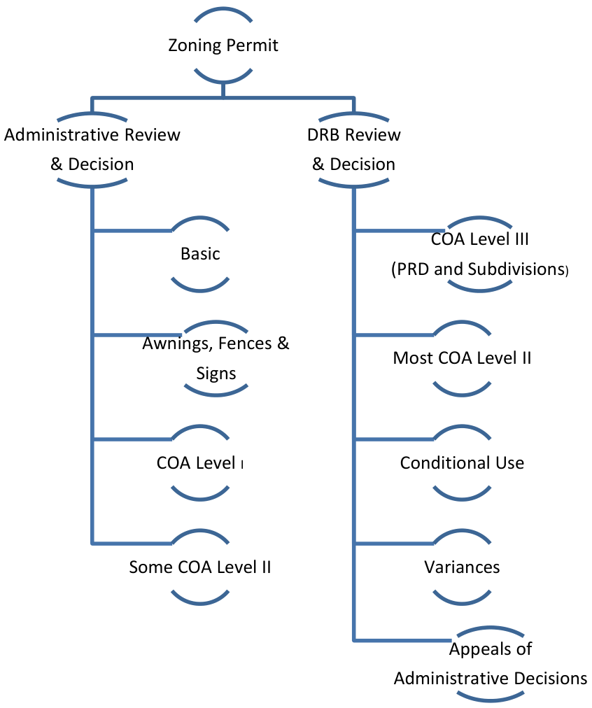
§ 3.2.7Administrative Review and Approval
Pursuant to the provisions of 24 V.S.A. Section 4464(c), this section provides for the administrative review and approval of new development and amendments to previously approved development
Administrative Authority:
The administrative officer is hereby authorized to undertake the review and approval of those applicable applications subject to the planBTV: Downtown Code under Sec. 14.7.1 e) i and all of the following types of applications:
Basic;
Awning;
Sign;
COA Level I; and,
In addition, the administrative officer is hereby authorized to undertake the review and approval of certain COA Level II applications subject to the following thresholds and conditions:
Waivers for residential parking in tandem situations where there is one space behind one other, usually in a driveway;
Additions to single family houses in a design control district located 200-feet or more from the lakeshore and that are 50% or less of the existing gross floor area of the principal structure;
Simple renovations in design control districts such as door and window changes, re-siding, re-roofing, enclosing porches, adding a shed or garage, and additions no greater than 500 square feet in size that otherwise comply with all applicable dimensional standards of Art. 4 and the development review criteria of Art. 6;
Compliance with conditions of approval as specified in a written decision of the DRB;
Minor amendments to development applications previously approved by the DRB where the proposed amendment otherwise qualifies for administrative review as a COA Level I application or under the planBTV: Downtown Code under Sec. 14.7.1 e) i and will not substantively alter any findings of fact or DRB decision and related conditions of approval; and,
Creation of an Accessory Dwelling Unit where no other applicable standards would require review by the DRB.
Further Delegation by the Development Review Board:
In addition to administrative review and approval authorized above, the DRB may authorize the administrative review and approval of additional applications where such delegation of authority is permitted by law and is specified in writing in the DRB’s Rules of Procedure with clearly specified thresholds and conditions under which the DRB classifies an application as eligible for administrative review. The thresholds and conditions shall be structured such that no new development shall be approved that results in a substantial adverse impact under any of the standards set forth in the bylaws. No amendment issued as an administrative review shall have the effect of substantively altering any of the findings of fact or DRB decision.
Administrative Decisions:
The administrative officer shall act with regard to an application subject to administrative review pursuant to this section within 30 days of receiving a complete application unless deferral is requested by the applicant per Sec. 3.2.5. Decisions to deny the application shall be sent by certified mail to the applicant, and shall contain a statement of the period of time within which an appeal may be taken pursuant to the requirements of Article 12. A notice of a decision made in favor of the applicant shall be posted in a public place pursuant to Sec. 3.2.9(c).
Should the administrative officer fail to take such action, a permit shall be deemed granted on the 31st day pursuant to 24 VSA 4448(d). A request by the applicant to defer shall toll the 30 day review period.
Appeal of Administrative Decisions:
Any decision or action by the administrative officer made under this article may be appealed to the DRB as specified under the provisions of Article 12.
§ 3.2.8Development Review Board Review and Approval
Final decisions on all applications for a zoning permit not otherwise eligible for review and approval by the administrative officer pursuant to the provisions of Section 3.2.7 shall be made by the DRB.
Public Notice:
Prior to any action by the DRB a copy of the applicable meeting agenda, or as applicable a public hearing notice pursuant to the requirements of Article 2, shall be sent by first class mail to all owners of land abutting the proposed project not less than seven days prior to the meeting. For condominium ownership, a notice to the condominium association shall satisfy the notice requirement.
Where applicable, applications to be reviewed pursuant to the provisions of Article 3, Part 5 – Conditional Use and Major Impact Review, Article 10 – Subdivision, Article 11 – Planned Development, and where otherwise required under this ordinance, shall require a public hearing pursuant to the requirements of Article 2.
The notification shall include a description of the proposed project and shall be accompanied by information that clearly informs the recipient where additional information may be obtained, and that participation in the local proceeding is a prerequisite to the right to take any subsequent appeal.
Additionally, such notice shall also include posting of the date, place, and purpose of the meeting or public hearing in three or more public places within the municipality in conformance with the time and location requirements of 1 V.S.A. § 312(c)(2).
Cost to the Applicant:
The applicant may be required to bear the cost of the public warning and the cost and responsibility of notification of adjoining landowners. In such cases, the applicant shall be required to demonstrate proof of delivery to adjoining landowners either by certified mail, return receipt requested, or by written notice hand delivered or mailed to the last known address supported by a sworn certificate of service.
Defect in Notice:
An error or defect in the notice provisions specified above shall not invalidate an action of the DRB unless such error was the result of a deliberate or intentional act.
Independent Technical Review:
An applicant may be required to pay the reasonable costs and fees incident to an independent technical review of the application. When required for reviewing the proposed development under applicable criteria, and when the required expertise is either not available within city government or not available within the time frame necessary, the DRB may retain independent consultants whose services shall be paid for by the applicant. These consultants shall be qualified professionals in technical planning, design, natural resource, and engineering fields as determined necessary by the DRB for review of the proposed development. The consultant(s) shall work at the DRB’s direction and shall provide such reports and assistance as the DRB deems necessary to review an application.
Fees for any such independent technical review shall be in addition to any application and development review fees collected, and shall be paid in full prior to the issuance of any zoning permit.
Development Review Board Decisions:
The DRB may recess the proceedings on any application pending submission of additional information. The DRB should close the evidence promptly after all parties have submitted the requested information. The DRB shall adjourn the proceeding and issue a decision within 45 days after the adjournment of the proceeding. Failure of the DRB to issue a decision within this period shall be deemed approval of the application as submitted, and shall be effective on the 46th day.
Decisions shall be issued in writing and shall include a statement of the factual bases on which the DRB has made its conclusions and a statement of the conclusions. The minutes of the meeting may suffice, provided the factual bases and conclusions relating to the review standards are provided in conformance with this subsection. The decision shall also contain a statement of the period of time within which an appeal may be taken pursuant to the requirements of Article 12.
Any decision shall be sent by certified mail within 45 days after the adjournment of the proceeding to the applicant and the appellant in matters on appeal. Copies of the decision shall also be mailed to every person or body appearing and having been heard at the proceeding and a copy of the decision shall be filed with the administrative officer and the city clerk as a part of the public records of the city.
In rendering a decision in favor of the applicant, the DRB may attach additional reasonable conditions and safeguards as it deems necessary to implement the purposes of this chapter and the pertinent bylaws and the municipal plan then in effect. Such conditions shall be made part of a zoning permit granted by the administrative officer.
§ 3.2.9Zoning Permits
Issuance of Permits:
A zoning permit may be granted and released by the administrative officer only in conformance with this ordinance, and subject to all applicable submission and review requirements described by this ordinance.
Zoning permits issued under the provisions of this ordinance may contain one or all of the following:
Standard Permit Conditions and other specific conditions and requirements as may be necessary for the approval for all development applications reviewed pursuant to the requirements of this ordinance;
Conditions of Approval for development applications subject to the requirements of Conditional Use Review (Article 3, Part 5); and,
Findings of Fact for development applications subject to the requirements of Conditional Use Review (Article 3, Part 5), Subdivision Review (Article 10), Planned Development (Article 11), and Variances (Article 12).
Permit Appeal Period:
No zoning permit granted by action of the administrative officer under this ordinance shall be released until a fifteen (15) day appeal period has passed. No zoning permit granted in association with a decision of the Development Review Board shall be released until a thirty (30) day appeal period has passed. In the event that a notice of appeal pursuant to the requirements of Article 12 is properly filed, the provisions of 24 V.S.A § 4449 (a) (3) shall control the effective date of the permit.
Posting of Permit – Administrative Officer:
Within three (3) days following the granting of a zoning permit, the administrative officer shall:
Deliver a copy of the permit to the City Assessor; and,
Post a notice of the permit in City Hall until the expiration of fifteen (15) days from the date of issuance of the permit.
The permit notice shall have sufficient detail, to inform the public of proposed scope of the project and contain a statement of the period of time within which an appeal may be taken pursuant to the requirements of Article 12.
Time Limit on Zoning Permits:
Notwithstanding (e) and (f) below, a zoning permit shall become invalid unless the work or action authorized commences within one (1) year after the date of final decision. All work or action authorized there under shall be completed, and a Final Zoning Certificate of Occupancy received, within three (3) years of the date of decision unless a written extension of time not to exceed one (1) year is granted in advance by the administrative officer. Extensions of time for a zoning permit issued in connection with a conditional use or variance shall require approval by the DRB after a public hearing. Extensions of time may be granted only when the work or action authorized under the zoning permit remains compliant with the current zoning regulations. Up to two (2) time extensions may be granted.
Time Limit on Zoning Permits: Violations:
Notwithstanding (f) below, a zoning permit which is issued in connection with a violation of this ordinance shall become invalid unless the work or action authorized is completed, and a Final Zoning Certificate of Occupancy is received, within one (1) year of the date of decision unless an extension of time not to exceed one (1) year is approved in advance after public hearing by the DRB. Extension of time may be granted only when the work or action authorized under the zoning permit remains compliant with the current zoning regulations. Only one (1) time extension may be granted.
Exceptions to Permit Time Limits:
Except for projects subject to additional state or federal permitting jurisdiction, or which have been appealed to Vermont Environmental Court pursuant to the requirements of Article 12, there shall be no exceptions to the time limits specified in Sec. 3.2.9(d) and (e) unless longer or shorter time limits are specifically imposed as permit conditions of approval by the DRB at the time of approval.
For projects subject to additional state or federal permitting jurisdiction, the date of decision shall be deemed to be the latest date of decision of the state or federal permitting authority. For projects under appeal pursuant to the requirements of Article 12, the date of decision shall be deemed to be the date of the decision adjudicating such appeal.
§ 3.2.10Performance Bond or Financial Surety
As security for the completion of any required improvements, the DRB may require from the subject property owner for the benefit of the city, a performance bond, irrevocable escrow, or irrevocable letter of credit, issued by a bank, bonding or surety company approved by the city council or by the owner with security acceptable to the city council, in an amount sufficient to cover the full cost of said required improvements and their maintenance for a period of two (2) years after completion as is estimated by the DRB or such municipal departments or officials as the DRB may designate. Such bond or other security shall provide for, and secure to the public, the completion of any improvements which may be required within the period fixed in the regulations for such completion, and for the maintenance thereof for a period of two (2) years after completion.
Any required performance bond shall run for a term to be fixed by the DRB, but in no case for a term longer than three years. However, with the consent of the owner, the term of that bond may be extended for an additional period not to exceed three years. If any required improvements have not been installed or maintained as provided within the term of the security instrument, the security shall be forfeited to the city and upon receipt of the proceeds of the security, the city shall install or maintain such improvements as are covered by the security.
§ 3.2.11Zoning Certificate of Occupancy
It shall be unlawful to use or occupy (or allow the use or occupancy of) any land or structure, or part thereof which has been created, changed, converted, or wholly or partly altered or enlarged in its use or structure after the effective date of this ordinance without a zoning certificate of occupancy issued by the administrative officer.
The zoning certificate of occupancy shall state that the proposed use of the structure or land conforms to the requirements of a permit and related conditions received under this ordinance. A building certificate of occupancy issued by the division of inspection services shall not constitute a zoning certificate of occupancy unless so specifically authorized in writing by the administrative officer.
Part 3Impact Fees
§ 3.3.1Applicability
Impact fees shall be pursuant to the Administrative Regulations adopted under Burlington’s Code of Ordinances Section 21-41.
Part 4Site Plan and Design Review
§ 3.4.1Purpose
These site plan review regulations are enacted to provide for the consideration of site features and their location and arrangement so as to protect important natural and cultural features, ensure the adequacy of parking and circulation, provide for necessary landscaping and screening, and protect and maintain the character and development pattern of the surrounding area.
Additionally, design review regulations are intended to provide for the detailed review of certain uses, structures, and architectural features in those areas of the city which contain structures of historical, architectural, or cultural merit, and where the community has a particular interest in the design of future development in order to address specific land development objectives.
§ 3.4.2Applicability
Site Plan Review shall be required for the approval of all development subject to the provisions of this ordinance with the exception of single-family dwellings not otherwise subject to the requirements of Design Review.
Design Review:
No structure may be erected, reconstructed, substantially altered, restored, moved, or demolished or any site improvement or modification made without approval subject to the provisions of this part and the review criteria described in Art 6 Design Review within the following geographic areas or for all development subject to the following provisions:
For any projects located within the geographic areas delineated as applicable on Map 3.4.2-1.
For any projects located within the geographic areas delineated as not applicable on Map 3.4.2-1 but that are subject to the following provisions:
Article 3, Part 5 – Conditional Use and Major Impact review;
Article 5, Part 3 – Non-Conformities;
Article 5, Part 4 – Special Use Regulations;
Sec. 7.1.6 Non-Conforming Signs and Article 7, Part 3 Sign Plans;
Article 10 – Subdivision;
Article 11 – Planned Development;
A project within an RL District where a building contains 3 or more units or proposes more than one building on a lot subject to Sec. 4.4.5; and,
Any development made subject to the provisions of this Part by direct reference not otherwise noted here.
Design Review shall not be required for:
Single detached dwellings and duplex dwellings within an RL District not otherwise subject to any of the above provisions.
All applications subject to the planBTV: Downtown Code under Art. 14, which instead shall be subject to the requirements of Article 14.
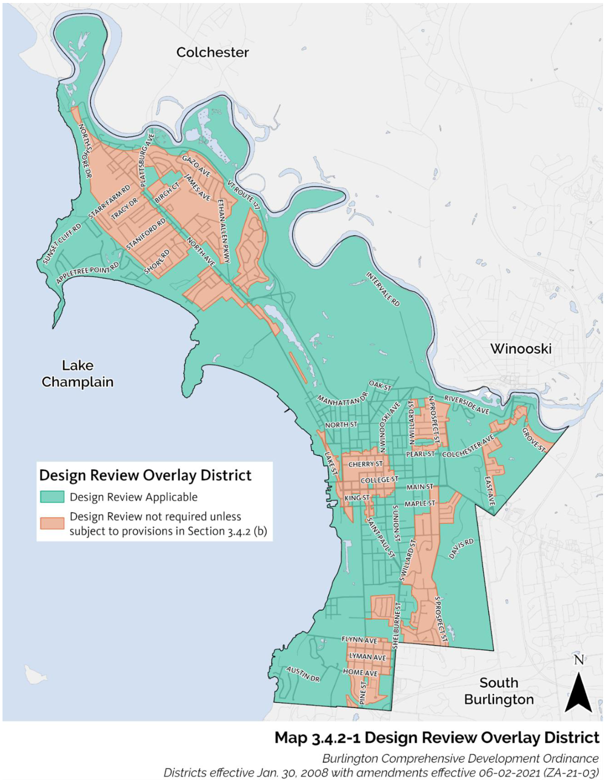
§ 3.4.3Submission Requirements
In addition to the applicable application and submission requirements pursuant to Sec. 3.2.2, all applications for a zoning permit subject to Site Plan and/or Design Review under this Part shall provide any additional information necessary for the adequate review of the proposal under the applicable development principles and standards found in Article 6.
§ 3.4.4Review Criteria
Approval of an application for a zoning permit may be granted by the DRB, or the administrative officer where applicable, only after it has been determined that the proposed development satisfies the applicable development review principles and standards contained in Article 6 - Development Review Standards.
Part 5Conditional Use and Major Impact Review
§ 3.5.1Purpose
These regulations are enacted to provide for a more detailed consideration of development proposals which may present a greater impact on the community, based on either the nature of the proposed use and/or the overall scale of the proposed development, in order to ensure that
the anticipated impact of such developments on the city’s natural and physical character, services and infrastructure are mitigated.
§ 3.5.2Applicability
Conditional Use Review:
Conditional Use Review shall be required for the approval of all development subject to the following provisions of this ordinance:
any use identified under Article 4 and Appendix A – Use Table as a “Conditional Use” or “CU;”
any Special Use specifically identified as being subject to conditional use review under Article 5, Part 3;
Major Impact Review:
Major Impact Review shall be required for the approval of all development involving any one or more of the following:
Table 3.5.2-1 Zoning Districts
| Downtown Mixed Use and Form Districts | Neighborhood Mixed Use, Institutional, Enterprise, Residential Corridor | Residential-Medium Intensity, Residential – High Intensity | Residential-Low Intensity | RCO-A, RCO-C, RCO-RG, UR | |
|---|---|---|---|---|---|
| Dwelling Units | Creation of fifty (50) or more dwelling units | Creation of twenty-five (25) or more dwelling units | Creation of ten (10) or more dwelling units | Creation of five (5) or more dwelling units | NA |
| Land Subdivision | NA | NA | Creation of ten (10) or more lots; | Creation of five (5) or more lots | NA |
| Non-residential or Mixed Use Development | A development footprint¹ of fifty thousand (50,000) s.f. or more, or the creation of one hundred thousand (100,000) s.f. or more of gross floor area. | A development footprint¹ of twenty thousand (20,000) s.f. or more, or the creation of forty thousand (40,000) s.f. or more of gross floor area. | A development footprint¹ of eight thousand (8,000) s.f. or more, or the creation of fifteen thousand (15,000) s.f. or more of gross floor area. | A development footprint¹ of five thousand (5,000) s.f. or more, or the creation of ten thousand (10,000) s.f. or more of gross floor area. | Creation of five thousand (5,000) s.f. or more of gross floor area² |
1 Development Footprint: total area of impervious coverage – buildings and parking.
2 Farm structures are exempt per 10 VSA 6001.
In addition, Major Impact Review shall also be required for multiple projects undertaken by the same applicant or responsible party within any consecutive twelve (12) month period on the same or adjacent property that in the aggregate equal or exceed the above criteria.
§ 3.5.3Exemptions
Major Impact Review shall not be required for applications involving one or more of the following:
Temporary structures that do not otherwise involve a conditional use;
Rehabilitation that does not expand the floor area of an existing building or the structural capacity of existing development;
Projects that do not result in a change of use;
Subsurface site improvements including but not limited to underground utility lines and subsurface drainage ways; and,
Projects where the scope and authority of municipal regulation is limited by statute pursuant to 24 VSA 4413.
§ 3.5.4Submission Requirements
In addition to the applicable application and submission requirements under in Section 3.2.2, all applications for a zoning permit subject to Conditional Use and/or Major Impact Review under this Part shall provide any additional information necessary for the adequate review of the proposal under the applicable review criteria of Section 3.5.6 pursuant to Section 3.2.3.
Any development subject to Major Impact Review under this Part shall also include an affidavit or certification documenting that the Pre-Application Public Neighborhood Meeting requirement pursuant to Sec. 3.2.1(d) has been satisfied in accordance with the procedures and requirements set forth by the department of planning and zoning.
Pursuant to Sec. 3.2.8(D), the DRB may require the applicant to pay the reasonable costs and fees incident to an independent technical review of the application.
§ 3.5.5Public Hearing Required
Applications involving Conditional Use and Major Impact Review shall require a public hearing pursuant to the provisions of Article 2 to provide an opportunity for public input and comment to the DRB on the proposed use and it’s conformity with the review criteria listed below.
§ 3.5.6Review Criteria
The application and supporting documentation submitted for proposed development involving Conditional Use and/or Major Impact Review, including the plans contained therein, shall indicate how the proposed use and associated development will comply with the review criteria specified below:
Conditional Use Review Standards:
Approval shall be granted only if the DRB, after public notice and public hearing, determines that the proposed conditional use and associated development shall not result in an undue adverse effect on each of the following general standards:
Existing or planned public utilities, facilities or services are capable of supporting the proposed use in addition to the existing uses in the area;
The character of the area affected as defined by the purpose or purposes of the zoning district(s) within which the project is located, and specifically stated policies and standards of the municipal development plan;
The proposed use will not have nuisance impacts from noise, odor, dust, heat, and vibrations greater than typically generated by other permitted uses in the same zoning district;
The transportation system is capable of supporting the proposed use in addition to the existing uses in the area. Evaluation factors include street designations and capacity; level of service and other performance measures; access to arterial roadways; connectivity; transit availability; parking and access; impacts on pedestrian, bicycle and transit circulation; safety for all modes; and adequate transportation demand management strategies; and,
The utilization of renewable energy resources; and,
Any standards or factors set forth in existing City bylaws and city and state ordinances;
Major Impact Review Standards:
Before a major impact development may receive approval, the DRB must be satisfied, based on documentation provided by appropriate city agencies, experts, interested parties and/or the applicant that the proposed development shall:
Not result in undue water, air or noise pollution;
Have sufficient water available for its needs;
Not unreasonably burden the city’s present or future water supply or distribution system;
Not cause unreasonable soil erosion or reduction in the capacity of the land to hold water so that a dangerous or unhealthy condition may result;
Not cause unreasonable congestion or unsafe conditions on highways, streets, waterways, railways, bikeways, pedestrian pathways or other means of transportation, existing or proposed;
Not cause an unreasonable burden on the city’s ability to provide educational services;
Not place an unreasonable burden on the city’s ability to provide municipal services;
Not have an undue adverse effect on rare, irreplaceable or significant natural areas, historic or archaeological sites, nor on the scenic or natural beauty of the area or any part of the city;
Not have an undue adverse effect on the city’s present or future growth patterns nor on the city’s fiscal ability to accommodate such growth, nor on the city’s investment in public services and facilities;
Be in substantial conformance with the city’s municipal development plan and all incorporated plans;
Not have an undue adverse impact on the present or projected housing needs of the city in terms of amount, type, affordability and location; and/or
Not have an undue adverse impact on the present or projected park and recreation needs of the city.
Conditions of Approval:
In addition to imposing conditions of approval necessary to satisfy the General Standards specified in (a) or (b) above, the DRB may also impose additional conditions of approval relative to any of the following:
Mitigation measures, including but not limited to screening, landscaping, where necessary to reduce noise and glare and to maintain the property in a character in keeping with the surrounding area.
Time limits for construction.
Hours of operation and/or construction to reduce the impacts on surrounding properties.
That any future enlargement or alteration of the use return for review to the DRB to permit the specifying of new conditions; and,
Such additional reasonable performance standards, conditions and safeguards, as it may deem necessary to implement the purposes of this chapter and the zoning regulations.
§ 3.5.7Development Review Board Decisions, Findings of Fact
In issuing a decision regarding an application for development subject to Conditional Use and/or Major Impact Review, the DRB shall issue Findings of Fact regarding the proposed application’s satisfactory conformance with each of the review standards of Sec. 3.5.6, and may attach such additional reasonable conditions and safeguards as it may deem necessary to implement the purposes of this ordinance and the city’s municipal development plan.
Pursuant to the requirements of Sec. 3.2.8(e), the DRB shall act to approve or disapprove any such requested conditional use within forty-five (45) days after the date of close of the final public hearing held under this section, and failure to so act within such period shall be deemed approval.
Any and all plans and documents pertaining to a request for Conditional Use and/or Major Impact Review as approved by the DRB along with the Findings of Fact issued, shall be incorporated into any permit issued, and except as otherwise provided, all development shall occur strictly in accordance with such approved plans, applications, findings, and conditions.
Part 6Combined Review
§ 3.6.1Intent
The intent of this part is to provide for the orderly and efficient review of development applications for a zoning permit which may be subject to multiple application submission requirements and review processes.
§ 3.6.2Authority
In accordance with 24 V.S.A. § 4462, in cases where a proposed project will require more than one type of review under the provisions of this ordinance, the DRB may warn and hold a joint hearing or single hearing for the purpose of reviewing and acting on the proposal. The administrative officer shall identify proposed projects appropriate for combined review and assist applicants in preparing and submitting coordinated applications to facilitate combined review.
Notice for a combined review hearing shall be made in accordance with statutory authority. The hearing notice shall include a statement that the hearing will be a combined review of the proposed project and list each review processes that will be conducted at the hearing.
All hearing and decision requirements and all deadlines applicable to each review process shall apply. Separate written decisions may be issued for each review conducted as part of the combined review, but shall be coordinated where appropriate.
Article 4Zoning Maps and Districts
§ 4Introduction
This Article of the Burlington Comprehensive Development Ordinance establishes zoning districts throughout the city and the district-specific uses, standards and regulations for each. It also establishes a series of overlay districts which modify the underlying regulations in special or specific circumstances.
§ 4.0Intent & Authority
These regulations are enacted under the provisions of 24 V.S.A. Chapter 117 with the purpose of:
Dividing all land within the city into zoning districts for the purpose of regulating land use and development;
Providing uniform provisions for each class of uses or structures within each district; and,
Requiring that every parcel of land and every structure in the city, except as otherwise provided by law or by this ordinance, be subject to the regulations, restrictions, and requirements specified for the district in which it is located.
Part 1Zoning Map
§ 4.1.1Title
There shall be a map known and designated as the “Official Zoning Map, City of Burlington, VT” (see Map 4.3.1-1) which shall show the boundaries of all zoning districts within the city. The map shall be maintained by the department of planning and zoning in a digital form within the city’s geographic information system. An official copy shall be dated and displayed for public reference.
§ 4.1.2Loss or Damage
Should the Official Zoning Map be lost, destroyed or damaged, the administrative officer may have a new map prepared. Computer-generated zoning maps, or copies thereof showing identical data, may be used as substitutes for prints. No further city council authorization or action is required so long as no district boundaries are changed in this process.
§ 4.1.3Amendments & Revisions
Amendments to this map shall be made pursuant to statutory authority and shall be automatically incorporated herein upon adoption. Only the administrative officer, or his or her designee, shall be authorized to alter or modify the Official Zoning Map in accordance with actions of the city council.
The administrative officer shall update the official zoning map and any data bases used for computer-generated zoning maps as soon as possible after amendments to it are adopted by the city council. Upon entering any such amendment, the administrative officer shall change the date of the map to indicate its latest revision. New prints or copies of the map may then be issued.
The department of planning and zoning shall keep copies of superseded prints of the zoning map for historical reference.
§ 4.1.4Interpretation of District Boundaries
Zoning district boundaries are intended to follow the center line of highways, roads, alleys, railroads, streams, other bodies of water, civil division lines, land lot lines, property lines, or contour lines, or from a specified distance from any of the aforementioned. All such lines or center lines shall be construed to be such boundaries as they existed at the time of passage of this ordinance;
Where uncertainty exists as to the boundaries of any district shown on the official zoning map, the following rules shall apply:
Where district boundaries appear to approximately follow the center line of highways, roads, alleys, railroads, streams, other bodies of water, civil division lines, land lot lines, property lines or contour lines, such lines or center lines shall be construed to be such boundaries as they existed at the time of passage of this ordinance;
Where district boundaries are indicated as being measured from or being parallel to the center line of highways, roads, alleys, railroads, civil division lines, land lot lines, or property lines, such boundaries shall be construed as being measured from or being parallel thereto and at a distance therefrom as indicated or as determined by the scale shown on the zoning map; and
If further uncertainty exists, the administrative officer shall make a determination as to the location of the boundaries based on the graphic scale of the zoning map.
Part 2Official Map
§ 4.2.1Authority and Purpose
A map entitled “The Official Map of the City of Burlington” and as depicted on Map 4.2.1-1 below is hereby established pursuant to 24 VSA 4421 that identifies future municipal utility and facility improvements, such as road or recreational path rights-of-way, parkland, utility rights-of-way, and other public improvements. The intent is to provide the opportunity for the city to acquire land identified for public improvements prior to development for other use, and to identify the locations of required public facilities for new subdivisions and other development under review by the city.
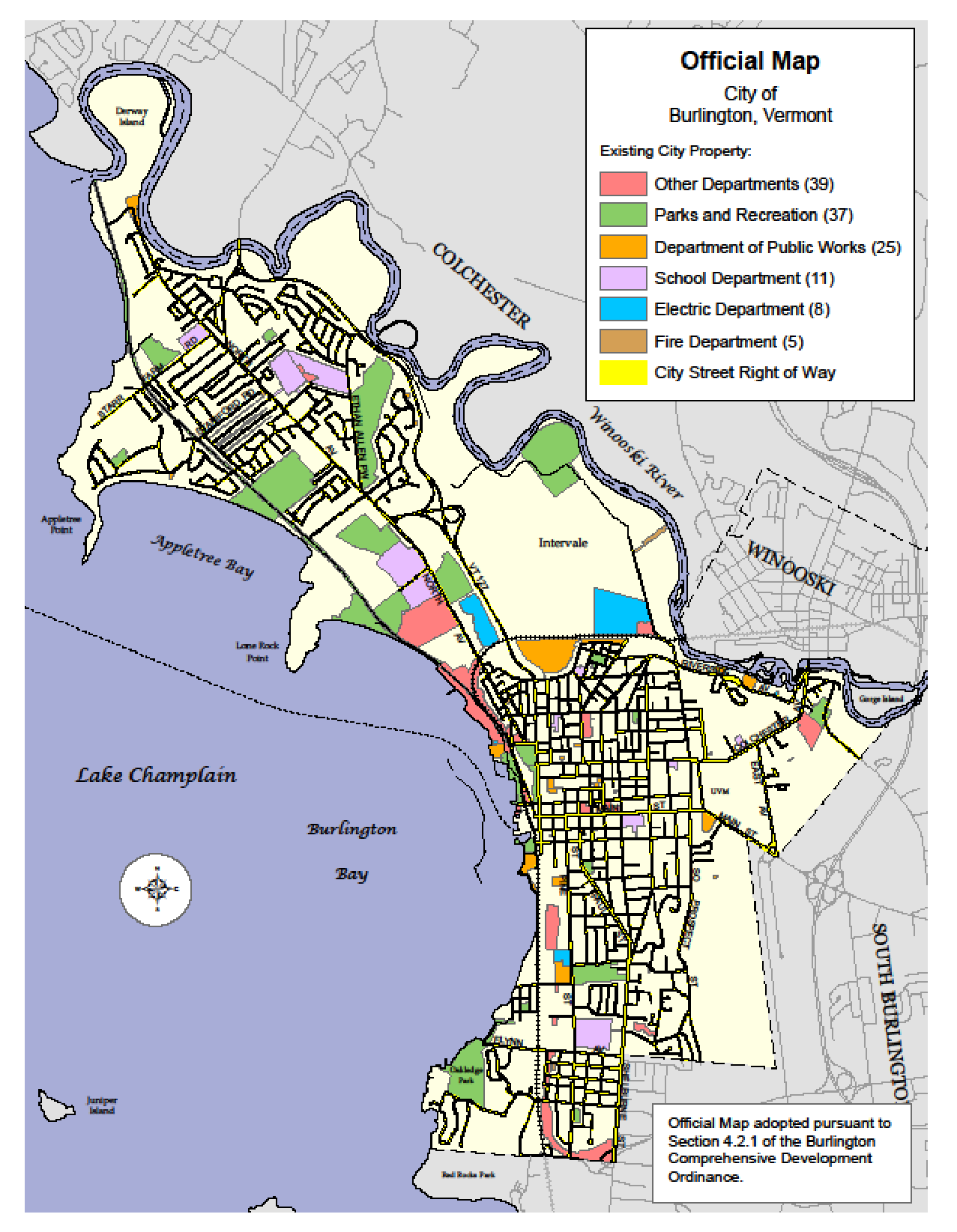
§ 4.2.2Downtown and Waterfront Core Official Map Established
A map entitled “The Official Map of the Downtown and Waterfront Core” and as depicted on Map 4.2.2-1 below is established as part of the Official Map established above. The proposed streets, public ways, public parks and other public lands and visual corridors contained therein are more particularly described as follows:
A waterfront pedestrian easement fifty (50) feet in width abutting the ordinary high water mark of Lake Chaplain from Maple Street extended to College Street;
A waterfront pedestrian easement one hundred (100) feet in width abutting the ordinary high water mark of Lake Champlain from College Street extended to the north property line of the city-owned lands designated as “urban reserve” and formerly owned by the Central Vermont Railway;
Visual corridors and/or pedestrian ways sixty (60) feet in width along the center lines of Bank, Cherry, Pearl and Sherman streets extended west to Lake Champlain and visual corridors above the fourth floor along Main Street and College Street;
The following existing streets remain: Maple and King Streets and as extended to Lake chaplain; Main street; College Street and as extended to Lake Champlain; Lake Street from Main Street to College Street; Depot Street; and Battery Street;
An easement for pedestrians and bicycles twenty (20) feet in width, located adjacent to and west of the old Rutland railway right-of-way and owned by the State of Vermont running between the King Street Dock and College Street;
Lake Street (north) modified: The portion of Lake Street is a street seventy (70) feet in width, the center line of which commences on the north line of College Street thence running northerly following the center line of existing Lake to a point intersecting the northerly property line of the Moran Generating Station extended east.
The re-establishment of St Paul Street between Cherry and Bank streets as a public street with a right-of-way sixty (60) feet in width to accommodate pedestrians, bicycles and vehicles; and,
The re-establishment of Pine Street between Cherry and Bank streets as a public street with a right-of-way sixty (60) feet in width to accommodate pedestrians, bicycles and vehicles.
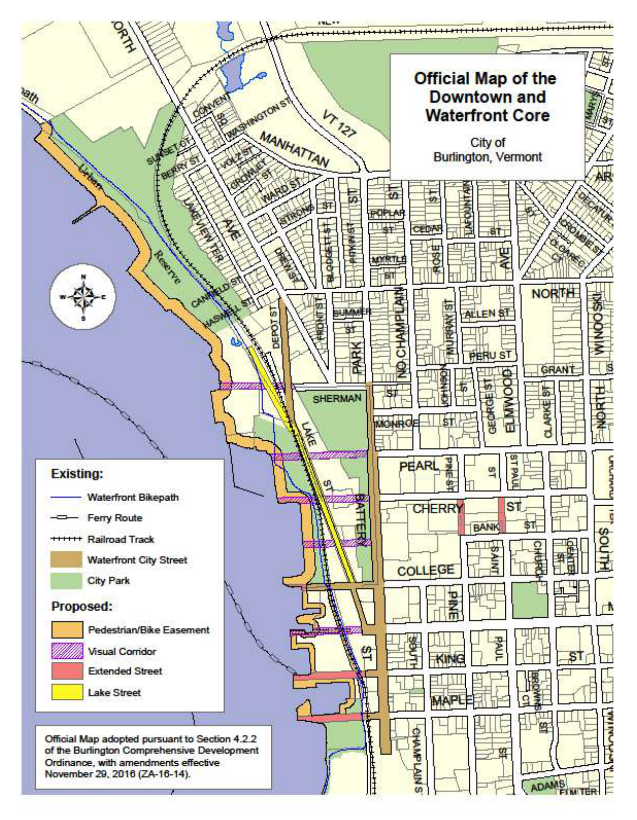
§ 4.2.3Permit Denial Regarding Official Map Parcels
If a permit for any structure within the lines of any proposed street, drainage way, park, school, or other public facility shown on the Official Map or the Waterfront Core Official Map is denied, the city council shall have one hundred and twenty (120) days from the date of the denial of the permit to institute proceedings to acquire such land or interest therein, and if no such proceedings are started within that time, the administrative officer shall issue the permit if the application otherwise conforms to all the applicable bylaws.
Part 3Zoning Districts Established
§ 4.3.1Base Districts Established
The following zoning districts are hereby established as illustrated in Map 4.3.1-1 and further described in Part 4 below:
A series of three (3) Downtown Mixed Use districts: (see Sec. 4.4.1 and Art. 14)
FD6 – Downtown Core (Art. 14);
FD5 – Downtown Center (Art. 14); and,
A series of four (4) Neighborhood Mixed Use districts: (see Sec. 4.4.2)
Neighborhood Mixed Use (NMU);
Neighborhood Activity Center (NAC);
A series of two (2) Enterprise districts: (see Sec. 4.4.3)
An Institutional district, as follows: (see Sec. 4.4.4)
A series of four (4) Residential districts: (see Sec. 4.4.5)
Residential Corridor (RC), where mapped, this district applies to properties with street frontage on North Avenue, Colchester Avenue, St. Paul Street, Pearl Street, and Shelburne Street to a maximum depth of 200 ft;
Residential Medium Intensity (RM); and
A series of three (3) Recreation, Conservation, and Open Space districts: (see Sec. 4.4.6)
Agriculture (RCO-A);
Recreation/Greenspace (RCO-RG); and,
Conservation (RCO-C);
An Urban Reserve District (UR). (see Sec. 4.4.7)
§ 4.3.2Overlay Districts Established
Overlay districts are overlaid upon the base districts established above, and modify certain specified development requirements and standards of the underlying base district. Properties within an Overlay District may be used and developed in a manner permitted in the underlying district only if and to the extent such use or alteration is permitted as may be modified by the applicable overlay district. The following districts are established as overlay districts as further described in Part 5 below:
A Design Review Overlay (DR) district;
A series of five (5) Institutional Core Campus Overlay (ICC) districts, as follows:
A series of four (4) Natural Resource Protection Overlay (NR) districts, as follows:
Riparian and Littoral Conservation Zone;
Wetland Protection Zone;
Natural Areas Zone; and,
A Mouth of the River Overlay (MOR) district;
A Centennial Woods Overlay (CWO) district; and,
A South End Innovation District Overlay.
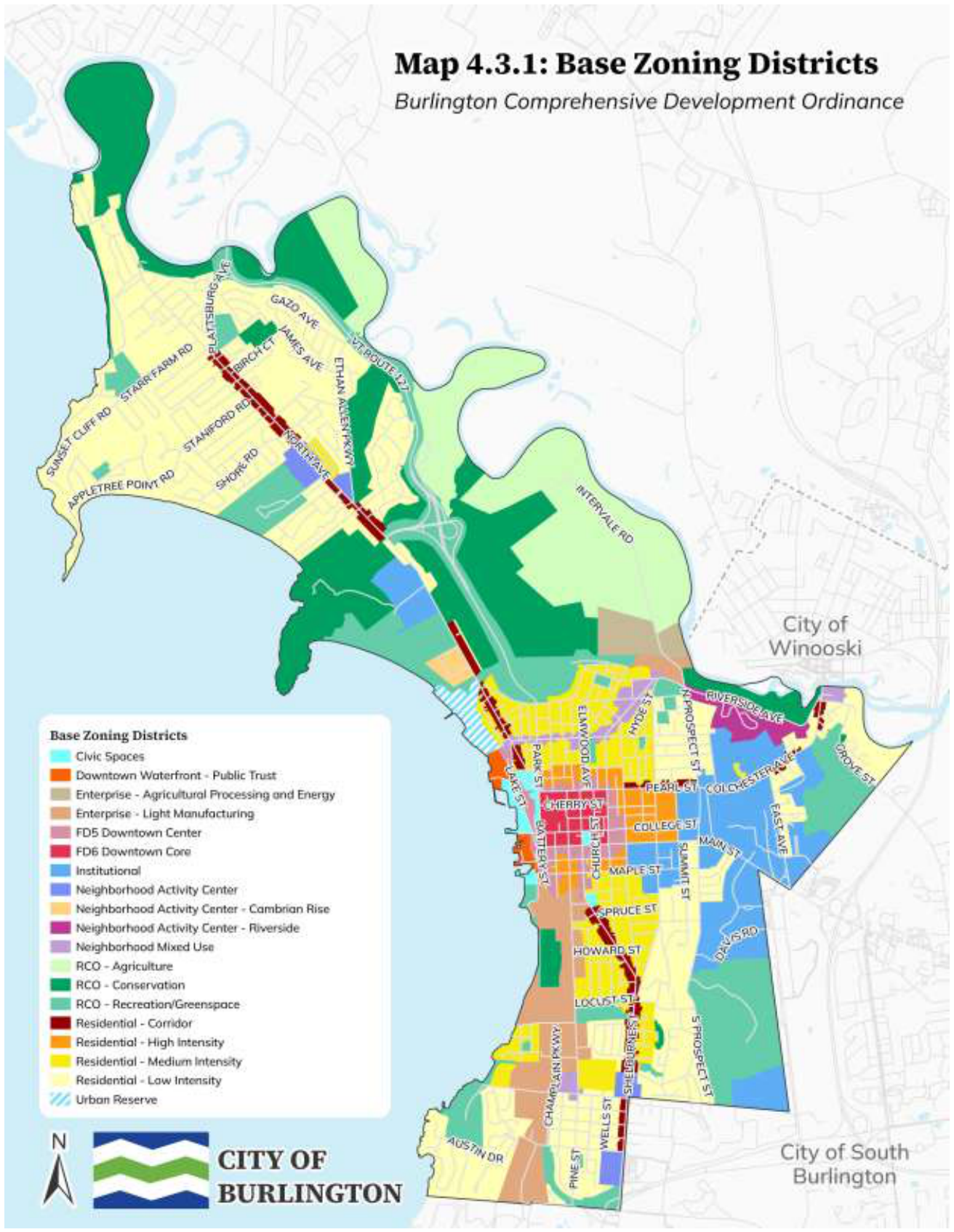
Part 4Base Zoning District Regulations
§ 4.4.1Downtown Mixed Use Districts
Purpose:
The Downtown Mixed Use districts are intended to provide for a diverse and vibrant mixture of commercial and residential development within Burlington's most highly developed and dynamic urban core. A broad range of uses that support a balance between residential and non-residential uses are encouraged reflecting Burlington's role as a regional urban center for commerce, culture, and government. Residential uses are encouraged on upper floors, but are intended to be secondary to non-residential uses and shall not be allowed to define or dominate the overall development objectives and standards for the district. Residential development must be cognizant of nearby non-residential uses in their design and construction, so as to minimize disturbance to residents from non-residential uses. Active uses are to be provided at street-level in order to create an active and interesting streetscape for pedestrians and enhance the vitality of the downtown area.
Development is intended to be intense with high lot coverage and large tall buildings placed close together. Development should complement the historic development pattern, and sensitive transitions should be provided where there is great difference in scale between the old and new. Development should be pedestrian-oriented with buildings oriented to the sidewalk with a strong emphasis on creating a safe and inviting streetscape. Buildings shall be designed with a high level of architectural detailing to help maintain a sense of scale so that they provide visual interest and create enjoyable, human-scale spaces. Parking is intended to be hidden within, behind, or underneath structures, and parked vehicles should not be visible from the street.
The 3 Downtown Mixed Use districts as illustrated in Map 4.4.1-1 are further described as follows:
Two Form Districts - FD6 – Downtown Core and FD5 - Downtown Center - are created pursuant to Article 14 planBTV: Downtown Code. The purpose, and all development standards and review procedures regarding development in these areas can be found in that article.
The Downtown Waterfront – Public Trust District (DW-PT) is intended to enhance and diversify commercial and residential development in the downtown waterfront area, and to increase access, utilization, and enjoyment of the lakeshore by the community. Strong emphasis is placed on enhanced public access to the lakeshore.
For the purposes of regulating building height in such a way as to provide vistas of harbor activity within the breakwater area, and to preserve panoramic views along public street corridors of the mountains and lake, the Downtown Waterfront – Public Trust District is further sub-divided into the following areas as depicted in Map 4.4.1-1, and subject to the height limits as defined in Table 4.4.1-1 below:
North of Pearl: Properties beyond 200’ of Lake Champlain north of the centerline of Pearl Street extended and west of railroad.
Lakeshore: Properties within 200’ of Lake Champlain and west of the railroad.
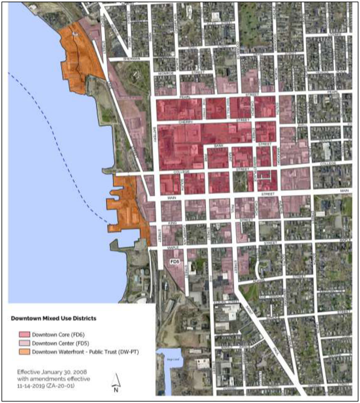
Dimensional Standards and Density:
The density and intensity of development, dimensions of building lots, the heights of buildings and their setbacks from property boundary lines, and the limits on lot coverage within the Downtown Waterfront – Public Trust District shall be governed by the standards as defined in Table 4.4.1-1 below:
Table 4.4.1-1 Dimensional Standards and Intensity
| Districts | Max. Intensity (floor area ratio¹) | Max. Lot Coverage | Min. Building Setbacks (feet) Front Side Rear | Height (feet) |
|---|---|---|---|---|
| Downtown Waterfront – Public Trust | ||||
| A. North of Pearl - West | 2 FAR | Same as Downtown Waterfront | Max: 35 | |
| B. Lakeshore² | 2 FAR | Same as Downtown Waterfront | Max: 35 | |
1 Floor area ratio is defined and described in Art 5. Bonuses for additional FAR where available are described in section (d)7 below. Actual maximum build out potential may be reduced by site plan and architectural design considerations of Art 6.
2 All structures shall be setback a minimum of 50-feet from the shoreline of Lake Champlain unless an encroachment is authorized under (d)5 below.
Permitted and Conditional Uses:
The principal land uses that may be permitted, or conditionally permitted pursuant to the requirements of Article 3, within the Downtown Waterfront – Public Trust District shall be as defined in Appendix A – Use Table and under (d)(2) below.
District Specific Regulations
Use Restrictions
These regulations set forth the permitted uses, identified by the Vermont General Assembly, associated with those parcels within the Downtown Waterfront – Public Trust District (DW-PT), and designated as “filled lands” along the waterfront and which are subject to the public trust doctrine. This district includes all parcels situated on filled public trust lands on the Burlington waterfront north of the centerline of Maple Street extended as illustrated in Map 4.5.4-1.
It is further the intent of these provisions to ensure that public trust filled lands are available to the public on an open and nondiscriminatory basis.
Uses permitted in the public trust district are limited to those uses specifically authorized by the Vermont General Assembly by legislative act. These regulations are enacted under the provisions of §4411 as amended, Act No. 274 (1988, VT. Adj. Sess.), Act No. 53 (1991), Act No. 87 (1996, VT. Adj. Sess.), Act No. 22 (1997), and Act No. 55 (2017).
Permitted Uses: North of Main Street
Only the following uses are permitted within that portion of the Downtown Waterfront – Public Trust District (DW-PT) located north of the centerline of Main Street extended:
Governmental facilities: such as water and sewer plants; Coast Guard and naval facilities; roads that are accessory and transportation facilities accessory to the uses permitted under this section; or existing roads, and similarly sized extensions of those roads, that service the filled public trust lands and immediately adjacent lands;
The arts, educational and cultural activities including theaters and museums;
Fresh water and other environmental research activities;
Services related and accessory to the uses permitted under subsections (i) through (iv) of this section, including restaurants, snack bars, and retail uses and ancillary parking; only those uses that are subordinate and customarily incidental to the uses listed shall be considered as related and accessory services; and/or
Railroad, wharfing, and storage uses.
Publicly Accessible Restrooms. Any structure larger than 1000 sq. ft. in size, other than roads, parking lots, railroad tracks or recreation paths, shall include publicly accessible restrooms with appropriate exterior signs indicating their availability. The DRB may waive this provision if it so determines that adequate publicly accessible restrooms are available within close proximity.
Public Markets.
Permitted Uses: Maple to Main Street
Only the following uses are permitted within that portion of the Downtown Waterfront – Public Trust District (DW-PT) located north of the centerline of Maple Street extended north to the centerline of Main Street extended:
Facilities for transporting pedestrians and vehicles upon Lake Champlain by ferry and cruise vessels, including necessary docks, wharfs, maintenance facilities, administrative offices, gift shops, snack bars and related parking facilities.
Marine related retail facilities.
Inns with public space, including restaurant, restroom and retail use. Restrooms in the inns shall be available to the public. The authorization granted under this subdivision is contingent upon the prior and continuing availability in Burlington Harbor of 45 transient dock slips which are appropriately marked for convenient access. The authorization granted under this subdivision is also contingent upon the availability, in perpetuity, of uninterrupted public access along the shoreline of Lake Champlain from the centerline of Maple Street extending north to the centerline of Main Street.
Public Markets.
Publicly Accessible Restrooms. Any structure larger than 1000 sq. ft. in size, other than roads, parking lots, railroad tracks or recreation paths, shall include publicly accessible restrooms with appropriate exterior signs indicating their availability. The DRB may waive this provision if it so determines that adequate publicly accessible restrooms are available within close proximity.
Other Regulations in Effect
All other regulations of this ordinance shall apply to any uses permitted under this Article.
Facades and Setbacks on Side and Rear Property Lines
New buildings, or additions or improvements to existing buildings, placed on a side or rear property line where no setback is required may contain neither doors nor windows along such façade. Where the façade of an existing adjacent principal building is within 5 feet of a common property line and has either doors or windows, a setback of 10-feet shall be required for any new development up to the height of the abutting building.
Lake Champlain Waterfront Setback:
In order to ensure that public trust lands are available to the public on an open and nondiscriminatory basis and the public has continuous and direct access to the waters edge, all buildings shall be setback a minimum of 50-feet from the mean high water mark of Lake Champlain (100-feet above mean sea level) unless an encroachment is authorized below.
Additions to Existing Structures.
Where a structure, existing as of the effective date hereof, encroaches into the required waterfront setback, no additions to or replacement of that structure may further encroach into the required setback beyond the footprint of the existing building. Above the ground floor, additions to or replacement of that structure may encroach into the required setback no farther than the maximum encroachment of the original structure.
Averaging of Setbacks.
If the waterfront setback of principal structures on adjacent lots, existing as of the effective date hereof, within a distance of one hundred fifty (150) feet on either or both sides of a lot encroaches into the waterfront setback, the required setback may be reduced to the average setback of such structures as illustrated in Figure 4.4.1-4.
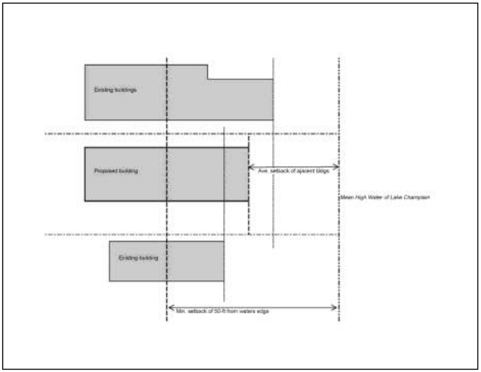
Permitted Encroachments.
The DRB may approve one or more of the following within the required waterfront setback: structures such as walkways, planters, benches, fountains, public art, sitting walls and other improvements which will enhance the pedestrian environment and enjoyment of the waterfront; and public marinas, public recreational piers, ferry docks, lake excursion facilities, and open-air markets, provided pedestrian circulation is not unreasonably impaired.
Development Bonuses/Additional Allowances
The following exceptions to the allowable base building height and FAR as provided in Table 4.4.1-1 above may be approved in any combination subject to the maximum limits set forth in Table 4.4.1-2 below at the discretion of the DRB. The additional FAR allowed shall correspond to the proportion of the additional building height granted to the maximum available.
Public Parking:
A bonus in excess of the base height and FAR allowance in Downtown Waterfront – Public Trust District may be permitted at the discretion of the DRB for the provision of public parking as follows:
10-feet of additional building height and corresponding FAR may be permitted where all onsite parking, subject to a minimum of 40 parking spaces, is made available to the general public at all hours of holidays; between the hours of 5:00 pm and 6:00 am on weekdays, and from 5:00 pm on Friday until 6:00 am on the following Monday. The DRB may make minor modifications to these hours as may be necessary to address the unique needs of the proposed development.
10-feet of additional building height and corresponding FAR may also be permitted, independent of subsection (i) above, where no less than 25 parking spaces are made available to the general public at all times.
The parking referenced in subsection (ii) above may be located anywhere within the same zoning district in which the proposed project is to be located.
Before authorizing additional height under this section the DRB must specifically require all of the following conditions, together with any other conditions it determines to be necessary or appropriate:
In no event shall the application of this bonus provision provide for more than 20-feet of building height above the base height permitted in Table 4.4.1-1;
All spaces made available to the general public shall be those most convenient to the public street, and there must be adequate signage indicating the availability of such spaces to the public and the location of such spaces;
Where a fee is charged, such fee shall be not more than the prevailing market rate for similar publicly and privately owned parking in the City; and,
A legally binding agreement, in a form and substance suitable to the city attorney, is executed to guarantee public access to the parking spaces provided.
Job Attraction and Expansion Bonus:
A bonus in excess of the base height and FAR allowance in Downtown Waterfront – Public Trust District may be permitted at the discretion of the DRB for the construction or rehabilitation of buildings for non-residential development that encourages and supports the expansion and retention of Burlington’s commercial employment base as follows:
10 additional feet of building height and corresponding FAR may be permitted for achieving a mixture of at least 75% non-residential and no more than 25% residential utilization of the gross floor area of the development site.
Another 10 additional feet of building height and corresponding FAR may be permitted for achieving 100% non-residential utilization, except that, as specified by Sec. 4.4.1.(d).1.B., no more than 75% of the gross floor area of any structure may be occupied by office use.
In order to be entitled to such additional height, the DRB must also affirmatively find that at least one of the two following criteria set forth below will be met:
such additional height allowance is necessary to accommodate the creation of additional jobs in Burlington which will not be created in the City without such allowance; or
such additional height allowance is necessary to preserve existing employment in Burlington which will be lost to the City without such allowance.
Reserved
An additional 10 feet of building height and corresponding FAR may be permitted at the discretion of the DRB for the construction or rehabilitation of buildings that incorporates a commitment to public art.
In order to qualify for the public art bonus, projects must:
include artworks that visually instigate pedestrian interest by reinventing the design of everyday functional elements (i.e. lighting, benches, pavement/hardscape), creating visual or thematic links to other artworks or design projects within 3 blocks, visually telling a story, and/or integrating texture, color, light, transparency or movement/activity into the design.
commit no less than two (2%) percent of their total construction costs, or $40,000, whichever is greater, to the public art features per each 10 feet of height or 1.0 FAR allowance up to a maximum of 20 feet or 2.0 FAR. For the purposes of this bonus, total construction costs mean the sum of all construction costs shown on all building permits associated with the project. For projects involving the expansion and/or rehabilitation of buildings, total construction costs shall mean the combined costs of new construction and the costs of improvements to the property as shown on all building permits associated with the project.
attend a Pre-Application Conference with the City Arts Public Art Committee (CAPAC), where they shall present an Art Plan for CAPAC review. The Art Plan must:
Present a budget detailing the proposed expenditure of funds on the project’s Public Art features relative to total construction costs.
Describe in detail the applicant’s process for selection of artist(s) and artwork(s) and how that process will foster collaboration among artist(s) and other building design team members.
Identify the intended site(s), media, and materials of artwork(s).
Describe the qualifying artwork, including artist concept drawings.
Detail the schedule for the selection, fabrication and installation of the artwork.
No Pre-Application conference with CAPAC shall be held until the applicant has submitted a fee in the full amount determined by City Arts as part of that department’s customary fee-setting process.
receive formal approval of the Art Plan by CAPAC, CAPAC’s formal approval of the Art Plan shall be conveyed in a memo to the DRB, including any and all Public Art Conditions of Approval. The Public Art Conditions of Approval shall be accepted by the applicant and recorded in a Covenant between the applicant and the City.
The installation of all Public Art features required as Public Art Conditions of Approval shall be complete before a Certificate of Occupancy is granted. Prior to receiving a Certificate of Occupancy, the applicant must submit a final written report to CAPAC, including visual documentation (slide, photos, etc.) of all Public Art features and a detailed statement of project expenses. Copies of contracts with art consultant(s) and artist(s) must be attached. No Certificate of Occupancy shall be granted without the issuance of a Final Approval Notice from CAPAC.
If the CAPAC determines it impossible for the applicant to complete installation of all required Public Art features prior to granting the Certificate of Occupancy, a Conditional CO may be granted. In such an event, the Conditional Certificate of Occupancy shall be granted only when the applicant posts a performance bond in the full amount dedicated for the Public Art. In addition, CAPAC must approve, in writing to the Building Inspector, a timeline for completion of the Public Art project.
The following City of Burlington Public Art Standards shall guide the CAPAC’s and DRB’s review of all applications seeking to utilize the Public Art Bonus. These standards are basic principles that help clarify the nature of Public Art as it relates to the comprehensive development ordinance of the City of Burlington. They are a series of concepts about reviewing Public Art Bonus proposals, and about designing new, or maintaining, repairing, or replacing existing Public Art Bonus eligible or permitted features through the design review process.
Eligible Art Expenditures
Eligible art expenditures include: The work of art itself; design fees for artists invited to submit proposals; selected artist(s)’ operating costs; travel related to the integration of the art with the project; transportation of the work to the site; installation of the artwork; identification plaques and labels, frames, mats, mountings, anchors, containments, pedestals, or materials necessary for the installation, location or security of the artwork(s); photographs of completed works.
Ineligible Art Expenditures
Ineligible art expenditures include: Art exhibitions and educational activities; architect’s fees; land costs; utility fee associated with electrical, water, or mechanical services used to activate the works of art; and, in connection with the works of art, registration, dedication, unveiling, security and publicity after selection.
Location of Art
Maximum visibility of the art is of primary concern. Art must be sited on the exterior of the building and/or at locations(s) clearly visible and freely accessible by the public from the sidewalk during daylight hours. The applicant will guarantee public access to the artwork(s). The art is a permanent part of the development and must remain in place for the life of the building. Works may be portable, as well as fixed, as long as the art is always at or adjacent to the site and accessible to the public.
Maintenance
Art must be maintained and repaired as necessary in accordance with accepted curatorial standards set forth in the Public Art Conditions of Approval by CAPAC. Stolen or vandalized art must be replaced or repaired as close as possible to its original form. So far as practical, in the event repair of a work is required, the responsible artist(s) shall be notified and given the opportunity to complete the repair for a reasonable fee. If the original artist is not available, a qualified professional, such as an art conservator, shall conduct any necessary repairs. Installation, future preservation, maintenance, and replacement if necessary, of the public art provided within this bonus program, or replacement Public Art features that have undergone the same process outlined in this ordinance, is assured for, through the covenant with the City, for as long as the building or buildings should stand.
The City Council may supplement this provision with regulations implanting it which may promulgate from time to time by Resolution. Such regulations must be consistent with the requirement of this provision.
Incorporation of Public Amenities:
Additional amenities available for public use on a regular and sustained basis such as, but not limited to open/garden space, internal or external walkways, rooftop terraces, extra wide sidewalks and additional setbacks which, in combination with all other specified conditions, render the benefits being provided to the public commensurate to the private benefits granted shall also be required by the DRB in connection with the granting of any of the bonuses referenced in subsections A, B, and D above inclusive.
Maximum Bonus:
In no case shall any development bonuses and allowances granted, either individually or in combination, enable a building to exceed the maximum FAR and maximum building height permitted in any district as defined below:
Table 4.4.1-2: Maximum FAR and Building Heights with Bonuses
| Maximum FAR | Maximum Height | |
|---|---|---|
| Downtown Waterfront – Public Trust: | ||
| A. North of Pearl - West | 3.0 FAR | 35 feet |
| B. Lakeshore | 3.0 FAR | 35 feet |
§ 4.4.2Neighborhood Mixed Use Districts
Purpose:
The Neighborhood Mixed Use districts promote development that combines non-residential and residential uses on a single site. These zones allow an increased intensity of development than would typically be found in the surrounding residential areas, and provides neighborhood oriented goods and services and employment opportunities within walking and biking distance. This development type will support transit use, provide a buffer between busy streets and residential neighborhoods, and provide new commercial and residential opportunities in the City. The emphasis of nonresidential uses should primarily be oriented to serving the needs of the surrounding residential neighborhoods and other neighborhood commercial uses.
Development is intended to consist primarily of businesses on the ground floor with housing and other non-residential uses on upper stories. The exception to this is the NAC – Cambrian Rise district that is intended to be more residential in nature than the other Neighborhood Mixed Use districts and thereby is expected to incorporate residential uses at the street level. Development is intended to be pedestrian-oriented with buildings oriented to the sidewalk, especially at corners. Parking is intended to be hidden from the street, since its appearance is out of character with the surrounding residential development and the desired orientation of the buildings.
The 4 Neighborhood Mixed Use districts as illustrated in Map 4.4.2-1 are further described as follows:
The Neighborhood Activity Centers (NAC) are intended to provide convenient neighborhood and city wide-oriented goods and services and employment opportunities within walking or biking distance of many of the city’s residential areas;
The Neighborhood Mixed Use (NMU) district is intended to preserve and enhance historically commercial areas while reinforcing the compact scale and development patterns within the city’s older neighborhoods. Uses are intended to provide neighborhood oriented goods and services and employment opportunities within walking or biking distance of residential neighborhoods; and,
The NAC – Riverside (NAC-R) is intended to allow commercial development in areas already predominantly built along this important travel corridor while encouraging emerging mixed-use development. The zone allows a full range of retail and service businesses with a local or regional market orientation. Light industrial uses are allowed but limited in size to avoid adverse effects different in kind or amount than commercial uses and to ensure that they do not dominate the character of the commercial area. The zone's development standards promote attractive development, an open and pleasant street appearance, and compatibility with adjacent residential areas. Development is intended to be aesthetically pleasing for motorists, transit users, pedestrians, and the businesses themselves. Parking is intended to be placed behind or to the side of principle buildings.
The NAC – Cambrian Rise (NAC-CR) is intended to create a new center for mixed use development that allows for a range of housing types and tenures, and to accommodate a diverse range of complimentary general office, institutional and neighborhood oriented small-scale retail and service uses. Much of the development is intended to be densely concentrated and oriented towards North Avenue, with new buildings that are complimentary to the iconic historic former-orphanage. Development should be compact, pedestrian-oriented and enhance the community with creative design, durable materials, and quality construction. Buildings fronting on North Avenue should be oriented toward and activate North Avenue, while Buildings fronting on new streets should be oriented toward and activate those streets. Buildings and landscaping should work together to contribute to the physical definition of streets as civic places, with buildings at and near the street level composed of human-scaled elements and details that promote pedestrian interest, comfort, and safety. Parking should to be hidden behind, to the side, within, or underneath principle buildings, and screened from view from public streets and community spaces.
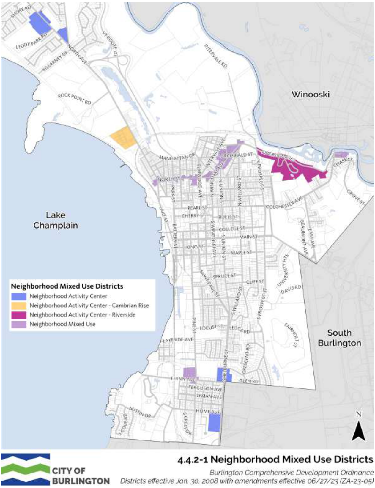
Dimensional Standards and Density:
The density and intensity of development, dimensions of building lots, the heights of buildings and their setbacks from property boundary lines, and the limits on lot coverage shall be governed by the following standards:
Table 4.4.2 -1 Dimensional Standards and Density
| Districts | Max. Intensity (floor area ratio¹) | Max. Lot Coverage | Minimum Building Setbacks (feet) | Building Height (feet) | ||
|---|---|---|---|---|---|---|
| Front ³ | Side | Rear | ||||
| NAC | 2.0 FAR | 80%⁴ | 0 | 0² | 0² | Min: 22’, 2 stories Max: 35 |
| NMU | 2.0 FAR | 80% | 0⁵ | 0² | 0² | Min: 22’, 2 stories Max: 35 |
| NAC-Riverside | 2.0 FAR | 80% | 0 | 0² | 0² | Min: 22’, 2 stories Max: 35 |
| NAC-CR | 2.0 FAR | 60% | Min. 0⁷ Max. 20⁷ | 10⁶ | 20⁶ | Min: 22’, 2 stories Max: 65’ |
1. Floor area ratio is described in Sec. 5.2.7. Measurement of and exceptions to height limits are found in Sec 5.2.6. Bonuses for additional FAR and height where available are described in section (d)3 below, and additional height, FAR and lot coverage is afforded by-right for inclusionary housing projects under Sec. 9.1.12. Actual maximum build out potential may be reduced by site plan and architectural design considerations of Art 6.
2. Structures shall be setback a minimum of 15-feet along any zoning district boundary line that abuts a residential zoning district. Lots of record existing as of September 9, 2015 that are split by neighborhood mixed use and residential zones are exempt from this district boundary setback.
3. Structures shall be setback a minimum of 12-feet from the curb on a public street.
4. Exceptions to maximum lot coverage are provided in (d)2.
5. Notwithstanding footnote 3, the NMU district at the intersection of Pine St. and Flynn Avenue shall have a minimum front yard setback of 10 feet.
6. Side and rear yard setbacks are applicable only to the periphery of the NAC-CR district and not to individual parcels within the district.
7. Front yard setbacks for buildings fronting on North Avenue shall be 20’ min and 30’ max.
Permitted and Conditional Uses:
The principal land uses that may be permitted, or conditionally permitted pursuant to the requirements of Article 3, within the Neighborhood Mixed Use districts shall be as defined in Appendix A – Use Table.
District Specific Regulations:
Ground Floor Residential Uses Restricted
In order to maintain an active streetscape for pedestrians and pedestrian-oriented businesses and activities, residential uses shall not be permitted within 25-feet of a public street right-of-way along the street-level frontage in the NAC District. This restriction shall not apply in the NAC – Riverside and NAC – Cambrian Rise districts.
Exception to Maximum Lot Coverage in NAC District
The following exceptions to the maximum lot coverage standards for the NAC District of Table 4.4.2 -1 may be provided as follows:
Landscaping
Developments that provide landscaping within a parking lot may increase lot coverage above the allowable 80% maximum up to a lot coverage maximum of 85%. This additional lot coverage is limited to twice the landscaping area within a parking lot for each landscaped area of at least 125 square feet with a minimum width of 8 feet excluding curbs, and that include significant shade trees whose mature height is at least 35 feet. If more than two such trees are planted, they shall be 30 feet on center, linear.
In calculating lot coverage, sidewalks are not to be included that are shaded with significant shade trees whose mature height is at least 35 feet and are planted 30 feet on center, linear. A substantial tree must be at least 3 inches in caliper and planted in accordance with Section 11 of the city’s “Burlington Street Tree Planting Plan” design and planting recommendations.
Housing
Developments that provide housing in addition to non-residential uses may increase lot coverage above the allowable 80% maximum by allowing an additional two square feet of lot coverage for every square foot of housing, up to a lot coverage maximum of 90%.
Development Bonuses/Additional Allowances
The following exceptions to maximum allowable base building height and FAR in Table 4.4.2-1 above may be approved in any combination subject to the maximum limits set forth in Table 4.4.2-2 below at the discretion of the DRB. The additional FAR allowed shall correspond to the proportion of the additional building height granted to the maximum available.
Inclusionary Housing:
Inclusionary housing units shall be provided, with applicable additional coverage and density exceptions, in accordance with the provisions of Article 9, Part 1. An additional allowance in the NAC and NAC-Riverside districts may be permitted at the discretion of the DRB for the provision of additional onsite inclusionary housing units.
A maximum of an additional 0.5 FAR may be permitted at the discretion of the DRB for an additional 5% inclusionary housing units provided onsite in excess of the requirements of Article 9, Part 1. The total gross floor area dedicated to the additional inclusionary housing shall be equivalent to the gross floor area resulting from the additional allowance.
Housing for Older Persons and Individuals with Disabilities:
A maximum of an additional 10-feet of building height, and corresponding FAR, may be permitted at the discretion of the DRB in the NAC and NAC-Riverside districts where no less than twenty-five per cent (25%) of the total number of onsite units are reserved for projects including exclusively housing for Older Persons (as defined by the federal Fair Housing Act), housing for Individuals with Disabilities (as defined by the federal Americans with Disabilities Act), or a mixture exclusively thereof, including no less than ten percent (10%) reserved for low-income households. The total gross floor area dedicated to housing for older persons and individuals with disabilities shall be equivalent to the gross floor area resulting from the additional allowance. Increased lot coverage allowance for such projects in these districts shall be the same as for inclusionary housing (see Sec. 9.1.12).
Maximum Bonus:
In no case shall any development bonuses or allowances granted, either individually or in combination, enable a building to exceed the maximum FAR and maximum building height permitted in any district as defined below:
Table 4.4.2 -2: Maximum FAR and Building Heights with Bonuses
| Maximum FAR | Maximum Height | |
|---|---|---|
| NAC | 3.0 FAR | 45 feet |
| NAC-Riverside | 3.0 FAR | 45 feet |
| NAC-Cambrian Rise | 2.5 FAR | 75 feet |
| NMU | 2.5 FAR | 45 feet |
§ 4.4.3Enterprise Districts
Purpose:
The two Enterprise districts as illustrated in Map 4.4.3-1 are described as follows:
The Light Manufacturing (E-LM) district is the traditional commercial/industrial center of Burlington, and is intended primarily to accommodate enterprises engaged in the manufacturing, processing, distribution, design, creating, repairing, or assembling of physical and digital goods, merchandise, equipment, or art. . This district is primarily intended to provide for various industrial and commercial uses, with specific provisions and limits intended to preserve and enhance areas of varied character throughout district. In some locations, commercial and residential uses are allowed to support the wide range of services and employment opportunities desired in the district, and support adjacent areas of residential development. Development is intended to respect interspersed historic industrial buildings, and reflect the industrial aesthetic of the district’s past. Parking is intended to be hidden within, behind, or to the side of structures. This district includes the SEID overlay which is intended to facilitate the redevelopment of a central portion of the E-LM into a walkable, mixed-use innovation district.
The Agricultural Processing and Energy (E-AE) district is intended primarily to accommodate enterprises engaged in the manufacturing, processing, and distribution of agricultural goods and products, and those related to the generation of energy from renewable sources. This district is intended to serve as a community of manufacturing and service businesses that work together to improve their environmental and economic performance. By working together they will reduce the use of raw materials, reduce outputs of waste, conserve energy and water resources, and reduce transportation requirements. Businesses with this district are encouraged to build linkages between themselves to coordinate the flows of energy and materials for maximum efficiency. Development should be designed with close attention paid to the principles of sustainable development and green building technologies. Parking is intended to be hidden within, behind, or to the side of primary structures.
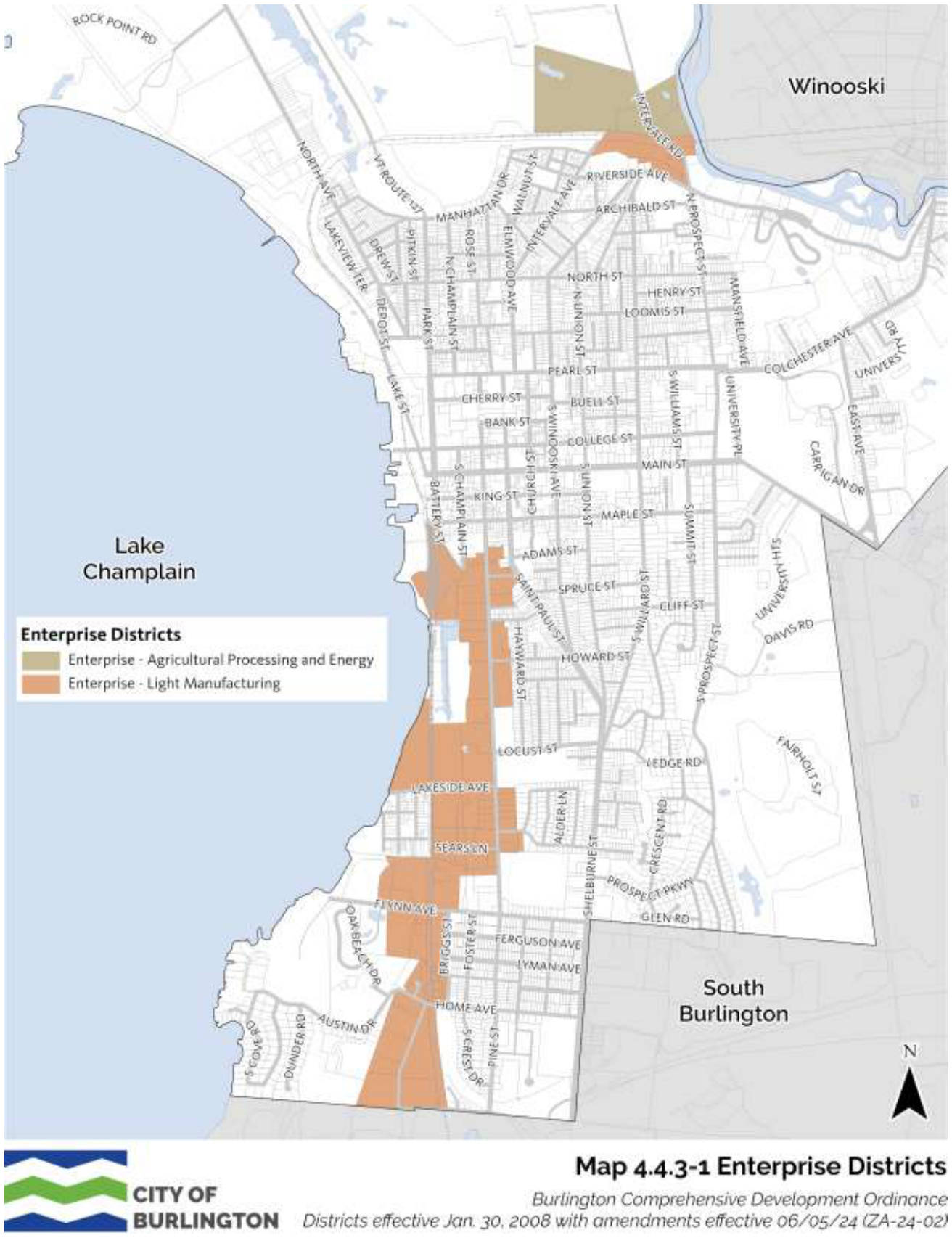
Dimensional Standards and Density
The density and intensity of development, dimensions of building lots, the heights of buildings and their setbacks from property boundary lines, and the limits on lot coverage shall be governed by the following standards:
Table 4.4.3 -1 Dimensional Standards and Density
| Districts | Max. Intensity (floor area ratio¹, ⁴) | Max. Lot Coverage¹, ⁴ | Minimum Building Setbacks¹, ⁴ (feet) | Max. Height¹, ⁴ (feet) | ||
|---|---|---|---|---|---|---|
| Front | Side | Rear ³ | ||||
| Light Manufacturing | 2.0 FAR | 80% | 5 min | 0² | 10%² | 45’ |
| Agricultural Processing and Energy | 0.75 FAR | 60% | 10 min | 10 min | 10 min | 45’ |
1 – Floor area ratio is further described in Art 5. Measurement of and exceptions to coverage, setback, and height standards are found in Art 5. Actual maximum build out potential may be reduced by site plan and architectural design considerations of Art 6.
2 – Structures shall be setback a minimum of 25-feet along any zoning district boundary line that abuts a residential zoning district. Lots of record existing as of September 9, 2015 that are split by enterprise and residential zones are exempt from this district boundary setback.
3 – Percentage of the lot depth.
4 – Maximum intensity, lot coverage, setbacks and building height in portions of the E-LM district are modified by provisions of the South End Innovation District overlay (SEID) in Sec. 4.5.6.
Permitted and Conditional Uses:
The principal land uses that may be permitted, or conditionally permitted pursuant to the requirements of Article 3, within the Enterprise districts shall be as defined in Appendix A – Use Table.
Within the E-LM district, uses unrelated to Industrial or Art Production are permitted to be located on lots south of Home Avenue only when both of the following conditions are satisfied. For lots north of Home Avenue within the EL-M district, this standard does not apply.
When one or more Industrial and/or Art Production use(s) exists on the lot; and
When the combined Gross Floor Area of all uses unrelated to Industrial or Art Production uses do not exceed 49% of the Gross Floor Area on the lot. Uses limited by this provision are identified by Footnote 27 in Appendix A-Use Table.
Uses that may be permitted, or conditionally permitted within the South End Innovation District overlay (SEID) are identified on Table 4.5.6-3.
District Specific Regulations:
The following shall apply to the review and approval of convenience stores in the E-LM district, except as regulated in Sec. 4.5.6: South End Innovation District, in addition to the provisions for the review of Conditional Uses under Art. 3 and General Regulations for convenience stores under Art 5:
Convenience stores in the E-LM district shall only be allowed on properties fronting on Pine Street, and must be sited at least 2,000 linear feet, measured lot line to lot line, from any other convenience store in the E-LM district;
A convenience store shall not contain more than 5,000 square feet of gross floor area;
If located at a street intersection, the nearest edge of any curb cut shall be located as far as possible from any intersections with a minimum distance of 50 feet from an intersection as measured from the corner of and along the lot line of the site;
Approval shall be granted only if, in addition to the general conditional use standards listed in Sec. 3.5.6, the DRB determines that a proliferation of convenience stores is not threatening the primary intent of the E-LM district for industrial purposes, as stated in Section 4.4.3 (a) 1; and,
Convenience stores that obtain a conditional use permit within the E-LM District may include gasoline pumps provided the total square footage occupied by pumps, pump islands and vehicular space(s) at a pump filling station is the lesser of 1,850 s.f. or 50% of the gross floor area of the enclosed convenience store.
Drive Thrus are not permitted.
§ 4.4.4Institutional District
Purpose:
The Institutional District (I) as illustrated in Map 4.4.4-1 allows for increased development scale and intensity than would typically be found in the adjacent residential districts to support continued growth and flexibility of the city’s major public and higher education and health care institutions within their respective institutional missions. New development is intended to be sensitive the historic development pattern of the existing campuses as well as the surrounding residential neighborhoods.
This district is intended to support a broad range of related uses reflecting the resident institutions’ roles as either regional education, health care, cultural and research centers or municipal educational facilities. Buildings should be designed with a high level of architectural detailing to provide visual interest and create enjoyable, human-scale spaces. Sensitive transitions between adjacent lower scale residential and open space areas and larger scale institutional development should be provided. Sites should be designed to be pedestrian friendly and encourage walking between buildings. Where parking is provided onsite, it is intended to be hidden behind, to the side, within, or underneath structures.
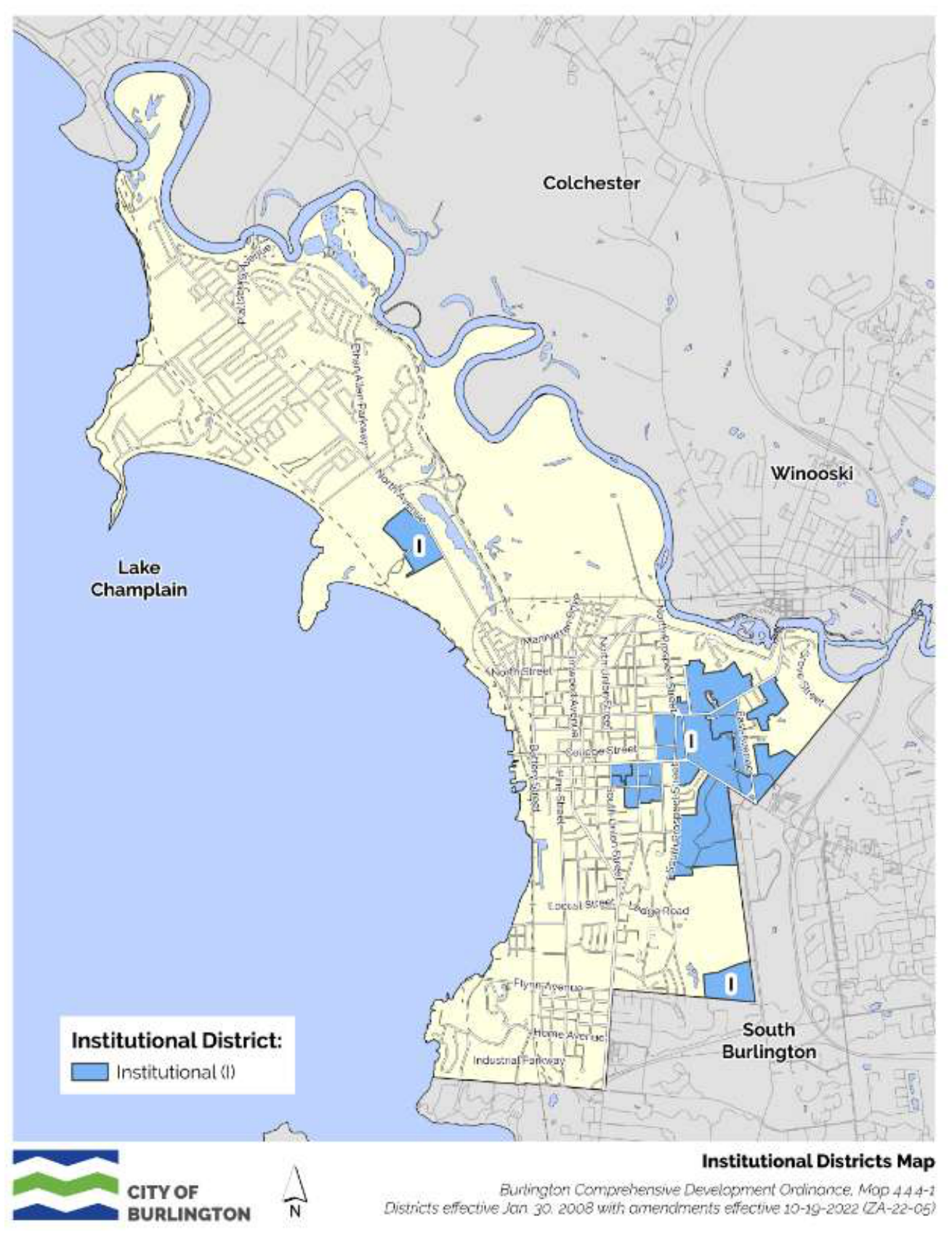
Dimensional Standards and Density:
The density and intensity of development, dimensions of building lots, the heights of buildings and their setbacks from property boundary lines, and the limits on lot coverage shall be governed by the following standards:
Table 4.4.4 -1 Dimensional Standards and Density
| Districts | Max. Intensity | Max. Lot Coverage¹ | Building Setbacks¹ (feet) | Max. Height¹ (feet) | ||
|---|---|---|---|---|---|---|
| Front ² | Side ³ | Rear ³ | ||||
| Institutional | 20 du/ac (24 du/acre with inclusionary req.) | 40% (48% with inclusionary req.) | Minimum: 15-feet | 10% of lot width Min: 5-ft Max required: 20-feet | 25% of lot depth Min: 20-feet Max required: 75-feet | 35’ |
1 –Measurement of and exceptions to coverage, setback and height standards are found in Art 5.
2 –The calculation of the front yard setback shall be a percentage of lot width and depth or as defined and described in Art 5.
3 – Maximum allowable lot coverage, setbacks and building height in portions of this district may be modified by the provisions of the Institutional Core Campus Overlays in Sec. 4.5.2, where applicable.
Permitted and Conditional Uses:
The principal land uses that may be permitted, or conditionally permitted pursuant to the requirements of Article 3, within the Institutional district shall be as defined in Appendix A – Use Table and as modified by provisions of the Institutional Core Campus Overlays in Sec. 4.5.2 where applicable.
§ 4.4.5Residential Districts
Purpose:
The Residential Districts are intended to control development in residential districts in order to create a safe, livable, and pedestrian friendly environment, while enabling neighborhoods to evolve to meet the changing needs of households and the economy, and as a result of the climate emergency. They are also intended to create an inviting streetscape for residents and visitors. Development that places emphasis on architectural details and form is encouraged, where primary buildings and entrances are oriented to the sidewalk, and new buildings are interspersed within a wide range of historic development patterns across the city. Parking shall be placed either behind, within, or to the side of structures, and building facades designed for parking shall be secondary to the residential aspect of a structure.
The Residential districts as illustrated in Map 4.4.5-1 are further described as follows:
The Residential Lower Intensity (Residential Low, RL) district is intended primarily for residential development that includes a mix of housing types such as single detached dwellings, with or without accessory dwelling units, duplexes, triplexes and quadplex organized in a compact neighborhood-scale that complements respective neighborhoods’ development and open space patterns. Building heights typically vary from one to two and half stories, and development generally results in lower lot coverage than in other residential districts. Limited commercial uses take the form of home-based businesses and the adaptive reuse of historic buildings as neighborhood-serving uses.
The Residential Medium Intensity (Residential Medium, RM) district is intended for residential development that includes a mix of housing types such as single-family detached dwellings, with or without accessory dwelling units, duplex, triplex, quadplex, and multi-unit buildings in compact, walkable neighborhoods. Building heights typically range from two to three stories, and development generally results in moderately higher lot coverage as compared to the RL district. Neighborhoods within this district are typically walkable to downtown or other mixed-use areas of the city, and commercial uses within the district take the form of home-based businesses and the adaptive reuse of historic buildings for neighborhood-serving uses.
The Residential High Intensity (Residential High, RH) district is intended for residential development that includes a mix of housing types such as duplex, triplex, quadplex, townhouse, and mid-sized and larger multi-unit buildings. Single-family detached dwellings are limited to buildings originally built for such purpose. Development is intended to be more intense than other residential areas, with building heights ranging from two to three and a half stories, high lot coverage, and buildings placed close to the street and each other on small lots. Neighborhoods within this district are typically immediately adjacent to downtown and the institutions, and commercial uses within the district take the form of home-based businesses and the adaptive reuse of historic buildings for neighborhood-serving uses.
The Residential Corridor (RC) district is intended for residential development that includes a mix of housing types such as duplex, triplex, quadplex, townhouse, and mid-sized, multi-unit and mixed-use buildings along major multi-modal transportation corridors that are adjacent to low intensity districts. Single-family detached dwellings are limited to buildings originally built for such purpose. New and infill development may be located closer to the street than historic development patterns, with building heights up to four stories and high lot coverage. Multiple Principal Uses are allowed, and neighborhood-serving commercial uses may be incorporated in existing or new buildings.
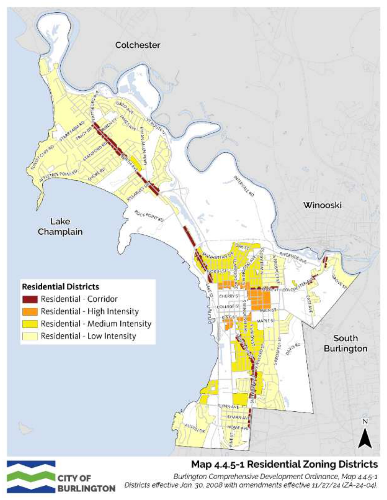
Dimensional Standards
The intensity of development, dimensions of building lots, the heights of buildings and their setbacks from property boundary lines, and the limits on lot coverage shall be governed by the following standards:
Table 4.4.5-1 Lot Size, Frontage, Setback, and Lot Coverage Standards in Residential Districts
| District | Min. Lot Frontage²,³,⁴, ⁵ (linear feet) | Setbacks¹,⁵,⁶,⁷,⁸,⁹ | Lot Coverage¹,⁹ | ||
|---|---|---|---|---|---|
| Front | Side | Rear | |||
| Residential Low (RL) | 30’ | Min: Avg. of front setback 2 adjacent lots on both sides +/- 5 feet Max required: 25 ft | Min: 10% of lot width or avg. of side setback of 2 adjacent lots on both sides Max required: 20 ft | 20 ft. | 45% |
| Residential Medium (RM) | 15 ft. | 55% | |||
| Residential High (RH) | N/A | 80% | |||
| Residential Corridor (RC) | N/A | Min required: 5 ft Max permitted: 20 ft | 80% | ||
1. Details regarding the measurement of and exceptions to coverage and setback standards are found in Art 5.
2. The DRB may reduce the frontage requirements for lots fronting on cul-de-sacs, multiple streets, or corner lots to more closely reflect an existing neighborhood pattern.
3. Exceptions to frontage requirements for flag lots and small lot subdivisions are found in Sec. 5.2.2
4. For lots in RL or RM with more than two primary buildings, the minimum lot frontage shall be 45’.
5. Average setback for front and side setbacks are calculated based on 4 adjacent lots, two on each side within the same block and on lots with the same frontage requirements. For the purposes of determining the required front setback only, among the comparative sample of four neighboring properties, one may be removed from the averaging calculation.
6. Where there are fewer than 2 adjacent lots on both sides within the same block having the same street frontage, the average side yard setback shall be calculated from the fewer number of lots. Where there are no adjacent lots, the side setback shall be 10% of the lot width. Refer to Sec. 5.2.5 for additional details.
7. A 75 ft setback shall be required from the ordinary high water mark of Lake Champlain and the Winooski River. Additional setbacks from the lakeshore and other water features may be applicable per the requirements of Sec 4.5.3 Riparian and Littoral Conservation Overlay Zone.
8. Reserved.
9. An additional ten per cent (10%) lot coverage may be permitted for accessory residential features per (d) 2C below.
Table 4.4.5-2 Principal & Secondary Structures Massing and Placement Standards in Residential Districts
| District | Max Height & Stories¹,³, ⁵ | Max Dwelling Units per Structure²,³ | Max. Principal Structure Footprint³, ⁶, ⁷ | Max. Secondary Structure Footprint³, ⁵, ⁶, ⁷ | Max. Linear Elevation before offset⁴ | Min. Distance between Structures on same lot |
|---|---|---|---|---|---|---|
| Residential Low (RL) | 35’ 3 stories | 4 | 1,800 sq.ft | 1,100 sq.ft. | 50’ | 15’ |
| Residential Medium (RM) | 35’ 3 stories | 4 | 1,800 sq.ft. | 1,100 sq.ft. | ||
| Residential High (RH) | 50’ 4 stories | N/A | N/A | N/A | ||
| Residential Corridor (RC) | 3,600 sq.ft. | N/A |
1. Details regarding the measurement of and exceptions to height limits are found in Art 5.
2. Minimum dwelling unit size is 350 sq.ft.
3. Within RL and RM zones, lots may have up to one (1) Principal and one (1) Secondary structure per lot, except as may otherwise be allowed by Table 4.4.5-3 or Article 11. Where an existing Principal Structure contains only an owner-occupied single detached dwelling and proposes to add one additional unit within the Principal Structure or in a Secondary Structure, see additional provisions in Sec. 4.4.5 (d) 4 D.
4. Required on all building Elevations. Minimum offset is 5 ft measured perpendicular to the building Elevation in excess of 50 linear feet.
5. Except as otherwise may be permitted in Article 11, PUD, a Secondary Structure shall be placed behind the Principal Structure.
6. Maximum Principal and Secondary Structure Footprint Standards shall not apply to the following Residential – Special Uses: Assisted Living, Community House, Convalescent/Nursing Home, Historic Inn.
7. The conversion to a Residential Use of an existing structure exceeding this standard as of January 1, 2025 shall be allowed.
8. Maximum Principal and Secondary Structure Footprint Standards shall not apply to Neighborhood Commercial Uses. See Sec. 4.4.5 (d) 3 iii for Neighborhood Commercial Use size limitations.
Permitted and Conditional Uses:
The principal land uses that may be permitted, or conditionally permitted pursuant to the requirements of Article 3, within the Residential districts shall be as defined in Appendix A – Use Table and as may be modified by district specific regulations in Sec. 4.4.5 (d).
District Specific Regulations:
The following regulations are district-specific exceptions, bonuses, and standards unique to the residential districts. They are in addition to, or may modify, city-wide standards as provided in Article 5 of this ordinance and district standards as provided above.
Additional Residential Development Permitted
In addition to any applicable development permitted according to Article 11 – Planned Unit Development, the following additional development types and intensities shall be allowed within the Residential Districts, subject to the following standards.
A Pocket Neighborhood is a group or cluster of small detached houses or two-unit attached houses that share a common area.
Development Standards
Unless otherwise stated, Pocket Neighborhood standards are required to follow the underlying district dimensional standards in Table 4.4.5-1.
Building and Site Standards
Lot Size: Pocket Neighborhoods must have a Minimum Lot Size of 4,000 sq. ft.
Principal Structure: Pocket Neighborhoods may have a Principal Structure adhering to the requirements listed in Table 4.4.5-2.
Pocket Neighborhood Dwelling Units must adhere to the standards in Table 4.4.5-3 below. However, Principal Structures are subject to the standards in Tables 4.4.5-1 and 4.4.5-2.
Building Separation: Within a Pocket Neighborhood, buildings shall be separated by a minimum distance of 6 feet.
Building Orientation: Dwellings shall be orientated toward and within 60 feet walking distance of the Common Area. However, this standard shall not apply to a Principal Structure in existence at the time of application.
Table 4.4.5-3: Pocket Neighborhood Standards
| Max. Dwelling Units per Structure | Number of Dwelling Units per Site | Max. Building Footprint | Maximum Building Height | Minimum Setback from Common Area |
|---|---|---|---|---|
| 2 | Min: 3 Max: 12 | 1,000sq ft | 30’ | 3’ |
Building and Site Standards
Pocket Neighborhoods shall have a Common Area that is a minimum of 400 square feet per dwelling made up of either a continuous open space or a series of interconnected open spaces.
No portion of the Common Area may be less than 20 feet in width or length.
Surface parking areas and driveways do not qualify as a Common Area.
A minimum of 75% of a Common Area shall be usable open space.
Common Areas shall not include areas of steep slopes greater than 15%.
Common Building Requirements
Common Buildings are intended to be utilized as a community building for the sole use of the Pocket Neighborhood residents.
Common Buildings are not required in Pocket Neighborhoods.
May take up to 25% of the required common open space, but no greater than 1,500 square feet.
Uses of the Common Building must be accessory to the Pocket Neighborhood.
Parking Requirements for Pocket Neighborhoods
Driveway and parking areas shall meet the standards outlined in Articles 6 and 8.
If onsite parking is provided, the parking area shall be consolidated to minimize the number of parking areas, except as provided for in Article 6, Sec. 6.2.2 (l).
Off-street parking can be located within a Common Building, provided that the ingress/egress to such parking is not oriented toward, or fronting on, the Common Area.
Single- and two-car garages and carports may be attached to individual residential structures, provided such garages are oriented toward the rear of the structure.
A Rowhouse is a principal structure containing one or two units that is attached in a row of no fewer than two (2) rowhouses.
Development Standards
Unless otherwise stated, Rowhouse standards are required to follow the underlying district dimensional standards in table 4.4.5-1
Vehicular Access
Unless otherwise stated, vehicular access standards are required to follow Sec. 6.2.2(i). In a Rowhouse development consisting of only two Rowhouses, access shall be provided by no more than one curb cut serving both dwelling units. A Rowhouse development consisting of three or more Rowhouses shall be accessed by a rear alley with a minimum width of 15 feet. In a Rowhouse development consisting of three or more Rowhouses, a garage attached to a Rowhouse and oriented toward the street is prohibited.
Dimensional Standards
The intensity of development, dimensions of building lots, the heights of buildings and their setbacks from property boundary lines, and the limits on lot coverage shall be governed by the following standards:
Table 4.4.5-4 Rowhouse Lot and Site Standards
| District | Lot Coverage | Setback | Min. Lot Width (Individual Fee Simple Lot within Project) | ||||
|---|---|---|---|---|---|---|---|
| Project Periphery | Party Wall Boundary (Lot or Structure) | ||||||
| Project¹ | Lot² | Rear | Side | Front³ | Side | ||
| Residential Low (RL) | 55% | 65% | 20 ft. | Min: 10% of lot width or avg. of side setback of two adjacent lots on both sides, whichever is less Max Required: 20 ft | Avg. of front setback 2 adjacent lots on both sides +/-5 feet Max Required: 20 ft | 0 ft. | 16 ft |
| Residential Medium (RM) | 65% | 65% | 15 ft. | ||||
| Residential High (RH) | 80% | 80% | |||||
| Residential Corridor (RC) | 80% | 80% | |||||
1. In Projects developed with Fee Simple Rowhouse Lots, lot coverage is based on the sum area of all individual Rowhouse Lots and any common areas; in all other Projects, lot coverage is based on the Project Lot.
2. The maximum lot coverage allowed on each Fee Simple Rowhouse Lot within a Project consisting of multiple Rowhouses.
3. In Rowhouse Projects constructed perpendicularly to the street, the Front Project Periphery Setback shall apply to the foremost Rowhouse in relation to the street.
4. In Rowhouse projects constructed perpendicularly to the public street, the foremost Rowhouse relative to the street shall have its principal entrance be oriented toward the public street.
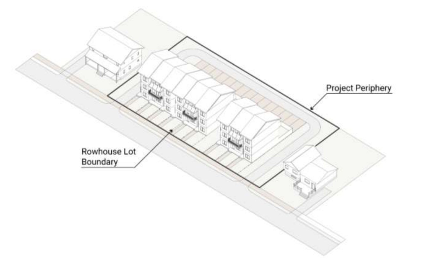
Table 4.4.5-5 Rowhouse Principal & Secondary Structure Massing & Intensity Standards
| Max. Dwelling Units per Structure¹ | Max. Height & Stories | Sequencing | Max. Building Footprint | |||
|---|---|---|---|---|---|---|
| Max. Rowhouses in Uninterrupted Sequence | Min. Bldg Separation Betweeen Uninterrupted Sequences | Rowhouse Unit | Secondary Structure | |||
| Side | Rear | |||||
| 1 | 40’ 3 stories | 10 | 10 ft. | 20 ft | 900 sq. ft. | 600 sq. ft. |
1. A Principal Rowhouse Structure may contain a second Dwelling Unit that is subordinate to and smaller than the Structure’s main Dwelling Unit.
Exceptions to Dimensional Standards
Encroachment into Side Setback for Residential Driveways
For purposes of enabling narrow or flag lots to create a driveway to provide a maximum of two tandem parking spaces, or to access a parking area behind a principal structure, driveways may encroach into a required side setback up to the property line. The maximum waiver from the side setback shall be the minimum necessary for the purposes of creating such a driveway or access to parking spaces. Applications for such waiver shall demonstrate that there will be no undue adverse impact on drainage, safety, light, and air, nor encroachment into a neighboring side yard. With such approval, the lot shall not be considered nonconforming due to the decreased setback.
Encroachment into the Waterfront Setback
The following exceptions to the required waterfront setback for Lake Champlain and the Winooski River established under Article 4, Table 4.4.5-1, footnotes7 and 8.
Replacement of Existing Structure
Replacement of a conforming principal structure existing as of the effective date hereof, may encroach into the required setback provided the replacement does not increase the area or extent of the encroachment more than the existing structure.
Averaging of Setbacks of Existing Structures
If the setback from the waterfront of existing principal structures within one hundred fifty (150) feet on either or both sides of a subject lot is less than the minimum required setback, the setback for the subject lot may be reduced to the average setback of such neighboring structures.
Exceptions to Lot Coverage for Accessory Residential Features
In addition to lot coverage exemptions in Sec. 5.2.3 (b), within the RL and RM districts, an additional ten (10) percent of lot coverage above the otherwise applicable limit may be permitted for the following amenity features accessory to residential uses provided that such features shall at no time be enclosed:
Decks;
Patios;
Porches;
Terraces;
Tennis or other outdoor game courts;
Swimming pool aprons;
Walkways;
Window Wells; and/or
Pervious pavement designed and maintained to infiltrate the 1-year/24-hour storm event onsite, subject to review and approval by the Stormwater Administrator .
With the exception of the additional lot coverage allowances provided for under Article 9: Inclusionary and Replacement Housing, requirements for such additional lot coverage shall not be permitted for any development where other bonus provisions of this ordinance are applicable.
Exceptions to Maximum Building Footprint Limit
Except as provided for in (ii) below, existing structures legally existing as of January 1, 2024 in excess of the building footprint limits in Table 4.4.5-2 shall not be considered non-conforming. Such buildings shall only be allowed to be converted, adaptively reused, or enlarged, including for the purpose of adding additional units, within the limits this part or as otherwise permitted in Sec. 5.4.8 or Article 11.
Single-family homes legally existing as of January 1, 2024 in excess of the building footprint limits in Table 4.4.5-2 may be expanded to 125% of the pre-existing footprint, as long as no additional units are added.
Exception for Neighborhood Commercial Uses
Neighborhood commercial uses as defined in Article 13 and intended to primarily serve the nearby residential area shall be considered permitted uses in RL, RM, RH and Institutional districts subject to the following:
This exemption shall only apply to:
Historic buildings that are listed or eligible for listing on the state or national register; or,
A street level neighborhood commercial use as defined in Article 13 in lawful existence as of January 1, 2007.
Neighborhood commercial uses shall be limited to a single story on the street level of any structure.
Neighborhood commercial uses less than 2,000 sqft shall be treated as a permitted use. Neighborhood commercial uses greater than or equal to 2,000 sqft but less than 4,000 sqft shall be treated as a conditional use. Neighborhood commercial uses occupying 4,000 sqft or more shall not be permitted.
The neighborhood commercial use shall not be counted against the property’s allowable residential density.
Hours of operation shall be limited to 6:00am to 11:00pm seven days per week. Any expansion in the hours of operation of an existing neighborhood commercial use shall require conditional use review by the DRB.
All building height and setback requirements for the underlying residential district shall apply, and the lot coverage shall not exceed 60%.
Any exterior changes to the building(s) or changes to the site plan shall be subject to the design review requirements of Article 6.
To the extent that additional parking is necessary, the parking standards for Shared-Use Districts shall apply pursuant to Article 8.
The conversion of a residential use to a neighborhood commercial use within a historic neighborhood commercial building more than 50 years old and originally designed and constructed for such purpose shall be exempt from the housing replacement requirements of Article 9, Part 2.
Home occupations as defined and regulated under this article are not restricted by the provisions of this section.
Any aspect of a neighborhood commercial use in lawful existence as of January 1, 2007 not in strict conformance with any of the above standards shall be considered non-conforming and be subject to the provisions of Article 5, Part 3.
Miscellaneous Standards
Additions to Existing Residential Structures.
No request for an addition to an existing structure shall be considered or imply approval of an additional unit, unless requested specifically on the zoning permit application form.
Accessory Residential Structures, Buildings, and Uses
An accessory structure, building, and/or use as defined in Article 13 and provided under Sec. 5.1.1 and 5.1.2 customarily incidental and subordinate to a principal residential structure, building and/or use, including but not limited to private garages, carriage houses, barns, storage sheds, tennis courts, swimming pools, cabanas for swimming pools and detached fireplaces may be permitted as follows:
Accessory structures or buildings shall meet the dimensional requirement set forth in the district in which they are located pursuant to Sec. 4.4.5(b) of this Article and related requirements in Art 5, Parts 1 and 2;
Any accessory structure or building that is seventy-five percent (75%) or greater of the ground floor area of the principal structure or building shall be subject to the site plan and design review provisions of Art. 3, Part 4 and the applicable standards of Art 6;
Private garages shall be limited to as many stalls as there are bedrooms in the dwelling to which it is accessory, provided that the ground floor area is less than seventy-five percent (75%) of the ground floor area of the principal structure or building; and
The outdoor overnight storage of commercial vehicles not otherwise associated with an approved home occupation or made available for the exclusive use of the residential occupants, or the outdoor storage of more than one unregistered vehicle, shall be prohibited. Any and all vehicles shall be stored in an approved parking space.
Residential Occupancy Limits.
In all residential districts, the occupancy of any dwelling unit is limited to members of a family as defined in Article 13. Notwithstanding the following, the minimum square footage requirements shall be reduced by ten (10%) percent in situations where the residential premises are owner occupied.
Subject to Conditional Use approval by the DRB, a dwelling unit may be occupied by more than four (4) unrelated adults if it contains at least twenty-five hundred (2,500) square feet excluding its attic and basement pursuant to the following:
If in a RL district, the dwelling unit also contains at least an additional two hundred fifty (250) square feet and two (2) onsite parking spaces, plus one (1) additional parking space per adult occupant in excess of four (4); or,
If in a RM district, the dwelling unit also contains at least an additional two hundred (200) square feet and two (2) onsite parking spaces, plus one (1) additional parking space per adult occupant in excess of four (4).
If in a RH district, the dwelling unit also contains at least an additional 150 square feet and two (2) onsite parking spaces, plus 1 additional parking space per adult occupant in excess of four (4).
In considering a request relating to permitting a greater number of unrelated individuals residing in a dwelling unit within a residential zoning district, no conditional use permit may be granted unless all facilities within the dwelling unit, including bathroom and kitchen facilities are accessible to the occupants without passing through any bedroom. Each room proposed to be occupied as a bedroom must contain at least one hundred twenty (120) square feet.
Additional Unit on lot or within Owner-Occupied Single Detached Dwelling
Where an existing Principal Structure in any Residential Zoning District contains only an owner-occupied Single Detached Dwelling, and an applicant proposes to add a single additional dwelling unit within the Principal Structure or within a detached Secondary Structure on the same lot as the owner-occupied home, the application shall be subject to administrative review and approval according to Sec.3.2.7 (a) 13, and exempt from paying impact fees, according to Sec. 3.3.1., except where otherwise required.
Residential Development Bonuses
The following exceptions to maximum allowable residential standards in Tables 4.4.5-1 and 4.4.5-2 may be approved in any combination subject to the maximum limits set forth in Table 4.4.5-6 at the discretion of the DRB. Any bonuses that are given pursuant to this ordinance now or in the future shall be regarded as an exception to the limits otherwise applicable.
Housing for Older Persons and Individuals with Disabilities Bonus
Residential development in excess of the limits set forth in Tables 4.4.5-1 and 4.4.5-2 may be permitted by the DRB for projects including exclusively housing for Older Persons (as defined by the federal Fair Housing Act), housing for Individuals with Disabilities (as defined by the federal Americans with Disabilities Act), or a mixture exclusively thereof provided the following conditions are met:
No less than twenty-five (25) per cent of the total number of units shall be reserved for low-moderate income households as defined by state or federal guidelines, including no less than ten (10) percent reserved for low-income households. (Projects taking advantage of this bonus are exempt from the Inclusionary Zoning requirements of Article 9, Part 1.);
The proposal shall be subject to the design review provisions of Art. 6;
Lot coverage, height, and development intensity shall not exceed the following. The maximum dwelling units per building in Table 4.4.5-2 may be waived subject to the DRB approval under Article 11.
Table 4.4.5-6: Housing for Older Persons and Individuals with Disabilities Bonus
| District | Maximum Lot Coverage | Maximum Development Intensity | Maximum Height |
|---|---|---|---|
| RL | 55% | 1.5 FAR | 4 stories, 50 ft |
| RM | 65% | 1.75 FAR | |
| RH, RC | 90% | 2.0 FAR | 5 stories, 62 ft. |
Residential Conversion Bonus
Development in excess of the limits set forth in Tables 4.4.5-1 and 4.4.5-2 may be permitted by the DRB subject to conditional use review for the conversion of an existing non-conforming nonresidential principal use to a conforming residential use subject to all of the following conditions:
Any applicable lot coverage, height, FAR, and units per building limits may be modified by the DRB up to a limit of 100% of the pre-application coverage, height and GFA condition.
Limitations on Residential Development Bonuses:
For projects where the conditions of more than one applicable bonus listed above and under Sec.5.4.8 (e) are met, and where any applicable development allowances per Article 9 are utilized, the applicant may use the most permissive exemption to the underlying lot coverage or residential intensities applicable.
In no case shall any development bonuses and allowances granted, either individually or in combination, enable a building to exceed the maximum development intensity, lot coverage, and building height permitted in any district as defined below:
Table 4.4.5-7: Maximum Intensity, Lot Coverage and Building Heights with Bonuses
| District | Maximum FAR* | Maximum Height | Maximum Lot Coverage* |
|---|---|---|---|
| RL | 1.5 FAR | 50-feet | 55% |
| RM | 1.75 FAR | 50-feet | 65% |
| RH, RC | 2.0 FAR | 62-feet | 90% |
*- or 125% of the pre-application gross floor area or coverage of the qualifying principal building as may be applicable per Table 5.4.8-1 Historic Building Rehabilitation Bonus
Effective Date.
The amendments to this Section 4.4.5 that allow for a secondary structure within RL and RM zones, except as may otherwise be allowed by Article 11, are effective November 1, 2024.
§ 4.4.6Recreation, Conservation and Open Space Districts
Purpose
The Recreation, Conservation and Open Space (RCO) Districts are intended to protect the function, integrity and health of the city’s natural systems environment, provide for a balance between developed and undeveloped land, protect air and water quality, provide adequate open areas for recreation, conservation, agriculture, and forestry, enhance the city’s quality of life and the aesthetic qualities of the city, moderate climate, reduce noise pollution, provide wildlife habitat, and preserve open space in its natural state.
The RCO districts are subdivided into three parts, and are further described as follows:
RCO-Agriculture (RCO-A): The Agriculture District is intended to protect productive agricultural soils, provide opportunities for viable commercial agricultural production, and to protect natural resources and working forest lands. The Agricultural District may contain designated trails or corridors for compatible passive recreational use.
RCO-Recreation/Greenspace (RCO-RG): The Recreation/Greenspace District is intended to provide a diversity of passive and active recreational opportunities and other urban green spaces that provide for public use and enjoyment. The District includes a wide spectrum of recreational opportunities including developed parks with active public-use facilities, undeveloped open areas, dog parks, community gardens, urban parks and pocket parks, playgrounds, transportation corridors, and cemeteries. The District also includes private property, including a golf course and residential properties, where appropriate future development could be provided.
RCO-Conservation (RCO-C): The Conservation District is intended to preserve the function, integrity and health of the city’s significant natural communities and features, both land and water, in their natural state for scientific, ecological, wildlife, educational or scenic purposes. The Conservation District may contain passive recreational opportunities where such activities are compatible with the protection of natural features.
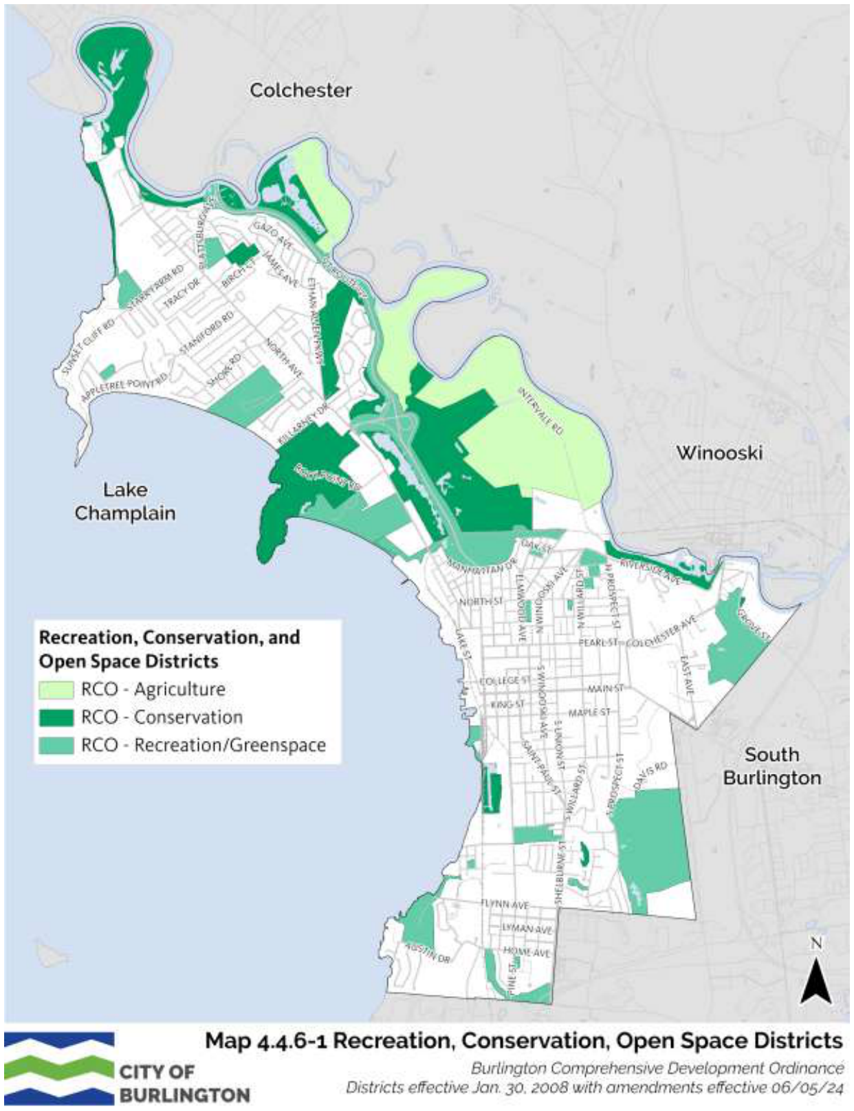
Dimensional Standards and Density
The density and intensity of development, dimensions of building lots, the heights of buildings and their setbacks from property boundary lines, and the limits on lot coverage shall be governed by the following standards:
Table 4.4.6 -1 Dimensional Standards and Density
1. See also exceptions to lot coverage, setbacks and maximum height in Article 5.
2. Percentages figure refers to either a percentage of lot width, 10% in the case of side yard setbacks, or lot depth of 25% in the case of rear yard setbacks.
3. City Parks have specific lot coverage maximums based on use and location. See table of lot coverage standards below.
Table 4.4.6 -2 City Park Lot Coverage Maximum Standards
| Park | Lot Coverage |
|---|---|
| Texaco Beach/Cambrian Rise | 10% |
| Baird, Calahan, Leddy, North Beach and Campground, Oakledge, Schmanska, Smalley, Starr Farm | 15% |
| Appletree, Lakeside | 20% |
| Pomeroy, Roosevelt | 30% |
Permitted and Conditional Uses
The principal land uses that may be permitted, or conditionally permitted pursuant to the requirements of Article 3, within the RCO districts shall be as defined in Appendix A – Use Table.
Provided, notwithstanding the foregoing, a planned unit development may be permitted pursuant to the standards and procedures of Article 11 hereof for residential development in accordance with the low density residential district (RL) allowances and standards for any property in excess of five acres which is located in the RCO-RG district south of Main Street. Any residential uses in the RCO-RG district south of Main Street existing on January 1, 2007 shall be treated as conforming uses and not otherwise subject to the restrictions for non-conforming uses pursuant to Sec.5.3.4.
District Specific Regulations
The following regulations are district-specific exemptions, bonuses, and standards unique to the RCO districts. They are in addition to, or may modify, city-wide standards as provided in Article 5 of this ordinance and district standards as provided above in Tables 4.4.6-1 and 4.4.6-2.
Lot Coverage for Agricultural Structures.
The maximum allowable coverage may be increased to ten percent (10%) in the RCO-Agricultural District for agricultural structures not otherwise exempted from zoning review under V.S.A. 24 § 4413 (d), subject to approval by the DRB.
Exemptions for low impact design (LID) stormwater management techniques Due to the unique nature and critical importance of City Parks in the City’s overall green infrastructure, LID stormwater management techniques (such as pervious pavement and asphalt, green roofs and rain gardens etc...) shall be credited against lot coverage as determined by the City’s Stormwater Administrator pursuant to the requirements of Burlington Code of Ordinances Chapter 26.
Pervious surface materials not included in impervious lot coverage calculations Pervious surface materials, such as woodchips and clay or dirt playfields in City Parks shall not be included in impervious lot coverage calculations.
§ 4.4.7Urban Reserve District
Purpose:
The Urban Reserve District (UR) as illustrated in Map 4.4.7-1 is a unique and temporary zoning district intended to:
Temporarily preserve a large portion of the lake shore from development in order to concentrate waterfront development activities farther south within the Downtown and the Downtown Waterfront districts; and,
Reserve the right for future generations to determine the most appropriate combination of development and conservation that should occur at this site through a comprehensive and participatory planning process.
As such, this District maintains the property as passively-used and publicly-accessible open space allowing for continued post-industrial re-naturalization, with opportunities for public education, enjoyment, and passive recreation.
No new development or dedicated uses on the property shall be considered except as may be provided below, including harbor-related development, and no additional fill shall be placed on the property unless part of an approved remediation plan.
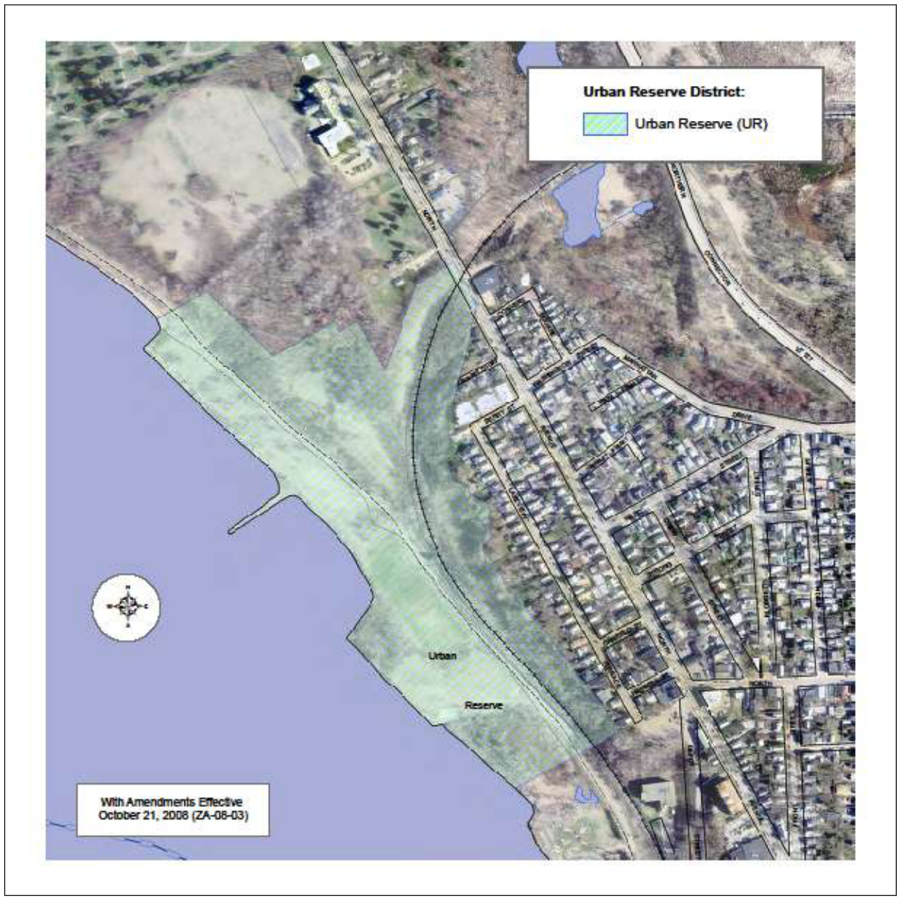
Dimensional Standards and Density:
There shall be no residential density, FAR or additional lot coverage permitted anywhere within this district.
Permitted and Conditional Uses:
There shall be no permitted or conditionally permitted uses in this district with the exception of the following which shall be considered as Conditional Uses on a case-by-case basis:
The temporary staging of off-site construction projects requiring deep-water lake access or projects located on an adjacent property with no other suitable access;
The seasonal and temporary storage of snow by the City;
Site improvements associated with environmental remediation, mitigation, or re-naturalization plans that have been pre-approved by the appropriate state and/or federal agency. These improvements shall be conducted in such a way as to enhance the natural landscape and improve ecological functions, including but not limited to wetlands enhancement, shoreline stabilization and re-naturalization, removal of shoreline sheet pile, concrete and asphalt, and plantings for the purpose of enhancing the natural attenuation of contaminants; and,
Existing public recreational paths and railroad facilities and their necessary maintenance.
District Specific Regulations
Any and all improvements in this district shall be consistent with any and all development and use restrictions and easements as may otherwise be applicable to the property.
Any authorization granted by the DRB shall include a prescribed duration for the activity after which such authority and all related permits shall expire. The DRB may consider an extension of this time period if such a request has been made prior to expiration. No permit should remain in effect for more than 2 years without reapplication and review pursuant to this section.
As a condition of any approval by the DRB for projects involving temporary construction staging or seasonal snow storage, the site shall be restored to its prior condition once the temporary activity has been completed for which the DRB may require a bond or other necessary surety in a form satisfactory to the city attorney.
Part 5Overlay Zoning District Regulations
§ 4.5.1Reserved
§ 4.5.2Institutional Core Campus Overlay Districts
Purpose
The Institutional Core Campus Overlay (ICC) districts are intended to provide for reasonable future growth for institutions within the core of their respective campuses without further intrusion into surrounding residential neighborhoods. This overlay allows increased development than would typically be found in the underlying districts. Development is intended to be more intense than the surrounding neighborhoods with higher lot coverage and larger buildings. New development should provide sensitive transitions to the historic development pattern and scale of the surrounding campus.
Buildings both large and small should be designed with a high level of architectural detailing to provide visual interest and create enjoyable, human-scale spaces. Sites should be designed to be pedestrian friendly and encourage walking between buildings. Circulation should largely emphasize the needs of pedestrians and bicycles, and parking should be very limited and generally provided offsite. Where parking is provided, it should be hidden either within or underneath structures.
Areas Covered.
The Institutional Core Campus Overlays as delineated on Map 4.5.2-1, and are further described as follows:
University of Vermont Medical Center Campus (ICC-UVMMC) allows for an increased development scale and intensity than would typically be found in the adjoining and underlying districts to support continued growth and expansion of the state’s academic medical center. As a regional tertiary-level care facility, on-site parking is expected to play a larger role than otherwise would be expected for other institutional campus overlays in order to accommodate the needs of patients and visitors. While outdoor spaces and circulation systems should be inviting and accommodating for pedestrians, the overall development of the campus would be expected to emphasize the needs of internal circulation and functions in order to meet patient care requirements;
UVM Central Campus (ICC-UVM) allows for an increased development scale and intensity than would typically be found in the adjoining and underlying districts to support continued growth and expansion of the state’s flagship academic institution. In contrast to the ICC-UVMMC, this core campus would be expected to be dominantly pedestrian-oriented, with all but the most essential parking provided off-site. Development within this core campus should reflect the institution’s core educational values in both design and quality;
UVM Trinity Campus (ICC-UVMT) is intended to provide reasonable future use of the Trinity College campus and to preserve the residential character of the existing neighborhoods adjacent to the district;
UVM South of Main Street Campus (ICC-UVMS) is intended to provide reasonable future use of the UVM residential and athletic campuses south of Main Street without further intrusion into the surrounding residential neighborhoods. This district allows for an increased development scale and intensity than would typically be found in the adjoining and underlying districts to support continued growth and expansion of the state’s flagship academic institution. This core campus would be expected to be dominantly pedestrian-oriented, with all but the most essential parking provided off-site. Development within this core campus should reflect the institution’s core educational values in both design and quality; and,
Champlain College (ICC-CC) allows for an increased development scale and intensity than would typically be found in the adjoining and underlying districts to support the long-term development of this small educational institution. Similar to the ICC-UVM, this core campus would be expected to be dominantly pedestrian-oriented, with all but the most essential parking provided off-site. Development within this core campus should reflect the both institution’s core educational values and the character of this historic residential neighborhood in both design and quality.
Burlington High School Campus (BHS) is intended to provide for increased development scale and intensity than would typically be found in the adjoining and underlying districts to facilitate the long-term use of this site as the city’s public high school, and a hub of educational and athletic uses and other district services. Buildings are designed with architectural detailing to provide visual interest and create an enjoyable human-scale experience, both within its internal circulation and in relation to the surrounding neighborhood, with the majority of parking to be located behind, to the side, within or underneath structures particularly with respect to frontage along North Avenue. Development should reflect the district’s core educational values in both design and quality.
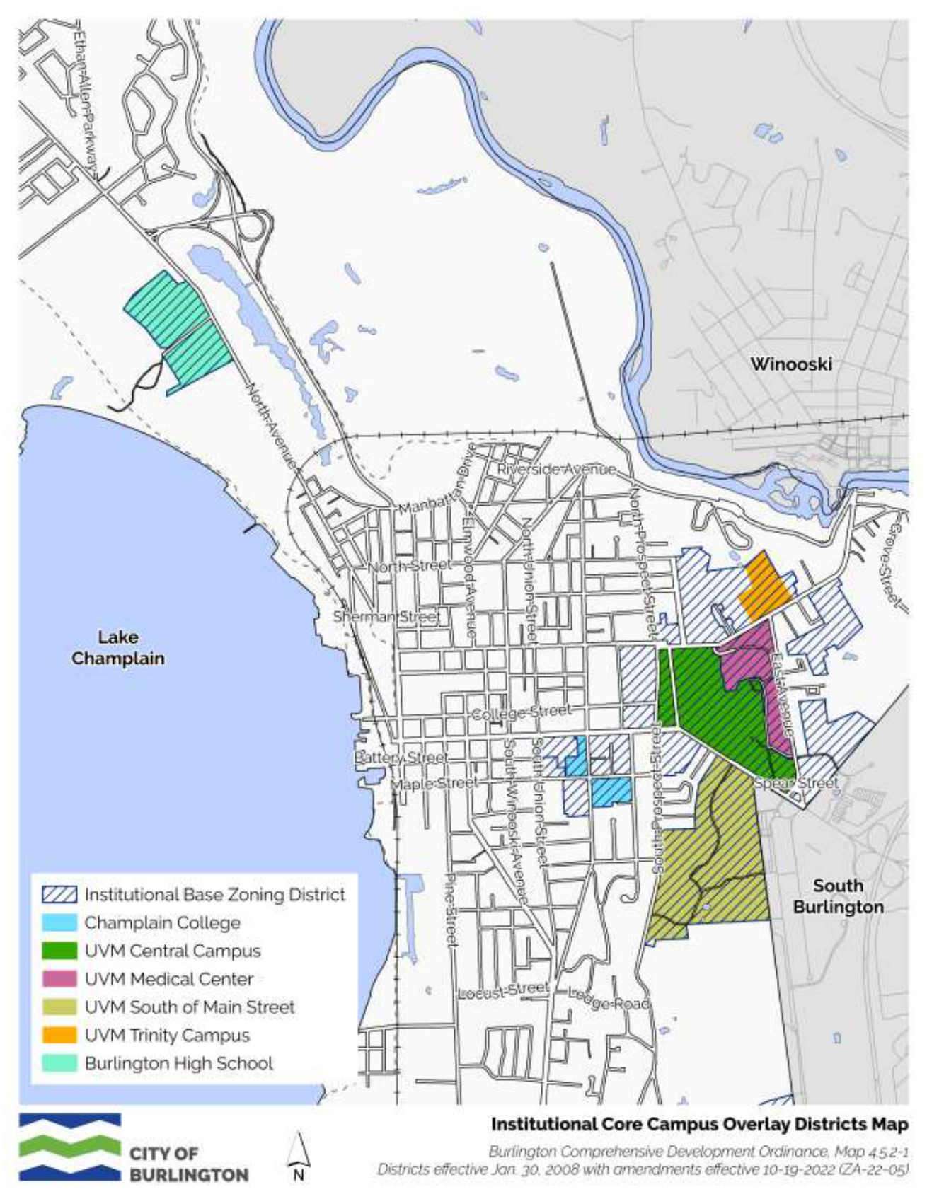
District Specific Regulations: University of Vermont Medical Center (ICC-UVMMC);
Transitional Buffer:
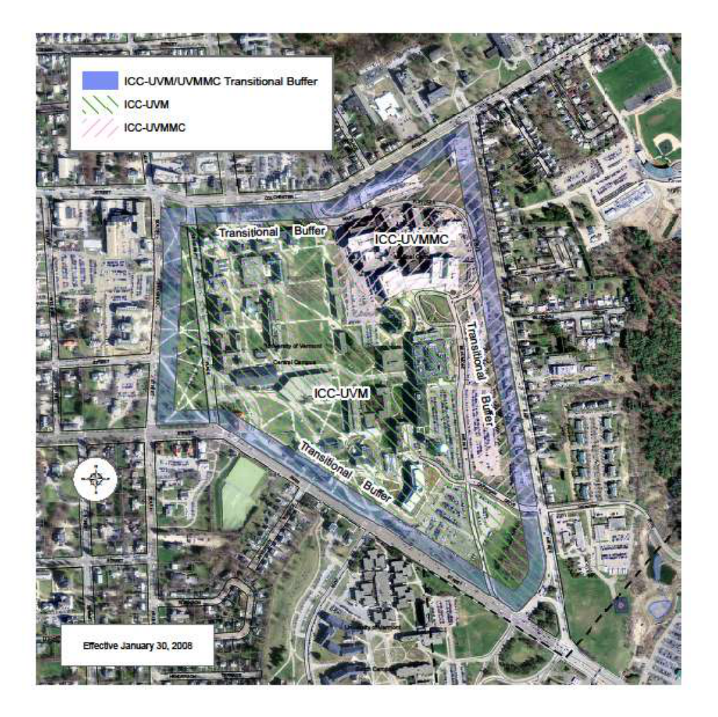
Lot coverage shall not exceed 40% for the aggregate of all land owned by an institution and located within the Transitional Buffer.
Unless replaced on site, no housing unit in a residential structure located within the Transitional Buffer shall be demolished or converted to a nonresidential use, except for housing units which are exempt from the provisions of Article 9. The Housing Replacement standards of this ordinance shall apply to any such activity.
Maximum lot coverage shall be applied to the aggregate of all lots owned by a respective institution and located within the ICC-UVMMC District. Lot coverage shall not exceed 60% except as provided below.
The maximum lot coverage for the entire tract of land owned by an institution within the ICC-UVMMC District may be increased by one percent for each one percent that the Transitional Buffer coverage is less than 40%, up to a maximum of 65%.
No new outdoor surface parking spaces shall be permitted unless the number of the new outdoor surface parking spaces is offset by a corresponding removal of outdoor surface parking spaces existing as of January 1, 2007, and upon the approval by the DRB.
No portion of any building within the ICC-UVMMC Height Overlay (as delineated on Map 4.5.2-3 ICC-UVMMC Height Overlay) shall exceed the elevation of a plane running parallel to the earth at 540-feet above mean sea level. The provisions of Sec. 5.2.6 Building Height Limits shall not be applicable within the ICC-UVMMC Height Overlay.
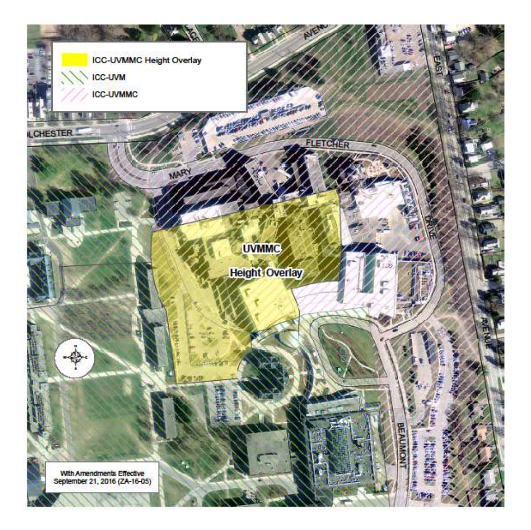
No portion of any building outside of the ICC-UVMMC Height Overlay may exceed the elevation of a plane running parallel to sea level from the highest point of the tallest structure at the highest elevation within the ICC-UVMMC District as depicted as of January 1, 2009.
Density
In the ICC-UVMMC District, density restrictions set forth in Article 4, Sec. 4.4.4 shall not apply to dormitories and rooming houses as defined in Chapter 18 of the Burlington Code of Ordinances. The restrictions on the non-residential equivalent set forth in Art. 5, Sec. 5.2.7 (a) 2 shall not apply in the ICC-UVMMC District.
District Specific Regulations: UVM Central Campus (ICC-UVM);
Transitional Buffer:
Lot coverage shall not exceed 40% for the aggregate of all land owned by an institution and located within the Transitional Buffer.
Unless replaced on site, no housing unit in a residential structure located within the Transitional Buffer shall be demolished or converted to a nonresidential use, except for housing units which are exempt from the provisions of Article 9. Housing Replacement standards of this ordinance shall apply to any such activity.
Maximum lot coverage shall be applied to the aggregate of all lots owned by the institution and located within the ICC -UVM District. Lot coverage shall not exceed 65% except as provided below.
The maximum lot coverage within the ICC -UVM District may be increased by one percent for each one percent that the Transitional Buffer coverage is less than 40%, up to a maximum of 70%.
No new outdoor surface parking spaces shall be permitted unless the number of the new outdoor surface parking spaces is offset by a corresponding removal of outdoor surface parking spaces existing as of January 1, 2007, and upon the approval by the DRB.
Building height shall be measured under the provisions of Art. 5 except that the Measurement Interval method specified in Sec. 5.2.5(a)(3) shall not apply.
For the sole purpose of regulating building height, the ICC-UVM District shall include an ICC-UVM Central Campus Height Overlay as delineated on Map 4.5.2-4 below. Building height within the ICC-UVM Central Campus Height Overlay shall not exceed 140-feet.
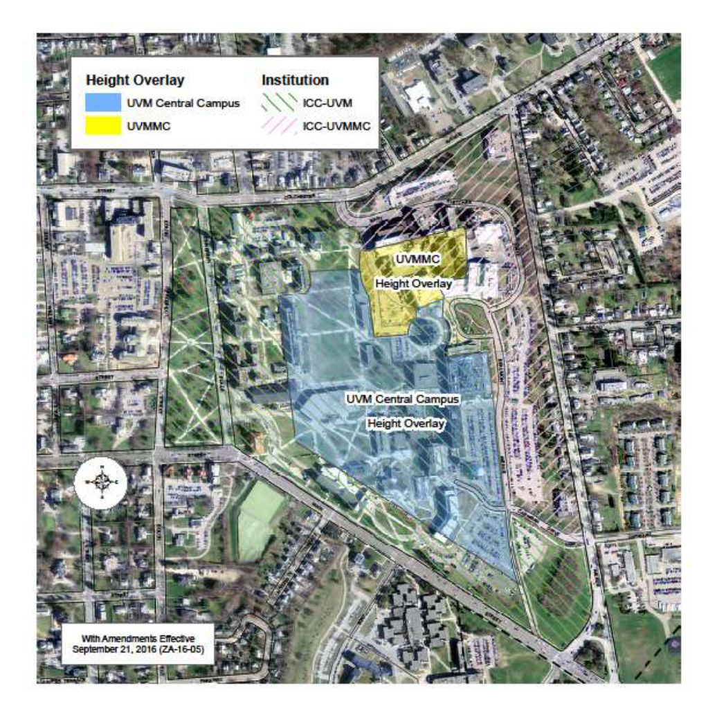
For all other areas within the ICC-UVM District, except for ornamental and symbolic architectural features, additions and new construction may be built to a height that does not exceed the lesser of:
The actual height of the tallest existing structure as of January 1, 2008 and located within the core campus district; or,
Density
In the ICC -UVM District, density restrictions set forth in Article 4, Sec. 4.4.4 shall not apply to dormitories and rooming houses as defined in Chapter 18 of the Burlington Code of Ordinances. The restrictions on the non-residential equivalent set forth in Art. 5, Sec. 5.2.7 (a) 2 shall not apply in the ICC -UVM District.
District Specific Regulations: UVM Trinity Campus (ICC -UVMT):
Lot coverage within the ICC-UVMT district shall not exceed 40% except as may be allowed under the inclusionary housing provision of Article 9, Inclusionary Housing.
Maximum lot coverage shall be applied to the aggregate of all lots owned by a single entity and located within the ICC-UVMT district.
Development in the ICC-UVMT shall be subject to the setback requirements as specified under the provisions of the underlying zoning district.
Minimum side and rear yard setbacks shall not be applicable between parcels under the same ownership within the ICC-UVMT district, but shall apply along the perimeter of the district.
Colchester Avenue Buffer. Within the ICC-UVMT no development of new surface parking or new structures, except for ancillary structures no larger than 200 square feet, shall be permitted within a setback of 115 feet from the front property line on Colchester Avenue.
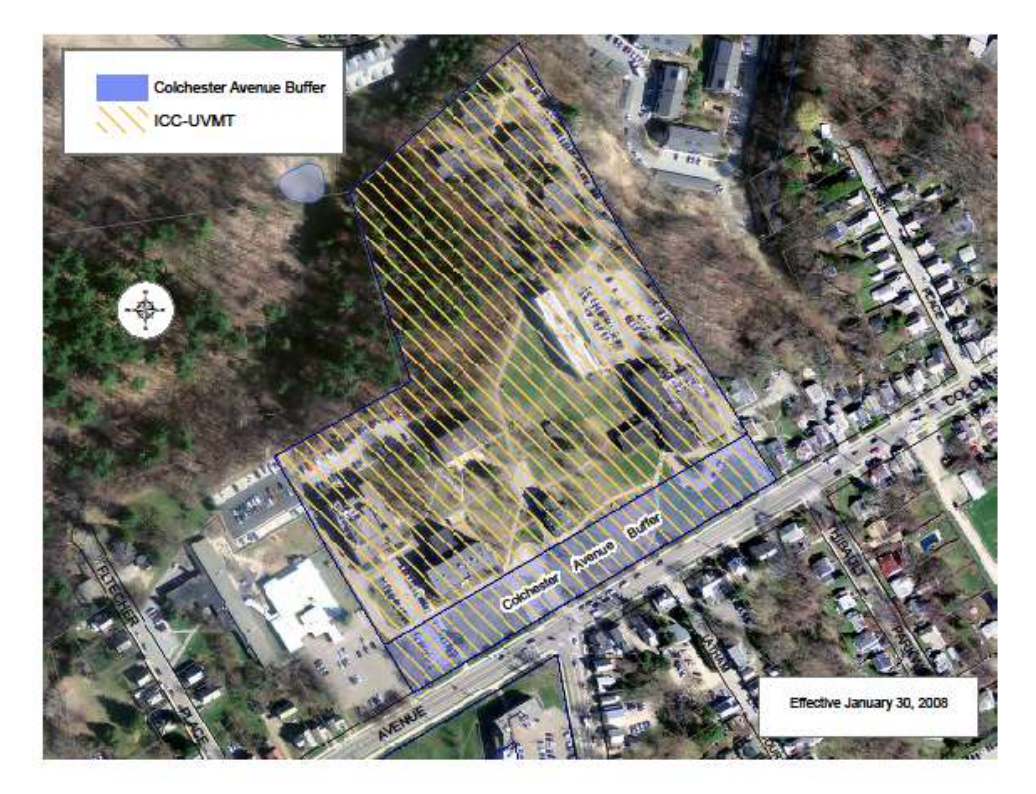
No new outdoor surface parking spaces shall be permitted in the ICC-UVMT district unless the number of the new outdoor surface parking spaces is offset by the corresponding removal of outdoor surface parking spaces in the ICC-UVMT district existing as of January 1, 2002 and the Development Review Board has approved such offset in issuing a certificate of appropriateness.
Height:
Additions and new construction may be built to a height that does not exceed the greater of thirty-five feet (35’) or the height of existing structures located on the same parcel within the ICC-UVMT district, but in no instances shall any building exceed fifty-five feet (55’) in height as measured from finished grade.
Density:
In the ICC-UVMT district, the restrictions on residential density set forth in the underlying zoning district, and in Article 9 (Inclusionary Housing) shall apply to all development, including changes in use.
Unless replaced on site no housing unit in a residential structure located within the ICC-UVMT shall be demolished or converted to a nonresidential use, except for housing units that are exempt from the provisions of Article 9, Part 2 - Housing Preservation and Replacement/Demolition and Conversion.
Uses:
Within the ICC-UVMT, only the following uses shall be permitted or conditionally permitted:
| Permitted Uses: | Conditional Uses: |
|---|---|
| Residential | |
| Assisted Living | |
| Attached Dwelling(s) – Mixed-Use | |
| Attached Dwellings - Multi-Family | |
| Attached Dwellings – Duplex | |
| Boarding House | |
| Convalescent /Nursing Home | |
| Single Detached Dwelling | |
| Non-Residential | |
| Bed and Breakfast, | Bakery – Retail |
| Community Center | Bank |
| Daycare – Large, Daycare - Small | Café |
| Dormitory | Convenience Store |
| Health Care Hospitality | Credit Union |
| Health Club | Dental Lab |
| Health Studio | Dry Cleaning Service |
| Historic Inn | General Merchandise/Retail – Small <4,000sqft |
| Hostel | Grocery Store – Small ≤10,000sqft |
| Office – General | Medical Lab |
| Office - Medical, Dental | Pharmacy |
| Park | Research and Development Facility |
| Performing Arts Studio | Research Lab |
| Record and Document Storage | Restaurant |
| School - Post-Secondary & Community College | |
| School - Preschool | |
| Worship, Place of | |
All non-residential uses are Permitted Uses within buildings existing as of January 1, 2002; and are Conditional Uses if located within a new building to be constructed after January 1, 2002.
No permitted or conditional use in the ICC-UVMT District may include drive-through facilities, gas pumps or canopies.
Parking:
Parking for all uses and structures shall be in accordance with the provisions of Article 8, Part 3 Institutional Parking Plans.
Review Requirements:
Within the ICC-UVMT, any new construction or any change in use of 15,000 square feet or more (including any cumulative change of use or new construction of 15,000 square feet or more within a twelve month period) shall be subject to the conditional use major impact review criteria (Article 3).
District Specific Regulations: UVM South of Main Street Campus (ICC -UVMS):
Maximum lot coverage shall be applied to the aggregate of all lots located within the ICC -UVMS District. Lot coverage shall not exceed 60%.
Side and rear yard setback requirements as stipulated in the underlying zoning district shall be applicable only along the perimeter of the ICC -UVMS District.
A front yard setback defined by the existing building line as of January 1, 2008 shall be maintained along the South Prospect Street and Main Street frontages of the ICC - UVMS District.
No new structures or surface development shall be permitted within the designated ICC-UVMS Development Buffers as delineated on Map 4.5.2-5 below. These areas shall be maintained as open greenspace, however landscaping, outdoor lighting, street furniture, and subsurface infrastructure improvements may be permitted.
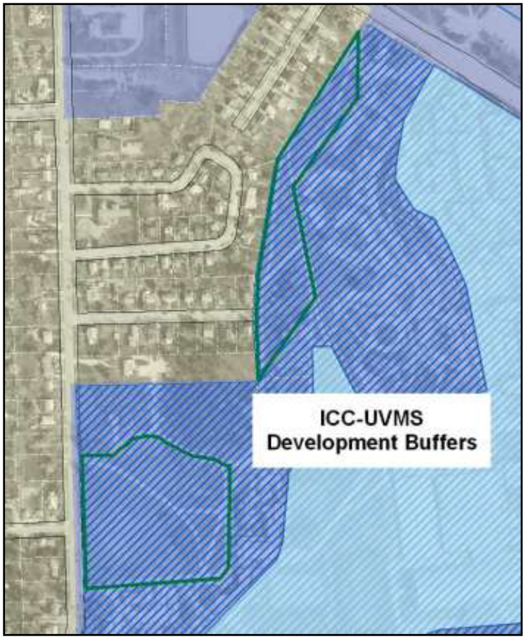
No new outdoor surface parking spaces shall be permitted unless the number of the new outdoor surface parking spaces is offset by a corresponding removal of outdoor surface parking spaces existing as of January 1, 2008, and upon the approval by the DRB.
Building height shall be measured under the provisions of Art. 5.
For the sole purpose of regulating building height, the ICC-UVMS District shall include an ICC-UVMS South of Main Street Campus Height Overlay as delineated on Map 4.5.2-6 below. Building height within the ICC-UVMS South of Main Street Campus Height Overlay shall not exceed 80-feet.
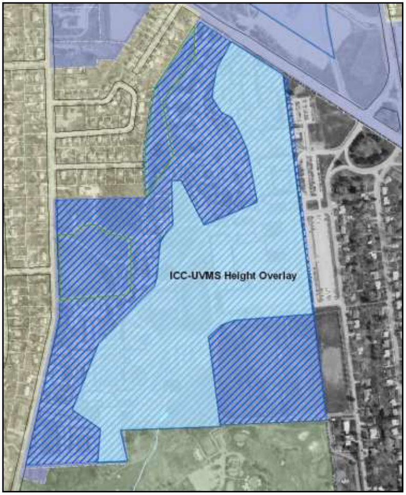
For all other areas within the ICC-UVMS District, except for ornamental and symbolic architectural features, additions and new construction may be built to a height that does not exceed the actual height of the tallest existing structure as of January 1, 2008 and located within the ICC-UVMS District.
Density
In the ICC -UVMS District, density restrictions set forth in Article 4, Sec. 4.4.4 shall not apply to dormitories and rooming houses as defined in Chapter 18 of the Burlington Code of Ordinances. The restrictions on the non-residential equivalent set forth in Art. 5, Sec. 5.2.7 (a) 2 shall not apply in the ICC -UVMS District.
District Specific Regulations: Champlain College (ICC -CC):
Lot coverage within the ICC-CC shall not exceed 60% inclusive of any applicable bonus provisions.
Except as illustrated below, a 20-foot setback shall be applicable along the perimeter of any contiguous ownership of Champlain College within the core campus district. As illustrated below, a 30-foot setback shall be applicable along the western perimeter of the Champlain College Residential Core Campus as delineated on Map 4.5.2-7 ICC-CC Core Campus adjacent and to the east of the Edmunds School playing field.
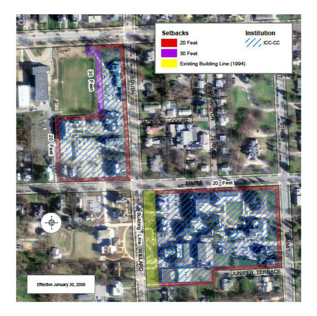
The front yard setback defined by the existing building line as of January 1, 1994 shall be maintained along the South Willard Street frontage south of Maple Street.
No new structures shall be placed with 50-feet of the College’s southern property line that runs approximately parallel to Tower Terrace as illustrated below.
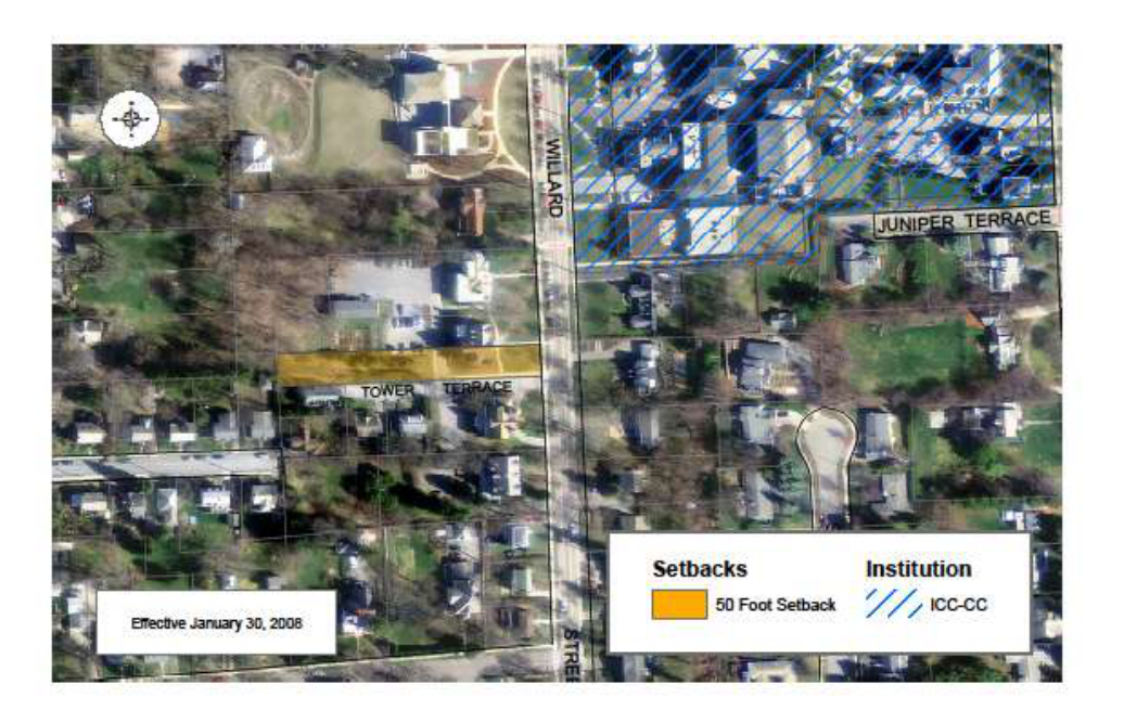
No new unstructured surface parking lots shall be permitted in the ICC-CC except for exchanging or consolidating with existing unstructured surface parking lots. Such exchanges or consolidations may occur only upon approval by the DRB.
Density
For the purposes of regulating the intensity of development, the core campus district shall be divided into two areas: a Residential Core Campus and an Academic Core Campus as delineated on Map 4.5.2-7 ICC-CC Core Campus below.
| Core Campus | Floor Area Ratio |
|---|---|
| Residential Core Campus | 1.0 |
| Academic Core Campus | 1.1 |
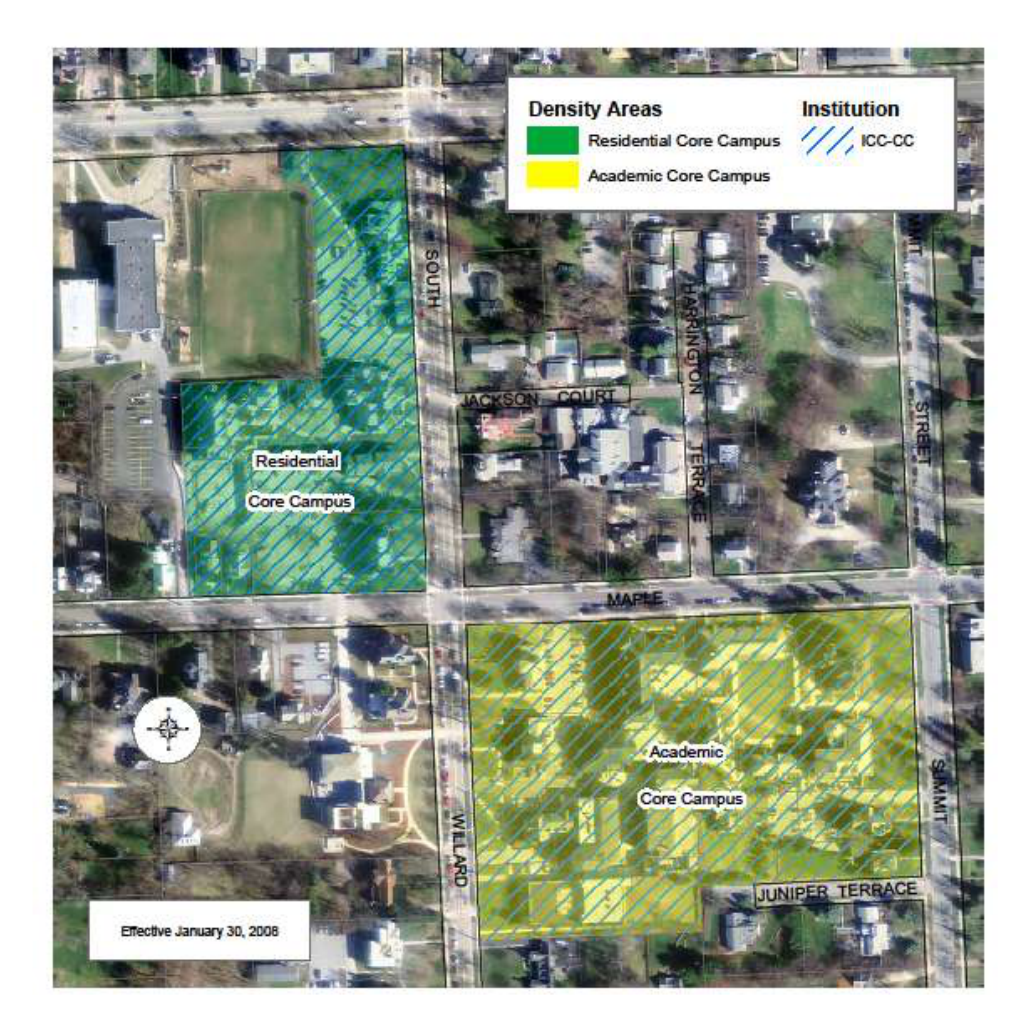
District Specific Regulations: Burlington High School Campus (BHS)
Lot Coverage Maximum lot coverage shall be applied to the aggregate of all lots located within the ICC-BHS District. Lot coverage shall not exceed 60%.
Setbacks A minimum 20 ft. front yard setback shall be applicable along North Avenue, and a 20 ft. minimum front yard setback along Institute Road. A minimum side setback of 10 ft. and minimum rear setback of 20 ft. shall apply only along the perimeter of the ICC-BHS District.
Building Height Building height shall be measured under the provisions of Art. 5. Building height Within the ICC-BHS shall not exceed:
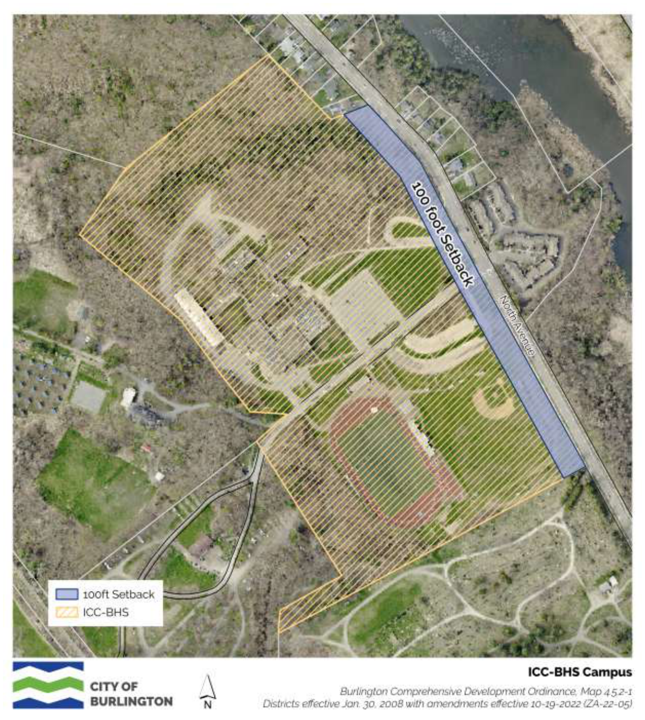
Uses Within the ICC-BHS district, School- Post-Secondary & Community College, School-Secondary, School-Primary, School-Preschool (see Sec. 5.4.1), and School- Trade or Professional are permitted. When part of the education program associated with a School use or when hosted within a School facility, the following uses are also permitted:
| Permitted Uses: | |
|---|---|
| Automobile Body Shop | Museum Small |
| Automobile/Vehicle Repair | Museum Large |
| Café | Performing Arts Center |
| Community Center | Performing Arts Studio |
| Community Garden | Recreational Facility- Indoor |
| Conference Center | Recreational Facility- Outdoor |
| Composting | Recycling Center- Large |
| Daycare (See Sec. 5.4.1) | Recycling Center- Small |
| Health Club | Research and Development Facility |
| Library | Research Lab |
| Park | |
§ 4.5.3Natural Resource Protection Overlay (NR) District
Purpose and Authority:
The Natural Resource Protection Overlay District is intended to:
Protect surface waters and wetlands from encroachment by development, and from sources of non-point pollution;
Preserve natural lakeshore vegetative cover where reasonably possible consistent with the Vermont Shoreland Protection Act, and the protection of native plants and vegetative cover that provide lake shoreland wildlife habitat, to the greatest extent possible;
Protect the functions and values of Burlington’s wetlands;
Protect and enhance water quality near public beaches and other water-based recreation areas from sources of non-point pollution;
Preserve natural features and communities, geologic features and cultural sites for education and research.
Provide opportunities for public access where feasible and appropriate;
Facilitate connections and corridors for wildlife between areas of publicly protected sites.
Ensure that development that occurs within a Flood Hazard Area conforms to the requirements of the National Flood Insurance Program.
Minimize and prevent the loss of life and property, the disruption of commerce, the impairment of the tax base, and the extraordinary public expenditures and demands on public services that result from flooding and other flood related hazards; and
Ensure that the design and construction of development in flood and other hazard areas are accomplished in a manner that minimizes or eliminates the potential for flood and loss or damage to life and property; and
Manage all flood hazard areas designated pursuant to 10 V.S.A. § 753; and
Make the City of Burlington and its residents eligible for federal flood insurance and other federal disaster recovery and hazard mitigation funds as may be available.
Areas Affected
This overlay district consists of all areas delineated on Map 4.5.3-1-Natural Resources Protection Overlay (NR) District and is divided into four (4) subparts:
A Riparian and Littoral Conservation Zone which consists of all surface water and a corresponding upland buffer area, and specifically includes the following areas:
Uplands within 250 feet of the Lake Champlain lakeshore (measured at 95.5 feet above mean sea level per National Geodetic Vertical Datum 1929) with the exception of that portion of the shoreline between the northern extent of the Interim Development Area north of the former Moran Generating Station and the most westerly extent of Roundhouse Point described as the “Urban Waterfront” in the 2000 Open Space Protection Plan;
Uplands within 250 feet horizontal distance measured from the top of the slope where the channel runs adjacent to a valley wall or high terrace, or top of the bank where the channel has access to its floodplain, of the Winooski River;
Uplands within 100 feet horizontal distance measured from the top of the slope where the channel runs adjacent to a valley wall or high terrace, or top of the bank, where the channel has access to its floodplain, of Engelsby Brook, Potash Brook or Centennial Brook; and,
Uplands within 50 feet horizontal distance measured from the top of the slope where the channel runs adjacent to a valley wall or high terrace, or top of the bank where the channel has access to its floodplain, of all other minor streams, or the mean shoreline of all other minor ponds;
A Wetland Conservation Zone which consists of wetlands and a corresponding upland buffer area for the following areas:
Uplands within 100 feet of all wetlands depicted in Map 4.5.3-1, Natural Resource Protection Overlay District except in cases where the State of Vermont has established a greater buffer zone width; and.
Uplands within 100 feet from all vernal pools.
A Natural Areas Zone which consists of all areas identified as Significant Natural Areas in the City’s Open Space Protection Plan and a corresponding buffer area of 100 feet; and,
A Special Flood Hazard Area which consists of all areas in the City of Burlington, Vermont identified as special flood hazard areas in and on the most current flood insurance studies and maps of the Department of Homeland Security (DHS), Federal Emergency Management Agency (FEMA), National Flood Insurance Program (NFIP), as provided by the Secretary of the Agency of Natural Resources pursuant to 10 V.S.A. § 753, which are hereby adopted by reference and declared to be part of these regulations.
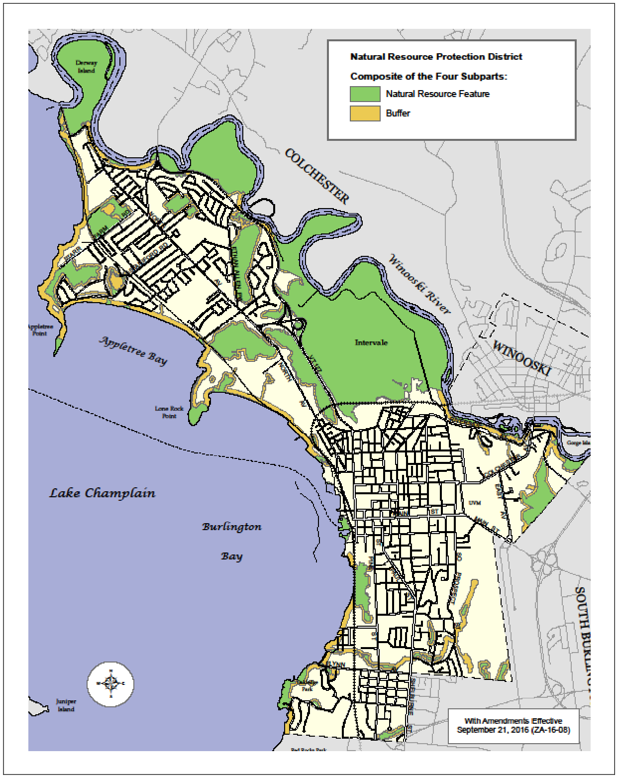
District Specific Regulations: Riparian and Littoral Conservation Zone:
Permitted Uses:
Except where otherwise noted herein, only the following uses are permitted within the Riparian and Littoral Conservation Zone and its associated buffer subject to the requirements and limitations set forth below under subpart 4.
Normal maintenance of existing lawns and maintained grounds including mowing, trimming of vegetation and the removal of dead or diseased vegetation around a residence, decorative landscaping and planting, vegetable and flower gardens, and the repair of existing private landscaping structures such as walkways and walls;
“Accepted agricultural and silvicultural practices” as defined under 24 VSA Ch 117;
Normal maintenance of constructed wetlands and stormwater systems, provided that naturally occurring wetlands are not disturbed in conjunction with the maintenance;
Normal maintenance of existing docks, roads, rail lines, bridges, and culverts provided that disturbance to any shoreland is minimized in conjunction with such maintenance;
Selective cutting of less than 25 percent of the trees six inches or more in diameter at breast height over any 10 year cycle; and,
Recreational and educational activities such as hiking, walking, fishing, nature study, and bird watching and associated boardwalks and unimproved trails.
Prohibited Uses:
Except where noted herein, the following uses shall be prohibited within the Riparian and Littoral Conservation Zone and its associated buffer.
The deposition or introduction of organic and inorganic chemicals, including herbicides and pesticides, except when the application of pesticides is reviewed and approved by the BCB and DRB, and performed by an applicator certified by the Vermont Department of Agriculture for the sole purpose of controlling invasive species and subject to the requirements of the City’s pesticide application ordinance (Burlington Code of Ordinances, Chapter 17, Section 9); and,
Regulated Uses:
Except where otherwise noted herein, all uses permitted or conditionally permitted in the respective underlying zoning district, including any construction of buildings or other structures, and roads, parking areas or any other impervious surface, may be approved only within the Riparian and Littoral Conservation Zone and its associated buffer after review and approval pursuant to the requirements and limitations below under Subpart 4.
Requirements
Any land disturbing activities (i.e., vegetation has been removed, or the landscape has been graded or filled resulting in bare soil surfaces) shall include a stormwater management, erosion prevention and sediment control plan pursuant to the requirements of Sec 5.5.3 to be reviewed by the conservation board and approved by the city engineer.
In making determinations and decisions required herein, the city engineer shall consider the requirements of the most recent State of Vermont Stormwater Management Rules and Guidance document. The city engineer shall require the best practicable means be used to manage stormwater, prevent erosion, and control sedimentation. The city engineer is hereby authorized to develop performance standards to ensure conformance with these state stormwater management rules.
For properties with frontage along Lake Champlain or the Winooski River, development that includes 400 square feet or more of new or redeveloped lot coverage shall establish a low-mow zone along the shoreline. A low-mow zone is a new or existing vegetated area that is not mowed more than once per year and allows vegetation to grow and mature. (Refer to Shoreland Best Management Practices established by Vermont Department of Environmental Conservation.). A low-mow zone shall be at least 15 ft. wide as measured inland from the 100 ft. elevation and shall be of a size equivalent to, or greater than, the new or redeveloped lot coverage, except that in no event shall a low-mow zone be required to extend more than 50 ft. wide as measured inland from the 100 ft. elevation or extend along more than 80% of a property’s shoreline frontage.
For properties with frontage along Lake Champlain or the Winooski River, development shall be located no closer to the shoreline than existing development wherever reasonably possible.
Agricultural and silvicultural activities shall follow Best Management Practices for the Protection of Water Quality;
Installation of any seawalls, rip-rap or other shoreland retention structures shall be submitted for review by the conservation board who shall consult with the city engineer prior to issuance of a recommendation to the DRB; and,
No new stormwater outfall shall directly discharge into any surface water without approval and implementation of a stormwater management plan approved by the city engineer.
District Specific Regulations: Wetland Conservation Zone:
Additional Application Requirements
The following information shall be submitted in addition to the applicable requirements of Article 3 for any development involving a wetland or wetland buffer zone:
Boundary Determination: The boundaries of a wetland shall be determined in the field by a qualified professional with expertise in wetland delineation and surveyed by a licensed land surveyor or other qualified individual. The boundary between wetland and upland shall be delineated by the methodology set forth in the Vermont Wetland Rules. The identification and delineation of wetlands for a proposed project must be performed within a five-year period prior to submission and acceptance of a complete zoning application;
A site plan for a project that will impact a wetland or buffer zone shall include delineated wetland boundaries, buffer zone boundaries, erosion control measures, and all components of the proposed project, including, but not limited to all structures, driveways, parking areas, lawns, utilities, and the overall footprint of the construction area/zone of disturbance; and,
As part of their application, applicants must submit a complete stormwater management, erosion prevention and sediment control plan pursuant to the requirements of Sec 5.5.3, and successfully demonstrate how the project will prevent adverse impacts to surface water and groundwater quality before, during, or after construction. At a minimum, an applicant should demonstrate how a project will meet the standards outlined in the latest edition of the Vermont Soil Erosion Handbook.
Permitted Uses:
Except where otherwise noted herein, only the following uses are permitted within a wetland and its buffer zone subject to the requirements and limitations set forth below under Subpart 6.
Normal maintenance of existing lawns and maintained grounds including mowing, trimming of vegetation and the removal of dead or diseased vegetation around a residence, decorative landscaping and planting, vegetable and flower gardens, and the repair of existing private landscaping structures such as walkways and walls;
“Accepted agricultural and silvicultural practices” as defined under 24 VSA Ch 117.
Normal maintenance of constructed wetlands and stormwater systems, provided that naturally occurring wetlands are not disturbed in conjunction with the maintenance;
Selective cutting of less than 25 percent of the trees six inches or more in diameter at breast height over any 10 year cycle; and,
Recreational and educational activities such as fishing, walking, hiking, nature study, and bird watching.
Prohibited Uses:
Except where noted herein, the following uses shall be prohibited within a wetland and its buffer zone.
The deposition or introduction of organic and inorganic chemicals, including pesticides, except when the application of pesticides is reviewed and approved by the BCB and DRB, and performed by an applicator certified by the Vermont Department of Agriculture for the sole purpose of controlling invasive species and subject to the requirements of the City’s pesticide application ordinance (Burlington Code of Ordinances, Chapter 17, Section 9); and,
Regulated Uses:
Except where noted herein, all uses permitted or conditionally permitted in the respective underlying zoning district, including the list of activities below, may be approved within a wetland and its buffer zone after review and approval pursuant to the requirements and limitations set forth below under Subpart 6 below.
The construction of buildings or other structures, and roads, parking areas or other impervious surface;
Any form of drainage, dredging, excavation, or removal of material either directly or indirectly;
Alteration or modification of natural drainage patterns, natural features and contours;
Installation of docks, rip-rap or other shoreline stabilization features;
Installation of utility poles or utility service lines, underground pipes or cable conduits, and wells;
Cutting of greater than 25 percent of the trees six inches or more in diameter at breast height over any 10 year cycle;
Construction, expansion or placement of any structure;
Construction or expansion of roads, rail lines parking areas, trails, and sidewalks;
Introduction of any form of pollution, including but not limited to the installation of a septic tank, the running of a sewer outfall, or the discharge of sewage treatment effluent or other liquid wastes into or so as to drain into a wetland;
The construction of a stormwater outfall as part of a stormwater management plan approved by the city engineer. In making determinations and decisions required herein, the city engineer shall consider the requirements of the most recent State of Vermont Stormwater Management Rules and Guidance document. The city engineer shall require the best practicable means be used to manage stormwater and prevent erosion and control sediment and the city engineer is hereby authorized to develop performance standards to ensure conformance with these state stormwater management rules; and,
Application of pesticides performed by an applicator certified by the Vermont Department of Agriculture for the sole purpose of controlling invasive species and subject to the requirements of the City’s pesticide application ordinance (Burlington Code of Ordinances, Chapter 17, Section 9). In no other cases shall pesticides be applied.
Prohibited activities in a vernal pool and buffer zone:
Except where noted herein, the following uses shall be prohibited within a vernal pool and its respective buffer.
Any activities which disturb the area within 100 feet of a vernal pool, including, but not limited to timber harvesting, disturbance of the understory vegetation, pesticide or herbicide application, the erection of fences or other barriers to amphibian dispersal, barriers and any other type of human activities that disturb the vegetation or water quality in the pool and buffer.
Criteria for Review
In granting, denying, or conditioning any permit involving a wetland, vernal pool or respective buffer zone, the DRB, in consultation with the conservation board, will consider the project’s impact on the functions and values of the wetland, and the measures that the applicant has incorporated into the project to avoid and minimize impacts. The DRB shall only approve a project having an impact on a wetland or wetland buffer zone if an applicant can demonstrate that any adverse impact is de minimus on the significant functions and values of the wetland including:
Water storage for floodwater and stormwater;
Erosion and sedimentation control through binding and stabilizing the soil or shoreline;
Surface water and groundwater protection, including sediment and toxicant retention, nutrient retention and transformation, and groundwater discharge and recharge;
Fisheries habitat;
Wildlife habitat;
Examples of natural community types that are exemplary, rare, or make an important contribution to the natural heritage of Burlington and Vermont;
Habitat for rare, threatened and endangered species;
Education and research in natural sciences;
Recreational and economic benefits; and,
Open space and aesthetics.
In addition, the review of a project having involving a wetland or wetland buffer zone shall also be subject to the following requirements and limitations:
Any land disturbing activities (i.e., vegetation has been removed, or the landscape has been graded or filled resulting in bare soil surfaces) shall include a stormwater management, erosion prevention and sediment control plan pursuant to the requirements of Sec 5.5.3 to be reviewed by the conservation board and approved by the city engineer;
No new stormwater outfall shall directly discharge into surface water without approval and implementation of a stormwater management plan approved by the city engineer;
No installation of docks, rip-rap or other shoreline stabilization features shall be installed without review approval by the city engineer;
Agricultural and silvicultural activities shall follow Best Management Practices for the Protection of Water Quality; and,
Stormwater management, erosion, and sedimentation control plans shall be submitted for review by the conservation board who shall consult with the development review board and city engineer prior to issuance of a recommendation to the city engineer who shall render a final decision on such plans.
In making determinations and decisions required herein, the city engineer shall consider the requirements of the most recent State of Vermont Stormwater Management Rules and Guidance document. The city engineer shall require the best practicable means be used to manage stormwater and control erosion and sedimentation and the city engineer is hereby authorized to develop performance standards to ensure conformance with these state stormwater management rules.
District Specific Regulations: Natural Areas Zone:
Additional Application Requirements
The following information shall be submitted in addition to the applicable requirements of Article 3 for any development involving a natural area or associated buffer zone:
The boundaries of a Natural Area shall be determined in the field by a qualified professional field naturalist with expertise in feature delineation and surveyed by a licensed land surveyor or other qualified individual. The identification and delineation must be performed within a five-year period prior to submission and acceptance of a complete zoning application;
A report shall be prepared addressing the proposed project’s impact on the natural areas functions and values, and the measures that the applicant has incorporated into the project to avoid and minimize impacts; and,
Permitted Uses:
Except where otherwise noted herein, only the following uses are permitted within a natural area and its buffer zone subject to the requirements and limitations set forth below under subpart 5.
Normal maintenance of constructed wetlands and stormwater systems, provided that naturally occurring wetlands are not disturbed in conjunction with the maintenance;
Selective cutting of less than 25 percent of the trees six inches or more in diameter at breast height over any 10 year cycle; and,
Recreational and educational activities such as fishing, walking, hiking, nature study, and bird watching.
Prohibited Uses:
Except where noted herein, the following uses shall be prohibited within the Natural Area and its associated buffer.
The deposition or introduction of organic and inorganic chemicals, including pesticides, except when the application of pesticides is reviewed and approved by the BCB and DRB, and performed by an applicator certified by the Vermont Department of Agriculture for the sole purpose of controlling invasive species and subject to the requirements of the City’s pesticide application ordinance (Burlington Code of Ordinances, Chapter 17, Section 9); and,
Regulated Uses:
Except where noted herein, all uses permitted or conditionally permitted in the respective underlying zoning district, including the list of activities below, may be approved after review and approval pursuant to the requirements and limitations set forth below under subpart 5.
The construction of buildings or other structures, and roads, parking areas and any other impervious surfaces;
Land disturbing activities (i.e., vegetation has been removed, or the landscape has been graded or filled resulting in bare soil surfaces) not associated with a permitted or conditionally permitted use. Land disturbing activities which expose 5,000 or more square feet of soil (i.e., vegetation has been removed, or the landscape has been graded or filled resulting in bare soil surfaces) are prohibited except where a stormwater management, erosion prevention and sediment control plan has been reviewed by the Burlington Conservation Board and approved by the city engineer;
Any form of drainage, dredging, excavation, or removal of material either directly or indirectly;
Alteration or modification of natural drainage patterns, natural features and contours;
Installation of docks, rip-rap or other shoreline stabilization features;
Installation of utility poles or utility service lines, underground pipes or cable conduits, and wells;
Cutting of greater than 25 percent of the trees six inches or more in diameter at breast height over any 10 year cycle;
Construction, expansion or placement of any structure;
Construction or expansion of existing roads, parking areas, trails, and sidewalks;
Introduction of any form of pollution, including but not limited to the installation of a septic tank, the running of a sewer outfall, or the discharge of sewage treatment effluent or other liquid wastes into or so as to drain into a wetland;
The construction of a stormwater outfall as part of a stormwater management plan approved by the city engineer. In making determinations and decisions required herein, the city engineer shall consider the requirements of the most recent State of Vermont Stormwater Management Rules and Guidance document. The city engineer shall require the best practicable means be used to manage stormwater and prevent erosion and control sediment and the city engineer is hereby authorized to develop performance standards to ensure conformance with these state stormwater management rules;
Application of pesticides performed by an applicator certified by the Vermont Department of Agriculture for the sole purpose of controlling invasive species and subject to the requirements of the City’s pesticide application ordinance (Burlington Code of Ordinances, Chapter 17, Section 9). In no other cases shall pesticides be applied; and,
Agricultural and silvicultural activities following Best Management Practices for the Protection of Water Quality including but not limited to housing of livestock, manure storage, pasturing livestock, growing crops, and compost storage, but excluding residential backyard compost storage.
Criteria for Review
In granting, denying, or conditioning any permit, the DRB, in consultation with the Conservation Board, will consider the significant functions and values of the natural area, the project’s impact on the significant functions and values, and the measures that the applicant has incorporated into the project to avoid and minimize impacts. The DRB shall only approve a project having an impact on a natural area or its associated buffer zone if an applicant can demonstrate that any adverse impact is de minimus on the significant functions and values of the natural area including:
Water storage for floodwater and stormwater;
Erosion and sedimentation control through binding and stabilizing the soil or shoreline;
Surface water and groundwater protection, including sediment and toxicant retention, nutrient retention and transformation, and groundwater discharge and recharge;
Fisheries habitat;
Wildlife habitat;
Examples of natural community types that are exemplary, rare, or make an important contribution to the natural heritage of Burlington and Vermont;
Habitat for rare, threatened and endangered species;
Education and research in natural sciences;
Recreational and economic benefits; and,
Open space and aesthetics.
District Specific Regulations: Special Flood Hazard Area:
Additional Application Requirements
The following information shall be submitted in addition to the applicable requirements of Article 3 for any development proposed within a Special Flood Hazard Area:
Base flood elevation data for all subdivision proposals and other proposed new developments containing more than fifty (50) lots or covering more than five (5) acres;
The elevation, in relation to mean sea level, of the lowest floor, including basement, of all new construction or substantial improvements of structures;
Confirmation if such structures contain a basement; and
The elevation, in relation to mean sea level, to which any structure has been flood proofed.
A Vermont Agency of Natural Resources Project Review Sheet for the proposal should be filled out. The Project Review Sheet should identify all State and Federal agencies from which permit approval is required for the proposal, and shall be filed as a required attachment to the City permit application. The identified permits, or letters indicating that such permits are not required, shall be submitted to the Administrative Officer and attached to the permit application before work can begin.
In addition, the applicant may be required to provide any of the following information deemed necessary for determining the suitability of the particular site for the proposed use:
Plans in triplicate, drawn to scale, showing the location, dimensions, contours and elevation of the lot; the size and location on the site of existing and/or proposed structures, fill or storage of materials; the location and elevations of streets, water supply and sanitary facilities; and the relationship of the above to the location of the channel, floodway and base flood elevation where such information is available;
A typical valley cross-section showing the channel of the stream, elevation of land areas adjoining each side of the channel and cross-sectional areas to be occupied by the proposed development;
A profile showing the slope of the bottom of the channel or flow line of the stream; and
Permitted Uses in Floodway Areas
The following open land uses shall be permitted within the floodway areas to the extent that they are permitted or conditionally permitted in the underlying zoning district, and provided that they do not require the erection of structures or storage of materials and equipment, the borrowing of fill from outside the floodway area, or channel modification or relocation, and do not obstruct flood flows, nor result in any increase in flood levels during the occurrence of the base flood discharge, decrease the water-carrying capacity of the floodway or channel, or increase off-site flood damage potential:
Agricultural uses, such as general farming, pasture, orchard, and grazing, outdoor plant nurseries, truck farming, and forestry;
Recreation uses, such as parks, camps, picnic grounds, tennis courts, golf courses, golf driving ranges, archery and shooting ranges, hiking and riding trails, hunting and fishing areas, game farms, fish hatcheries, wildlife sanctuaries, nature preserves, swimming areas and boat launching sites; and/or
Accessory residential uses, such as lawns, gardens, and parking areas.
Permitted Uses in Special Flood Hazard Areas (including Floodway areas)
All those permitted open space uses as listed in Section 4.5.3.(f).2 above shall be permitted in the Special Flood Hazard Areas.
All other uses permitted in the underlying zoning district are permitted only upon review and approval per subpart 7 below.
Permitted Accessory Uses in Special Flood Hazard Areas (Including Floodway areas)
Uses customarily accessory and incidental to any of the permitted uses listed in underlying zoning district may be permitted, subject to the limitations therein.
Mandatory DEC Notification and 30-Day Review Period
Prior to issuing a permit a copy of the application and supporting information shall be submitted by the administrative officer to the State National Flood Insurance Program Coordinator at the Vermont Agency of Natural Resources, Department of Environmental Conservation, River Management Section in accordance with 24 V.S.A. § 4424. A permit may be issued only following receipt of comments from the Agency or the expiration of 30 days from the date the application was mailed to the Agency, whichever is sooner.
Adjacent communities and the Stream Alteration Engineer at the Vermont Agency of Natural Resources, Department of Environmental Conservation, River Management Section shall be notified at least 30 days prior to issuing any permit for the alteration or relocation of a watercourse and copies of such notification shall be submitted to the VT National Flood Insurance Program Coordinator.
No permit may be granted for new construction, substantial improvement, filling, installation of a residential structure, or the development of land in any area designated as a floodplain by the Federal Emergency Management Agency (FEMA) prior to the expiration of a period of thirty (30) days following the submission of the application and a report to the Department of Environmental Conservation. The application and report shall describe the proposed use, the location requested and an evaluation of the effect of such proposed use on Burlington’s municipal development plan and the regional plan, if any.
The subsection shall not be applicable to public utility generating stations and transmission lines which shall require the issuance of a certificate of public good under 30 V.S.A. Sec. 248 prior to any land filling or construction.
Evaluation
Review of the application shall include the evaluation by the Department of Environmental Conservation. Approval shall be predicated on finding that the proposed use will conform to the development standards of subpart 7 below.
Special Review Criteria
The flood-carrying capacity within any portion of an altered or relocated watercourse shall be maintained. Review shall consider:
The danger to life and property due to increased flood heights or velocities caused by encroachments;
The danger that material may be swept on to other lands or down stream to the injury of others;
The proposed water supply and sanitation systems and the ability of these systems to prevent disease, contamination and unsanitary conditions;
The susceptibility of the proposed facility and its contents to flood damage and the effect of such damage on the individual owners;
The importance of the services provided by the proposed facility to the community;
The availability of alternative locations not subject to flooding for the proposed use;
The compatibility of the proposed use with existing development and development anticipated in the foreseeable future;
The relationship of the proposed use to the municipal development plan;
The expected heights, velocity, duration, rate of rise, and sediment transport of the flood-waters expected at the site; and,
Conformance with all other applicable requirements of this ordinance.
Approval Conditions
Upon consideration of those factors in subpart 7 above and the purposes of these regulations, the following conditions shall be attached to any permit granted.
In Floodway Areas such conditions require that:
Along watercourses with a designated Floodway no encroachments, including fill, new construction, substantial improvements and other development are allowed within the floodway unless it has been demonstrated through hydrologic and hydraulic analyses performed in accordance with standard engineering practices that the proposed encroachment would not result in any increase in flood levels within the community during the base flood discharge.
The flood-carrying capacity within any altered or relocated portion of a watercourse shall be maintained;
In all Special Flood Hazard Areas (including Floodway areas) such conditions require that:
All development:
New construction and/or substantial improvements to structures shall be reasonably safe from flooding and be:
Designed and adequately anchored to prevent flotation, collapse, or lateral movement during the occurrence of the base flood;
Constructed of materials resistant to flood damage;
Constructed by methods and practices that minimize flood damage; and
Constructed with electrical, heating, ventilation, plumbing and air conditioning equipment and other service facilities that are designed and/or located so as to prevent water from entering or accumulating within the components during conditions of flooding;
All development shall be designed to minimize flood damage to the proposed development and to public facilities and utilities;
All development shall be designed to provide adequate surface drainage to reduce exposure to flood hazards;
All new construction and substantial improvements that have fully enclosed areas below the lowest floor shall:
Be designed to automatically equalize hydrostatic flood forces on exterior walls by allowing for the entry and exit of floodwaters. Such designs must be certified by a registered professional engineer or architect, or meet or exceed the following minimum criteria: A minimum of two openings of two walls having a total net area of not less than one square inch for every square foot of enclosed area subject to flooding shall be provided. The bottom of all openings shall be no higher than one foot above grade. Openings may be equipped with screens, louvers, valves, or other coverings or devices provided that they permit the automatic entry and exit of floodwaters;
All necessary permits shall be obtained from those governmental agencies from which approval is required by federal or state law.
All new and substantially improved residential structures within Special Flood Hazard Area have the lowest floor, including basement, elevated one foot or more above, the base flood elevation;
All new, replacement or substantially improved manufactured homes in the Special Flood Hazard Area shall be elevated on a permanent foundation such that the lowest floor of the manufactured home is elevated one foot or more above the base flood elevation and be securely anchored to an adequately anchored foundation system to resist floatation, collapse, and lateral movement during the occurrence of the base flood. The manufactured home may be elevated on properly compacted fill such that the top of the fill (the pad) under the entire manufactured home is above the base flood elevation OR so that the lowest floor is supported by reinforced piers or other foundation elements of at least equivalent strength that are no less than one foot in height above the base flood elevation.
Non-Residential Development:
All new construction and substantial improvements for nonresidential purposes shall have the lowest floor, including basement, elevated one foot or more above the base flood elevation. Existing non-residential structures may be flood proofed where designed to be watertight to one foot or more above the base flood elevation, with walls substantially impermeable and with structural components having the capability of resisting hydrostatic and hydrodynamic loads and effects of buoyancy. A permit for a proposed building to be flood proofed shall not be issued until a registered architect or engineer has reviewed the structural design, specifications and plans and has certified that the design and methods of construction are in accordance with meeting the provisions of this subsection.
Water Supply Systems:
New and replacement water supply and sanitary sewer systems shall be designed so as to prevent the infiltration of floodwaters into the systems and discharge from the systems;
On-Site Waste Disposal Systems:
On-site waste disposal systems shall be located to avoid impairment to them or contamination from them during flooding;
Recreational Vehicles placed on sites with special flood hazard areas shall either:
be on the site for fewer than 180 consecutive days, or
be fully licensed and ready for highway use, or
be permitted in accordance with the elevation and anchoring requirements for “manufactured homes” in Sec. 4.5.3 (f).8.(D).
Records
The administrative officer shall maintain a record of:
All permits issued in areas covered by this bylaw;
An Elevation Certificate with the as-built elevation, in relation to mean sea level, of the lowest floor, including basement, of all new or substantially improved structures, and whether or not such structures contain a basement in the Special Flood Hazard Area; and
The elevations, in relation to mean sea level, to which existing structures have been flood-proofed.
Any certification of floodproofing.
Variances to the above standards may be granted in writing by the DRB only in accordance with Article 12 and 44 CFR Section 60.6, and after a hearing noticed in the same manner as for a conditional use.
Review Criteria.
A decision in favor of the appellant shall be granted if all the following facts are found, and the supporting findings are specified in the decision. The variance, if authorized shall be issued by the DRB only upon:
determination that failure to grant the variance would result in exceptional hardship to the applicant; and,
the variance will not increase the potential of materials being swept onto other lands or into the stream and causing damage to others; and,
Notice to Applicant.
Upon request for a variance the administrative officer shall notify the applicant in writing over the signature of the zoning administrator or his/her designee that:
The issuance of a variance to construct a structure below the base flood elevation will result in increased flood insurance premium rates up to amounts as high as $25 for $100 of coverage; and
Such construction below the base flood elevation increases risks to life and property.
Annual Recording.
The administrative officer shall:
Maintain a record of all variance actions, including justification for their issuance; and
Report such variances issued in its annual report
Warning of Disclaimer of Liability
These regulations do not imply those areas outside the flood hazard area or land uses permitted within such districts will be free from flooding or flood damages. These regulations shall not create liability on the part of any city official or employee thereof for any flood damages that result from reliance on this ordinance or any administrative decision lawfully made there under.
§ 4.5.4Mouth of the River Overlay District
Purpose
The Mouth of the River Overlay District is intended to support the continuation of small-scale non-residential marine and recreational uses.
Areas Covered.
The Mouth of the River Overlay District includes those portions of the RL Zoning District as delineated on Map 4.5.4-1.
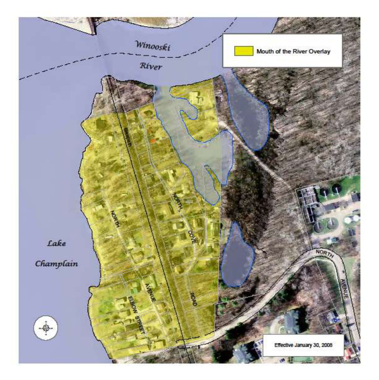
District Specific Regulations: Mouth of the River Overlay:
Uses
Exception for Non-Residential Marine and Recreational Uses.
Small-scale non-residential marine and recreational uses in the Mouth of the River Overlay shall be allowed as follows:
The following non-residential marine and recreational uses shall be permitted as follows:
| Use | Permitted – Y Conditional - CU |
|---|---|
| Bicycle Sales/Repair | Y |
| Boat Sales/Rentals | Y |
| Café | Y |
| Marina | CU |
In addition to the requirements of (i) above, non-residential uses less than 2,000 sqft shall be treated as a permitted use. Non-residential uses greater than or equal to 2,000 sqft but less than 4,000 sqft shall be treated as a conditional use. Non-residential uses occupying 4,000 sqft or more shall not be permitted;
The sale of fuel shall be prohibited;
Boats for sale or rent, and those accommodated for marine services shall be limited to no more than 25 feet in length;
Hours of operation shall be limited to 6:00am to 11:00pm seven days per week;
All building height, coverage, and setback requirements for the underlying residential district shall apply;
Any exterior changes to the building(s) or changes to the site plan shall be subject to the design review requirements of Article 6;
To the extent that parking is provided, the parking standards for Shared-Use Districts shall apply pursuant to Article 8;
Home occupations as defined and regulated under this article are not restricted by the provisions of this section; and,
Any aspect of a neighborhood commercial use in lawful existence as of January 1, 2007 not in strict conformance with the above standards shall be considered non-conforming and be subject to the provisions of Article 5, Part 3.
§ 4.5.5Centennial Woods Overlay District
Purpose:
The Centennial Woods Overlay District is intended to provide for educational, institutional and accessory uses, as well as a diversity of passive and active recreational opportunities and other urban green spaces that provide for public use and enjoyment.
Areas Covered:
The Centennial Woods Overlay District includes those portions of the Institutional (I) and RCO-Recreation/Greenspace (RCO-RG) zoning districts as delineated on Map 4.5.5-1.
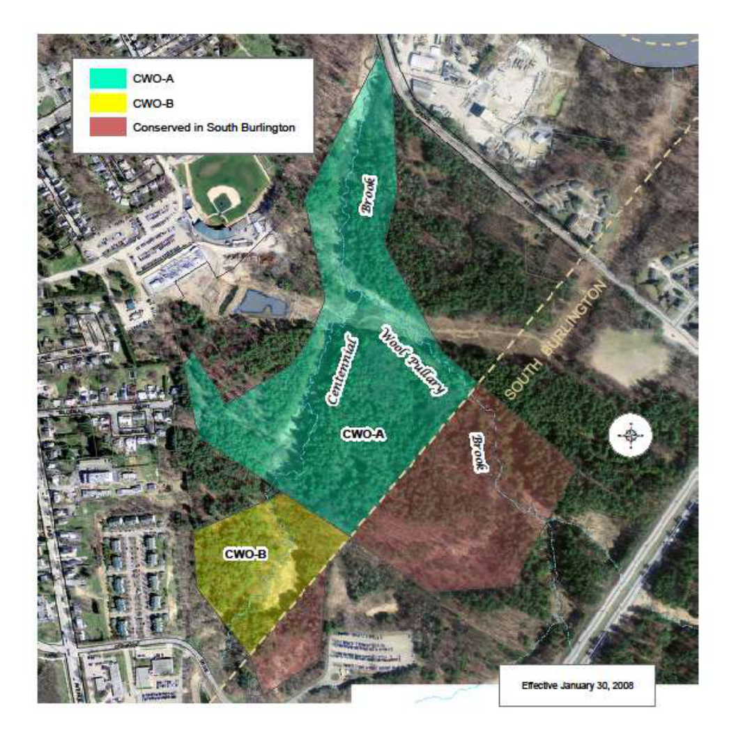
District Specific Regulations: Centennial Woods Overlay:
Uses
Exception for Educational Uses.
All permitted and conditionally permitted uses in the underlying zoning districts as provided in Appendix A – Use Table shall apply with the following exceptions for educationally-related uses:
| Use | CWO-A | CWO-B |
|---|---|---|
| Dormitory | Y | CU |
| Sorority/Fraternity | N | CU |
| Office - General | Y | CU |
| Recreational Facility - Indoor | Y | CU |
| Recreational Facility -Outdoor | Y | CU |
| Research Lab | Y | CU |
| School - Post-Secondary & Community College | Y | CU |
§ 4.5.6South End Innovation District Overlay
Purpose:
The South End Innovation District Overlay (SEID) is intended to provide for a dense, vibrant and dynamic mixed-use district. The overlay is unique in its allowance for residential uses in that it limits the most intensive manufacturing and industrial uses allowed elsewhere in the district. The overlay permits arts, employment, and other non-residential uses intrinsic to an amenity-rich, convenient urban neighborhood.
Development is intended to be dense and highly sustainable. Lot coverage standards permit significant development but a high degree of permeable surfaces achieved through green stormwater infrastructure is encouraged. Buildings should range in height from one to eight stories, and should be constructed of materials and in manners that limit embodied carbon and achieve the highest possible energy performance permitted by the Vermont Building Code. Sites should incorporate ample public and private open spaces and include extensive networks of accessible paths that are free of cars. Streets should be constructed in a manner that allocates the majority of their space to pedestrians and cyclists. Buildings should be oriented to the public realm – streets, paths and open spaces, in a manner that creates a safe and inviting district. Site and building design should support public and ecological health to the highest possible degree.
Parking should be hidden behind structures, including perimeter buildings or screening devices. Where possible, parking structures should be located along the most heavily trafficked roads to encourage residents, employees and visitors who arrive by car to park at the district’s edge and travel on foot, by bike, or other mode of transportation that is compatible with Burlington’s climate objectives. Special consideration should be given to the design and construction of parking structures to allow for their renovation to other uses in coming decades as Burlington evolves from car dependence.
Areas Covered:
The South End Innovation District includes those portions of the E-LM Zoning District as delineated on Map 4.5.6-1.
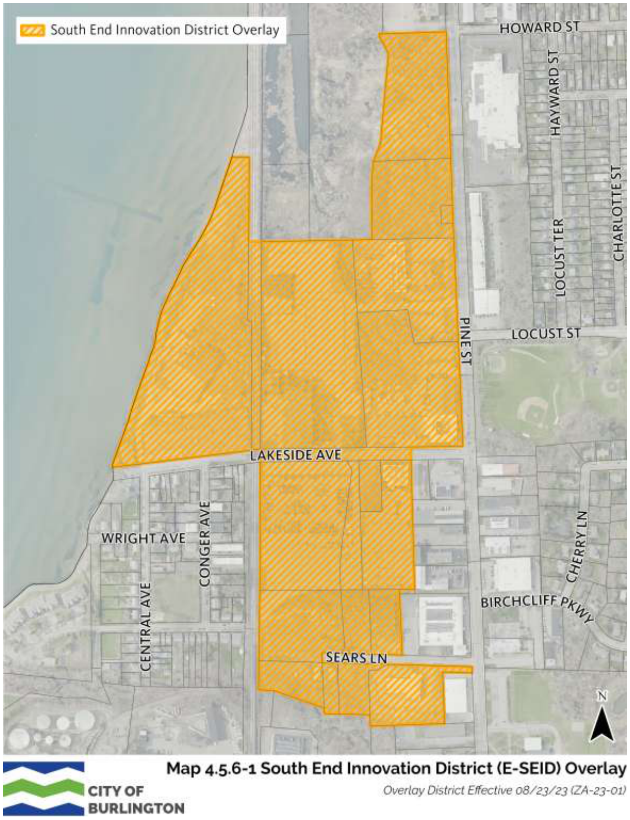
District Specific Regulations
Table 4.5.6-1: SEID Dimensional Standards & Density
| Block Perimeter¹ | Max. Intensity (floor area ratio²,³) | Max Building Size per Floorplate⁴,⁵ | Max. Lot Coverage & Pervious Surface Required | Minimum Building Setbacks ⁶ | Max. Height⁷ | ||
|---|---|---|---|---|---|---|---|
| Front | Side | Rear | |||||
| 1,600’ max | 2.5 FAR | Floors 1-6: 15,000 sq. ft. Floors 7-8: 10,000 sq. ft. Except as permitted by Sec.4.5.6 (c) 1 | 80% max impervious | 0’ min 20’ max⁵ | 0’ min 20’ max⁵ | 0’ min 20’ max⁶ | 85’ |
1. Blocks may be enclosed by any combination of streets within public Rights-of-Way or Public Paths. Where a property abuts a railroad or area identified as Wetland, Conservation or Natural Area on Map 4.5.3-1 Natural Resource Protection Overlay District, such boundaries may serve as enclosing block boundaries.
2. Floor area ratio is described in Sec 5.2.7.
3. Bonuses for additional FAR for inclusionary housing projects are described in Sec. 9.1.12.
4. Maximum square footage applies to each floorplate.
5. One parking structure per lot established as of January 1, 2023 may exceed the 15,000 sq. ft. floorplate maximum standard according to the following:
a. When the structure contains a transit use, the maximum floorplate is 60,500 sq. ft., or
b. When the structure does not contain a transit use, the maximum floor plate is 30,000 sq. ft.
6. Setbacks are measured from the property line; however, buildings must be at least 15’ from the curb or edge of a public Right of Way if no curb exists.
7. Maximum building height in the E-SEID shall be further limited by Map 4.5.6-2: SEID Specific Height Area Map.
Dimensional Standards & Density
Within the SEID the standards set forth in Table 4.5.6-1 shall apply to new development and redevelopment, except:
Floors 7-8 may increase maximum size to 15,000 sq.ft. per floorplate for buildings constructed of Mass Timber consistent with currently adopted Building Code as contained under Chapter 8 of the City Code of Ordinances.
The maximum lot coverage may be increased by 10%, to a maximum of 90%, if the site is certified as Gold or Platinum under the SITES system, as administered by Green Business Certification, Inc. (GBCI).
Map 4.5.6-2 SEID Specific Height Area Map
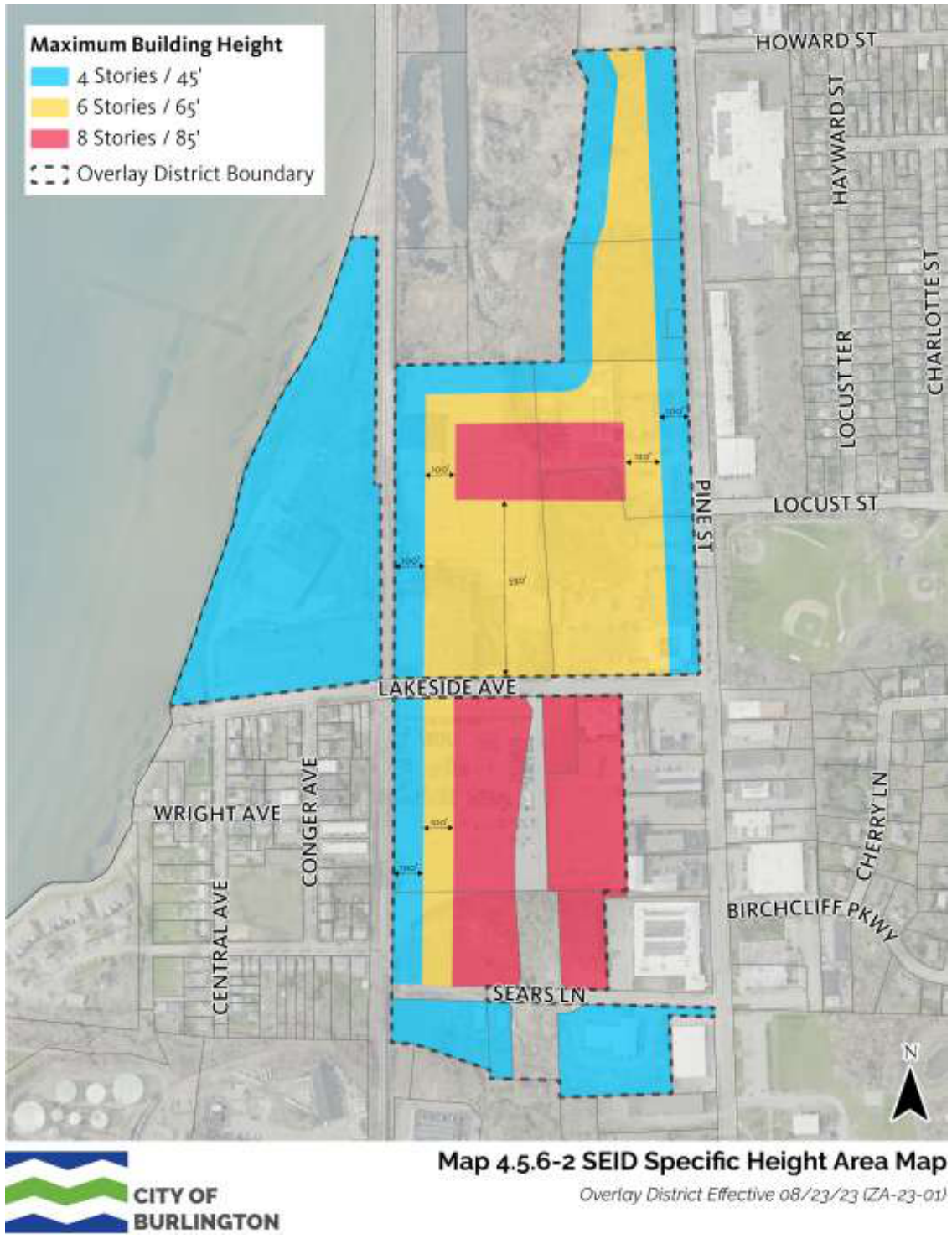
Table 4.5.6-2: Frontage and Activation Standards
1. Measured linearly.
2. A courtyard on a building façade adjacent to a street or Public Path, with minimum dimensions 12 feet minimum and 35 feet maximum, shall be counted in the calculation of frontage to satisfy this requirement.
Frontage and Ground Floor Activation Standards
Lot Frontage Occupied by Buildings: Buildings shall be placed on a lot such that they frame Streets and Public Paths. The percentage of a lot’s frontage that must be occupied by a building(s) located between the minimum and maximum setback is determined by Table 4.5.8-2.
A lot’s frontage buildout may be reduced by up to 10 percent upon the determination of the Zoning Administrative Officers that the relief is necessary to access to the rear of the lot as a result of lot width or building placement constraints.
Building Frontage Occupied by Non-Residential Uses: Buildings fronting on Streets of Public Paths must contain a minimum amount of non-residential uses on the ground floor as determined by Table 4.5.8-2.
Building corners, when located at the intersection of two Streets or Public Paths, must include non-residential uses.
The depth of a building’s ground floor non-residential uses shall be at least an average of 15 feet, measured orthogonally from the building facade.
For all Streets and Public Paths, Primary and Secondary frontages must be identified by the property owner.
The minimum non-residential frontage requirements may be reduced to 35% for Primary Frontages and 0% for Secondary Frontages using one of two, but not a combination thereof, of the alternative compliance methods described below:
Alternative 1: The required percentage of ground floor non-residential uses may be reduced in 15% increments for each Primary frontage and 7% increments for each secondary frontage for each of the following methods:
At least 30% of non-residential use ground floor area is maintained as affordable for at least 30 years, as defined and administered by the Community and Economic Development Office (CEDO).
A building is placed adjacent to one or more publicly accessible open spaces on the same lot. Such open spaces must be at least 4,000 sq. ft. in area and no portion of the open space may have a dimension less than 10 feet. Qualifying open spaces may be located in a courtyard on the building’s frontage, to the side, or in front of the building for which a reduction in ground floor non-residential use is being sought.
A building containing residential uses includes an allocation of at least 10% three-bedroom units and 15% percent two-bedroom units.
Alternative 2: A detached, one- or two-story permanent structure containing non-residential uses that is constructed within or adjacent to the public realm, including Rights-of-Way, or open space on the same lot may be provided in lieu of required ground floor non-residential uses on a one-to-one basis as determined by the square footage of the detached structure.
Parking
No more than 25 total spaces or 15% of the Lot’s area, whichever is greater, may be permitted in Surface Parking Lots on any one lot. For the purposes of this standard, Surface Parking Lot area shall include area of all stalls and drive aisles. The total number of off-street parking spaces provided shall not be more than as allowed in Table 8.1.9-1. On Primary Frontages, Parking is not permitted between a building and the Street or Public Path. In such Parking Lots, priority parking spaces shall be made available, as described in Sec. 8.1.16 (c) c.4 – Parking Management.
Structured Parking
All above ground Parking Structures shall be located behind a Perimeter Building, or screened so that cars and internal structure lighting are not visible from adjacent streets or properties. Screening can be provided by architectural structure or vegetative trellis.
Parking Structure ingress/egress shall be consolidated into one façade opening and shall not exceed 24 feet in width or shall be separated into no more than two openings per façade, with a combined width of no more than 28 feet. Each façade opening shall not exceed 16 feet clear height.
At least one pedestrian route shall lead directly to a Street or Public Path. When portions of a Building containing parking front on more than one street, multiple pedestrian routes to the Frontage are strongly encouraged.
Uses
Within the SEID, only the following uses shall be permitted.
Table 4.5.6-3 Uses Permitted & Limited within the SEID
| Permitted Uses: | |
|---|---|
| Residential¹ | |
| Assisted Living | |
| Attached Dwellings - Multi-Family | |
| Co-Housing | |
| Convalescent/Nursing Home | |
| Emergency Shelter | |
| Group Home | |
| Dormitory | |
| Non-Residential | |
| Adult Day Care | Office - General |
| Agricultural Use | Office – Medical/Dental |
| Amusement Arcade | Office - Technical |
| Animal Boarding/Kennel Shelter | Open Air Markets |
| Animal Grooming | Park |
| Animal Hospital/Veterinarian’s Office | Parking Garage³ |
| Appliance Sales/Service | Parking Lot³ |
| Art Gallery/Studio | Performing Arts Center |
| Bakery | Performing Arts Studio |
| Bank/Credit Union | Pet Store |
| Bar/Tavern | Pharmacy |
| Beauty/Barber Shop | Photo Studio |
| Bicycle Sales/Repair | Photography Lab |
| Billiard Parlor | Place of Worship |
| Bowling Alley | Police Station - Local |
| Cafe | Post Office - Local |
| Cinema | Printing Plant |
| Community Center | Printing Shop |
| Community Garden | Public Transit Terminal |
| Convenience Store | Public Works Yard/Garage |
| Crisis Counseling Center | Radio & TV Studio |
| Daycare | Recording Studio |
| Dry Cleaning Service | Recreational Facility - Indoor |
| Film Studio | Recreational Facility - Outdoor |
| Fire Station | Research & Development Facility |
| Food & Beverage Processing | Research Lab |
| Garden Supply Store | Restaurant |
| General Merchandise/Retail - Small < 4,000 sqft | Restaurant – Take Out |
| Grocery Store ≤ 10,000 sf | Salon/Spa |
| Health Club | School – Post-Secondary and CC |
| Health Studio | School - Preschool |
| Laundromat | School - Primary |
| Library | School - Secondary |
| Manufacturing - Light | School – Trade, or Professional |
| Mental Health Crisis Center | Tailor Shop |
| Museum – Small ≤ 10,000 sf | |
1. Residential uses are permitted only in new buildings, or in additions to existing buildings, built after January 1, 2023.
2. Parking Structure and Parking Lot uses are regulated by Sec. 4.5.6(c) 3 Parking and Table 4.5.6-1 SEID Dimensional Standards & Density.
Article 5Citywide General Regulations
§ 5Introduction
This Article of the Burlington Comprehensive Development Ordinance provides general development regulations that apply citywide and in all zoning districts unless otherwise modified by the specific district standards in Article 4.
§ 5.0.0Purpose
It is the purpose of this Article to provide general and citywide standards and regulation of land development that will promote the public health, safety, convenience, and welfare.
Part 1Uses and Structures
§ 5.1.1Uses
Except as otherwise provided by law or by this ordinance, no land or structure in any district shall be used or occupied except as specified under the provisions of this ordinance and the requirements of the zoning district in which such land or structure is located as specified in Article 4 and in Appendix A-Use Table.
Preexisting Uses:
Any use lawfully existing as of the effective date of this ordinance shall be authorized to continue solely on the basis of the provisions of this ordinance.
Preexisting Non-conforming Uses:
Pre-existing uses that do not conform to the requirements of this ordinance shall be subject to the provisions of Sec. 5.3.4.
Permitted Uses:
A permitted use is allowed as of right in any district under which it is denoted by the letter "Y" in Appendix A -.Use Table. Permitted uses are subject to such requirements as may be further specified in this ordinance such as but not limited to dimensional and intensity limitations, performance and design standards, and parking standards.
A conditional use is listed in any district where denoted by the letters "CU" in Appendix A - Use Table. Such uses may be permitted by the DRB only after review under the conditional use provisions provided in Article 3, Part 5, such further restrictions as the DRB may establish and such additional requirements as may be established by this ordinance such
as but not limited to dimensional and intensity limitations, performance and design standards, and parking standards.
Uses Not Permitted:
A use in any district denoted by the letter "N," or any use not listed, shall not be allowed in any zoning district unless the administrative officer determines that the use is substantially equivalent in use, nature, and impact to a listed permitted or conditional use.
Only one principal use shall be permitted on any lot in any residential zoning district unless otherwise expressly authorized pursuant to another provision of this ordinance including Article 11 – Planned Development. In all other districts, more than one principal use may be permitted on any single lot.
Accessory Uses:
Accessory Dwelling Units. Accessory dwelling units as mandated by 24 VSA 4412 (1)(E) shall be regulated as set forth in Sec. 5.4.5 hereof.
Accessory Residential Uses: Except as specified in 1 above and subject to the restrictions of 3 below, accessory residential uses shall also be governed by Sec. 4.4.5(d)4.
Other Accessory Uses. Except as specified in 1 above, any use may be an accessory use provided in Article 3, Part 5 provided each of the following standards are present:
The accessory use is subordinate and customarily incidental to the principal use;
The accessory use is reasonably necessary to the conduct of the principal use;
Except for home occupations as regulated by Sec. 5.4.6, no accessory use, or combination of accessory uses, shall occupy more than twenty-five (25%) per cent of the total gross area dedicated to the principal use;
The accessory use shall not include the outdoor storage of more than one unregistered vehicle;
The accessory use does not result in, or increase the extent of, any pre-existing non-conformity or violation of the provisions of this ordinance; and,
The combination of uses on any given property shall meet all of the other provisions of this ordinance.
Temporary Uses
The administrative officer may approve a temporary use that is incidental and accessory to a principal use subject to the following:
| No Review or Permit Required | Site Plan Review: Zoning Permit & COA | Review as per Underlying Zoning |
|---|---|---|
| A use in place for up to 10 consecutive days or 30 days within any 12-month period at the same location. | A use in place from 11-31 consecutive days or 31-60 days within any 12 month period at the same location. | A use in place for over 31 consecutive days or more within any 12 month period at the same location, is no longer considered a temporary use. |
Temporary Uses Incidental to Development
The administrative officer may issue a zoning permit for a temporary use that is incidental and accessory to the development or redevelopment of a building and/or site, and where reasonably required for such development activity. Such permits for temporary uses shall not be issued for a period in excess of ninety (90) days in any consecutive twelve (12) month period unless such uses would otherwise conform to the applicable provisions of this ordinance.
§ 5.1.2Structures
Except as otherwise provided by law or by this ordinance, no structure in any district shall be created, removed or altered except in conformance with the provisions of this Article and the requirements of the district in which such land or structure is located.
Preexisting Structures:
Any preexisting structure lawfully existing as of the effective date of this ordinance shall be authorized to continue solely on the basis of the provisions of this ordinance.
Preexisting Non-conforming Structures:
Pre-existing structures that do not conform to the requirements of this ordinance shall be subject to the provisions of Sec. 5.3.5.
More than one principal structure is permitted on a lot within a residential zoning district subject to the limits of Sec. 4.4.5 Residential Districts, or as otherwise authorized pursuant to the requirements of Article 11 – Planned Development. In all other districts, more than one principal structure may be permitted on any single lot.
Accessory Residential Structures or Buildings:
An accessory structure or building customarily incidental and subordinate to a principal residential use, structure, or building shall also be governed by the provisions of Sec. 4.4.5(d) 4 (B).
The administrative officer may approve a temporary structure that is incidental and accessory to a principal use subject to the following:
| No Review or Permit Required | Site Plan Review: Zoning Permit & COA | Review as per Underlying Zoning |
|---|---|---|
| A structure placed up to 10 consecutive days or 30 days within any 12-month period at the same location. | A structure placed from 11-30 consecutive days or 31-60 days within any 12 month period at the same location. | A structure placed over 31 consecutive days or more within any 12 month period at the same location, is no longer considered a temporary structure. |
| Tents used for recreational non-commercial camping purposes. | ||
| Tents as defined in Chapter 3 of NFPA 101 for non-residential purposes, as approved by the Burlington Fire Marshal, placed up to 180 days within a 12-month period at the same location. | ||
| Temporary structures for non-residential purposes in both Civic Spaces and all enumerated City of Burlington Parks (Code of Ordinances Chapter 22-1), without review or required zoning permit for up to 60 days within a 12 month period, provided that the structure is approved by the Burlington Fire Marshal. |
Part 2Dimensional Requirements
§ 5.2.1Reserved
§ 5.2.2Required Frontage or Access
§ 5.2.3Lot Coverage Requirements
Where a maximum lot coverage is specified pursuant to the requirements of Article 4, no building or part of a building or impervious surface or other form of coverage shall exceed such maximum allowable except as specifically authorized by this ordinance.
Calculating Lot Coverage:
Lot coverage shall be calculated in the following manner:
Compute the square footage of all parts of the lot, or portion of the lot where split by a zoning district boundary, covered by all buildings including accessory structures, decks, patios, paved or unpaved walkways and parking areas, and any other paved surface;
Add the square footage calculated in subsection (1) above to obtain a figure for total coverage; and,
Divide the total coverage calculated in subsection (2) above by the square footage of the entire upland portion of the lot to derive the percentage of lot coverage. Lot area inundated by water including streams, ponds, lakes, wetlands, and other bodies of water, shall not be included.
For more information and a description of lot coverage calculations please see the City of Burlington, Department of Planning and Zoning’s Design Guide for Site Plans.
Exceptions to Lot Coverage:
In all districts, the following shall not be counted as lot coverage:
Lawns, gardens and unpaved landscaped areas;
Drainage ways;
Fountains;
Swimming pools (Note: aprons, decks and walks adjacent to swimming pools shall be considered as lot coverage);
Retaining walls less than eighteen (18) inches in width across the top surface; if eighteen(18) inches or greater, the entire top surface shall be considered as lot coverage; and,
Ramps for the disabled, for which the sole purpose is to provide access for the disabled, and which have no more than the minimum dimensions required to meet accessibility standards.
For the purposes of lot coverage calculations, at-grade green roofs shall be counted as open space, and above-grade green roofs shall be counted as lot coverage. Partially at-grade green roofs shall be counted as lot coverage as follows:
Intensive green roofs will be counted at 50% lot coverage of their total roof area.
Extensive green roofs will be counted at 75% lot coverage of their total roof area.
Walkways, equipment, and other un-vegetated areas within the green roof shall not receive lot coverage credit.
These lot coverage exceptions are contingent on continued maintenance and functionality of the green roof.
§ 5.2.4Buildable Area Calculation & Steep Slopes Overlay District
The intent of this section is to:
To protect sensitive natural features;
To prevent overdevelopment of properties that contain sensitive and unbuildable areas, and
To minimize the potential for erosion, slope failure, and contamination of surface waters caused by the adverse effects of development on steep slopes, and
To ensure that new development fits within the existing scale and intensity of the surrounding neighborhood.
Buildable Area Calculation
For any properties two (2) or more acres in size within any RCO, RM, or RL zoning district, the maximum building density or lot coverage shall be calculated using the buildable area only. Buildable area shall be deemed to include only those portions of a property that are not inundated at least six months per year by water including streams, ponds, lakes, wetlands and other bodies of water; and lands with a slope in excess of 30%.
The DRB may under conditional use criteria allow up to 50% of the maximum building density or lot coverage to be calculated on lands with a slope between 15-30% if the applicant can demonstrate that the additional density or lot coverage will be compatible within the existing scale and intensity of the surrounding neighborhood, and not have an undue negative impact on sensitive natural features.
Steep Slopes Overlay District
This overlay district consists of all lands delineated in Map 5.2.4-1 – Steep Slopes Overlay District. This overlay district contains expanses of contiguous land with an average slope of 15% or greater over 50-foot intervals and adjacent lands within 50 feet of the top of slope.
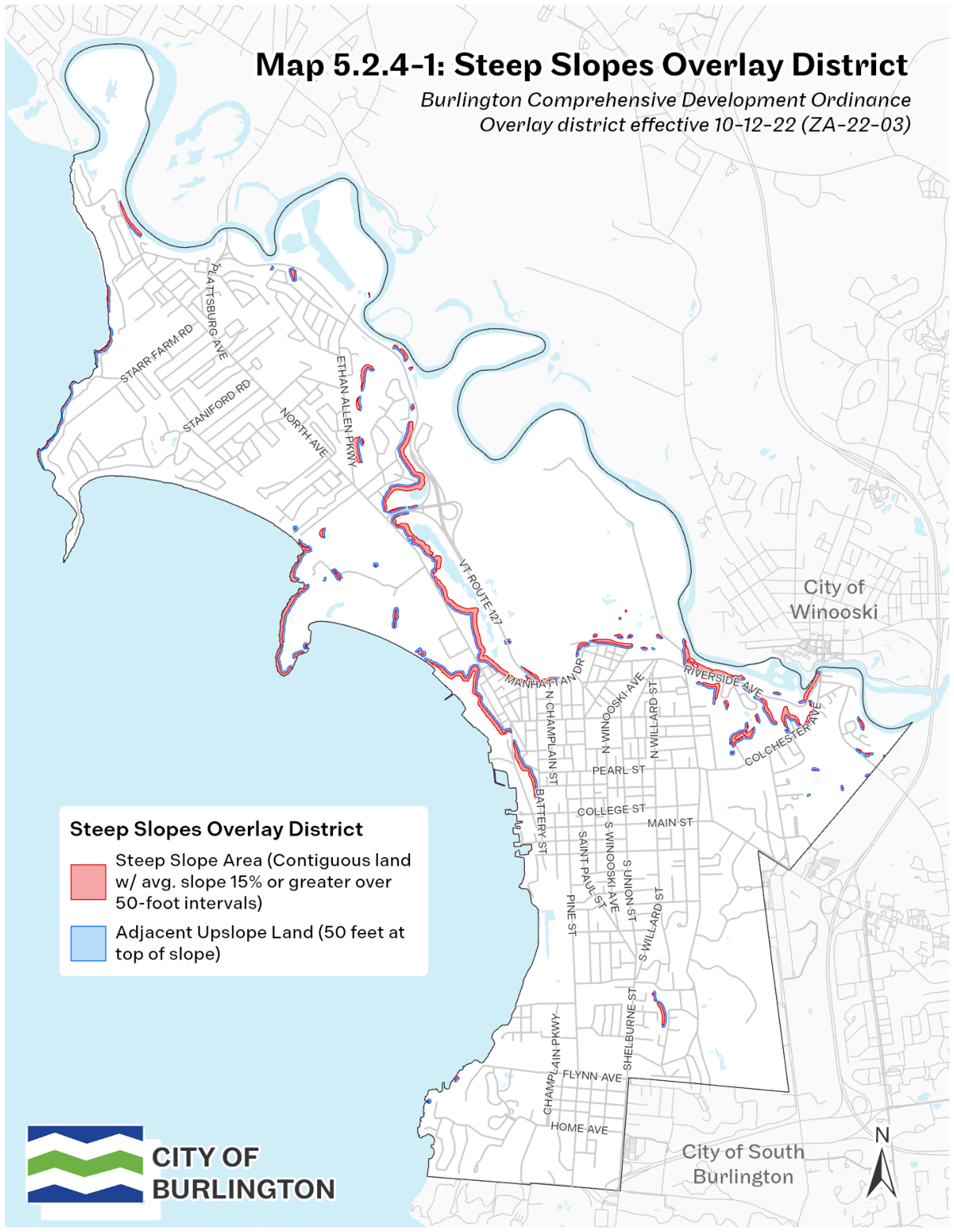
The boundaries shown on the Steep Slopes Overlay Map may be supplemented or modified by examination of one or more of the following sources by the Development Review Board whenever an application is submitted for review.
Contour maps prepared from the most current orthophotography.
On-site survey prepared by a registered professional engineer or surveyor.
The Zoning Administrative Officer or Development Review Board shall determine whether or not the Steep Slope Overlay District has been shown accurately on the application plans. The applicant may be required to revise the steep slope boundaries shown on the application plans.
The burden of proving the correct boundary shall be on the applicant, supported by engineering and/or surveying data or mapping.
District Specific Regulations
The Steep Slope Overlay District shall be an overlay on all zoning districts. The regulations in the overlay are in addition to those regulations of the underlying zoning district.
These regulations apply to applications within the Overlay District that include 400 square feet or more of earth disturbance.
Finished slopes of all cuts and fills shall not exceed 30%, unless the applicant can demonstrate that steeper slopes can be stabilized and maintained adequately to the satisfaction of the ZAO or DRB in consultation with the City Engineer.
Any fills placed on a steep slope shall be property stabilized and, when necessary, supported by retaining walls or other appropriate measures as approved by the ZAO or DRB in consultation with the City Engineer.
Finished grades shall be reasonably safe from slide, collapse, or similar failure as determined by the ZAO or DRB in consultation with the City Engineer.
Additional Application Requirements
A site plan prepared by a registered professional engineer or surveyor that accurately depicts the proposed development and related land disturbance relative to the Steep Slope Overlay District boundaries, with all pertinent information describing the proposal, and a topographical survey depicting existing and proposed contour lines at no greater than 2-foot intervals. The plan shall depict all proposed cut, fill, and grading.
A plan depicting the extent of proposed vegetation clearing.
Approval Condition
Prior to construction, the applicant shall provide a geotechnical analysis prepared and stamped by a professional geotechnical engineer that determines the suitability of the steep slope for development.
§ 5.2.5Setbacks
Setbacks between structures and property lines where required are intended to provide access to light and air, provide fire separation and access, and maintain the existing neighborhood pattern of structures and open spaces between them and to the street.
Setbacks Required:
Unless otherwise authorized or specified under the district-specific provisions of Article 4, which shall be controlling over these provisions, a setback shall be provided between any proposed structures and/or site features, and the front, side and rear yard property lines as follows: (See Art. 13 for definitions of “setback” and “yard.”)
Front yard. In order to maintain the existing pattern of development along a given street, both a minimum and maximum front yard setback shall be maintained where required under Article 4.
The minimum front yard setback for any structure shall be the average of the front yard setback of principal structures in lawful existence as of the adoption of this ordinance on the two (2) neighboring lots on either side and within the same block and having the same street frontage. Among the comparative sample of four neighboring properties, one may be removed from the averaging calculation.
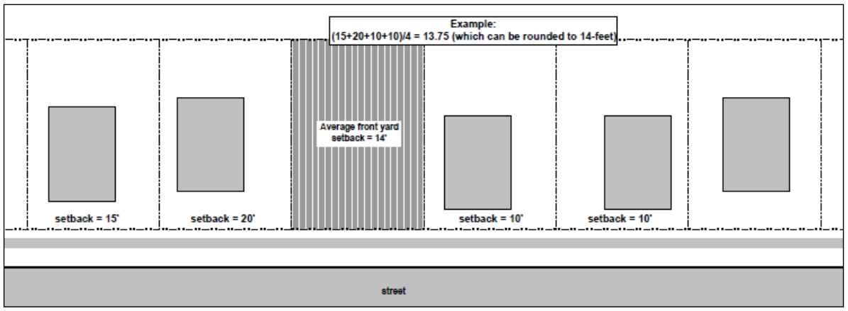
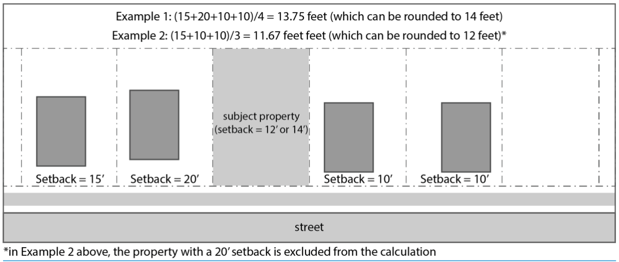
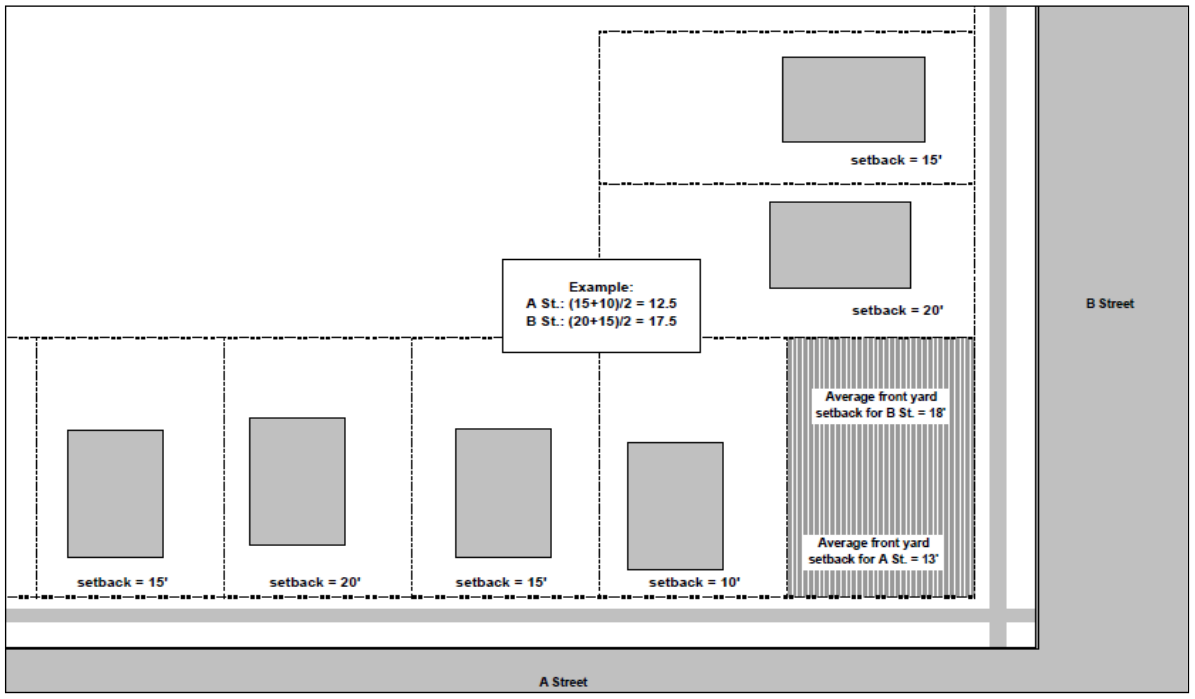
The maximum front yard setback for any structure, if any is required, shall be a distance specified under the district-specific provisions of Article 4 permitted in addition to the minimum front yard setback specified above in order to allow for continued variation of the building pattern along the street.
Lots having frontage on more than one public street shall maintain a front yard setback on each public street except access alleys.
Side yard. The minimum side yard setback for any principal structure shall be as required under the provisions of Article 4. Where the side yard setback is expressed as a percent of the lot width, such width shall be measured parallel to the lot frontage. Alternatively, where provided for under Article 4, the minimum side yard setback may be the average of the correlating side yard setbacks (i.e. left or right) of principal structures in lawful existence as of the adoption of this ordinance on the four (4) neighboring lots (2 on either side) and within the same block having the same street frontage.
Exceptions to Yard Setback Requirements:
The following projections into required yard setbacks may be permitted subject to the standards of Article 6 to ensure compatibility with neighboring properties:
Abutting Building with Doors or Windows. New Buildings, additions, or significant improvements to existing Buildings placed on a side or rear property line, or within 10 feet of another building, where no setback is required are subject to construction material and building opening restrictions as established in the effective Building Code.
Building and Site Features. Building and site features outside of the building envelope, including but not limited to eaves, sills, roof overhangs, cornices, steps to first floor and basement entries, window wells, walkways, ramps for people with disabilities, fences and walls may project into a required yard setback. Such projecting building features are subject to construction material and building opening restrictions as established in the effective Building Code.
Retaining Walls. Retaining walls no greater than 5’ tall may project into a required yard setback, but retaining walls should be set back a minimum of 2’ from a property boundary. Retaining walls projecting into a required setback and exceed 5’ tall and/or come within 2’ of a property boundary shall be subject to Development Review Board review per Article 6. These provisions shall not apply to retaining walls acting as seawalls and constructed along, and parallel to, the banks of any river, stream, or brook or constructed in whole or in part below the 102’ elevation along the Lake Champlain Shoreline.
Historic Building Features. Features of a historic building such as porches, additions, entries, bays and porticos that have been removed may be replaced and may project into required yard setbacks subject to the following:
The structure is listed or eligible for listing on the State or National Register of Historic Places;
The building feature replacement is completed in accordance with the standards for historic buildings contained in Sec. 5.4.8.
Accessory Structures and Parking Areas. Accessory structures no more than fifteen (15) feet in height, parking areas, and driveways may project into a required side and rear yard setback provided they are no less than five (5) feet from a side or rear property line where such a setback is required.
Swimming Pools. Swimming pools and related features, but not including structures, may project into a required side or rear yard setback provided that the water's edge is no less than five (5) feet, and any apron less than two (2) feet, from any property line.
Driveways. Common or shared driveways and walkways along shared property lines and associated parking areas, including those to serve residential lots and developments per Sec. 4.4.5 (d) 4.A and Sec. 5.2.2, do not have to meet setback requirements along the shared property line. Other driveway encroachments may be permitted subject to Tables 4.4.5-1 and 4.4.5-2.
Additional exceptions for nonconforming structures under Sec. 5.3.5.
§ 5.2.6Building Height Limits
No structure shall exceed thirty-five (35) feet in height unless otherwise authorized under the district-specific provisions of Article 4:
Height Measurement:
The maximum height of any building shall be measured as follows:
Starting Point: Building height shall be measured from:
a public sidewalk, alley, or other public way or space where the proposed building’s street-facing façade is within a 50-foot horizontal distance of the lot’s street frontage; or,
the average finished grade within a 10-foot horizontal distance of the building’s street-facing façade where the proposed building is more than a 50-foot horizontal distance from the lot’s street frontage.
For buildings on sloped sites, see additional measurement standards in (b) below.
Ending Point: Building height shall be measured to:
Flat Roof: the highest point of the decking of a flat or flat-topped mansard roof. A parapet no taller than four (4) feet shall not be considered part of a flat roof for the purposes of measuring building height;
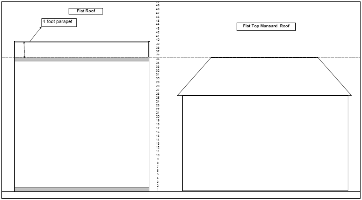
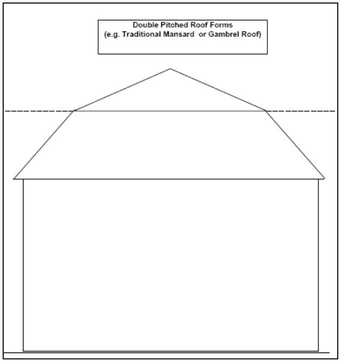
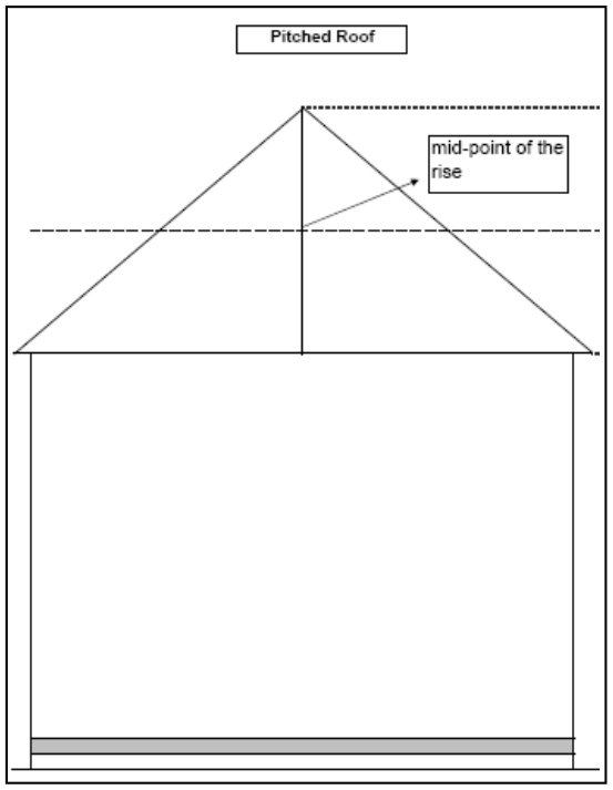
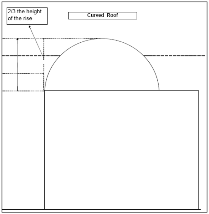
Roofs with Dormers: Building height will be calculated to the midpoint of the rise of dormers that either individually or collectively exceed 50% of the width of the horizontal eave length of the roof. Dormers less than this width do not affect height calculation noted in A – C and E of this subsection.
Other Roof Forms: Building height shall be measured as determined by the administrative officer in a manner that most closely reflects the intent of subsections (a) through (c).
Buildings on Sloped Sites:
Buildings on slopes shall reflect the pre-construction topography of the site by making use of opportunities to vary the building’s height and roof forms relative to terrain changes as follows:
Measurement Interval: Building height shall be measured from the average grade along the street-facing façade at intervals of no less than 32-feet or more than 65-feet along the entire length of the street-facing façade (s).
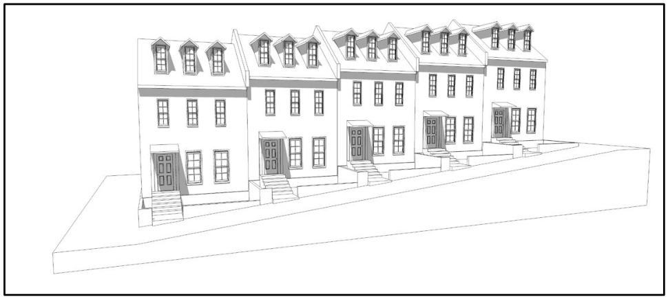
Lots Fronting on Two or More Streets: Where a lot, other than a corner lot, fronts on two or more streets, the building height shall be measured along each street-facing façade. Where the streets are at differing elevations, the building height may gradually increase above the maximum height allowed on the lowest street provided that any such additional height along the lowest street shall be set-back a minimum of 16-feet from the average plane of the building’s street-facing façade below for every 10-feet of additional building height up to the maximum height allowed on the highest street.
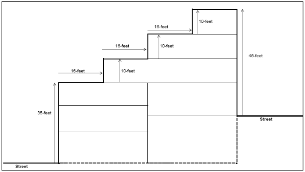
Illustration: To evaluate the height and bulk of a proposed building in context with its surroundings, the applicant may be required to prepare a scale model, computer visualization, illustrations, or other renderings.
Exceptions to Height Limits
Additions and new construction on parcels created prior to January 1, 2008 that contain a non-conforming Principal Building exceeding the maximum permitted Building height may exceed the maximum permitted Building height of the zoning district subject to the design review provisions of Art. 3 and 6, but in no event shall exceed the height of the existing non-conforming Principal Building.
In no case shall the height of any structure exceed the limit permitted by federal and state regulations regarding flight paths of airplanes.
Ornamental and symbolic architectural features, including towers, spires, cupolas, belfries and domes; greenhouses, garden sheds, gazebos, rooftop gardens, terraces, and similar features; and fully enclosed stair towers, elevator towers and mechanical rooms, where such features are not used for human occupancy or commercial identification, are exempt from specific height limitations but shall be subject to the design review provisions of Art. 3 and 6. Such features and structures shall be designed and clad in a manner consistent and complementary with the overall architecture of the Building.
Exposed mechanical equipment shall be allowed to encroach beyond the maximum building height by no more than 15-feet provided that portion exceeding the height limit does not exceed 20% of the roof area.
Exposed mechanical equipment shall be fully screened on all sides to the full height of the equipment, and positioned on the roof to be unseen from view at the street level. Screening may consist of parapets, screens, latticework, louvered panels, and/or other similar methods. Such features and structures shall be designed and clad in a manner consistent and complementary with the overall architecture of the Building
Where mechanical equipment is incorporated into and hidden within the roof structure, or a mechanical penthouse setback a minimum of 10-ft from the roof edge, no such area limit shall apply and the structure shall be considered pursuant with 4 above.
All forms of communications equipment including satellite dish antennae shall not be exempt from height limitations except as provided in Sec 5.4.7 of this Article.
The administrative officer may allow for up to a 10% variation in the maximum building height to account for grade changes across the site. In no event however, shall such additional height enable the creation of an additional story beyond the maximum permitted.
Fences placed within a clear sight triangle along driveways and at street intersections, or between an existing building and the front property line, whichever is less, shall be limited to 3-feet in height above the curb in order to provide safe sight distances for pedestrians and vehicles.
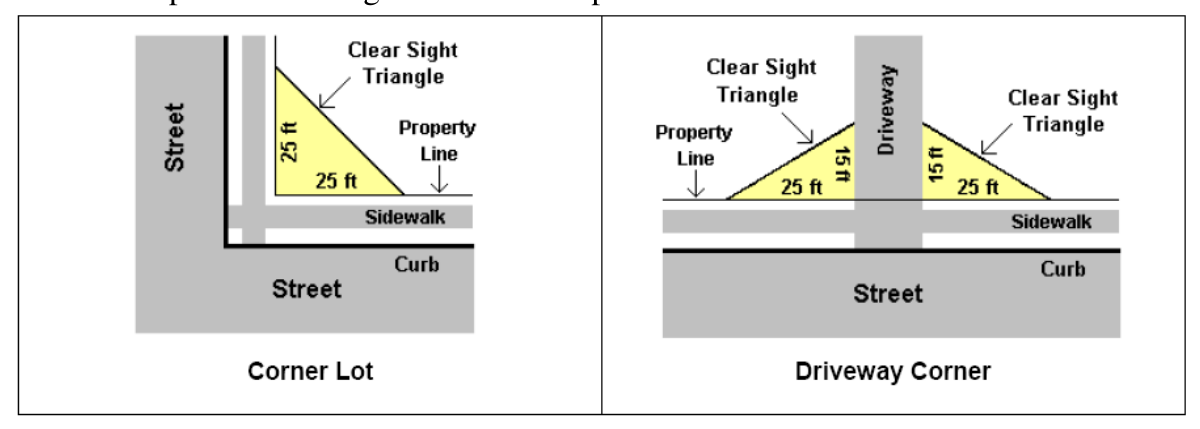
§ 5.2.7Density Calculations
Dwelling Units per Acre:
In accordance with the district-specific provisions of Article 4, the calculation of density shall be measured as follows in such cases where the density is measured on a dwelling unit per acre basis:
Density Calculation: The total number of dwelling units provided on a lot or lots, or portion of the lot(s) where split by a zoning district boundary, shall be divided by the area expressed in acres calculated to the nearest fractional tenth (i.e. to a single decimal point). The area of the lot(s) shall account for buildable area where applicable (see Sec. 5.2.4). In calculating the number of dwelling units permitted, fractional units of less than five-tenths (0.5) shall be rounded down to the nearest whole number and fractional units of five-tenths (0.5) or greater shall be rounded up to the nearest whole number. Any rounding of fractional units shall be limited to a single final calculation.
Density Equivalent, Nonresidential Uses: For purposes of density calculations, each one thousand, five hundred (1,500) square feet of nonresidential gross floor area shall be counted as one dwelling unit.
Floor Area Ratio:
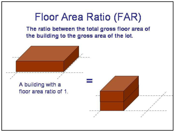
In accordance with the district-specific provisions of Article 4 where the intensity of development is measured on a floor area ratio basis, the calculation of development intensity shall be measured by dividing the gross floor area of all structures on a lot or lots, or portion of the lot(s) where split by a zoning district boundary, by the area of the lot(s).
Part 3Non-Conformities
§ 5.3.1Purpose
These regulations are enacted for the purpose of governing all aspects of nonconformity, regardless of whether it is a use, a structure or a lot. As defined under Article 13, nonconformity means a use, structure or lot that was legal at the time it was constructed or laid out, but would not be lawful under the requirements of this ordinance. This Part will also address “Bianchi-controlled Situations”, in which a zoning violation may not subject to enforcement under the standards set forth by the Vermont Supreme Court in the case entitled Bianchi v. Lorentz and later codified in 24 VSA Sec. 4454.
In combination, these standards are intended to establish the property rights of individuals and organizations in a manner consistent with the overall goals of zoning and to promote the City's general health, safety, and welfare.
§ 5.3.2“Bianchi” controlled uses, structures, and lots
Although not subject to enforcement action pursuant to Article 2, uses, structures, and lots which are deemed to be controlled by the Bianchi decision, and the subsequent enactment of 24 VSA Sec. 4454, shall be considered violations that are not considered legal to any extent and shall in no event be granted the consideration or allowances of nonconforming structures, uses, and lots. Thus, no change, alteration, enlargement, and reestablishment after discontinuance for more than sixty (60) days or reconstruction after an occurrence or event which destroys at least 50% of the structure in the judgment of the city’s building inspector shall be permitted, except to a conforming use, structure, or lot.
§ 5.3.3Continuation
Except as otherwise specified in this Article, any nonconformity which lawfully existed at the time of passage of the applicable provisions of this or any prior ordinance or any amendment thereto may be continued subject to the provisions of this Part.
§ 5.3.4Nonconforming Uses
Changes and Modifications:
A nonconforming use may be changed to a conforming use pursuant to all applicable provisions of this ordinance. When a nonconforming use has been made conforming, it shall not be made nonconforming again.
Any change or modification to a nonconforming use, other than to full conformity under this Ordinance, shall only be allowed as specified below and shall require conditional use approval pursuant to the provisions of Article 3, Part 5 by the DRB.
Nonconforming Non-Residential Use:
A nonconforming non-residential use shall not be expanded or altered in any way, other than to full conformity under this Ordinance, except as follows:
Exception for residential conversion.
A non-residential nonconforming use may be converted to a residential non-conforming use pursuant to the applicable residential conversion provisions of Sec. 4.4.5(d)(1).
Existing Neighborhood Commercial Uses.
Existing non-residential uses intended to primarily serve the nearby residential area shall not be considered non-conforming to the extent they comply with the provisions of Sec. 4.4.5(d)(3).
Nonconforming Residential Use:
A change or expansion of a non-conforming residential use may be allowed subject to conditional use approval pursuant to the provisions of Article 3, Part 5 by the DRB provided:
Such an expansion does not add any additional dwelling units except as may be permitted for residential conversion bonuses approved per the provisions of Sec. 4.4.5(d)(1), this Historic Building Rehabilitation Bonus under Sec. 5.4.8 (e) and for Accessory Dwelling Units per the provisions of Sec. 5.4.5;
Such an expansion does not increase the degree of non-conformity of any non-conforming structure; and,
In such cases where the non-conforming residential use is located in a zoning district where residential uses are generally permitted, expansion of a non-conforming residential use into an existing and previously uninhabited attic or basement within the principle structure may be permitted subject to administrative review provided no additional dwelling units are created, except for Accessory Dwelling Units per Sec. 5.4.5.
Discontinuance:
A nonconforming use shall not be re-established if such use has been discontinued for any reason for a period of one (1) year or longer. Provided, however, a period not in excess of two (2) years shall be the applicable standard for the re-establishment of discontinued uses in the Enterprise-Light Manufacturing (E-LM) district.
An extension to this time limit may be granted by the DRB after a public hearing and on the basis of documented evidence of a continuous good faith effort to re-establish the nonconforming use. Such evidence shall include but not be limited to application(s) to the DRB, bid documents, records of expenditures, newspaper advertisements, and/or real estate listings. Any request for such an extension shall be submitted in writing prior to the expiration of the one (1) or two (2) year time limit as specified above.
Any extension approved by the DRB shall be made in writing and shall specify the date after which no nonconforming use will be permitted upon the subject property.
§ 5.3.5Nonconforming Structures
Changes and Modifications:
Nothing in this Part shall be deemed to prevent normal maintenance and repair or structural repair, or moving of a non-complying structure pursuant to any applicable provisions of this Ordinance.
Any change or modification to a nonconforming structure, other than to full conformity under this Ordinance, shall only be allowed subject to the following:
Such a change or modification may reduce the degree of nonconformity and shall not increase the nonconformity except as provided below.
Within the residential districts, and subject to Development Review Board approval, existing nonconforming single family homes and community centers (existing enclosed spaces only) that project into side and/or rear yard setbacks may be vertically expanded so long as the expansion does not encroach further into the setback than the existing structure. Such expansion shall be of the existing nonconformity (i.e. setback) and shall:
Be subject to conformance with all other dimensional requirements (i.e. height, lot coverage, density and intensity of development);
Not have an undue adverse impact on adjoining properties or any public interest that would be protected by maintaining the existing setbacks; and,
Be compatible with the character and scale of surrounding structures.
Existing accessory buildings of 15 feet in height or less shall not exceed 15 feet tall as expanded.
Such a change or modification shall not create any new nonconformity; and,
Such a change or modification shall be subject to review and approval under the Design Review provisions of Article 3, Part 4.
When any portion of a nonconforming structure has been made conforming, it shall not be made nonconforming again except as provided for historic building features pursuant to Sec. 5.2.5(b)(4).
A non-conforming residential structure may be enlarged up to the dimensional standards of the underlying zoning district, subject to review and approval by the DRB pursuant to Art. 3, Part 4 Design Review. Adaptive reuse or residential conversion bonuses may allow a greater expansion than the underlying zoning district allows approved per the provisions of Article 4.
A nonconforming structure may be replaced by a new structure retaining the same degree of nonconformity as the original structure. This provision is limited to the existing dimensional nonconformity (i.e. setback, lot coverage, or height), and shall not expand the degree of nonconformity except as provided for in (a) above. The new structure shall be subject to conformance with all other dimensional requirements (i.e. setback, lot coverage, and height). Zoning permit application for the replacement structure shall be completed within 1 year of demolition of the nonconforming structure; failure to do so shall result in the loss of the ability to retain the nonconformity.
In all other cases, a nonconforming structure that has been demolished or moved shall not be re-built or relocated in any way other than in full conformance with the provisions of this ordinance. Structures or any portion thereof that are structurally unsound, and are required to be removed by order of the building inspector, may be replaced within the original footprint provided both the requirement to demolish the building is not the result of demolition by neglect and the replacement shall not expand the degree of nonconformity.
§ 5.3.6Nonconforming Lots
Development may occur on a non-conforming lot only in the following manner:
Existing Small Lots:
See Sec. 5.2.1.
Required Frontage or Access:
See Sec. 5.2.2.
Changes to a Nonconforming Lot:
No change shall be permitted to any nonconforming lot which would have the effect of increasing the density at which the property is being used, or increasing the structure located upon such lot, if the dimensional requirements and standards of the underlying zoning district are not met as a result thereof. Allowance of adaptive reuse and residential conversion bonuses shall be an exception to the foregoing standards. In such cases where a parking waiver or waivers may be or have been legally granted, such a waiver shall be considered superseded by the standards provided in Article 8.
§ 5.3.7Nonconforming Signs
Any sign or other advertising device which does not conform to the provisions of this ordinance in terms of location, area, illumination, type, or height shall be deemed a nonconforming sign. Nonconforming signs may remain in use at the same location and ordinary maintenance and repair of such signs shall be permitted. Specific provisions regarding changes or modifications to non-conforming signs can be found in Article 7 - Signs.
§ 5.3.8Rebuilding After Catastrophe
If the structure housing a nonconforming use or a nonconforming structure is damaged by fire, explosion, or other catastrophe, and no government investigation determines that the damage resulted from the owner's intentional conduct or gross negligence the use may be restored or the structure rebuilt subject to the following provisions:
A zoning permit shall be obtained;
Any restoration or rebuilding which results in a modification of exterior features or to the site plan shall be subject to the provisions of Art. 3, Part 4 – Site Plan and Design Review where applicable;
A nonconforming use shall not be expanded in size or intensity beyond its extent prior to the catastrophe. If a nonconforming use is relocated and becomes operational in an area where it is a permitted use as a result of a catastrophe, it shall not be reestablished as a nonconforming use;
Noncompliance, in terms of dimensional regulations, shall not be increased beyond what existed prior to the catastrophe and, where physically possible, shall come into compliance;
If the structure is a nonconforming non-residential structure, determined to be 50% or more destroyed as determined by the City’s building inspector, any reconstruction must be in full conformity with then existing zoning regulations, except that a building that is listed or eligible for listing on the National or State Registers of Historic Places may be reconstructed in accordance with the provisions of Secretary of the Interior’s Standards for Rehabilitation, where such reconstruction is approved pursuant to the requirements of Art. 3, Part 5 Conditional Use Review; and
Such restoration or reconstruction shall be completed within one year after such catastrophe unless extended in accordance with Sec. 5.3.4(b).
Part 4Special Use Regulations
§ 5.4Introduction
The following regulations are use-specific requirements that shall apply in all cases where such uses are otherwise permitted or conditionally permitted pursuant to the provisions of Article 4. These regulations are in addition to, or may modify, other applicable provisions of these bylaws.
The following provide specific regulatory requirements for each use listed that shall apply in all cases where such uses are otherwise permitted or conditionally permitted pursuant to the provisions of Article 4.
§ 5.4.1Day Care Centers and Preschools
In addition to the provisions of Art 3, Part 5 for conditional uses, and applicable site and design review standards in Art 6, the following additional regulations shall be applicable to an application involving a day care center or preschool where such uses are treated as conditional uses pursuant to Appendix A – Use Table:
No playground equipment shall be located within the front yard;
[Reserved]
The site plan review shall insure adequate and safe drop-off and pickup space is provided and that traffic problems are not created;
Any additions, signage, or site improvements shall be residential in character;
The facility shall be licensed by the State of Vermont;
No more than one residential unit may be converted for the creation of a single day care center or preschool. Such a conversion shall be exempt from the requirements of Article 9, Part 2- Housing Replacement; and,
The neighborhood is not overburdened with other day care centers or preschools.
§ 5.4.2Historic Inns
In addition to the applicable provisions of Art 3, Part 5 for conditional uses, and site and design review standards in Art 6, the following additional regulations shall be applicable to an application involving a historic inn:
Historic Building:
The principal building shall be listed or eligible for listing on the State or National Register of Historic Places, and located on a lot of record as of January 1, 2007 a minimum of one-half (1/2) acre (21,780 square feet) in size and located on a major street.
Owner-Occupied:
In districts where a Historic Inn is a conditional use, the premises shall by occupied by a person as their primary residence who is an owner of the property or of the business. For purposes of this subsection only, an “owner” is defined as someone who holds, at least, a twenty-five (25%) percent ownership interest in the property or in the business.
Guestrooms:
The maximum number of guestrooms allowed shall be based on an overall density of twelve (12) rooms per acre. In districts where a Historic Inn is a conditional use, the DRB may determine that a lesser number of rooms is appropriate, based on their consideration of the impact of the proposed use on neighboring properties and traffic on nearby streets.
Exterior Modifications:
Any exterior modifications to the principal structure and changes to the site plan shall be subject to the development review standards for historic buildings in Sec 5.4.8.
Dining Facilities:
Common dining facilities for overnight guests and their guests may be included where a Historic Inn is a permitted use. In districts where a Historic Inn is a conditional use, regular meals may be limited if so determined by the DRB based on their consideration of the impact of the proposed use on neighboring properties and traffic on nearby streets.
Ancillary Events:
In districts where a Historic Inn is a permitted use, ancillary events are allowed. In districts where a Historic Inn is a conditional use, ancillary events may be permitted only at the discretion of the DRB based on their consideration of the impact of the proposed use on neighboring properties and traffic on nearby streets, and if so permitted shall be limited to indoor business meetings and meals in conjunction with those meetings for overnight guests and no more than four (4) invited guests.
Parking:
The full setback requirements as for a new principal structure shall be applied to new parking areas in the RL districts; and,
All parking shall be adequately screened from neighboring properties and the public street.
§ 5.4.3Convenience Stores
In addition to the applicable provisions of Art 3, Part 5 for conditional uses, and site and design review standards in Art 6, the following additional regulations shall be applicable to an application involving a convenience store:
Access to a public street shall be limited to a width and location approved by the city engineer. In no case shall such access extend along the length of road frontage, or the nearest edge of any curb cut be located any less than 50 feet from any intersection between public streets. Shared access between adjacent properties is encouraged, and may be required subject to review and approval by the DRB in order to reduce congestion and improve safety;
No outside storage except for a screened dumpster, displays, or vending machines shall be allowed on the site. The term “vending machine” does not include pay telephones, air pumps, or vacuum machines;
There shall be no exterior service windows or exterior ATMs allowed;
There shall be a least one sidewalk dedicated exclusively for pedestrians from a public way/sidewalk to the store entrance; and,
Gasoline Sales: Where permitted, the area for the sale of gasoline shall not exceed the lesser of 1,850 s.f. or 50% of the gross floor area of the enclosed convenience store. The area for the sale of gasoline is determined by the total square footage occupied by pumps, pump islands, and vehicular space(s) at a pump filling station.
§ 5.4.4Community House
Community houses shall be considered a conditional use in any residential district and subject to all applicable provisions of Art 3, Part 5, and the site and design review standards in Art 6. In addition to conditional use standards, proposals for new community houses shall also comply with the following requirements:
Density shall not exceed 1 person per two hundred (200) square feet of gross floor area;
All dimensional standards for the underlying zoning per the requirements of Art. 4 shall be applicable; and,
The minimum distance (lot line to lot line) between any two community houses shall be at least the following:
| Total Occupancy (beds) | Distance (feet) |
|---|---|
| 6 or less | 0 |
| 7 – 12 | 500 |
| 13 – 20 | 1,000 |
| 21 or more | 1,500 |
§ 5.4.5Reserved
§ 5.4.6Home Occupations
Pursuant to the requirements of 24 VSA 4412(4), it is the intent of these regulations to provide for the use of a minor portion of a dwelling unit for a home occupation and to ensure compatibility with other permitted uses and with the residential character of the neighborhood. Such a home occupation must clearly be secondary or incidental to the principal residential use, and so located and conducted that the average neighbor, under normal circumstances, would not otherwise be aware of its existence.
Administrative Approval:
Home occupations may be approved by the administrative officer subject to the following:
A home occupation not located within a residential or institutional district;
A home occupation located in a residential or institutional district as follows:
Home occupations that are low impact office in nature and including design studios, using normal office equipment such as computers, calculators, telephone, fax machines, desks, drafting tables or other similar office furnishings;
No clients or customers come to the premises;
There shall be no vehicles associated with the home occupation except:
A personal vehicle with no commercial identification can be used; and,
deliveries or pick-ups shall occur no more than an average of one (1) time per day between the hours of 8 am and 6 pm;
No goods are located on site except for samples or designs produced on site and no such samples or other materials associated with the home occupation may be stored outside of an enclosed structure;
All employees shall be residents of the home where the home occupation is conducted. No outside employees are allowed on the premises;
No more than 25%, up to 500 square feet, of a residence can be used for the home occupation; and,
No signs are allowed.
Conditional Use Review:
All home occupations not otherwise eligible for administrative approval above shall require review and approval by the DRB pursuant to the requirements of Art. 3, Part 5. In addition to the conditional use criteria, the following criteria must be met for any home occupation:
A home occupation shall be conducted solely by resident occupants plus no more than one additional full-time equivalent employee in RL districts, and no more than two (2) full-time equivalent employees in other districts. The home occupation shall be conducted entirely within an existing dwelling unit and/or one enclosed accessory structure;
No more than thirty-five per cent (35%) of the floor area of said residence, including accessory structures, up to a maximum of seven hundred fifty (750) square feet, whichever is less, shall be used for such purpose;
No home occupation shall require alterations, construction or equipment that would change the fire rating of the structure or the fire district in which the structure is located;
There shall be no outside storage of any kind related to the home occupation;
There shall be no exterior evidence of the conduct of a home occupation except for:
No home occupation may increase vehicular traffic flow or parking by more than one additional vehicle at a time for customers or deliveries. All parking shall be located off-street and shall maintain the required front yard setback;
No home occupation shall create sounds, noise, dust, vibration, smell, smoke, heat, humidity, glare, radiation, electrical interference, fire hazard or any other hazard, nuisance or unsightliness which is discernible from any adjacent dwelling unit;
The home occupation shall be clearly incidental and secondary to the use of the dwelling for residential purposes and shall not change the character thereof or adversely affect the uses permitted in the residential district of which it is a part.
Delivery of products and materials related to the home occupation by vehicles other than automobiles shall occur no more than once per day;
With the exception of one delivery per day, as specified in subparagraph (9), no more than one (1) commercial vehicle shall be allowed on the premises at any one time; and
There shall be no sale of goods except for goods fabricated on the premises as part of an approved home occupation.
Exclusions:
Home occupations shall not include commercial stables or kennels, veterinary clinics, or similar establishments.
Revocation:
Approval of a home occupation may be revoked by the DRB in accordance with the following provisions:
Noncompliance. Upon receipt of notification or evidence of noncompliance with conditions of approval or evidence of error or misrepresentation, the DRB may schedule a public hearing to consider the revocation or modification of approval for a home occupation;
Notice. The administrative officer shall duly warn such public hearing and give notice to the applicant, abutters, and other interested parties;
Public Hearing. The DRB shall hold a public hearing to hear cause as to why the approval of the home occupation should not be revoked. The DRB shall render its decision in accordance with the conditional use time limitations set forth in Article 3, Part 5; and
Errors. The burden of providing complete and accurate information shall be the sole responsibility of the applicant. Any error or misrepresentation may result in voiding or modification of the approval for a home occupation.
§ 5.4.7Wireless Telecommunications Facilities
The purpose of these regulations are to promote the public health, safety, welfare, and convenience of the residents of the City of Burlington while accommodating the wireless telecommunication needs of the city’s residents, businesses, and visitors. It is a further intent of these regulations to ensure that wireless telecommunication facilities be sited and designed in such as way as to minimize visual intrusion and ensure compatibility with the city’s landscape and architectural features.
Authority, Applicability and Exemptions:
These regulations shall govern the construction, alteration, development, decommissioning and dismantling of all wireless telecommunication facilities as defined in this ordinance.
These regulations shall be applicable in all zoning districts with the exception that the development of new wireless telecommunication facilities shall be prohibited in any RCO zoning district.
The provisions of this Section shall not be applicable, and no permit shall be required, for any of the following:
a wireless telecommunication facility that is used exclusively for municipal radio dispatch service or emergency radio dispatch service, and which does not exceed 50 feet in height.
a wireless telecommunication facility that is used solely for amateur (ham) radio activities, citizens-band radio, single-use local business radio dispatch, or television antennas for home use, and which does not exceed 50 feet in height.
a temporary wireless telecommunications facility. A temporary wireless telecommunications facility is one that is in use for no more than 5 consecutive days within a 60 day period.
Submission Requirements:
In addition to the submission requirements of Article 3 for COA Level II applications, applications involving a wireless telecommunications facility shall also be required to submit the following additional information:
Construction sequence and time schedule for completion of each phase of the entire project;
In the case of a site that is forested, the approximate average elevation of the existing vegetation within 50 feet of any tower base;
A report from a qualified engineer that:
Describes the facility’s design and elevation;
Documents the elevation above grade for all proposed mounting positions for antennas to be collocated on a facility and the minimum distances between antennas;
Describes a facility’s capacity, including the number, elevation and types of antennas that the facility is proposed to accommodate;
In the case of new facility, demonstrates that existing structures within 5 miles of the site cannot reasonably be modified to provide adequate coverage and adequate capacity to the community;
Describes potential changes or additions to existing structures that would enable them to provide adequate coverage;
Describes the output frequency, number of channels and the power output per channel for each antenna. In the alternative, a coverage map may be provided;
Demonstrates the facility’s compliance with the standards set forth in this bylaw or other applicable standards;
Provides proof that at the proposed facility will be in compliance with all FCC regulations, standards and requirements, and includes a statement that the applicant commits to continue to maintain compliance with all FCC regulations, standards and requirements for radio frequency radiation (RFR); and,
Includes such other information as determined by the administrative officer to evaluate the application.
A letter of intent committing the facility owner and its successors to permit shared use of any tower if the additional users agree to meet reasonable terms and conditions for shared use, including compliance with all applicable FCC regulations, standards and requirements and the provisions of this ordinance and all other applicable laws;
To the extent required by the National Environmental Policy Act (NEPA) and as administered by the FCC, a complete Environmental Assessment (EA) draft or final report describing the probable impacts of the Facility, or a written statement by the applicant that an EA is not required is not required for the facility.
Independent Consultants:
An applicant may be required to pay the reasonable costs and fees incident to an independent technical review of the application. Upon submission of an application for a wireless telecommunications facility, the DRB may retain independent consultants whose services shall be paid for by the applicant. These consultants shall be qualified professionals in wireless telecommunications engineering, structural engineering, monitoring of electromagnetic fields and such other fields as determined by the DRB The consultant(s) shall work at the DRB’s direction and shall provide the DRB such reports and assistance as are deemed necessary to the Board’s review an application.
Visual Impact Assessment:
The DRB may require the applicant to prepare a visual impact assessment such as a scaled model, computer visualization, and/or to fly a four-foot diameter brightly colored balloon at the location and maximum elevation of any proposed wireless telecommunications tower.
If a balloon test is required, the applicant shall advertise the date, time, and location of this balloon test 7 days in advance of the test in a newspaper with a general circulation in the city. The applicant shall also inform the administrative officer, in writing, of the date, time, and location of the test, at least 15 days in advance of the test. The balloon shall be flown for at least eight consecutive daylight hours on two days. If visibility and weather conditions are inadequate for observers to be able to clearly see the balloon test, further tests may be required by the development review board.
Conditional Use Approval:
All wireless telecommunications facilities as defined in this ordinance shall require conditional use review and approval by the DRB pursuant to the requirements of Article 3, Part 5. No conditional use permit relating to a wireless telecommunications facility shall be authorized by the DRB unless it finds that such facility:
Is necessary to provide adequate service to locations that the applicant is not able to serve with existing facilities;
Conforms to all applicable regulations promulgated by the Federal Communications Commission, Federal Aviation Administration, and other federal agencies;
Will be designed and constructed in a manner which minimizes its visual impact on the surrounding community to the extent practical including the extent to which the proposed facility has been designed to blend into the surrounding environment through the use of screening, camouflage, architectural design, and/or imitation of natural features;
Is the most appropriate site among those available within the technically feasible area for the location of a wireless telecommunications facility; and,
Is in conformance with all of the applicable development standards pursuant to Sec.5.4.7(f) below.
As part of its approval, the DRB may additionally require the following:
The Facility shall not be built on speculation. If the applicant is not a Wireless Telecommunication Service Provider, the DRB may require the applicant to provide a copy of a contract or letter of intent showing that a Wireless Telecommunication Service Provider is legally obligated to locate a Wireless Telecommunication Facility on lands owned or leased by the applicant;
The applicant shall maintain adequate insurance on the facility; and,
The facility shall be properly identified with appropriate warnings indicating the presence of radio frequency radiation. The DRB may condition a permit on the provision of appropriate fencing and signage.
Development Standards:
All wireless telecommunications facilities shall comply with the following development standards as applicable.
Co-Location/Location On Existing Structure
The shared use of existing wireless telecommunications towers or other structures shall be preferred to the construction of new facilities. Any conditional use permit application, renewal, or modification thereof shall include proof that reasonable efforts have been made to co-locate within an existing wireless telecommunications facility or upon an existing structure within a reasonable distance, regardless of municipal boundaries, of the site. The applicant must demonstrate that the proposed wireless telecommunications facility cannot be accommodated on existing wireless telecommunications facilities due to one or more of the following reasons:
The planned equipment would exceed the structural capacity of existing and approved wireless telecommunications facilities or other structures, considering existing and planned use for those facilities;
The planned equipment would materially impact the usefulness of other equipment at the existing facility which cannot be reasonably prevented or cause radio frequency interference with other existing or planned equipment in violation of federal standards;
Existing or approved wireless telecommunications facilities or other structures do not have space on which proposed equipment can be placed so it can function effectively and reasonably;
Other technical reasons make it impracticable to place the equipment proposed by the applicant on existing facilities or structures; or,
The property owner or owner of the existing wireless telecommunications facility or other structure refuses to allow such co-location or requests an unreasonably high fee for such co-location compared to current industry rates.
Height Limitations
The height limit for all telecommunications facilities shall not exceed twenty-five (25) feet above the average height of the tree line within fifty (50) feet of the base of the tower in wooded areas; or, not exceed twenty-five (25) feet above the average height of surrounding buildings within five-hundred (500) feet of the base of the telecommunication facility in a developed area. This height limitation shall not apply to panel antennas or similar telecommunication equipment installed on existing structures where height shall be governed by the applicable provisions of Sec. 5.2.7.
Fall Zones
Wireless telecommunication towers shall be constructed so as to minimize the potential safety hazards and located in such a manner that if the facility should fall, it will remain within the property boundaries and avoid habitable structures, public streets, utility lines and other wireless telecommunications facilities.
Lighting
Facilities shall not be artificially lighted except as required by the Federal Aviation Administration (FAA). Notwithstanding, an applicant may be compelled to add FAA-style lighting and marking, if in the judgment of the DRB, such a requirement would be of direct benefit to public safety. The board may choose the most appropriate lighting and marking plan from the options acceptable by the FAA at that location. The applicant must provide both standard and alternative lighting and marking plans for the board’s review.
Engineering Standards
All wireless telecommunications facilities shall be built, operated, and maintained to acceptable industry standards. Each application including a wireless telecommunications tower must contain a site plan for the facility containing the signature of an engineer licensed by the State of Vermont.
Every facility shall be inspected at least every second year for structural integrity by a state-licensed engineer. A copy of the inspection report shall be submitted to the administrative officer and placed on file.
Residential Districts
Wireless telecommunications facilities determined by the DRB to be necessarily located in a residential district in order to provide service to such district may be approved by the DRB provided it also finds that such facilities are being co-located with other existing utility facilities or are otherwise shielded from public view.
Abandonment and Removal:
At the time of submission of the application for a wireless telecommunication facility the applicant shall submit an agreement and financial surety in a form suitable to the city attorney to remove all antennas, driveways, structures, buildings, equipment sheds, lighting, utilities, fencing, gates, accessory equipment or structures, as well as any tower used as a wireless telecommunication facility if such facility becomes technologically obsolete or ceases to perform its originally intended function for more than twelve consecutive months. Upon removal, the property shall be restored to its previous condition.
§ 5.4.8Historic Buildings and Sites
The City seeks to preserve, maintain, and enhance those aspects of the city having historical, architectural, archaeological, and cultural merit. Specifically, these regulations seek to achieve the following goals:
To preserve, maintain and enhance Burlington’s historic character, scale, architectural integrity, and cultural resources;
To foster the preservation of Burlington’s historic and cultural resources as part of an attractive, vibrant, and livable community in which to live, work and visit;
To promote a sense of community based on understanding the city’s historic growth and development, and maintaining the city’s sense of place by protecting its historic and cultural resources; and,
To promote the adaptive re-use of historic buildings and sites.
Applicability:
These regulations shall apply to all buildings and sites in the city that are listed, or eligible for listing, on the State or National Register of Historic Places.
As such, a building or site may be found to be eligible for listing on the state or national register of historic places and subject to the provisions of this section if all of the following conditions are present:
The building is 50 years old or older;
The building or site is deemed to possess significance in illustrating or interpreting the heritage of the City, state or nation in history, architecture, archeology, technology and culture because one or more of the following conditions is present:
Association with events that have made a significant contribution to the broad patterns of history; or,
Association with the lives of persons significant in the past; or,
Embodiment of distinctive characteristics of a type, period, or method of construction, or representation of the work of a master, or possession of high artistic values, or representation of a significant or distinguishable entity whose components may lack individual distinction; or,
Maintenance of an exceptionally high degree of integrity, original site orientation and virtually all character defining elements intact; or,
Yielding, or may be likely to yield, information important to prehistory; and,
The building or site possess a high degree of integrity of location, design, setting, materials, workmanship, feeling, and association
Standards and Guidelines:
The following development standards, following the Secretary of the Interior’s Standards for the Treatment of Historic Properties, shall be used in the review of all applications involving historic buildings and sites subject to the provisions of this section and the requirements for Design Review in Art 3, Part 4. The Secretary of the Interior’s Standards are basic principles created to help preserve the distinctive character of a historic building and its site. They are a series of concepts about maintaining, repairing and replacing historic features, as well as designing new additions or making alterations. These Standards are intended to be applied in a reasonable manner, taking into consideration economic and technical feasibility.
A property will be used as it was historically or be given a new use that requires minimal change to its distinctive materials, features, spaces, and spatial relationships.
The historic character of a property will be retained and preserved. The removal of distinctive materials or alteration of features, spaces, and spatial relationships that characterize a property will be avoided.
Each property will be recognized as a physical record of its time, place, and use. Changes that create a false sense of historical development, such as adding conjectural features or elements from other historic properties, will not be undertaken.
Changes to a property that have acquired historic significance in their own right will be retained and preserved.
Distinctive materials, features, finishes, and construction techniques or examples of craftsmanship that characterize a property will be preserved.
Deteriorated historic features will be repaired rather than replaced. Where the severity of deterioration requires replacement of a distinctive feature, the new feature will match the old in design, color, texture, and, where possible, materials recognizing that new technologies may provide an appropriate alternative in order to adapt to ever changing conditions and provide for an efficient contemporary use. Replacement of missing features will be substantiated by documentary and physical evidence.
Chemical or physical treatments, if appropriate, will be undertaken using the gentlest means possible. Treatments that cause damage to historic materials will not be used.
Archeological resources will be protected and preserved in place. If such resources must be disturbed, mitigation measures will be undertaken.
New additions, exterior alterations, or related new construction will not destroy historic materials, features, and spatial relationships that characterize the property. The new work shall be differentiated from the old and will be compatible with the historic materials, features, size, scale, and proportion, and massing to protect the integrity of the property and its environment.
New additions and adjacent or related new construction will be undertaken in such a manner that, if removed in the future, the essential form and integrity of the historic property and its environment would be unimpaired.
Additional information can be found at: http://www.cr.nps.gov/hps/tps/standguide/rehab/rehab_standards. htm.
No owner of a historic building, or lessee who is obligated by lease to maintain and repair such a structure (other than the interior), shall allow, cause, or permit the structure to suffer or experience demolition by neglect. Examples of such disrepair and deterioration include, but are not limited to, the following:
Deterioration of walls or other vertical supports; walls, partitions or vertical supports that split, lean, list, or buckle, thus jeopardizing structural integrity;
Deterioration or inadequate foundations that jeopardize structural integrity;
Deterioration of roofs, ceilings, or other horizontal members;
Deterioration of fireplaces or chimneys;
Deterioration or crumbling exterior stucco or mortar;
Ineffective waterproofing of exterior walls, roof, or foundations, including broken windows or doors;
Lack of weather protection that jeopardizes the structural integrity of walls, roofs, plumbing, electricity, or overall structural integrity, including lack of paint, lack of adequate heating, and lack of adequate ventilation;
Vandalism caused by lack of reasonable security precautions; and/or
Deterioration of any feature so as to create a hazardous condition that could require demolition for public safety.
In such cases, the building inspector shall notify the property owner of any violation of this section. Such person shall have sixty (60) days to remedy any such violation. In the event the violation is not corrected within sixty (60) days of notification, the city shall be authorized to perform all repairs necessary to correct the violation and to place a lien on the property for the costs of such repairs and reasonable administrative and legal fees incurred.
Demolition of Historic Buildings:
The purpose of this subsection is:
To discourage the demolition of a historic building, and allow full consideration of alternatives to demolition, including rehabilitation, adaptive reuse, resale, or relocation;
Provide a procedure and criteria regarding the consideration of a proposal for the demolition of a historic building; and,
To ensure that the community is compensated for the permanent loss of a historic resource by a redevelopment of clear and substantial benefit to the community, region or state.
Application for Demolition.
For demolition applications involving a historic building, the applicant shall submit the following materials in addition to the submission requirements specified in Art. 3:
A report from a licensed engineer or architect who is experienced in rehabilitation of historic structures regarding the soundness of the structure and its suitability for rehabilitation;
A statement addressing compliance with each applicable review standard for demolition;
Where a case for economic hardship is claimed, an economic feasibility report prepared by an architect, developer, or appraiser, or other person experienced in the rehabilitation and adaptive reuse of historic structures that addresses:
the estimated market value of the property on which the structure lies, both before and after demolition or removal; and,
the feasibility of rehabilitation or reuse of the structure proposed for demolition or partial demolition;
A redevelopment plan for the site, and a statement of the effect of the proposed redevelopment on the architectural and historical qualities of other structures and the character of the neighborhood around the sites; and,
Elevations, drawings, plans, statements, and other materials which satisfy the submission requirements specified in Art. 3, for any replacement structure or structures to be erected or constructed pursuant to a development plan.
Standards for Review of Demolition.
Demolition of a historic structure shall only be approved by the DRB pursuant to the provisions of Art. 3, Part 5 for Conditional Use Review and in accordance with the following standards:
The structure proposed for demolition is structurally unsound despite ongoing efforts by the owner to properly maintain the structure; or,
The proposed redevelopment of the site will provide a substantial community-wide benefit that outweighs the historic or architectural significance of the building proposed for demolition.
And all of the following:
The demolition and redevelopment proposal mitigates to the greatest extent practical any impact to the historical importance of other structures located on the property and adjacent properties;
All historically and architecturally important design, features, construction techniques, examples of craftsmanship and materials have been properly documented using the applicable standards of the Historic American Building Survey (HABS) and made available to historians, architectural historians and others interested in Burlington’s architectural history; and,
The applicant has agreed to redevelop the site after demolition pursuant to an approved redevelopment plan which provides for a replacement structure(s).
Such a plan shall be compatible with the historical integrity and enhances the architectural character of the immediate area, neighborhood, and district;
Such plans must include an acceptable timetable and guarantees which may include performance bonds/letters of credit for demolition and completion of the project; and,
The time between demolition and commencement of new construction generally shall not exceed six (6) months.
This requirement may be waived if the applicant agrees to deed restrict the property to provide for open space or recreational uses where such a restriction constitutes a greater benefit to the community than the property’s redevelopment.
Deconstruction: Salvage and Reuse of Historic Building Materials.
The applicant shall be encouraged to sell or reclaim a structure and all historic building materials, or permit others to salvage them and to provide an opportunity for others to purchase or reclaim the building or its materials for future use. An applicant may be required to advertise the availability of the structure and materials for sale or salvage in a local newspaper on at least three (3) occasions prior to demolition.
Historic Building Rehabilitation Bonus:
In order to facilitate the rehabilitation and reuse of historic buildings in Residential and Institutional districts, development in excess of the limits set forth in Tables 4.4.4-1, 4.4.5-1 and 4.4.5-2 may be permitted by the DRB subject to all of the following conditions:
The principal building shall be listed or eligible for listing in the United States Department of the Interior’s National Register of Historic Places or the Vermont State Register of Historic Places;
The density limits of the underlying zoning district in Sec. 4.4.4(b) and 4.4.5(b) shall not apply. The extent of development shall instead be limited to an expansion up to a total of 125% of pre-application gross floor area of the qualifying principal building in (i) above;
The rehabilitation conforms to the requirements of Sec.5.4.8 (b) above;
Neighborhood commercial uses may be permitted by the DRB subject to the applicable requirements of Sec. 4.4.5(d)(3); and,
Lot coverage shall not exceed the figure established in Table 5.4.8-1:
Table 5.4.8-1 Historic Building Rehabilitation Bonus
| District | Maximum Coverage¹ |
|---|---|
| RL, RL-W, I | Expansion up to the greater of 62% lot coverage or a total of 125% of pre-application principal building coverage. |
| RM, RM-W | Expansion up to the greater of 72% lot coverage or a total of 125% of pre-application principal building coverage. |
| RH | Expansion up to the greater of 92% lot coverage or a total of 125% of pre-application principal building coverage. |
1. The maximum lot coverages identified in this table are applied in Table 4.4.5-8 – Maximum Density, Lot Coverage and Building Heights with Bonuses
§ 5.4.9Brownfield Remediation
The City of Burlington encourages the remediation and redevelopment of brownfield sites through the waiver or modification of the requirements of this ordinance in situations where development otherwise authorized by the underlying zoning is constrained due to the presence of surface and subsurface contamination. Specifically, these regulations seek to achieve the following goals:
To promote the public health and safety by remediating contaminated sites that pose a threat to human and environmental health; and,
To encourage an efficient pattern of development in Burlington by supporting the redevelopment of previously developed sites.
Applicability:
The provisions of this section shall only be available to the following types of properties throughout the city:
Properties eligible to participate in the Redevelopment of Contaminated Properties Program (RCPP) within the Agency of Natural Resources, Department of Environmental Conservation created pursuant to 10 VSA §6615a or are otherwise impacted by a VT DEC approved Corrective Action Plan (CAP) for such a property;
Property listed on the national priorities list of superfund sites established under the federal Comprehensive Environmental Response Compensation and Liability Act ("CERCLA") or otherwise impacted by a US EPA approved Record of Decision (ROD) for such a property; and,
Properties which have a hazardous waste certificate under 10 VSA §6606 and which are undergoing corrective action under the federal Resource, Conservation and Recovery Act ("RCRA") pursuant to the Vermont Hazardous Waste Management Regulations (VHWMR) §7-105(b) or are otherwise impacted by a VT DEC approved Corrective Action Plan (CAP) for such a property.
Application Submission Requirements:
In addition to the submission requirements pursuant to Article 3, the following information as applicable specifying any and all use and development limitations of the site shall also be provided at the time of application:
A VT DEC Approved Corrective Action Plan (CAP) pursuant to 10 VSA §6615a (h);
A Record of Decision (ROD) issued by the US EPA;
A VT DEC Approved Corrective Action Plan (CAP) pursuant to VHWMR) §7-105(b); and,
Any Warranty Deed specifying any and all use and development limitations of the site.
Review Process:
Applications seeking a waiver from the requirements of the underlying zoning pursuant to the provisions of this section shall be required to participate in both an Administrative Conference and Sketch Plan Review pursuant to Sec. 3.2.1 of Article 3.
Applications seeking a waiver from the requirements of the underlying zoning pursuant to the provisions of this section shall require review and approval by the DRB pursuant to the requirements of:
Site Plan and Design Review under Article 3, Part 4; and,
Major Impact Review under Article 3, Part 5.
Waiver Limitations and Review Criteria:
The DRB has the discretion to waive or modify any relevant dimensional and use standards of the underlying zoning and other limitations imposed by this ordinance based on a demonstrated nexus with specific development limitations imposed by an approved corrective action plan, record of decision, or deed restriction limiting potential reuse and redevelopment or an eligible property.
In addition to the review criteria required pursuant to the provisions of Major Impact Review under Article 3, Part 5, and the development principles and design standards of Article 6, no permit shall be authorized by the DRB unless it finds that:
Any waiver or modification so granted is based on a demonstrated nexus with the development limitations imposed by an approved corrective action plan, record of decision, or deed restriction limiting potential use and redevelopment;
Any waiver or modification so granted is the minimum necessary to grant relief from the specific limitations imposed by an approved corrective action plan, record of decision, or deed restriction that would prevent the site from being redeveloped in strict conformance with the underlying requirements of the ordinance; and,
The redevelopment of the effected site as proposed more effectively satisfies the goals of the municipal development plan, furthers the intent of the zoning district in which it is located, and addresses the development principles and design standards of Article 6 than redevelopment in strict conformance with the underlying standards of this ordinance.
§ 5.4.10Crisis Counseling Center
Crisis Counseling Center shall be considered a conditional use in any residential district and subject to all applicable provisions of Art 3, Part 5, and the site and design review standards in Art 6. In addition to conditional use standards, proposals for new Crisis Counseling Center in any residential district shall also comply with the following requirements:
A Crisis Counseling Center may only be permitted on lots fronting the following streets: North Ave., Shelburne St., Main St., St. Paul St., Colchester Ave., and Pearl St.;
A Crisis Counseling Center may only be permitted in a principal building existing as of January 1, 2007;
Secondary residential use in the same building or on the same lot may be permitted consistent with the requirements of the underlying zoning district per Art. 4; and,
All dimensional standards for the underlying zoning per the requirements of Art. 4 shall be applicable.
§ 5.4.11Mental Health Crisis Center
A Mental Health Crisis Center shall be considered a conditional use in the Neighborhood Mixed-Use (NMU) district and subject to all applicable provisions of Art 3, Part 5, and the site and design review standards in Art. 6. In addition to conditional use standards, proposals for a Mental Health Crisis Center shall also comply with the following requirements:
A Mental Health Crisis Center may only be permitted on lots fronting on Flynn Avenue and/or Pine Street within one thousand feet of the northwest corner of Pine St and Flynn Avenue.
Inpatient short-term crisis care shall not exceed fourteen (14) consecutive nights;
The number of beds for inpatient use shall not exceed ten (10);
All dimensional standards for the underlying zoning per the requirements of Art. 4 shall be applicable.
§ 5.4.12Mobile Home Parks
In addition to the applicable provisions of Site Plan Design Standards in Art 6, Part 2, and Article 10 Subdivision Review (if applicable), the following additional regulations shall be applicable to any application involving a Mobile Home Park. The provisions of Art 3, Part 5 for Conditional Uses shall also apply to applications involving new or expanded Mobile Home Parks.
Regarding the establishment and operation of a Mobile Home Park:
The required minimum lot and building dimensions, development intensities, and setbacks shall be as required per the applicable Zoning District standards found in Tables 4.4.5-1 and 4.4.5-2.
The required minimum side and rear setback shall be 20’ and shall be calculated at the periphery of the Mobile Home Park.
The maximum permissible lot coverage shall be 60% calculated across the entire Mobile Home Park parcel.
The required minimum lot size shall be for the entire Mobile Home Park parcel, not the individual mobile home lots.
The required minimum separation distance between individual Mobile Homes within the Mobile Home Park shall be 10’.
The Mobile Home Park shall maintain a circulation network that provides direct access to, and the mobility and replacement of, each individual Mobile Home.
Mobile Home Parks shall be exempt from the requirements of Art 9, Part 1 Inclusionary Zoning.
Individual Mobile Homes may be removed without triggering the requirements of Art 9, Part 2 Replacement Housing provided the total number of permitted Mobile Home lots remain available for occupancy, and any vacant lots are being actively marketed to prospective occupants.
Non-Conforming Mobile Home Parks
Where a pre-existing Mobile Home Park is nonconforming pursuant to Art 5, Part 4, the entire Mobile Home Park, and not individual Mobile Homes and lots, shall be treated as nonconforming.
A Mobile Home Park shall be considered abandoned when the Mobile Home Park as a whole has been vacant for a period of six months or more. An individual Mobile Home lot that is vacated shall not be considered abandoned. No pre-existing nonconforming Mobile Home Park may be resumed once it has been abandoned except in full conformity with these bylaws.
An individual Mobile Home within a nonconforming Mobile Home Park may be altered, expanded, or replaced, provided:
the applicant provides proof of adequate water and wastewater capacity;
any portion of the relocated or expanded Mobile Home shall not be located less than five (5) feet from any other primary structure(s); and,
the expansion or replacement will not:
obstruct or prohibit ingress or egress for any primary structure;
obstruct or prohibit mobility or replacement of any primary structure;
obstruct or prohibit the provision of emergency services;
obstruct existing utilities or rights of way; nor
threaten or unduly degrade public health, safety, or welfare
Any of the requirements in (3) above may be waived by the DRB provided:
the applicant demonstrates that adherence to these standards would have the effect of prohibiting the replacement of a Mobile Home on an existing lot;
the DRB shall provide only the minimum waiver that will afford relief and will represent the least deviation possible from the bylaw, while ensuring public health, safety, and welfare; and,
in approving any waiver, the DRB may impose conditions requiring design features, screening, or other remedy as may be necessary to mitigate anticipated impacts of granting any such waiver.
§ 5.4.13Emergency Shelters
Emergency shelters shall be subject to the site and design review standards in Art 6.
In addition to conditional use standards where applicable, proposals for all new emergency shelters shall comply with the following requirements:
All dimensional standards for the underlying zoning per the requirements of Art. 4 shall be applicable;
Density within the residential zones shall be per the residential density standards of Article 4. For the purposes of density calculation for emergency shelters, every four (4) beds shall count as one (1) dwelling unit;
Density within the neighborhood mixed use zones shall be limited to fifty (50) beds, and there is no density limit in the FD5 and FD6 zones;
Overnight stays by any individual are limited to 180 consecutive days. An extension of up to 60 days may be provided if no alternative housing is available;
There shall be onsite management by qualified adults during all hours of operation with at least 1 management person for every 25 beds; and,
An emergency shelter may be the primary use of a property, or it may be accessory to another primary use on a property.
Part 5Performance Standards
§ 5.5.1Nuisance Regulations
All applications for a zoning permit shall be required to demonstrate compliance with the applicable nuisance regulations and performance standards pursuant to the requirements of the Burlington Code of Ordinances. All such standards shall be met and maintained for all uses, except for agriculture and forestry, in all districts, as determined or measured at the property line. In determining ongoing compliance, the burden of proof shall fall on the applicant, property owner, and/or all successors and assigns.
§ 5.5.2Outdoor Lighting
It is the intent of these standards to encourage outdoor lighting practices and systems which will minimize light pollution and trespass; conserve energy while facilitating night-time visibility, surveillance and evening commercial and recreational activity ; and curtailing the degradation of the night time visual environment. All outdoor lighting shall be evaluated to ensure that the functional and security needs of the project are met in a way that will not adversely affect the adjacent properties or the surrounding neighborhood.
Site Plan Review Required:
Unless otherwise exempt by this Section, all outdoor light fixtures shall be subject to review and approval in conjunction with any land use and development permits under the requirements of Article 3 – Site Plan Review.
Exemptions:
The following types of outdoor lighting and lighting fixtures shall be exempt from the requirements of this chapter subpart as specified below:
Outdoor light fixtures for single-family dwellings not otherwise subject to the requirements of Art 3 - Design Review;
All outdoor light fixtures existing and legally installed prior to the effective date of this article. This exemption shall only apply for the replacement of an existing light fixture when it is replaced in-kind;
All outdoor light fixtures producing light directly by the combustion of fossil fuels, such as citronella or kerosene lanterns or gas lamps;
Seasonal or holiday low output lighting decorations. Such lighting may not be moving or otherwise animated to the point of being distracting to motorists;
Decorative fixtures using low output lamps used for landscaping that do not emit direct illumination or glare, or cast a shadow onto adjacent property;
Lighting fixtures using low output lamps to light building entryways that do not emit direct illumination or glare, or cast a shadow onto adjacent property;
Construction or emergency lighting provided that such lighting is temporary and is discontinued immediately upon completion of construction work or abatement of said emergency. Such lighting shall not emit direct illumination or glare onto adjacent property; and,
Lighting of temporary uses and special events permitted by the city consistent with the provisions of the Title.
Lighting Prohibited:
The following outdoor lighting shall be prohibited as specified below.
Up-lighting or back-lit canopies unless otherwise allowed under this Section;
The operation of searchlights or beacons for advertising or promotional purposes;
Moving or otherwise animated lighting to the point of being distracting to motorists; and,
Any light that imitates or causes visual interference with a traffic signal or other necessary safety or emergency light.
Lighting Plan Submission Requirements:
In addition to the application submission requirements of Article 3, projects involving outdoor lighting not otherwise exempt from this Section shall also include a lighting plan. The following information shall be included within a lighting plan:
A site plan showing:
The area(s) to be illuminated;
A point-by-point photometric analysis of the anticipated illumination levels, including the maximum, minimum, and average illumination levels for each area specified to be illuminated;
The number, type, location, and mounting heights of all pole mounted and building mounted fixtures;
If vertical surfaces are to be illuminated, a point by point distribution of vertical illumination levels shall be provided, along with an indication of the maximum illumination level to be generated;
Specifications of all fixtures to be used including lamps, poles or other supports, and refractors, reflectors and lenses, along with documentation for cut-off classification, horizontal and vertical light distribution patterns which may be provided as catalogue cut sheets from the manufacturer; and,
Any additional information as may be required by the administrative officer in order to determine compliance with this Article.
General Outdoor Lighting Standards:
All outdoor lighting shall be designed to provide no more than the minimum lighting necessary to ensure adequate vision and safety for the intended task to be performed in the lighted area. Light levels shall be compatible with or have gradual transitions with lighted public streets and sidewalks, and to not cause glare or cast direct illumination onto adjacent properties or streets.
Unless otherwise specified in Sec 5.5.2 (f) below, all outdoor lighting shall comply with the applicable sections of one or more of following general standards as may be required and interpreted by the administrative officer. In the case of conflicts, the lowest light level or most restrictive standard shall apply:
Standards developed by the Illuminating Engineering Society of North America (IESNA) Lighting for Exterior Environments (RP-33-99) or the most current edition.
Standards developed by the Illuminating Engineering Society of North America (IESNA) Lighting for Parking Facilities (RP-20-98) or the most current edition.
Outdoor Lighting Manual for Vermont Municipalities published by the Chittenden County Regional Planning Commission (1996) or the most current edition.
All outdoor lighting fixtures, other than those using only low output lamps and alternatives specifically allowed under these regulation, shall be “Full Cut-off” or “Cut-off” as defined by the Illuminating Engineering Society of North America (IESNA) to ensure that glare is minimized, that lighting is directed only to the area to be illuminated, that illumination is directed below a horizontal plane, and that illumination does not cast direct light beyond the boundaries of the property on which they are located. Light levels on adjacent properties shall not exceed one-tenth (0.1) footcandle as a direct result of the on-site lighting measured twenty (20) feet beyond the property line of the development site.
All illumination shall be of a white light, such as a fluorescent, metal halide, incandescent or a combination of lamps having a color rendering index greater than seventy (70).
Illumination levels where indicated are to be measured in mean footcandles (fc) produced by the mean light output of the lamps specified. Actual or estimated illumination levels shall be measured horizontally at ground level unless otherwise specified in these regulations.
The use of laser source light or any similar high intensity light for outdoor advertising or entertainment shall not project above the horizontal plane and shall not extend beyond the property line, nor in the direction of the public right of way used for traffic or pedestrians or residential properties.
The illumination of all flags, other than the flag of a state or national government as may be required under law, shall be extinguished at the end of public business hours or by 10:00 PM whichever is later.
Such flags not taken down at sunset may be illuminated by down-directed lighting or pole mounted up-lighting using no more illumination than is necessary for it to be recognized by the casual observer. All fixtures used to illuminate flags shall be narrow beam spot lights using low voltage and low level lighting selected to focus only on the area of the flag. Spot lights shall conceal the source by employing shields, grids, and hoods that prevent lamp glare from impacting surrounding uses.
Neon tubing or band lighting along a building or structure highlighting articulations shall only be allowed after review and approval subject to the requirements of Article 3 - Design Review. Such lights are exempt from the shielding and color rendering requirements of this ordinance.
Specific Outdoor Lighting Standards:
In addition to the general standards above, the following specific lighting standards shall apply to each of the following outdoor lighting applications:
Parking Lot Lighting:
Outdoor lighting of parking and related circulation areas shall comply with the following standards:
The maximum mounting height for any fixture shall be 25 ft.
The maximum illumination level shall not exceed 4 footcandles (fc) at any point.
The maximum illumination level shall only be computed for the functional area of the parking lot.
The maximum to minimum uniformity ratio shall not exceed 20:1.
Illumination levels are encouraged to be reduced by at least 50% within one hour after the end of public business hours
These standards also shall apply to the top and/or unenclosed level of any parking garage. Enclosed areas within parking garages such as parking and circulation areas, internal stairways, and attendant booths are subject to the lighting regulations pertaining to Parking Garages found in Sec 5.5.2(f)(5).
Walkway Lighting:
Outdoor lighting of walkways, alleys, and pedestrian paths shall comply with the following standards:
The average illumination level on a walkway or pathway surface shall not exceed 0.5 footcandles. Maximum lighting levels shall not exceed 2 footcandles;
The area over which the average illumination level is computed shall only include the walkway surface plus an area on each side not more than 5 feet in width; and,
Lighting fixtures other than full cut-off fixtures may be used but shall be designed to minimize glare, direct illumination downward, and shall have an initial output of no more than 1,200 initial lumens.
Lighting of walkways and paths in all RCO districts is discouraged. If lighting is installed, in no case shall such lighting exceed the levels cited above under (A) above.
Lighting of Gasoline Fueling Pump Islands and Canopies:
Lighting of areas around fueling pump islands, and under canopies sheltering such fueling pump islands, shall meet the following standards:
The average illumination level for canopies in commercial and other zones where permitted shall not be more than 10.0 footcandles. Canopies in Residential Zones and/or where they are associated with a non-conforming use, average illumination levels shall not exceed 5.0 footcandles;
Illumination levels shall be reduced by at least 50% within one hour after the end of public business hours; and,
Areas away from fueling pump islands, as defined by the extent of the canopy, shall be considered parking and circulation areas. They shall be identified as such on the lighting plan submitted in accordance with Sec 5.5.2(d), and shall be subject to parking area lighting regulations as set forth in Sec 5.5.2(f)(1) above.
Other Vehicular Canopies:
This section applies to canopies associated with commercial buildings that are used to protect drivers and pedestrians from inclement weather
Average illumination levels below the perimeter of the canopy shall not exceed 2 footcandles.
Light fixtures mounted under a canopy shall be full cut off.
Lights shall be turned off during non-business hours. If security lighting is required, such lighting shall be submitted and reviewed as per Sec 5.5.2 (f)7.
Parking Garage Lighting
Recommended illumination levels for parking garages are generally higher and more uniform that that of exterior parking lots. Non-cut-off, up-light and in-direct light is often used to create a uniform lighting environment and an added feeling of security.
Light levels shall not exceed minimums currently recommended by IESNA.
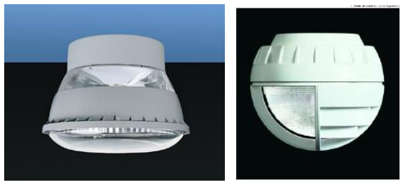
Lighting of Exterior Sales/Display Areas:
Illumination of exterior sales/display areas shall meet the following standards:
Areas designated for exterior display or sales shall have an average illumination level of no more than 2.0 footcandles and a maximum illumination of no more than 10 footcandles;
The average illumination level shall be computed only for the area used for exterior display or sales;
Illumination levels shall be reduced by at least 50% within one hour after the end of public business hours; and,
Areas used for passive storage or parking and circulation shall be illuminated in accordance with the parking area standards of these regulations, and indicated as such on the lighting plan submitted in accordance with Sec 5.5.2 (d).
Security Lighting:
Lighting for security surveillance should be kept to a minimum. Use of motion/heat activated light and security alarms are encouraged to minimize the use of full site lighting when the building is not occupied or in use.
All applications involving security lighting shall include a written narrative outlining the need for and purposes of security lighting as part of a security plan. A site plan shall designate the area to be illuminated for security purposes. To the extent that the area designated for security lighting may also be illuminated for other purposes, independent security lighting fixtures shall be discouraged.
All fixtures used for security lighting shall be full cut-off as defined by IESNA.
The use of flood light fixtures is prohibited unless approved by the DRB. The applicant shall present cause as to why cut-off fixtures cannot be used for the illumination needed.
Security lighting fixtures may be mounted on poles located no more than ten (10) feet from the perimeter of the designated area being illuminated. Illumination from pole mounted fixtures outside the property line is not permitted.
Security lighting designed to illuminate a perimeter (such as a fence) are encouraged to include motion/heat sensors designed to be off unless triggered by an intruder located within five (5) feet of the perimeter.
Security lighting may illuminate vertical surfaces up to a level eight (8) feet above grade or eight (8) feet above the bottom of doorways or entries, whichever is greater.
The average illumination level of vertical surfaces shall be measured at a height of 5 feet above grade, and computed over the area of the surface designated to be illuminated in the security plan.
Security lighting may remain illuminated beyond 10:00pm or the close of business to one hour after sunrise.
Outdoor Recreational Facility Lighting:
There are a variety of outdoor recreation facilities that may be illuminated to allow nighttime use. Examples include tennis courts, ball fields, swimming pools, outdoor skating rinks, and public parks. The regulations in this section are intended to allow illumination of such activities while minimizing adverse impacts such as glare, unwanted illumination of nearby properties and streets, and skyglow. Such lighting shall be consistent with the following regulations:
Cut-off, shielded, and/or louvered lighting are recommended for fields designed for Class III or IV levels of play (typically amateur or municipal league, elementary to high school, training, recreational or social levels; cf. IESNA Lighting Handbook and IESNA RP-6 Sports and Recreational Area Lighting).
Lighting for facilities designed for Class I and II levels of play (typically college, semi-professional, professional, or national levels) shall utilize luminaires with minimal uplight consistent with the illumination constraints of the design.
Where cut-off fixtures are not utilized, acceptable luminaires shall include those which:
Are provided with internal and/or external glare control louvers and installed so as to minimize uplight and offsite light trespass;
Are installed and maintained with aiming angles that permit no greater than five percent (5%) of the light emitted by each fixture to project above the horizontal; and;
All lighting installations shall be designed to achieve no greater than the minimal illuminance levels for the activity as recommended by the Illuminating Engineering Society of North America (IESNA).
Lighting fixtures other than full cut-off fixtures may be allowed only if their beams fall within the primary playing area and immediate surroundings, and so that no direct illumination is directed offsite.
Lighting shall be turned off except when the facilities are in use or being maintained.
Lighting of Building Facades:
Low level illumination of building facades may be allowed behind and beneath covered walkways. Lighting of building facades other than behind and beneath covered walkways may be allowed only for buildings of cultural or religious significance. Façade lighting shall meet the following requirements.
The maximum illumination level on any vertical surface shall not exceed 5.0 footcandles;
If a first floor façade is illuminated by lights mounted under a canopy sheltering a walkway, the maximum horizontal illumination of the walkways shall not exceed 3.0 footcandles at grade level. If there is no walkway under the canopy, the average horizontal illumination shall not exceed 1.0 footcandle at grade level;
Roofs shall not be illuminated;
Lighting fixtures shall be shielded so that the light source and/or lens is not visible from adjacent or adjoining properties or streets; and,
Cut-off lighting fixtures shall be used for lighting of building facades behind and beneath covered walkways. Non-cut-off lighting fixtures may be used for building façade lighting of significant public or institutional buildings.
Exceptions
Technological advances in outdoor lighting lamp sources and luminaires may allow for options not considered in these regulations. Induction (electrodeless) or LED lighting are two current examples. The use of new technologies, and especially those that have energy saving properties, are encouraged. Applications that use new technologies, and follow the spirit of the ordinance will be considered and evaluated for approval.
§ 5.5.3Stormwater and Erosion Control
All new development and redevelopment projects that require a zoning permit shall be required to demonstrate compliance with the standards in Article 3, Stormwater & Erosion Control of Chapter 26 of the City Code of Ordinances: Wastewater, Stormwater, and Pollution Control.
§ 5.5.4Tree Removal
Zoning permit requests for tree removal are subject to DRB review per the following criteria.
Review criteria for zoning permit requests for tree removal.
Grounds for Approval
Tree removal involving six (6) or more trees, each of ten (10) inches or greater in caliper or the removal of ten (10) or more trees, each of which is three (3) inches or greater in caliper during any consecutive twelve (12) month period may be permitted for any of the following reasons:
Removal of dead, diseased, or infested trees
Thinning of trees for the health of remaining trees according to recognized accepted forestry practices
Removal of trees that are a danger to life or property; or
As part of a development with an approved zoning permit
Grounds for Denial
Tree removal involving six (6) or more trees, each of ten (10) inches or greater in caliper or the removal of ten (10) or more trees, each of which is three (3) inches or greater in caliper during any consecutive twelve (12) month period may be denied if existing healthy trees are known to be:
Providing a significant privacy or aesthetic buffer or barrier between properties
Providing stabilization on slopes vulnerable to erosion
Located within a riparian or littoral buffer
Provide unique wildlife habitat
A rare northern Vermont tree species as listed by the Vermont Natural Heritage Program; or
A significant element of, or significantly enhances, an historic site
Institutions or other property owners who practice ongoing tree removal shall be exempt from the requirement to obtain a zoning permit for individual tree removal projects subject to obtaining approval from the DRB for a plan as follows:
A Tree Maintenance Plan prepared by a certified arborist shall be submitted as a Level I Certificate of Appropriateness, with a level I application fee. This plan shall include general and specific criteria for removing trees based on the criteria as per Sec. 5.5.4 (a).
The Tree Maintenance Plan if approved by the Development Review Board. Approval of the Plan is valid for up to five (5) years.
In order to continue tree removal, Tree Maintenance Plans must be updated or re-written and approved by the Development Review Board at five (5) year intervals.
Article 6Development Review Standards
§ 6Introduction
This Article of the Burlington Comprehensive Development Ordinance provides a comprehensive set of development principles and design standards that are intended to apply to all types of development throughout the city. The “Development Principles” are drawn from community goals as defined in adopted city plans, while the “Design Standards” provide more specific direction regarding design methods or strategies that may be used to achieve the development principles. Divided into three sections, these standards address issues regarding the creation of new lots and streets, site plans for individual properties, and the characteristics of individual buildings.
§ 6.0.1Intent and Citywide Development Principles
This Article is intended to provide specific direction in the planning, design, and subsequent review of development in Burlington with the objective of ensuring that all proposed development furthers Burlington’s vision for a dynamic, vibrant, sustainable city amidst a scenic, natural setting. Burlington’s built environment must protect the city’s rich collection of historical, architectural, and natural features, while enhancing the urban experience and livability of neighborhoods by ensuring that development is sensitive to the scale, detailing, and intensity appropriate to each district and allowable use.
Burlington is a leader in advancing the goal of creating a sustainable community. In order to reach this goal, all development in the city shall address the following development principles as applicable:
Development in Burlington shall:
Complement its context and environment – both natural and built, and enhance the community with creative design, durable materials, and quality construction.
Retain and preserve important natural features by incorporating them into site plans and landscape designs.
Emphasize function - natural, aesthetic, social, and recreational – in its landscape design.
Promote effective and efficient transportation systems to mitigate the adverse impacts of vehicles such as by maintaining and perpetuating the urban street grid, supporting multiple and integrated modes, giving pedestrian the priority, reducing curb cuts, integrating parking and circulation into architectural and landscape designs, and minimizing the presence of service areas.
Promote personal safety and accessibility for those with disabilities in the design of publicly accessible outdoor and indoor spaces.
Complement Burlington’s architectural and cultural heritage by conserving and/or reflecting dominant design elements and characteristics of neighborhoods, and maintaining neighborhood proportions of scale and mass.
Incorporate climate sensitive and environmentally-conscious design considerations to create healthier, more productive, and more sustainable places to live and work.
Ensure that public buildings, structures, and spaces, be designed and constructed to the highest standards in order to reflect community values, inspire future development, foster civic pride, and serve as a model to others.
Given their more dynamic and complex nature, the following development principles shall also apply as applicable within any mixed-use zoning district as defined in Article 4:
Contribute to Burlington’s moderately scaled urban form, and emphasize a more efficient pattern of development.
Ensure the scale, massing, and dominant architectural elements contribute to the overall composition and developing character of the surrounding area.
Complement Burlington’s natural setting and conserve scenic public views and view corridors.
Enhance the city’s skyline and promote visual interest with a variety of roof forms and architectural elements.
Unify architectural elements, details, and materials of a building, such that all components appear integral to the whole.
Compose the massing of the building to create a transition of height, bulk, and scale to less intensively developed neighboring properties.
Compose building facades at and near the street level with human-scaled elements and details that promote pedestrian interest, comfort, and safety.
Facilitate pedestrian movement, and provide access to the lakeshore and other natural and cultural amenities.
Orient advertising features to the pedestrian, and compliment the architecture of the building.
The role of these development principles, and the design standards found later in this Article, are as follows:
Development Principles are drawn from established community goals as defined in adopted city plans, and serve as the highest order of importance in cases where individual standards appear to conflict and greater discretion on the part of the DRB is required.
Design Standards provide more specific direction regarding design methods or strategies that may be used to achieve the development principles. Design standards include both required (“shall”) and flexible (“should”) components. It is understood that many of the standards presented are not the only options available, and creativity is encouraged to achieve the desired result.
It is recognized that the application of these principles and standards involves value-based design and decision-making requiring a balancing of complex factors, interests, and needs. In applying these city-wide development principles and design standards, particular attention shall be given to the context of the development proposal and achieving conformance with the purpose of the district(s) in which the project is located.
The intent of Article 14, the planBTV Downtown Code, also embodies these same principles and standards through an emphasis on the intended physical form, character of place, and compatibility of uses of new development in the city’s downtown and waterfront area through a more objective and prescriptive set of development and urban design standards. As such, all applications subject to the planBTV Downtown Code shall not also be subject to the requirements of this Article 6.
Part 1Land Division Design Standards
§ 6.1.1Applicability
These standards are enacted to apply to all development subject to the provisions of this ordinance found in Art. 10 – Subdivisions or Art. 11 – Planned Development involving the subdivision of land, or an adjustment or reconfiguration of lot lines.
§ 6.1.2Review Standards
Protection of important natural features:
The arrangement of blocks and lots shall preserve watercourses, wetlands, steep slopes, flood-prone areas, rock outcroppings, wildlife habitat and travel corridors, specimen trees and contiguous stands of forest, and other sensitive ecological and geological areas to the extent practicable.
Arrangement of lots:
The size and arrangement of new lots shall reflect and perpetuate the existing development pattern of the surrounding neighborhood. Lots shall be created in such a way as to enable their development pursuant to the requirements of this ordinance, and ensure a clear transfer of title.
Interior lot lines extending from a street should be perpendicular or radial to the street right-of-way line to the greatest extent feasible. Flag lots and through lots are discouraged, and shall be allowed only to the extent where topography and existing block and lot arrangement allow no suitable alternative. In such cases, a minimum frontage for access of 20-feet shall be required.
Connectivity of streets within the city street grid:
The established grid of interconnected streets shall be maintained and extended to the extent practicable. All streets shall be in conformance with applicable street design & construction details as provided by the department. of public works, and shall be dedicated to the city.
Connectivity of sidewalks, trails, and natural systems:
The established sidewalk network shall be maintained and extended to the extent possible. Trail networks and uninterrupted corridors of greenspace outside of the established street grid should be maintained and extended wherever possible. All sidewalks shall be in conformance with applicable street design & construction details as provided by the department of public works, and shall be dedicated to the city.
Part 2Site Plan Design Standards
§ 6.2.1Applicability
These standards shall be satisfied for the approval of all development subject to the provisions of this ordinance found in Article 3, Section 3.4.2(1) – Site Plan Review.
§ 6.2.2Review Standards
Protection of Important Natural Features:
The landscape, existing terrain and any significant trees and vegetation shall be preserved in their natural state insofar as practicable in keeping with the objectives of the underlying zoning district. Development and site disturbance shall preserve watercourses, wetlands, steep slopes, flood-prone areas, rock outcroppings, wildlife habitat and travel corridors, specimen trees and contiguous stands of forest, and other sensitive ecological and geological areas insofar as practicable in keeping with the objectives of the underlying zoning district. Site plans shall provide suitable buffers from any proposed site improvements, and maintain continuity and contiguousness of greenspace while allowing reasonable development in support of the overall intent of the zoning district. Where any natural features are proposed to be removed or the topography altered, special attention shall be given to replace or mitigate the loss of such features. Any development occurring on parcels containing significant natural areas identified in the city’s Open Space Protection Plan shall avoid disturbance to these natural areas and establish appropriate buffers that protect their natural functions.
Topographical Alterations:
Alteration to the natural contour of the site shall minimize grading, cut, and fill, and shall take necessary measures to protect against erosion and future instability. Any grade changes shall be in keeping with the general appearance of neighboring developed areas. In areas where more intense levels of development are encouraged, development should seek to take advantage of topographical changes to hide and/or blend new construction into the landscape. Proposed design and construction details for any cut and fill, or retaining walls over 3-feet in height, or any height along the lakeshore, shall be subject to review and approval by the city engineer before receiving approval of the site plan.
Protection of Important Public Views:
Distant terminal views of Lake Champlain and the mountains to the east and west, and important public and cultural landmarks, framed by public rights-of-way or viewed from public spaces shall be maintained through sensitive siting and design to the extent practicable. This shall not be construed to include views from exclusively private property.
Protection of Important Cultural Resources:
Burlington’s architectural and cultural heritage shall be protected through sensitive and respectful redevelopment, rehabilitation, and infill. Archeological sites likely to yield information important to the city’s or the region’s pre-history or history shall be evaluated, documented, and avoided whenever feasible. Where the proposed development involves sites listed or eligible for listing on a state or national register of historic places, the applicant shall meet the applicable development and design standards pursuant to Sec. 5.4.8(b).
Supporting the Use of Renewable Energy Resources:
Where feasible, the site plan should be so designed as to take advantage of the site’s inherent potential to utilize sources of renewable energy including direct sunlight, wind, or running water. The site plan should also incorporate site planning and landscaping decisions intended to minimize energy demand such as siting buildings to maximize solar access or the use of deciduous and coniferous trees to create shade and windbreak.
Buildings should, where appropriate within the context of the neighborhood development pattern, maximize their solar exposure by being oriented to maximize natural light and heat gain during winter months, and to minimize casting shadows into ground floor living space of a building on an adjacent property.
Brownfield Sites:
Where a proposed development involves a known or suspected brownfield, the site plan shall indicate areas of known or suspected contamination, and the applicant shall identify completed or planned remediation necessary to support the intended use(s).
Provide for nature's events:
Special attention shall be accorded to stormwater runoff so that neighboring properties and/or the public stormwater drainage system are not adversely affected. All development and site disturbance shall follow applicable city and state erosion and stormwater management guidelines in accordance with the requirements of Art 5, Sec 5.5.3.
Design features which address the effects of rain, snow, and ice at building entrances, and to provisions for snow and ice removal or storage from circulation areas shall also be incorporated.
Building Location and Orientation:
The introduction of new buildings and additions shall be consistent with the intent of the district. New buildings and additions should be aligned with the front façade of neighboring buildings to reinforce the existing “street-edge,” or where necessary, located in such a way that complements existing natural features and landscapes. Buildings placed in mixed-use areas where high volumes of pedestrian traffic are desired should seek to provide sufficient space (optimally 12-15 feet) between the curbline and the building face to facilitate the flow of pedestrian traffic. In such areas, architectural recesses and articulations at the street-level are particularly important, and can be used as an alternative to a complete building setback in order to maintain the existing street wall.
Principal buildings shall have their main entrance facing and clearly identifiable from the public street except as allowed in Sec. 5.2.2 and Sec. 11.1.5. The development of corner lots shall be subject to review by the city engineer regarding the adequacy of sight distances along the approaches to the intersection. To the extent practicable, development of corner lots in non-residential areas should try to place the building mass near the intersection and parallel to the street to help anchor the corner and take advantage of the high visibility location.
In residential areas, accessory buildings shall be located in such a way so as to be secondary and subordinate in scale and design to the principal structure. A parking structure – either attached or detached – shall be setback from the longest street-facing wall of the principal structure and be deferential yet consistent in character and design. Where a garage is not oriented towards the street (i.e. the garage doors face the rear or side yard), the street-facing garage wall shall have windows or doors or other features that break-up the mass into smaller elements, and be blended with the character of the residential portion of the structure.
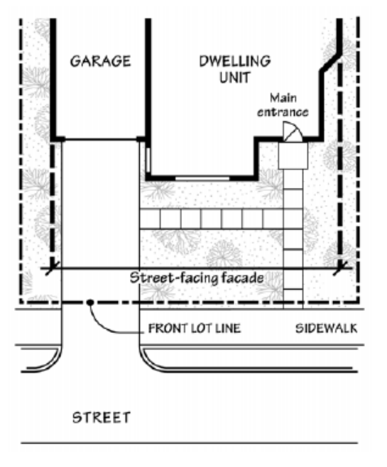
Where a garage is attached to a principal single-family or duplex residential structure and oriented to the street (i.e. the garage doors face the street) the following standards shall apply:
Except as provided in subsections 3, 4 and 5 below, a street-facing garage wall shall constitute no more than 50% of the width of the street-facing façade of the entire structure (including the garage portion), and shall not exceed 24-feet. In cases where a street-facing garage wall constitutes between 30%-50% of the street-facing façade, living space is encouraged above to integrate the garage more closely into the design and mass of the overall structure. In cases where the street-facing garage wall constitutes more than 50% of the width of the street-facing façade, living space above is required.
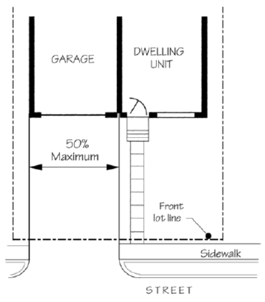
Each bay of the garage shall have a separate entrance door of no more than 10-feet in width.
Where the width of the street-facing façade of the residential portion of the structure is less than 14 feet, the street-facing garage portion may be allowed up to but not exceeding 14 feet in order to allow for a single garage bay.
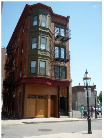
Where a garage entrance is within a single roofline and wholly integrated into the overall design the front façade of the structure, it may constitute more than 50% of the width of the street-facing façade provided there is interior living space above, and the primary pedestrian entrance offers a clear and welcoming entrance from the street.
Enclosed space originally designed and constructed as a garage for vehicular parking but converted to living space may be converted back to enclosed vehicular parking provided there is no expansion of the building footprint necessary to complete the conversion.
Vehicular Access:
Curb cuts shall be arranged and limited in number to reduce congestion and improve traffic safety. A secondary access point from side roads is encouraged where possible to improve traffic flow and safety along major streets. The width and radius of curb cuts should be kept to the minimum width necessary, and sight triangles and sufficient turnarounds for vehicles shall be provided to reduce the potential for accidents at points of egress.
Driveways for commercial properties may require a traffic study to identify the impacts of the movement of traffic to and from the property, and design for safe access. Access for service and loading areas should be located behind buildings or otherwise screened from streets or public ways with landscaping or other barriers. Whether commercial or residential, shared driveways are encouraged, where possible and appropriate.
Pedestrian Access:
Pedestrians shall be provided one or more direct and unobstructed paths between a public sidewalk and the primary building entrance. Well defined pedestrian routes shall be provided through parking areas to primary building access points and be designed to provide a physical separation between vehicles and pedestrians in a manner that minimizes conflicts and improves safety. Where sidewalks and driveways meet, the sidewalk shall be clearly marked by differentiated ground materials and/or pavement markings.
Accessibility for the Handicapped:
Special attention shall be given to the location and integration of accessible routes, parking spaces, and ramps for the disabled. Special attention shall also be given to identifying accessible access points between buildings and parking areas, public streets and sidewalks. The federal Americans with Disabilities Act Accessibility Guidelines (ADAAG) shall be used as a guide in determining the adequacy of the proposed development in addressing the needs of the disabled.
Parking and Circulation:
To the extent possible, parking should be placed at the side or rear of the lot and shall be screened from view from surrounding properties and adjacent public rights of ways. Any off-street parking occupying street level frontage in a Downtown Mixed Use District shall be setback from the edge of the front property line in order to provide space for active pedestrian-oriented uses. Where street-level parking is provided within an existing structure, the cars shall be screened from the sidewalk and the area shall be activated with landscaping, public art, or other design amenities. Parking areas of more than 20 spaces should be broken into smaller areas separated by landscaping.
Attempts to link adjacent parking lots or provide shared parking areas which can serve neighboring properties simultaneously shall be strongly encouraged.
Parking shall be laid out to provide ease in maneuvering of vehicles and so that vehicles do not have to back out onto city streets. Dimensions of spaces shall at a minimum meet the requirements as provided in Article 8. The perimeter of all parking areas shall be designed with anchored curb stops, landscaping, or other such physical barriers to prevent vehicles from encroaching into adjacent green spaces.
Surface parking and maneuvering areas should be shaded in an effort to reduce their effect on the local microclimate, air quality, and stormwater runoff with an objective of shading at least 30% of the parking lot. Shading should be distributed throughout the parking area to the greatest extent practical, including within the interior depending on the configuration. New or substantially improved parking areas with 15 or more parking spaces shall include a minimum of 1 shade tree per 5 parking spaces with a minimum caliper size of 2.5”-3” at planting. Up to a 30% waiver of the tree planting requirement may be granted by the development review board if it is found that the standard requirement would prove impractical given physical site constraints and required compliance with minimum parking requirements. All new shade trees shall be: of a species appropriate for such planting environments, expected to provide a mature canopy of no less than 25-feet in diameter, and selected from an approved list maintained by the city arborist. Existing trees retained within 25-feet of the perimeter of the parking area (including public street trees), and with a minimum caliper size greater than 3-inches, may be counted towards the new tree planting requirement.
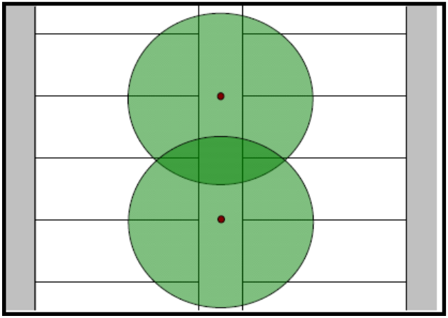
All parking areas shall provide a physical separation between moving and parked vehicles and pedestrians in a manner that minimizes conflicts and gives pedestrians a safe and unobstructed route to building entrance(s) or a public sidewalk.
Where bicycle parking is provided, access shall be provided along vehicular driveways or separate paths, with clearly marked signs indicating the location of parking areas. Where bicycle parking is located proximate to a building entrance, all shared walkways shall be of sufficient width to separate bicycles and pedestrians, and be clearly marked to avoid conflicts. All bicycle parking areas shall link directly to a pedestrian route to a building entrance. All bicycle parking shall be in conformance with applicable design & construction details as provided by the dept. of public works.
Landscaping, Fences and Retaining Walls:
Landscaping shall be used to beautify the development site and to provide specific functions and benefits to the uses and buildings on the site. These include but are not limited to stormwater retention and erosion control, winter windbreaks and summer shade, recreational and habitat corridors, buffers and screening of parking areas, and creating privacy for and from adjacent property.
Existing trees shall be retained and incorporated into a landscape plan to the extent possible, and existing trees to be retained shall be protected during construction in accordance with specifications provided by the city arborist. Contiguous green space, both within the site and with adjacent properties, should be provided on a site whenever possible and be designed to provide wildlife travel corridors and habitat preservation, as well as enabling recreational access. If open space is intended to be publicly accessible, it shall be designed to maximize accessibility for all individuals including the disabled, encourage social interaction, and facilitate ease of maintenance. Along the street edge, landscaping shall be used to provide a visual buffer into parking areas from the public street and reinforce the streetscape.
The selection of plant materials and planting sites should create a sustainable landscape, and consideration shall be given to factors such as hardiness, salt tolerance, disease resistance, invasiveness, root and canopy spread, underground and overhead utilities, soil conditions, and microclimates. The use of native plant materials is encouraged, and the use of plants considered invasive by VT Agency of Agriculture shall be prohibited. For more information on sustainable landscapes, applicants are encouraged to consult Planting Sustainable Landscapes: A Guide for Plan Reviewers prepared for the Vermont Department of Forests Parks and Recreation by the Vermont Chapter of the American Society of Landscape Architects.
New or replacement street trees shall be provided consistent with the city’s Street Tree Master Plan. All proposed street trees shall be selected and planted in accordance with specifications provided by the city arborist.
Fences may be placed within the required setback along a property line, but shall be setback sufficiently to provide for the maintenance of both sides of the fence without entering onto the adjacent property and shall present a finished side to the adjoining property and public street. Fences placed within a clear sight triangle shall adhere to the standards of Sec. 5.2.6 (d). Styles, materials, and dimensions of the proposed fence shall be compatible with the context of the neighborhood and the use of the property.
Retaining walls greater than 5 feet tall shall incorporate textured surfaces, terracing, and/or vegetation to avoid long monotonous unarticulated expanses and to minimize adverse visual impacts to neighboring properties. As with fences, retaining wall styles, materials, and dimensions shall be compatible with the context of the neighborhood and use of the property.
Public Plazas and Open Space:
Where public open space is provided as an amenity to the site plan, it should be sited on the parcel to maximize solar exposure, with landscaping and hardscape (including fountains, sitting walls, public art, and street furniture) to encourage its use by the public in all seasons. Public plazas should be visually and physically accessible from public rights-of-ways and building entrances where appropriate and shall be designed to maximize accessibility for all individuals, including the disabled and encourage social interaction.
Public space should be coordinated with the surrounding buildings without compromising safety and visibility. Public spaces should be surrounded by active uses that generate pedestrian traffic, and connect the space to major activity centers, streets, or corridors.
New structures and additions to existing structures shall be shaped to reduce shadows on public plazas and other publicly accessible spaces. In determining the impact of shadows, the following factors shall be taken into account: the mass of area shaded, the duration of shading, and the importance of sunlight to the utility of the type of open space being shadowed. Proposed development shall be considered for solar impact based the sun angle during the Vernal and Autumnal equinox.
Outdoor Lighting:
Where exterior lighting is proposed the applicant shall meet the lighting performance standards as per Sec 5.5.2.
Integrate infrastructure into the design:
Exterior storage areas, machinery and equipment installations, service and loading areas, utility meters and structures, mailboxes, and similar accessory structures shall utilize setbacks, plantings, enclosures and other mitigation or screening methods to minimize their auditory and visual impact on the public street and neighboring properties to the extent practicable.
Utility and service enclosures and screening shall be coordinated with the design of the principal building, and should be grouped in a service court away from public view. On-site utilities shall be place underground whenever practicable. Trash and recycling bins and dumpsters shall be located, within preferably, or behind buildings, enclosed on all four (4) sides to prevent blowing trash, and screened from public view.
Any development involving the installation of machinery or equipment which emits heat, vapor, fumes, vibration, or noise shall minimize, insofar as practicable, any adverse impact on neighboring properties and the environment pursuant to the requirements of Article 5, Part 5 Performance Standards.
Part 3Architectural Design Standards
§ 6.3.1Applicability
These standards are enacted and shall be satisfied for the approval of all development subject to the provisions of this ordinance found in Article 3, Section 3.4.2(b) – Design Review.
§ 6.3.2Review Standards
Relate development to its environment:
Proposed buildings and additions shall be appropriately scaled and proportioned for their function and with respect to the purpose of the zoning district. They should integrate harmoniously into the topography, and to the use, scale, and architectural details of existing buildings in the vicinity; however, such consideration shall not require building height to be more limited than otherwise allowed within an applicable zoning district or overlay zone per Article 4.
The following shall be considered:
Massing, Height and Scale:
While architectural styles or materials may vary within a streetscape, proposed development should maintain an overall scale similar to that of surrounding buildings, or provide a sensitive transition, where appropriate, to development of a dissimilar scale.
In low and medium residential districts, the height and massing of existing residential buildings should be carefully considered when evaluating the compatibility of additions and infill development; however, no modifications by the DRB shall be made to projects which otherwise limit the allowable Principal Structure footprint, height, and number of units per building otherwise permitted by Tables 4.4.5-1 and 4.4.5-2. Where the zoning encourages greater intensity and larger scale buildings in high density residential and non-residential zoning districts, buildings that are over 3-stories should provide a transition by employing design elements that reduce the apparent building mass from the street level. Taller buildings and elements are most appropriate where they provide a focal point of a terminal view, anchor a street corner, frame view corridors, or relate to larger scaled structures. The impacts at the street-level of increased or altered wind currents and downdrafts created by buildings over six (6) stories should be considered.
Buildings should maintain consistent massing and perceived building height at the street level, regardless of the overall bulk or height of the building. Buildings should maintain a relationship to the human scale through the use of architectural elements, variations of proportions and materials, and surface articulations. Large expanses of undifferentiated building wall along the public street or sidewalk shall be avoided. The apparent mass and scale of buildings shall be broken into smaller parts by articulating separate volumes reflecting existing patterns in the streetscape, and should be proportioned to appear more vertical than horizontal in order to avoid monotonous repetition. (See also (d) Provide an active and inviting street edge below.)
Roofs and Rooflines.
New buildings should incorporate predominant roof forms and pitches within the existing neighborhood and appropriate to the context. Large expanses of undifferentiated roof forms shall be avoided. This can be achieved by incorporating dormers or some variation in the roof form to lessen the impact of the massing against the sky. While flat roofs can be a reasonable architectural solution, pitched roof forms and architectural elements that enhance the city’s skyline are strongly encouraged. Roof eaves, parapets, and cornices should be articulated as an architectural detail. Roof-top mechanicals shall be screened from view from the public street, and should be incorporated into and hidden within the roof structure whenever possible.
Dormers shall not exceed the height of the ridgeline of the roof to which they are attached, and shall be set back a minimum of 1-foot from the edges of the underlying roofline, Individual dog house dormers shall be limited to 33% of the horizontal eave length of the principal roofline.
Solar panels, light colored ballast or roof membranes, split roof clerestories, planted or “green” roof technologies (with a clearly articulated maintenance plan) and “gray water” collection are encouraged. Active rooftop uses are also encouraged to add to the visual complexity and activity of the city’s skyline, and afford public access to otherwise unseen views of the city and surrounding landscape.
Building Openings
Principal entrances shall be clearly defined and readily identifiable from a public street whether by a door, a canopy, porch, or other prominent architectural or landscape features. People with physical challenges should be able to use the same entrance as everyone-else and shall be provided an “accessible route” to the building. Attention shall also be accorded to design features which provide protection from the affects of rain, snow, and ice at building entrances, and to provisions for snow and ice removal or storage.
Window openings shall maintain consistent patterns and proportions appropriate to the use. The window pattern should add variety and interest to the architecture, and be proportioned to appear more vertical than horizontal. Where awnings over windows or doors are used, the lowest edge of the awning shall be at least eight (8) feet above any pedestrian way, and shall not encroach into the public right-of-way without an encroachment permit issued by the dept. of public works.
Buildings placed on a side or rear property line where no setback is required shall contain neither doors nor windows along such façade so as not to restrict future development or re-development options of the adjacent property due to fire safety code restrictions. Otherwise they should be setback a minimum of 5-feet.
Protection of Important Architectural Resources:
Burlington’s architectural and cultural heritage shall be protected through sensitive and respectful redevelopment, rehabilitation, and infill. Where the proposed development involves buildings listed or eligible for listing on a state or national register of historic places, the applicant shall meet the applicable development and design standards pursuant to Sec. 5.4.8. The introduction of new buildings to a historic district listed on a state or national register of historic places shall make every effort to be compatible with nearby historic buildings.
Protection of Important Public Views:
Development shall preserve distant terminal views of Lake Champlain and the Adirondack Mountains and important public and cultural landmarks from public places and along east-west public rights-of-way to the extent practicable. This shall not be construed to include similar views from exclusively private property.
Sensitivity shall be used in the massing of proposed development such that light and air is allowed to penetrate and some views may be preserved. Alternatives that extend access to such views by allowing public access into and through the proposed development are encouraged. In no case shall development be permitted to span across the public rights-of-way in such corridors.
Provide an active and inviting street edge:
Building facades shall be varied along the street edge by the integration of architectural features, building materials, or physical step-backs of the façade along its length. Large expanses of undifferentiated building wall shall be avoided. This may be accomplished by incorporating fenestration patterns, bays, horizontal and vertical façade articulations, the rhythm of openings and prominent architectural features such as porches, patios, bays, articulated bases, stepping back an elevation relative to surrounding structures, and other street level details. The use of traditional facade components such as parapet caps, cornices, storefronts, awnings, canopies, transoms, kick plates, and recessed entries are highly encouraged. In areas where high volumes of pedestrian traffic are desired, the use of architectural recesses and articulations at the street-level are particularly important in order to facilitate the flow of pedestrian traffic.
Non-residential buildings should provide visual access into the interior of building at the street level through the use of large transparent windows and/or window displays in order to create a dynamic and engaging public streetscape. The use of mirrored, frosted, or tinted glass shall not be permitted along an active pedestrian street-level façade. In contrast, residential buildings may be slightly recessed and/or elevated from the street-level in order to provide privacy. In such cases, visual interest along the streetscape can be provided through the use of landscaping, porches, and other similar features that offer a transition between public and private space.
Buildings in downtown districts that provide open space by way of building setbacks at the ground level shall utilize landscaping, street furniture, public art, sitting walls, fountains, etc. to maintain a sense of the existing street wall, define a sense of entry for the building and create a space that enhances the pedestrian’s experience. Urban “open” space shall maximize accessibility for all individuals including the disabled, and encourage social interaction.
Quality of materials:
All development shall maximize the use of highly durable building materials that extend the life cycle of the building, and reduce maintenance, waste, and environmental impacts. Such materials are particularly important in certain highly trafficked locations such as along major streets, sidewalks, loading areas, and driveways. Efforts to incorporate the use of recycled content materials and building materials and products that are extracted and/or manufactured within the region are highly encouraged.
Owners of historic structures are encouraged to consult with an architectural historian in order to determine the most appropriate repair, restoration or replacement of historic building materials as outlined by the requirements of Art 5, Sec. 5.4.8.
Reduce energy utilization:
New structures should incorporate the best available technologies and materials in order to maximize energy efficient design. All new construction shall meet the Guidelines for Energy Efficient Construction pursuant to the requirements of Article VI. Energy Conservation, Section 8 of the City of Burlington Code of Ordinances.
New structures should take advantage of solar access where available, and shall undertake efforts to reduce the impacts of shadows cast on adjacent buildings where practicable, in order to provide opportunities for the use of active and passive solar utilization.
Make advertising features complementary to the site:
Where signs and other advertising features are proposed, the applicant shall meet the requirements as per Article 7 - Signs. The size, location, design, texture, lighting, and materials of all exterior signs and advertising features shall not detract from the use and enjoyment of proposed buildings or surrounding properties. National branding through signage and architecture shall be discouraged.
Integrate infrastructure into the building design:
Exterior machinery and equipment installations, service and loading areas, utility meters and structures, mailboxes, and similar accessory features shall utilize setbacks, plantings, enclosures and other mitigation or screening methods to minimize their auditory and visual impact on the public street and neighboring properties.
Rooftop mechanicals, including heating and cooling devices and elevator equipment, should be incorporated into the structure’s design, and shall be arranged to minimize their visibility from the street level. Such features, in excess of one foot in height, shall be either enclosed within the roof structure, outer building walls, or parapets, or designed so that they are integrated into the overall design and materials of the building. Where such rooftop features do not exceed ten percent (10%) of the total roof area, they may be considered “ornamental and symbolic features” pursuant to Sec. 5.2.7 for the purposes of measuring building height.
Any development involving the installation of machinery or equipment which emits heat, vapor, fumes, vibration, or noise shall minimize any adverse impact on neighboring properties and the environment pursuant to the requirements of Article 5, Part 5 Performance Standards.
Make spaces secure and safe:
Spaces shall be designed to facilitate building evacuation, accessibility by fire, police or other emergency personnel and equipment, and, to the extent feasible, provide for adequate and secure visibility for persons using and observing such spaces. Building entrances/entry points shall be visible and adequately lit, and intercom systems for multi-family housing should be incorporated where possible, to maximize personal safety.
Article 7Signs
§ 7Introduction
This Article of the Burlington Comprehensive Development Ordinance addresses the type, size, location, and design of all types of Signs throughout the city. In the regulation of Signs, it is important to understand that the City is considering only the physical aspects of the Sign, not content. Signs can be considered and permitted individually, or as part of a “Sign Master Plan” that treats all Signs within a development or complex as a group to encourage creativity.
Part 1General Provisions
§ 7.1.1Authority and Intent
These regulations are enacted under the provisions of 24 V.S.A. Section 4411 with the intent to ensure that all Signs and advertising features:
Effectively maintain a safe and orderly pedestrian and vehicular environment by being legible and not distracting to motorists, cyclists, and pedestrians;
Reduce potentially hazardous conflicts between Signs and traffic control devices;
Compliment their surroundings, and protect and promote neighborhood and community character;
Effectively optimize communication that support the community’s sustained economic development, and reduce visual clutter within or directed upon the public realm; and,
Are an enhancement to the city's built environment, and are harmonious in size, design, color, material, and lighting with the building to which it relates, without removing, obscuring or detracting from the community’s character, history, and architecture.
Any sign or advertising feature not expressly permitted by this ordinance shall be prohibited.
§ 7.1.2Permit Required
All Signs shall require the issuance of a zoning permit subject to the standards of this Article before public erection and display unless otherwise specifically exempt by this Article. All Signs must be maintained in a condition or state of equivalent quality to which it was approved or required by the City.
§ 7.1.3Exemptions
Repainting, refacing, repair, or change of lettering, logo, or colors using the same materials within an existing permitted Sign frame shall be exempt from the requirements of this Article and allowed without the requirement to obtain a new zoning permit.
The following types of Signs are permitted in all parts of the city, and shall also be exempt from the requirements of this Article and the necessity to obtain a permit:
Highway and Official Signs. Signs within the public right-of-way or along a public thoroughfare designed and placed in conformance with the Manual on Uniform Traffic Control Devices (MUTCD) published by the US Dept. of Transportation, and other public information, traffic control, identification, special event, directional, public notice, and other such Signs erected by or at the direction of a government agency, court, or public utility in the performance of their public duty.
Street Address Identification. As required pursuant to Chapter 27 Sec. 101 of the Burlington Code of Ordinances, numerals that identify the street address of the property so that it can be easily identified from a public thoroughfare by patrons, guests, and emergency responders provided such numerals are a minimum of 3-inches and maximum of 10-inches in height, and the area of the numerals does not exceed two (2) square feet. In cases where the building is not located within view of the public street, the numerals shall be located on a mailbox or other suitable device such that it is visible from a public thoroughfare.
In all Residential and RCO zones: up to 2 flags which may or may not be attached to 1 freestanding pole per lot. Each flag may be up to 15 square feet in area with no single dimension exceeding 5-feet. Any freestanding flag pole shall meet the maximum height and minimum setback requirements per the district-specific dimensional requirements of Article 4.
In all other Zoning or Form districts: 1 flag per 25 feet of a lot’s road frontage, up to a maximum of 6 flags which may or may not be attached to up to 6 freestanding poles are permitted. Each flag may be up to 24 square feet in area with no single dimension exceeding 6-feet. The height of any freestanding flag pole shall not exceed the highest point of the Principal building on the lot or 50-feet whichever is lower, and shall meet the minimum setback requirements per the district-specific dimensional requirements of Article 4 or 14 or 10-feet whichever is more restrictive.
Property Management, Information, and Directional Signs. Non-illuminated Signs two (2) square feet or less in size controlling access to a property and/or oriented to and intended primarily for use internal to the property. Examples may include those announcing no trespassing or solicitation; warning of hidden dangers; the private nature of a road or driveway; directional and parking; and, regulating fishing or hunting.
Signs Inside Buildings. Any Sign which is located completely within an enclosed building and 12-inches or more behind a window or door provided they do not obscure more than 40% of the total window area between 4 and 7 feet above the adjacent sidewalk and otherwise preclude an unobstructed view into the establishment from the sidewalk.
Vending Machines and Gas Pumps: Signs incorporated into or upon vending machines or fuel pumps.
Temporary Signs: Temporary Signs are permitted subject to the standards found in Sec. 7.1.5 Temporary Signs below.
Murals: Non-commercial artistic expression in the form of a unique hand-produced work of visual art which is tiled, painted directly upon, or otherwise affixed or placed directly onto an exterior wall of a building or structure provided that the Mural:
does not contain any advertising copy, symbols, lettering, logos or other such recognized branding related to products or services provided on the premises where the mural is located except where otherwise permitted and incorporated into a permitted Sign Type as provided in Secs. 7.2.2 through 7.2.14 Sign Types;
is not illuminated.
§ 7.1.4Prohibited Signs
The following types and characteristics of Signs shall be prohibited in all parts of the city:
No person shall paint, paste, brand, stamp, or in any other manner hang, place on or over, or attach to any tree, rocks, or other natural feature; and any utility pole, street light, transformer, hydrant, bench, or any similar object or surface any advertisement, bill, notice, card, Sign, or poster for any purpose unless as permitted by this Article or otherwise installed by or at the direction of the Department of Public Works or the Burlington Electric Department.
Signs that may obstruct the view of approaching or intersecting traffic, or otherwise interfere with the clear and unobstructed view of a highway or official Sign and/or the safe movement of vehicles, bicycles, or pedestrians operating within, entering, leaving, or crossing a public right-of-way, sidewalk, path, or Thoroughfare including those located within a clear sight triangle;
Any Sign and copy that mimics the City’s E-911 street naming and addressing system by using a fictitious, or “vanity,” address consisting of a combination of a number, name, and/or place type (e.g. “1 City Square”) that has not been assigned by the City and thus may interfere with the timely and accurate response by emergency services.
Signs located on any property without prior authorization granted by the Property Owner;
Signs mounted, attached, or painted on a trailer, boat, motor vehicle, or other mobile conveyance when parked, stored, or displayed conspicuously close to or within the public right-of-way in a manner intended to attract the attention of the public for advertising purposes, except where the motor vehicle or trailer is regularly and consistently used and moved to conduct normal business activities; and,
Signs of any of the following types or with any of the following features or characteristics:
Any Sign, portion of a Sign, or other advertising device with:
visibly moving or movable parts; or,
flashing, animated, or intermittent illumination except for those specifically allowed in Sec. 7.1.9 or Sec. 7.2.7; or,
fluorescent paint or tape, mirrors, disks, reflectors, or similar devices which has the effect of intensifying reflected light.
Portable Signs, except for Sandwich Board Signs as permitted under Sec. 7.2.11 below or by the Department of Public Works for placement in the public right-of-way;
Windblown devices such as but not limited to, streamers, spinners, banners, pennants, and Flags other than those specifically allowed in Sec. 7.1.3 (d); and,
Searchlights, outdoor image projections, or any other similar displays projected from an external light source into the sky or onto any Building, Structure, right-of-way, or Thoroughfare, except as may be allowed on a limited basis for special events by the Church Street Marketplace Commission, Public Works Commission, Parks Recreation and Waterfront Commission, or City Council.
§ 7.1.5Temporary Signs
The following types of Temporary Signs are allowed in all Districts without the requirement of a zoning permit provided they meet the standards found in Table 7.1.5-A - Temporary Signs below:
Table 7.1.5-A Temporary Signs
| Temporary Banner | |
|---|---|
| Number of Signs | 1 on a primary street frontage |
| Types Allowed | Wall |
| Sign Area | 50 sf max. |
| Sign Height | No higher than the floor level of the 2nd story. |
| Illumination | None |
| Duration/Frequency | Shall not exceed 30 consecutive days and a maximum of 2 display periods per calendar year separated by a minimum of 30 days between display periods. |
| Temporary Sign | |
| Number of Signs | 1 on a primary street frontage |
| Types Allowed | Freestanding, Wall, or Window |
| Sign Area | 6 sf max. for any individual Sign |
| Sign Height | Freestanding: 4’ max above the finished grade (including supports), 3’ max if located within a Clear Sight Triangle |
| Wall or Window: No higher than the floor level of the 2nd story. | |
| Illumination | None |
| Duration/Frequency | Shall not exceed 30 consecutive days and a maximum of 2 display periods per calendar year separated by a minimum of 30 days between display periods. |
| Real Estate Sign | |
| Number of Signs | 1 on a primary street frontage of a property offered for rent or sale |
| Types Allowed | Freestanding, Wall, or Window |
| Sign Area | 6 sf max. |
| Sign Height | Freestanding: 4’ max above the finished grade (including supports), 3’ max if located within a Clear Sight Triangle |
| Wall or Window: No higher than the floor level of the 2nd story. | |
| Illumination | None |
| Duration/Frequency | Shall not be erected prior to the property being offered for sale or rent, and shall be removed within 3 days after a rental agreement has been executed or title to the property has been transferred. |
| Election Period Sign | |
| Number of Signs | 6 Signs max. per property |
| Types Allowed | Freestanding, Wall, and/or Window including Banners |
| Sign Area | 6 sf max. for any individual Sign |
| Sign Height | • Freestanding: 4’ max above the finished grade (including supports), 3’ max if located within a Clear Sight Triangle |
| • Wall or Window (including Banners): No higher than the floor level of the 2nd story. | |
| Illumination | None |
| Duration/Frequency | Shall not be erected earlier than 60 days prior to an election, and shall be removed within 3 days afterwards. |
| Construction Site Sign | |
| Number of Signs | 1 per street frontage max. |
| Sign Types Allowed | Freestanding or Wall |
| Total Sign Face Area | 32 sf max in a Residential or RCO district; or, 64 sf max in all other districts. |
| Sign Height | 8’ max. |
| Illumination | None |
| Location | Installed on the premises of a project under construction |
| Duration/Frequency | Installed no sooner than one week prior to the commencement of construction and shall be removed within 24 hours of completion of construction or if the project ceases construction for 12 months or longer. |
| Construction Site Wrap | |
| Number of Signs | 1 per street frontage max. |
| Sign Height | 12’ max. |
| Illumination | None |
| Location | Installed along the perimeter of the premises of a project under construction. Must not be located within any public street right-of-way unless permitted by the Department of Public Works |
| Duration/Frequency | Installed no sooner than one week prior to the commencement of construction and shall be removed within 24 hours of completion of construction or if the project ceases construction for 12 months or longer. |
| Construction/Real Estate Window Wrap | |
| Number of Signs | 1 per window and door max. |
| Sign Area | May fill the entire glazed portion of the window and/or door. |
| Sign Height | No higher than the ceiling level of the 1st story |
| Illumination | None |
| Location | Installed on the premises of a project under construction. |
| Duration/Frequency | Shall not be erected prior to the property being offered for sale or rent, or one week prior to the commencement of construction, and shall be removed within 3 days after a rental agreement has been executed or title to the property has been transferred or within 24 hours of completion of construction. |
§ 7.1.6Non-Conforming Signs
Any legally pre-existing Sign or other advertising device which does not conform to the current provisions of this Article shall be deemed a non-conforming Sign. Non- conforming Signs may remain in use at the same location, and ordinary maintenance and repair of such Signs shall be permitted.
A non-conforming Sign shall not be relocated, enlarged, replaced, redesigned, or altered in any way (except for repainting, refacing, repair or a change of lettering, logo, or colors using the same materials within the existing Sign frame) except to bring the Sign into complete or substantially greater compliance with this Article. In such cases, the DRB may allow a new Sign to be in substantially greater compliance than the existing nonconforming Sign subject to the applicable requirements of this Article. Nonconforming signs that are destroyed or damaged by 50% or more of their value shall not be rebuilt or repaired after one (1) year except in full conformance with this Article.
§ 7.1.7Discontinuance and Removal
Any Sign advertising an activity, business, service, or product must be removed, or the Sign face replaced with a blank face, within 60 days of the activity, business, or service promoted by the Sign being discontinued on the premises where the Sign is displayed. If the use is not reestablished, or a new use is not established, within one (1) year, then the entire Sign Structure and mounting hardware shall be removed.
§ 7.1.8Sign Permit Applications, Submission Requirements, Review and Decision-making
An application as provided in Article 3 is necessary for those requests pertaining to all Signs covered by the requirements of this Article. Submission requirements shall also include all the following as applicable:
A completed application form, and signed by the property owner, along with the applicable fee;
A scaled rendering of the proposed Sign indicating its dimensions in square inches or feet (length, width, height), and all materials and colors used;
Applications involving Awning, Blade, Canopy, Marquee, Nameplate, Outdoor Display Case, Projecting, Window, and/or Wall Signs shall include scaled building elevations indicating the location of all existing and proposed Signs on the building facade and the frontage dedicated to the establishment in linear feet.
Where applicable, the type and method of illumination (i.e. external, internal, or backlit), including the fixture style, placement, and bulb wattage and type. Applications involving an Electronic Changeable Message must also provide written certification from the sign manufacturer that the luminance of the display has been factory pre-set so that it will not exceed 5,000 nits.
The total square footage of all existing Signs for the establishment; and,
Sign Permit requests shall receive administrative review and approval pursuant to the procedural requirements of Sec. 3.2.7 and the requirements and standards of this Article except as provided for in Sec. 7.1.6 for modifications to a non-conforming sign and Sec. 7.3.2 Master Sign Plans which shall receive review and approval by the DRB.
The Church Street Marketplace District shall be afforded an opportunity to review and comment on any application for a Sign placed within the Church Street Marketplace prior to final action under this Article.
§ 7.1.9Calculation of Sign Area and Height
The following shall govern the calculation of a Sign’s area:
The area of a Sign shall include all numerals, lettering, designs, logos, or symbols, together with the background, whether open or enclosed, upon which they are displayed. Not included are any supporting framework incidental to the display itself unless specifically indicated otherwise under Secs. 7.2.2 through 7.2.14 Sign Types.
If a Sign has two or more faces, the area of all faces is included in determining the maximum area of the Sign, unless the two faces are identical and placed back to back or are no more than two feet apart. In such case, the Sign area is calculated as the area of one face. If the two faces are unequal in area, the area of the larger face is used to calculate Sign area.
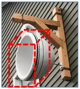
Limitations on the height of lettering shall pertain only to the height of individual characters.
Unless described otherwise under Secs. 7.2.2 through 7.2.14 Sign Types, the following shall govern the calculation of a Sign’s height:
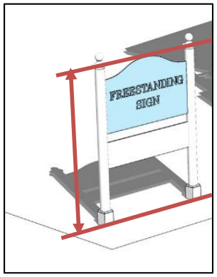
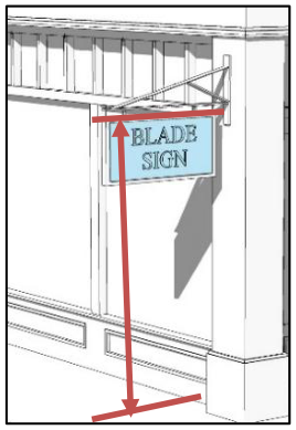
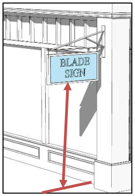
§ 7.1.10Sign Lighting
The following requirements shall pertain to the lighting of all Signs:
The eligibility of lighting for any Sign shall be as indicated under Secs. 7.2.2 through 7.2.14 Sign Types.
The luminance of any Sign shall not exceed 250 nits between dusk and dawn, as measured from the brightest element of the Sign’s face. Dusk and dawn are defined as, respectively, the time starting at one-half hour before sunset and one-half hour after sunrise, as determined by the National Weather Service (actual time).
External Illumination:
Light fixtures shall be located, shielded, and directed such that the light source is directed only onto the Sign face.
Neither the light source or reflective surfaces of the fixture shall be visible from the public way or surrounding properties.
Ground mounted lights shall not be used unless under special circumstances where conditions of (3) above cannot be met. In such cases, the receptacle or device housing the light source shall not extend more than 12 inches above ground, and shall be fully screened and housed.
Projecting light fixtures must be simple and unobtrusive in appearance and not obscure the Sign.
Reverse Channel Illumination (i.e. Backlit):
Backlit Signs shall light lettering and logo and other related Sign elements only, and lighting design shall be such that no excess light spill or glare results from the back lighting fixtures and/or source.
The light source shall not be visible from the public way or surrounding properties.
Illumination levels shall not increase the measurable vertical light level at any point 20 feet distant from the Sign in any direction.
Internal Illumination:
The background must be opaque and a darker color than the message of the Sign.
Direct Illumination (i.e. the use of exposed lamps, such as neon tubes and LED’s, that have no shielding and are visible to the eye):
Direct illumination is limited to letters, numbers, symbols, and accents.
Raceways, Conduit, Wiring, and Transformers
All electrical raceways, conduits, and wiring shall be contained completely within the Sign assembly or inside the wall and shall not be exposed.
If a raceway is necessary, it cannot extend in width or height beyond the area of the Sign.
A raceway must be finished to match the background wall or canopy, or integrated into the overall design of the Sign.
Visible transformers are not allowed.
Electronic Changeable Message:
Where permitted as provided in Secs. 7.2.2 through 7.2.14 Sign Types, Electronic Changeable Message displays shall:
Not have any distracting appearance of motion including but not limited to flashing, blinking, shimmering, animation, video, or scrolling advertising.
Limit the luminance of the display not to exceed 5,000 nits at any time.
Have characters of sufficient size to be easily discerned and must not constitute a safety hazard by distraction of drivers where readily visible to drivers of vehicles on any public way.
Consist only of alphabetic or numeric characters on a plain background, and shall not include any graphic, pictorial, video, or photographic images.
Utilize a maximum of only one color for the message on a dark background of only one color.
Have a minimum display time of two (2) minutes. When the message changes, it must complete the transition within 1 second or as rapidly as is technologically practicable whichever is less with no phasing, rolling, scrolling, flashing, or blending.
Be equipped with a light detector/photocell that automatically adjusts the display’s brightness according to natural ambient light conditions.
Contain a default mechanism that freezes the changeable message in one position, or shuts off the device entirely, in the event of a malfunction.
Limit the area occupied by the electronic changeable message to no more than (50) percent of the maximum total allowable Sign area as provided in Secs. 7.2.2 through 7.2.14 Sign Types.
Be limited to a maximum of three (3) lines of characters including all letters, numbers, spaces, or other symbols dedicated to the electronic changeable message.
§ 7.1.11Alternative Compliance
Minor variation and relief any non-numerical standard found in this Article, and any numerical standard by no more than 20% of such requirement, may be granted by the Development Review Board after review and recommendation by the Design Advisory Board and a Public Hearing.
Decisions by the DRB regarding any Alternative Compliance granted shall be made in writing, and upon affirmative findings that:
the relief sought is necessary in order to accommodate a unique circumstance or opportunity;
the relief, if granted, will yield a result equal to or better than strict compliance with the standard being relieved;
the relief, if granted, is the minimum variation necessary from the applicable standard to achieve the desired result;
the relief, if granted, will not impose an undue adverse burden on adjacent properties; and,
the remainder of the Sign will otherwise be developed consistent the purpose of this Article, and all other applicable standards.
Part 2Sign Types
§ 7.2.1Sign Types
All Signs shall meet the standards set forth in this Article, and the Sign Types described in this Part in Secs. 7.2.2 through 7.2.14 below.
Mixing Multiple Sign Types:
Mixing multiple Signs types on a single building or site in any combination is permitted unless otherwise limited by the Sign Type or Table 7.2.1-A below.
Table 7.2.1-A Sign Type Combinations
| Awning & Canopy Sign | Band Sign | Blade Sign | Directory Sign | Freestanding Sign | Freestanding Yard Sign | Marquee | Monument Sign | Outdoor Display Case | Projecting Sign | Sandwich Board | Wall Sign | Window Sign | |
|---|---|---|---|---|---|---|---|---|---|---|---|---|---|
| Awning & Canopy Sign | ● | ● | ● | ● | ● | ○ | ● | ● | ● | ● | ● | ● | |
| Band Sign | ● | ● | ● | ● | ● | ● | ● | ● | ● | ● | ● | ● | |
| Blade Sign | ● | ● | ● | ● | ○ | ○ | ○ | ● | ○ | ● | ● | ● | |
| Directory Sign | ● | ● | ● | ● | ● | ● | ● | ● | ● | ● | ● | ● | |
| Freestanding Sign | ● | ● | ● | ● | ○ | ○ | ○ | ● | ○ | ● | ● | ● | |
| Freestanding Yard Sign | ● | ● | ○ | ● | ○ | ○ | ○ | ● | ○ | ● | ● | ● | |
| Marquee | ○ | ● | ○ | ● | ○ | ○ | ○ | ● | ○ | ● | ● | ● | |
| Monument Sign | ● | ● | ○ | ● | ○ | ○ | ○ | ● | ○ | ● | ● | ● | |
| Outdoor Display Case | ● | ● | ● | ● | ● | ● | ● | ● | ● | ● | ● | ● | |
| Projecting Sign | ● | ● | ○ | ● | ○ | ○ | ○ | ○ | ● | ● | ● | ● | |
| Sandwich Board | ● | ● | ● | ● | ● | ● | ● | ● | ● | ● | ● | ● | |
| Wall Sign | ● | ● | ● | ● | ● | ● | ● | ● | ● | ● | ● | ● | |
| Window Sign | ● | ● | ● | ● | ● | ● | ● | ● | ● | ● | ● | ● |
○ - Sign Types are not permitted on the same frontage or elevation.
● - Sign Types are permitted on the same frontage or elevation.
The Sign Types permitted in each form or zoning district shall be as defined in Table 7.2.1-B below:
Table 7.2.1-B Sign Types Permitted by Form/Zoning District
| Mixed Use | Enterprise & Institutional | Sign Type Standards | |||||||||
|---|---|---|---|---|---|---|---|---|---|---|---|
| Sign Type | FD6 | FD5 | DW-PT | NAC | NAC-CR | NAC-RC | NMU | E-LM | E-AE | I | |
| Awning & Canopy Sign | ● | ● | ● | ● | ● | ● | ● | ● | ● | ● | 7.2.2 |
| Band Sign | ● | ● | ● | ● | ● | ● | ● | ● | ● | ● | 7.2.3 |
| Blade Sign | ● | ● | ● | ● | ● | ● | ● | ● | ● | ● | 7.2.4 |
| Directory Sign | ● | ● | ● | ● | ● | ● | ● | ● | ● | ● | 7.2.5 |
| Freestanding Sign | ● | ● | ● | ● | ● | ● | ● | ● | ● | ● | 7.2.6 |
| Freestanding Yard Sign | ● | ● | ● | ● | ● | ● | ● | ● | ● | ● | 7.2.7 |
| Marquee | ● | ● | ● | ● | ○ | ○ | ○ | ○ | ○ | ● | 7.2.8 |
| Monument Sign | ● | ● | ● | ● | ● | ● | ● | ● | ● | ● | 7.2.9 |
| Outdoor Display Case | ● | ● | ● | ● | ● | ● | ● | ● | ● | ● | 7.2.10 |
| Projecting Sign | ● | ● | ● | ● | ● | ● | ● | ● | ● | ● | 7.2.11 |
| Sandwich Board | ● | ● | ● | ● | ● | ● | ● | ● | ● | ● | 7.2.12 |
| Wall Sign | ● | ● | ● | ● | ● | ● | ● | ● | ● | ● | 7.2.13 |
| Window Sign | ● | ● | ● | ● | ● | ● | ● | ● | ● | ● | 7.2.14 |
● - Sign Type is permitted
○ - Sign Type is not permitted
Table 7.2.1-B Sign Types Permitted by Form/Zoning District (continued)
| Residential | Civic, RCO & Urban Reserve | Sign Type Standards | |||||||
|---|---|---|---|---|---|---|---|---|---|
| Sign Type | RC | RH | RM | RL | Civic & RCO-R/G | RCO-A | RCO-C | UR | |
| Awning & Canopy Sign | ● | ● | ○ | ○ | ○ | ○ | ○ | ○ | 7.2.2 |
| Band Sign | ● | ○ | ○ | ○ | ○ | ○ | ○ | ○ | 7.2.3 |
| Blade Sign | ● | ● | ● | ● | ● | ● | ● | ○ | 7.2.4 |
| Directory Sign | ● | ● | ● | ● | ● | ● | ○ | ○ | 7.2.5 |
| Freestanding Sign | ● | ○ | ○ | ○ | ● | ○ | ○ | ● | 7.2.6 |
| Freestanding Yard Sign | ● | ● | ● | ● | ● | ● | ● | ● | 7.2.7 |
| Marquee | ○ | ○ | ○ | ○ | ○ | ○ | ○ | ○ | 7.2.8 |
| Monument Sign | ○ | ○ | ○ | ○ | ● | ○ | ○ | ● | 7.2.9 |
| Outdoor Display Case | ● | ○ | ○ | ○ | ● | ● | ○ | ○ | 7.2.10 |
| Projecting Sign | ● | ○ | ○ | ○ | ● | ○ | ○ | ○ | 7.2.11 |
| Sandwich Board | ● | ○ | ○ | ○ | ● | ● | ● | ● | 7.2.12 |
| Wall Sign | ● | ● | ● | ● | ● | ○ | ○ | ○ | 7.2.13 |
| Window Sign | ● | ● | ● | ● | ● | ● | ● | ○ | 7.2.14 |
● - Sign Type is permitted
○ - Sign Type is not permitted
§ 7.2.2Awning & Canopy Sign
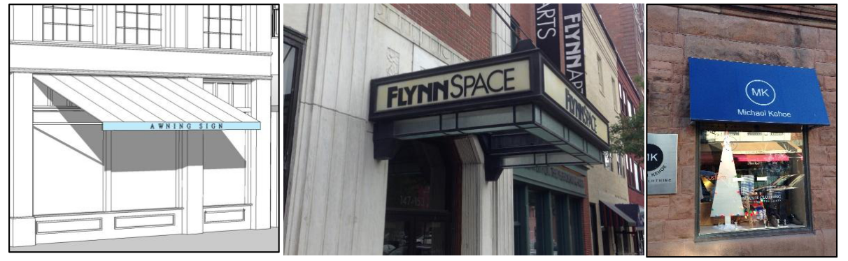
Description
This Sign type consists of one or more faces, and is integrated within or part of an Awning or Canopy extending over a principal entrance and/or first floor windows on a Primary or Secondary Frontage, or spanning across an individual storefront or an entire building façade.
Specifications
| Location | Only Awnings and Canopies on ground floor doors or windows may contain signs. |
| Quantity (max) | • 1 per Awning |
| • 3 per Canopy | |
| Area, Lettering (max) | • 75% of the area of the Valance or Canopy face |
| • 25% of the area of the sloping plane of an Awning | |
| Height, Lettering (min/max) | • 5-in min; 10-in max on the Valance, or 18-in max on sloping plane of an Awning |
| • 24” max. on a Canopy |
Miscellaneous
Canopy Signs may be placed on the face and sides of the Canopy, or extend above or below the Canopy face provided 8-ft min. clear height above the sidewalk is maintained.
Awning Signs may only be placed on the Valance or sloping plane of the Awning, not both.
Awning Signs shall not be internally illuminated or backlit. Canopy Signs may only be backlit.
Awning or Canopy Signs in a Residential district shall not be illuminated.
Any encroachment into or over the public right-of-way must also be approved by the Dept. of Public Works and/or City Council as may be applicable.
§ 7.2.3Band Sign
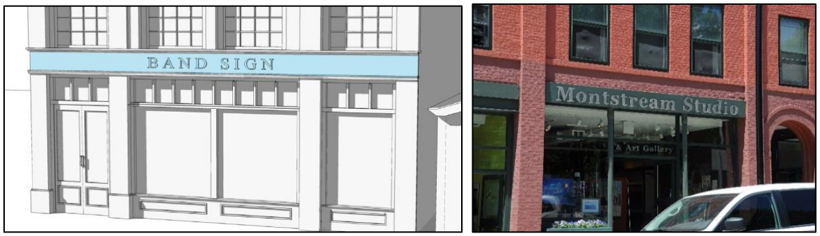
Description
This Sign type consists of a single face, and is placed within a Sign Band that is architecturally integrated into the overall design of the building façade over a principal entrance and spanning across an individual storefront or the entire façade on a Primary Frontage.
Specifications
| Quantity (max) | 1 Band Sign per street-level storefront, except that where a Primary Frontage contains more than one architecturally distinguishable Sign Band, 1 Band Sign shall be permitted per Sign Band. |
| Width, Sign (max) | Length of the street-level storefront frontage |
| Height, Sign (max) | 3-ft |
| Height, Overall (max) | the lesser of the floor level of the second floor or 18-ft above the finished sidewalk. |
| Depth/Projection, lettering (max) | 7-in from the face of the Sign Band |
| Area, Sign (max) | 75% of that portion of the Sign Band associated with the street-level use |
Miscellaneous
Band Signs shall include only characters, background, lighting, and an optional logo.
If illuminated, Band Signs may only be externally illuminated or backlit.
§ 7.2.4Blade Sign
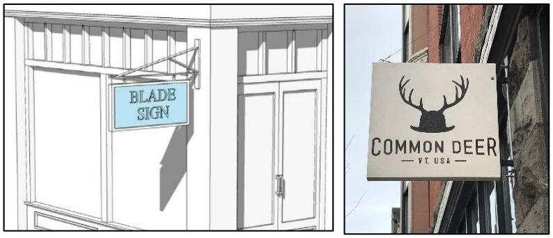
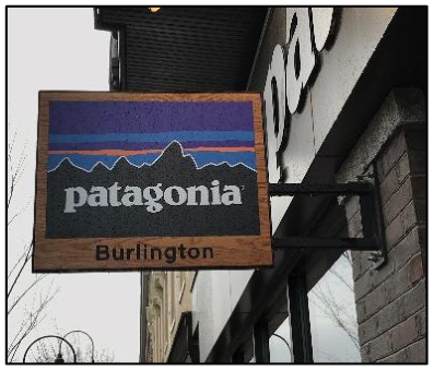
Description
This Sign type consists of 1-2 faces, and projects perpendicular from the Building facade on a Primary or Secondary Frontage, or elevation where street frontage is not available.
Specifications
| Location (max) | within 4-feet of a principal entrance. |
| Quantity (max) | 1 per ground floor tenant |
| Width, Sign (max) | 3-ft |
| Height, Sign (max) | 3-ft |
| Depth, Sign (max) | 6-in |
| Offset from Building (min/max) | 6-in min and 12-in max from the facade |
| Projection (max) | 4-ft from the facade |
| Area, Sign (max) | 9 sqft |
| Height, Clear (min) | 8-ft min. above finished sidewalk (the lowest portion of the overhanging sign and/or bracket) |
| Height, Overall (max) | The lesser of the floor level of the second floor or 18-ft above the finished sidewalk. |
Miscellaneous
The bracket must be an integral part of the Sign design.
A Blade Sign erected on a building that adjoins the intersection of 2 streets may intersect at a 45 degree angle to the corner of the building.
A Blade Sign may be attached to the face or underside of a canopy
If illuminated, Blade Signs shall only be externally illuminated.
Blade Signs in any Residential, RCO, or Urban Reserve district shall not be illuminated.
Any encroachment into or over the public right-of-way must also be approved by the Dept. of Public Works and/or City Council as may be applicable.
§ 7.2.5Directory Sign
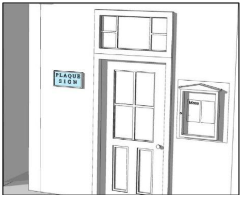
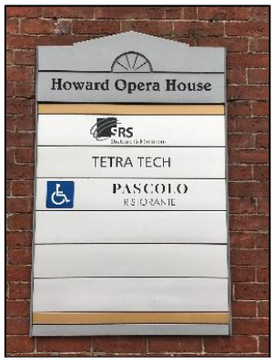
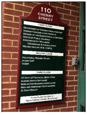
Description
This Sign type has a single face and consists of either a panel or individual letters applied directly to a building wall, typically listing the names of building tenants.
Specifications
| Location (max) | within 4-feet and to the side of a principal entrance. |
| Quantity (max) | 1 per principal entrance |
| Width (max) | 18-inches |
| Height (max) | 36-inches |
| Depth/Projection (max) | 3-inches from the facade |
Miscellaneous
If illuminated, Directory Signs may only be backlit.
Directory Signs in any Residential, RCO, or Urban Reserve district shall not be illuminated.
§ 7.2.6Freestanding Sign
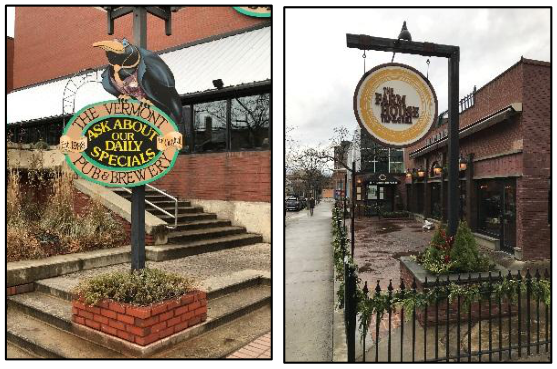
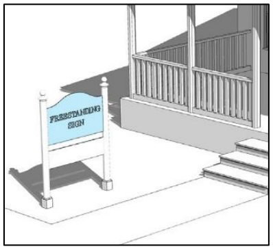
Description
This Sign type consists of 1 or 2 faces, is fully detached from a Building, and placed in a front yard with external support consisting of 1-2 posts.
Specifications
| Quantity (max) | 1 per primary street frontage |
| Width (max) | 8-ft (not including supports) |
| Height | 10-ft (not including supports) |
| Depth (face-to-face) (max) | 1-ft |
| Sign Area (max) | 60 sf. (not including supports) or 0.5 sf per linear foot of street facing building frontage whichever is less. |
| Setback (min) | The lesser of 3-ft from the front properly line or in-line with the building façade, and 5-ft from any side properly line |
| Height, Overall (max) | 14-ft above the finished grade (including supports). |
Miscellaneous
No part of a Freestanding Sign may encroach or overhang upon a public right-of-way, clear sight triangle, driveway, parking area, or walkway.
Freestanding Signs associated with a Fuel Service Station may include an electronic changeable message only for the display of numerals.
Freestanding Signs may only be internally or externally illuminated or backlit.
§ 7.2.7Freestanding Yard Sign
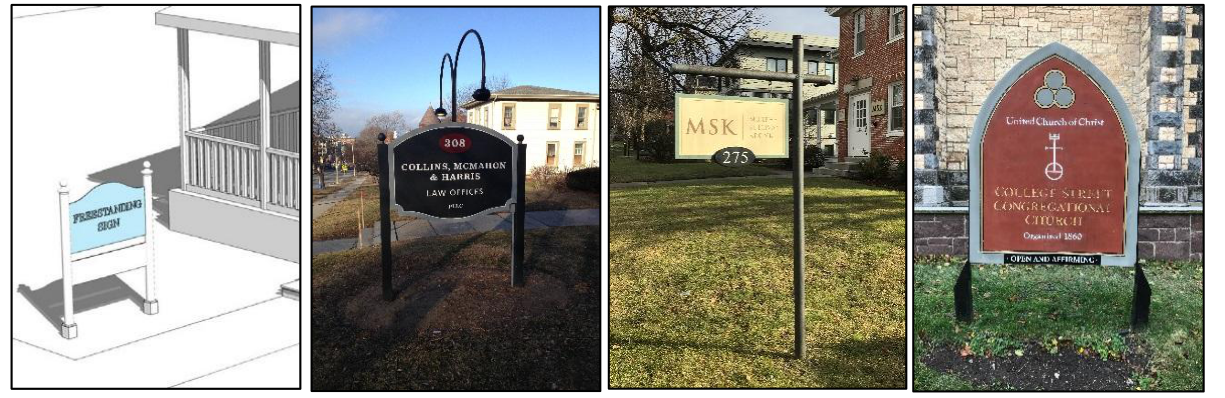
Description
This Sign type consists of 1 or 2 faces, is fully detached from a Building, and placed in a front yard with external support consisting of 1-2 posts.
Specifications
| Location | primary street frontage |
| Quantity (max) | 1 per lot. |
| Width (max) | 6-ft (not including supports) |
| Height | 4-ft (not including supports) |
| Depth (face-to-face) (max) | 1-ft |
| Area (max) | 20 sf (not including supports) |
| Setback (min) | The lesser of 3-ft from the front properly line or in line with the building façade, and 5-ft from any side properly line |
| Height, Overall (max) | 6-ft above the finished grade (including supports). |
Miscellaneous
No part of a Freestanding Yard Sign may encroach or overhang upon a public right-of-way, clear sight triangle, driveway, parking area, or walkway.
Freestanding Yard Signs may only be externally illuminated.
Freestanding Yard Signs in any Residential, RCO, or Urban Reserve district shall not be illuminated.
§ 7.2.8Marquee
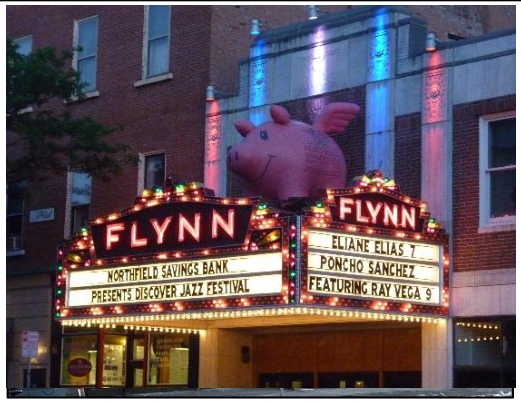
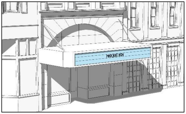
Description
This Sign type consists of 1-3 faces on an iconic structural feature of a Building that projects perpendicular from the façade over a principal entrance.
Specifications
| Quantity (max) | 1 per primary street frontage. |
| Width (max) | Width of the street-level frontage associated with the principal entrance |
| Projection (min/max) | 6-ft min.; 10-ft max. from the facade |
| Setback (min) | No closer than 3-ft from the back of the curb |
| Area, Sign (max) | 75% of any face of the Marquee |
| Height, Clear (min) | 10-ft above the finished sidewalk |
| Height, Overall (max) | The top of the Marquee shall be no more than the lesser of the floor level of third Story or 35-ft above the finished sidewalk |
Miscellaneous
Marquees shall be allowed only for the following uses: Cinemas, Conference/ Convention Centers, Performing Arts Centers, and Recreation Facility - Indoor.
A Marquee erected on a Building that adjoins the intersection of 2 streets may intersect at a 45 degree angle to the corner of the Building.
Marquees shall be cantilevered or supported from above. Columns or Posts extending to the ground are prohibited.
Marquees may be illuminated internally and directly, and may include manual or electronic changeable message. Marquees may include intermittent blinking and flashing lamps and borders.
Any encroachment into or over the public right-of-way must also be approved by the Dept. of Public Works and/or City Council as may be applicable.
§ 7.2.9Monument Sign
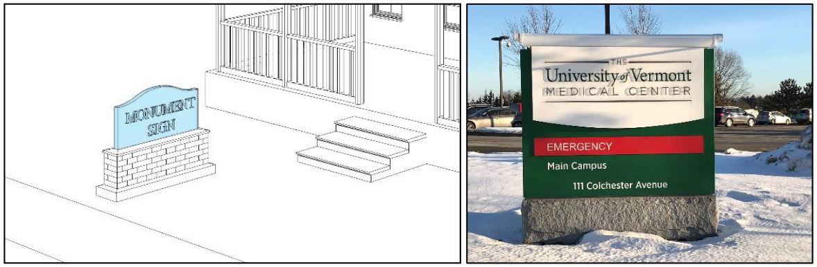
Description
This Sign type consists of 1-2 faces, is placed in a front yard fully detached from a Building, and is supported along the entire length of its base.
Specifications
| Quantity | 1 per primary street frontage. |
| Depth (face-to-face) (max) | 2.5-ft |
| Setback (min) | • The lesser of 3-ft from the front properly line or in line with the building façade. |
| • 5-ft from any side properly line. | |
| Area (max) | 60 sf (not including supports) or 0.5 sf per linear foot of street facing building frontage whichever is less. |
| Height, Overall (max) | 6-ft from the finished grade |
Miscellaneous
No part of a Monument Sign may encroach upon a public right-of-way, clear sight triangle, driveway, parking area, or walkway.
If illuminated, a Monument Sign may only be internally or externally illuminated or backlit.
Monument Signs in a Residential or RCO district shall not be illuminated.
A Monument Sign associated with a public or civic use may include manual or electronic changeable message.
§ 7.2.10Outdoor Display Case
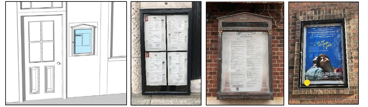
Description
This Sign type has a single face and consists of a metal or wood framed cabinet mounted onto a building facade on a Primary or Secondary Frontage with a transparent window and a lockable opening allowing the contents, such as menus or posters, to be kept current.
Specifications
| Quantity (max) | 1 per tenant* |
| Width(max) | 3-ft |
| Height (max) | 4-ft |
| Area (max) | 6-sf* |
| Depth/Projection (max) | 3-in from the Facade |
* Cinemas, Performing Arts Centers, and Performing Arts Studios may have up to 4 Outdoor Display Cases per street frontage, each not exceeding 12-sqft in area, not to exceed fifteen (15%) per cent of the area of the Façade associated with the tenant.
Miscellaneous
Outdoor Display Cases may only be illuminated from inside the display case, and shall not include electronic changeable messages.
§ 7.2.11Projecting Sign
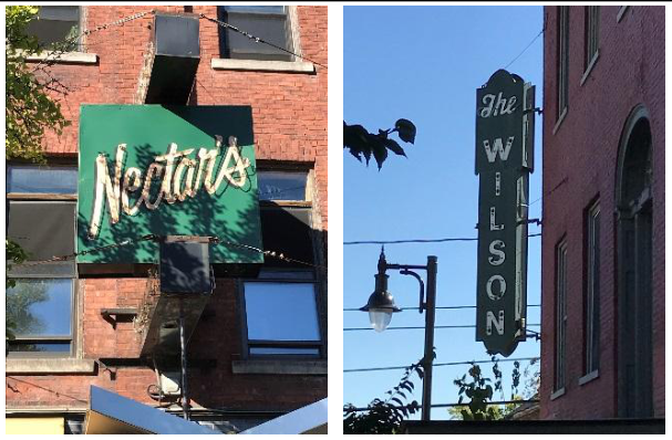
Description
This Sign type consists of 2 faces on an iconic structural feature of a Building that projects perpendicular from the Façade.
Specifications
| Quantity (max) | 1 per Primary street Frontage |
| Width, Sign (max) | 4-ft |
| Height, Sign (max) | 10-ft |
| Depth, Sign (max) | 6-in |
| Offset from Building (min & max) | 6-in min and 12-in max from the Facade |
| Projection (max) | 5-ft from the Façade (incl brackets) |
| Area, Sign (max) | 40 sqft |
| Height, Clear (min) | the greater of the floor level of second Story or 15-ft above finished sidewalk |
| Height, Overall (max) | the lesser of the floor level of third Story or 35-ft above the finished sidewalk |
Miscellaneous
The bracket must be an integral part of the Sign design.
A Projecting Sign erected on a building that adjoins the intersection of 2 streets may intersect at a 45 degree angle to the corner of the building.
A Projecting Sign shall be cantilevered or supported from above. Columns or Posts extending to the ground are prohibited.
A Projecting Sign may be illuminated externally, internally, and directly.
Any encroachment into or over the public right-of-way must also be approved by the Dept. of Public Works and/or City Council as may be applicable.
§ 7.2.12Sandwich Board
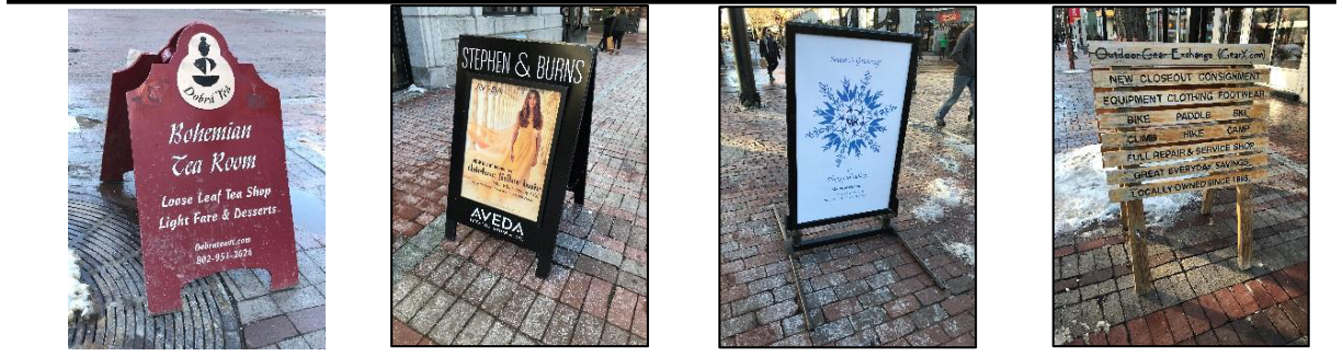
Description
This Sign type is a two-sided, portable sign that is constructed in the form of an “A” or similar tent-like shape, or attached to a heavy base in the form of an inverted “T”.
Specifications
| Quantity (max) | 1 per ground floor tenant; and 1 per 4 upper story or below grade tenants |
| Area (max) | 8 sf |
| Height (max) | 4-ft above the finished grade; 3-ft if placed within a clear sight triangle |
| Width (max) | 3-ft |
| Location | • 15-ft max. from a principal entrance |
| • no closer than 10-ft from a street intersection or crosswalk | |
| • no closer than 12-ft from another Sandwich Board |
Miscellaneous
A Sandwich Board shall not interfere with ingress and egress points and the flow of pedestrian traffic, and a minimum of 5-feet of sidewalk clearance must be maintained at all times.
A Sandwich Board shall only be displayed during business hours, and must be taken indoors when the business is closed.
A Sandwich Board must be freestanding, and shall not be attached to the ground or any other structure or object.
A Sandwich Board shall not be illuminated.
A Sandwich Board shall be constructed of durable, weather resistant materials and finish, and sufficiently weighted to the ground to prevent blow-down. During high wind events all Sandwich Boards shall be taken indoors.
The requirements of this Sign Type do not apply to Sandwich Boards placed within the public right-of-way which must be approved by the Dept. of Public Works or the Church Street Marketplace Commission as may be applicable.
§ 7.2.13Wall Sign
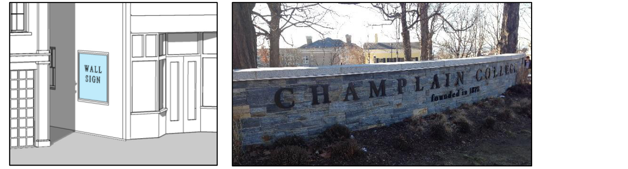

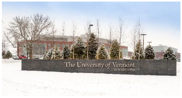
Description
This Sign type has a single face and is attached, painted, or otherwise mounted parallel to a building or structure wall on a Primary or Secondary Frontage or elevation where no street Frontage is available.
Specifications
| Height (max) | No higher than the floor level of the second story. |
| Area (max) | • 2 sf per linear foot of street frontage, or elevation where no street frontage is available, associated with a first floor tenant. |
| • 10 sf for a second floor or above tenant with only a ground floor entryway. | |
| • In no case may the total area of all Wall Signs exceed the lesser of two hundred (200) square feet or fifteen (15%) per cent of the area of the façade or elevation to which they are attached. | |
| • A Wall Sign in any residential district shall not exceed 6-sf in area. | |
| • A Wall Sign in a RCO-R/G district shall not exceed 20-sf in area. | |
| Depth/Projection (max) | 12-in max. from the facade |
Miscellaneous
A Wall Sign may not be applied on or obscure architectural features such as: windows, doors (other than egress-only), pilasters, cornices, window, door or other building trim, feature bands, and other recessed or projecting features.
A Wall Sign may not be painted on walls made of previously unpainted stone or brick.
If illuminated, Wall Signs may be externally illuminated or backlit.
§ 7.2.14Window Sign
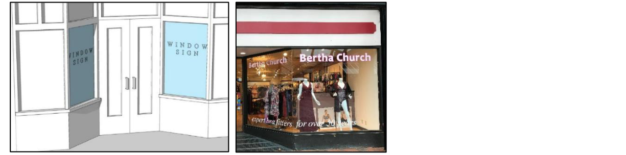
Description
This Sign type has a single face, and is affixed directly onto or behind the glazing of a window and/or door on a Primary or Secondary Frontage, or elevation where no Frontage is available.
Specifications
| Quantity (max) | 1 per first or second floor window and/or ground floor entry. |
| Area (max) | • 20% of the area of any individual window located between 4 and 7 feet above the adjacent sidewalk or finished grade. |
| • total area may not exceed 30% of the total window area of all windows with Signs per façade or elevation. | |
| Height, Lettering (max) | 8-inches |
Miscellaneous
Characters and logos shall be placed directly on the glazing or placed no more than 12” behind the glazing. Items placed more than 12” from the glazing shall not be considered a Window Sign.
Window Signs shall not be illuminated, however the use of neon as part of the Sign design is permitted.
Window Signs in any Residential, RCO, or Urban Reserve district shall not be illuminated.
Window area calculations shall include only the glazing.
Window Signs shall not interfere with the primary function of windows, which is to enable passersby and public safety personnel to see through windows into premises and view product displays.
Part 3Master Sign Plans
§ 7.3.1Intent
§ 7.3.2Applicability
Within any Mixed Use, Enterprise, or Institutional zoning district, all Signs located on a site, building, or a complex of buildings with three or more owners, tenants, or uses located on a single lot or adjacent lots under common ownership may be granted a Master Sign Plan submitted by the building owner and reviewed and approved by the DRB under the provisions of this Part. Signs located on City property erected by or at the direction of the City or any of its departments in the performance of their public duty or responsibility may also seek approval under the provisions of this Part.
Where a Master Sign Plan includes sufficient detail regarding the location, type, lighting, and other requirements for individual Signs, those Signs may be approved as part of the Master Sign Plan without the necessity for an individual permit(s). Otherwise the installation of individual Signs proposed pursuant to, and in compliance with, an approved Master Sign Plan shall receive administrative review and approval pursuant to the procedural requirements of Sec. 3.2.7.
§ 7.3.3Submission Requirements
A Master Sign Plan shall be a comprehensive plan of all planned Signs to be located on the site(s) and on all facades of the building(s) or building complex.
Information to be included in a Master Sign Plan shall include, but not be limited to, the following in sufficient detail as necessary to render a decision for the Master Sign Plan and individual Signs as may be applicable:
Sketch of Signs clearly indicating size/dimensions of all Signs – including height above finished grade, lettering, logos or other graphics, colors, materials, texture.
Types of Signs – see Part 2.
Building elevations/photographs clearly illustrating the placement of Signs placed on all buildings.
Methods of illumination.
§ 7.3.4Flexibility from Existing Standards
A Master Sign Plan shall be consistent with the intent and purpose of the form or zoning district within which the site is located and the intent of this Article, and be compatible with the site and character of the surrounding area.
All of the Signs in a Master Sign Plan shall be designed and organized in a manner consistent and complementary with the overall architecture of the Building, and employ complimentary materials, colors, design, and scale of letters while still providing diversity and differentiation among individual tenants,
Individual Signs in an approved Master Sign Plan may vary from the locational standards of Part 2 of this Article pertaining to each Sign Type, and be granted Alternative Compliance per Sec. 7.1.11. However, no individual Sign may exceed the maximum area limitations for the specified Sign Type, or conflict with the limitations and prohibitions of Sec. 7.1.4 .
§ 7.3.5On the Record Review
Pursuant to the authority of 24 V.S.A. §4471(b), any permit request for a Master Sign Plan approval by the DRB will be on the record, so that any appeal is not a de novo review, in accordance with the Vermont Rules of Civil Procedure.
Article 8Parking
§ 8Introduction
This Article of the Burlington Comprehensive Development Ordinance establishes the requirements for off-site parking throughout the city. It also includes parking for bicycles and requirements for institutional parking management plans.
Part 1General Requirements
§ 8.1.1Purpose
It is the purpose of this article to:
Ensure there are adequate parking and loading facilities to serve the use or uses of the property;
Ensure that parking facilities are designed to provide proper circulation, reduce hazards to pedestrians, and protect the users of adjoining properties from nuisance caused by the noise, fumes, and glare of headlights which may result from the operation of vehicles parking off the street;
Reduce congestion in the streets and contribute to traffic safety; and
Encourage alternate modes of travel that will reduce dependence upon the single-occupancy automobile.
These regulations are enacted under the provisions of 24 V.S.A. Chapter 117
§ 8.1.2Applicability
No structure shall be erected or altered, or any use changed or established, unless or until the provisions of this Article have been met. No onsite parking shall be required or provided within the Urban Reserve District.
§ 8.1.3Parking Districts
The demand for parking is highly dependent on the context within which a given use or structure is located. Factors such as proximity to other related uses, availability of public transportation and alternative forms of and supports for transportation, the density of land uses, and the ability to share parking with nearby uses are all factors which influence the demand for individual and dedicated off-site parking. For the purposes of this Article, the following three (3) Parking Districts as illustrated in Map 8.1.3-1 are hereby created:
Neighborhood Parking District:
This parking district encompasses the primarily residential neighborhoods of the city where the demand for off-site parking is largely dependent on the needs and characteristics of and transportation resources available to an individual site or land use.
Shared Use Parking District:
This parking district recognizes that opportunities exist to share parking demand between related nearby land uses, and that travel to and between these uses may not be strictly automobile dependent.
Multimodal Mixed-Use Parking District:
This parking district recognizes the opportunity for extensive sharing of parking demand between nearby mixed land uses makes travel to and between proximate land uses largely independent from an automobile; and that an array of non-vehicular transportation modes, public parking facilities, and frequent transit service greatly reduces the need for independent on-site parking for individual land uses.
This Parking District includes all properties in the following Zoning Districts:
Neighborhood Mixed Use (NMU)
NAC – Riverside (NAC-R)
NAC – Cambrian Rise (NAC-CR)
The Parking District also includes the properties located at 0 and 52 Institute Road.
With the exception of those properties subject to Part 3 - Institutional Parking Management Plans, this Parking District also includes all properties with street frontage on the following major thoroughfares to a maximum depth of 200-ft.:
North Avenue from Battery Park to Plattsburg Avenue
Colchester Avenue
Pearl Street
North Winooski Avenue
Riverside Avenue from N. Winooski Ave to Colchester Ave
Battery Street
Main Street
College Street to South Williams Street
Pine Street
Saint Paul Street
Shelburne Street
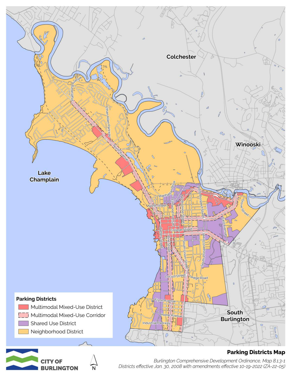
§ 8.1.4Existing Structures
Any structure or land use lawfully in existence prior to the adoption of this ordinance shall not be subject to the requirements of this Article as long as the kind or extent of use is not changed, and provided further that any parking facilities now serving such structures shall not in the future be altered.
Within the Multimodal Mixed-Use Parking District, an administrative permit may be requested to remove the minimum off-street parking requirements associated with permits issued prior to December 16, 2020. This provision does not apply to permits containing public parking provided in exchange for an Article 4 Development Bonus (See Sec. 4.4.1 (d) (5) (A)). For those permits, the public parking provided shall be maintained. This provision does not apply within the Neighborhood or Shared Use Parking Districts.
§ 8.1.5Existing Structures - Change or Expansion of Use
Whenever there is an alteration or conversion of a structure or a change or expansion of a use which does not involve complete redevelopment or substantial rehabilitation of the structures on a lot:
The parking and TDM requirements of this Article shall apply only to the new use or net new area of the expanded use, and
Existing parking may exceed the maximum limits per Table 8.1.9-1 as a result of a change of use or change in the intensity of a use(s) on a lot, and
Changes to existing parking in Shared Use and Neighborhood Parking districts is not precluded by Sec. 8.1.4.
§ 8.1.6(Reserved)
§ 8.1.7(Reserved)
§ 8.1.8Minimum Off-Street Parking Requirements
Requirements for a minimum number of off-street parking spaces have been recognized as an impediment to building housing and other desired uses, inhibit the expansion of alternative transportation and transportation demand management, and act as an instrument to overbuild parking and incentivize single occupancy automobile use. Therefore, minimum off-street spaces are eliminated in all parking districts for all uses except for applications seeking to exceed occupancy of a dwelling unit by more than four (4) unrelated adults. Such applications are subject to the parking requirements of Sec. 4.4.5 (d), 4, C, Residential Occupancy Limits.
§ 8.1.9Maximum On-Site Parking Spaces
The total number of off-street parking spaces provided in any parking district shall not be more than as allowed in Table 8.1.9-1 below:
Where a use is not listed, the maximum parking requirements shall be determined by the administrative officer based upon a determination that the use is substantially equivalent in use, nature, and impact to a listed use.
When the calculation yields a fractional number of maximum spaces, the number of spaces shall be rounded to the nearest whole.
Table 8.1.9-1 Maximum Off-Street Parking Requirements
| Neighborhood Districts | Shared Use Districts | Multimodal Mixed-Use Districts | |
|---|---|---|---|
| RESIDENTIAL USES¹ | Per Dwelling Unit except as noted | ||
| Multi-unit attached dwelling units, studio units or 1-bedroom dwelling unit. | 3 | 2 | 1 |
| Single Family detached and Duplex | 3 | 2 | 2 |
| 1. Adjusted for development with inclusionary housing units per Sec. 8.1.8(c) | |||
| RESIDENTIAL USES - SPECIAL¹ | Per Dwelling Unit except as noted | ||
| Assisted Living | 1 | 1 | 1 |
| Boarding House (per two (2) beds) | 1 | 1 | 1 |
| Community House | 1 | 1 | 1 |
| Convalescent Home (per four (4) beds) | 1 | 1 | 1 |
| Dormitory (per two (2) beds) | 1 | 1 | 1 |
| Emergency Shelter | 1 | 1 | 1 |
| Group Home (per two (2) beds) | 1 | 1 | 1 |
| Historic Inn (per room, in addition to single-family residence) | 1 | 1 | 1 |
| Sorority & Fraternity (per two (2) beds) | 1 | 1 | 1 |
| NON-RESIDENTIAL USES | Per 1,000 square feet of gross floor area (gfa) except as noted | ||
| Adult Day Care (per two (2) employees) | 1 | 1 | 1 |
| Agricultural Use | 1 | 1 | 1 |
| Amusement Arcade | 3 | 2 | 1 |
| Animal Boarding/Kennel/Shelter | 3 | 3 | 2 |
| Animal Grooming (per grooming station) | 1 | 1 | 1 |
| Animal Hospitals/Veterinarian Office | 4 | 3 | 2 |
| Appliance & Furniture Sales/Service | 3 | 3 | 1 |
| Aquarium | 2 | 1 | 1 |
| Art Gallery/Studio | 4 | 3 | 3 |
| Auction Houses | 4 | 3 | 3 |
| Automobile & Marine Parts Sales | 3 | 3 | 2 |
| Automobile Body Shop | 3 plus 1/bay | 3-plus 1/bay | 2 plus 1/bay |
| Automobile Repair/Service | 3 plus 2/bay | 3 plus 2/bay | 2 plus 1/bay |
| Automobile Sales – New & Used (for public and employee parking only; unregistered for-sale vehicles exempt from limits) | 3 | 2 | 2 |
| Bakery | 3 | 3 | 3 |
| Bank, Credit Union | 3 | 3 | 2 |
| Bar/Tavern | 5 | 4 | 3 |
| Beauty/Barber Shop (per station/chair) | 1 | 1 | 1 |
| Bicycle Sales/Repair | 3 | 2 | 1 |
| Billiard Parlor (per game table) | 1 | 1 | 1 |
| Boat Repair/Service | 3 | 2 | 2 |
| Boat Sales/Rental | 3 | 2 | 2 |
| Boat Storage | 4 | 3 | 2 |
| Bowling Alley (per lane) | 4 | 3 | 2 |
| Building Material Sales | 4 | 3 | 3 |
| Café (per four (4) seats) | 1 | 1 | 1 |
| Camp Ground (per camping space) | 1 | 1 | 1 |
| Car Wash (stacking spaces per wash bay) | 5 | 4 | 4 |
| Cemetery | 1 | 1 | 1 |
| Cinema (per four (4) seats) | 1 | 1 | 1 |
| Club, Membership | 4 | 3 | 3 |
| Community Center | 4 | 3 | 3 |
| Community Garden (per ten (10) plots) | 1 | 1 | 1 |
| Conference Center | 4 | 3 | 2 |
| Contractor Yard (per 1,000 gfa of office space) | 3 | 3 | 2 |
| Convenience Store | 4 | 3 | 2 |
| Convention Center | n/a | n/a | 3 |
| Courthouse | n/a | n/a | 3 |
| Crematory (per FTE employee) | 1 | 1 | 1 |
| Crisis Counseling Center | 5 | 4 | 3 |
| Daycare - Home (6 children or less) | 1 | 1 | 1 |
| Daycare - Large (Over 20 children) (per two (2) employees) | 1 plus 1 drop-off per 5 children | 1 plus 1 drop-off per 5 children | 1 plus 1 drop-off per 5 children |
| Daycare - Small (20 children or less) (per two (2) employees) | 1 plus 1 drop-off per 5 children | 1 plus 1 drop-off per 5 children | 1 plus 1 drop-off per 5 children |
| Dental Lab | 3 | 2 | 1 |
| Distribution Center (per 3,000 gfa) | 1 | 1 | 1 |
| Dry Cleaning Plant | 2 | 1 | 1 |
| Dry Cleaning Service | 3 | 3 | 2 |
| Film Studio | 4 | 3 | 3 |
| Fire Station (per apparatus) | n/a | n/a | n/a |
| Food & Beverage Processing | 2, plus 4 per 1,000 gfa devoted to patron use | 1, plus 3 per 1,000 gfa devoted to patron use | 1, plus 2 per 1,000 gfa devoted to patron use |
| Fuel Service Station per employee/shift) | 3 | 3 | 2 |
| Funeral Home (per four (4) seats) | 1 | 1 | 1 |
| Garden Supply Store (per 1,000 gfa of retail area.) | 4 | 3 | 2 |
| General Merchandise/Retail | 4 | 3 | 2 |
| Grocery Store | 4 | 3 | 2 |
| Hazardous Waste Collection/Disposal (per two (2) employees on the largest shift) | 1 | 1 | 1 |
| Health Club | 4 | 3 | 2 |
| Health Studio | 3 | 2 | 1 |
| Hospitals (per patient bed) | 3 | 2 | 2 |
| Laundromats (per washing machine) | 1 | 1 | 1 |
| Library | 2 | 1 | 1 |
| Lodging | 1 | 1 | 1 |
| Lumber Yard (per 1,000 gfa of retail area.) | 4 | 3 | 2 |
| Manufacturing-Light | 2, plus 4 per 1,000 gfa devoted to patron use. | 1, plus 3 per 1,000 gfa devoted to patron use. | 1, plus 2 per 1,000 gfa devoted to patron use. |
| Manufacturing | 2, plus 4 per 1,000 gfa devoted to patron use. | 1, plus 3 per 1,000 gfa devoted to patron use. | 1, plus 2 per 1,000 gfa devoted to patron use. |
| Marina (per berth) | 1 | 1 | 1 |
| Medical Lab | 3 | 2 | 1 |
| Museum | 1 | 1 | 1 |
| Office - General | 3 | 2 | 2 |
| Office - Medical, Dental | 4 | 3 | 2 |
| Office – Technical | 3 | 2 | 2 |
| Open Air Markets | 1 | 1 | 1 |
| Operations Center - Taxi (per three (3) employees) | 1 | 1 | 1 |
| Operations Center - Truck/Bus (per 1,000 gfa) (registered transit vehicles exempt from limits) | 1, plus 1 per 1 employee | 1, plus 1 per 1 employee | 1, plus 1 per 1 employee |
| Park (per playing area) | 6 | 5 | 1 |
| Parking Garage – Private | N/A | N/A | N/A |
| Parking Lot – Private | N/A | N/A | N/A |
| Performing Arts Center (per four (4) seats) | 1 | 1 | 1 |
| Performing Arts Studio | 1 | 1 | 1 |
| Pet Store | 3 | 3 | 1 |
| Pharmacy | 4 | 3 | 2 |
| Photo Studio | 3 | 3 | 1 |
| Photography Lab | 1 | 1 | 1 |
| Police Station | n/a | n/a | n/a |
| Post Office | 2 | 1 | 1 |
| Post Office - Local | 3 | 2 | 2 |
| Printing Plant | 2 | 1 | 1 |
| Printing Shop | 3 | 2 | 2 |
| Public Transit Terminal | 1 per 200 gfa of public waiting space | 1 per 200 gfa of public waiting space | 1 per 200 gfa of public waiting space |
| Public Works Yard/Garage (for public and employee parking only; fleet parking exempt from limits) | 1 | 1 | 1 |
| Radio & TV Studio | 3 | 2 | 2 |
| Rail Equip. Storage & Repair | 1 | 1 | 1 |
| Recording Studio | 2 | 1 | 1 |
| Recreational Facility - Indoor (per four (4) seats) | 1 | 1 | 1 |
| Recreational Facility - Outdoor (per playing field) | 19 | 15 | 10 |
| Recreational Facility - Outdoor Commercial | Larger of 1per 4 seats or 19 per playing field | Larger of 1 per 4 seats or 15 per playing field | Larger of 1 per 4 seats or 10 per playing field |
| Recreational Vehicle Sales – New and Used | 3 | 2 | 2 |
| Recycling Center - Large above 2,000 gfa | 1 | 1 | 1 |
| Recycling Center - Small 2,000 gfa or less | 1 | 1 | 1 |
| Research Lab | 3 | 3 | 2 |
| Restaurant | 5 | 4 | 3 |
| Restaurant – Take-Out | 5 | 4 | 3 |
| Salon/Spa | 5 | 4 | 4 |
| School - Secondary (per Classroom) | 9 | 7 | 5 |
| School - Primary (per Classroom) | 2 | 2 | 2 |
| School – Preschool Large (per two (2) employees | 1 plus 1 drop-off per 5 children | 1 plus 1 drop-off per 5 children | 1 plus 1 drop-off per 5 children |
| School – Preschool Small (up to 20 children) (per two (2) employees | 1 plus 1 drop-off per 5 children | 1 plus 1 drop-off per 5 children | 1 plus 1 drop-off per 5 children |
| School - Trade/Professional | 6 | 5 | 3 |
| School, - Post-Secondary | 3 | 2 | 2 |
| Solid Waste Facility - Incinerator, Landfill, Transfer Station | 1 | 1 | 1 |
| Tailor Shop | 3 | 2 | 1 |
| Vehicle Salvage | 1 | 1 | 1 |
| Warehouse | 1 | 1 | 0 |
| Warehouse - Self Storage Facility | 1 per resident manager, plus 1 per 100 leasable storage spaces | 1 per resident manager, plus 1 per 100 leasable storage spaces | 1 per resident manager, plus 1 per 100 leasable storage spaces |
| Warehouse - Retail | 4 | 3 | 3 |
| Wholesale Sales | 2 | 1 | 1 |
| Worship, Place of (per four (4) seats) | 1 | 1 | 1 |
Exemptions: The following shall not be included in the maximum number of allowable spaces required by this section:
Public Parking: Spaces provided and available for use by the public shall not be counted towards the maximum. Such spaces shall be available to the public at a minimum of nights and weekends, and be signed or marked accordingly;
Carpool, Vanpool, and Car-Share Parking: Spaces dedicated for vehicles participating in a carpool, vanpool, or car-share program shall not be counted towards the maximum. Such spaces shall be reserved for such use, and be signed or marked accordingly; and,
Alternative Fueled Vehicle Parking. Parking spaces dedicated for vehicles operating on primarily alternative fuels including but not limited to electric, natural gas, and hydrogen shall not be counted towards the maximum. Such spaces shall be reserved for such use, and be signed and/or the space painted with the words “Alternative Fueled Vehicles Only.”
ADA Accessible Parking: Parking spaces specifically designed, located and reserved by persons according to the standards in the Federal Americans with Disabilities Act (ADA) as administered by the Dept. of Public Works.
Institutional Parking: Parking spaces, provided by institutions, that have been approved as part of a plan per the standards of Article 8, Part 3: Institutional Parking Plans
Driveways: Parking for residential uses within driveways compliant with the standards of Sec. 8.1.12 (b), Front Yard Parking Restricted and Residential Driveways.
Waiver of Maximum Parking Limitations. Parking in excess of the maximum parking limitation of this section, may be waived by the DRB pursuant to the following requirements:
The applicant requesting the waiver shall also provide:
a peak demand parking study for two similar uses in the area; and,
a TDM Plan pursuant to the requirements of Sec. 8.1.16, provided that Affordable Projects shall only be required to comply with Sections 8.1.16(c) 1 and 8.1.16(c) 4, as stated in Table 8.1.16-1.
The following additional review criteria shall be addressed regarding how:
The need for additional parking cannot reasonably be met through provision of on-street parking or shared parking with adjacent or nearby uses;
The proposed development demonstrates that its design and intended uses will continue to support high levels of existing or planned transit and pedestrian activity; and,
The site plan indicates where additional parking can be redeveloped to a more intensive transit supportive use in the future.
§ 8.1.10Off-Street Loading Requirements
Outside of the Multimodal Mixed-Use Parking District, every structure constructed after the effective date of this ordinance and used for non-residential use shall provide sufficient space for the unloading and loading of vehicles. The adequacy of any proposed loading areas shall be considered as part of the site plan and traffic circulation review. Such loading areas shall have access to a public alley or a public street in such a way to minimize conflicts with the circulation of other vehicles and pedestrians, be screened from public view, and provide safe and effective access to the city’s street network.
§ 8.1.11Parking Dimensional Requirements
The following standards in Table 8.1.11-1 below shall be applicable in all Parking Districts to ensure safe, adequate, and convenient access and circulation. These standards shall be adhered to except in situations where a lesser standard is deemed necessary by the DRB after consultation with the city engineer due to site topography, location of existing or proposed structures, lot configuration, and/or the need to preserve pervious lot coverage for on-site stormwater management, existing trees, and mature vegetation.
Mechanical access parking shall be exempt from the dimensional requirements of this section.
Table 8.1.11-1 Minimum Parking Dimensions
| Parking Space Type | Space Width (A) | Space Length(B) | Vertical Clearance (C) (Stall and Aisle) |
|---|---|---|---|
| Standard | |||
| Parallel | 8.0’ | 18.0’ | 7.5’ |
| 45° Angle² | 9.0’¹ | 18.0’ | 7.5’ |
| 60° Angle² | 9.0’¹ | 18.0’ | 7.5’ |
| 90° Angle² | 9.0’¹ | 18.0’ | 7.5’ |
| Compact³ | Compact spaces must be clearly identified with pavement marking and signage. | ||
| Parallel | 7.5’ | 15.0’ | 6.8’ |
| 45° Angle² | 8.0’ | 16.0’ | 6.8’ |
| 60° Angle² | 8.0’ | 16.0’ | 6.8’ |
| 90° Angle² | 8.0’ | 16.0’ | 6.8’ |
| Tandem | 9.0’ | 36’ | 7.5’ |
| Scooter/Motorcycle | 4’ | 8.0’ | 6.8’ |
| Aisle Width (D) | |||
| Aisle width (one-way) | 12’ 14’ for 60O angled spaces 90O angled spaces not permitted | 7.5’ | |
| Aisle width (two-way) | 20’ 23’ for 90O angled spaces | 7.5’ | |
¹ The minimum stall width may be reduced to 8.5’ for spaces dedicated to residential uses.
² Angled spaces may be either head-in or back-in.
³ The overall proportion of compact spaces may not exceed 50%.
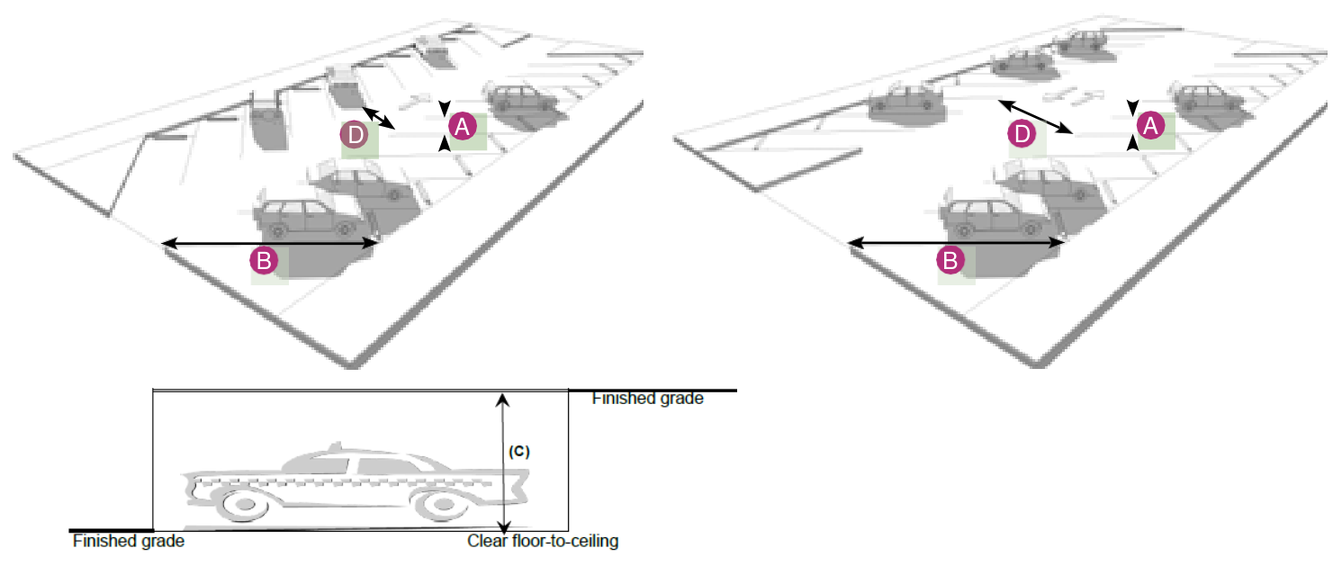
§ 8.1.12Limitations, Location, Use of Facilities
Shared Parking for Off-Site Use:
Parking may be used by onsite or offsite users. Parking may not be the primary use of any property unless it is approved as such with a zoning permit where allowed.
Front Yard Parking Restricted and Residential Driveways:
Parking spaces in all residential zoning districts shall be located to the side or rear of the principal residential structure. Parking spaces shall not be located within a front yard setback except within a driveway and located to the side or rear of the principal residential structure.
Notwithstanding the above paragraph, parking spaces may be located within a driveway in front of garages that have been converted to habitable space.
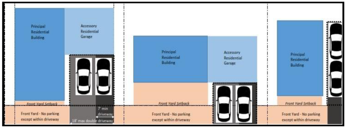
The provisions of this subsection shall not be applicable during such times as when the winter parking ban pursuant to Section 20-56 of the Code of Ordinances is in effect.
Residential driveways shall be a minimum of 7 feet in width or consist of two 1.5’ driveway strips made of pavement or pervious pavement. The maximum width for single or shared access driveways shall be 18’ except where a physical barrier taller than 6” (other than a structural column) exists along one side of the parking stall. In such cases, the maximum width may be increased by 1’. Where such a physical barrier exists along both sides of the parking stall, the maximum width may be increased by 2.’ In a residential district, driveways and parking areas shall be set back a minimum of 5’ from side and rear property lines. Driveways that have a slope of 5% or greater (towards the right of way) shall be made of a solid surface including conventional pavement, pavers or pervious pavement.
Availability of Facilities:
Required parking pursuant to this Article shall be available for parking of operable passenger vehicles used by residents, customers and employees only, and shall not be used for the storage or display of vehicles or materials. The distribution of parking spaces for any and all individual uses will be required to be arranged in such a way as to ensure optimal access and use by the patrons of such use(s).
§ 8.1.13Parking for Disabled Persons
Parking spaces for disabled persons in all Parking Districts shall comply with current the Americans with Disabilities Act guidelines and shall be at least eight feet (8’) wide with an adjacent access aisle at least five feet (5’) wide. Parking access aisles shall be part of an accessible route to the building or facility entrance. Accessible parking spaces shall be designated as reserved for the disabled by a sign showing the symbol of accessibility. Painting of the paved area for the dedicated parking spaces alone shall not be sufficient as the sole means of identifying these spaces.
§ 8.1.14Stacked and Tandem Parking Restrictions
Except as otherwise provided below, all parking facilities in all Parking Districts shall be designed so that each motor vehicle may proceed to and from the parking space provided for it without the moving of any other motor vehicle. The requirements for minimum or maximum spaces continue to apply for stacked and Tandem parking.
Stacked or valet parking may be allowed if an attendant is present to move vehicles. If stacked parking is used for required parking spaces, a written guarantee must be filed with the City ensuring that an attendant will always be present when the lot is in operation.
Tandem Parking shall be allowed for all dwelling units (whether attached or detached). Each dwelling unit may have a pair of tandem parking spaces, however any pair of tandem parking spaces shall not serve more than one dwelling unit . Tandem parking shall also be allowed for dedicated employee-only parking where signed as such.
Stacked parking shall be allowed for single-family detached dwelling units and Accessory Dwelling Units with no requirement for an attendant to be present.
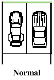
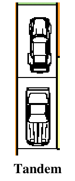
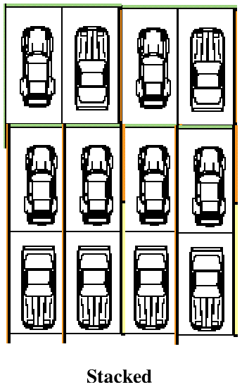
§ 8.1.15(Reserved)
§ 8.1.16Transportation Demand Management
Purpose: This section requires the implementation of a Transportation Demand Management (TDM) Program for certain projects for the purpose of advancing the goals of the City’s land use and transportation plans, and promoting public health, safety, welfare, and protection of the environment by:
Reducing parking demand;
Reducing car ownership;
Increasing transit use and non-motorized travel;
Applicability:
A Transportation Demand Management Program shall be required for all projects in any Parking District involving any one or more of the following:
Table 8.1.16-1 Transportation Demand Management Program Required
| Project Type | Applicable Projects | Affordable Projects | Small Projects |
|---|---|---|---|
| • Creation of 10 or more dwelling units • A non-residential or Mixed Use development with a building footprint of eight thousand (8,000) sq.ft. or more; or the creation of fifteen thousand (15,000) sq.ft. or more of gross floor area | Projects involving one or more “Applicable Projects” and that also contain at least 75% of dwelling units meeting or exceeding the affordability criteria of Article 9, Inclusionary & Replacement Housing, or housing rented to tenants receiving federal or state rental assistance including buildings within a Planned Unit Development that meet or exceed the above criteria | Creation of five (5) to nine (9) dwelling units | |
| Applicable TDM Sections | All provisions of Sec. 8.1.16 (c) | Sec. 8.1.16 (c) 1. and Sec. 8.1.16 (c) 4. only | Sec. 8.1.16 (c) 3. b. only |
For projects that were issued permits with TDM requirements prior to January 31, 2023, an administrative permit amendment may be requested to align the permit with the TDM requirements set forth herein.
Transportation Demand Management (TDM) Program: A TDM Program shall include each of the following elements at a minimum:
Outreach and Education:
Designation of a Transportation Coordinator who directly, or indirectly through membership in a Transportation Management Association, shall be responsible for each of the following:
Prepare and always make available to all residents and employees informational and educational materials regarding available TDM strategies and opportunities for increased use and participation;
Preparation and dissemination of an annual travel survey of all residents and employees; and,
Record-keeping and reporting to City upon request of all TDM activities offered and rates of participation (including parking utilization if applicable).
TDM Strategies: In addition to compliance with the on-site Bicycle Parking requirements found in Article 8, Part 2, each TDM Program must incorporate TDM strategies to minimize the amount of parking demand associated with the project. At a minimum, a TDM Program shall select no less than two (2) of the following TDM strategies, which shall be selected and filed with the Administrative Officer on an annual basis:
Maintain an ongoing and active membership in a Transportation Management Association (TMA);
Provide GMT Transit passes to all residents and employees at a minimum discount of 50%;
Provide a free car share membership to all residents and employees;
Provide a free bike share membership to all residents and employees;
If not already provided through a TMA membership, provide residents and employees with a shuttle service, guaranteed ride home program, or ride to a nearby transit center.
Parking Management: Where on-site or off-site parking is also made available:
Conduct parking utilization studies at least annually for a period of 7 years from receipt of a Certificate of Occupancy;
With the exception of permanently affordable housing units, the cost of parking shall be un-bundled from all residential and non-residential leases and deeds and made available at a market rate;
Where parking spaces are made available to off-site users, parking spaces may be made available by a renewable lease, provided the term of any lease does not exceed one (1) year; and,
Priority parking spaces: when on-site parking is provided, the following must be located in closest proximity to a primary building entrance and/or public street frontage:
ADA Accessible spaces;
Bicycles, scooters, and motorcycles spaces;
Car-share: where 1 space must be offered for projects with 20 or more residential units, subject to an agreement with a car-share provider; and,
Carpool and/or Vanpool vehicles: where more than 20 spaces are available for non-residential uses. In such cases, 5 spaces or 5% of the parking spaces on site, whichever is less, must be reserved for carpool/vanpool use before 9:00 AM on weekdays.
TDM Agreement: Each TDM Plan shall include a signed commitment to and acknowledgement of each of the following on a form provided by the Administrative Officer:
Commitment to ongoing implementation of the TDM requirements as set forth above;
Acknowledgement that the project has no claim to the ongoing availability of nearby on-street public parking, and that, as is the case with other on-street public parking, the City retains the right to charge for, restrict or remove such on-street parking at any time;
Acknowledgement that failure to maintain transportation demand management as required above is a violation of this ordinance, and understanding that, pursuant to Sec. 2.7.8 of this ordinance, no zoning permit or certificate of occupancy may be granted until any such violation has been remedied; and,
Commitment to notify any subsequent owners and tenants in writing of their obligations under this section as part of any purchase and sale and/or lease agreements.
Review and Enforcement: The Administrative Officer shall be responsible for determining compliance with the TDM Program requirements as set forth above, and ongoing implementation shall be included as a condition of any discretionary or administrative permit required for development subject to the conditions of this Section.
Failure to maintain a TDM Program as required above shall be a violation of this ordinance, and pursuant to Sec. 2.7.8 of this ordinance no zoning permit or certificate of occupancy may be granted without a TDM Program in effect.
Guidelines regarding compliance with these TDM requirements shall be developed and provided to applicants by the Administrative Officer.
Part 2Bicycle Parking
§ 8.2.1Intent
It is the intent of this subpart to:
Ensure the provision of parking spaces that are designed for bicycles and to ensure that bicycle parking needs of new land uses and development are met, while ensuring bicycle parking spaces are designed and located in a consistent manner. Provide bicycle access to employment, commercial destinations, and other transportation alternatives;
Provide safe, convenient, and adequate bicycle parking facilities that:
Meet the demands of the use of the property;
Reduce hazards to pedestrians;
Enhance the visual quality of the city;
Reduce the adverse impacts associated with the bicycle parking, which includes bicycles parked on parking meters, signs, trees, etc; and,
Encourage the use of bicycles which has the effect of reducing traffic congestion, influencing modal split, and increasing the safety and welfare of residents and visitors to the city.
§ 8.2.2Applicability
Bicycle parking requirements as set forth in this subpart shall apply to new development, changes in land use, and changes to a structure that cause an increase or decrease of 25% or greater in gross floor area, seating capacity, or number of dwelling units.
§ 8.2.3Joint Use of Bicycle Parking Facilities
Required bicycle parking spaces for two (2) or more adjacent uses or structures may be satisfied by the same parking facilities used jointly, provided that such right of joint use and maintenance is evidenced by a deed, lease, contract, reciprocal easement, or similar written instrument establishing the joint use, and that the facilities are within 200 feet of the building or parcel housing the use.
§ 8.2.4Bicycle Parking Requirements
Bicycle parking for all uses and structures in all Parking Districts shall be provided in accordance with Table 8.2.4-1.
Where no requirement is designated, and the use is not comparable to any of the listed uses, bicycle parking requirements shall be determined by the DRB upon recommendation of the city’s bicycle and pedestrian planner based upon the capacity of the facility and its associated uses.
When the calculation yields a fractional number of required spaces, the number of spaces shall be rounded to the nearest whole number.
Where bicycle parking is required, the minimum number of bicycle parking spaces provided at each site shall be two (2), not including long term parking.
Bicycle parking that meets the requirements for both long term and short term bicycle parking may contribute to the minimum requirement of one type or the other but not both.
Table 8.2.4-1 Bicycle Parking Requirements
| Specific Use | Long Term Spaces | Short Term Spaces | |
|---|---|---|---|
| Per Square Feet of Gross Building Area, except as noted otherwise | |||
| RESIDENTIAL | |||
| Household Living | Multi unit | 1 per 2 bedrooms | 1 per 10 units |
| Group living | Elderly housing | 1 per 10 units | 1 per 10 units |
| Fraternity, sorority, & dormitory | 1 per 3 residents | 1 per 6 residents | |
| Temporary lodging | Hotel, motel, bed & breakfast, boarding house, campground | 1 per 20 rooms/sites | 2 per 20 rooms/sites |
| COMMERCIAL | |||
| Office | 1 per 5,000 sq. ft. | 1 per 10,000 sq. ft. | |
| Medical, dental | 1 per 5,000 sq. ft. | 1 per 8,000 sq. ft. | |
| Retail sales and service | 1 per 12,000 sq. ft. | 1 per 2,000 sq. ft. | |
| Auto, boat, motorcycle related sales, service and retail | 1 per 30,000 sq. ft. | 1 per 10,000 sq. ft. | |
| Restaurants, bars, taverns | 1 per 1,000 sq. ft. | Per 500 sq. ft. of seating space | |
| INDUSTRIAL | |||
| Industrial, manufacturing, production, and warehousing | 1 per 20,000 sq. ft. | 1 per 25,000 sq. ft. (at least 2 per public entrance) | |
| PERMITTED PUBLIC/INSTITUTIONAL USES | |||
| Colleges or Universities | Excluding dormitories | 1 per 15,000 sq. ft. | 1 per 1,000 sq. ft. |
| Daycare, except home | 1 per 20,000 sq. ft. | 1 per 10,000 sq. ft. | |
| Schools | Grades 2-5 | 1 per 20,000 sq. ft. plus 1 per 10 of student capacity | 2 per classroom |
| Grades 6-12 | 1 per 20,000 sq. ft. plus 1 per 10 of student capacity | 4 per classroom | |
| Community Services | Museums, aquariums, libraries, community centers, municipal buildings, post office | 1 per 20,000 sq. ft. | 1 per 1,500 sq. ft. |
| Medical Center | Excluding medical or dental offices | 1 per 10,000 sq. ft. | 1 per 20,000 sq. ft. |
| Worship, places of | 1 per 20,000 sq. ft. | 1 per 20 seats | |
| Recreation, government owned | Parks | Per DRB review | 1 per 10 daily users |
| OTHER | |||
| Terminal | Taxi/Bus/Passenger/Ferry | As determined during Site Plan Review by DRB | As determined during Site Plan Review by DRB |
| Parking | Parking lot, garage; public or private | 1 per 20 automobile spaces (minimum of 6) | 1 per 10 automobile spaces (minimum 6)- to be located within view of entrance |
§ 8.2.5Limitations
No bicycle parking spaces required by this standard shall be rented or leased to employees or residents residing at the location at which bicycle parking is required; however, a refundable deposit fee may be charged. This does not preclude a bike parking rental business.
Short term bicycle parking may be provided within the public street right-of-way. Provision of bicycle parking within the right-of-way requires an encumbrance permit issued at the discretion of the City Council with recommendation from the Department of Public Works.
§ 8.2.6Location & Design Standards
All bicycle parking facilities shall be installed in accordance with the Association of Pedestrian and Bicycle Professionals’ “Bicycle Parking Guidelines.” (Revision 1.0. September 2015)
Short term bicycle parking or a sign leading thereto shall be visible from the main entrance of the structure or facility.
Short term bicycle parking shall be as convenient to cyclists as auto parking.
Short term bicycle parking may be provided within the interior of a building. In such cases, the bicycle parking must be located such that it is immediately apparent and accessible to the public, such as within the front lobby. Outdoor directional signage shall indicate the availability of such parking indoors.
Bicycle parking facilities such as bicycle racks and lockers shall provide sufficient security from theft and damage. Bicycle racks shall be securely anchored to the ground, shall allow the bicycle wheel and frame to be locked to the rack, and shall be in a location with sufficient lighting and visibility.
Bicycle parking facilities shall be visually compatible and of a design standard consistent with their environment and the development standards of Art 6.
Required bicycle parking spaces shall be of a sufficient dimension to accommodate a full-sized bicycle, including space for access and maneuvering.
The surfacing of bicycle parking facilities shall be designed and maintained to be clear of mud and snow.
Bicycle parking facilities shall be kept in place and maintained for year-round use.
Covered bicycle parking facilities are encouraged whenever feasible.
Existing bicycle parking may be used to satisfy the requirements of this section provided the rack design is consistent with Association of Pedestrian and Bicycle Professionals’ “Bicycle Parking Guidelines.”
§ 8.2.7Payment in Lieu
In instances wherein the total requirement for short term bicycle parking cannot be accommodated onsite, the applicant may make a payment to the Department of Public Works to construct short term bicycle parking facilities in the public street right-of-way. The payment shall be sufficient to cover the cost of the bicycle parking equipment (i.e. such as racks), installation, and 5 year estimated maintenance costs. The short term bicycle parking is met or as much as may be reasonably accommodated in the public right-of-way as determined by the Department of Public Works, whichever is less. The option to provide an in lieu payment shall be at the discretion of the Director of public Works or their designee and will be based on evidence that short term bicycle parking cannot be accommodated onsite. Alternatively, within the right-of-way per Sec. 8.2.5 (b).
§ 8.2.8Long Term Bicycle Parking
Long term bicycle parking shall:
Protect bicycles from the weather;
Provide secure storage that prevents theft of the bicycle and accessories; and,
Be located in a well lit area.
Long Term bicycle parking requirements can be met in any of the following ways:
A bicycle storage room;
Bicycle lockers, pods, or lids;
Lockable bicycle enclosure; or
By certifying to the city’s bicycle and pedestrian planner that employees may store their bicycles within their workspace and that residents may store their bicycles within their dwelling unit.
When long term parking is required, showers and changing facilities for employees shall be required in accordance with Table 8.2.8-1, except for parking garages, parking lots, and residential units, which are exempt from the requirements of this section. Shower and changing facilities shall be provided onsite or through an agreement for offsite use.
Table 8.2.8-1 Shower and Changing Facilities
| Required Long Term Spaces | Minimum Number of Required Shower and Changing Facilities |
|---|---|
| 1-4 | 1 |
| 5-10 | 2 |
| 11-20 | 3 |
| 21+ | 4 plus one for each additional 15 Long Term spaces or part thereof |
§ 8.2.9Waivers from Bicycle Parking Requirements
Requests for reductions to bicycle parking requirements shall be made and documented separately from requests made for reductions in the automobile parking requirements.
The requirements of Sec. 8.2.5 may be reduced upon approval of the DRB based upon recommendation of the city’s bicycle and pedestrian planner to the extent that the applicant can demonstrate the regulation is unnecessarily stringent due to:
The characteristics of the use, structure, or facility makes the use of bicycles unlikely;
The characteristics of the site or area preclude the installation of bicycle parking; and/or,
Results from a documented survey of bicycle parking use in similar situations.
For reductions granted due to the characteristics of a site or area, applicants must mitigate the loss of bicycle parking through contribution into the capital fund. The amount shall be equal to the cost required for installation of required bicycle parking.
Part 3Institutional Parking Plans
§ 8.3.1Intent
It is the intent of this part to:
Ensure that city streets in nearby neighborhoods are not unfairly burdened by parking demands from post-secondary educational or medical institutions; and,
Recognize the unique ability of institutions to manage their own parking resources in a comprehensive and creative way.
§ 8.3.2Applicability
Each post-secondary educational or medical institution within the Institutional district shall provide off-street parking and loading facilities consistent with its needs according to the standards specified in this Article.
In order to accomplish the intent of this Part, each such institution, either individually or collectively, shall prepare, maintain, and monitor a comprehensive parking management plan for their respective campus or institution.
§ 8.3.3Institutional Parking Management Plans
An Institutional Parking Management Plan shall include the following:
A narrative that outlines how the proposed parking management plan addresses the specific needs of existing and anticipated development and effectively satisfies the intent of this Article and the goals of the Municipal Development Plan.
Information specifying the current and anticipated numbers over the ensuing 5 year period for: number of students of all academic programs (full-time, part-time, commuter, on-campus, off-campus, and continuing education), faculty and staff (full-time and part-time), patients and visitors being served by the institution;
An analysis of the anticipated parking demand by user group, time of day and/or demand by use and parking provided to meet that demand currently and anticipated over the ensuing five-year period;
Information specifying the number and composition of the institution’s vehicle fleet, where these vehicles are regularly kept, and designated “service vehicle-only” parking;
Strategies used to reduce or manage the demand for parking which may include but are not limited to:
Policies which restrict and/or prohibit the bringing of vehicles to the institution for various users or groups of users;
A telecommuting program;
Programs and employee and student subsidies to encourage the use of public transit, car-share, walking, and bicycling;
Implementation of a shuttle service system serving off-site parking;
Implementation of a parking permit system to allocate parking throughout the system; and,
Implementation of a monitoring, compliance and enforcement system to measure and ensure compliance with the plan.
§ 8.3.4Review and Approval of Institutional Parking Management Plans
Plan Approval
Such a plan shall require review and approval by the DRB, after consultation with the planning commission, and after a public hearing. In order to approve a proposed Institutional Parking Plan, the DRB shall find:
the proposed Institutional Parking Plan adequately serves existing and proposed development and user groups by the institution(s);
the proposed Institutional Parking Plan effectively meets the intent of this Article and the goals of the municipal development plan.
Such a plan, if approved by the DRB, shall be applicable for a period not to exceed five (5) years, and may be amended as necessary pursuant to the requirements of this Part. The DRB may approve one extension of up to six (6) months so long as the extension is requested prior to the Plan’s expiration.
Annual Reporting
The institution shall provide a report annually to the administrative officer regarding the implementation and performance of the approved plan and any significant changes in the size or makeup of user groups, parking supply, travel by mode for user groups, availability and utilization of parking management strategies, anticipated development activity, and any other conditions impacting supply and/or demand.
Failure to submit such annual report shall be a violation of this ordinance.
§ 8.3.5Review and Approval of Applications for Future Development
Pursuant to Sec. 2.7.8 of this ordinance, no zoning permit or certificate of occupancy may be granted for projects which will impact the supply of or demand for parking without an approved or amended plan. Projects such as routine maintenance, repair, equipment installation, walkways, landscaping, installation of public art, and the like are exempt from this requirement so long as they do not result in a change of use, habitable area, or parking facilities upon which a plan’s supply and demand calculations are based.
In reviewing any application for development from a post-secondary educational or medical institution within the Institutional district, the DRB shall find that the proposal is included and addressed within an approved Institutional Parking Plan and that the proposal is consistent with the approved Plan.
Any development proposed by a post-secondary educational or medical institution within the Institutional district that is not included and addressed within an approved Institutional Parking Plan shall only be approved pursuant to the underlying parking requirements of Parts 1 and 2 of this Article and upon approval of an amendment to an approved plan.
In addition to application requirements specified in Article 3 and this Part, the Institutions(s) shall submit an amendment to an approved plan that addresses how the development is consistent with or modifies supply and demand calculations and applicable TDM strategies contained in the approved Plan. Amendments may be in the form of an addendum that addresses any relevant sections of an approved Plan. The amendment shall be approved by either the administrative officer or DRB based on the underlying application type. Such developments shall be reflected in subsequent annual reports submitted to the administrative officer, and future plan updates.
Article 9Inclusionary and Replacement Housing
§ 9Introduction
This Article of the Burlington Comprehensive Development Ordinance establishes requirements for including affordable housing units within certain residential developments, and ensures the replacement of housing units that may be lost as a result of redevelopment.
Part 1Inclusionary Zoning
§ 9.1.1Intent
The intent of these regulations is:
To meet the specific mandates of 24 V.S.A. Chapter 117 related to housing opportunities for all of Vermont’s citizens, particularly for those citizens of low or moderate income;
To ensure the provision of housing that meets the needs of all economic groups by precluding construction of only market rate housing on the limited supply of available land within the City;
To improve the quality of life for all residents by having an economically integrated housing supply throughout the City; and,
To prevent overcrowding and deterioration of the limited supply of affordable housing, and thereby promote the public health, safety and general welfare.
§ 9.1.2Authority
These regulations are enacted under the authority of 24 V.S.A. Chapter 117.
§ 9.1.3Inclusionary Units, General Description
Inclusionary units shall include those units in a covered project, which are regulated in terms of:
Selling price or rent level;
Marketing and initial occupancy; and,
Continued requirements pertaining to re-sale, rent or carrying cost increases, as specified in this article.
§ 9.1.4Miscellaneous Definitions
“Affordable” shall refer to housing in which the total cost of the housing, including principal, interest taxes and insurance and condominium association fees, if owned housing, or the total cost of the housing, including rent, utilities and condominium association fees, if rental housing, is not more than thirty per cent (30%) of the household’s gross annual income.
“Area Median Income (AMI)” shall refer to the income for the Burlington Metropolitan Statistical Area (MSA) set forth in or calculated by regulations promulgated by the United States Department of Housing and Urban Development (HUD), pursuant to Section 8 of the Housing Act of 1937, as amended by the Housing and Community Development Act of 1974. The area median income (AMI) shall be calculated based on all households in the geographic area. The median is the middle value when all are arranged from highest to lowest. The AMI shall be updated annually, as of the effective date of the revised AMI provided by HUD, and shall be used until the next annual revision of AMI by HUD where AMI is applicable in the general requirements under this article.
“Campus” shall mean the grounds and buildings of a post-secondary educational institution.
“Carrying charges” refer to costs associated with housing co-operatives.
“Certificate of Inclusionary Housing Compliance” shall refer to a certificate issued by the Manager of the Housing Trust Fund, which certificate provides legal assurance that a developer's obligations under this article are being satisfied.
“Exclusive Use by Students” shall mean that fewer than 5% of beds within an off-campus student housing project are leased to individuals not enrolled with the institution.
“Housing Trust Fund (HTF)” shall refer to a special revenue account established by the Burlington City Council for purposes related to the creation, promotion, and preservation of long-term affordable housing for very low, low, or moderate income households.
“Housing Trust Fund (HTF) Administrative Committee” shall refer to an administrative committee consisting of the Housing Trust Fund Manager, an appointee of the City Council President and a designee of the Mayor responsible for the administration of the HTF by resolution of the City Council.
“Housing Trust Fund Manager” or “Manager” shall be the Director of the City’s Community and Economic Development Office, unless otherwise designated by the City Council by resolution.
“Off-Campus Housing Cost” shall refer to the estimated cost of off-campus housing per student per academic year as calculated each year by the post-secondary educational institutions for the purposes of financial aid awards.
“Off-Campus Student Housing” shall mean housing projects developed and managed by a post-secondary educational institution, or are developed, managed, or leased in partnership between the institution and a private developer, for the exclusive use and occupancy by that institution’s students.
“Metropolitan Statistical Area (MSA)” shall mean a geographic entity delineated by the federal Office of Management and Budget for use by federal statistical agencies. Metropolitan statistical areas consist of the county or counties associated with at least one urbanized area of at least 50,000 population, plus adjacent counties having a high degree of social and economic integration with the core as measured through commuting ties. The Burlington Metropolitan Statistical Area consists of Chittenden, Franklin, and Grand Isle counties.
§ 9.1.5Applicability
This ordinance provision shall apply to any development of five or more residential units in a single structure. Multiple developments or projects by the same applicant or responsible party within any consecutive twelve (12) month period that in the aggregate equal or exceed the above criteria shall be subject to these regulations.
Except as otherwise provided in this ordinance, these regulations shall apply in the instances specified below.
The creation of five (5) or more residential units through new construction and/or substantial rehabilitation of existing structures, including the development of housing units utilizing development provisions other than those specified in Sec 9.1.5 (b).
Where units are created using the Residential Conversion criteria pursuant to the provisions of Art 4, Sec 4.4.5, this article shall be applicable when at least ten (10) or more dwelling units are created.
An applicant may elect to be subject to the provisions of this article when developing fewer than 5 residential units in a single structure, or when new units are added to existing units notwithstanding the applicability in the first paragraph of this section.
Off-campus student housing projects, created through new construction and/or substantial rehabilitation of existing structures, for exclusive use by students.
§ 9.1.6Exemptions
Exempt from the requirements of this article are:
On campus projects that are located within an Institutional (I) zoning district that are for the exclusive residential use and occupancy by that institution’s students;
Those dwelling units in a covered project that are produced as “replacement units,” pursuant to Article 9, Part 2 and which do not produce any net new units; and,
Projects created using the Senior Housing Development Bonus pursuant to the provisions of Article 4.
§ 9.1.7Certificate of Inclusionary Housing Compliance
Notwithstanding any other provision of this ordinance, no certificate of occupancy for a project covered by this chapter shall be granted unless and until a Certificate of Inclusionary Housing Compliance has been issued by the Housing Trust Fund Manager.
§ 9.1.8Inclusionary Units, Rental and Sales
For covered projects in which units are offered for rent or sale, a base of fifteen percent (15%) of all of the dwelling units in the project, graduated as specified in Table 9.1.8-1, shall be designated as inclusionary units
This includes any covered project where units are offered for sale via the conveyance of a deed or share for individual units, including fee simple ownership, condominium ownership and cooperative ownership.
Table 9.1.8-1 Inclusionary Zoning Percentages
| If the average sale and rental price of project units is affordable to a household earning: | The percentage of units which are subject to rent and sales prices as per Sec. 9.1.9 and are subject to marketing and continued affordability provisions (Sec. 9.1.15 and Sec. 9.1.16) shall be at least: |
|---|---|
| Less than 139% of AMI | 15% |
| 140%-179% of AMI | 20% |
| Development in any Waterfront district (RM-W, RL-W, NAC-CR and FD5 west of Battery St) or 180% of AMI and above in any other district | 25% |
| Off-campus student housing | 15% of total beds |
§ 9.1.9Calculating Percentage of Inclusionary Units
Covered projects shall meet the percentage requirements for inclusionary units as specified above, calculated as follows:
Using the units/acre allowed for a covered project (i.e. 46 in the RH, 24 in the RM or 5.5 in the RL), the total number of units proposed is multiplied by the required percentage of Inclusionary units (15%, 20% or 25%, depending on the rent/selling price of the units).
For off-campus student housing projects, the percentage of inclusionary beds shall be calculated based on the total project bed count.
When the calculation yields a fractional number of required inclusionary units, the number of units shall be rounded up to the nearest whole number if the fractional number is .50 or greater, and down to the nearest whole number if the fractional number is .49 or less.
(Example: a moderately-priced, multi-family housing development with no commercial space on a one-acre lot in the RH would be able to provide 46 units on-site. Of those, 46 x .15 (15%) = 6.9 (rounded up to 7) units of a total of 46 must be inclusionary units. If the applicant can only provide 20 of such moderately priced units on the site, 15% of the 20 units, i.e. 20 units x .15 = 3 units shall be Inclusionary units).
§ 9.1.10Income Eligibility
Except as provided for in the second paragraph below, Inclusionary Units required under this Article, shall be marketed for purchase or rent to households earning less than the AMI for the Burlington Metropolitan Statistical Area, adjusted for household size, as specified in Sec 9.1.12. The AMI shall be determined per the definition in Sec. 9.1.4. Inclusionary units occupied by households receiving Section 8 vouchers can be presumed to satisfy the income eligibility requirements of this section.
§ 9.1.11Calculating Rents and Selling Prices
The following provision shall apply to the calculation of rents, selling prices and carrying charges, and to the relationship between unit size and household size:
Inclusionary rental units shall be rented at a price which is affordable for a household with an annual income that is sixty-five percent (65%) of AMI adjusted for household size;
Inclusionary units for sale, including cooperative units and the carrying costs associated therewith, shall be sold at a price which is affordable for a household with an annual income that is seventy percent (70%) of AMI adjusted for household size;
In calculating the rents or carrying charges of inclusionary units, the following relationship between unit size and household size shall apply:
| Unit Size | Household Size Equivalent |
|---|---|
| Efficiency Units: | 1 Person Household; |
| One-Bedroom Units: | 1.5 Person Household (average of one and two-person household incomes); |
| Two-Bedroom Units: | 3 Person Household; |
| Three-Bedroom Units: | 4.5 Person Household (average of four and five-person household incomes); |
| Four-Bedroom Units: | 6 Person Household. |
With respect to inclusionary units offered for sale, prices will be calculated on the basis of:
An available fixed-rate thirty-year mortgage, consistent with a “blended rate” for Burlington banks plus the Vermont Housing Finance Agency as determined and declared semi-annually (January and July) by the Housing Trust Fund Manager. A lower rate may be used in calculating affordable prices if the developer can guarantee the availability of a fixed-rate thirty-year mortgage at this lower rate from the Vermont Housing Finance Agency for all of the required inclusionary units;
A down payment of no more than five percent (5%) of the purchase price;
Annual property taxes; and
Homeowner insurance, homeowner association fees or condo fees. Homeowner association fees shall be calculated in the same manner as the fees for the market units in the same development. The Housing Trust Fund Manager may modify the amount used in the calculation of condominium fees for the determination of the initial sale price limit for condominium inclusionary units. This modification shall be for the purposes of removing costs, such as plowing, maintenance, insurance and electricity, which are not included in the calculation of the sale price limit for single family inclusionary units; and
With respect to off-campus student housing projects:
At least 15% of beds shall be provided at or below 80% of that institution’s annual estimated off-campus housing cost.
§ 9.1.12Additional Density and Other Development Allowances
All covered projects shall be entitled to increases in the development allowances of the underlying zoning district in accordance with the provisions of this section.
Any covered project shall be entitled by right to an increase in the maximum lot coverage density/intensity, and, where applicable, height allowed for the lot(s) on which the project is located when all required Inclusionary Units are constructed on the same lot, or lots subject to Article 11 Planned Development. Calculations for these entitlements shall be based on the following table:
| Zoning District | Maximum FAR | Height | Maximum Lot Coverage |
|---|---|---|---|
| RH, RC | 2.0 FAR | 5 Stories, 62 ft. 12’ height set back 10’ along street facade ¹ | 90% |
| RM | 1.75 FAR | 4 Stories, 50 ft. | 65% |
| RL | 1.5 FAR | 4 Stories, 50 ft. | 55% |
| FD6, FD5 | 0.5 FAR | 100% | |
| NMU, NAC, NAC-R | 0.5 FAR | 12’ height set back 10’ along street facade | 92% |
| NAC-CR | 0.5 FAR | 12’ height set back 10’ along street facade | 72% |
| E-LM-SEID | 0.25 FAR | n/a | n/a |
1. In the Neighborhood Mixed Use zones an additional 12 feet of building height shall be allowed by right only for an additional 5% of inclusionary housing units provided in excess of the minimum requirements of Sec. 9.1.8.
The allowances provided for herein may be declined at the option of the applicant;
With the approval of the DRB, units added to a project as market rate units may be substituted by nonresidential uses wherever such nonresidential uses are otherwise permitted in the district where the project is located. Approved substitution for nonresidential uses shall occur at the following rate: 1 market-rate dwelling unit = 1,500 square feet nonresidential space
All provisions of Sec. 9.1.8 through 9.1.11 shall apply, without exception, to any inclusionary units that are constructed.
§ 9.1.13Off-Site and Payment in Lieu Options
In no event may a covered project which benefited from additional density or development allowances per Sec. 9.1.12 that has been constructed and occupied utilize the following options.
Off-Site Option
The developer of a covered project may construct inclusionary units on a lot (or lots) within the City of Burlington other than that on which the covered project is located as determined by HUD’s Low- and Moderate-Income Summary Data as updated annually. The offsite option may be utilized by right per the following scenario:
In areas where less than fifty-one percent (51%) of the residents are below eighty percent (80%) AMI as determined by HUD’s Low- and Moderate-Income Summary Data, utilization of the off-site option shall not be allowed.
In all cases, utilization of the off-site option shall be subject to the following conditions:
The number of inclusionary units to be provided by the developer or by the developer’s designee through off-site development shall be equivalent to the number otherwise required by this Article;
No additional development provisions as outlined in Sec. 9.1.12 shall be granted to the development of units constructed off-site or to the project constructed on-site;
Off-site inclusionary units must be located within the City of Burlington;
All of the provisions of Sections 9.1.8 through 9.1.11 shall apply without exception to off-site inclusionary units under the provisions of this section; and,
The off-site option shall not apply to a project located within a waterfront zoning district or the South End Innovation District overlay (E-SEID), nor shall it apply to off-campus student housing projects as defined by this Article. For the purposes of this Sec. 9.1.13, “site” shall consist of all adjacent lots which are the subject of a PUD or other single development application.
Payment In-Lieu Option
The developer of a covered project may provide a payment in lieu to the Housing Trust Fund rather than construct inclusionary units on or offsite contingent on AMI as determined by HUD’s Low- and Moderate-Income Summary Data. The payment in lieu option may be utilized by right under the two following scenarios:
Covered projects located in a census block where more than fifty-one percent (51%) of the residents are below eighty percent (80%) AMI as determined by HUD’s Low- and Moderate-Income Summary Data may utilize the payment in lieu option subject to the following standards:
The payment in lieu fee shall be $35,000 per dwelling unit for projects containing 5-16 dwelling units.
The payment in lieu fee shall be $70,000 per dwelling unit for projects containing 17-49 dwelling units.
The payment in lieu fee shall be $85,000 per dwelling unit for projects containing 50 or more dwelling units.
A marginal fee approach shall be used in payment of the in lieu fees.
(Example: A 17-unit project would pay a total of $140,000 {$35,000 for each of the first two inclusionary units and $70,000 for the third inclusionary unit}.)
Covered projects located in a census block where less than fifty-one percent (51%) of the residents are below eighty percent (80%) AMI as determined by HUD’s Low- and Moderate-Income Summary Data may utilize the payment in lieu option per the following standards:
The payment in lieu fee shall be $35,000 per dwelling unit for projects containing 5-16 dwelling units.
The payment in lieu fee shall not be allowed for projects containing 17 or more dwelling units.
The payment in lieu option shall not apply to a project located within a waterfront zoning district or the South End Innovation District overlay (E-SEID). For the purposes of this Sec. 9.1.13, “site” shall consist of all adjacent lots which are the subject of a PUD or other single development application.
§ 9.1.14General Requirements for Inclusionary Units
All covered projects must comply with the requirements set forth below.
The bedroom mix requirements established in Section 9.1.14(a) do not apply when the ratio of the gross floor area of all inclusionary dwelling units to the total gross floor area of all dwelling units within the project exceeds the required percent of inclusionary units as established in Table 9.1.8-1, based on the project’s average unit sale and rental price (e.g. where at least 15.5 percent of a project’s residential gross floor area is composed of inclusionary units when the project’s average sale and rental price is affordable to a household earning less than 139% of AMI);
Rental inclusionary units within a covered project may “float” (as opposed to designating specific units). Owner-occupied inclusionary units within a covered project must be specifically designated. In either case, inclusionary units may be grouped together or distributed throughout a covered project;
Covered projects including both rental and owner-occupied dwelling units shall provide inclusionary units proportionate to the numbers of rental and owner-occupied dwelling units;
Inclusionary units may differ from the market units in a covered project with regard to interior amenities and gross floor area, provided that:
These differences, excluding differences related to size differentials, are not apparent in the general exterior appearance of the project’s units;
These differences do not include insulation, windows, heating systems, and other improvements related to the energy efficiency of the project’s units; and,
Inclusionary units are afforded the same opportunity for parking that the market units are afforded.
The floor area of the inclusionary units is not less than ninety percent (90%) of the average gross floor area of the market rate units within the project with the same number of bedrooms, except when the ratio of the gross floor area of all inclusionary dwelling units to the total gross floor area of all dwelling units within the project exceeds the required percent of inclusionary units as established in Table 9.1.8-1, based on the project’s average unit sale and rental price (e.g. where at least 15.5 percent of a project’s residential gross floor area is composed of inclusionary units when the project’s average sale and rental price is affordable to a household earning less than 139% of AMI).
When the gross floor area ratio described above is proposed, the minimum gross floor area of inclusionary units by bedroom count is as follows:
Studio: 350 sf
1 bedroom: 550 sf
2 bedroom: 750 sf
3 bedroom: 950 sf
4+ bedroom: 1,150 sf
Upon demonstration of inability to sell units to income eligible residents earning 70% of the AMI, the Manager of the HTF may extend income eligibility to allow priority in the sale of inclusionary units to households earning as much as AMI, adjusted for household size and to households residing in Burlington at the time that these units are offered for sale. In extending income eligibility, priority shall be given to the lowest income household who qualifies for purchase, all else being equal;
Except for household income limitations as set forth herein, occupancy of any inclusionary unit shall not be limited by any conditions that are not otherwise applicable to all units within the covered project unless required under federal law, e.g. local use of the Low Income Housing Tax Credit, or in conflict with the stricter bylaws of the designated housing agency; and
The final calculations for the number of inclusionary units shall be determined by the Manager prior to the issuance of the zoning permit. If there is any change in the project due to sales prices for these units that increases the number of inclusionary units required, such modifications shall be determined by the Manager and communicated to the administrative officer prior to the issuance of a certificate of occupancy for the covered project. The rental or sales price of the inclusionary units shall also be determined by the Manager prior to the issuance of a certificate of occupancy.
§ 9.1.15Marketing of Inclusionary Units
Any applicant developing a covered project shall adhere to the following provisions with respect to the initial offering of inclusionary units for sale or rental:
Trust Fund Notification.
The developer shall notify the Housing Trust Fund Manager, as defined in Section 18-403 of the Burlington Code of Ordinances, of the prospective availability of any inclusionary units at the time that the building permit is issued for such units in a covered project;
Trust Fund Option.
The Housing Trust Fund Manager, in consultation with the other members of the HTF Administrative Committee, shall then have an exclusive option for one hundred twenty (120) days to purchase each inclusionary unit offered for sale from the developer unless waived or assigned;
Trust Fund Waiver.
If the Housing Trust Fund Manager, in consultation with the other members of the HTF Administrative Committee or its designee, fails to exercise its option by failing to negotiate and sign a purchase and sale agreement for the inclusionary units, or if the Manager declares its intent not to exercise its option, the developer shall offer the units for purchase to households earning less than the AMI referenced in Section 9.1.11. If requested by the developer, the Housing Trust Fund Manager shall execute documents that may be recorded in the Burlington Land Records to evidence said waiver of the option;
Time of Closing.
Closing on inclusionary units purchased by the Housing Trust Fund Manager shall occur on or after the time of issuance of the certificate of occupancy. If the Housing Trust Fund Manager fails to close on these inclusionary units, the developer shall offer the unit for purchase or rent to households earning less than the AMI referenced in Section 9.1.11, adjusted for household size;
Transfer of Option.
On or before a purchase and sale agreement is executed between the developer and the Housing Trust Fund Manager, the Manager may assign the options specified in this section to any “designated housing agency,” as defined by the provisions of Article 5 of Chapter 18 of the Burlington Code of Ordinances, in which event it shall notify the developer of such assignment and the agency to which it has assigned the option, which agency shall deal directly with the developer, and shall have all of the authority of the Manager, as provided under this section.
Rentals.
In the case that the inclusionary units are being offered for rent rather than for sale, the Housing Trust Fund Manager shall also be notified in the manner prescribed by subsection (a) regarding Housing Trust Fund Notification, and the Housing Trust Fund Manager and developer shall cooperate in order to rent such units to individuals meeting the income guidelines of Sec 9.1. 11(a) or (h).
§ 9.1.16Continued Affordability Requirements
All covered projects shall comply with the following provisions to ensure continued affordability of inclusionary units provided under this article and units required to be continually affordable under Section 9.1.16.
99-Year Requirement.
All inclusionary units shall remain affordable for a period of no less than ninety-nine (99) years commencing from the date of initial occupancy of the units. Where a developer can establish that regulatory or other considerations make it impossible to provide the required inclusionary units if subject to the full extent of this requirement, the development review board may modify the duration of the period of continued affordability only to the extent necessary to render the development feasible;
Deed Restrictions.
Provisions to ensure continued affordability of inclusionary units shall be embodied in legally binding agreements and/or deed restrictions satisfactory to the City Attorney’s office, which shall be prepared by the developer, but which shall not be recorded or filed until reviewed and approved by the Housing Trust Fund Manager with such modifications as it may deem necessary to carry out the purpose of this article. Such review and approval shall be completed within forty-five (45) days following date of submission of such documents to the Manager. Failure of the Manager to respond within the forty-five (45) day period as set forth herein shall constitute approval of the documents;
Resale Restrictions.
Provisions to ensure continued affordability of inclusionary units offered for sale shall include a formula for limiting equity appreciation to an amount not to exceed twenty-five percent (25%) of the increase in the inclusionary unit’s value, as determined by the difference between fair market appraisal at the time of purchase of the property and a fair market appraisal at the time of resale, with such adjustments for improvements made by the seller and necessary costs of sale;
Rent Changes
Provisions for continued affordability of inclusionary rental units shall limit annual rent changes to the percentage change in the AMI within the Burlington MSA which shall become effective when approved by the Housing Trust Fund Manager. Further changes made necessary by hardship or other unusual conditions shall require the approval of the Housing Trust Fund Administrative Committee in writing;
Purchase Option
Provisions for continued affordability of inclusionary units shall provide that the Housing Trust Fund Administrative Committee or its designee shall have an exclusive option to purchase any owner-occupied inclusionary unit when it is first offered for resale for a period of one hundred twenty (120) days from the date on which the HTF Administrative Committee is notified of the availability of the unit; and,
Sublet Restrictions.
Provisions for continued affordability of inclusionary units shall prohibit subletting rental units for a price exceeding that which is affordable for a household with an annual income that is seventy percent (70%) of AMI consistent with the relationship between unit size and household size set forth in Section 9.1.11.
Off-Campus Institutional Student Housing.
For off-campus student housing projects, annual reporting by the institution or the developer to the Housing Trust Fund Manager shall verify continuing affordability of beds per Section 9.1.11 and continuing exclusive use by students. Upon written request by the Manager, applicable records as to continuing affordability and exclusive use by students shall be made available for review by the Manager.
§ 9.1.17Review of Proposal for Phasing
Proposals for projects to be constructed in phases shall be reviewed as a component of the initial project review and shall be included in any conditions of approval. A schedule setting forth the phasing of the total number of units in a covered project, along with a schedule setting forth the phasing of the required inclusionary unit(s), shall be presented for review and approval as part of the permitting process, for any develop-ment subject to the provisions of this article. If phasing is not included as part of the review process, no phasing of the inclusionary units shall be allowed.
If a covered project is approved to be constructed in phases, the requirements of the following section shall be applicable to each such phase.
§ 9.1.18Timeline for Availability/Phasing of Inclusionary Units for Issuance of Certificate of Occupancy
Inclusionary units shall be made available for occupancy on approximately the same schedule as a covered project’s market units, except that certificates of occupancy for the last ten percent (10%) of the market units shall be withheld until certificates of occupancy have been issued for all of the inclusionary units; except that with respect to covered projects to be constructed in phases, certificates of occupancy may be issued on a phased basis consistent with the conditions of approval set forth in Sec. 9.1.17.
§ 9.1.19Enforcement
Violations of this article shall be punishable as provided by Article 2 of this Ordinance.
§ 9.1.20Administration
The Housing Trust Fund Manager or designee shall monitor activity under this article and shall provide a report no less than every year to the city council, setting forth its findings, conclusions, and recommendations for changes that will render the program more effective. The report described above shall be presented to the city council at a legally warned public hearing.
Part 2Housing Preservation and Replacement/Demolition and Conversion
§ 9.2.1Intent
The intent of these regulations is:
To prevent the demolition and conversion to a nonresidential use of residential structures, many of which contain the city’s most affordable housing, and to maintain housing that meets the needs of all economic groups within the city;
To meet the specific mandates of 24 V.S.A. Section 4302 related to housing opportunities for all of Vermont’s citizens, particularly for those citizens of low or moderate income;
To support the retention of housing units in the city;
To preserve the residential character of neighborhoods in which the expansion of commercial, professional or educational activities is likely to eliminate existing housing units;
To offset the loss of housing by requiring replacement of housing units with new construction, conversion, or creation of assisted housing; and
To mitigate the impact on tenants displaced or threatened with displacement by demolition or conversion to a nonresidential use.
§ 9.2.2Applicability
Except as otherwise provided for in Section 9.2.10, this Part is applicable to the loss, demolition, or conversion to a nonresidential use of any housing unit in the City, including those demolished or declared unfit for habitation pursuant to any order, decision or other action of the city’s office of inspection services.
The conversion to a nonresidential use of any housing unit located on the ground floor of a building within a form or mixed-use zoning district shall be exempt from the provisions of this Part.
§ 9.2.3Approval
Notwithstanding any other provision of this ordinance, a person who proposes to remove, demolish, or to convert to a nonresidential use, any housing unit or units, in a zone where such a use is otherwise permitted, must obtain approval pursuant to all applicable provisions of this Ordinance.
In addition to the permit application requirements contained in Article 3, the applicant must also submit:
A statement certifying the number of housing units to be demolished or converted to a nonresidential use and the number of bedrooms existing within each of these units; and
A list containing the name of each tenant currently residing in the housing units to be demolished or converted, as well as verification by affidavit of compliance with the tenant notice requirements of this section.
§ 9.2.4Relocation Requirements; Notice and Relocation Costs
Prior to demolition or conversion, the owner shall:
Deliver to every tenant who occupies a housing unit slated for demolition or conversion, written notice to vacate the unit due to the owner’s intent to demolish or convert the unit to nonresidential use. The notice to tenants shall consist of the written notice that an owner is required to send by certified mail and by regular mail or hand delivery to the current tenants of any housing unit that is slated for demolition or conversion to a non-residential unit, announcing the owner’s intent to demolish or convert the unit to non-residential use, required under the Federal Uniform Relocation Act. As previously noted, this notice to tenants shall be sent certified mail, return receipt requested, and by either regular mail or hand delivery, and shall provide the tenant not less than one hundred eighty (180) days to vacate the rental unit. Evidence of receipt of notice to each affected tenant shall be required prior to approval by the development review board; and
Be responsible for paying the costs of relocation for any tenant(s) displaced from any housing unit demolished or converted to a nonresidential use. The costs that are included and the manner in which these costs are paid shall be identical to the relocation services that are required for displaced persons under Section 18-2 of the Burlington Code of Ordinances.
§ 9.2.5Housing Replacement Requirement
Notwithstanding the housing replacement in-and-of-itself does not require Development Review Board review and approval, an owner shall replace any housing units that are demolished or converted to a nonresidential use in accordance with and subject to all other applicable requirements of the Comprehensive Development Ordinance.
Replacement units may be provided by the owner or by the owner’s designee fully in any of the following ways:
New Construction. Construction of housing units within a new structure or new addition;
Residential Conversion. Conversion of all or a portion of a nonresidential building to residential use; or,
Subsidy. Creation of affordable housing units that have not been affordable to low-income households for the twenty-four (24) months preceding the date of application for conditional use approval.
An applicant may use any of the three methods to partially fulfill their replacement requirements, until the total requirement is met.
§ 9.2.6Replacement Unit Requirements
In addition to the foregoing, all replacement units must meet the following requirements:
Each unit shall have at least the same number of bedrooms as the unit being replaced;
These units must be provided within the City of Burlington;
These units must be ready for occupancy within eighteen (18) months of the date on which the conditional use approval is granted;
These units must remain assisted housing, as either rental housing or limited equity housing, for a period of not less than ten (10) years from the date of first occupancy;
These units must be sold or leased to prospective occupants who qualify as low-income households at the time they first lease or purchase the unit; and
These units shall contain at least the same number of accessible units being replaced,
or the number of accessible units that may otherwise be required by statute or regulation, or one accessible unit, whichever is greater.
§ 9.2.7Performance Bond
Owners must post a performance bond, letter of credit, or other security acceptable to the city attorney in an amount equivalent to the estimated cost of producing the replacement unit(s) required by this section, as determined by the administrative officer. Should the owner fail to provide the replacement unit(s) required within the time period specified in Section 9.2.6(c), the performance bond, letter of credit or other security shall be forfeited and the proceeds placed in the city’s Housing Trust Fund.
§ 9.2.8Adjustment for Increased Units
A downward adjustment of fifty percent (50%) in the number of years that replacement units must remain assisted housing may be approved by the Zoning Administrative Officer where the owner creates on site, through new construction or by the conversion of a nonresidential building to residential use, at least twice the number of housing units as the number being lost through units required by this Article.
§ 9.2.9Relief
Any owner who has applied for approval for demolition or conversion of a housing unit or units may apply to the DRB for relief from the housing replacement requirements of Section 9.2.5. Such relief may be a downward adjustment of up to fifty percent (50%) of the owner’s housing replacement obligation if the owner establishes to the board’s satisfaction that:
The literal interpretation and strict application of the housing replacement requirement would be impossible for the owner;
The requested relief would be consistent with the spirit and purpose of this Article; and
The requested relief does not constitute a grant of special privilege inconsistent with the limitations upon similar properties.
The DRB must make positive findings on each of the three (3) criteria above in order for any such adjustment to be valid.
§ 9.2.10Exemptions
This article shall not be applicable to:
A loss or change of use lasting less than one (1) year, where residential use is restored within that same one (1) year period, shall not be subject to the replacement requirements of this Part.
Any housing unit ordered demolished or declared unfit for habitation by the office of inspection services because of damage caused by civil commotion, malicious mischief, vandalism, natural disaster or other causes beyond the owner’s control shall not be subject to these regulations. Any housing unit ordered demolished, or declared unfit for human habitation, by the office of inspection services because of deterioration caused by neglect or deferred maintenance by the existing or prior owner(s) shall not be exempt. A determination of neglect or deferred maintenance shall be made by the administrative officer based on evidence of one or more of the following:
The deterioration of exterior walls or other vertical support;
The deterioration of roofs or other horizontal members;
The deterioration of external chimneys;
The deterioration or crumbling of exterior mortar;
The ineffective waterproofing of exterior walls, roofs and/or foundations; and/or
The existence of broken windows or doors.
In the event that any unit is demolished prior to obtaining conditional use approval, enforcement action in accordance with Article 2 shall commence immediately and the requirements of this Article shall apply in addition to any enforcement penalties.
The demolition, loss, or conversion to a nonresidential use of a single attached or detached housing unit or duplex that is occupied by the owner as his or her primary residence for the twelve-(12) month period preceding the date of application for approval. Nor shall this section be applicable in its replacement requirement to that portion of a multi-unit building of three (3) units or more that is occupied by the owner as his or her primary residence for the thirty-six-(36) month period preceding the date of application for approval. Any exemption allowed under this provision shall be void if the owner sells any of the applicable units within twenty-four (24) months of the date of approval; and,
The demolition or conversion of a housing unit that has rented, for the twenty-four (24) months preceding the date of application for conditional use approval, for a monthly charge in excess of twice the HUD Fair Market Rent for the Burlington MSA, adjusted for unit size.
Article 10Subdivision Review
§ 10Introduction
This Article of the Burlington Comprehensive Development Ordinance addresses the relocation of property boundaries, the creation of new lots, and the recording of plats in the City Land Records. The application and review process contained in this Article provides an overall framework for the consideration of such development proposals and all of their component parts. Often, but not always, land development that creates new lots also includes the placement of buildings and other site improvements. The specific regulation and review of such buildings and site improvements are can be found elsewhere in this ordinance.
§ 10.1.1Purpose
The city hereby adopts regulations governing the subdivision of lands to encourage the appropriate development of all lands in a manner which will promote the public health, safety, prosperity, comfort, convenience, efficiency, economy and general welfare; and to provide means and methods for the prevention, minimization and future elimination of land development problems which may presently exist or which may be foreseen.
In addition, this Article shall further the following specific aims:
To create an optimum urban environment by encouraging a rational pattern of development and the conservation of important natural areas, views and open space through implementation of the comprehensive master plan and insuring compliance with the applicable zoning bylaws;
To protect the public health and safety by the reduction of noise, air, and water pollution, protects access to adequate light and air, providing adequate access by emergency services and the creation of opportunities for daily physical activity;
To provide adequate access to public ways that will be safe and convenient for pedestrian, bicycle, and vehicular traffic;
To secure adequate and compatible provision for water, wastewater, stormwater and other utility services; street lighting, fire and police protection, recreational and educational facilities and similar municipal services; and any other requirements where necessary in a subdivision; and,
§ 10.1.2Nonretroactive Effect
The provisions of this Article shall not apply to any existing subdivision which has heretofore been approved by the city and the plat thereof recorded pursuant to the provisions of the subdivision regulations of the City of Burlington adopted April 1954, and as amended from time to time thereafter. In the event any such subdivision of said property shall be subject to the provisions hereof, no such prior approved subdivision shall be modified, changed or altered except by approval of the DRB in accordance with the provisions of this Article.
§ 10.1.3Platting Jurisdiction
Platting Authority:
The DRB shall be the official city platting authority responsible for the review and acceptance of all land subdivision plats. No plat of a land subdivision shall be entitled to be recorded in the city land records without the approval of the DRB or its designee inscribed thereon.
Use of plat:
The transfer of, sale of, agreement to sell, or negotiation to sell land by reference to or exhibition of, or other use of a plat of a subdivision that does not have final approval by the DRB or its designee inscribed thereon and is not recorded in the city land records shall be prohibited.
Erection of buildings:
No zoning or building permit shall be issued and no building shall be erected on any lot within a proposed subdivision unless and until the final subdivision plat has been approved by the DRB and properly recorded in the city’s land records.
§ 10.1.4Administrative Conference
Applicants are encouraged to discuss their proposals with the administrative officer or designee prior to the submission of an application in order to provide the applicant with constructive suggestions, and to generally determine the information and review process that will be required for the issuance of a permit.
§ 10.1.5Lot Line Adjustments
The intent of this section is to provide for an abbreviated review and approval process for the realignment of lot boundary lines between existing adjacent lots, including the merger of lots, where no additional lots are being created. In addition, a lot line adjustment shall include the addition and subtraction of vestigial alleys, as defined in Article 13, when being combined with an adjacent lot. A lot line adjustment shall not constitute a subdivision.
Lot Line Adjustment Submission Requirements:
An applicant requesting review of a lot line adjustment shall submit the following documentation to the administrative officer:
A complete application form pursuant to the provisions of Art. 3 and signed by the property owner;
A letter requesting review and approval of a lot line adjustment, giving the names and address of property owners;
The applicable application fee; and,
One digital or electronic copy of a lot line adjustment plat which shall include the following:
The plat shall be prepared by a Vermont licensed land surveyor and indicate all lots that are proposed to be modified as a result of the proposed lot line adjustment. The survey shall be sufficient to clearly indicate the area, metes, bounds, and ties of each of the affected lots.
The survey shall include all structures and site improvements and delineate all building/structure setbacks, lot coverage, parking spaces and any other details as may be specified by the Administrative Officer..
The following additional language shall be printed on the plat:
“Approval of this lot line adjustment plat does not constitute the creation of a separate parcel or lot. It adjusts the physical location of the common boundary of the adjoining parcels or lots. This lot line adjustment has been approved by:”
City of Burlington Administrative Officer/ Assistant Administrative Officer
Date: _________Zoning Permit #_________
Completeness of Submission:
Upon receipt of a complete application, the administrative officer shall have no more than thirty (30) days to render a decision on the lot line adjustment application pursuant to the provisions of Sec. 3.2.5.
Lot Line Adjustment – Administrative Decision:
The administrative officer shall have the authority to approve or deny an application for a Lot Line Adjustment as follows:
An application may be denied for good cause based upon substantial evidence including but not limited to:
Such cases where the proposed adjustment will result in a new lot being created;
Such cases where the proposed adjustment will result in the creation of a non-conforming parcel or non-conforming buildings or structures or yard areas or any non-conforming dimensional standard; and,
Such cases where the proposed adjustment does not adequately address the applicable Land Division Design Standards of Art. 6.
Provided the adjustment does not create a non-conforming parcel, structure or nonconforming yard area or other dimensional non-conformity, or upon the issuance of a variance by the DRB, and upon submission of a plat per subsection (b) above, the administrative officer shall approve the proposal as presented or as modified.
All appeals of an administrative officer’s decision shall be made pursuant to the applicable provisions of Article 12.
§ 10.1.6Sketch Plan Review
Whenever a subdivision is proposed that will create five (5) or more lots or dwelling units, the applicant shall submit sketch plans and data pursuant to Article 3, Section 3.2.1(c) Sketch Plan Review showing existing conditions within the site and its vicinity and the proposed layout and development of the subdivision prior to the preparation of any preliminary and/or final plats.
All other applications are encouraged but not required to submit sketch plans for review prior to submitting an application.
§ 10.1.7Combined Preliminary and Final Plat
For subdivisions that will create fewer than five (5) lots or dwelling units, and are not otherwise subject to consideration under Major Impact Review pursuant to the provisions of Article 3, Part 5 or Planned Unit Development pursuant to the provisions of Article 11, the applicant may request, and the DRB may authorize the hearings on preliminary and final subdivision plats to be combined into a single public hearing.
In such cases, the submission requirements for final subdivision plats pursuant to Sec. 10.1.9 shall be met at the time of application, and decisions by the DRB shall be based on the project’s conformance with the review criteria for both preliminary (Sec. 10.1.8(d)) and final plats (Sec. 10.1.9(d)).
§ 10.1.8Preliminary Plat Review
After sketch plan review if applicable, the applicant may submit an application for Preliminary Plat Review pursuant to requirements specified below and containing any additional information requested by the administrative officer after completion of the sketch plan review.
Preliminary Plat Submission Requirements
An applicant requesting preliminary plat review shall submit the following to the administrative officer:
A complete application form pursuant to the provisions of Art. 3 and signed by the property owner;
The applicable application fee;
A narrative describing the proposed project’s conformance with each of the applicable review criteria in (d) below;
One digital or electronic copy of a preliminary plat meeting the following specifications:
Sheet scale: The preliminary plat shall be clearly and legibly drawn to a scale of no larger than one-inch equals forty (40) feet.
The preliminary plat must show all of the following as applicable:
Subdivision name or title, address, scales, north arrow indicating magnetic and true north, date, and legend;
Names and addresses of the applicant, designer, and other parties to the subdivision;
Vicinity map, drawn at a scale of one inch equals six hundred (600) feet, showing boundary lines of adjoining developed and undeveloped land within an area bounded by nearest arterial streets or other natural boundaries; identifying type of use and ownership of surrounding land and showing alignments of existing streets;
Total acreage of subdivision and number of lots proposed;
Exact boundary lines of the tract by bearings and distances with such measurements tied into an existing reference point and the boundaries of contiguous properties;
Location and size of existing sewers, water mains, culverts, or other underground facilities within the tract and to a distance of one hundred (100) feet beyond the tract; also indicate such data as grade invert elevations, and locations of catch basins, manholes, and hydrants;
One digital or electronic copy of a preliminary site plan meeting the following specifications:
Site plan, drawn to a scale of 1” =, 10, 20, 40 or 60 ft., of the subject property;
The preliminary site plan must show all of the following as applicable:
Physical features such as water courses with respective buffers, wetlands with respective buffers, rock outcrops, wooded areas, slopes in excess of 15%, significant trees with a diameter at breast height of 6” or greater, and other significant natural or cultural features, and soil boring data at locations and depths as may be reasonably required by the administrative officer or city engineer to carry out the purposes and intent of this chapter.
Preliminary erosion and sedimentation control plan including temporary and permanent measures to meet the most current city, state and federal water quality standards.
Existing and proposed contours at vertical intervals of not more than five (5) feet with elevations indicated in feet above mean sea level except where the city engineer may require further delineation of the topography.
Proposed layout including streets and alleys with proposed street names, lot lines with approximate dimensions, approximate location of proposed structures including public facilities and land to be reserved or dedicated for public uses. Where only a portion of a larger parcel is being subdivided, the development review board may require a complete site plan of the entire parcel so as to examine the partial development to be sure it does not adversely affect the arrangement and continuity of the overall design. The site plan of the entire parcel shall indicate the types of land uses, densities, and vehicular accessibility.
Remaining and protected open space, systems of drainage, and provisions for disposal of sewerage and water supply within the subdivision.
Building types, approximate size, footprint location, if applicable.
Proposed street tree planting including proposed species, size, and spacing.
Zoning district and overlay district boundaries of all areas shown on the site plan.
Completeness of Submission, Administrator’s Action
Upon receipt of a complete application, including all supporting documents and payment of all applicable fees, the administrative officer shall have no more than thirty (30) days to refer the application to the DRB pursuant to the provisions of 24 VSA Sec 4448 and Art. 3, Sec. 3.2.5. In addition, the administrative officer shall date each copy and immediately distribute one copy to each of the following:
the city engineer/director of the department of public works;
the director of the department of parks and recreation;
the director of the Burlington electric department;
the chair or designated individual of the DRB; and,
the fire marshal.
The administrative officer shall retain a copy. The administrative officer shall also notify the school board and the city councilors serving the affected ward(s) of the pending development; its size, location, and general character.
Public hearing on preliminary plat:
Applications for preliminary plat review shall require a public hearing by the DRB pursuant to the provisions of Article 2. Should the proposed subdivision be located within five hundred (500) feet of a municipal boundary, a copy of the public notice shall also be sent to the regional planning commission and to the clerk of the planning commission of the affected municipality.
The notice shall describe the location of the proposed subdivision, the name of the applicant and the time and place of the hearing. It shall specifically state the hearing is on the applicant’s proposed preliminary plat. A copy of said notice shall be sent by first class mail to the applicant and to all owners of land abutting the proposed subdivision.
Once convened, the DRB may recess the public hearing to be reconvened at a later date, time, and place announced during said hearing without having to re-advertise and repost notice of such recessed hearing. The DRB shall make a record of all comments presented at the public hearing.
Pursuant to a schedule issued by the DRB prior to the close of the public hearing, affected city departments shall provide a written report to the DRB, administrative officer, and the applicant of all objections and comments regarding the proposed subdivision. Representatives of state and private agencies may likewise be requested to provide written comments. The applicant shall then provide written responses to all such reports to the DRB and administrative officer.
Review Criteria:
The review of a preliminary plat by the DRB shall address all issues pertaining to conformance with city plans; the capacity of municipal infrastructure; and overall site development and configuration including but not limited to the preservation of open spaces and natural resources, the layout of blocks and lots; streets, sidewalks pathways, and other access ways; stormwater management systems, water, sanitary sewage and other utility systems; and buffering of uses.
In its review of a Preliminary Plat, the DRB shall include consideration of the input of the Conservation Board, Design Advisory Board and city departments where offered. Such comments shall be considered by the DRB throughout the review process.
Decisions by the DRB on a preliminary plat shall be based on the project’s conformance with the following:
the requirements of the underlying zoning district(s) and all applicable overlay district(s) as set forth in Article 4;
the review criteria for Conditional Uses and Major Impact in Article 3, Part 5 where applicable;
the requirements of Article 5 with regard to Special Uses and Performance Standards as applicable; and,
the land division and site development principles and design standards in Article 6.
Decision of the DRB on the preliminary plat:
Pursuant to Sec. 3.2.8, within forty-five (45) days from the close of the public hearing on the preliminary plat the DRB shall issue Findings of Fact regarding the proposed application’s conformance with each of the review standards of (d) above. The DRB’s decision may be to approve, approve with modifications, or disapprove the preliminary plat. Failure of the DRB to issue a decision within this period shall be deemed approval and shall be effective on the 46th day. Notation of the action taken by the DRB shall be provided to the applicant and one copy retained for the records of the DRB.
Approval of the preliminary plat shall not constitute a final decision of the DRB on the proposed project or in any manner whatsoever constitute an approval of a final plat unless as specifically provided under Sec. 10.1.7 above. Such a decision shall indicate only conceptual approval of the proposed layout and serve as a guide to the preparation of the final plat.
Disapproval of the preliminary plat shall constitute a final decision of the DRB on the proposed project and be subject to the provisions for appeal pursuant to Art. 12, or consideration of a revised preliminary plat as provided under (f) below. In the case of disapproval, the DRB shall include in the Findings of Fact the specific reasons for denial which shall accompany the provided copy of the preliminary plat.
Consideration of a Revised Preliminary Plat.
In the case of disapproval, the applicant may submit a substantially revised preliminary plat within six (6) months of the decision and upon payment of fifty (50) per cent of the original application fee. No time extensions of the six month period shall be granted.
Such a revised preliminary plat shall substantively address the reasons for denial as outlined by the DRB, but shall not constitute an entirely new development proposal as determined by the administrative officer. Consideration of a revised preliminary plat shall follow the same process and address the same review criteria as the original preliminary plat pursuant to the requirements of this Article.
In the case of disapproval of a revised preliminary plat, no additional reconsideration shall be permitted, and the decision of the DRB shall constitute a final decision on the proposed project which may be appealed pursuant to the provisions of Article 12.
Time Limits for a Preliminary Plat:
A preliminary plat approved or conditionally approved by the DRB shall be valid for a period of one (1) year after the date of decision after which the approval shall be void and the applicant shall be required to submit a new subdivision application for approval. The period of validity may be extended for an additional one (1) year only if a written request for such an extension has been received and granted by the DRB prior to the expiration of the preliminary plat. No additional renewals shall be granted.
§ 10.1.9Final Plat Approval Process
During such time that an approved preliminary plat remains effective, the applicant may submit an application for approval of a final plat.
Final Plat and Construction Detail Submission Requirements
The applicant may seek approval of a final plat by filing the following items with the administrative officer. All plat maps, including street and utility construction plans, shall also be provided in a digital computer format compatible with the city mapping and CAD systems as determined by the administrative officer.
A narrative describing the proposed project’s conformance with each of the applicable review criteria in (d) below, and a timetable or phasing plan for the construction of all site improvements.
One digital or electronic copy of the final plat, as specified in subsection (6) below.
One digital or electronic copy of the final site plan, as specified in subsection (7) below.
One digital or electronic copy of construction detail drawings of the sewer, water and drainage systems, other underground utilities, surface improvements, street profiles and street cross-sections as specified in subsection (8) below.
Final plat specifications: The final plat shall be prepared by a Vermont licensed land surveyor. The plan shall be at a scale of one inch equals forty feet (1”=40’). In addition such other scale as the board may require to showing details clearly and adequately shall be included. Sheet sizes shall be twenty-four (24) inches by thirty-six (36) inches with one-inch margins on three (3) sides and two (2) inch margin on the side to be bound. If multiple sheets are used, they shall be accompanied by an index sheet referencing the entire final plat. The final plat shall contain all information required for the preliminary plat pursuant to Sec. 10.1.8 (a)4 above, updated and accurate, together with the following information:
Existing and proposed lines of streets, ways, lots with areas of each, dimensions and areas of easements, parks and other property within the subdivision to be dedicated for public use.
Location, width, name, and final grade of proposed streets.
Sufficient data including the length, radii, and central angles of all curves to readily determine the location, bearing, and length of every street and right-of-way, lot line and boundary line and to reproduce same on ground; all bearings to be referred to magnetic meridian. Wherever a boundary line of the subdivision is within five hundred (500) feet of a Vermont Coordinate Survey monument, the survey of the subdivision shall be tied to said monument(s). The error of closure must not exceed one to fifteen thousand (15,000); traverse streets or a copy thereof showing error of closure of the field surveys and the calculations for final adjustment must be submitted to the office of the city engineer for approval.
Location of all permanent monuments properly identified as to whether existing or proposed. The distance and bearing to the nearest municipal, county or state monument on an accepted way and monuments at all points of curvature and changes in direction of street right-of-way lines or where designated by the city engineer.
Location, names and present widths of streets bounding, approaching or within reasonable proximity of the subdivision and street lines of the access street leading from the subdivision to the nearest accepted public street.
Lot numbers, proposed house numbers and areas of other adjoining land of applicant not included in subdivision.
Final Site Plan detail drawings: All submitted applications for final plat approval must likewise include a final site plan consisting of the following as applicable:
All information required for the preliminary site plan pursuant to Sec. 10.1.8 (a)5 above, updated and accurate;
Minimum front, side, and rear setback lines shall be shown and dimensioned in accordance with the applicable zoning ordinance requirements of Article 4; and,
Subsurface conditions of the tract, location, and results of tests made to ascertain subsurface soil rock and ground water conditions and depth to ground water, as may be reasonably required to carry out the purposes and intent of these regulations.
Construction detail drawings: Standards for public streets and related infrastructure shall be as established by the City Engineer. All submitted applications for final plat approval must have construction detail drawings consisting of the following as applicable:
Plans and profiles showing existing and proposed elevations along centerlines of all streets within the subdivision.
Plans and profiles showing location of street pavements, curbs, gutters, sidewalks, manholes, catch basins, culverts and existing intersecting walks and driveways.
Typical cross-sections of improved streets indicating the material used for construction of the roadbed and surface sidewalk, curbing and tree belt, tree pit showing centerline right-of-way width, width of pavement and travel lanes, height of crown, curb reveal, and any other pertinent information.
Plans and profiles of the storm drainage system showing the location, pipe size and invert elevations of existing and proposed storm drains together with invert and rim elevations of all catch basins and manholes. Surface elevations and approximate depth of water shall be shown at each point where drainage pipe ends at a waterway. Drainage calculations prepared by the applicant’s engineer, including design criteria used, drainage area and other information shall be sufficient for the city engineer to determine the size of any proposed drain, culvert, or bridge.
Plans and profiles of the sanitary sewer system showing the location, pipe size and invert elevations of existing and proposed sewage system together with invert and rim elevations of all manholes. All lots within the proposed subdivision shall be serviced by the municipal sewerage system. Where a gravity flow of sewage cannot be attained, the applicant shall install a pumping or lift station of a make and type specified by the sewage disposal superintendent to provide for the proper disposal of all waste into the existing sanitary systems. The applicant shall covenant that one year after the pumping station has been installed and found to function to the satisfaction of the city engineer said pumping station shall be deeded to the city and thereafter shall be maintained and operated by the waste water division of the public works department.
Plans and profiles of the water supply system showing the location, pipe size and invert elevations of the subdivision water system. All lots within the proposed subdivision shall be supplied by the municipal water system.
All profiles shall be drawn with:
A horizontal scale of one inch to forty (40) feet and a vertical scale of one inch to four (4) feet.
Existing centerline in fine black line with elevation shown every fifty- (50) feet.
Proposed centerline grades in heavier black line with elevations shown every fifty (50) foot station except that in vertical curves elevations shall be shown at twenty-five (25) foot station. All changes in street grade shall be shown by a tangent to the vertical curve with the grade of the tangent indicated at the point of tangency.
Cross-sections at every fifty (50) foot station or any unusual section, as is common practice in the design of roadways by the Vermont Agency of Transportation.
Existing right-of-way line in fine black dash line.
Proposed right-of-way line in fine black dash line.
All elevations based on the U.S. Coast and Geodetic Survey benchmarks.
Requirements (i), (ii), (iii) and (iv) of such construction detail drawings must be approved by the city engineer prior to approval of the final plat.
Monuments: Provision shall be made for permanent monuments to be set at all corners and angle points of the subdivision boundaries and at all street intersections and points of curve. Monuments shall be stone or concrete with a one-inch diameter metal pipe at least two (2) feet long set in the center, located in the ground at final grade level, and indicated on the final plat. Metal stakes shall be set at all corners and angle points of individual lot lines within the subdivision located in the ground at or above final grade level.
Completeness of Submission, Administrator’s Action
Upon receipt of a complete application for review of a final plat, the administrative officer shall have no more than thirty (30) days to refer the application to the DRB pursuant to the provisions of 24 VSA 4448 and Art. 3, Sec. 3.2.5. In addition, the administrative officer shall date each copy of such drawings and distribute a copy to the city engineer and the director of each affected city department. The final plat shall be made available for use by private utilities and shall be retained by the administrative officer.
Public hearing on final plat:
Applications for final plat review shall require a public hearing by the DRB pursuant to the provisions of Article 2. Should the proposed subdivision be located within five hundred (500) feet of a municipal boundary, a copy of the public notice shall also be sent to the regional planning commission and to the clerk of the planning commission of the affected municipality.
The notice shall describe the location of the proposed subdivision, the name of the applicant and the time and place of the hearing. It shall specifically state the hearing is on the applicant’s proposed final plat. A copy of said notice shall be sent by first class mail to the applicant and to all owners of land abutting the proposed subdivision.
The administrative officer shall check the final plat for conformance with this article and report his or her findings and recommendations together with the findings and recommendations of the other city officials whose departments are affected by the proposed subdivision to the DRB. The DRB shall include consideration of the input of the conservation board, design advisory board and city departments where offered. The DRB shall make a record of all comments presented at the public hearing. Such comments shall be considered by the DRB throughout the review process.
Once convened, the DRB may recess the public hearing to be reconvened at a later date, time, and place announced during said hearing without having to re-advertise and repost notice of such recessed hearing.
Review Criteria:
The review of an application for final plat shall also take into consideration modifications to the preliminary plat as required by the DRB, and address all infrastructure designs and detailed site development including the stormwater management systems, erosion control, water and sanitary sewage, utility systems; architectural designs, and streets and sidewalks.
Decisions by the DRB on a final plat shall be based on the project’s conformance with the following:
the requirements of the underlying zoning district(s) and all applicable overlay district(s) as set forth in Article 4;
the review criteria for Conditional Uses and Major Impact in Article 3, Part 5 where applicable;
the requirements of Article 5 with regard to Special Uses and Performance Standards as applicable; and,
all development principles and design standards in Article 6.
DRB approval of final plat:
Pursuant to Art. 3, Sec. 3.2.8, within forty-five (45) days from the close of the public hearing on the final plat the DRB shall issue Findings of Fact regarding the proposed application’s conformance with each of the review standards of (d) above, and may attach such additional reasonable conditions and safeguards as it may deem necessary to implement the purposes of this ordinance and the city’s municipal development plan. The decision of the DRB may be to approve, approve with modifications (conditions), or disapprove the final plat. Failure of the DRB to issue a decision within this period shall be deemed approval and shall be effective on the 46th day.
If the final plat is approved or disapproved, grounds for such action shall be stated as Reasons for approval or denial in the Findings of Fact and included in a letter advising the applicant of the approval/disapproval of the plat. In the case of denial of the final plat, a minimum of six (6) months must elapse, commencing from the date of denial, before the applicant may submit a new subdivision application for the same property. Any such future application shall be substantially different from the denied application as determined by the administrative officer.
§ 10.1.10Performance Bond and Guarantee of Completion
Bonds and Securities:
Prior to the release of any zoning permits for construction associated with an approved final plat, the applicant shall file with the administrative officer, and with the city clerk for recording, a covenant acceptable to the city attorney, running with the land, committing such applicant to complete all required improvements within a maximum period of three (3) years from the date of final plat approval. A longer phasing period for such improvements may be permitted as a condition of approval of the final plat by the DRB.
Either a performance bond, irrevocable letter of credit or a deposit of money or negotiable securities pursuant to 24 VSA Sec. 4416-4417 and Sec. 10.1.10 shall secure such covenant. The amount of such bond, letter of credit, money, or negotiable securities (security deposit) shall be based upon the estimated cost of such improvements verified by the city engineer or appropriate department head, plus a ten percent (10%) contingency factor and the estimated maintenance cost for such improvements for a period of two (2) years following their completion. If a performance bond is filed, the penal sum of such bond shall be one hundred percent (100%) of the above-determined amount. The bond or any other form of surety or security shall be approved as to legal sufficiency, form, and manner of execution by the city attorney and as to credit worthiness by the city’s chief administrative officer. If money or negotiable securities are filed, the necessary sum shall be one hundred percent (100%) of such above determined amount.
Security Reduction:
As an applicant completes any one or more of the required improvements, and such completion is certified by the DRB or its designee after inspection by appropriate city departments, the DRB may permit a corresponding reduction in the amount of security held under subparagraph (a) hereof. The applicant shall inform the administrative officer at least forty-eight (48) hours prior to completion of any improvement so that arrangements for proper inspection thereof can be made. No part of any improvement shall be covered over until such inspection is made and completion of such improvement is certified. In no event, however, shall such security be reduced below the amount required to cover the ten percent (10%) contingency factor and the estimated two-year maintenance cost.
Certification of Occupancy:
The DRB or its designee shall issue a final certificate of occupancy for the subdivision and all required improvements when it is satisfied, after appropriate inspections, that all improvements required by it under authority of this Article have been completed by the applicant, and the “as-built” drawings” required by Sec. 10.1.14 have been filed. Additional certificates of occupancy will be necessary for any associated buildings constructed within the subdivision.
Upon the issuance of a final certificate of occupancy, all security deposits required shall be released except the amount required for the issuance thereof, all security deposits required shall be released except the amount required for the ten percent (10%) contingency factor and the estimated two-year maintenance cost. Such remaining amount shall be released two (2) years from the date such final certificate of occupancy is issued, unless all or any portion thereof has been previously forfeited or is required for necessary maintenance work which arises prior to the expiration of such period.
Forfeiture:
In the event any required improvements are not completed within the maximum period allowed, or are not maintained as required, such security deposit may be declared forfeit by the DRB or its designee, and the proceeds thereof utilized by the city to complete such improvements, maintenance, or “as-built drawings.”
§ 10.1.11Recording of Final Plats
Certifications and Endorsement:
Every approved final plat seeking recording in the city land records shall carry the following executed certifications:
Project Engineer’s certification as follows:
“It is hereby certified that this plat fully complies with all engineering requirements set forth in the subdivision regulations of the City of Burlington and all other engineering requirements of Burlington, Vermont.”
By: _____
Registered _____
Seal
Surveyor’s certification as follows:
“It is hereby certified that this plat is true and correct and was prepared from an actual survey of the property by me or under my supervision; that all monuments shown hereon actually exist or are marked as “future” and their location, size, type and materials are correctly shown.
By: _____
Registered _____
Seal
Applicant’s certification as follows:
State of Vermont, County of Chittenden, City of Burlington
“The owner of the land shown on this plat and whose name is subscribed hereto, in person or through a duly authorized agent, certifies that this plat was made from an actual survey.”
Agent/Owner:
Date: ___________________________
Certificate of dedication: A certification by the applicant setting forth the description of the areas and improvements being dedicated to the public and the extent of the title which is being dedicated.
Text of protective covenants whereby the applicant proposes to regulate land use in the subdivision and otherwise protect the proposed development.
Certificate of the City Engineer, as follows:
“I, , city engineer, do hereby certify that the subject plat has been examined by me and found to comply with the engineering requirements set forth in the regulations governing plats of subdivided land adopted by the city council, with the following exceptions:”
City Engineer
Certificate of the Superintendent of City Parks as follows:
“I, , superintendent of parks do hereby certify that the subject plat has been examined by me and found to comply with the street planting requirements and park area requirements set forth in the regulations governing plats of subdivided land adopted by the city council with the following exceptions:”
City Superintendent of Parks
Certificate of the City Fire Marshal as follows:
“I, , fire marshal do hereby certify that the subject plat has been examined by me and found to comply with the fire prevention requirements set forth in this chapter governing plats of subdivided land adopted by the city council with the following exceptions:”
City Fire Marshall
Any other certificate as may be reasonably required by the DRB to carry out the purpose and intent of these regulations.
Every approved final plat seeking recording in the city land records shall carry the following endorsement stating that the plat has been approved by resolution of the development review board, and specifying the date of such approval, including the Findings of Fact and any conditions of approval, and signed and dated by the chair of the development review board.
“Approved by Resolution of the City of Burlington Development Review Board, Burlington Vermont, on this _______day of _______ 20__ Subject to All Requirements and Conditions of The Comprehensive Development Ordinance of the City of Burlington, Vermont.”
Signed This _____ day of ____________, 20__
By______________________________________________
Witness ____________________DRB Chair_____________
Zoning Permit/Certificate of Appropriateness #_____________
Endorsement shall not take place until all required plats, construction drawings, and supporting documents have been submitted to the administrative officer and determined to be complete and accurate. Prior to the endorsement of the final plat, the city engineer and the administrative officer shall check all documents to be filed to ascertain that they are as approved.
Where necessary, a certification by the city clerk of the development review board's failure to act within forty-five (45) days of the close of the final public hearing held under these regulations shall serve as the required endorsement.
Recording within 180-days
The final plat, endorsement by the DRB and all associated documents, shall be recorded in the office of the chief administrative officer within 180 days of the DRB’s approval of the final plat. Failure to file all such materials within 180 days of the decision shall render the final plat approval void. In the case of an appeal of the DRB’s approval of the final plat, or where additional state or federal permits may be required, the filing deadline shall be within 180 days of the final action or adjudication.
Upon written request, the administrative officer may extend the date for filing the plat by an additional 90 days.
The plat to be filed with the chief administrative officer shall comply with the requirements of 27 V.S.A. Chapter 17 and Section 10.1.9 (a)6 of this Article, and shall be drawn in black permanent inks on three (3) to five (5) mil stable-base polyester film (mylar) and 18 inches by 24 inches in dimension. After such filing or recording, the plat shall be part of the City of Burlington Official Map.
In addition to the final plat as recorded in the city land records:
One copy of the approved plat shall be filed with the building inspector before building permits for structures within the subdivision are made available;
One copy of the approved plat shall be filed with the city assessor; and,
A digital version of the approved plat shall be filed with the Department of Permitting & Inspections in a format acceptable to the administrative officer.
Plat Void if Revised After Approval:
No changes, erasures, modifications, or revisions shall be made on any subdivision plat after approval has been given by the DRB and endorsed in writing on the plat, unless said plat is first resubmitted to the DRB and the DRB approves any modification. In the event that such subdivision plat is recorded without complying with this requirement, the plat shall be considered null and void and the DRB shall institute proceedings to have the plat stricken from the records of the chief administrative officer. Any person altering or attempting to alter any plat subsequent to final development review board approval shall be guilty of a misdemeanor and upon conviction thereof shall be subject to a fine not to exceed two hundred dollars ($200.00).
§ 10.1.12Dedication and Acceptance of Public Facilities
Acceptance of streets.
The city council has exclusive authority to accept streets. Upon the effective date of these regulations no city improvements or maintenance shall be authorized on any unaccepted streets except by resolution authority of such city council; or unless security as required herein has first been posted by an applicant. An applicant shall not lay out, open, improve, grade, pave or light any street unless such street corresponds to the street location shown on the approved final plat of such subdivision.
Contract required.
Prior to approval of any final plat, the DRB shall require an applicant to execute a contract pledging to dedicate and convey to the city all property lying within each street right-of-way to be constructed, all land designated for park and/or recreational use and all improvements which will, after a specified period of time, become the property of the city. Such contracts may be executed on behalf of the city by the chairperson of the DRB when duly authorized so to do by the board. The city attorney shall approve all documents as to legal sufficiency, form, and manner of execution.
Private status.
Notwithstanding the execution of any contract requiring future dedication, all proposed streets, park and/or recreational lands and improvements shall remain the private property of the applicant until the same have been formally accepted by the city council. Furthermore, final plat approval by the DRB shall not be deemed to constitute or imply acceptance by said city council. No city department shall install any improvement within an unaccepted street right-of-way until the contract required by this section and the performance bond required by Sec 10.1.10 has been filed with the DRB.
Acceptance procedure.
Upon receipt of a certificate of occupancy under Sec 10.1.10, an applicant shall prepare and submit to the city council for acceptance pertinent deeds describing by metes and bounds all lands pledged to be dedicated to the city by the contract executed under Sec 10.1.12(b). All required easements for utility line maintenance shall likewise be submitted. No such deed or easement may be considered by the council until a certificate of final completion has been issued. Upon proper submission, the city council shall set the matter down for public hearing, and give notice thereof by publication in a newspaper of general circulation in the city at least fifteen (15) days before such hearing. The notice shall state the name and location of the proposed street, park or easement, the name of the grantor on the proposed deed or easement, and the time and place of the hearing. Following such hearing the council shall, upon finding that all requirements of this chapter have been met, and that all liens, encumbrances, or charges of record affecting title or right to such land and/or easements have been discharged, accept such streets, lands, or easements as the property of the city.
Previously developed streets.
Any provision of this chapter to the contrary notwithstanding, the city council may in its discretion, after a warned public hearing, accept a street the development of which shall have been substantially completed prior to the effective date hereof, and which shall be recommended for acceptance by the city engineer and the DRB.
§ 10.1.13Waivers for Required Improvements
Where the DRB, on the recommendation of the city engineer, specifically finds that due to the special circumstances of a particular plat, or because of exceptional or unique conditions of topography, access, location, shape, size, drainage of other physical features of the site, provision of any one or more of the required improvements under this chapter is not requisite in the interest of the public health, safety or general welfare, or is inappropriate because of inadequacy or lack of connecting facilities adjacent or proximate to the proposed subdivision, it may waive or modify such requirement(s) subject to appropriate conditions
Such conditions must, in the judgment of the DRB, substantially secure the objectives of the requirements so waived. No such waiver may be granted if it would have the effect of nullifying the intent and purpose of the zoning regulations, the municipal development plan, the official map, or this chapter. Where a more specific waiver provision is established for any provision of this chapter, this section shall be applicable.
§ 10.1.14As-built Drawings
One reproducible set of drawings showing the location of all required improvements as-built shall be certified by an engineer or land surveyor and filed with the development review board in a digital form and format acceptable to the city engineer and the administrative officer prior to the issuance of any certificate of occupancy.
Article 11Planned Development
§ 11Introduction
This Article of the Burlington Comprehensive Development Ordinance provides for greater flexibility in the design and layout of more complex developments in order to encourage and more efficient design, and preserve important natural and cultural features in the City. In exchange for flexibility, and in some cases development incentives, the application must undergo a more rigorous application and review process.
Part 1Planned Unit Development
§ 11.1.1Intent
The intent of this Article is to:
Promote the most appropriate use of land through flexibility of design and development of land;
Facilitate the adequate and economical provision of streets and utilities;
Preserve the natural and scenic qualities of open space;
Provide for a variety of housing types;
Provide a method of development for existing parcels which because of physical, topographical, or geological conditions could not otherwise be developed; and
Achieve a high level of design quality and amenities.
§ 11.1.2Authority
These regulations are enacted under the provisions of 24 V.S.A. Section 4417.
§ 11.1.3General Requirements and Applicability
With the exception of development subject to the requirements of Art 14, any development involving multiple lots, tracts or parcels of land to be developed as a single entity, or seeking to place multiple structures and/or uses on a single lot where not otherwise permitted, may be permitted as a PUD subject to the provisions of this Article.
A planned unit development may be permitted subject to minimum project size as follows in the following districts:
Table 11.1.3-1 Planned Unit Development Project Size Standards
| Districts | Minimum Project Size |
|---|---|
| Downtown Waterfront – Public Trust District and Neighborhood Mixed Use, Institutional, E-LM | No minimum project size. |
| RH, RL, RM, RC | See 11.1.5-1 for additional standards for PUD project sizes in the Residential districts. |
| RCO-R/G | See 4.4.6 (c) for additional standards for PUD project sizes in the RCO-R/G Districts. |
§ 11.1.4Modification of Regulations
With the approval of the DRB after a public hearing, the following modifications of the requirements of the underlying zoning may be altered within a planned unit development:
minimum lot size, frontage, lot coverage, and setback requirements may be met as calculated across the entire project rather than on an individual lot-by-lot basis;
more than one principal use and more than one principal structure may be permitted on a single lot;
one or more residential uses not otherwise permitted may be permitted; and,
Any proposed modifications of regulations shall be listed in a statement accompanying the application submission and such modifications shall be subject to the provisions of Sec. 11.1.5 and Sec. 11.1.6.
§ 11.1.5Residential District Planned Unit Developments
Dimensional Standards
Unless otherwise stated, Planned Unit Development standards are required to follow the underlying district dimensional standards.
A Planned Unit Development with Project Size of less than 0.5 acres and consisting of a Pocket Neighborhood or Rowhouse project, shall be allowed, subject to underlying standards in Sec. 4.4.5(d)1.
A Planned Unit Development with Project Size of 0.5 acres or more shall be allowed, subject to the standards established below in Table 11.1.5 -1 and Table 11.1.5-2.
Table 11.1.5 -1 Residential District Planned Unit Development Intensity Standards
| District | Project Size | Max. Building Footprint¹, ² | Max. Dwelling Units Per Structure³ | Max. FAR | Max. Bldg. Height |
|---|---|---|---|---|---|
| RL | 0.5 – 2.99 Acres | 5,000 sq. ft. | 12 | 0.75 | 3 Stories 35 ft. |
| 3+ Acres | 15,000 sq. ft. | Bldg. footprint of 5,000 sq. ft or less: 12 units Bldg. footprint greater than 5,000 sq. ft.: N/A | |||
| RM | 0.5 – 2.99 Acres | 5,000 sq. ft. | 12 | 1.0 | |
| 3+ Acres | 15,000 sq. ft. | Bldg. footprint of 5,000 sq. ft or less: 12 units Bldg. footprint greater than 5,000 sq. ft.: N/A | |||
| RH | N/A | N/A | N/A | 1.0 | 4 Stories 50 ft. |
| RC | Less than 0.5 Acres | 3,600 sq. ft. | N/A | 1.0 | 4 Stories 50 ft. |
| 0.5 – 2.99 Acres | 5,000 sq. ft. | ||||
| 3+ Acres | 15,000 sq. ft. |
1. For projects within RL, RM, RH, and RC zones, the limit on the number of Principal and secondary structures is not applicable.
2. The DRB may grant an expansion beyond these maximum footprints for additions to existing buildings in excess of these footprint limits as of January 1, 2024.
3. A PUD designated a Priority Housing Project as per 10 V.S.A. § 6001 may increase the maximum dwelling units per structure with footprint of 5,000 square foot or less to 16 when the building has a height of four stories.
The Development Review Board may exempt Planned Unit Developments existing as of January 1, 2024 from any standard in Table 11.1.5-2
Table 11.1.5-2 Residential District Planned Unit Development Setback Standards
| District | Setback | ||||
|---|---|---|---|---|---|
| Project Periphery | Front Internal ROW³ | Rowhouse Party Wall Boundary (Lot or Building) | |||
| Rear¹ | Front² | Side | |||
| RL | 20 ft. | Avg. of front setback 2 adjacent lots on both sides +/- 5 feet Max Required: 20’ | Min: 10% of lot width or avg. of side setback of two adjacent lots on both sides, whichever is less Max Required: 20’ Min Required: 0 ft. | 0’ Min 20’ Max | 0 ft. |
| RM | 15 ft. | ||||
| RH | |||||
| RC | Min Required: 5’ Max Required: 20’ | ||||
1. Buildings with a footprint greater than 5,000 sq. ft. must be set back at least 50 feet from any adjacent Lot not within the PUD and located in an RL or RM district. However, this footnote shall not apply to the Residential – Special Uses specified in footnote 6 of Table 4.4.5-2.
2. Buildings fully contained in the RL and RM districts with a footprint greater than 5,000 sq. ft. must have a front project periphery setback of at least 50 feet. This footnote does not apply to any building that partially occupies any portion of a lot zoned RC, nor does it apply to Residential – Special Uses specified in footnote 6 of Table 4.4.5-2.
3. Front setbacks shall be measured from the edge of the Right-of-Way that is fully internal to the project, to which the building draws its frontage. Buildings must be at least 10’ from the curb or edge of a public Right-of-Way if no curb exists, except where the ROW is a Public Path, in which case the building must be at least 5’ from the edge of the Public Path.
§ 11.1.6Approval Requirements
The following requirements shall be met for the DRB to approve a planned unit development:
The minimum project size requirements of Sec. 11.1.3 shall be met;
The minimum setbacks required for the district have been met at the periphery of the project;
The project shall be subject to design review and site plan review of Article 3, Part 4;
The project shall meet the requirements of Article 10 for subdivision review where applicable;
Density, frontage, and lot coverage requirements of the underlying zoning district have been met as calculated across the entire project;
All other requirements of the underlying zoning district have been met as calculated across the entire project;
Open space or common land shall be assured and maintained in accordance with the conditions as prescribed by the DRB;
The development plan shall specify reasonable periods within which development of each phase of the planned unit development may be started and shall be completed. Deviation from the required amount of usable open space per dwelling unit may be allowed provided such deviation shall be provided for in other sections of the planned unit development;
The intent as defined in Sec. 11.1.1 is met in a way not detrimental to the city’s interests; and,
The proposed development shall be consistent with the municipal development plan.
Any proposed accessory uses and facilities shall meet the requirements of Sec. 11.1.6 below.
§ 11.1.7Non-Residential Facilities
A planned unit development may contain a building or buildings intended for use as a community center, recreation facility, child care center and/or business office if the DRB determines that such use or uses are compatible with the intended principle residential use and will not contribute to parking problems on site or in the surrounding area.
A planned unit development may contain a building or buildings intended for non-residential uses such as but not limited to a community convenience store if approved by the DRB under the following standards:
A determination shall be made by the DRB that the community convenience store will not contribute to parking problems on site or in the surrounding area.
The maximum size of the store is 1000 square feet.
No outside storage or displays or vending machines, except for a telephone and a screened dumpster, is allowed.
There shall be no exterior service windows or exterior ATM’s allowed.
There shall be no gas pumps allowed.
The building(s), sign and site for any such store shall be subject to the development review criteria under Article 6.
Parking shall be in back or at the side of the community convenience store building with the building oriented for pedestrian access.
Article 12Variances and Appeals
§ 12Introduction
This Article of the Burlington Comprehensive Development Ordinance establishes the process by which a variance from the strict interpretation of dimensional standards of this ordinance can be considered, as well the process to consider appeals of decisions made by the administrative officer or the DRB.
§ 12.0.1Purpose
It is the purpose of this Article to provide for review of all questions arising out of or with respect to the implementation of this ordinance. Except as specifically provided herein, no DRB may amend, alter, invalidate or affect any development plan or bylaw or the implementation or enforcement thereof, or allow any use not permitted by any zoning regulations or other bylaw.
Part 1Variances
§ 12.1.1Variances
Use variances shall not be allowed under this ordinance. A variance from the provisions of this ordinance may be granted by the DRB, and a decision rendered in favor of the request for a structure that is not primarily a renewable energy resource structure, if all of the following facts are found and specified in its decision:
That there are unique physical circumstances or conditions, including irregularity, narrowness, or shallowness of lot size or shape, or exceptional topographical or other physical conditions peculiar to the particular property, and that unnecessary hardship is due to such conditions, and not the circumstances or conditions generally created by the provisions of the zoning regulation in the neighborhood or district in which the property is located;
That because of such physical circumstances or conditions, there is no possibility that the property can be developed in strict conformity with the provisions of the zoning regulation and that the authorization of a variance is, therefore, necessary to enable the reasonable use of property;
The unnecessary hardship has not been created by the applicant;
That the variance, if authorized, will not alter the essential character of the neighborhood or district in which the property is located, substantially or permanently impair the appropriate use or development of adjacent property, reduce access to renewable energy resources, nor be detrimental to the public welfare;
That the variance, if authorized, will represent the minimum variance that will afford relief and will represent the least deviation possible from the zoning regulation and from the municipal development plan; and that,
The variance, if granted, will not result in either the extension of a non-complying situation or allow the initiation of a nonconforming use of land.
§ 12.1.2Variances: Renewable Energy Resource Structures
Where a variance from the provisions of this ordinance is requested for a structure that is primarily a renewable energy resource structure, the DRB may grant such variances, and render a decision in favor of the request if all the following facts are found and the finding is specified in its decision:
It is unusually difficult or unduly expensive for the appellant to build a suitable renewable energy resource structure in conformance with the regulations; and,
That the hardship was not created by the appellant; and,
That the variance, if authorized, will not alter the essential character of the neighborhood or district in which the property is located, substantially or permanently impair the appropriate use or development of adjacent property, reduce access to renewable energy resources, nor be detrimental to the public welfare; and,
That the variance, if authorized, will represent the minimum variance that will afford relief and will represent the lease deviation possible from the zoning regulation and from the municipal development plan.
§ 12.1.3Filing a Request, Public Hearing and DRB Decision
A request for a variance is taken by filing a written request with the administrative officer. Such request shall include:
the name and address of the appellant;
a brief description of the property with respect to which the appeal is taken;
a reference to the regulatory provisions applicable;
the relief requested by the appellant; and,
the grounds why such requested relief is believed proper under the variance criteria in Sec 12.1.1 or Sec. 12.1.2.
The DRB shall set a date and place for a public hearing of a request for a variance under this ordinance, which shall be within sixty (60) days of the filing with the administrative officer. The board shall give public notice of the hearing in accordance with Section 2.6.2 hereof.
The burden of presenting evidence sufficient to allow the DRB to reach the conclusions set forth in this Part, as well as the burden of persuasion on those issues, remains with the applicant seeking the variance.
In rendering a decision in favor of a variance, the DRB may attach such conditions as it may consider necessary and appropriate under the circumstances to implement the purposes of this ordinance and the municipal development plan, and to ensure that the property to which the variance applies will be as compatible as practicable with the surrounding properties.
A variance may be issued for an indefinite duration or only for a specified duration. The nature of the variance and any conditions attached to it shall be entered on the face of the zoning permit, or the zoning permit may simply note the issuance of the variance and refer to the written record of the variance for further information. All such conditions are enforceable in the same manner as any other applicable requirements of this chapter.
Part 2Appeals
§ 12.2.1Interested Persons
For the purposes of this ordinance, an interested person means any one of the following:
A person owning title to property affected by a bylaw who alleges that such regulation imposes on such property unreasonable or inappropriate restrictions of present or potential use under the particular circumstances of the case;
The City of Burlington or any municipality which adjoins the city;
A person owning or occupying property in the immediate neighborhood of a property which is the subject of any decision or act taken under the ordinance, who can demonstrate a physical or environmental impact on the person’s interest under the criteria reviewed, and who alleges that the decision or act, if confirmed, will not be in accord with the policies, purposes or terms of the plan or bylaw of that municipality;
Any ten (10) persons owning real property within the city or an adjoining municipality who, by signed petition to the DRB, the plan or bylaw of which is at issue in any appeal brought under this article, allege that any relief requested by a person under this article, if granted, will not be in accord with the policies, purposes or terms of the plan or bylaw of the city. Such a petition must designate one person so serve as a representative of the petitioners regarding all matters related to the appeal;
Any department and administrative subdivision of the State of Vermont owning property or any interested therein, the city or an adjoining municipality, and the Vermont Agency of Development and Community Affairs; and,
the Burlington Conservation Board.
§ 12.2.2Appeals of Administrative Officer Decisions
Any interested person may take an appeal from any final order or decision of the administrative officer to the DRB within fifteen (15) days after the date of decision or act appealed from as follows;
Notice of Appeal:
An appeal must be taken within fifteen (15) days after the date of decision or act appealed from, and is taken by filing a written notice of appeal with the administrative officer and the DRB. Such notice of appeal shall include:
the name and address of the appellant;
a brief description of the property with respect to which the appeal is taken;
a reference to the regulatory provisions applicable to that appeal;
the relief requested by the appellant; and,
the alleged grounds why such requested relief is believed proper under the circumstances.
A notice of appeal shall be considered filed with the administrative officer and the DRB when delivered to the planning department, and the date and time of filing shall be entered on the notice by the planning staff; and,
Whenever an appeal is filed, the administrative officer shall forthwith transmit to the DRB all the papers constituting the record relating to the action appeal from.
Hearing within 60 Days:
The DRB shall set a date and place for a public hearing of an appeal under this ordinance, which shall be within sixty (60) days of the filing of the notice of such appeal with the administrative officer pursuant to (a) above. The board shall give public notice of the hearing in accordance with Section 2.6.2 hereof.
Burden of Proof:
When an appeal is taken to the DRB in accordance with this section, the administrative officer shall have the initial burden of presenting sufficient evidence and argument to justify the order or decision appealed from. The burden of presenting evidence and argument to the contrary then shifts to the appellant, who shall also have the burden of persuasion.
Rejection of Appeal:
The DRB may reject an appeal without hearing and render a decision, which shall include findings of fact, within ten (10) days of the date of filing of the notice of appeal, if the DRB considers the issues raised by the appellant in his or her appeal to have been decided in an earlier appeal or the same in substantially or materially the same facts by or on behalf of that appellant, such decision shall be rendered, or notice given, as in the case of a decision under and shall constitute a decision of the board for the purpose of appeal to environmental court.
Stay of Enforcement:
If a notice of appeal includes a request for a stay of enforcement, and states the grounds for such request with a statement under oath by the appellant that irremediable damage will directly result if such stay is not granted, the DRB may grant a stay of enforcement of the regulatory provisions referred to in the notice of appeal, under such terms and conditions, including, without limitation, a bond to be furnished by the appellant, as the board deems in its judgment and discretion appropriate under the circumstances. Any stay of enforcement granted under this section shall expire upon the expiration of the time to appeal to the environmental court. The grant or denial of a request for a stay shall be given in writing by the board, and shall be sent by registered or certified mail, or delivered, to the appellant within fifteen (15) days of the filing of the notice of appeal with the board.
Whenever practicable, the DRB shall conduct a hearing before deciding on a request for a stay. Any hearing under this section shall be held after publication of notice thereof in a newspaper of general circulation in Burlington, and in two public places within the city, and by mail to the appellant, at least five (5) days prior to the hearing date. However, the DRB may give abbreviated notice where, in its judgment, circumstances require prompt action.
§ 12.2.3Appeals of Development Review Board Decisions
An interested person may appeal a decision of the DRB to the Vermont Environmental Court within 30 days of the date of the written decision as follows;
Notice of Appeal:
The appeal shall be taken in such a manner as the Supreme Court or the environmental court may by rule provide for appeals from state agencies governed by Sections 801 through 816 of Title 3, Vermont Statutes Annotated. Notice of the appeal shall be sent by mail to every interested person appearing and having been heard at the hearing before the DRB, and, if any one or more of those persons are not then parties to the appeal, upon motion they shall be granted leave by the court to intervene.
Appeal to Environmental Court - On the Record:
If the city council has determined (or been instructed by the voters) to provide that appeals of DRB determinations shall be on the record, has defined the magnitude or nature of the development proposal shall be subject to the production of an adequate record by the panel, and has provided that the Municipal Administrative Procedure Act shall apply in these instances, then an appeal from such decision of the DRB shall be taken on the record in accordance with the Vermont Rules of Civil Procedure.
§ 12.2.4Exclusivity of Remedy
Except as otherwise provided by state statue, the exclusive remedy of an interested person with respect to any decision or act taken, or any failure to act, under this ordinance or any one or more of its provisions shall be the appeal to the DRB, and the appeal to Vermont environmental court from an adverse decision upon such appeal.
Except as otherwise specified by statute, the exclusive remedy of an interested person with respect to any decision or act taken, or any failure to act, under this chapter or with respect to any one or more of the provisions of any plan or bylaw shall be an appeal to the DRB, and the appeal to the environmental court from an adverse decision upon such appeal. The appeal to the environmental court, if not on the record, as allowed under 24 VSA Section 4471, shall be governed by the Vermont Rules of Civil Procedure and such interested person shall be entitled to a de novo trial in the environmental court. If the appeal to the environmental court is on the record, according to the provisions of 24 VSA Section 4471, it shall be governed by the Vermont Rules of Civil Procedure. Whether proceeding on the record or de novo, the court shall have and may exercise all powers and authorities of a superior court.
§ 12.2.5Finality
Upon the failure of any interested person to appeal to the DRB or to the environmental court, all interested persons affected shall be bound by such decision or act of such administrative officer, such provisions or such decisions of the DRB, as the case may be, and shall not thereafter contest, either directly or indirectly, such decision or act, such provision, or such decision in any proceeding, including without limitation, any proceeding brought to enforce this ordinance.
Article 13Definitions
§ 13Introduction
This Article of the Burlington Comprehensive Development Ordinance provides definitions of terms, concepts, and uses found throughout the ordinance.
§ 13.1.1Miscellaneous
For the purposes of this ordinance,
Words used in the singular include the plural and words used in the plural include the singular;
Words used in the present tense include the future;
The word "shall" is mandatory and not merely directory;
The word "lot" includes the word "plot"; and,
The word "land" includes the words "marsh", "wetland" and "water".
§ 13.1.2Definitions
For the purpose of this ordinance certain terms and words are herein defined as follows:
Unless defined to the contrary in Section 4303 of the Vermont Planning and Development Act as amended, or defined otherwise in this section, definitions contained in the building code of the City of Burlington, Sections 8-2 and 13-1 of the Code of Ordinances, as amended, incorporating the currently adopted edition of the American Insurance Association's "National Building Code" and the National Fire Protection Association's "National Fire Code" shall prevail.
Additional definitions specifically pertaining to Art. 14 planBTV: Downtown Code can be found in Sec. 14.8, and shall take precedence without limitation over any duplicative or conflicting definitions of this Article.
Academic Space: Spaces within buildings owned or leased by an educational institution for classrooms, laboratories, chapels, auditoriums, and lecture halls.
Accessible Unit: a housing unit designed, constructed or altered such that the unit is located on an accessible route and can be approached, entered and used by an individual regardless of any disabilities an individual may have, as set forth in the specifications of the American National Standards Institute's "Standard for Buildings and Facilities Providing Accessibility and Usability for Physically Handicapped People, A117.1-1986," or the latest edition thereof.
Accessory Appurtenance, Building, Structure, or Use: A use, building, or structure that:
Is located on the same lot as the principal use, structure, or building served;
Is clearly incidental to and customarily found in connection with the principal use, structure, or building; and
Is subordinate in area, temporal extent, or purpose to the principal use, structure, or building served, and is not to exceed twenty-five percent (25%) of the gross area or sales of the principal use, structure, or building served.
Accessory Dwelling Unit or Apartment: A dwelling unit that is clearly subordinate to a single-family dwelling, and has facilities and provisions for independent living, including sleeping, food preparation, and sanitation.
Adaptive Reuse: The rehabilitation and reuse of a building or site listed or eligible for listing in the United States Department of the Interior’s National Register of Historic Places or the Vermont State Register of Historic Places for a purpose other than that for which it was built or for which it was designed where alterations do not radically change, obscure, or destroy character-defining spaces, materials, features, or finishes.
Administrative Determination: Any decision made by the Administrative Officer or an Assistant Administrative Officer.
Administrative Officer(s): The person or persons designated pursuant to Article 2 to receive and process applications under this ordinance, also known as the zoning administrator, zoning administrative officer and to include chief assistant administrative officer and assistant administrative officer(s).
Affordable Housing/Unit: A housing development or unit for which the monthly rent, monthly carrying charge (including utilities paid by the tenant or co-op member), or monthly mortgage payment plus the average monthly utilities cost does not exceed thirty percent (30%) of household income adjusted for household size or for which carrying charges paid by the owner-occupant (including mortgage payments, taxes, condominium fees, and insurance) shall not exceed thirty percent (30%) of the household’s income. A household size of 1.5 shall be used in determining whether a one (1) bedroom unit is affordable housing. A household size of 3, 4, 5, and 6, respectively, shall be used in determining whether a two (2) bedroom unit, three (3) bedroom unit, or a four (4) bedroom unit is affordable housing.
Agriculture (See also Urban Agriculture): For the purposes of this ordinance, agriculture shall mean accepted agricultural practices, including the construction of farm structures, as defined by the Vermont Secretary of Agriculture, Food, and Markets under 10 V.S.A. Sec. 1021 (f) and 1259 (f) and exempted from zoning review under V.S.A. 24 Sec. 4413 (d).
Agricultural structure (see Farm structure)
Alteration: The rearrangement of the exterior features including bearing walls, doors, windows, exits or facades; the construction, addition, reconstruction, moving, or demolition of any exterior portion of the structure; the rearrangement of interior space, including the addition of walls, halls, steps, elevators, and escalators, but not including ordinary maintenance or repairs.
Amusement Arcade: An indoor or outdoor area or structure open to the public, which contains coin operated games and similar entertainment and amusement devices.
Animal
Boarding: An establishment involving any structure, building, land, or combination thereof used, designed, or arranged for the keeping of five (5) or more domestic pets more than three (3) months of age for profit or exchange, inclusive of equines but exclusive of other livestock used for agricultural purposes in areas approved for agricultural uses. The keeping of four (4) or less such animals more than three (3) months of age for personal enjoyment shall not be considered “boarding” for the purposes of this ordinance.
Domestic Pet: Any canine, feline, or European ferret (Mustela putorious furo) and such other domestic animals as the Secretary of the Agency of Agriculture, Food and Markets shall establish by rule and that has been bred or raised to live in or about the habitation of humans, and is dependent on people for food and shelter.
Livestock: Animals used for food production (including eggs, milk, honey, and meat) or fiber.
Grooming: Any establishment where domestic pets are bathed, clipped, or combed for the purpose of enhancing their aesthetic value or health.
Hospitals: An establishment for the care and treatment of the diseases and injuries of animals and where animals may be boarded during their convalescence. (See Veterinarian Office)
Kennel: Building or enclosure for the keeping of domestic pets.
Barn or coop: Building or enclosure for the keeping of livestock.
Shelter: A facility used to house or contain stray, homeless, abandoned, or unwanted domestic pets or livestock for the purpose of providing temporary kenneling and finding permanent adoptive homes and that is owned, operated, or maintained by a public body, an established humane society, animal welfare society, society for the prevention of cruelty to animals, or other nonprofit organization devoted to the welfare, protection, and human treatment of animals.
Store, Pet: A retail sales establishment primarily involved in the sale of domestic pets, such as dogs, cats, fish, birds, and reptiles, excluding exotic animals and livestock.
Apartment: A single dwelling unit located in a building containing more than two dwelling units or a single dwelling unit located in a mixed-use building. (See Dwelling Unit and Mixed Use Building)
Appliance Service: An establishment whose primary activity is the provision of assistance, as opposed to the sale of products, for the on site repair and service of portable household appliances, devices or instruments including but not limited to, vacuum cleaners, televisions, toasters, hairdryers; and may also provide off site repair and service (service calls to customer) of non-portable domestic appliances including but not limited to, washer machines, dryers, refrigerators, freezers and stoves.
Appurtenance, Attached or Detached: Any visible, functional or ornamental objects accessory to a building, structure, or site, including, but not limited to, windmills, sheds, outbuildings, garages, landscaping features, walls, fences, light fixtures, steps, paving, sidewalks, shutters, awnings, solar panels, satellite dishes, and signs. (See Accessory Appurtenance, Building or Use)
Aquarium: An establishment where collections of primarily living aquatic organisms are kept and exhibited.
Area, Gross: The total area of a lot or parcel of land including street rights of way and other publicly dedicated improvements such as parks, open space, and stormwater detention and retention facilities. “Gross area” is expressed in either acres or square feet. (Also “considered gross leasable” where applicable).
Area, Gross Leasable Floor Area: The total floor area of a building designed for tenant occupancy and exclusive use, including basements, mezzanines, and upper floors, expressed in square feet as measured from the center line of joint partitions and from outside wall faces.
Area, Net: The total area of a lot or parcel of land, excluding street rights of way and other publicly dedicated improvements such as parks, open space, and stormwater detention and retention facilities. “Net area” is expressed in either acres or square feet.
Art Gallery/Studio: An establishment in which original works of art or limited editions of original art are created, bought, sold, loaned, appraised, or exhibited to the general public.
Art Production: Activities associated with the creation, printing, and recording of works of art, except live performing art performances open to the public.
Art, public: Any visual work of art displayed for two weeks or more in an open city-owned area, on the exterior of any city-owned facility, within any city-owned facility in areas designated as public area, lobbies, or public assembly areas; or, on non-city property if the work of art is made available, installed or financed, either wholly or in part, with city funds or grants procured by the city or in exchange for additional developable area pursuant to applicable provisions of this ordinance.
Assisted Living: Supported living arrangement, including help with daily activities, such as dressing, grooming, bathing, etc.
Auction House: A building, area, or areas within a building used for the non-continuous public sale of goods, wares, merchandise, or equipment to the highest bidder. The bidding is conducted in person. This definition excludes therefrom an auction, the principal purpose of which is the sale of livestock or motor vehicles.
Automated Teller Machine (ATM): An automated device that performs banking or financial functions at or in a location remote from the controlling financial institution.
Automobile: Motor vehicles including but not limited to motorcycles, passenger cars, light trucks, vans, and similar size vehicles that have gross vehicle weights less than 10,000 pounds. (See Trucks)
Automobile Body Shop: A facility which provides collision repair services, including body frame straightening, replacement of damaged parts, and painting of automobiles, trailers, and recreational vehicles.
Automobile Impound: A facility that provides temporary outdoor storage of automobiles, trailers, and recreational vehicles that are to be claimed by titleholders or their agents.
Automobile & Marine Part Sales: An establishment which sells new or used parts and accessories for automobiles, trailers, recreation vehicles, or boats.
Automobile Sales – New & Used: An establishment for the storage and display for sale of more than two automobiles or trailers.
Automobile/Vehicle Salvage Yard: Land or buildings used for the collection, wrecking, dismantling, storage, salvaging, and sale of machinery parts or vehicles not in running condition. Three or more unregistered vehicles are considered a salvage yard. An automobile/vehicle salvage yard does not include automobile/vehicle repair as defined in this Article.
Automobile/Vehicle Repair/Service: An establishment for the general repair, servicing, rebuilding, or reconditioning of automobiles, recreational vehicles, or trailers.
Average Monthly Utilities Cost: The Section 8 housing allowances for tenant-furnished utilities and other services for the Burlington MSA, as promulgated from time to time by HUD, and as adjusted for building type, level of energy efficiency, unit size, and the type of utilities and services actually provided in a particular housing unit.
Awning: A hood, cover or porte-cocheres often comprised of fabric, metal, or glass that is designed and intended to provide for protection from the elements or as a decorative appurtenance, and which projects from a wall or roof of a structure over a window, walk, door, landing, public right-of-way or the like, and that may include a type which can be retracted, folded, or collapsed against the face of a supporting building. An awning with symbols, logo(s) or lettering (excluding the street address) are considered a sign for the purposes of this ordinance.
Bakery: An establishment primarily used for the on or off-site preparation and retail sale of bread, cake, cupcakes, confections and other similar baked pastries. Such uses may include incidental food service.
Bank/Credit Union: A financial institution open to the public and engaged in deposit banking, and performs closely related functions such as making loans, investments, exchange of money, facilitating the transmission of funds and other fiduciary duties.
Banner: A typically rectangular piece of fabric or other similar non-rigid material, and with or without characters, letters, illustration, or ornamentation, supported or anchored at its four corners, top and bottom, or along top with weighted bottom.
Bar: An establishment, or portion thereof, subject to Vermont Liqueur Control Regulations and primarily devoted to the serving and on-premise consumption of alcoholic beverages, and where the service of food is only incidental to the consumption of such beverages (alcoholic beverage is greater than fifty percent (>50%) of the gross sales of food and beverages at the establishment). (See Restaurant)
Barber Shop: An establishment or place of business of one or more individuals whose practice is the cutting, trimming or shaving of head or facial hair. Said use does not include chemical treatments such as perms or dyes.
Basement: A portion of any building located wholly or partly underground and having half or more than half (≥ 50%) of its clear floor-to-ceiling height below the average finished grade of the immediately adjacent or relative adjoining ground.
Bedroom: A room located within a housing unit that is used primarily for sleeping purposes by human occupants and that contains at least seventy (70) square feet of floor area.
Bicycle Parking, Long Term: Facilities which protect the entire bicycle, its components, and accessories against theft inclement weather, including wind-driven rain.
Bicycle Parking, Short Term: Bicycle racks which permit the locking of the bicycle frame and one wheel to the rack and which support the bicycle in a stable position without damage to wheels, frame, or components
Bicycle Sales/Repair: An establishment where bicycles are repaired and/or sold.
Billiard Parlor/Pool Hall: A building or portion thereof having within its premises three or more pool tables or billiard tables, or combination thereof, regardless of size, and whether activated manually or by the insertion of a coin, token, or other mechanical device.
Block: The aggregate of private Lots, Passages, Rear Alleys, and Rear Lanes, circumscribed by Streets and Public Paths.
Block Perimeter: The allowable maximum distance, measured linearly, of the Streets and Public Path circumscribing a block.
Boarding House: A building or premises where rooms are let to individuals for compensation for a period of time greater than thirty (30) days, and where meals may be regularly served in a common dining area. Hotels, motels, apartment houses, bed and breakfasts, dormitories, sorority, fraternities and historic inns, shall not be considered boarding houses.
Boat: Any type of vehicle or watercraft designed and intended for traveling in or on water.
Bowling Alley: An indoor facility comprised of bowling lanes and, equipment, and customary arcades, play areas, restaurants, and snack bars.
Boat Repair/Service: An establishment for the general repair, servicing, rebuilding, or reconditioning of boats, where boats are repaired and stored only until repairs are completed.
Boat Sales/Rental: An establishment for retail sales and service in which boats are rented or sold. The sale or rental of non-motorized boats smaller than 25 feet and/or less than 150-pounds shall be considered general merchandise and not included.
Boat Storage: A space or place where boats are placed and kept for more than 24 consecutive hours.
Private: A storage facility on a site used for the property owners own boat(s) without compensation.
Bowling Alley: An indoor facility comprised of bowling lanes and, equipment, and customary arcades, play areas, restaurants, and snack bars.
Brownfield: Abandoned, idled, or under-used industrial and commercial facilities where expansion or redevelopment is complicated by real or perceived environmental contamination.
Buffer: An area designated to act as a visible or environmental separation between lots, districts, structures, or uses.
Building: Not synonymous with Structure; man-made construction completely enclosed by a roof, window, doors, and solid exterior walls, and designed, built, or occupied as a shelter or enclosure for persons, animals, or property.
Build-to Line: A line to which at least a specified portion of the front wall of a building is to be constructed. A build-to line runs parallel to the front property line and the public right-of-way, and is established to create a consistent row of building facades along a street.
Building Code: The Building Code of the City of Burlington contained under Chapter 8 of the City Code of Ordinances.
Building Footprint: The sum of the area of the largest floor of a Building measured from the exterior Elevations. It does not include un-insulated porches if said areas are not used for human occupancy, nor protrusions in a wall (i.e. a bay window) if such protrusions do not create habitable area.
Building Height: The vertical measurement of a building. See Sec. 5.2.6 for specific calculation provisions.
Building Inspector: The administrative officer of the building code for the City of Burlington.
Building Lot: A lot or parcel of land upon which a structure may be legally constructed. (See definition of lot).
Building Material Sales: The sale of goods for building construction purposes, which may include outdoor storage of products.
Building Permit: A permit issued by the Building Inspector for the construction, alteration or removal of a structure subject to the building code for the City of Burlington.
Café: Any food service establishment subject to Vermont Health Regulations containing less than or equal to 2,000 gross square feet where food and beverages are prepared, and served for consumption either on or off premises. (See Restaurant)
Campground: An area of land containing temporary or permanent buildings, tents, or other structures established or maintained as a temporary living quarter for recreation, religious, education, or vacation purposes, it may also be designed or improved for seasonal use of recreational vehicles, motor homes or mobile trailers.
Canopy: An attached or detached accessory structure intended to provide protection from inclement weather for drivers seeking goods or services. Examples of canopies include fuel pump canopies at gas stations, drive-through canopies at banks or pharmacies. Hotel or residential porte-cocheres are not canopies for the purposes of this ordinance.
Car Wash: The use of a site for washing and cleaning of passenger vehicles, recreational vehicles, or other light duty equipment.
Caterer: Any food service establishment subject to Vermont Health Regulations where food and beverages are prepared and served exclusively for consumption off-premises. (Also see Café, Restaurant and Restaurant, Take-Out)
Cemetery: Land used or intended to be used for the burial of the dead and dedicated for such purposes including columbariums and mausoleums, when operated in conjunction with and within the boundary of land permitted or allowed for such purposes.
Certificate of Inclusionary Housing Compliance: A certificate approved by the Housing Trust Fund, in consultation with the Community and Economic Development Office, which certificate provides legal assurance that a developer’s obligations under this ordinance will be satisfied.
Chief Administrative Officer: The chief administrative officer of the City of Burlington.
Cinema: An establishment devoted to showing motion pictures.
Clear Sight Triangle: An area formed for the purpose of traffic and/or pedestrian safety. See Section 5.2.6(c) for specific provisions.
Club, Membership: An organization and associated properties, buildings or facilities owned or operated for the exclusive use and benefit of members and their guests for social, intellectual, educational, or recreational purposes, but not primarily for profit or to tender a service that is customarily carried on as a business. Specifically excluded are fraternities and sororities.
Code Enforcement Office: The Code Enforcement Office of the City of Burlington.
Co-Housing: Multi-unit residential buildings containing individual dwelling spaces which include bathroom facilities and may or may not contain individual kitchen facilities. Within such residential buildings, residents share amenities, such as full kitchens, and open space in a communal living arrangement. In zoning districts where dwelling unit per acre density limits are applicable, four (4) individual dwelling spaces shall be the equivalent of one Dwelling Unit.
Cold Frame: A temporary structure placed overtop of a garden bed typically made of, but not limited to, glass, plastic, fabric or other material used to extend growing season or protect seedlings and plants from the cold or heat.
Color Rendering Index: A figure of merit, on a scale of 0 to 100, used by manufacturers of fluorescent, metal halide, and other non-incandescent lighting equipment to describe the visual effect of the light on colored surfaces.
Commercial: Any activity involving the purchase, sale, storage, or other transaction regarding the disposition of any article, substance, commodity, or services for consideration and profit; and the maintenance or conduct of offices, professions, dwelling rooms and units, or recreational or amusement enterprises conducted for profit.
Community Center: A facility or portion thereof which provides recreational, educational or cultural activities for the residents of that immediate neighborhood.
Community Garden: A private not for profit or public common area used by a group of households to grow and harvest food crops or non-food crops (e.g. flowers) for personal or group consumption, for donation, or for sale. Community gardens may be principal or accessory uses and may be located on a roof or within a structure.
Community House: A community house is a residential dwelling unit where individuals are not handicapped as per the Federal Fair Housing Act but where, due to the particular needs of the resident individuals, a joint living arrangement is necessitated and where the individuals are under sponsorship or care of a public, nonprofit, or for profit agency where the sponsor or caretaker provides, or arranges for, the provision of varying degrees of personal supervision and/or care in a residential environment, such as a halfway house, a personal care residence, a community transitional facility, or any other such facility that provides such services.
The following are not considered community houses: group homes, fraternities, sororities, dormitories, convents, communes, apartments, boarding and rooming houses, tourist homes, and hotels and motels. See Article 5 for specific provisions.
Composting: A facility engaged in the controlled biological decomposition of organic matter through active management to produce, use, or sell a stable humus-rich material but shall not mean sewage or septage or materials derived from sewage or septage.
Conditions: Those requirements, as denoted or assigned in conjunction with the approval of a zoning permit, which must be met prior to the issuance of a zoning permit or certificate of occupancy.
Conditional Use: Certain uses that may be allowed only by approval of the Development Review Board subject to affirmative findings under general and specific standards, as outlined in Article 3 of this ordinance.
Conference Center: A facility used for governmental and service organizations, business and professional conferences, and seminars along with associated accessory functions. The provision of rooms for rent and meals generally available to the public shall not be considered accessory uses. (See Convention Center)
Conservation Legacy Fund: A fund established by the City Council, administered by the Department of Parks and Recreation, and used to acquire park and/or recreational property or to improve existing park and/or recreational facilities.
Constructed Wetland: Stormwater treatment systems that use natural processes involving wetland vegetation, soils and their associated microbial assemblages to improve water quality.
Contractor Yard: Storage yards operated by, or on behalf of, a contractor for storage of large equipment, vehicles, or other materials commonly used in individual contractor’s type of business; storage of materials used for repair and maintenance of contractor’s own equipment; and buildings or structures for uses such as offices and repair facilities.
Convalescent Home: A health center or home licensed by the State of Vermont where patients are given custodial or chronic medical, psychiatric, or psychological care but shall exclude acute care on a continuing basis. Also known as a Nursing Home.
Convenience Store: A retail store no larger that 5,000 gross square feet that is open extended hours and that typically sells limited lines of groceries, household items, snacks and may include the sale of gasoline or other motor fuel where permitted, and is intended for the convenience of the surrounding neighborhood.
Convention Center: A facility designed to be used for conventions, conferences, seminars, product displays, trade shows, special events, recreational activities, and entertainment functions, along with accessory functions including temporary outdoor displays, and food and beverage preparation and service for on-premise consumption, excluding the provision of rooms for rent. (See Conference Center)
Conversion to a Nonresidential Use: A change in use of any housing unit, whether occupied or vacant, from a residential to a nonresidential use.
Correctional Facility: Any building, enclosure, space or structure of or supported by the Vermont Department of Corrections and used for the confinement of person committed to the custody of the Commissioner of the Vermont Department of Corrections, or for any other matter related to such confinement. See 28 V.S.A. §1 et seq.
Courthouse: A building housing judicial courts and associated administrative offices.
Crisis Counseling Center: An establishment containing offices and facilities for providing direct services and support resources to victims of domestic abuse or sexual assault by certified crisis workers as defined under Vermont statute (12 V.S.A. §1614).
Crematory: A building containing a properly installed, certified apparatus, typically a furnace, intended for use in the act of cremation (burning a cadaver to ashes).
Day Care Center: (See Article 5 for specific provisions.)
Family Day Care Home: For the purposes of this ordinance, family day care home shall have the same meaning as that set forth in 24 V.S.A. sec. 4412 (5).
Day Care Center: A state licensed daycare facility.
Demolition by Neglect: Any neglect in the maintenance and repair of a structure which results in the deterioration of the foundations, exterior walls, roofs, chimneys, doors, or windows; the lack of adequate waterproofing; or the deterioration of interior features which will or could result in permanent damage, injury, or loss of foundations, exterior walls, roofs, chimneys, doors, or windows or so as to create or permit a hazardous or unsafe condition to exist.
Density Calculation: A calculation based on the lot size and the allowable units per acre or FAR as applicable in a given zoning district.
Density Equivalent, Nonresidential: A conversion factor that is used in calculations that are normally made using units per acre to quantify the square footage of a proposed non-residential use in comparable terms.
Dental Lab: An establishment where products are produced for dentistry purposes, including but not limited to, crowns, dental plates and artificial teeth; does not include facilities for the care and treatment of patients.
Design Advisory Board: A board appointed by the City Council to give guidance to the Development Review Board in the areas of landscaping, architecture, engineering and other pertinent site and architectural design criteria pursuant to this ordinance. See Article 2.
Design Review/Design Control District: Any defined area of the city that is subject to Design Review, as outlined in Article 6, in order to receive consideration for a zoning permit.
Development: Any building, construction, renovation, mining, extraction, dredging, filling, excavation, or drilling activity or operation; any material change in the use or appearance of any structure or in the land itself; including but not limited to the division of land into parcels; any change in the intensity or use of land, such as an increase in the number of dwelling units in a structure or a change to a commercial or industrial use from a less intensive use; any human activity that alters a shore, beach, river, stream, lake, pond, canal, marsh, woodlands, wetland, rare or endangered species habitat, aquifer or other resource area, including shoreland construction or other activity.
Development Review Board or Board: A quasi-judicial decision-making board created by the Burlington City Council pursuant to 24 V.S.A. §4460.
Direct Illumination: Illumination resulting from light emitted directly from a lamp or luminaire, not light diffused through translucent signs or reflected from other surfaces such as the ground or building faces.
Distribution Center: A use where goods are received and/or stored for delivery to remote locations.
Dormer: A roofed structure, often containing a window that projects vertically beyond the plane of a pitched roof. Dormers are commonly used to increase the usable space in a half story and to create window openings in a roof plane.
Shed dormers have a single, inclined roof.
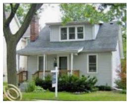
Dog house dormers are gable roofed, typically with a single window.
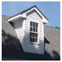
Dormitory: A structure owned or operated by an accredited educational institution specifically designed for stay of an academic term by students of that institution for the purpose of providing individual beds for sleeping purposes. Shared kitchen and bathroom facilities and some gathering rooms for social, cultural, or educational purposes may also be provided.
Dry Cleaning/Laundry Service: An establishment or business maintained for the drop off, pickup and/or delivery of dry cleaning and/or laundry without the maintenance or operation of any laundry or dry-cleaning equipment or machinery on the premises.
Dry Cleaning Plant: A building, portion of a building, or premises used or intended to be used for cleaning fabrics, textiles, apparel, or articles of any sort by immersion and agitation, or by immersions only, in volatile solvents including, but not by way of limitation, solvents of petroleum distillate type, and/or the chlorinated hydrocarbon type, and the processes incidental thereto.
Duplex: A single structure containing two (2) separate dwelling units, regardless of the type of construction. For purposes of this ordinance a single-family detached structure with an accessory apartment shall not be considered a duplex.
Dwelling Unit (or Housing Unit): A room or set of rooms fitted with a private bath, kitchen, and living facilities comprising an independent, self-contained dwelling space occupied by a family and where rooms are not let to individuals. Kitchen, living and shared bathroom facilities must be separate and distinct from bedroom facilities. Each bedroom must contain a minimum square footage consistent with the current minimum housing standards. Separate bathroom facilities will be deemed to exist only when it is possible to access such bathroom facilities without passing through a room which is designated as a bedroom. If there is more than one meter for any utility, address to the property, or kitchen; or if there are separate entrances to rooms which could be used as separate dwelling units: or if there is a lockable, physical separation between rooms in the dwelling unit such that a room or rooms on each side of the separation could be used as a dwelling unit, multiple dwelling units are presumed to exist; but this presumption may be rebutted by evidence that the residents of the dwelling share utilities and keys to all entrances to the property and that they (A) share a single common bathroom as the primary bathroom or (B) share a single common kitchen as the primary kitchen. (See also definition of Family and Rooming Unit)
Dwelling Unit, Single Detached: Free standing residential structure containing a single dwelling unit occupied by a "family." and where rooms are not let to individuals. Also known as a single family residence (SFR). (See definition of Family)
Easement: An acquired right of or upon the property of another for a specified purpose.
Eave: The edge of the roof which overhangs the face of an exterior building wall and, normally, projects beyond the side of a building; performing the primary function of the roof in throwing water clear of the exterior building walls.
Electronic Message Display: Any element of a Sign or Sign structure capable of displaying words, symbols, figures, images, or messages that can be electronically or mechanically changed by remote or automatic means. This also includes any display that incorporates rotating panels, LED lights manipulated through digital input, “digital ink,” or any other method or technology that allows a Sign to present a series of images, messages, or displays. This does not include Signs with manually-changeable copy.
Elevation: An exterior wall of a Building.
Emergency Shelter: Overnight shelter with supportive services for homeless persons that is limited to temporary occupancy, typically 180 consecutive nights or less, by a homeless person. Provide shelter only overnight.
Environmentally Sensitive Area(s): Land that contains physical environmental characteristics including but not limited to the following: wetlands; streams and riparian areas; floodplains; slopes 30 percent or greater; landslide hazard areas and other geological hazards and critical fish and wildlife habitat. These areas typically either present a constraint to development or are extremely susceptible to development impacts.
Estimated Development Cost: Cost calculated based upon building construction, alteration, and/or structural site improvement expenses including but not limited to fill, grading, cutting, etc. Not included in this figure is the purchase price of the land and the final interior finishes relative to a specific tenant, i.e. specialized equipment, finishes, furniture, drapes, etc. See Article 3.
Exterior Features: The architectural style, design, and general arrangement of the exterior of a structure, including the type and texture of building materials, and the type, arrangement, and style of all windows, doors, light fixtures, signs, or similar items found on or affixed to the exterior of a structure.
Family: One or more persons occupying a dwelling unit and living as a single nonprofit housekeeping unit, but not including group quarters such as dormitories, sororities, fraternities, convents, and communes. Occupancy by any of the following shall be deemed to constitute a family:
Members of a single family, all of whom are related within the second degree of kinship (by blood, adoption, marriage or civil union).
A “functional family unit” as defined below.
Persons with disabilities as so defined in Title VII of the Civil Rights Act of 1968, as amended by the “Fair Housing Amendments Act of 1988”.
A state registered or licensed day care facility serving six or fewer children as required by 24 V.S.A. 4412(5), as the same may be amended from time to time.
No more than four unrelated adults and their minor children.
Provided that a dwelling unit in which the various occupants are treated as separate roomers cannot be deemed to be occupied by a family.
For purposes of this definition of family, a group of adults living together in a single dwelling unit and functioning as a family with respect to those characteristics that are consistent with the purposes of zoning restrictions in residential neighborhoods shall be regarded as a “functional family unit” and shall also qualify as a family hereunder.
In determining whether or not a group of unrelated adults is a “functional family unit”, under the standard set forth above, the following criteria must be present:
The occupants must share the entire dwelling unit. A unit in which the various occupants act as separate roomers cannot be deemed to be occupied by a functional family unit.
The household must have stability with respect to the purpose of this chapter. Evidence of such stability may include but not be limited to, the following:
Minor dependent children regularly residing in the household, and school age children are enrolled in local schools.
Proof of the sharing of expenses for food, rent, or ownership costs, utilities and other household expenses and sharing in the preparation, storage and consumption of food.
Whether or not different members of the household have the same address for purposes of:
Voter registration
Drivers’ licenses
Motor vehicle registration
Summer or other residences
The filing of taxes
Common ownership of furniture and appliances among the members of the household.
Employment of householders in the local area.
A showing that the household has been living together as a unit for a year or more, whether in the current dwelling unit or other dwelling units.
Any other factor reasonably related to whether or not the group or persons is the functional equivalent of a family.
The initial determination of whether a “functional family unit” status exists shall be made by the Code Enforcement Office (“CEO”). The burden will rest upon the individuals claiming “functional family status” to submit information to the CEO to substantiate their claim. Some of the information provided to the CEO as part of a “functional family unit” status request, as well as the CEO’s initial determination, may be highly confidential, and, thus, will be maintained in a separate “red envelope” in the property file. It will be left to the CEO to determine whether the information is sensitive enough to be retained in the “red envelope.” Information maintained in the “red envelope” will be considered confidential and thus used only by the CEO. Access to the “red envelope” by persons outside of the CEO will only be allowed under court order or during litigation regarding said property.
Farm(ing): The use of land and/or structures for agricultural purposes. (See Agriculture and Urban Agriculture)
Farm Structure: A building, enclosure, or fence for housing livestock, raising horticultural or agronomic plants, or carrying out other practices associated with accepted agricultural or farming practices, including a silo, as “farming” is defined in 10 V.S.A. subsection 6001(22), but excludes a dwelling for human habitation.
Fence: A structure serving as an enclosure, a barrier, or a boundary usually made of posts or stakes joined by boards, wire or rails.
Film Studio: An establishment for movie production.
Finished Grade: The final elevation of the ground surface after all man-made alterations, such as grading, grubbing, filling, or excavating, have been made.
Fire Station: A building used to house fire fighting equipment and firefighters.
Flag: A typically rectangular or triangular piece of fabric or other similar non-rigid material, with or without characters, letters, illustration, or ornamentation, supported or anchored along one edge or two corners. If any side is more than three times as long as any other side the flag is considered a banner.
Flood Hazard Area - See Article 13, Part 2 below for all Flood Hazard Definitions.
Floor Plate: The above-ground gross floor area of each story of a building. Below-ground floor area is not included where maximum floor plate standards are established.
Food and Beverage Processing: The preparation and packaging of food and/or beverage (including alcoholic and non-alcoholic) products for distribution and/or wholesale or retail sales, on or off premise, excluding restaurants and cafes except as an accessory use.
Footcandle: A unit of measure for illuminance. A unit of illuminance on a surface that is within a one (1) foot radius from a uniform point source of light of one (1) candlepower and equal to one (1) lumen per square foot.
Frontage: (See Article 5 for specific measurement calculations.)
Building: That portion of a building that faces a public street or right of way.
Street: That dimension of the lot which abuts a public street or right of way.
Front Yard: The full width of property along a street frontage and between the structure and the right of way. See Article 5 for specific measurement calculations.
Fuel Service Station: Any area of land, including structures thereon, that is used or designed to be used for the sale of gasoline, oil or other motor vehicle fuel, or that is used or designated to be used for lubricating, washing, cleaning or otherwise servicing motor vehicle, but not including the painting or major repair thereof or the use of mechanical car washing equipment. A service station may also include a convenience store, provided that the store is accessory to the fuel or service station building.
Full Cut-off Fixture: A luminaire or light fixture that by design of the fixture housing, does not allow any light dispersion or direct glare to shine above a 90-degree, horizontal plane from the base of the fixture.
Fully Shielded Fixture: A light fixture constructed and mounted such that no light rays are emitted, either directly from the lamp or indirectly by reflection or refraction from any part of the luminaire above the horizontal plane running through the lowest point of the fixture where light is emitted.
Functional Family: See Family.
Funeral Home: A building used for the preparation of the deceased for burial and display of the deceased and rituals connected therewith before burial or cremation. A funeral home, as defined for purposes of this ordinance, may include a funeral chapel.
Garage: A building or structure, or a portion thereof which is designed for the storage of motor vehicles.
Garage Sale: Any sale entitled “garage sale,” “lawn sale,” “moving sale,” “rummage sale” or any similar casual sale of tangible personal property which is advertised by any means whereby the public at large can be aware of such sale. More than six days of sales within a 12-month period is considered commercial retail sales for the purposes of this ordinance.
Garden Supply Store: A place of business where retail and wholesale gardening products and produce are sold to the consumer. These centers may include a nursery and/or greenhouses.
General Merchandise/Retail: Goods bought and sold in business. (See definition of retail.)
Glare: Stray, unshielded light striking the eye that may result in (a) nuisance or annoyance such as light shining into a window; (b) discomfort causing squinting of the eyes; (c) disabling vision by reducing the ability of the eyes to see into shadows; or (d) reduction of visual performance.
Green House: A permanent structure typically made of, but not limited to, glass, plastic, or fiberglass in which plants are cultivated.
Green Roof: A contained green space planted over a synthetic waterproofed membrane created by adding layers of growing medium and plants on top of a traditional roofing system which also includes a layer for drainage. The green space on the roof may partially or completely cover the traditional roofing system. There are two types of green roofs: extensive and intensive. Extensive green roofs have a growing medium depth of less than six inches, require little maintenance, and are lightweight. Intensive green roofs have a growing medium depth of more than six inches, require more frequent maintenance, and are heavier than extensive green roofs. In order to be classified as an intensive green roof for lot coverage credit the green roof must have a minimum growing depth of six inches.
Green Stormwater Management: Low impact stormwater management infrastructure utilizing soil-water-plant systems to intercept stormwater and facilitate its infiltration, evaporation and release into waterbodies in a manner that promotes ecological health and environmental resilience.
Grocery Store: A retail establishment where most of the floor area is devoted to the sale of prepackaged and perishable food products for home preparation and consumption, which typically also offer other household and personal care products, and which are substantially larger and carry a broader range of merchandise than convenience stores.
Gross Floor Area: The sum of the areas of the several floors of a building, including areas used for human occupancy in basements, attics, and penthouses as measured from the exterior faces of the walls. It does not include un-insulated porches if said areas are not used for human occupancy. It shall include the horizontal area at each floor level devoted to stairwells and elevator shafts.
Group Home: A residential dwelling unit occupied by unrelated individuals as a single nonprofit housekeeping unit only if all said occupants, with the exception of supervisory personnel, are handicapped persons as defined in Title VIII of the Civil Rights Act of 1968, as amended by the "Fair Housing Act of 1988". Such unrelated individuals shall have the right to occupy a residential dwelling unit in the same manner and to the same extent as any family unit as defined in this article.
Habitable: A space in the building for living, sleeping, eating, or cooking. Bathrooms, toilet rooms, closets, halls, storage or utility spaces and similar areas are not considered habitable spaces.
Hazardous Waste Collection/Disposal: All structures, other appurtenances, and improvements on the land used for collection, processing, treating, storing, or disposing of hazardous waste generated offsite or brought in from offsite, including all operations or storage areas, diked overflow, or emergency spillway areas. A hazardous waste disposal facility may consist of several treatment, storage, or disposal operational units; it includes all areas where hazardous waste may be received, stored, handled, or processed. Said facility must be state certified. This shall not be interpreted to include collection, handling, and temporary storage of hazardous wastes generated on a property as part of normal activities of any use authorized under this ordinance.
Health Club: An indoor facility, between 5,000 and 20,000 square feet in size, with or without seating for spectators, and providing accommodations for a variety of individual, organized, or franchised sports, including but not limited to basketball, ice hockey, wrestling, soccer, tennis, volleyball, racquetball, laser tag, paint ball, miniature golf, or handball. Such facility may also provide other regular organized or franchised events, health and fitness club facilities, swimming pool, climbing wall, snack bar, restaurant, retail sales of related sports, health or fitness items, and other support facilities. Said establishment may or may not include membership. (See also Health Studio and Indoor Recreational Facility.)
Health Care Hospitality: An establishment providing temporary guest rooms and lodging services with or without compensation to patients receiving medical treatment, and/or their family members. Such an establishment may also include secondary educational programs, recreational activities, and non-clinical support services.
Health Studio: A facility less than 5,000 square feet in size used for fitness instruction and classes in such disciplines as yoga, pilates or other similar exercises and includes exercise facilities. Such facility has no fixed seating.
Historic Inn: A building which has the primary use of housing overnight guests, subject to the criteria of Article 5, Sec. 5.4.2, that is listed or eligible for listing on the State or National Register of Historic Places.
Historic Resource: Buildings, structures, landscapes, places and sites that are listed or eligible for listing on the National Register of Historic Places.
Historic Site: The location of an event of historic significance or a structure, whether standing or ruined, which possesses historic, architectural, archeological, or cultural significance and is listed or eligible for listing on the State or National Register of Historic Places.
Housing Unit: See Dwelling Unit.
Home Occupation: An accessory use of a dwelling unit for employment involving the provision of services or the fabrication of goods. Home occupations are subject to all the procedures, conditions, and standards of Article 5, Sec 5.4.6.
Hoop House: A temporary structure typically made of, but not limited to, piping or other material covered with translucent plastic, constructed in “half-round” or “hoop” shape, for the purposes of growing plants.
Horizontal Illuminance: The measurement of brightness from a light source, usually measured in footcandles or lumens, which is taken through a light meter’s sensor in a horizontal position.
Hospital/Medical Center: An institution, licensed by the state department of health, providing primary health services and medical or surgical care to persons, primarily inpatients, suffering from illness, disease, injury, deformity, and other abnormal physical or mental conditions, and including as an integral part of the institution, related facilities such as laboratories, outpatient facilities, or training facilities. This definition shall not include convalescent or nursing homes, community houses, or other similar facilities.
Inclusionary Unit or Affordable Inclusionary Unit: Any dwelling unit within any covered project that is made affordable pursuant to Article 6 Part 1 of this ordinance.
Industrial: Businesses involved in activities such as manufacturing or processing of products by automated, digital, mechanical, or manual means; warehousing and storage; waste disposal; transportation and logistics; research and development; and related technical engineering and distribution functions. (See also Manufacturing-Light, Office-Technical, Research and Development Facility, Food and Beverage Processing, etc.)
Institutions: Public and private uses including, but not limited to, colleges, universities, hospitals, churches and membership clubs.
Interested Person: A person who has participated in a municipal regulatory proceeding authorized under 24 VSA Ch. 117 who may appeal a decision rendered in that proceeding by an appropriate municipal panel to the environmental court. Participation in a local regulatory proceeding shall consist of offering, through oral or written testimony, evidence or a statement of concern related to the subject of the proceeding.
Junkyard: Any place of outdoor storage of deposit that is maintained, operated, or used for storing, keeping, processing, buying, or selling garbage, trash, appliances, and/or furniture as articulated under Article III, Division 1. Sec. 18-111 of the City Code of Ordinances. Junkyard does not include a solid waste facility or a vehicle salvage yard as defined in this ordinance.
Lakefront: Lake front or lakeshore means the water's edges of Lake Champlain at the ordinary high water mark (the elevation of one hundred (100) feet above mean sea level) unless otherwise defined.
Lamp: The light-producing source installed in the socket portion of the luminaire.
Landscape Areas: The portion of a lot that is not defined as “lot coverage” including grass, ground covers, gardens, shrubs, trees, and natural areas. Landscaped open space shall not include parking, drives, or impervious walkways.
Laundromats: A business that provides washing, drying, and/or ironing machines for hire to be used by customers on the premises.
Laundry: The process of laundering, the cleaning of fabrics, textiles, apparel, or articles of any sort by immersion and agitation.
Legislative Body: The Burlington City Council with Mayor presiding.
Library: A facility in which literary, musical, artistic, or reference materials including but not limited to books, manuscripts, computers, recordings, or films are kept for use by or on loan to patrons of the facility, but are not normally offered for sale.
Light Trespass: Light emitted by a luminaire that shines beyond the boundaries of the property on which the luminaire is located.
Lighting, Festoon: A method of illuminating a structure with a group of incandescent bulbs hung or strung overhead or used to outline a structure or any part thereof.
Lighting Fixture: See luminaire. An assemblage of ballast, lamp receptacles, wiring, reflectors, refractors, prisms, lenses, etc., all contained within a single housing or casing, and designed to be mounted as a single unit. A fixture may be designed to accept one (1) or more lamps. One (1) or more fixtures may be mounted to a single support.
Limited Equity Dwelling Unit: Any dwelling unit in which the occupant possesses an ownership interest and which is kept affordable for low- or moderate-income households through restrictions upon equity accrual of the occupant’s ownership interest.
Loading Area: A parking space or berth, directly serving a building for the loading or unloading of merchandise or material, and which has access to a street, alley or other appropriate means of ingress and egress.
Lodging: An establishment providing for a fee three or more temporary guest rooms and customary lodging services (such as onsite staffing at all hours, lobby space, and room service), and subject to the Vermont rooms and meals tax. Lodging may, or may not, be owner occupied. Lodging does not include historic inns or short term rentals (except when per-building short term rental limits noted in Chapter 18: Minimum Housing Standards of the Burlington Code of Ordinances are exceeded).
Lot: A parcel of land distinguishable from other parcels by deed, as recorded in the City of Burlington Land Records on a subdivision plat, record, or survey map, or as described by metes and bounds, and intended for transfer of ownership or for building development. For purposes of this ordinance, the term does not include any portion of a dedicated right-of-way.
Lot, Corner: A lot abutting two (2) or more streets at their intersection.
Lot Coverage: The total at grade area or footprint of all structures and impervious surfaces including but not limited to parking areas, walkways drives, etc.; expressed as a percent of the total lot area. (See Art. 5)
Lot Line Adjustment: The relocation of a common property boundary where an additional lot is not created and where an existing lot reduced in size by the adjustment complies with the dimensional requirements of this ordinance. In addition. a lot line adjustment shall include the addition and subtraction of vestigial alleys when being combined with an adjacent lot. See definition of Lot above.
Lot Merger: The combination of two or more lots into one single lot pursuant to a single deed. See definition of Lot above.
Low-income Household: A household with income not exceeding eighty percent (80%) of median income for the Burlington MSA, as set forth in regulations promulgated from time to time by the U.S. Department of Housing and Urban Development pursuant to 42 U.S.C. Section 1437 et seq.
Low Output Lamps: Lamps with an internal lumen output of 2,000 lumens or less. Examples of lamp types of 2,000 lumens and below are: 100-Watt Standard Incandescent, 15-Watt Cool White Fluorescent, 15-Watt Compact Fluorescent, and 18-Watt Low Pressure Sodium.
Lumberyard: A facility where building materials such as lumber, plywood, drywall, paneling, cement blocks and other cement products, and other building products are stored and sold. Lumberyards may also process lumber performing millwork, planing, cutting, and other customizing processes. Lumberyards may provide for the sale of associated products including tools and fasteners.
Lumen: A unit of measure of the quantity of light that falls on an area of one square foot every point of which is one foot from the source of one candela. A light source of one candela emits a total of 12.57 lumens.
Luminaire: Means the complete lighting system, including all necessary mechanical, electrical, and decorative parts.
Manufacturing: The mechanical or chemical transformation of materials or substances into new products, including but not limited to the assembling of component parts, the creation of products, and the blending of materials including but not limited to oils, plastics, resins, metal, wood, stone, etc, including drop forge , and incidental storage and distribution of products. A manufacturing use may include a show room and/or offer public tours that are incorporated into the facility’s ordinary operations.
Manufacturing-Light: The manufacturing of finished products or parts from previously prepared materials using hand tools, mechanical tools, and electronic tools, including processing, fabrication, assembly, treatment, and packaging of products, as well as incidental storage, sales, and distribution of such products; as well as shops for overhaul and repair including for plumbing, HVAC, and electrical. A light manufacturing use may include a show room and/or offer public tours that are incorporated into the facility’s ordinary operations.
Marina: Facility for berthing, rental, repair, fueling, and sale of recreational marine craft for a fee.
Market Unit: A dwelling unit that is available for sale or rent at a price determined by the economy at which both the buyer and the seller are willing to do business, where each is informed as to the advantages and limitations of the property. This definition does not include either Inclusionary or affordable Inclusionary units, as defined herein.
Mass Timber: A method of construction defined as Type IV in the Building Code (International Building Code) and where the majority of structural load-bearing members are made of wood with a minimum dimension of 3.75 inches.
Mean Sea Level (MSL): The Mean Sea Level is a value obtained by averaging hourly tide heights observed over a period of time, or the average water level that would exist in the absence of tides.
Median Income: The income for the Burlington MSA set forth in or calculated by regulations promulgated by the United States Department of Housing and Urban Development, pursuant to Section 8 of the Housing Act of 1937, as amended by the Housing and Community Development Act of 1974. The median income that is current on the first day of March of any year shall be used throughout the subsequent twelve (12) months in calculating the general requirements for affordable housing under Article 9.
Medical Lab: A facility offering diagnostic or pathological testing and analysis of blood, bodily fluids, pathological specimens, DNA sampling and analysis, and any other diagnostic test generally recognized in the healthcare industry.
Mental Health Crisis Center: A facility licensed by the State of Vermont Department of Mental Health and used exclusively by physicians, psychologists, social workers, and similar mental health care professionals and related administrative personnel for the counseling, care, and treatment of patients and clients. Such a facility may include both out-patient and short-term acute inpatient treatment.
Metal-Halide: A high intensity discharge lamp where the light is produced by radiation from metal-halide vapors.
Mixed Use, Attached Dwelling: A building containing any combination of residential and/or non-residential uses.
Mixed Use, Building Site: A tract of land developed with any combination of residential and/or non-residential uses.
Mobile Home: Means a structure or type of manufactured home that is built on a permanent chassis and is designed to be used as a dwelling with or without a permanent foundation when connected to the required utilities, including the plumbing, heating, cooling, and electrical systems contained in the structure, and is:
transportable in one or more sections; and
at least eight feet wide or 40 feet long or when erected has at least 320 square feet or if the structure was constructed prior to June 15, 1976, at least eight feet wide or 32 feet long; or
any structure that meets all the requirements of this subdivision except for the size requirements and for which the manufacturer voluntarily files a certification required by the U.S. Department of Housing and Urban Development and complies with the construction and standards established under Title 42 of the U.S. Code. 10 V.S.A. §6201(1).
Mobile Home Park: Means any parcel or contiguous lots of land under common ownership or control on which are sited, or which is designed, laid out or adapted to accommodate, more than two mobile homes. A parcel or contiguous lots owned by agricultural employers providing up to four mobile homes for use by full-time workers or employees, and a parcel or contiguous lots used solely on a seasonal basis for vacation or recreational mobile homes shall not be considered a mobile home park. 10 V.S.A. §6201 (2), further clarified in the Housing Division Rules, Part 1, Mobile Home Parks, Section 2.10.
Moderate-income Household: A household having an income not exceeding one hundred ten percent (110%) of median income for the Burlington MSA, as set forth in regulations promulgated from time to time by the U.S. Department of Housing and Urban Development pursuant to 42 U.S.C. Section 1437 et seq.
Mounting Height: The height of a light fixture or lamp above the finished grade.
Multi-family, Attached Dwelling: Any building or part thereof containing three (3) or more dwelling units.
Municipal Development Plan (MDP) (a.k.a. Comprehensive Plan, Master Plan): A land development and policy plan developed and adopted by the city pursuant to 24 V.S.A. Chapter 117, Subchapter 5.
Museum: A building and site serving as a repository for a collection of natural, scientific, or literary curiosities or objects of interest, or works of art, and arranged, intended, and designed to be used by members of the public for viewing, with or without an admission charge, and which may include, but is not limited to, the sale of goods to the public as gifts or for their own use and a café as accessory uses. Such a facility may also include interactive exhibits and programs for learning through hands-on experiences.
Neighborhood Commercial Uses: Non-residential establishments intended to serve or accommodate the needs of a limited geographic segment of a community or area. Such uses include: banks, places of worship, neighborhood convenience stores, day cares, cleaners & laundromats, fire & police stations, beauty salons and barbers, hardware and general merchandise; libraries, medical/dental offices, parks, pharmacies, post offices, cafes, schools, community centers, and health studios.
Neon Lighting: Low intensity gas filled tube lighting which, when subject to high voltage, becomes luminescent in colors characteristic of the particular gas used.
Nightclub: An establishment operated as a place of entertainment, characterized by any or all of the following as a principal use: (1) live, recorded, or televised entertainment, including but not limited to performance by magicians, musicians or comedians; (2) dancing, and/or (3) the dispensing alcoholic beverages for consumption on the premises.
Nit: a photometric unit of measurement referring to luminance (the visible-light intensity or brightness given off by a surface or object). One nit is equivalent to one candela per square meter(cd/m²).
Nonconformity: A nonconforming use, structure, lot, or parcel.
Nonconforming Lot or Parcel: A lot or parcel that does not conform to the present bylaws covering dimensional requirements, including parking, but was in conformance with all applicable laws, ordinances, and regulations prior to the enactment of the present bylaw, including a lot or parcel improperly authorized as a result of error by the administrative officer or Development Review Board under the finality provisions of 24 V.S.A. §4472.
Nonconforming Structure: A structure or part thereof not in conformance with the current zoning regulations covering building bulk, maximum height, and disposition on lot, area, or yards, where such structure conformed to all applicable laws, ordinances, and regulations prior to the enactment of such zoning ordinance, including a structure improperly authorized as a result of error by the administrative officer or Development Review Board under the finality provisions of 24 V.S.A. §4472.
Nonconforming Use: An existing use of land or building that does not conform to the current use or density regulations for the district in which such use of land or building exists as set forth in Appendix A - Use Table. Such nonconforming uses are those in legal existence at the time of the adoption of the regulations to which they do not conform, including a use improperly authorized as a result of error by the administrative officer or Development Review Board under the finality provisions of 24 V.S.A. §4472. To the maximum extent possible, no entitlement shall be given to those that provide misinformation to City Officials. Permits issued as a result of such misinformation shall gain no legal entitlement regardless of duration of the permit or inaction.
Nursing Home: See definition of Convalescent Home.
Office, General: A room or group of rooms used for conducting the affairs of a business, profession, service industry, or government.
Office, Medical/Dental: A facility used exclusively by physicians, dentists, chiropractors, psychologists and similar health care professionals for the treatment and examination of patients solely on an outpatient basis, provided that no overnight patients shall be kept on the premises.
Office-Technical: Offices of businesses providing professional services in a technical field including but not limited to engineering, graphic design, industrial design, product design/development, surveying and publishing but not including standalone medical/dental, or general professional, and administrative services.
Official Map: A map adopted pursuant to 24 V.S.A. §4421 as amended which identifies future municipal utility and facility improvements, such as road or recreational path rights-of-way, parkland, utility rights-of-way, and other public improvements, in order to provide the opportunity for the community to acquire land identified for public improvements prior to development for other use and to identify the locations of required public facilities for new subdivisions and other development under review by the municipality.
Opaque: A material that does not transmit light from an internal illumination source.
Open Air Market: A building or site used for selling or offering for sale at retail of locally-grown vegetables or produce, occurring in a pre-designated area, where there may be a collection of individual vendors or single vendor who have/has raised the vegetables or produce or have/has taken the same on consignment for retail sale. Also includes the incidental sale at retail of artisan-produced handicrafts, artwork, and baked goods.
Operation Center - Taxi/Bus: A facility for the housing of motor-driven buses or taxis, which may include maintenance of those vehicles.
Operation Center – Trucking: A facility for the operations and maintenance of a trucking business which may include maintenance of those vehicles.
Ordinary High Water Mark: The elevation of one hundred (100) feet above mean sea level.
Owner: Any person, firm, partnership, association, joint venture, corporation or other entity or combination of entities who alone, jointly or severally with others hold(s) legal or equitable title to any real property.
Owner Occupied: Where owner occupancy is required by this ordinance, owner occupancy shall mean occupancy of premises by an owner for at least 50% of the year.
Park: Any area designated by the City as a park pursuant to Section 22-1 of the Code of Ordinances of the City of Burlington, Vermont.
Parking Garage/Structure: A structure containing parking facilities, below or above grade.
Parking, Off-site: One or more parking spaces on one parcel of land providing parking spaces for a use on another parcel of land.
Parking, Surface/Lot: Parking facilities that are at grade and uncovered or not within a structure.
Parking, Stacked: The parking of more than two (2) cars in a parallel line, one behind the other.
Parking, Tandem: The parking of up to two (2) cars, one behind the other.
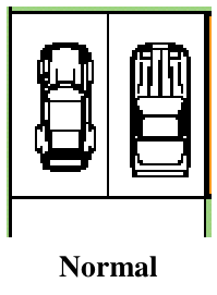
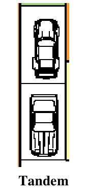
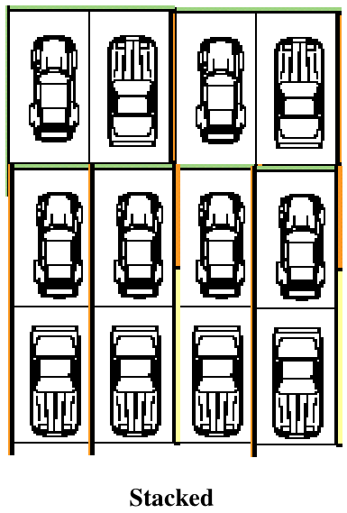
Parking, Underground: Parking spaces within a covered structure where either: fifty percent of the volume of the parking space is below the finished surface of the ground adjacent to the exterior walls of the building; or, the floor of the parking space is four (4) feet below the finished surface of the ground adjacent to the exterior walls of the building, whichever is greater.

Passive House: A building construction standard that results in highly energy efficient buildings through use of airtight building envelopes, ventilation, waterproofing, heating and cooling, and electrical loads as certified and administered by Passive House Institute (PHI or PHIUS).
Performing Arts Center/Theatre: An establishment primarily used for performing arts performances which may include permanent seating.
Performing Arts Studio: An establishment less than 5,000 square feet in size primarily used for acting, music, dance classes, rehearsal, or other instruction in the performing arts. Such an establishment has no permanent seating for performances.
Perimeter Building: A shallow medium to large sized attached or detached Building that is always associated with and screens an above ground Parking Structure.
Person: Any individual, corporation, business trust, estate trust, partnership, association, or any other entity or combination thereof.
Pervious Pavement: Alternatives to traditional pavement that allow rain and snowmelt to infiltrate underlying layers of soil and gravel in a manner that reduces runoff and promotes pollutant filtration.
Pharmacy: A retail business substantially devoted to the sale of pharmaceutical items, supplies, and equipment, including the preparation and dispensing of prescription drugs. Said business shall be licensed by the State of Vermont as such.
Photo Studio: An establishment used by a photographer for taking pictures of subjects.
Photography Lab: An establishment used for processing film and printing images from negatives.
Photometric Data: The quantitative measurement of the properties of light, especially luminous intensity.
Planned Unit Development: A development plan for one or more lots, tracts, parcels to be developed as a single, integrated entity. See Article 11 for specific provisions.
Planning Commission (PC) or Commission: The planning commission of the City of Burlington, Vermont, established pursuant to 24 V.S.A. Chapter 117, Subchapter 2.
Plat: A map prepared pursuant to the requirements of Article 10 and recorded in the City Land Records representing a tract of land showing the boundaries and location of individual properties and street.
Pocket Neighborhood: A group or cluster of small detached houses or two-unit attached houses that share a common area.
Police Station: A public safety facility operated by a governmental agency, including administrative offices, storage of equipment, temporary detention facilities, and the open or enclosed parking of patrol vehicles.
Post Office: A facility that contains service windows for mailing packages and letters, post office boxes, offices, vehicle storage areas, and sorting and distribution facilities for mail.
Central Distribution Center: A post office comprised of at least 5,000 square feet which includes centralized/regional processing facilities and storage for a fleet of vehicles.
Local: A post office comprised of less than 5,000 square feet.
Principal Building or Structure: The main or primary Building or Structure located on a Lot within which there is conducted any one or more of the Principal Use(s) found on such Lot.
Principal Use: A main or primary Use accommodated by a Building, Structure, or a Lot. The dominant use or uses to which the premises is devoted and the primary purpose for which the premises exists.
Printing: A facility for the reproduction of written or graphic materials on an order basis for individuals or businesses. May include a commercial printing operation involving a process such as printing, imprinting, reproducing, or duplicating images and using printing methods including but not limited to offset printing, lithography, web offset, flexographic, and screen process printing, binding or other similar processes.
Plant: A facility that is greater than or equal to 5,000 square feet.
Shop: A facility that is less than 5,000 square feet.
Public Art: Public art is a general term for forms of community expression. Public Art may be located in the public domain (rights-of-way), or on private property yet available for community viewing. Public art may be cast, carved, built, assembled, or painted, and include murals, sculpture, memorials, integrated architectural or landscape architectural work, painting, tapestry, mosaics, ceramics, stained glass, community art, digital new media, Earthworks, assemblage, installation art and performance. Installations may be transient or permanent.
Public Path: A Right-of-Way that provides a main route of transportation for non-vehicular access. Public Paths must be designed to standards defined by DPW to provide emergency vehicle access.
Public Transit Terminal: A facility or location where the principal use is the handling, receiving, and transfer of passenger traffic by various modes of travel, including, but not limited to aircraft, buses, taxis, public rail systems and ferries. (See also Operation Center - Taxi/Bus.)
Public Use: A use that is owned and operated by a public agency, or by a private/non-profit entity for use by the general public without unreasonable restriction.
Public Works Yard/Garage: A support facility housing administration, operations, maintenance, and storage for City departments with its associated public site or right-of-way necessary to provide transportation, drainage, public or private utilities, energy, or similar essential services.
Quasi-judicial: Having a partly but essentially judicial character by possession of the right to hold hearings on and conduct investigation into items dealing with rules and regulations and to make decisions in the general manner of courts.
Radio & Television Studio: An establishment for radio and television production and broadcasting.
Rail Equipment Storage & Repair: An area of land and associated structures for storage and repair of railroad equipment.
Record and Document Storage: Warehousing and storage of medical records and other documents.
Recording Studio: An establishment for recording and production of sounds and/or images, excluding broadcasting. The area for recording or practice shall be soundproof.
Recreational Facility - Indoor : An indoor facility, greater than 20,000 square feet in size, with or without seating for spectators, and providing accommodations for a variety of individual, organized, or franchised sports, including but not limited to basketball, ice hockey, wrestling, soccer, tennis, volleyball, racquetball, laser tag, paint ball, miniature golf or handball. Such facility may also provide other regular organized or franchised events, health and fitness club facilities, swimming pool, climbing wall, snack bar, restaurant, retail sales of related sports, health or fitness items, and other support facilities. Said establishment may or may not include membership. (See also Outdoor Recreational Facility, Health Club, and Health Studio)
Recreational Facility - Outdoor Commercial: An outdoor facility where tickets are sold or fees are collected from spectators and/or participants, with or without seating for spectators, and providing accommodations for a variety of individual, organized, or franchised sports, including but not limited to basketball, field/ice hockey, soccer, lacrosse, baseball/softball, football or tennis. Such facility may also provide other regular organized or franchised events, snack bar, retail sales of related sports, health or fitness items, and other support facilities. (see also Indoor Recreational Facility and Outdoor Recreational Facility)
Recreational Facility - Outdoor: An outdoor facility, without seating for spectators, and providing accommodations for a variety of individual or organized sports, including but not limited to basketball, field/ice hockey, soccer, lacrosse, baseball/softball, football, tennis, or golf. Such facility may also provide a snack bar, restaurant, and other support facilities.. Said establishment may or may not include membership. (see also Indoor Recreational Facility and Outdoor Commercial Recreation)
Recreational pier: A structure built into or out over the water and used as a landing place for boats, promenade or entertainment/recreational area, including but not limited to fishing.
Recreational Vehicle: Any type of motorized vehicle used primarily for recreational purposes which have gross vehicle weight less than 10,000 pounds including but not limited to travel trailers, motor homes, ATV’s, snowmobiles, etc. Recreational vehicles shall include any mobile structure designed for temporary occupancy, but shall exclude manufactured homes. (See Boats and Trucks)
Recreational Vehicle Sales – New & Used: The storage and display for sale of more than two recreational vehicles including those recreational purposes which have a gross vehicle weight more than or equal to 10,000 pounds.
Recycling Center: A building or enclosed area used for the collection, processing, sorting and resale of recyclable materials. For this use, processing means the preparation of material for shipment, or an end user’s specifications, by such means as baling, briquetting, compacting, flattening, grinding, crushing, sorting, shredding, cleaning, and remanufacturing. Processing facilities include storage and loading areas located entirely on the processing center site.
Rehabilitation: The act or process of physically restoring a property or structure through repair, alterations, and additions while preserving those portions or features which convey its historical, cultural, or architectural integrity.
Renewable Energy Resources: Energy available for collection or conversion from direct sunlight, wind, running water, organically derived fuels, including wood and agricultural sources, waste heat, and geothermal sources.
Rental Dwelling Unit: Any dwelling unit which is made available to a non-owner by another for compensation, pursuant to a lawful lease or rental agreement, whether oral or written, expressed or implied.
Research and Development Facility: A facility used primarily for applied and developmental research, where product testing is an integral part of the operation, and goods or products may be manufactured as necessary for testing, evaluation, and test marketing but does not involve the mass manufacture, fabrication, processing, or sale of products as a principal use.
Research Lab: A facility for scientific and/or academic research, investigation, testing, or experimentation, but not facilities for the manufacture or sale of products, except as incidental to the main purpose of the laboratory.
Residential: Regularly used by its occupants as a permanent abode, which is made one’s home as opposed to one’s place of business and which has housekeeping and cooking facilities for its occupants only.
Restaurant: Any food service establishment subject to Vermont Health Regulations where food and beverages are prepared and served for consumption primarily on premises; and where the service of alcoholic beverages is incidental to the consumption of food (less than fifty percent (50%) of the gross sales receipts from the business). (Also see Café, Caterers and Restaurant, Take-Out)
Restaurant, Take-Out: Any food service establishment subject to Vermont Health Regulations whose primary business is the sale of prepared food for consumption off the premises. (Also see Café, Caterers, and Restaurant)
Retail: The selling of goods, wares, or merchandise directly to the consumer.
Retaining Wall: A wall or terraced combination of walls used at a grade change to hold soil and other earth materials at a higher elevation.
Right-of-Way: The real property or other legal instrument, such as an access easement, associated with transportation infrastructure, including but not limited to Streets and Public Paths.
Road: See street.
Roof: The uppermost covering and its supporting structures on the top of a building
Flat Roof: is a roof with no pitch spanning across the uppermost portion. In cases where the upper portion of a mansard roof is flat (i.e. second empire), these shall be considered a flat roof.
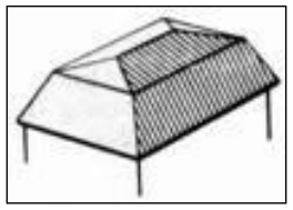
Gambrel Roof: is a pitched roof with two slopes on either side, the lower slope having the steeper pitch, and having a gable at both ends.
Hipped Roof: is a pitched roof comprising adjacent flat surfaces that slope upward from all sides of the perimeter of the building
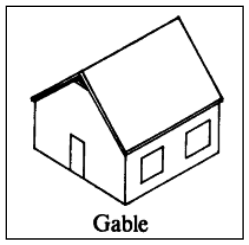
Mansard Roof: is a pitched roof having a double slope on all four sides, with the lower slope much steeper than the upper. The second empire mansard roof is a variation on the traditional mansard roof where the lower slopes are nearly perpendicular and the upper portion is flat or nearly flat.
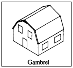
Pitched or Gable Roof: is a pitched roof with one slope on either side, having a gable at both ends. Also called gable roof.
Rooming Unit: as defined by Chapter 18 of the Burlington Code of Ordinances. Examples include dormitories, fraternities, sororities, and boarding houses. This shall not include units for the temporary occupancy of patients or guests in a hospital, hotel, motel or convalescent facility. Any four (4) “rooming units” shall be considered a single housing unit in calculating density for the requirements of Article 4 and applying the housing replacement requirements of Article 9 Part 2.
Rowhouse: A principal structure containing one or two units that is attached in a row of no fewer than two (2) rowhouses.
Salon/Spa: An establishment where non-surgical cosmetology services are provided including hair care, nail care, and skin care on a regular basis for compensation, including but not limited to day spas, tanning beds and chemical treatments.
Satellite Dish Antenna: A solid, open mesh, or bar configured device, often with the shape of a shallow dish, for the purpose of transmitting and/or receiving radio or electromagnetic waves between terrestrially and/or orbitally based uses. Satellite dish antennas larger than 24” in width or diameter are subject to regulation as specified in Article 5, Sec. 5.4.7. Any satellite dish equipment less than 24" in diameter in the aggregate on a single structure or lot shall not be considered a satellite dish antenna for the purposes of this ordinance, and is not subject to regulation as such.
Seawall: A wall of stone, concrete, or other sturdy material, built along the banks or shoreline of any river, stream, brook, or lake to prevent erosion.
Setback: The open, unobstructed area required to be provided between the furthermost projection of a building and the adjacent property line. (See also definition for Yard)
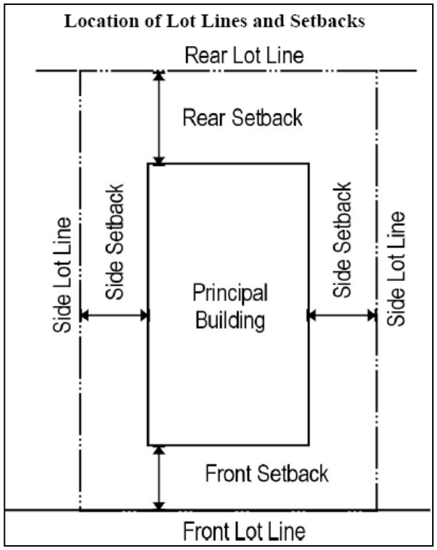
School: The academic space and accessory uses for the teaching of children or adults.
Primary: elementary school, inclusive of grades K-8.
Secondary: a high school and/or vocational center for attendance after elementary/primary school, granting a high school diploma for levels of education inclusive of grades 9-12.
Post-Secondary: after high school, including colleges, community colleges, universities, or continuing education.
Trade or Professional: a school that offers instruction in skilled trades.
Preschool: a school providing educational services for children from 3 years of age until their admission to first grade and that may include kindergarten.
Screen(ing): A method of visually shielding one structure, space or use from another structure space or use with vegetation, fencing, walls, berms, or other natural or man-made landscape elements.
Short term rental (STR): A dwelling unit that is rented in whole or in part (i.e. renting bedrooms within a unit) to guests for less than thirty (30) consecutive days and for more than 14 days per calendar year and is subject to the Vermont rooms and meals tax, pursuant to Chapter 18: Minimum Housing Standards of the Burlington Code of Ordinances.
Sign: Any words, lettering, parts of letters, figures, numerals, phrases, sentences, emblems, devices, designs, images, trade names, and trade marks by which anything is made known, that are used to identify, advertise, or attract attention to an individual, firm, association, corporation, profession, business, place, event, commodity, or product which are visible from a public thoroughfare or right-of-way.
Site Plan: A scaled map of a lot or site that indicates all significant features including, but not limited to, site improvements, structures, boundaries, parking, drives, walkways, etc. in accordance with Article 3.
Site Plan Review: Review of the spatial layout and proposed content of a parcel of land illustrated on a site plan in accordance with the authority, limitations and procedures set forth in the municipal development plan, 24 V.S.A. §4416, and this ordinance, all as amended.
Small Lots: Any lot of record in existence as of April 26, 1973 not conforming to minimum lot size requirements of the zoning district in which it is located, if such lot is not less than four thousand (4,000) square feet in area with a minimum width or depth dimension of forty (40) feet.
Solar Access: The availability of direct sunlight to a property.
Solid Waste Facility (Incinerator/Landfill, Transfer Station): A facility regulated by the State of Vermont for the collection, treatment, or disposal of solid waste.
Sorority/Fraternity: A property used as group living quarters for students of a post-secondary educational institution who are members of a group organized for the purpose of sharing social, cultural, scholarly, or religious interests associated with and officially recognized and supervised by such an institution. A sorority/fraternity shall not be considered a “family” under the provisions of this ordinance.
Special Flood Hazard Area - See Article 13, Part 2 below for all Flood Hazard Definitions.
Specimen Tree: Trees in excess of 30-inch caliper or that are determined to be over 100 years old by a certified arborist.
Stacking Area: An area for the temporary queuing of automobiles which serves a particular business, i.e.: drop offs, drive-up windows, drive through windows, etc.
Stormwater Administrator: The administrative officer of Chapter 26: Wastewater, Stormwater, and Pollution Control for the City of Burlington.
Story: That portion of a building, other than a basement, included between the surface of any floor and the surface of the floor next above it and which is equal to or greater than 50% of the total perimeter of the building. If there is no floor above it, then the space between the floor and the ceiling above the floor of such story. Where the floor level of the first story is at least five feet below the adjoining finished grade, the space shall be considered a basement and not counted as a story.
Street or Alley: A public way as defined in Section 1-2 of the Code of Ordinances of the City of Burlington, or a private way devoted to public use. The word “street” shall include the entire width between property lines of every way used for vehicular and pedestrian travel which has become public by authority of the law, and such ways on public places other than highways as the public is permitted to use for vehicular and pedestrian traffic. Streets shall be further classified as follows:
Arterials: Limited access highways moving large volumes of traffic between major points within or outside of the city.
Major Collectors: Interconnect the neighborhood of the city, other adjacent communities and the downtown to the neighborhoods.
Minor Collectors: Gather traffic from local streets and feed it to major collectors.
Local Streets: Streets used primarily for direct access to individual properties.
Alleys: Ways which provide access to the back or side of properties abutting on a street and used primarily for providing services to such properties.
Cul-de-sac: The turn around at the dead end of a local street.
Street Classification: Hierarchy of streets based on use and connectivity.
Streetscape: The physical elements that combine to create a public street and together define its character, including but not limited to, building frontages, landscaping, signs, and lighting.
Structure: Any construction, erection, assemblage or other combination of materials to form a construction that is stable, including but not limited to, buildings, stadiums, reviewing stands, platforms, stagings, observation towers, radio towers, water tanks and towers, trestles, bridges, piers, bulkheads, wharves, sheds, coal bins, shelters, fences, and display signs visible or intended to be visible from a public way, footings or a foundation attachment to the land and swimming pools necessitating pilings. The term “structure” shall be construed as if followed by the words: “or part thereof.”
Subdivision: A division of a parcel of land into two (2) or more lots, or other divisions. (Also see Lot Merger and Lot Line Adjustment.)
Substantial Rehabilitation: For the purposes of this ordinance any rehabilitation of an existing structure that requires an investment equal to at least fifty percent (50%) of the structure’s total replacement cost as approved by the City.
Surface parking: See Parking, Surface.
Suspended Pavement: A site construction technology that supports the weight of overlying pavement and creates a subsurface void that is filled with soil for root growth.
Tailor Shop: An establishment for the repair, alteration, and/or custom making of garments such as suits, coats, and dresses.
Temporary structures: A building or structure intended for removal or demolition within a prescribed time. See Article 5.
Tenant(s): Any person, group of individuals or family who occupies a single dwelling unit or commercial space pursuant to a lawful lease or rental agreement, whether oral or written, expressed or implied.
Transit Pass: Any pass, token, fare card, voucher, or similar item entitling a person to transportation to and from work or school on mass transit facilities and provided by an employer or institution consistent with Internal Revenue Code Section 132(f).
Trailer: A vehicle standing on wheels without an independent mode of power, designed to be towed or hauled by another vehicle, and used for short-term human occupancy, carrying materials, goods, or objects, or as a temporary office or recreational vehicle.
Tree Caliper: Caliper Measurement of the trunk taken six inches above ground up to and including four-inch caliper size. If the caliper at six inches above the ground exceeds four inches, the caliper should be measured at 12 inches above ground up until the tree is considered too large to transplant.
Tree Diameter: Diameter Measurement of the trunk shall be taken at 4.5 feet above ground also known as DBH (diameter Breast Height). This measurement is used to determine size for trees considered too large to transplant.
Tree Maintenance Plan: A plan prepared by a certified arborist that includes general and specific criteria for removing trees.
Truck: Motor vehicles including but not limited to recreational vehicles, tractors, buses, heavy equipment, and similar size vehicles which have gross vehicle weights greater than or equal to 10,000 pounds, but excluding aircraft or boats. (See Automobile)
Uplighting: Any light source that distributes illumination above a ninety (90) degree horizontal plane.
Urban Agriculture: The production of food in a city at a household, community, or commercial scale; it can involve a range of activities including the cultivation of plants, keeping animals, and aquaculture. For the purposes of this ordinance, the term “urban agriculture” pertains to all agricultural activities not included in “agriculture” as defined in this ordinance.
Usable Open Space: Any lot area(s) or portion thereof, which enhance utility and amenity by providing space for active or passive recreation including improvements such as: recreational facilities, walkways, plazas, tennis courts, bikeways, boardwalks, recreational piers, sitting walls, fountains, lawns, gardens, unprogrammed landscaped areas and works of art. Usable open space shall not include parking or drives.
Variance: A deviation from the physical dimensional requirements of this ordinance as may be granted by the development review board pursuant to Article 12, but not to include any land use or density changes.
Vehicle: Any automobile, truck, motorcycle, or trailer as defined in this ordinance. (See Automobile, Trucks, and Trailer)
Very Low-income Household: A household having an income not exceeding fifty percent (50%) of median income for the Burlington MSA, as set forth in regulations promulgated from time to time by the U.S. Department of Housing and Urban Development pursuant to 42 U.S.C. Section 1437 et seq..
Vestigial Alley: An orphaned alley way, service way or similar lane originally platted for the purpose of providing rear yard access between lots, that is no longer in use for such purpose or is no longer a contiguous alleyway.
Veterinarian office: The office of one who practices medicine dealing with the prevention and treatment of diseases and injuries in animals.
Viewshed: The area within view from a defined observation point.
Waiver: Relief granted from a specific standard or requirement as authorized by this ordinance.
Warehouse: A building used for the storage of goods or materials. Warehouses may include the local, regional, national or international distribution of goods but do not include retail sale of goods.
Warehouse, Retail: A building used for the sale of goods, in bulk or as individual retail items, to the general public or to a membership.
Warehouse, Self-storage or Mini Warehouse: A building consisting of individual, self-contained units that are leased or owned for the storage of business supplies and household goods. Business goods are limited to those not associated with any office, retail or other business or commercial use within the self-storage warehouse facility.
Waterfront Pedestrian Corridor: An area along the lake shoreline dedicated for public access and circulation pursuant to the requirements of this ordinance.
Waiver Fee: A payment that is made for a person to "waive" or relinquish a specific right (e.g. the right to a hearing) with respect to an action of the court. For purposes of this ordinance, when a party is issued a municipal complaint ticket with a penalty fee and also a waiver fee, that party may consent to no hearing and instead pay only the designated "waiver" fee and send the payment with the ticket form in accordance with the procedures of the Judicial Bureau.
Wetlands: An area that is inundated or saturated by surface or groundwater at a frequency and duration sufficient to support a prevalence of vegetation typically adapted for life in saturated soil conditions. Commonly referred to as swamps, marshes, or bogs. The methodology for delineating wetlands shall be those as established for the state of Vermont under the Vermont Wetland Rules.
Wetland Buffer Zone: A defined upland area contiguous to a wetland that serves as the transition between wetlands and uplands on the landscape, and may also perform important functions independent of their buffering capacity for the wetland. Also referred to as Wetland Conservation Zone pursuant to Article 4.
Wholesale Sales: The selling and/or distributing of merchandise to retailers; to industrial, commercial, institutional, or professional business users, or to other wholesalers; or acting as agents or brokers and buying merchandise for, or selling merchandise to, such individuals or companies. May include two (2) day sales to public not more than four (4) times per year.
Windmill: Any mechanism including blades, rotors, and other moving surfaces and supporting structures designed for the purpose of converting wind into mechanical or electrical power.
Window Well: The clear space created by a soil-retaining structure located immediately below a window whose sill height is lower than the adjacent ground level. The window well provides drainage around the window and in some cases, an emergency egress route from the structure.
Wireless Telecommunication Facility: Any tower, antennae, panel or other device, and any accompanying structure, building, access road, service utility or equipment, that broadcasts or receives radio frequency waves carrying Wireless Telecommunication Services.
Wireless Telecommunication Service: Any commercial mobile service, common carrier wireless exchange service, cellular service, personal communication service (PCS), specialized mobile radio service, paging service, wireless data service, or public or private radio dispatch service.
Wireless Telecommunication Service Provider: Any person or entity providing Wireless Telecommunication Services.
Wireless Telecommunication Tower: Any tower or other support structure, including antennae that will extend twenty (20) or more feet vertically, and related equipment, and base structures to be used primarily for communication or broadcast purposes to transmit or receive communication or broadcast signals.
Worship, Place of: A building, structure, or defined space used for religious devotion, including but not limited to churches, synagogues, and mosques.
Yard: All open space, other than an enclosed court, on the same lot with a building or group of buildings, which open space lies between a building or group of buildings and a lot line.
Yard, side: The area between the side lot line of the lot and the nearest line of the building, and extending from the front yard to the rear yard, or, in the absence of either, to the front or rear lot lines. A side yard has no street frontage, but may abut an alley.
Zoning Permit: Document signed by the administrative officer authorizing land development pursuant to the requirements of this ordinance.
Part 2Flood Hazard Definitions
§ 13.2Flood Hazard Definitions
For the sole purpose of administering the Special Flood Hazard Area provisions of this ordinance pursuant to Sec. 4.5.4, the following terms and words are herein defined:
Base Flood means the flood having a one percent chance of being equaled or exceeded in any given year.
Base Flood Elevation (BFE) the height of the base flood, usually in feet, in relation to the National Geodetic Vertical Datum of 1929, the North American Vertical Datum of 1988, or other datum referenced in the Flood Insurance Study report, or average depth of the base flood, usually in feet, above the ground surface.
Basement means any area of the building having its floor elevation subgrade (below ground level) on all sides.
Development means any human-made change to improved or unimproved real estate, including but not limited to buildings or other structures, mining, dredging, filling, grading, paving, excavation or drilling operations, or storage of equipment or materials.
Existing manufactured home park or subdivision means a manufactured home park or subdivision for which the construction of facilities for servicing the lots on which the manufactured homes are to be affixed (including, at a minimum, the installation of utilities, the construction of streets, and either final site grading or the pouring of concrete pads) is completed before the effective date of the floodplain management regulations adopted by a community.
Expansion to an existing manufactured home park or subdivision means the preparation of additional sites by the construction of facilities for servicing the lots on which the manufacturing homes are to be affixed (including the installation of utilities, the construction of streets, and either final site grading or the pouring of concrete pads).
Flood means (a) A general and temporary condition of partial or complete inundation of normally dry land areas from: the overflow of inland or tidal waters; the unusual and rapid accumulation or runoff of surface waters from any source; and mudslides which are proximately caused by flooding and are akin to a river of liquid and flowing mud on the surfaces of normally dry land areas, as when earth is carried by a current of water and deposited along the path of the current. (b) The collapse or subsidence of land along the shore of a lake or other body of water as a result of erosion or undermining caused by waves or currents of water exceeding anticipated cyclical levels or suddenly caused by an unusually high water level in a natural body of water, accompanied by a severe storm, or by an unanticipated force of nature, such as flash flood or abnormal tidal surge, or by some similarly unusual and unforeseeable event which results in flooding.
Flood Insurance Rate Map (FIRM) means an official map of a community, on which the Federal Insurance Administrator has delineated both the special hazard areas and the risk premium zones applicable to the community.
Flood Insurance Study means an examination, evaluation and determination of flood hazards and, if appropriate, corresponding water surface elevations or an examination, evaluation and determination of mudslide (i.e., mudflow) and /or flood related erosion hazards.
Floodplain or flood-prone area means any land area susceptible to being inundated by water from any source (see definition of “flood”).
Floodproofing means any combination of structural and nonstructural additions, changes, or adjustments to properties and structures that substantially reduce or eliminate flood damage to any combination of real estate, improved real property, water or sanitary facilities, structures, and the contents of the structures.
Floodway, Regulatory in the City of Burlington (Floodway) means the channel of a river or other watercourse and the adjacent land areas that must be reserved in order to discharge the base flood without cumulatively increasing the water surface elevation more than one foot at any point.
Historic structure means any structure that is: (a) listed individually in the National Register of Historic Places (a listing maintained by the Department of the Interior) or preliminarily determined by the Secretary of the Interior as meeting the requirements for individual listing on the National Register; (b) certified or preliminarily determined by the Secretary of the Interior as contributing to the historical significance of a registered historic district or a district preliminarily determined by the Secretary to qualify as a registered historic district; (c) individually listed on a state inventory of historic places in states with historic preservation programs which have been approved by the Secretary of the Interior; or (d) individually listed on a local inventory of historic places in communities with historic preservation programs that have been certified either: (i) by an approved state program as determined by the Secretary of the Interior or (ii) directly by the Secretary of the Interior in states without approved programs.
Lowest Floor means the lowest floor of the lowest enclosed area, including basement. An unfinished or flood resistant enclosure, usable solely for parking of vehicles, building access or storage in an area other than a basement area is not considered a building’s lowest floor; Provided, that such enclosure is not built so as to render the structure in violation of the applicable non-elevation design requirements of 44 CFR 60.3.
Manufactured home means a structure, transportable in one or more sections, which is built on a permanent chassis and is designed for use with or without a permanent foundation when attached to the required utilities. The term “manufactured home” does not include a “recreational vehicle”.
Manufactured home park or subdivision means a parcel (or contiguous parcels) of land divided into two or more manufactured home lots for rent or sale.
New construction means, for the purposes of determining insurance rates, structures for which the “start of construction” commenced on or after the effective date of an initial FIRM or after December 31, 1974, whichever is later, and includes any subsequent improvements to such structures. For floodplain management purposes, new construction means structures for which the start of construction commenced on or after the effective date of the floodplain management regulation adopted by a community and includes any subsequent improvements to such structures.
New manufactured home park or subdivision means a manufactured home park or subdivision for which the construction of facilities for servicing the lots on which the manufactured homes are to be affixed (including at a minimum, the installation of utilities, the construction of streets, and either final site grading or the pouring of concrete pads) is completed on or after the effective date of the floodplain management regulations adopted by a community.
Recreational vehicle means a vehicle which is: (a) Built on a single chassis; (b) 400 square feet or less when measured at the largest horizontal projection; (c) Designed to be self-propelled or permanently towable by a light duty truck; and (d) Designed primarily not for use as a permanent dwelling but as a temporary living quarters for recreational, camping, travel, or seasonal use.
Special Flood Hazard Area is the land in the floodplain within a community subject to a 1 percent or greater chance of flooding in any given year. The area may be designated a Zone A on the Flood Hazard Boundary Map (FHBM). After detailed ratemaking has been completed in preparation for publication of the Flood Insurance Rate Map (FIRM), Zone A usually is refined into Zones AE.
The SFHA is composed of the floodway and the flood fringe. The floodway is the stream channel and that portion of the adjacent floodplain that must remain open to permit passage of the base flood without cumulatively increasing the water surface elevation more than one foot at any point. Floodwaters generally are deepest and swiftest in the floodway, and anything in this area is in the greatest danger during a flood. The remainder of the floodplain is called the flood fringe, where water may be shallower and slower.
The following figure illustrates the relationship between the floodway and flood fringe.
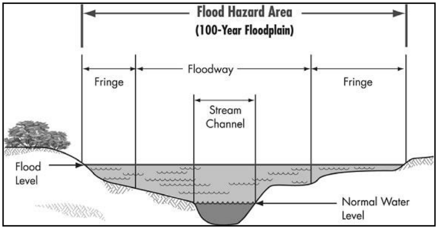
Illustration courtesy of the University of New Hampshire (UNH) Complex System Research Center (CSRC).
Start of Construction includes substantial improvement, and means the date the building permit was issued, provided the actual start of construction, repair, reconstruction, rehabilitation, addition placement, or other improvement was within 180 days of the permit date. The actual start means either the first placement of permanent construction of a structure on a site, such as the pouring of slab or footings, the installation of piles, the construction of columns, or any work beyond the stage of excavation; or the placement of a manufactured home on a foundation. Permanent construction does not include land preparation, such as clearing, grading and filling; nor does it include the installation of streets and/or walkways; nor does it include excavation for a basement, footing, piers, or foundations or the erection of temporary forms; nor does it include the installation on the property of accessory buildings, such as garages or sheds not occupied as dwelling units or not part of the main structure. For a substantial improvement, the actual start of construction means the first alteration of any wall, ceiling, floor, or other structural part of a building, regardless whether that alteration affects the external dimensions of the building.
Structure means, for floodplain management purposes, a walled and roofed building, including a gas or liquid storage tank, that is principally above ground, as well as a manufactured home. Structure, for insurance purposes, means: (a) A building with two or more outside rigid walls and a fully secured roof, that is affixed to a permanent site; (b) A manufactured home (“a manufactured home,” also known as a mobile home, is a structure: built on a permanent chassis, transported to its site in one or more sections, and affixed to a permanent foundation); or (c) A travel trailer without wheels, built on a chassis and affixed to a permanent foundation, that is regulated under the community’s floodplain management and building ordinances or laws. For the latter purpose, “structure” does not mean a recreational vehicle or a park trailer or other similar vehicle, except as described in (c) of this definition, or a gas or liquid storage tank.
Substantial damage means damage of any origin sustained by a structure whereby the cost of restoring the structure to its before damaged conditions would equal or exceed 50 percent of the market value of the structure before the damage occurred.
Substantial improvement means any reconstruction, rehabilitation, addition, or other improvement of a structure after the date of adoption of this bylaw, the cost of which, over three years, or over a the period of a common plan of development, cumulatively equals or exceeds 50 percent of the market value of the structure before the “start of construction” of the improvement. This term includes structures which have incurred “substantial damage”, regardless of the actual repair work performed. The term does not, however, include either: (a) Any project for improvement of a structure to correct existing violations of state or local health, sanitary, or safety code specification which have been identified by the local code enforcement official and which are the minimum necessary to assure safe living conditions or (b) Any alteration of a “historic structure”, provided that the alteration will not preclude the structure’s continued designation as a “historic structure”.
Violation means the failure of a structure or other development to be fully compliant with the community’s floodplain management regulations. A structure or other development without the elevation certificate, other certifications, or other evidence of compliance required in 44 CFR 60.3 is presumed to be in violation until such time as that documentation is provided.
Article 14planBTV Downtown Code
§ 14Preamble: A Place-Based Approach to Zoning
Subsections:
P.1 What is a Form-Based Code?
P.2 The Rural-to-Urban Transect: The Framework for the planBTV Downtown Code
P.3 Foundation for the planBTV Downtown Code
P.4 Guiding Principles for the planBTV Downtown Code
P.5 The Burlington Form Districts
P.6 Organization of the planBTV Downtown Code
P.7 How to Use the planBTV Downtown Code
This Preamble provides an overview of the planBTV Downtown Code generally, and its creation and organization. This text is not regulatory and is intended only to provide an introduction and an overview for users.
§ P.1What is a Form-Based Code?
The growing use of “form-based” development regulations represents a paradigm shift in the way that communities regulate the growth and development of the built environment. More and more communities are realizing that conventional, use-based approaches to zoning are much less effective for regulating diverse, urban, mixed-use environments.
Unlike conventional zoning regulations, form-based codes use the intended built form and physical characteristics of a place as the organizing principle or framework of the code, rather than one based on separating or concentrating land uses. A form-based approach helps to explain how buildings and structures relate to their lots, surrounding buildings and structures, and the street and other public rights-of-way. The naming conventions used in a form-based codes are typically “use-neutral” and instead reflect the intended physical form of a place or building. For example, instead of an area being labeled “single-family residential,” it might be called “traditional neighborhood.” The terms “neighborhood” and “downtown” both may include a mix of uses and different building types but with a different intended physical form, scale, and intensity of development.
While form-based codes primarily focus on the intended physical form and character of a place, it is not to say they ignore uses. Form-based codes carefully provide for a range of uses to maximize compatibility with the intended physical form of the area. In many cases, the defined physical form and character of a place or building will greatly influence the type or scale of a given use. This allows for a more simplified list of permitted and conditionally permitted uses. Burlington is using form-based codes to help achieve the overarching vision of planBTV-Downtown & Waterfront Master Plan to create a vibrant downtown that is welcoming to all.
§ P.2The Rural-to-Urban Transect: The Framework for the planBTV Downtown Code
The rural-to-urban transect is an organizing principle used by many form-based codes that establishes a hierarchy of places and contexts from the most rural to the most urban, and replaces use as the organizing principle as is used in conventional or Euclidean zoning. The designation of each zone along this hierarchy is determined first by the character and form, intensity of development, and type of place and secondly by the mix of uses within the area.
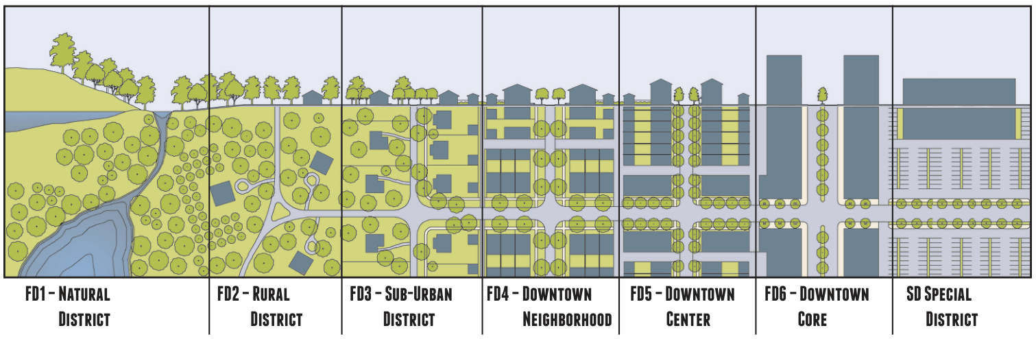
The planBTV Downtown Code uses the term “Form Districts” rather than “Transect Zones” for ease of use and understanding by the majority of users. The Burlington Form Districts currently include only the most urbanized (FD5-FD6) end of the hierarchy. The more natural, rural and suburban (generally FD1 through FD4) district types are not used at this time because they are generally not present within the downtown area of the city.
§ P.3Foundation for the Burlington Code
In 2013, the City of Burlington completed a comprehensive downtown and waterfront master plan called planBTV: Downtown and Waterfront Master Plan (www.burlingtonvt.gov/planBTV/), which was unanimously supported and adopted by the City Council. The development of planBTV began in 2011 with a series of studies to inventory and assess existing conditions and identify primary needs, challenges and opportunities. These assessments provided critical information and perspective necessary to inform a meaningful and grounded visioning and planning process. After 18 months of intensive public engagement by Burlingtonians, the development of the master plan began. planBTV is the culmination of these efforts and includes a cohesive vision that emerged from a planning process grounded in real-world present-day context. This vision for the future of the downtown and waterfront joins other major City policy documents such as the 2014 Climate Action Plan to ensure a “Sustainable Burlington” for the benefit of this generation and those that will follow.
One of the most important implementation tools identified in planBTV was the development of a form-based code for the Downtown and Waterfront area. This was understood to be a critical tool with which to facilitiate infill, allow for a more diverse range of building types, and create a more predictable and transparent public approvals process for new and future development within the city’s core.
§ P.4Guiding Principles for the planBTV Downtown Code
The planBTV Downtown Code is designed to be applied across the planBTV study area, becoming Article 14 of the Comprehensive Development Ordinance for this part of the City, in order to help advance the following guiding principles of the planBTV: Downtown and Waterfront Master Plan:
A Vibrant Economy - local food, local business, local character
Housing Choice - choice, affordability, dignity
Transportation Choice - walking, biking, transit, driving
Active and Healthy Living - Access to nature, arts, people, entertainment
Environmental & Cultural Stewardship - Access to clean water, clean air & natural spaces
Sense of Place - Civic pride, tolerance, community, authenticity
Creativity & Innovation - innovation, arts, creativity
§ P.5The Burlington Form
As part of the creation of the planBTV: Downtown and Waterfront Master Plan and the planBTV Downtown Code, City staff and their consultant team carefully documented different elements of the existing built and desired urban form in each of the different “Form Districts” to extract the Burlington-specific “DNA” for each sampled area. The result is the creation of two Form Districts for Burlington’s downtown and waterfront area as follows:
FD5 - Downtown Center applies to areas that have higher density of residential or commercial development often in attached or slightly detached forms providing a transition between the mixed use core and adjacent residential neighborhoods.
FD6 - Downtown Core applies to the core of the downtown with the highest density of residential or commercial development in attached or slightly detached forms.
For each of these Form Districts, a suite of suitable Building and Frontage Types were identified and create development forms that are appropriate in each zone. The result is a menu of building forms and configurations that are complimentary to the existing character of Burlington, and should be used as the city contines to evolve in order to retain and enhance its urban form.
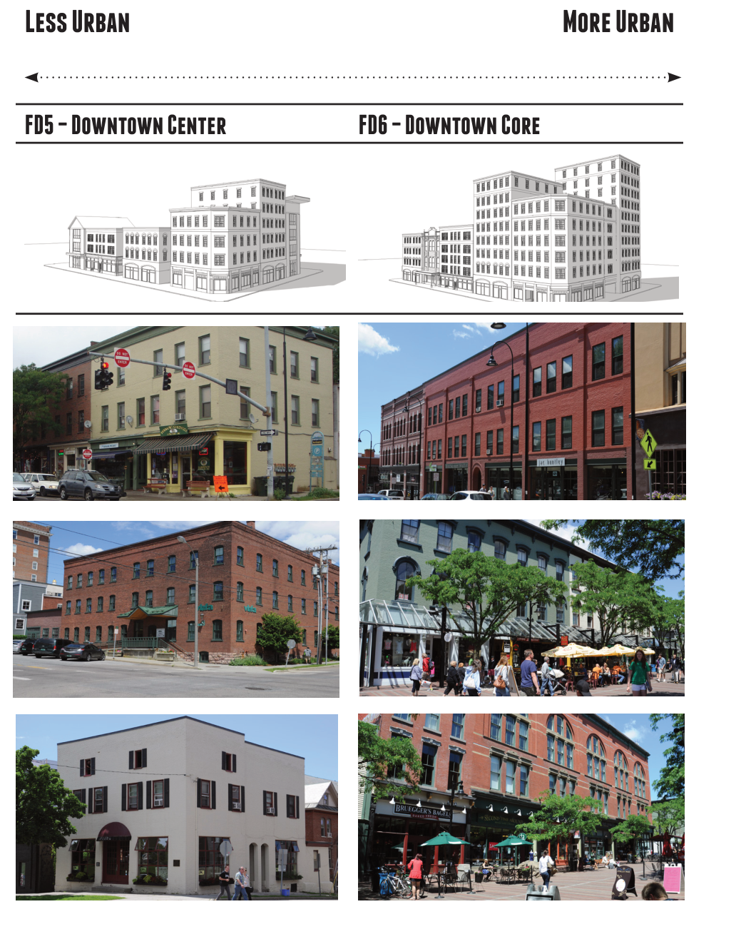
§ P.6Organization of the Burlington Form -Based Code
The following offers a brief overview of the organization of the planBTV Downtown Code and where to find the information that may be applicable to a given development proposal.
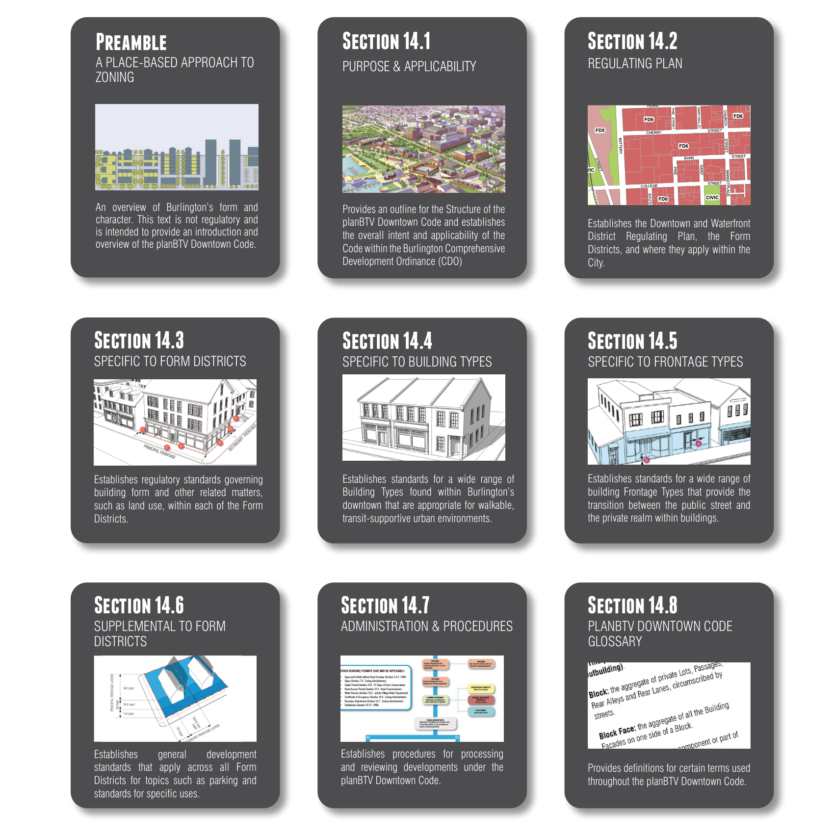
| Preamble | A PLACE-BASED APPROACH TO ZONING | An overview of Burlington’s form and character. This text is not regulatory and is intended to provide an introduction and overview of the planBTV Downtown Code. |
| Section 14.1 | PURPOSE & APPLICABILITY | Provides an outline for the Structure of the planBTV Downtown Code and establishes the overall intent and applicability of the Code within the Burlington Comprehensive Development Ordinance (CDO) |
| Section 14.2 | REGULATING PLAN | Establishes the Downtown and Waterfront District Regulating Plan, the Form Districts, and where they apply within the City. |
| Section 14.3 | SPECIFIC TO FORM DISTRICTS | Establishes regulatory standards governing building form and other related matters, such as land use, within each of the Form Districts. |
| Section 14.4 | SPECIFIC TO BUILDING TYPES | Establishes standards for a wide range of Building Types found within Burlington’s downtown that are appropriate for walkable, transit-supportive urban environments. |
| Section 14.5 | SPECIFIC TO FRONTAGE TYPES | Establishes standards for a wide range of building Frontage Types that provide the transition between the public street and the private realm within buildings. |
| Section 14.6 | SUPPLEMENTAL TO FORM DISTRICTS | Establishes general development standards that apply across all Form Districts for topics such as parking and standards for specific uses. |
| Section 14.7 | ADMINISTRATION & PROCEDURES | Establishes procedures for processing and reviewing developments under the planBTV Downtown Code. |
| Section 14.8 | PLANBTV DOWNTOWN CODE GLOSSARY | Provides definitions for certain terms used throughout the planBTV Downtown Code. |
§ P.7How to Use the planBTV Downtown Code
In graphic form, the illustration below highlights the basic steps to follow in using the planBTV Downtown Code. This is illustrative only and is not intended to set forth specific administration and procedures, which are described more fully in Section 14.7 (Administration and Procedures).
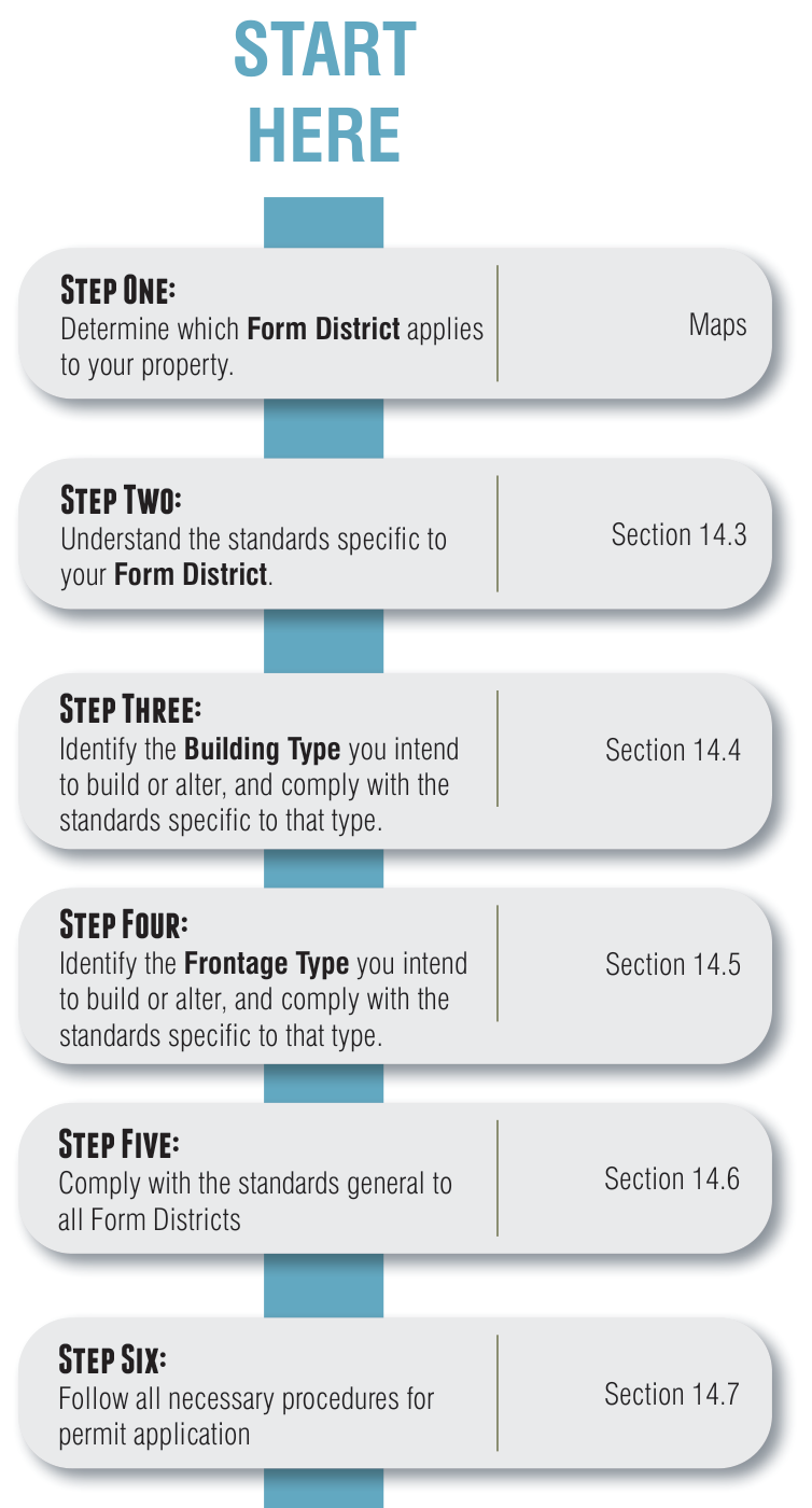
| Step One: | Determine which Form District applies to your property. | Maps |
| Step Two: | Understand the standards specific to your Form District. | Section 14.3 |
| Step Three: | Identify the Building Type you intend to build or alter, and comply with the standards specific to that type. | Section 14.4 |
| Step Four: | Identify the Frontage Type you intend to build or alter, and comply with the standards specific to that type. | Section 14.5 |
| Step Five: | Comply with the standards general to all Form Districts | Section 14.6 |
| Step Six: | Follow all necessary procedures for permit application | Section 14.7 |
Part 1Purpose and Applicability of the planBTV Downtown Code
§ 14.1Purpose and Applicability of the planBTV Downtown Code
Subsections:
14.1.1 Purpose
14.1.2 Intent
14.1.3 Applicability
§ 14.1.1Purpose
Article 14-planBTV Downtown Code is adopted as part of the Burlington Comprehensive Development Ordinance (CDO) to regulate development in the Downtown and Waterfront District as defined on Map 1-Regulating Plan (Section 14.2). Article 14 emphasizes the intended physical form and character of place and compatibility of uses. The organizing principle of Article 14 is based on a hierarchy of places in Burlington that range from the most rural to the most urban. The designation of Form Districts along this hierarchy is determined by the character and form, intensity of development, type of place, and the mix of uses within an area. These Form Districts reinforce existing, or enable creation of new, walkable mixed-use urban environments.
This Section 14.1 establishes the overall intent and applicability of Article 14 within the Burlington Comprehensive Development Ordinance.
§ 14.1.2Intent
The intent of this Article 14-planBTV Downtown Code is to enable, encourage, and qualify the implementation of the following within the Downtown and Waterfront District:
That development contiguous to urban areas should be structured in the pattern of, and be integrated with, the existing urban pattern, and contribute to Burlington’s moderately scaled urban form emphasizing a more efficient pattern of development.
That development should be compact, pedestrian-oriented, and mixed-use, and enhance the community with creative design, durable materials, and quality construction.
That ordinary activities of daily living should occur within walking distance of most dwellings, allowing independence to those who do not drive, and the promotion of personal safety and accessibility for those with disabilities in the design of publicly accessible outdoor and indoor spaces.
That a range of housing types and price levels should be provided to accommodate diverse ages and incomes.
That development should reinforce the implementation of Complete Streets that provide for the mobility needs of all segments of our population.
That architecture and landscape design should grow from local climate, topography, history, and building practice, and incorporate modern, climate-sensitive, and environmentally-conscious design considerations to create healthier, more productive, and more sustainable places to live and work.
That development should enhance the city’s skyline and promote visual interest with a variety of architectural styles and elements, details, and materials of a Building integral to the whole Building composition.
That important Civic Buildings should be distinctive and appropriate to a role more important than the other Buildings that constitute the fabric of the city, and be designed and constructed to the highest standards in order to reflect community values, inspire future development, foster civic pride, and serve as a model to others.
That the preservation and renewal of Historic Buildings should be facilitated.
That the intended physical form and character of development and resulting places shall be emphasized.
§ 14.1.3Applicability
This planBTV Downtown Code shall be applicable to all lands outside of the public rights-of-way or a Thoroughfare within the Downtown and Waterfront District as mapped or described on the Burlington Regulating Plan (Section 14.2), as such may be changed from time to time, pursuant to Section 14.2 - Regulating Plan. Any and all subdivision of land, development, and construction or modification of all Improvements, land, Buildings, and Structures in the Downtown and Waterfront District shall occur only in accordance with this Article 14 planBTV Downtown Code as in effect on the date of acceptance of the completed application for approval of the applicable Project Plan submitted pursuant to Section 14.7 Administration and Procedures.
Improvement, development, construction or modification within an existing or proposed public right-of-way or a Thoroughfare shall be made in accordance with Great Streets BTV: Downtown Street Standards, and require approval by the Dept. of Public Works.
To the extent applicable, and not otherwise in conflict with this Article 14-planBTV Downtown Code, the following sections of the Burlington Comprehensive Development Ordinance (CDO) shall also continue to apply:
Article 1 - General Provisions
Article 2 - Administrative Mechanisms;
Article 3 - Applications, Permits and Project Reviews, Parts, 1, 2, 3, 5 and 6;
Article 4 - Zoning Maps and Districts, Parts 1, 2, 3, and Part 5 Sec. 4.5.4;
Article 5 - Citywide General Regulations, Parts 1, 2 and 3; Part 4, Secs 5 Sec. 5.4.7 and Sec. 5.4.8; and Part 5;
Article 7 - Signs
Article 8 - Parking
Article 9 - Inclusionary and Replacement Housing;
Article 10 - Subdivision Review;
Article 12 - Variances and Appeals; and,
Article 13 - Definitions.
In each case, the standards and requirements applicable to the Downtown and Waterfront District Regulating Plan and this Article 14 shall take precedence without limitation over any duplicative or conflicting provisions of the other Articles of the Burlington Comprehensive Development Ordinance (BCDO).
If there is any conflict between the provisions of this Article 14 and any provisions of any other existing City codes, ordinances, regulations or standards (the “Existing Local Codes”), the provisions of this Article 14 shall take precedence over such conflicting provisions except for City and state Building, Fire, Health and Safety Codes.
The graphics, illustrations, photographs, tables, and metrics are an integral part of the planBTV Downtown Code; however:
Photographs are provided only as general illustrative examples and are not binding;
The illustrations of Table 14.3-A Burlington Form Districts Summary Table, Table 14.3.6-A Civic Space Types Summary Table, Table 14.4-A Building Types Summary Table, and Table 14.5-A Frontage Types Summary Table are provided only as general illustrative descriptions and are not binding;
The diagrams, photographs, and illustrations contained in Sections 14.3.4 through 14.3.6 (Specific to Form Districts), Sections 14.4.4 through 14.4.13 (Specific to Building Types), and Sections 14.5.4 through 14.5.17 (Specific to Frontage Types) are provided only to indicate the general character of the various Form Districts and elements. References to metrics shown thereon however shall have regulatory effect.
The graphics, illustrations, and photographs in Section 14.8 Glossary are provided for illustrative purposes only and are not binding;
The graphical depictions of the Form Districts on the various Tables are provided for ease of reference only and are not binding. The Form District designations and standards applicable to each Form District are binding.
Where in conflict, metrics represented in text and/or tables shall take precedence over metrics represented graphically, and a more specific standard shall take precedence over a more general standard.
Part 2Regulating Plan
§ 14.2Regulating Plan
Subsections:
14.2.1 Purpose
14.2.2 Applicability
14.2.3 Regulating Plan Amendments
14.2.4 Form Districts
14.2.5 Civic Space
14.2.6 Special Requirements
§ 14.2.1Purpose
This Section 14.2 establishes the Downtown and Waterfront District Regulating Plan (Map 1-Regulation Plan) which provides the geographic framework to define and describe the location and nature of all regulation of Improvements, land, Structures, Buildings, and Lots within the Downtown and Waterfront District.
§ 14.2.2Applicability
The Downtown and Waterfront District Regulating Plan (Map 1- Regulating Plan) is adopted as an element of the “Official Zoning Map, City of Burlington VT” established under Section 4.1.1 of the Burlington Comprehensive Development Ordinance. The Downtown and Waterfront District Regulating Plan indicates the boundaries of the Downtown and Waterfront District, and the applicable Form Districts, Civic Spaces, Special Requirements, and any other elements. The Official Map of the City of Burlington and the Downtown and Waterfront Core Official Map established under Article 4, Part 2 of the Burlington Comprehensive Development Ordinance shall also have applicability within the Downtown and Waterfront District.
All Development, redevelopment, Substantial Modification, and Improvements to land, Structures, Buildings, and Lots within Downtown and Waterfront District shall comply with the Downtown and Waterfront District Regulating Plan and the elements and standards for such applicable Form Districts, Civic Spaces, and Special Requirements reflected on the Downtown and Waterfront District Regulating Plan.
§ 14.2.3Downtown and Waterfront District Regulating Plan Amendments
The Downtown and Waterfront District Regulating Plan may be amended from time to time pursuant to Section 4.1.3 of the Burlington Comprehensive Development Ordinance.
§ 14.2.4Form Districts
A Form District is one of several areas on the Downtown and Waterfront District Regulating Plan to which certain development, Lot and Building standards, and other elements of the intended built environment are applicable. Form Districts shall be assigned for and mapped on the Downtown and Waterfront District Regulating Plan, and as applicable, for and on each proposed Downtown and Waterfront District Regulating Plan Amendment and Development Plan. As depicted on the Downtown and Waterfront District Regulating Plan- Map 1, in the Burlington Downtown & Waterfront District there are two (2) Form Districts as follows :
FD6 - Downtown Core (Section 14.3.4 - Specific to Form Districts - Downtown Core)
FD5 - Downtown Center (Section 14.3.5 - Specific to Form Districts - Downtown Center)
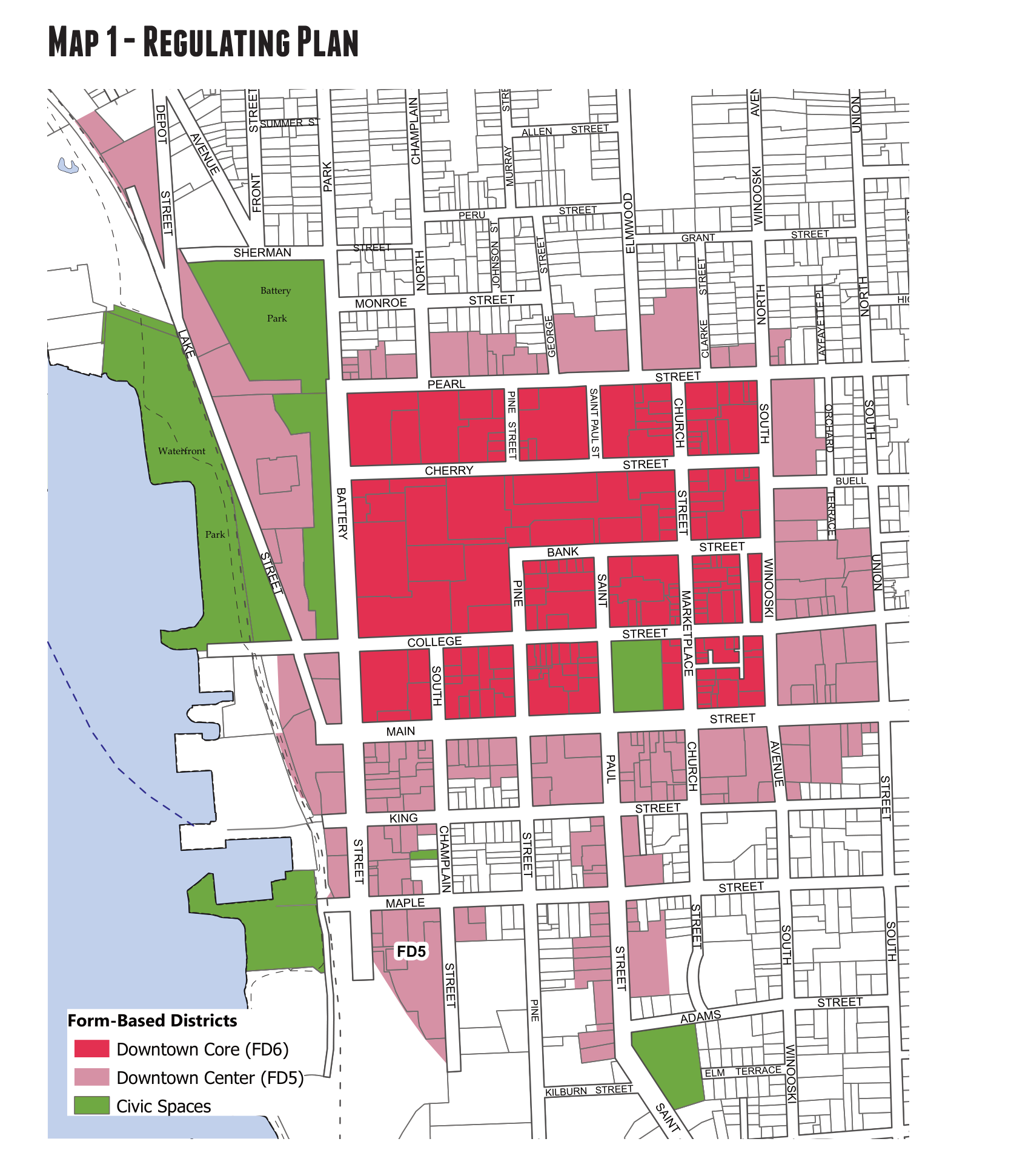
§ 14.2.5Civic Space
A Civic Space (CS) is an area dedicated for Civic use and defined by the combination of certain physical constants and Improvements, including the relationships among their intended use, size, landscaping, and any Enfronting Buildings.
Civic Space assigned and mapped on the Downtown and Waterfront District Regulating Plan are areas that are owned and operated by the City and which are already dedicated for one or more Civic purposes. Additional Civic Spaces as established and described in Section 14.3.7 Civic Spaces, may be incorporated into new development or established independently as may be permitted in each of the various Form Districts.
§ 14.2.6Special Requirements
The Downtown and Waterfront District Regulating Plan also designates Special Requirements listed below and as depicted on Map 2 - Specific Height Areas and Map 3 - Shopfronts Required. Where the Downtown and Waterfront District Regulating Plan designates any one or more of such Special Requirements, the following standards shall be applied:
Specific Height Areas - Areas within Form Districts where the height limit of Buildings, subject to the requirements of the applicable Form District, shall be as follows:
The height of a Building in FD6 with a Principal Frontage in the area identified as “A” on Map 2 - Specific Height Areas may be increased to a maximum of 14 Stories not to exceed 160-feet.
The height of a Building in FD6 with a Principal Frontage on the Church Street Marketplace District in the area identified as “B” on Map 2 - Specific Height Areas shall be decreased to a maximum of 4 Stories not to exceed 45-feet within 20-feet of the Frontage Line. Thereafter, any portion of a building fronting on Church Street exceeding 65-feet shall be set-back a minimum of 10-feet for every 10-feet of additional building height above 65-feet.
The height of a Building in FD5 with a Principal Frontage on the south side of Main Street west of S. Winooski Ave. in the area identified as “C” on Map 2 - Specific Height Areas may be increased to a maximum of 10 Stories not to exceed 105-feet to a depth of 150-feet from the Frontage Line.
The height of a Building in FD5 with a Principal Frontage on the north side of Main Street, east of S. Winooski Ave. in the area identified as “D” on Map 2 - Specific Height Areas may be increased to a maximum of 8 Stories not to exceed 85-feet.
The height of a Building in FD5 with a Principal Frontage in the area identified as “E” on Map 2 - Specific Height Areas may be increased to a maximum of 6 Stories not to exceed 65-feet.
The height of a Building in FD5 with a Principal Frontage on the east side of Battery Street south of Main Street in the area identified as “F” on Map 2 - Specific Height Areas may be increased to a maximum of 5 Stories not to exceed 55-feet.
The height of a Building in FD5 with a Principal Frontage on Lake Street in the area identified as “G” on Map 2 - Specific Height Areas may be incrementally increased beyond 50’ from the Lake St. Frontage Line in order to establish a second Façade and Frontage along Battery Park Extension with the building having a presence of no more than 1 Story not to exceed 20 feet facing Battery Park Extension.
The DRB may alow for an increase of the applicable depths from the Frontage Line as noted above, not to exceed an additional 20 feet, in order to match an existing rear property line pursuant to the provision of Sec. 14.7.3b) allowing for Alternative Compliance.
Shopfront Required - Areas within Form Districts where a Shopfront Frontage Type per the requirements of Sec. 14.5.13 are required as illustrated on the Downtown and Waterfront District Regulating Plan - Map 3 - Shopfronts Required. The required Shopfront Frontage may be used in conjunction with a Courtyard, Arcade, Gallery and/or Terrace Frontage Type as regulated per the requirements of Sec. 14.5. Civic Buildings established per Sec. 14.3.6 and Sec. 14.7.1f) are exempt from this requirement.
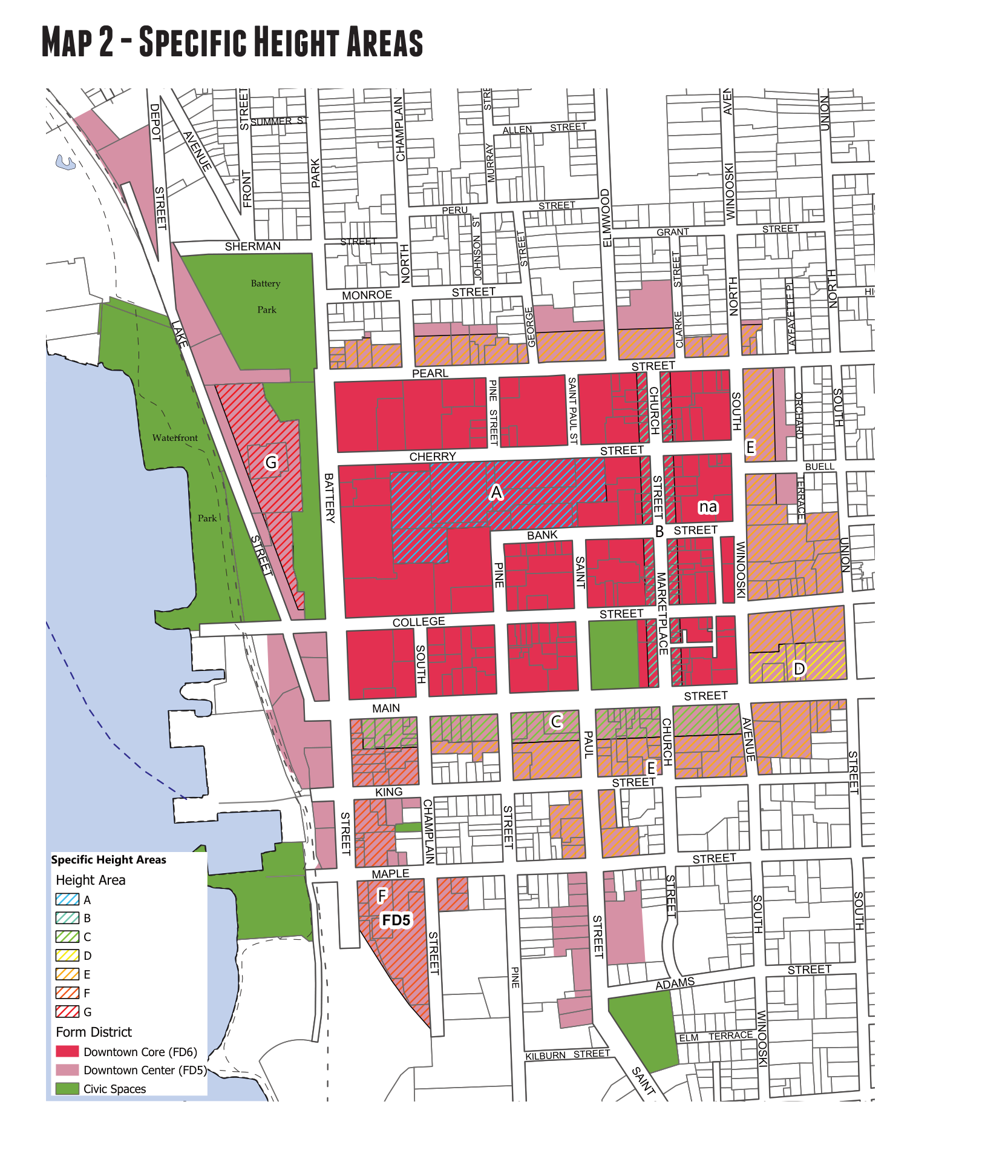
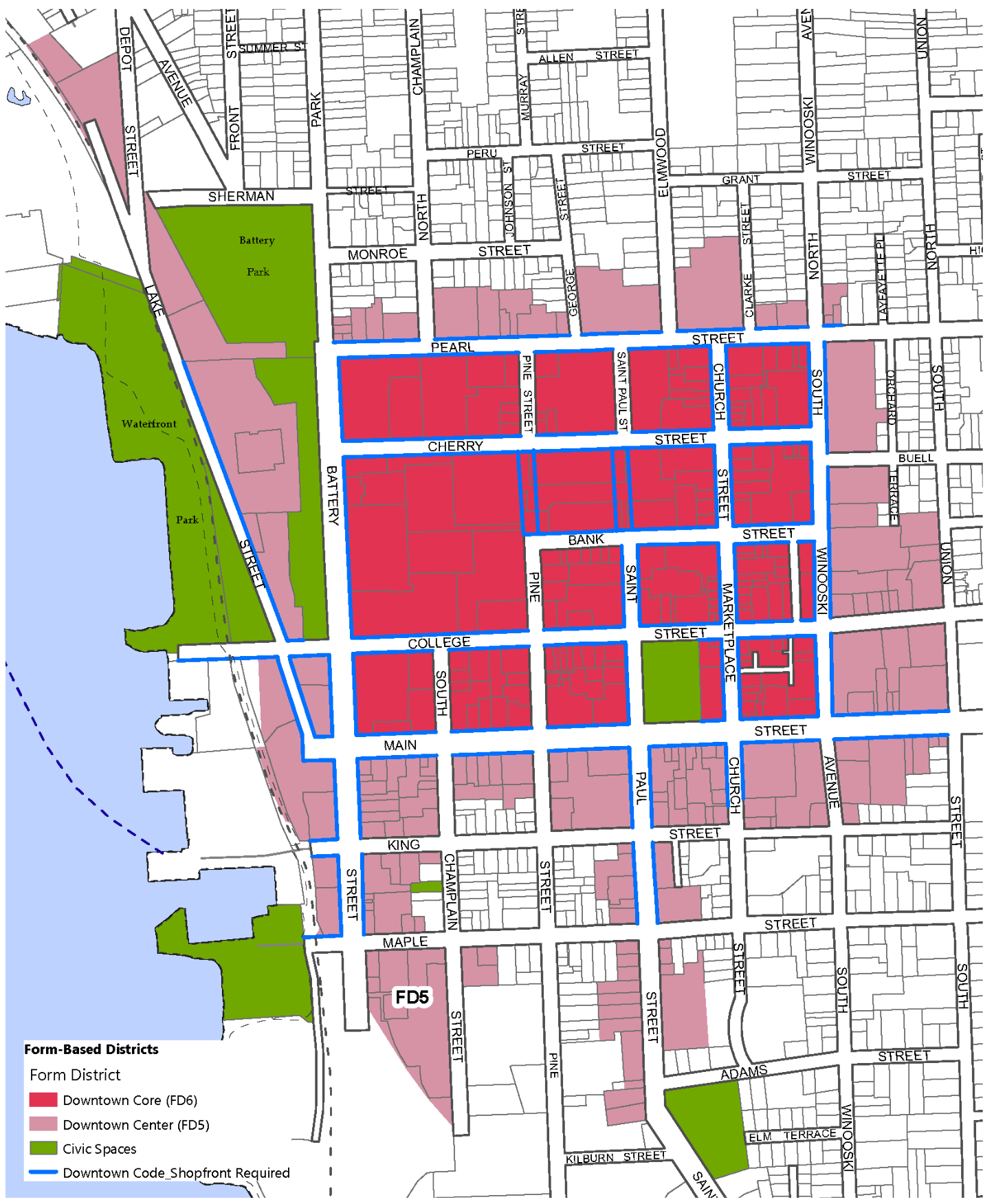
Part 3Specific to Form Districts
§ 14.3Specific to Form Districts
Subsections:
14.3.1 Purpose
14.3.2 Applicability
14.3.3 Form Districts General
14.3.4 FD6 Downtown Core (FD6)
14.3.5 FD5 Downtown Center (FD5)
14.3.6 Civic Spaces
§ 14.3.1Purpose
This Section provides regulatory standards governing Building form standards, use, and parking standards for each Form District. Article 14 - planBTV Downtown Code is a reflection of the community vision for implementing the intent of planBTV–Downtown & Waterfront Master Plan to create places of walkable urbanism. These standards are intended to ensure that all proposed development is compatible with existing and future development on neighboring properties, and produces a walkable, urban environment.
§ 14.3.2Applicability
All Development, redevelopment, Substantial Modification, and Improvements to land, Structures, Buildings, and Lots within the Downtown and Waterfront District shall comply with all standards of Section 14.3 (Specific to Form Districts) including all Tables specific to each Form District, and shall be considered in combination with the standards of Section 14.4 (Specific to Building Types), Section 14.5 (Specific to Private Frontage Types), and Section 14.6 (Supplemental to Form Districts).
The standards and requirements applicable to a Form District shall modify and take precedence without limitation over any duplicative or conflicting provisions of Section 14.6 (Supplemental to Form Districts) unless otherwise specified.
§ 14.3.3Form Districts General
The following shall be applicable to all Form Districts:
Lots being newly platted or re-platted shall be dimensioned as allowed for by the applicable Form District or Building Type as may be applicable.
Buildings shall be disposed in relation to the boundaries of their Lots according to the standards shown for the applicable Form District in this Section.
One or more Principal Buildings at the Frontage, and one or more Outbuildings and Backbuilldings to the rear of the Principal Building, may be built on each Lot.
Residential development must be cognizant of nearby non-residential uses in their design and construction, so as to minimize disturbance to residents. Accomodations for residential uses shall not undermine or reduce the overall development objectives and intensities on adjacent properties in FD6 and FD5.
Table 14.3-A - The Burlington Form Districts Summary Table provides an overview of the Burlington Form Districts.
TABLE 14.3-A- The Burlington Form Districts Summary Table [not-regulatory]
| FD5 – Downtown Center | FD6 - Downtown Core |
|---|---|
| Intent | Intent |
| To enhance the vibrant urban center with a variety of high density building types that provide locally and regionally serving office, retail, service, hospitality, entertainment, and Civic functions, as well as a wide variety of urban housing choices. This district reinforces and extends the walkable nature of the adjacent downtown core with shallow front setbacks and active street frontages, and provides a transition between larger and smaller scale buildings in the adjacent districts. | To enhance the vibrant urban center with a variety of high density building types that provide locally and regionally serving office, retail, service, hospitality, entertainment, and Civic functions, as well as a wide variety of urban housing choices. This district reinforces the walkable nature of the city’s urban core with shallow front setbacks and buildings forming a continuous building wall along the sidewalk, and very active and engaging street frontages. |
| Desired Form | Desired Form |
| Attached Buildings with little to no side Setback | Attached Buildings with little to no side Setback |
| Small to large footprint | Small to large footprint |
| Building at the Frontage line | Building at the Frontage line |
| Multiple Buildings on a single lot | Multiple Buildings on a single lot |
| 3 to 10 stories | 3 to 14 stories |
| Outbuildings are not common | Outbuildings are not common |
| General Use | General Use |
| Vertically Mixed Uses: retail, service, hospitality, entertainment, Civic, on the ground floor with residential and other commercial uses on upper floors. | Vertically Mixed Uses: retail, service, hospitality, entertainment, Civic, on the ground floor with residential and other commercial uses on upper floors. |
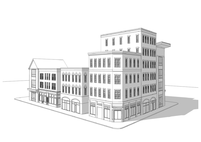
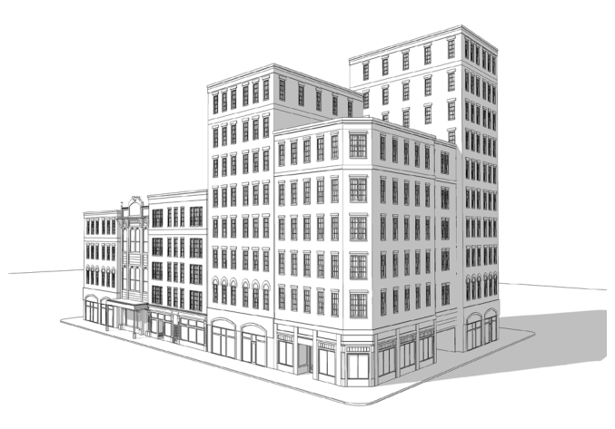
§ 14.3.4FD6 - Downtown Core
14.3.4-A- Intent
To enhance the vibrant urban center with a variety of high density building types that provide locally and regionally serving office, retail, service, hospitality, entertainment, and Civic functions, as well as a wide variety of urban housing choices. This district reinforces the walkable nature of the city’s urban core with shallow front setbacks and buildings forming a continuous building wall along the sidewalk, and very active and engaging street frontages.
Attached Buildings with little to no side Setback
Small to large footprints
Buildings at the Frontage line
3 to 14 stories
Multiple Buildings on a single lot
Outbuildings uncommon
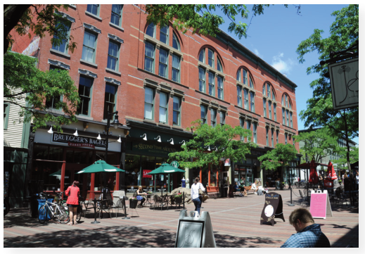
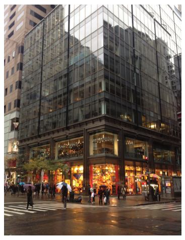
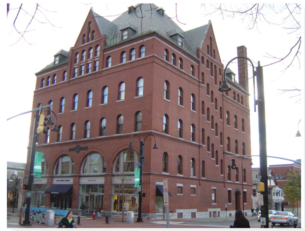
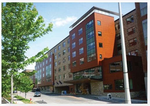
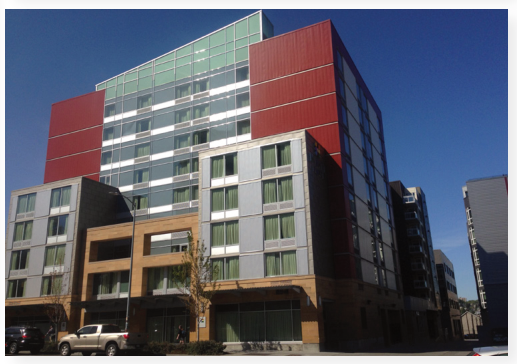
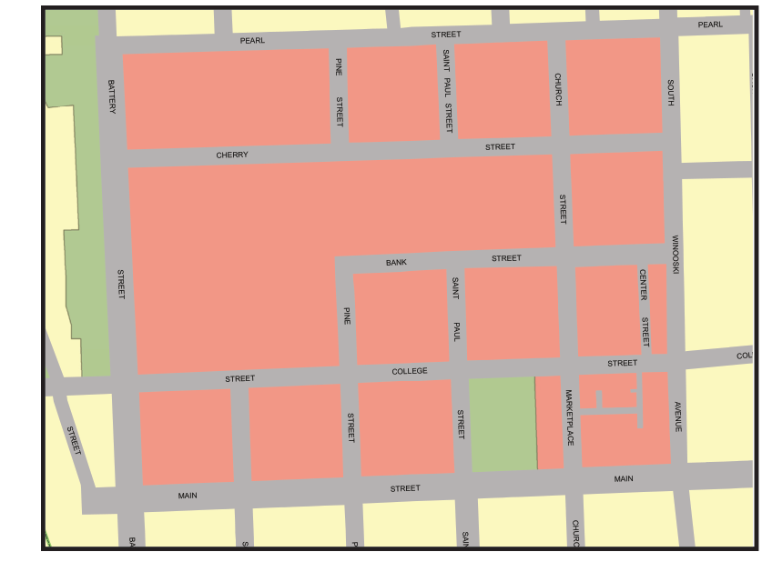
14.3.4-B- Allowed Building Types
| Building Type | Standards |
|---|---|
| Rowhouses¹ | Section 14.4.7 |
| Multi-Family: Small¹ | Section 14.4.8 |
| Multi-Family: Large¹ | Section 14.4.9 |
| Mixed-Use | Section 14.4.10 |
| Perimeter | Section 14.4.11 |
| Civic | Section 14.4.12 |
¹ Only permitted where a Shopfront Frontage Type is not required.
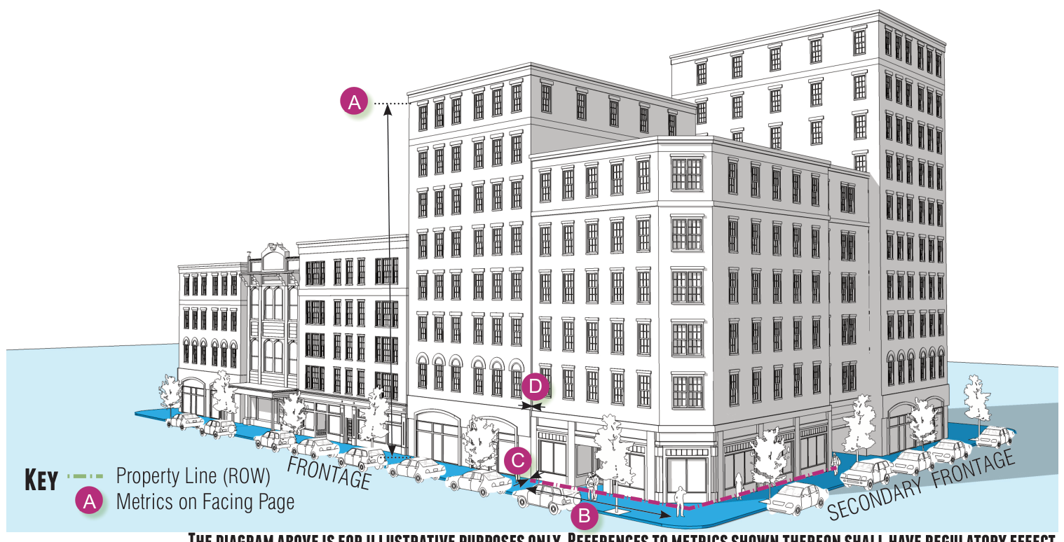
The diagram above is for illustrative purposes only. References to metrics shown thereon shall have regulatory effect.
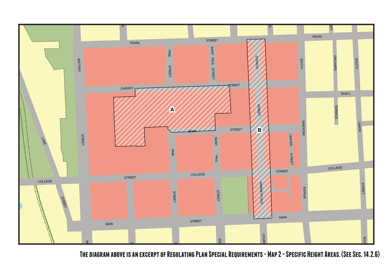
The diagram above is an excerpt of Regulating Plan Special Requirements - Map 2 - Specific Height Areas. (See Sec. 14.2.6)
14.3.4-C- Lot Occupation & Building Placement
| Building Disposition | ||
|---|---|---|
| Block Perimeter | 2,000-ft max. | |
| Pervious Area | 10% min. | |
| Yard Type (see Section 14.6.3) | - Sideyard; - Rearyard | |
| Ground Floor Entries (linear distance along the Primary Frontage) | every 60-ft max. | |
| Frontage Buildout & Building Setback | ||
| Frontage Buildout | 100% min. along a Primary Frontage | (B) |
| 80% min. along a Secondary Frontage | ||
| Front Setback: | (C) | |
| - Principal Buildings | 0-ft min.; 6-ft max. but in no event less than 12-ft from the curb. | |
| - Outbuildings | In third Lot Layer | |
| Front Setback Exceptions: | ||
| In no event shall any Building be set closer than 15-ft from the curb along Main St from S. Winooski to Battery St., and along S. Winooski Ave from Main to Pearl St. | ||
| Additional exceptions and variations regarding front setbacks may be provided as part of a specific Frontage Type (see Sec. 14.5.). | ||
| Side Setback: | (D) | |
| - Principal Buildings | 0-ft min. - 12-ft max. | |
| - Outbuildings | 0-ft min. or 3-ft min. on a Secondary Frontage | |
| Rear Setback: | ||
| - Principal Buildings | 0-ft min. or 15-ft from a rear public Alley centerline | |
| - Outbuildings | 0-ft min. or 15-ft from a rear public Alley centerline | |
Any development shall also be subject to the provisions of Burlington CDO Sec. 4.2.2 Downtown and Waterfront Official Map as may be applicable.
14.3.4-D- Building Form
| Building Height (A) | |
|---|---|
| Principal Buildings | Subject to Administrative Review: • 3 Stories min. • 4 Stories max., not to exceed 45-feet within 20-feet of the Frontage Line on the Church Street Marketplace¹; otherwise, • 6 Stories max., not to exceed 65-feet |
| Subject to DRB Review per Sec. 14.6.4 f: • 10 Stories max., not to exceed 105-feet; or, • 14 Stories max, not to exceed 160-feet ² | |
| Outbuildings | 2 Stories max. not to exceed 24-feet |
¹ Subject to Regulating Plan Special Requirements Map 2 - Specific Height Areas (See Sec. 14.2.6), a Building with a Principal Frontage on the Church Street Marketplace in the area identified as “B” shall be decreased to a maximum of 4 Stories not to exceed 45-feet within 20-feet of the Frontage Line. Thereafter, any portion of a building fronting on Church Street exceeding 65-feet shall be set-back a minimum of 10-feet ( B & D below) for every 10-feet of additional building height ( A & C below) above 65-feet.
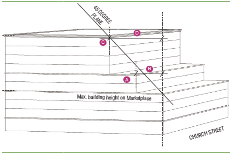
² Subject to Regulating Plan Special Requirements Map 2 - Specific Height Areas (See Sec. 14.2.6), a Building with a Principal Frontage in the area identified as “A” may be increased to a maximum of 14 Stories not to exceed 160-feet.
14.3.4-F- Encroachments into Required Setbacks
| Encroachment Type | Rear |
|---|---|
| Awnings and Canopies² | Not permitted |
| Balcony and Decks | 4-ft max. encroachment |
| Other Architectural Features⁴ | 4-ft max. encroachment |
| Landscaping | Permitted |
| Fences or freestanding walls | 6-ft max. height |
| Driveways, Walkways | Permitted |
| Utility Structures | Permitted |
¹ Subject to Frontage Type standards in Sec.14.5.
² Subject to Sign standards in Art 7 of the BCDO.
³ Subject to Awning and Canopy standards in Sec. 14.4.13 h.
⁴ Building eaves, roof overhangs, solar shades, light shelves, bay windows, oriels, vestibules that are less than ten feet wide, cornices, belt courses, window sills, buttresses, and other similar architectural features may encroach into a required setback provided that such extension does not encroach a property line.
14.3.4-E- Parking, Loading & Service
On-Site Parking
On-site parking shall be provided per the requirements of Sec. 14.6.7.
Location on the Lot
All parking provided within a Principal Building Type (other than a Perimeter Building) shall be located Underground, at or above the second Story, and/or at-grade within the first Story where located in the Third Lot layer and separated from the street by an Active Street-level Use.
All Parking Structures, Garages and Parking Areas shall be located in the Third Lot Layer behind a Principal Building Type. Parking Lots are not permitted
Miscellaneous
See also Sec. 14.6.7 for additional requirements pertaining to parking and site design.
14.3.4-G- Encroachments - Public right-of-way
(Along Principal and Secondary Frontages only)
| Encroachment Type | Public ROW |
|---|---|
| Awnings¹ | Permitted |
| Canopies¹ | Permitted |
| Signs ² | Permitted |
| Other Architectural Features ³ | 4-ft max. |
¹ Subject to Awning and Canopy standards in Sec. 14.4.13 h.
² With the exception of Freestanding Signs.
³ Building eaves, roof overhangs, solar shades, light shelves, bay windows, oriels, vestibules that are less than ten feet wide, cornices, belt courses, window sills, buttresses, and other similar architectural features may encroach into the ROW provided they are a minimum of 10-ft above the Sidewalk.
14.3.4-H- Use Type
Uses not specifically listed in a use table, and that are not similar in nature and impact to a use that is listed, are not permitted.
| FD6 | |
|---|---|
| RESIDENTIAL - GENERAL | |
| Attached Dwellings | P |
| Single Detached Dwellings (only pre-existing; Buildings originally designed and constructed for such purpose) | P |
| RESIDENTIAL - SPECIAL | |
| Assisted Living | P |
| Boarding House¹ | P |
| Community House (Sec.14.6.6.e) | P |
| Convalescent /Nursing Home | P |
| Short Term Rental (See Ch. 18: Min. Housing) | P |
| SHORT-TERM ACCOMMODATIONS | |
| Historic Inn (Sec.14.6.6.c) | P |
| Lodging | P |
| Shelter | P |
| RETAIL - GENERAL | |
| ATM | P |
| Auto/Boat/RV Sales/Rentals³ | P |
| Convenience Store | P |
| Fuel Service Station² (Sec.14.6.6.d) | CU |
| General Merchandise/Retail | P |
| RETAIL - OUTDOOR | |
| Open Air Markets | P |
| Key | |
|---|---|
| Permitted Use | P |
| Conditional Use | CU |
END NOTES
¹Must be owner-occupied.
² Automobile sales not permitted as an Accessory Use
³ Exterior storage and display not permitted.
| FD6 | |
|---|---|
| OFFICE & SERVICE | |
| Animal Grooming | P |
| Auto/Boat/RV Service³ (Sec.14.6.6.d) | P |
| Beauty Salon/Barber Shop/Spa | P |
| Car Wash | P |
| Crisis Counseling Center (Sec. 14.6.6.g) | P |
| Office – General | P |
| Office – Medical | P |
| Office – Technical | P |
| Dry Cleaning Service | P |
| Funeral Home | P |
| Health Club/Studio | P |
| Laundromat | P |
| Mental Health Crisis Center | P |
| Tailor Shop | P |
| HOSPITALITY/ ENTERTAINMENT/ RECREATION | |
| Aquarium | P |
| Art Gallery/Studio | P |
| Bar, Tavern | P |
| Billiards, Bowling & Arcade | P |
| Café | P |
| Cinema | P |
| Club, Membership | P |
| Community Center | P |
| Conference/Convention Center | P |
| Museum | P |
| Performing Arts Center | P |
| Performing Arts Studio | P |
| Recreational Facility - Indoor | P |
| Restaurant | P |
| Restaurant – Take Out | P |
| FD6 | |
|---|---|
| MANUFACTURING/ PRODUCTION/ STORAGE | |
| Dental Lab | P |
| Food Processing | P |
| Manufacturing - Light ³ | P |
| Manufacturing ³ | P |
| Medical Lab | P |
| Production Studio | P |
| Photography Lab | P |
| Printing Plant | P |
| Research & Development Facility | P |
| Research Lab | P |
| Warehouse/Storage ³ | P |
| Warehouse, Self-Storage ³ | P |
| EDUCATION & DAY CARE | |
| Day Care - Adult | P |
| Daycare - All (Sec. 14.6.6.b) | P |
| School - Post-Secondary & Community College | P |
| School - Primary | P |
| School - Secondary | P |
| School, -Trade, or Professional | P |
| FD6 | |
|---|---|
| Civic | |
| Courthouse | P |
| Fire Station | P |
| Library | P |
| Park | P |
| Police Station | P |
| Post Office | P |
| Worship, Place of | P |
| TRANSPORTATION & UTILITIES | |
| Recycling Center - Small ³ (2,000 sf or less) | P |
| Public Transit Terminal | P |
| Operations Center – Taxi/Bus ³ | P |
| Parking Structure | P |
| Key | |
|---|---|
| Permitted Use | P |
| Conditional Use | CU |
END NOTES
³ Exterior storage and display not permitted.
§ 14.3.5FD5 – Downtown Center
14.3.5-A- Intent
To enhance the vibrant urban center with a variety of high density building types that provide locally and regionally serving office, retail, service, hospitality, entertainment, and Civic functions, as well as a wide variety of urban housing choices. This district reinforces and extends the walkable nature of the adjacent downtown core with shallow front setbacks and active street frontages, and provides a transition between larger and smaller scale Buildings in adjacent districts.
Attached Buildings with little to no side Setback
Small to large footprints
Buildings at the Frontage line
3 to 10 stories
Multiple Buildings on a single lot
Outbuildings uncommon
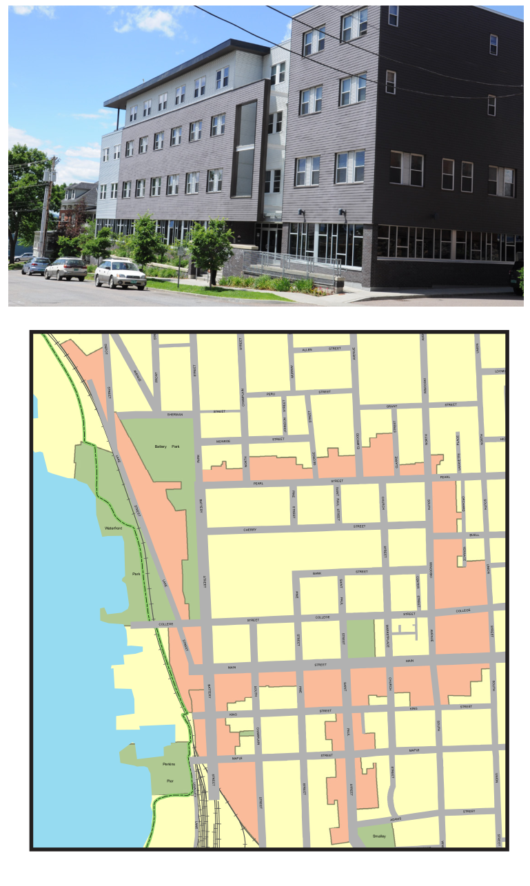
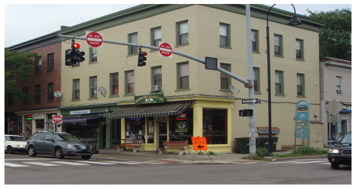
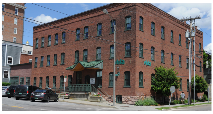
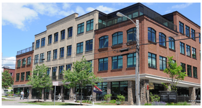
14.3.5-B- Allowed Building Types
| Building Type | Standards |
|---|---|
| Rowhouses ¹ | Section 14.4.7 |
| Multi-Family: Small ¹ | Section 14.4.8 |
| Multi-Family: Large ¹ | Section 14.4.9 |
| Mixed-Use | Section 14.4.10 |
| Perimeter | Section 14.4.11 |
| Civic | Section 14.4.12 |
¹ Only permitted where a Shopfront Frontage Type is not required.
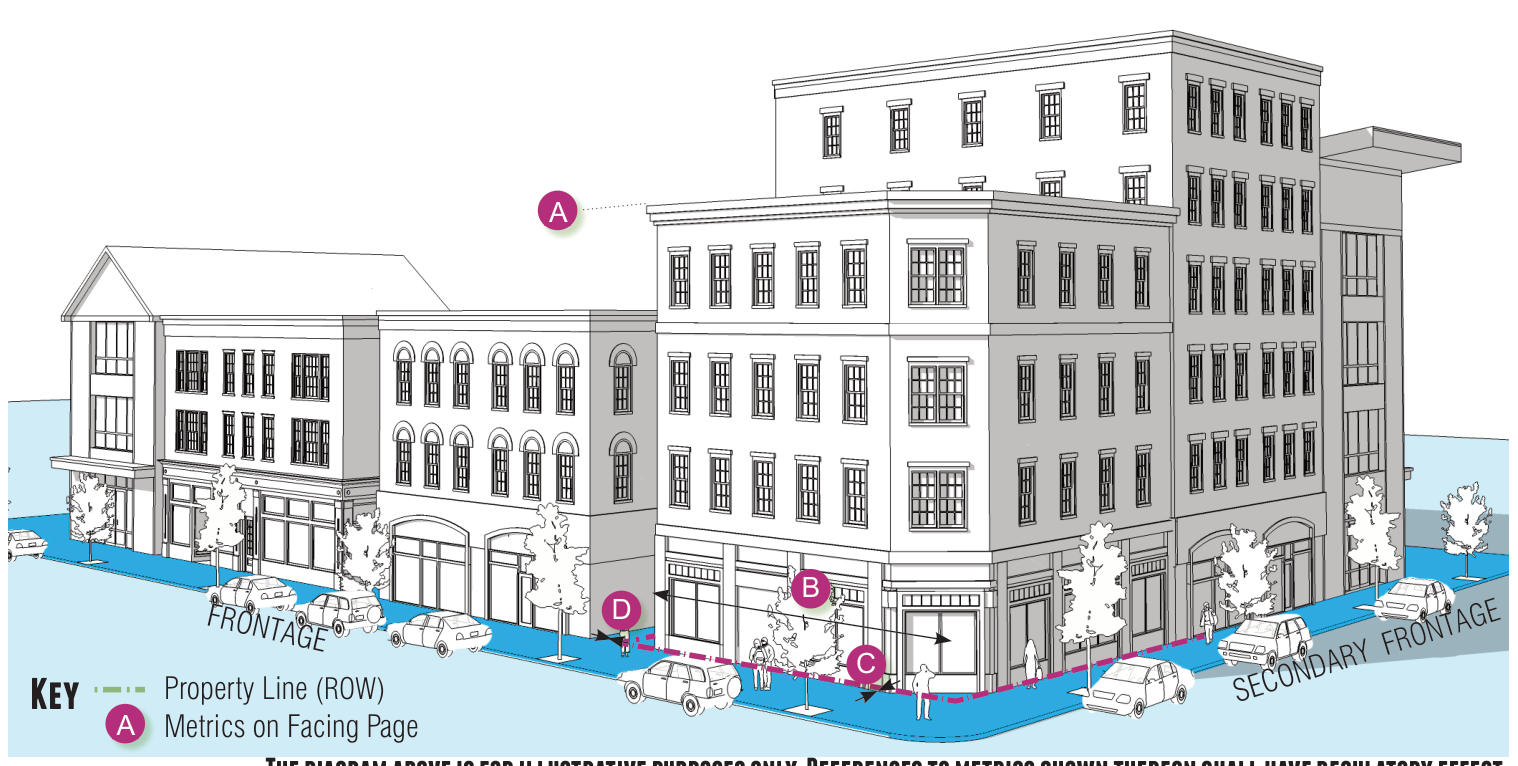
The diagram above is for illustrative purposes only. References to metrics shown thereon shall have regulatory effect.
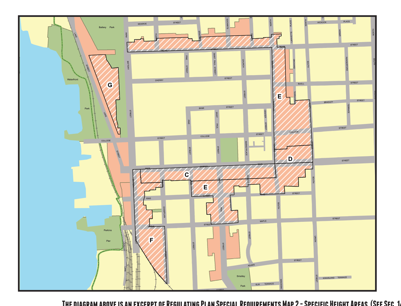
The diagram above is an excerpt of Regulating Plan Special Requirements Map 2 - Specific Height Areas. (See Sec. 14.2.6)
14.3.5-C- Lot Occupation & Building Placement
| Building Disposition | ||
|---|---|---|
| Block Perimeter | 2,000 ft. max. | |
| Pervious Area | 10% min. | |
| Yard Type (see Section 14.6.3) | - Sideyard; - Rearyard | |
| Ground Floor Entries (linear distance along the Primary Frontage) | 60-ft max. | |
| Frontage Buildout & Building Setback | ||
| Frontage Buildout | 80% min. along both Primary and Secondary Frontages | (B) |
| Front Setback: | (C) | |
| Principal Buildings | - 0-ft min.; 6-ft max, but in no event less than 12-ft from the curb. | |
| Outbuildings | In third Lot Layer | |
| Front Setback Exceptions: | ||
| In no event shall any Building be set closer than 15-ft from the curb along Main St from S. Union to Battery St., and along S. Winooski Ave from King to Pearl St. | ||
| For additional exceptions and variations regarding front setbacks provided as part of a specific Frontage Type see Sec. 14.5. | ||
| Side Setback: | (D) | |
| Principal Buildings | - 0-ft min. - 12-ft max. - 10-ft min. along a Form District boundary shared with a residential district. | |
| Outbuildings | - 0-ft min. or 3-ft min. on secondary frontage | |
| Rear Setback: | ||
| Principal Buildings | - 0-ft min. or 15-ft from rear public Alley centerline; - 10-ft min. along a Form District boundary shared with a residential district. | |
| Outbuildings | - 0-ft min. or 15-ft from rear public Alley centerline | |
Miscellaneous
Any development in the area west of Battery Street, between and including Sherman to Maple streets extended, shall also be subject to the provisions of Burlington CDO Sec. 4.2.2 Downtown and Waterfront Official Map as may be applicable.
14.3.5-D- Building Height & Bulk
| Building Height (A) | |
|---|---|
| Principal Buildings (See Sec. 14.2.6 Regulating Plan Special Requirements - Map 2 for specific reference areas) | Subject to Administrative Review: • 3 Stories min. • 3 Stories max., not to exceed 35-ft in area “F” along Battery St.; otherwise, • 4 Stories max., not to exceed 45-ft; and, • 6 Stories max., not to exceed 65-ft in area “C” along Main St. |
| Subject to DRB Review per Sec. 14..6.4 f: • see below¹ | |
| Outbuildings | 2 Stories max. not to exceed 24-ft |
¹ Subject to Regulating Plan Special Requirements Map 2 (see Sec. 14.2.6), any Building with a Principal Frontage in the area identified as:
“C” may be increased to 10 Stories not to exceed 105-ft.
“D” may be increased to 8 Stories not to exceed 85-ft.
“E” may be increased to 6 Stories not to exceed 65-ft.
“F” may be increased to 5 Stories not to exceed 55-ft.
“G” may be increased beyond 50-ft from the Lake St. Frontage Line in order to establish a second Frontage along Battery Park Extension of no more than 1 Story not to exceed 20-feet.
Additional height granted by the DRB per Sec. 14..6.5-d must not extend into a 45-degree angular plane projecting over the property measured from a height of 35 feet at any required side or rear setback along a Form District boundary shared with a residential district.
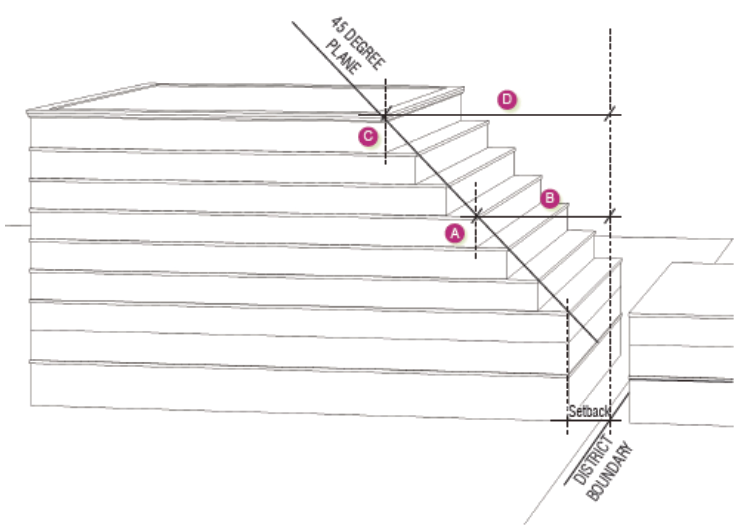
14.3.5-E- Parking, Loading & Service
On-Site Parking
On-site parking shall be provided per the requirements of Sec. 14.6.7.
Location on the Lot
All parking provided within a Principal Building (other than a Perimeter Building Type) shall be located: Underground, at or above the second Story, and/or at-grade within the first Story where located in the Third Lot layer and separated from the street by an Active Street-level Use.
All Parking Structures, Garages, and Parking Areas shall be located in the Third Lot Layer behind a Principal Building Type. Parking Lots are not permitted.
Miscellaneous
See also Sec. 14.6.7 for additional requirements pertaining to parking and site design.
14.3.5-F- Encroachments into Required Setbacks
| Encroachment Type | Rear |
|---|---|
| Awnings and Canopies² | Not permitted |
| Balcony and Decks | 4-ft max. encroachment |
| Other Architectural Features⁴ | 4-ft max. encroachment |
| Landscaping | Permitted |
| Fences or freestanding walls | 6-ft max. height |
| Driveways, Walkways | Permitted |
| Utility Structures | Permitted |
¹ Subject to Frontage Type standards in Sec.14.5.
² Subject to Awning and Canopy standards in Sec. 14.4.13 h.
³ Subject to Sign standards Art 7 of the BCDO.
⁴ Building eaves, roof overhangs, solar shades, and light shelves; bay windows, oriels, and vestibules that are less than ten feet wide; and, cornices, belt courses, window sills, buttresses, or other similar architectural features may encroach into a required setback provided that such extension does not encroach a property line.
14.3.5-G- Encroachments - Public right-of-way
(Along Primary and Secondary Frontages only)
| Encroachment Type | Public ROW |
|---|---|
| Awnings¹ | Permitted |
| Canopies¹ | Permitted |
| Signs² | Allowed |
| Other Architectural Features ³ | 4’ max. |
¹ Subject to Awning and Canopy standards in Sec. 14.4.13 h.
² With the exception of Freestanding Signs
³ Building eaves, roof overhangs, solar shades, and light shelves; bay windows, oriels, and vestibules that are less than ten feet wide; and, cornices, belt courses, window sills, buttresses, or other similar architectural features may encroach into the ROW provided they are a minimum of 10-ft above the Sidewalk.
14.3.5-H- Use Types
Uses not specifically listed, and that are not similar in nature and impact to a use that is listed, are not permitted.
| FD5 | |
|---|---|
| RESIDENTIAL - GENERAL | |
| Attached Dwellings | P |
| Single Detached Dwellings (only pre-existing; Buildings originally designed and constructed for such purpose) | P |
| RESIDENTIAL - SPECIAL | |
| Assisted Living | P |
| Boarding House¹ | P |
| Community House (Sec.14.6.6.e) | P |
| Convalescent /Nursing Home | P |
| Group Home | P |
| Short Term Rental (See Ch. 18: Min. Housing) | P |
| Short-term accommodations | |
| Historic Inn (Sec.14.6.6.c) | P |
| Lodging | P |
| Shelter | P |
| RETAIL - GENERAL | |
| ATM | P |
| Automobile and RV Sales and Rental ² | P |
| Convenience Store | P |
| Fuel Service Station ² (Sec.14.6.6.d) | CU |
| General Merchandise/Retail | P |
| RETAIL - OUTDOOR | |
| Boat Sales/Rentals | P |
| Garden Supply Store | P |
| Open Air Markets | P |
| FD5 | |
|---|---|
| OFFICE & SERVICE | |
| Animal Grooming | P |
| Beauty Salon/Barber Shop/Spa | P |
| Car Wash | P |
| Crisis Counseling Center (Sec. 14.6.6.g) | P |
| Dry Cleaning Service | P |
| Funeral Home | P |
| Health Club/Studio | P |
| Laundromat | P |
| Mental Health Crisis Center | P |
| Office – General | P |
| Office – Medical | P |
| Office – Technical | P |
| Tailor Shop | P |
| Vehicle/Boat Repair/Service ² | P |
| HOSPITALITY/ ENTERTAINMENT/ RECREATION | |
| Aquarium | P |
| Art Gallery/Studio | P |
| Bar, Tavern | P |
| Key | |
|---|---|
| Permitted Use | P |
| Conditional Use | CU |
END NOTES
¹Must be owner-occupied.
² Exterior storage and display not permitted.
| FD5 | |
|---|---|
| HOSPITALITY/ ENTERTAINMENT/ RECREATION | |
| Aquarium | P |
| Art Gallery/Studio | P |
| Bar, Tavern | P |
| Billiards, Bowling & Arcade | P |
| Cafe | P |
| Cinema | P |
| Club, Membership | P |
| Community Center | P |
| Conference/Convention Center | P |
| Museum | P |
| Performing Arts Center | P |
| Performing Arts Studio | P |
| Recreational Facility - Indoor | P |
| Restaurant | P |
| Restaurant – Take Out | P |
| MANUFACTURING/ PRODUCTION/ STORAGE | |
| Boat Storage ² | P |
| Dental Lab | P |
| Food Processing | P |
| Manufacturing - Light ² | P |
| Manufacturing ² | P |
| Medical Lab | P |
| Production Studio | P |
| Photography Lab | P |
| Printing Plant | P |
| Research and Development Facility | P |
| Research Lab | P |
| Warehouse/Storage ² | P |
| Warehouse, Self-Storage ² | P |
| FD5 | |
|---|---|
| EDUCATION & DAY CARE | |
| Day Care - Adult | P |
| Daycare - All (Sec. 14.6.6.b) | P |
| School - Post-Secondary & Community College | P |
| School - Primary | P |
| School - Secondary | P |
| School, -Trade, or Professional | P |
| Civic | |
| Courthouse | P |
| Fire Station | P |
| Library | P |
| Park | P |
| Police Station | P |
| Post Office | P |
| Worship, Place of | P |
| TRANSPORTATION & UTILITIES | |
| Recycling Center - Small ² (2,000 sf or less) | P |
| Public Transit Terminal | P |
| Operations Center – Taxi/Bus ² | P |
| Parking Structure | P |
| Key | |
|---|---|
| Permitted Use | P |
| Conditional Use | CU |
END NOTES
¹Must be owner-occupied.
² Exterior storage and display not permitted.
§ 14.3.6Civic Spaces (C)
Purpose & Applicability:
The purpose of this Subsection is to provide a diverse palette of parks and other publicly accessible Civic Spaces for use within the Form Districts as essential components of walkable urban environments and vibrant community centers. The standards established in this Subsection shall be applicable to the development all proposed Civic Spaces within a Form District either independent from or in combimation with other forms of development, and shall be considered independent from the standards found within each Form District
Civic Spaces established in this subsection are intended to be created independent from or in combination with other Civic Space Types and/or Building Types. The process regarding the review of newly proposed, or alterations to existing, Civic Spaces shall be as provided in Sec. 14.7.1 f).
Civic Space Types: Table 14.3.6-A (Civic Space Types Summary Table) provides an overview of the permitted Civic Space Types. The following apply to all Civic Space Types established by this subsection and may be further defined by each type as applicable.
Location: The Form District(s) in which the Civic Space type is allowed.
Size: The range of allowed sizes of the Civic Space type
Frontage: The relationship along property lines of a Civic Space to Adjacent Buildings or Lots. The front of the Lots attached to or across a Thoroughfare from a Civic Space should face on to the Civic Space to the maximum extent possible.
Building. Lots that are attached to or across a thoroughfare from a Civic Space listed as having a “Building” frontage shall have the front of the Lot facing on to the Civic Space for a minimum of three quarters of the Civic Space perimeter.
Independent. Lots that are attached to or across a Thoroughfare from Civic Space listed as having an “Independent” frontage may have the front, side street, or rear of the Lot facing on to the Civic Space.
Form. The placement and Disposition of objects within the Civic Space.
Natural. Civic Spaces with a “Natural” character are designed in a natural manner with no formal arrangement of elements.
Formal. Civic Spaces with a “Formal” character have a more rigid layout that follows geometric forms and has Trees and other elements arranged in formal patterns.
Informal. Civic Spaces with an “Informal” character have a mix of both Formal and Natural characteristics.
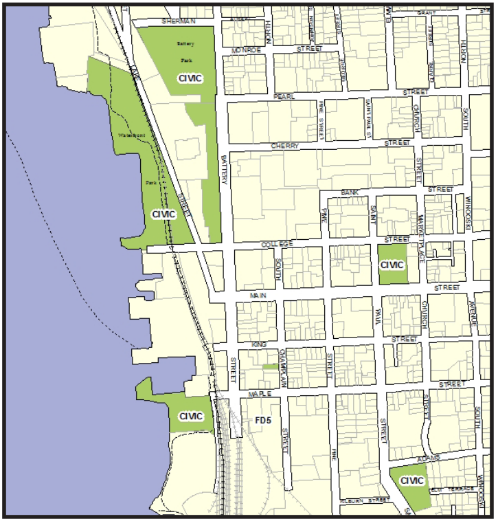
Coverage. The allowed proportion of Impervious Surface within the Civic Space type.
Typical Facilities. A list of the typical facilities found within the Civic Space. This list is not intended to be a complete list of facilities allowed nor is it intended that every Civic Space would contain each of the facilities listed. Where allowed, Buildings, Structures, and commercial concessions within a Civic Space Type shall be Accessory to the overall Civic or recreational function of the Civic Space type. Any commercial concessions shall require a license approved by the Parks, Recreation, and Waterfront Director or the City Council as applicable.
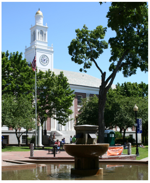
Table 14.3.6-A - Civic Space Types Summary Table [Not Regulatory]
| Civic Space Type | Illustration | Districts | Standards |
|---|---|---|---|
| Natural Area: A naturalized Open Space available predominantly for the protection and enjoyment of nature. | FD5 | 14.3.6-B | |
| Park: An Open Space available for both structured and unstructured recreation. | FD5; FD6 | 14.3.6-C | |
| Greenway: A linear Open Space that may follow natural and transportation corridors providing unstructured and structured recreation. | FD5; FD6 | 14.3.6-D | |
| Square: An Open Space often located at the intersection of important Thoroughfares available for unstructured recreation, Civic purposes. | FD5; FD6 | 14.3.6-E | |
| Plaza: A predominantly hardscaped Open Space often located at the intersection of important Thoroughfares available for Civic purposes. | FD5; FD6 | 14.3.6-F | |
| Pocket Park: A small predominantly green Open Space available for passive recreation. | FD5; FD6 | 14.3.6-G | |
| Pocket Plaza: A small predominantly hardscaped Open Space available for Civic purposes. | FD5; FD6 | 14.3.6-H | |
| Water Dependent: An Open Space associated with water-dependent recreation and related facilities. | FD5 | 14.3.6-I |
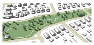
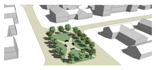
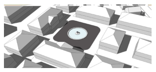
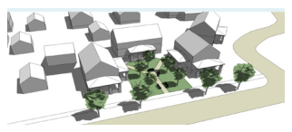
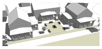
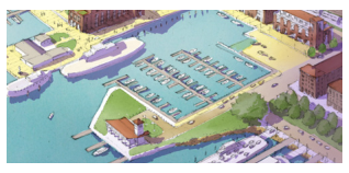
14.3.6-B Natural Area
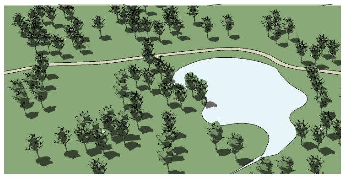
Diagram provided for illustrative purposes only.
Intent
A natural Open Space for the protection and enjoyment of nature and available for unstructured recreation where appropriate.
Specifications
Typical Facilities
Passive recreation and trails
Accessory Buldings and Structures
Parking
No on-site parking is required.
14.3.6-C Park
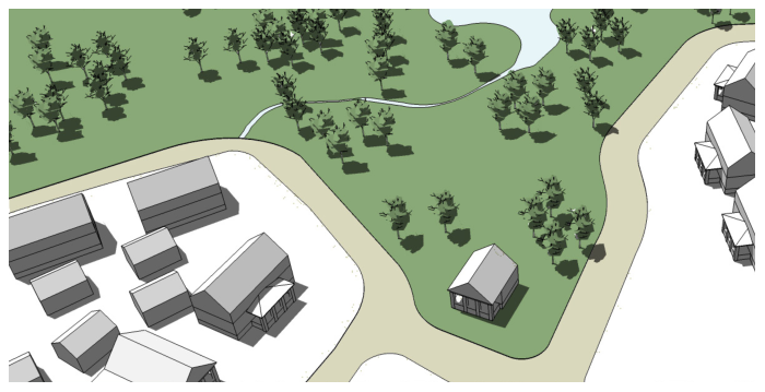
Diagram provided for illustrative purposes only.
Intent
An Open Space available for both structured and unstructured recreation.
Specifications
¹ Not inclusive of any associated Civic Buildings.
Typical Facilities
Passive and active recreation
Civic, recreational and community facilities
Playgrounds and play Structures
Paths and trails
Accessory Buldings and Structures
Limited commercial concessions
Parking
No on-site parking is required.
14.3.6-D Greenway
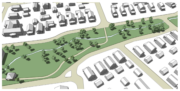
Diagram provided for illustrative purposes only.
Intent
A linear Open Space that may follow natural and transportation corridors providing unstructured and structured recreation.
Specifications
| Form District | FD5, FD6 |
| Size | No size limits |
| Frontage | Independent |
| Character | Informal |
| Coverage ¹ | 0% min. - 30% max. |
| Structures | 1,500 sqft max in aggregate |
| Setback for Structures | 5’ min |
¹ Not inclusive of any associated Thoroughfares and transportation facilities.
Typical Facilities
Passive and active recreation
Playgrounds and play Structures
Paths and trails
Accessory Structures
Limited commercial concessions
Parking
No on-site parking is required.
14.3.6-E Square
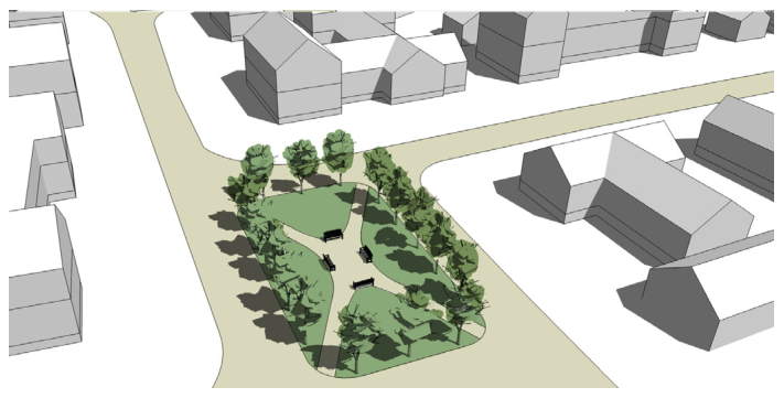
Diagram provided for illustrative purposes only.
Intent
An Open Space often located at the intersection of important Thoroughfares available for unstructured recreation and Civic purposes.
Specifications
| Form District | FD5, FD6 |
| Size | 0.5 acres min. 5 acres max. |
| Frontage | Buildings |
| Character | Formal |
| Coverage | 0% min. - 60% max. |
| Structures | 600 sqft max in aggregate |
| Setback for Structures | none |
Typical Facilities
Passive recreation
Paths
Accessory Structures
Limited commercial concessions
Parking
No on-site parking is required.
14.3.6-F Plaza
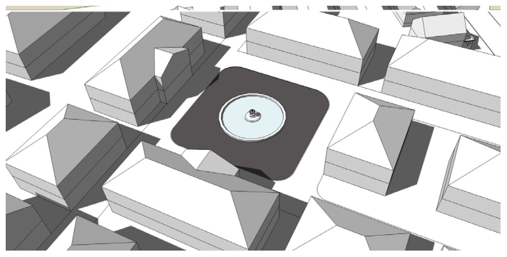
Diagram provided for illustrative purposes only.
Intent
A predominantly hardscaped Open Space often located at the intersection of important Thoroughfares available for Civic purposes.
Specifications
| Form District | FD5, FD6 |
| Size | 0.5 ac min. 5 ac max. |
| Frontage | Buildings |
| Character | Formal |
| Coverage | 60% min. - 100% max. |
| Structures | 600 sqft max in aggregate |
| Setback for Structures | none |
Typical Facilities
Passive recreation
Paths
Accessory Structures
Limited commercial concessions
Parking
No on-site parking is required.
14.3.6-G Pocket Park
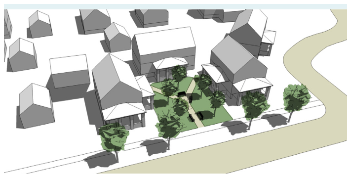
Diagram provided for illustrative purposes only.
Intent
A small predominantly green Open Space available for unstructured passive recreation.
Specifications
| Form District | FD5, FD6 |
| Size | 500 sf min. 0.5 ac max. |
| Frontage | Independent |
| Character | Formal |
| Coverage | 0% min. - 50% max. |
| Structures | 600 sqft max in aggregate |
| Setback for Structures | none |
Typical Facilities
Passive recreation
Playgrounds and play Structures
Paths and trails
Limited transient commercial concessions
Parking
No on-site parking is required.
14.3.6-H Pocket Plaza
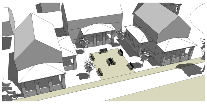
Diagram provided for illustrative purposes only.
Intent
A small predominantly hardscaped Open Space available for Civic purposes.
Specifications
| Form District | FD5, FD6 |
| Size | 500 sf min. 0.5 ac max. |
| Frontage | Independent |
| Character | Formal |
| Coverage | 60% min. - 100% max. |
| Structures | not permitted |
| Setback for Structures | na |
Typical Facilities
Passive recreation
Paths
Limited transient commercial concessions
Parking
No on-site parking is required.
14.3.6-I Water Dependent
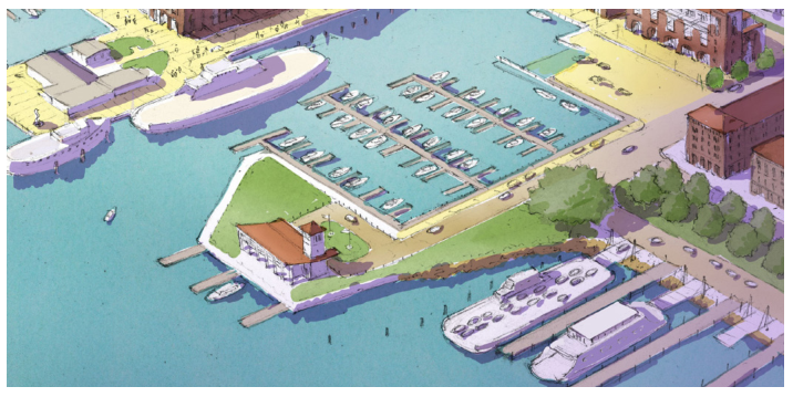
Diagram provided for illustrative purposes only.
Intent
An Open Space associated with water-dependent recreation and related facilities.
Specifications
| Form District | FD5 |
| Size | No size limit |
| Frontage | Independent |
| Character | Informal |
| Coverage¹ | 80% max. |
| Buildings and Structures¹ | 1,500 sqft max in aggregate |
| Setback for Buildings and Structures | 50-feet from the mean high water mark of Lake Champlain (100-feet above mean sea level) unless encroachment is required for the operation of a water-dependent use or facility. Features such as walkways, planters, benches, fountains, public art, sitting walls and other improvements to enhance the pedestrian environment and enjoyment of the waterfront may encroach into this required setback provided public access to the water’s edge and pedestrian circulation is not unreasonably impaired. |
¹ Not inclusive of any associated Civic Buildings.
Typical Facilities
Water-oriented facilities and services such as docks, marinas, boat ramps and lifts, boat fueling and pump-out, restrooms, marina office and chandlery, and facilities for commercial vessels.
Civic, recreational, and community facilities
Playgrounds and play Structures
Passive recreation, paths, and trails
Buildings and Structures necessary to support water-oriented facilities and services
Commercial concessions
Parking
On-site parking is not required, and may not occupy more than 60% of
Part 4Specific to Building Types
§ 14.4Specific to Building Types
§ 14.4.1Purpose
This Section sets forth the standards applicable to each Building Type established below. These standards supplement the standards for each Form District within which the Building Types are allowed. These standards are intended to ensure development that reinforces the highly-valued existing character and scale of Burlington’s neighborhoods and downtown.
§ 14.4.2Applicability
The requirements in this Section shall apply to all proposed development within the Form Districts, and shall be applied in addition to the standards for the applicable district in Section 14.3 (Specific to Form Districts) and in Section 14.5 (Specific to Private Frontage Types). The standards and requirements applicable to a Building Type shall modify and take precedence without limitation over any duplicative or conflicting provisions of Section 14.3 (Specific to Form Districts) and Section 14.6 (Applicable in all Form Districts).
§ 14.4.3Building Types General and Green Buildings
Building Types. Table 14.4.3-A (Building Types Summary Table) provides an overview of the permitted Building Types. The Building Types are not intended to indicate or suggets a specific architectural style, and their names are not intended to limit uses within a Building Type. For example, a detached house type may or may not include non-residential uses within it, such as a restaurant or office where allowed by the Form District.
Green and High Performance Buildings: Any new Building, addition, and/or major renovation of an existing Building, over 25,000 square feet of Gross Floor Area (GFA) but less than 50,000 square feet of GFA, shall be required to conduct third-party commissioning for the basic Building envelope and mechanical systems at a minimum. Any new Building, addition, and/or major renovation of an existing Building, over 50,000 square feet of GFA, shall also be required to be built to an approved high performance Building standard as listed in this section.
These requirements are applicable in all Form Districts, and for the purposes of this section only “major renovation” shall mean extensive alterations and/or improvements to the exterior shell, primary structural components, and/or core and peripheral MEP and service systems.
One of the following Green and High Performance Building Standard systems shall be used to satisfy the requirements for projects over 50,000 square feet of GFA:
Gold Certification or higher under the applicable LEED standard as administered by Green Business Certification, Inc (GBCI);
Petal or Net Zero Energy Certification under the Living Building Challenge as administered by International Living Future Institute (INFI);
Passive House Certification as administered by Passive House Institute (PHI or PHIUS); or,
Another nationally recognized equivalent quantifiable high performance building system or standard as may be approved by the Planning Commission.
In order to demonstrate and document compliance with this section, the applicant shall be required to provide the following:
At the time application:
A third-party Commissioning Plan for the basic Building envelope and mechanical systems at a minimum following the requirements for LEED v.4 Fundamental Commissioning and Verification signed by both the commissioning agent and project owner; and,
In the case of projects over 50,000 square feet of GFA, documentation that the project has been registered with the appropriate certifying authority; and documentation of the intended approach, performance criteria, credits, and/or elements of the project necessary to obtain the targeted certification level. This list is only binding as to the overall certification level to be achieved and not for any individual credits sought.
Prior to release of a Final Certificate of Occupancy:
A written certification from the third party commissioning agent that they are under contract to complete the activities described in the third -party Commissioning Plan, that all measures receiving rebates from Burlington Electric or any other utility have been commissioned under the Commissioning Plan, and that the commissioning process is not less than 75% complete at the time of the Final Certificate of Occupancy; and,
Only in the case of projects over 50,000 square feet of GFA, submission of the revised and final approach, performance criteria, credits, and/or elements of the project used to obtain the target certification level, and written certification from the project owner, each design professional of record directly contracted by owner, and the contractor, that to the best of their knowledge the project has been designed and constructed to meet the requirements of the selected high performance building program. This list is only binding as to the overall certification level to be achieved and not for individual credits.
Table 14.4-A - Building Types Summary Table [not-regulatory]
| Building Type | Form Districts |
|---|---|
| 14.4.7 Rowhouse: A collection of very narrow to medium sized attached Buildings each containing a single unit and connected to one another side-by-side by a party wall. Each Building has an individual entry facing the street, and groupings often share uniform plans, fenestration and architectural treatments. This Building Type may sit on a single lot, or span across multiple lots each with an individual Building. | FD5; FD6 |
| 14.4.8 Multifamily- Small: A medium sized detached Building that consists of side-by-side and/or stacked units, with individual or shared entries at least one of which faces the street. This Building Type may often have the appearance of a large single-family home. | FD5; FD6 |
| 14.4.9 Multifamily- Large: A medium to large sized detached or attached Building consisting of side-by-side and/or stacked units, with one or more shared entries at least one of which faces the street. | FD5; FD6 |
| 14.4.10 Mixed-Use: A medium to large sized attached or detached Building that may provide a vertical and/or horizontal mix of uses or a single non-residential use. Units are commonly organized with pedestrian-oriented retail, hospitality or service uses on the ground floor with individual entries facing the street, and residential or office uses on upper floors served by one or more shared entries. | FD5; FD6 |
| 14.4.11 Perimeter Building: A shallow medium to large sized attached or detached Building that is always associated with and screens a Garage, Parking Structure, Parking Lot or Parking Area located directly behind. This Building Type may provide a vertical and/or horizontal mix of uses commonly organized with pedestrian-oriented retail, hospitality or service uses on the ground floor with individual entries facing the street, and residential or office uses on upper floors served by one or more shared entries. | FD5; FD6 |
| 14.4.12 Civic: A medium to large sized attached or detached Building dedicated to a Civic Use and designed to stand apart from its surroundings due to the specialized nature of its public or quasi-public use for public assembly and activity. Examples include libraries, places of worship, courthouses, schools, centers of government, performing arts, and museums. They are often the most prominently sited and architecturally Significant Structures in the community. | FD5; FD6 |
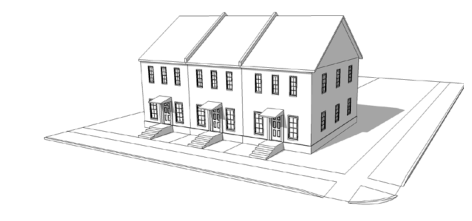
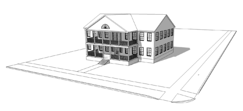
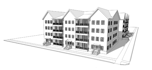
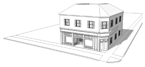
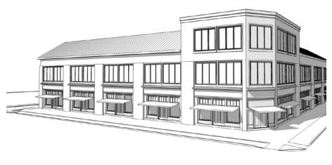
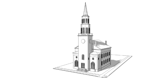
§ 14.4.7Rowhouse
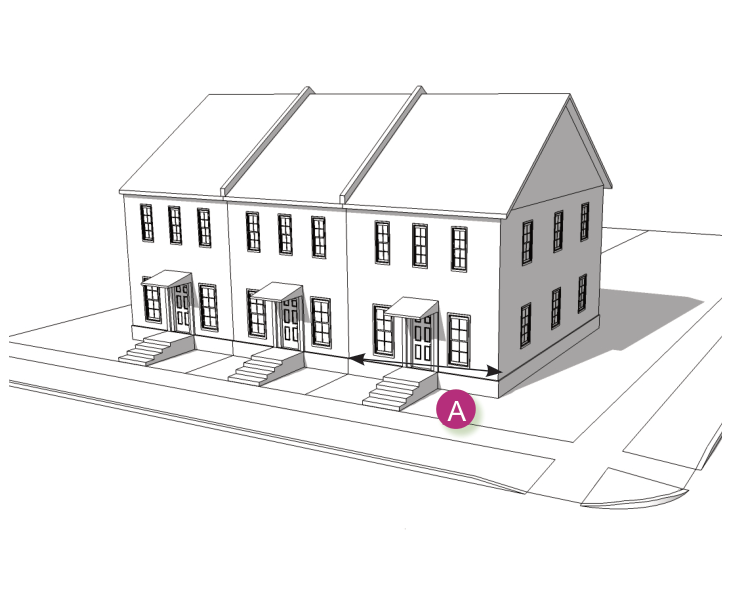
14.4.7-A - Description
Rowhouse: A collection of very narrow to medium sized attached Buildings each containing a single unit and connected to one another side-by-side by a party wall. Each Building has an individual entry facing the street, and groupings often share uniform plans, fenestration and architectural treatments. This Building Type may sit on a single lot, or span across multiple lots each with an individual Building.
Allowed In
14.4.7-B - Number of Units
14.4.7-C - Building Size and Massing
14.4.7-D - Allowed Frontage Types
| Porch: Projecting | Section 14.5.4 |
| Porch: Engaged | Section 14.5.5 |
| Porch: Integral | Section 14.5.6 |
| Stoop | Section 14.5.7 |
| Dooryard | Section 14.5.9 |
| Doorway | Section 14.5.10 |
| Lightwell & Landing | Section 14.5.11 |
14.4.7-E - Pedestrian Access
| Principal Entrance Location | Principal Frontage |
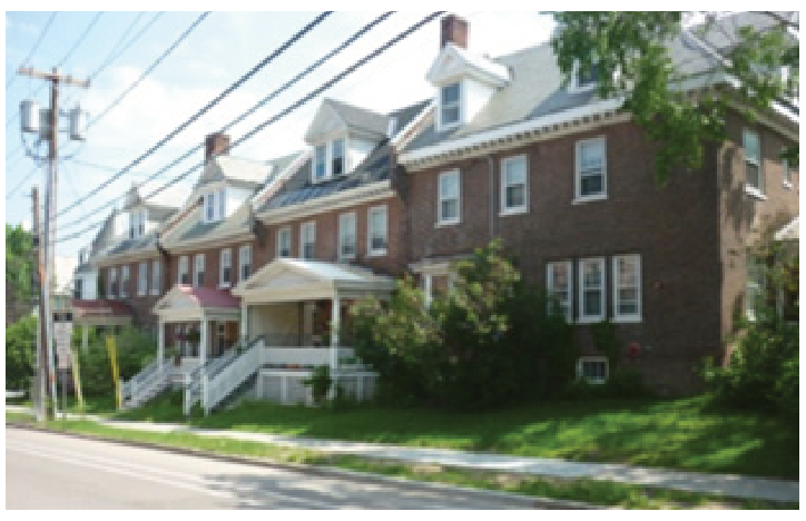
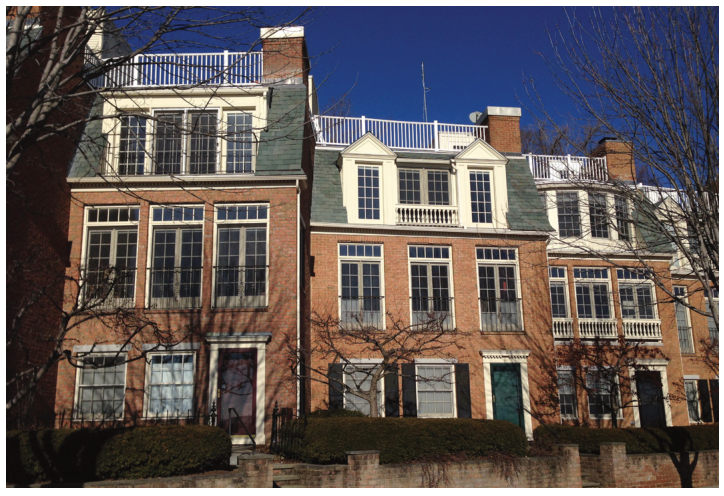
The diagram and photographs on this page are intended for illustrative purposes only. Metrics shown thereon shall have regulatory effect.
§ 14.4.8Multi-Family-Small
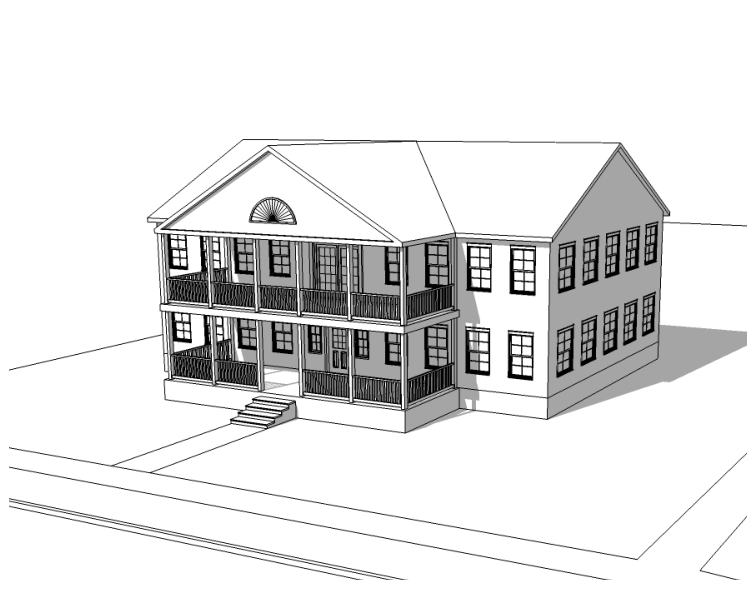
14.4.8-A - Description
Multi-Family, Small: A medium sized detached Building that consists of side-by-side and/or stacked units, with individual or shared entries with at least one of which facing the street. This Building Type may often have the appearance of a large single-family home.
Allowed In
14.4.8-B - Number of Units
14.4.8-C - Building Size and Massing
| Height | 2 Stories min. |
| Width | 36-ft min. 48-ft max. |
The diagram and photographs on this page are intended for illustrative purposes only. Metrics shown thereon shall have regulatory effect.
14.4.8-D - Allowed Frontage Types
| Porch: Projecting | Section 14.5.4 |
| Porch: Engaged | Section 14.5.5 |
| Porch: Integral | Section 14.5.6 |
| Stoop | Section 14.5.7 |
| Courtyard | Section 14.5.8 |
| Dooryard | Section 14.5.9 |
| Doorway | Section 14.5.10 |
| Lightwell & Landing ¹ | Section 14.5.11 |
| Terrace | Section 14.5.14 |
¹ Only allowed in situations where the slope prevents at-grade entry to the Building.
14.4.8-E - Pedestrian Access
| Principal Entrance Location | Principal Frontage |
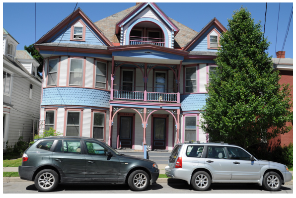
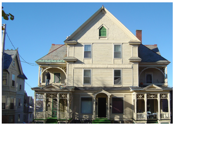
§ 14.4.9Multi-Family-Large
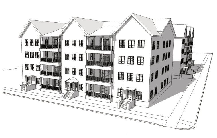
14.4.9-A - Description
Multi-Family, Large: A medium to large sized detached or attached Building consisting of side-by-side and/or stacked units, with one or more shared entries at least one of which faces the street.
Allowed In
14.4.9-B - Number of Units
14.4.9-C - Building Size and Massing
| Ground Floor Height, floor to floor | 14-ft min. |
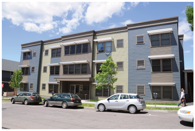
14.4.9-D - Allowed Frontage Types
| Porch: Projecting | Section 14.5.4 |
| Porch: Engaged | Section 14.5.5 |
| Porch: Integral | Section 14.5.6 |
| Stoop | Section 14.5.7 |
| Courtyard | Section 14.5.8 |
| Dooryard | Section 14.5.9 |
| Doorway | Section 14.5.10 |
| Lightwell & Landing ¹ | Section 14.5.11 |
| Terrace | Section 14.5.14 |
¹ Only allowed in situations where the slope prevents at-grade entry to the Building.
14.4.9-E - Pedestrian Access
| Principal Entrance Location | Principal Frontage |
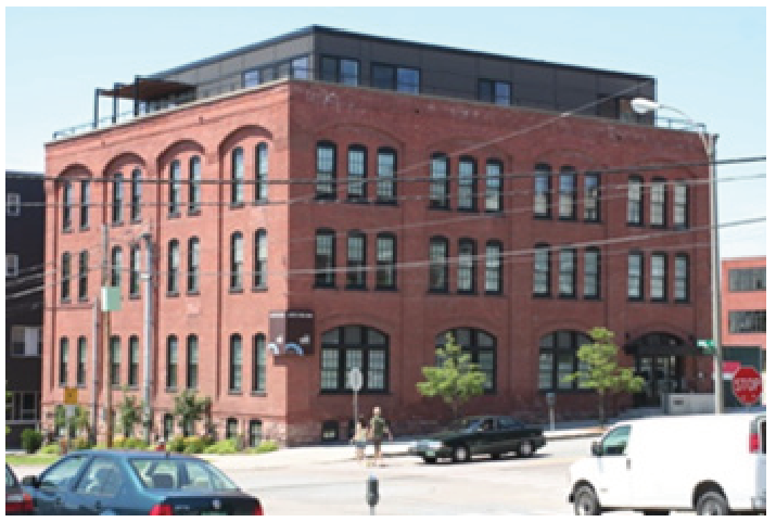
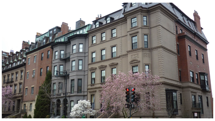
The diagram and photographs on this page are intended for illustrative purposes only. Metrics shown thereon shall have regulatory effect.
§ 14.4.10Mixed-Use
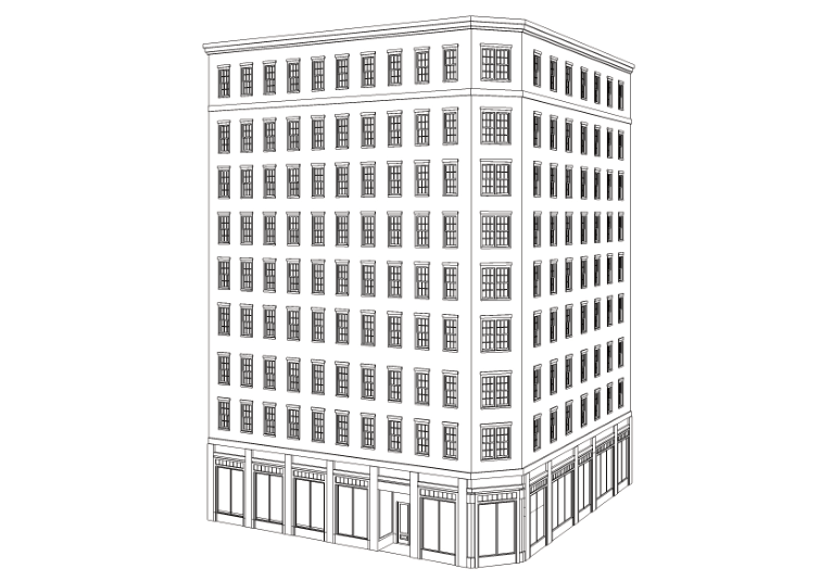
14.4.10-A - Description
Mixed-Use: A medium to large sized attached or detached Building that provides a vertical and/or horizontal mix of uses or a single non-residential use. Units are commonly organized with pedestrian-oriented retail, hospitality or service uses on the ground floor with individual entries facing the street, and residential or office uses on upper floors served by one or more shared entries.
Allowed In
14.4.10-B - Number of Units
Not applicable
14.4.10-C - Building Size and Massing
| Ground Floor Height, floor to floor | 14-ft min. |
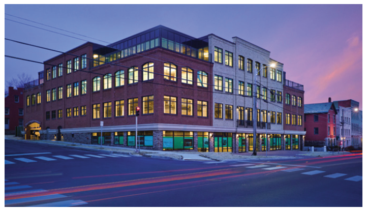
14.4.10-D - Allowed Frontage Types
| Courtyard | Section 14.5.8 |
| Dooryard | Section 14.5.9 |
| Doorway | Section 14.5.10 |
| Lightwell & Landing | Section 14.5.11 |
| Officefront | Section 14.5.12 |
| Shopfront | Section 14.5.13 |
| Terrace | Section 14.5.14 |
| Forecourt | Section 14.5.15 |
| Gallery | Section 14.5.16 |
| Arcade | Section 14.5.17 |
14.4.10-E - Pedestrian Access
| Principal Entrance for Ground Floor Units | Principal Frontage |
| Principal Entrance for Upper Floors Units | Principal or Secondary Frontage |
Upper floors units shall be Accessed by a common entry.
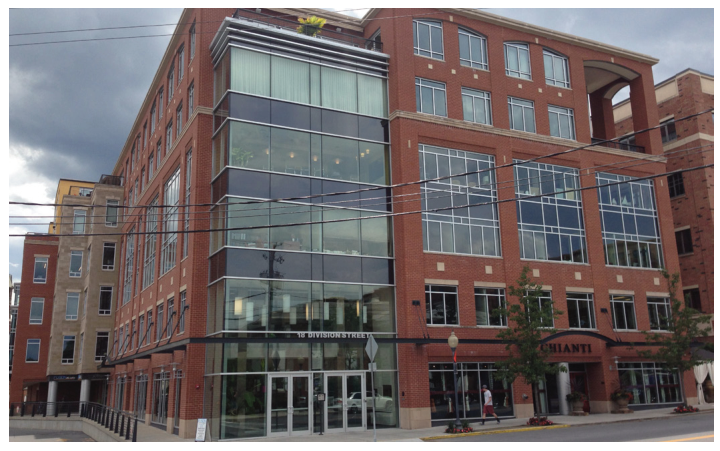
The diagram and photographs on this page are intended for illustrative purposes only. Metrics shown thereon shall have regulatory effect.
§ 14.4.11Perimeter Building
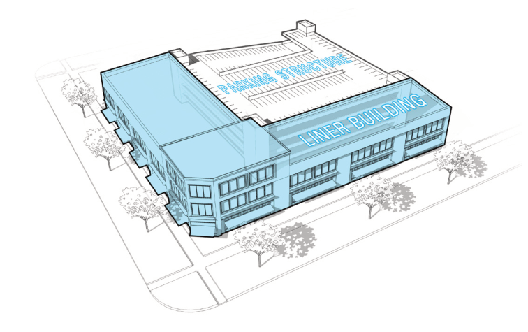
14.4.11-A - Description
Perimeter Building: A shallow medium to large sized attached or detached liner Building that is always associated with and screens a Garage, Parking Structure, Parking Lot or Parking Area located directly behind. This Building Type may provide a vertical and/or horizontal mix of uses commonly organized with pedestrian-oriented retail, hospitality or service uses on the ground floor with individual entries facing the street, and residential and/or office uses on upper floors served by one or more shared entries.
Allowed In
14.4.11-B - Number of Units
Not applicable
14.4.11-C - Building Size and Massing
| Ground Floor Height, floor to floor | 14-ft min. |
| The height of the Perimeter Building must equal or exceed the height of the Parking Structure or Garage behind; however the floors are not required to align. | |
| Width | Minimum - Full width of the Parking Structure behind |
| Depth | 20-ft min. |
14.4.11-D - Allowed Frontage Types
| Dooryard | Section 14.5.9 |
| Doorway | Section 14.5.10 |
| Lightwell & Landing | Section 14.5.11 |
| Officefront | Section 14.5.12 |
| Shopfront | Section 14.5.13 |
| Terrace | Section 14.5.14 |
| Gallery | Section 14.5.16 |
| Arcade | Section 14.5.17 |
14.4.11-E - Pedestrian Access
| Principal Entrance for Ground Floor Units | Principal Frontage |
| Principal Entrance for Upper Floors Units | Principal or Secondary Frontage |
Ground floor units may have individual entries along the front street or side street.
Secondary Access for units may be directly from the Parking Structure.
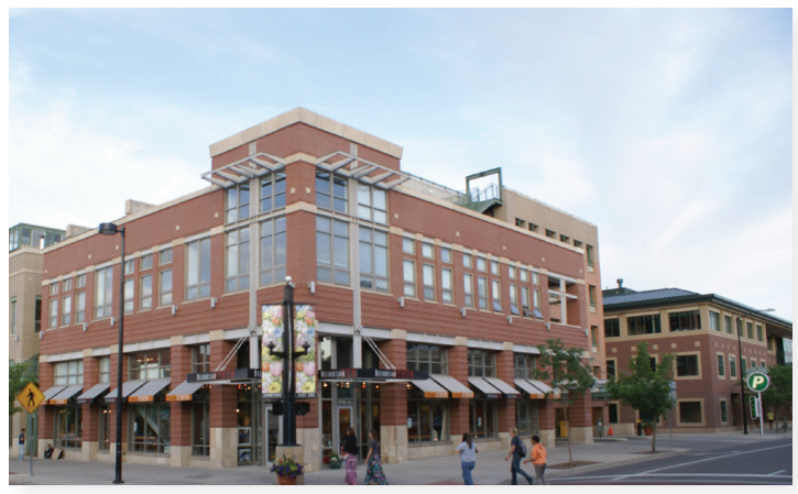
The diagram and photographs on this page are intended for illustrative purposes only. Metrics shown thereon shall have regulatory effect.
§ 14.4.12Civic
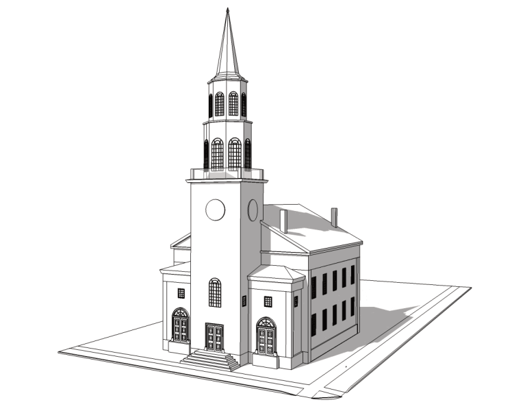
14.4.12-A - Description
Civic: A medium to large sized attached or detached Building dedicated to a Civic Use and designed to stand apart from its surroundings due to the specialized nature of its public or quasi-public use for public assembly and activity. Examples include libraries, places of worship, courthouses, schools, centers of government, performing arts, and museums. They are often the most prominently sited and architecturally significant Buildings in the community.
Allowed In
14.4.12-B - Number of Units
Not applicable
14.4.12-C - Building Location, Size and Massing
Overall Building height and other massing requirements are per the Form District standards in Section 14.3 (Specific To Form Districts).
Form District standards with regard to Lot Occupation and Building Placement (Specific To Form Districts) shall not apply to Civic Buildings.
14.4.12-D - Allowed Frontage Types
Frontage Types standards in Section 14.5 (Specific to Frontage Types) shall not apply to Civic Buildings.
14.4.12-E - Pedestrian Access
| Principal Entrance for Ground Floor | Principal Frontage |
| Principal Entrance for Upper Floors | Principal or Secondary Frontage |
14.4.12-F Miscellaneous
The process regarding the review of newly proposed, or alterations to existing, Civic Buildings shall be as provided in Sec. 14.7.1 f).
Civic Buildings may be developed as part of or independent from Civic Spaces established pursuant to Sec. 14.3.6.
The diagram and photographs on this page are intended for illustrative purposes only. Metrics shown thereon shall have regulatory effect.
§ 14.4.13Urban Design Standards
While traditional architectural styles and forms are welcome, a diversity of traditional, neo-traditional, and modern architectural styles and forms are highly encouraged in order to both reflect and advance the evolution and diversity of Burlington’s built environment. Regardless of the architectural style used, there remain a number of fundamental urban design standards that must be addressed in order to ensure the creation of a dynamic, engaging, and pedestrian-oriented streetscape.
The following urban design standards shall be applicable to all new construction and Substantial Modification of all Buildings in the Downtown and Waterfront District:
Voids and Transparency: Requirements regarding the proportion and spacing of voids, and the transparency of glazing on a Building Facade for the purposes of activating the public street, shall be as required in Table 14.4.13-A Street Activation - Primary and Secondary Facade below.
14.4.13-A- Street Activation – Primary and Secondary Facade
| Building Types: Rowhouse, and Multi-Family: Small | Building Types: Mixed-Use, Multi-Family: Large, Perimeter, and Civic | |||
|---|---|---|---|---|
| Ground Floor | Upper Floors | Ground Floor | Upper Floors | |
| Facade Voids: (Rough openings of all windows, doors and the transparent portion of a curtain wall per floor) | 15% min | 10% min | 40% min¹ | 20% min |
| Distance between voids measured both horizontally and vertically | 35-ft max. | 20-ft max. | ||
| Transparency and Reflectance of Glazing: applicable to 80% of the glazing per floor. | VLT - na; VLR - 15% max² | VLT - na; VLR - 15% max² | 60% VLT min²; VLR - 15% max² | VLT - na; VLR - 15% max² |
(VLT - Visible Light Transmittance, VLR - Visible Light Reflectance)
¹ Additional requirements shall be as required for Officefront or Shopfront Frontage Types.
² May be reduced to 50% and 30% respectively to meet the requirements of a High Performance Building Energy Code or equivalent program.
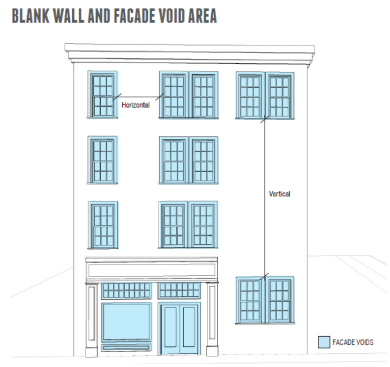
Windows & Doors:
All Principal Buildings shall have one or more Principal Entrances that are clearly identified as such along the Primary Frontage, or at a corner on a corner lot where a chamfered corner may be used. Additional entrances may also be provided along a secondary Frontage. Principal Buildings fronting a Civic Space shall also have a minimum of one Principal Entrance directly onto the Civic Space.
To be counted in the Ground floor Entry spacing requirements of a Form District, doors must be open and operable by residential occupants at all times, and non-residential occupants and customers during business hours.
Principal Entrances shall be defined and articulated by architectural elements such as lintels, pediments, pilasters, columns, canopies, awnings, transoms, sidelights, or other design elements appropriate to the architectural style and details of the Building as a whole. Bays including a Principal Entrance should be expressed vertically and may continue onto the upper stories. Such bays are not required to include additional horizontal expression or upper story step-backs as required in c) below.
Where provided:
Muntins shall be either true divided lites, or simulated divided lites fixed on both the exterior and interior surfaces with spacer bars to cast a shadow.
Storm Windows and Screens shall be integral with the window.
Bay windows may project a maximum of 4-feet from the Facade.
Shutters shall be provided to either all or none of the window openings on any given Elevation, and shall be sized, shaped and proportioned to match the associated openings.
Façade Articulation and Upperstory Stepbacks:
A majority of the Facade of a Building shall be built parallel to a rectilinear Principal Frontage Line or to the tangent of a curved Principal Frontage Line.
Building Facades shall be vertically articulated as follows:
All Building Facades must provide surface relief through the use of elements such as bay windows, cladding, columns, corner boards, cornices, door surrounds, moldings, piers, pilasters, sills, belt courses, sign bands, windows, balconies, and other equivalent architectural features at least 3 of which must either recess or project from the average plane of the Facade by at least 4-inches;
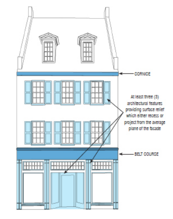
Buildings with Facades greater than 150-feet in width must include a more substantial change in the horizontal plane where for every 150-feet in Facade width, 1 or more architectural bay as required above must either recess or project from the average plane of the facade by at least 4-feet involving the full height of the façade and no closer than 50-feet from the corner in order to suggest individual volumes.
Building Facades shall be horizontally articulated as follows:
Where visible, a raised foundation or basement of a Building shall not exceed 4-ft as measured from the exterior finished grade to the finished floor of the Story above, and must be visually differentiated from the stories above by a horizontal expression line and change in color, material, and/or pattern of fenestration;
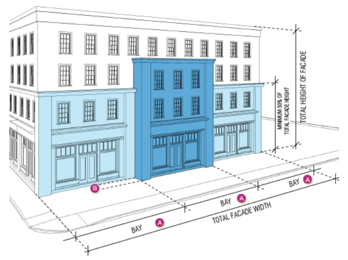
The top story (other than a penthouse setback at least 10-feet from the primary plane of the Façade below) must have a cornice, parapet, pitched or shaped roof form and/or other equivalent architectural feature involving a projection from the average plane of the Facade of the story below by at least 12-inches to serve as an expression of the Buildings top.
The upper stories of any Building exceeding 6 stories in height shall step-back as follows:
An upper story step-back of at least 10-feet from the primary plane of the Façade below shall occur above the 2nd story with the resulting Building base maintaining a consistent height of at least 50-feet along Main and Battery streets, and at least 33-feet on all other downtown streets, in order to frame and define the public realm.
Step-backs shall involve a minimum of 75% of the full width of the Building Façade, but do not have to occur in the same story. Buildings with Facades greater than 150-feet in width shall vary the location of step-backs in order to further modulate the volume of the larger Building mass. Additional step-back may occur in order to provide additional terraces, taper and visual interest to taller Buildings.
Step-backs must be visually set off from the stories below by a balustrade, parapet, cornice, and/or similar architectural feature, and are encouraged to be activated as an outdoor amenity space for Building occupants.
The upper stories beyond a step-back may be visually differentiated from the stories below by a horizontal expression line, belt courses, banding, and/or equivalent architectural feature, and include a change in color, material, and/or pattern of fenestration across a majority of the Facade in order to reduce the actual or perceived massing of the Building.
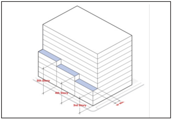
Building Materials: The following requirements regarding the selection and use of Building materials is intended to improve the physical quality and durability of buildings, enhance the pedestrian experience, and maintain the character of the downtown area.
Primary Materials: Not less than 80 percent of each street-facing Facade (not inclusive of voids) shall be constructed of one or more primary materials comprised of tested and proven, high quality, durable, natural products, and those with low embodied carbon. For Facades over 100 square feet, more than one Primary Material shall be used. Changes between Primary Materials must occur only at inside corners. The following are considered acceptable Primary Materials:
Brick and tile masonry;
Native or sintered stone;
Wood – panels, clapboard or shingles;
Glass curtain wall; and,
Cementitious siding;
Accent Materials: The following Accent Materials may make up no more than 20% of the surface area on each Façade. Accent Materials are limited to:
Pre-cast and cast-in-place board-formed, finished and/or textured, and patterned masonry;
External Insulation Finishing System - EIFS (for upper story trim and cornice elements only);
Gypsum Reinforced Fiber Concrete (GFRC—for trim elements only);
Metal (for beams, lintels, trim elements and ornamentation, and exterior architectural metal panels and cladding only);
Split-faced block (for piers, foundation walls and chimneys only); and,
Glass block.
Doors and Windows: Commercial grade doors, windows, and hardware shall be used on all Building Types with the exception of the Rowhouse and Multi-family - Small Building Types used for residential purposes.
Roof Materials (not applicable to flat roofs). Acceptable roof materials include 300 pound or better, dimensional asphalt composite shingles, wood shingles and shakes, metal tiles or standing seam, slate, and ceramic tile. To the extent possible, all roof materials and colors should be selected to maximize the roof’s Solar Reflectance Index (SRI).
Alternate Materials: Alternate Primary and Accent materials, including high quality synthetic materials, may be approved by the Administrative Officer after seeking input from the Design Advisory Board. New materials must be considered equivalent or better than the materials listed above and demonstrate successful, high quality installations in a similar climate. Regionally-available materials, and those with low embodied carbon, will be strongly preferred.
Other:
The use of recycled and/or regionally-sourced materials is strongly encouraged.
With the exception of natural wood siding or shingles such as cedar or redwood intended to gradually weather with time, all exposed wood and wood-like products (e.g. fiber-cement) shall be painted or stained. Exterior trim shall be indistinguishable from wood when painted.
Any synthetic siding and finish products shall be smooth-faced with no artificial grain texturing.
Walls:
Unfinished (ie. not clad or constructed in a Primary or Secondary Material per d) above) foundation walls on a Principal Building shall be exposed no more than 48-inches above the finished grade. Surface-applied waterproofing on any foundation wall shall not be visible.
The following items are not permitted to project from a Facade: air conditioner and HVAC equipment; utility or gas meters; chimneys, vents, piping, ducts, and conduits external to the building; wind generation; and antennas, satellite dishes, and other telecommunications equipment. When placed on a side elevation, these items shall be concealed from view from the Frontage by landscaping, grills, screens, or other enclosures in a manner consistent with the overall architectural design of the Building.
Small exterior vents (less than 10-in x 10-in) associated with small scale heating/cooling equipment or residential appliances shall be permitted on the Facade of Buildings where residential occupancy occurs along the Facade - these are not permitted for other occupancies. Every effort should be made to minimize and consolidate the number of these vents. They shall be located, organized, screened, and detailed to harmonize and compliment the overall design of the Facade.
New Buildings, additions, or significant improvements to existing Buildings placed on a side or rear property line or within 10 feet of another building where no setback is required are subject to construction material and building opening restrictions as established in the effective Building Code.
The use of green walls is encouraged where possible.
Buildings are encouraged to incorporate Blue and/or Green roof technologies, solar collection devices, and access for use by owners, tenants, or the public wherever possible.
All pitched roofs shall be designed and configured to prevent the avalanching of snow and ice onto any street, path, walkway, Building entrances and emergency exits, driveways, parking areas, and adjacent property.
Solar collection devices, wind turbines, and wireless telecommunication equipment shall be positioned to minimize their view from the street level. To the maximum extent practical, screening shall be incorporated in a manner consistent with the overall architectural design of the Building. Solar collection devices may be placed on or incorporated into a pitched roof provided they are at no point more than 10-feet above the roof surface.
All Buildings, and Structures where appropriate, shall have gutters, downspouts or rain chains, splash blocks or downspouts connected to rain barrels, above or underground drainage systems, and/or other such devices and systems designed for the on-site collection and managment of stormwater. Downspouts shall be arranged as an integral part of the Facade composition, and shall generally be placed at the corners of the Building.
Balconies and Decks: Where provided, all Balconies and Decks shall meet the following specifications:
Balconies must be at least 4-feet deep (A) and 5-feet wide, and shall shall not project more than 8-feet from the plane of the Façade or Elevation to which it is attached.
Balconies shall be cantilevered or visibly supported by brackets or beams sized, shaped and proportioned to match the associated Balcony. Columns or posts extending to the ground within the public right-of-way are prohibited.
Balconies shall provide 8-feet minimum clear height above the finished grade, or 13-feet 6-inches minimum clear height above the finished grade above any area used for vehicular parking or circulation, or emergency vehicle access.
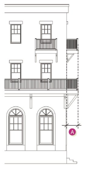
Awning and Canopies: Awning and Canopies are encouraged as a traditional street-level store-front fitting to accent and provide shade and/or shelter over a primary entrance, display windows, or outdoor seating. Awnings and Canopies may also be found above upper story windows and Balconies, and over secondary entrances. Where provided, all Awnings and Canopies shall meet the following specifications:
Awnings and Canopies shall provide 8-feet minimum clear height above the finished grade, and 13-feet 6-inches minimum clear height above the finished grade shall be provided above any area used for parking or circulation or emergency vehicle access (A).
First floor Awnings and Canopies shall project a minimum of 3-feet from the Façade (B) or Elevation to which it is attached to a maximum of 2-feet from the curb (C). Awnings and Canopies on upper story windows may project no more than 5-feet from the Facade. Awnings that cannot project a minimum of 3-feet due to the small size of the opening, shall project a minimum of 50% of the height of the opening (e.g. a window that is 4-ft tall shall project at least 2-ft).
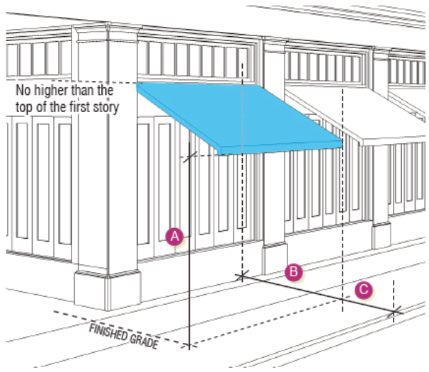
Awnings and Canopies shall not be internally illuminated or backlit, however they may contain lighting fixtures intended to illuminate the ground beneath when covering a Building entrance.
Awnings and Canopies may incorporate signage pursuant to the requirements of Article 7.
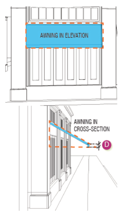
Awnings shall have a structural framework of steel/aluminum or other appropriate, durable structural material supporting a thin, non-translucent covering material with a matte finish such as metal, acrylic, canvas, or synthetic fabric. Awnings shall not include a soffit, and columns or posts extending to the ground are prohibited within the public right-of-way. Retractable awnings are encouraged.
Canopies shall be constructed of steel/aluminum or other appropriate, durable structural material, and may be clad in metal panel, wood, or other durable finished material.
Canopies projecting into the public right-of-way shall be cantilevered or supported from above, and columns or posts extending to the ground are prohibited. Canopies placed outside of the public right-of-way may be partially or fully free-standing.
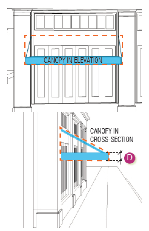
Other:
Permanent vertical access features (stairs, ramps, etc.) located in the First Lot Layer must be integrated into the design of the chosen Frontage Type. Otherwise they must be located in the Second or Third Lot Layer.
All utility service connections shall be underground for new construction.
The footprint area of an Outbuilding may not exceed the footprint area of the Principal Building.
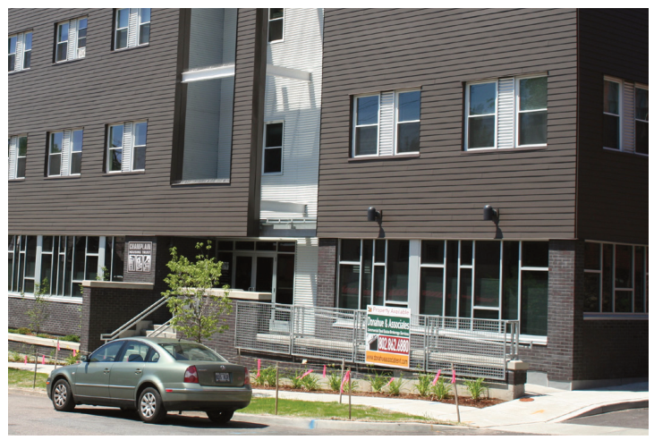
An example of a vertical access ramp integrated into a Building Frontage.
Part 5Specific to Private Frontage Types
§ 14.5Specific to Private Frontage Types
SubSections:
14.5.1 Purpose
14.5.2 Applicability
14.5.3 Frontage Types Summary Table
14.5.4 Porch: Projecting
14.5.5 Porch: Engaged
14.5.6 Porch: Integral
14.5.7 Stoop
14.5.8 Courtyard
14.5.9 Dooryard
14.5.10 Doorway
14.5.11 Lightwell & Landing
14.5.12 Officefront
14.5.13 Shopfront
14.5.14 Terrace
14.5.15 Forecourt
14.5.16 Gallery
14.5.17 Arcade
§ 14.5.1Purpose
This Section sets forth the standards applicable to Private Frontages. Private Frontages are the components of a Building that provide an important transition and interface between the public realm (Thoroughfares and Sidewalks, lakeshore and Civic Spaces) and the private realm (yard and/or Building) illustrated below. For each Frontage Type, a description, a statement of the type’s intent, and specific design standards are provided. These standards are intended to ensure development that reinforces the highly-valued existing character and scale of Burlington’s neighborhoods and downtown by providing an active and intentional relationship between the public and the private realm.
§ 14.5.2Applicability
These standards shall be applied to all Private Frontages within all Form Districts along Thoroughfares, the Lakeshore, and Civic Spaces. Individual Buildings may divide the Facade into a series of architectural bays each containing an individual Private Frontage Type. The standards and requirements applicable to a Frontage Type shall modify and take precedence without limitation over any duplicative or conflicting provisions of Section 14.3 (Specific to Form Districts), Section 14.4 (Specific to Building Types) and Section 14.6 (Supplemental to Form Districts).
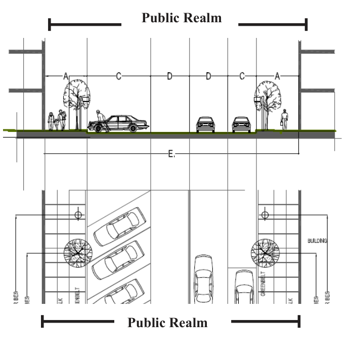
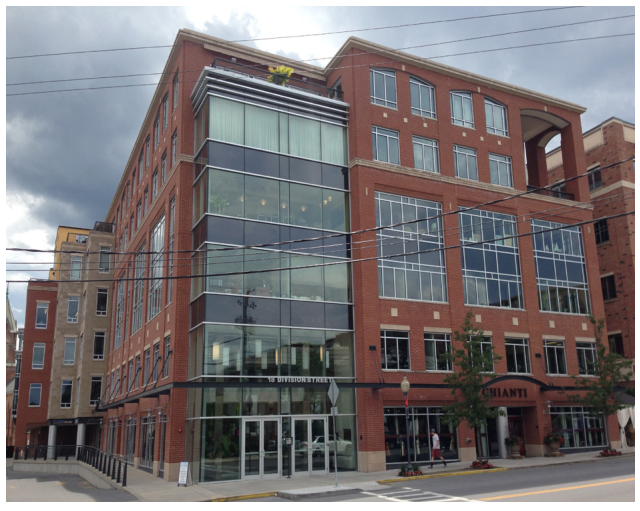
An example of an individual Mixed Use Building employing multiple Frontage Types.
§ 14.5.3Frontage Types General
Table 14.5-A (Frontage Types Summary Table) provides an overview of all allowed Frontages Types.
Table 14.5-A - Private Frontage Types Summary Table [not-regulatory]
The Private Frontage is the area between the Building Façade and the ROW/Lot Line.
Frontage Type
Illustration Type
14.5.4 - Porch: Projecting
A Private Frontage where the Building Facade is set back from the Frontage Line, and includes an attached open porch that Encroaches into the First Lot Layer which may be planted and include a fence to maintain spatial definition with the public right-of-way. The porch contains a Principal entrance sufficiently elevated from the Sidewalk to secure privacy for the first story from a busy public Sidewalk. This type is commonly associated with ground-floor Residential use.
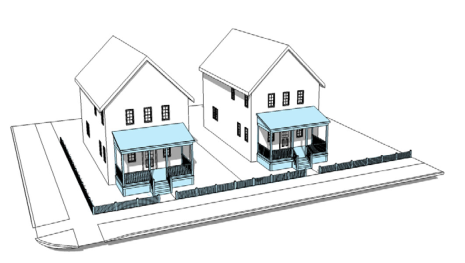
14.5.5 - Porch: Engaged
A Private Frontage where the Building Facade may or may not be set back from the Frontage Line, and includes an open porch with two adjacent sides that are engaged to the Building while two sides remain open. The porch does not Encroach into the First Lot Layer, which may be planted and include a fence to maintain spatial definition with the public right-of-way. The porch contains a Principal entrance sufficiently elevated from the Sidewalk to secure privacy for the first story from a busy public Sidewalk. This type is commonly associated with ground-floor Residential use.
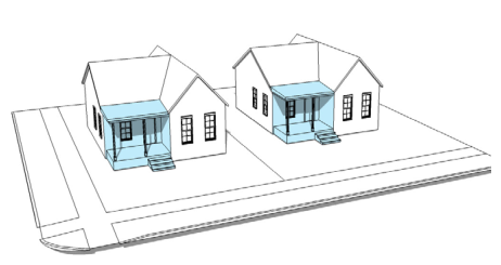
14.5.6 - Porch: Integral
A Private Frontage where the Building Facade may or may not be set back from the Frontage Line, and includes a porch integral to the overall massing and roof form of the Building and open on one, two or three sides. The porch does not Encroach into the First Lot Layer, which may be planted and include a fence to maintain spatial definition with the public right-of-way. The porch contains a Principal entrance sufficiently elevated from the Sidewalk to secure privacy for the first story from a busy public Sidewalk. This type is commonly associated with ground-floor Residential use.
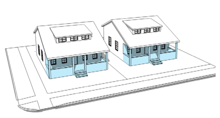
14.5.7 - Stoop
A Private Frontage where the Building Facade is aligned very close to the Frontage Line, and the first Story is elevated from the Sidewalk sufficiently to secure privacy for the windows from a busy public Sidewalk. The elevated Principal entrance is accessed by an exterior stair and small landing that is permitted to Encroach into the First Lot Layer. The remainder of the First Lot Layer must be planted, or paved to join with the adjoining public Sidewalk. This type is commonly associated with ground-floor Residential use.
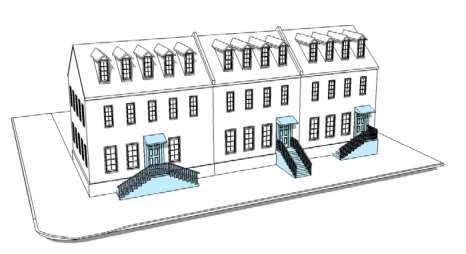
14.5.8 - Courtyard
A Private Frontage where a portion of the Facade is aligned close to or at the Frontage Line, and the central portion of the Façade is set back to create a courtyard with a Principal entrance at-grade and space for gathering and circulation, or for outdoor shopping or restaurant seating. The First Lot Layer and courtyard must be planted or paved to join with the adjoining public Sidewalk. This type should be used sparingly, and must be used in conjunction with other Frontage Types to define individual or shared entries at least one of which faces the street.
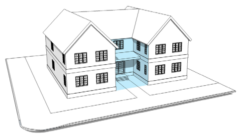
14.5.9 - Dooryard:
A Private Frontage where the Building Facade is aligned close to the Frontage Line, and the Frontage Line is defined by a low wall, decorative fence or hedge providing a strong spatial definition from the public Sidewalk. The result is a small semi-private dooryard containing the Principal entrance in First Lot Layer accessed by a Stoop for an elevated entry or a Doorway for at-grade entry. The remainder of the First Lot Layer may be planted or serve as a small patio. This type is commonly associated with ground-floor Residential use.
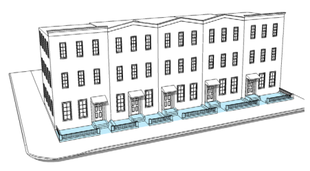
14.5.10 - Doorway
A Private Frontage where the Building Facade is aligned close to or at the Frontage Line, and the street-facing Principal entrance provides an at-grade entry. To the extent there is a First Lot Layer, it may be planted or paved to join with the adjoining public Sidewalk. This type is commonly associated with ground-floor Residential use.
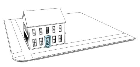
14.5.11 - Lightwell & Landing
A Private Frontage where the Building Facade is set back from the Frontage line, and a street-facing Principal entrance is elevated and accessed by an exterior stair with or without a small landing, and/or sunken and accessed via a Lightwell. The Frontage Line adjoining the Lightwell is partially defined by a low wall, decorative fence or hedge providing a strong spatial definition from the public Sidewalk and safety for pedestrians passing by. This type is particularly well-suited for accommodating grade changes along a Frontage Line, allows for activation of below grade spaces, and buffering residential uses from busy public Sidewalks. The First Lot Layer and Lightwell may be planted or serve as a small patio.
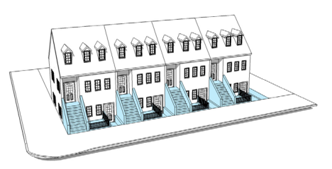
14.5.12 - Officefront
A Private Frontage where the Building Facade is aligned close to or at the Frontage Line with street-facing individual and/or shared entries that provide at-grade access directly onto the public Sidewalk. This type is commonly associated with office, retail, service or hospitality uses, and has ample glazing on the Sidewalk level, and may include an Awning and/or Canopy that may Encroach into the First Lot Layer and over-lap the Sidewalk. To the extent there is a First Lot Layer, it is paved to join with the adjoining public Sidewalk with or without outdoor shopping or restaurant seating.
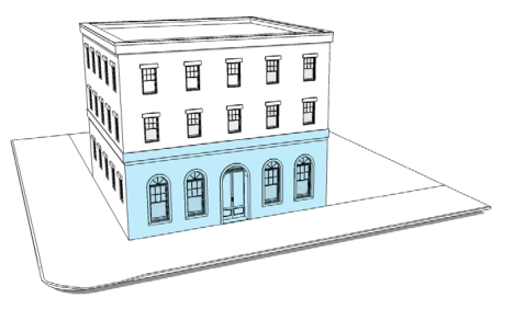
14.5.13 - Shopfront
A Private Frontage where the Building Facade is aligned close to or at the Frontage Line with street-facing individual and/or shared entries that provide at-grade access directly onto the public Sidewalk. This type is commonly associated with retail, service and/or hospitality uses, has substantial glazing on the Sidewalk level, and may include an Awning and/or Canopy that may Encroach into the First Lot Layer and over-lap the Sidewalk. To the extent there is a First Lot Layer, it is paved to join with the adjoining public Sidewalk with or without outdoor shopping or restaurant seating.
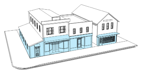
14.5.14 - Terrace
A Private Frontage where the Building Facade is aligned close to or at the Frontage Line with an elevated terrace that may Encroach into the First Lot Layer providing level or terraced public circulation along the Façade. This type provides at-grade access to first story uses and shared entries for upper story uses while accommodating a grade change along a Frontage Line. Frequent steps up to the terrace are necessary to avoid overly tall terrace walls, and the Frontage Line along the terrace edge is defined by a low wall or decorative fence providing a strong spatial definition from the public Sidewalk and safety for pedestrians. Awnings and Canopies may Encroach into the First Lot Layer but shall not cross the Frontage Line. This type is required to be used in conjunction with other Frontage Types to define individual or shared entries facing the street.
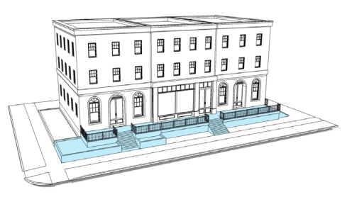
14.5.15 - Forecourt
A Private Frontage where the Building Facade is setback from the Frontage Line with individual at-grade entries for ground level uses and shared entries for upper story uses provide access directly onto a permanent outdoor patio. The First Lot Layer must include a low wall or decorative fence at the Frontage Line to maintain spatial definition with the public right-of-way, and shall be paved to support outdoor seating and dining. Awnings and Canopies may Encroach into the First Lot Layer but shall not cross the Frontage Line. This type should be used sparingly; is intended to serve ground floor commercial, hospitality or retail uses; and requires the use of the Shopfront Frontage Type to define individual or shared first floor entries facing the street.
14.5.16 - Gallery
A Private Frontage where the Building Facade is set back from the Frontage Line with an attached cantilevered porch with a lightweight colonnade that fully Encroaches into the First Lot Layer. The First Lot Layer is paved to join with the adjoining public Sidewalk which may be activated with outdoor shopping and/or restaurant seating. Upper story porches are also intended to be activated with outdoor use such as seating and/or dining. This type is required to be used in conjunction with a Shopfront or Officefront Frontage Type to define individual or shared at-grade entries facing the street.
14.5.17 - Arcade
A Private Frontage where only the ground floor level of the Building Facade is set back from the Frontage Line. The Building Facade for the upper floors is at the Frontage Line and is supported by a colonnade supporting habitable space above. This type is intended to serve ground floor commercial, hospitality or retail uses, and is required to be used in conjunction with a Shopfront, or Officefront Frontage Type to define individual or shared first floor at-grade entries facing the street.
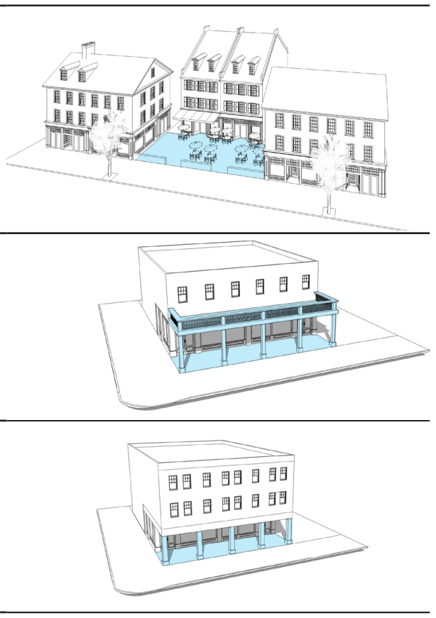
§ 14.5.4Porch: Projecting
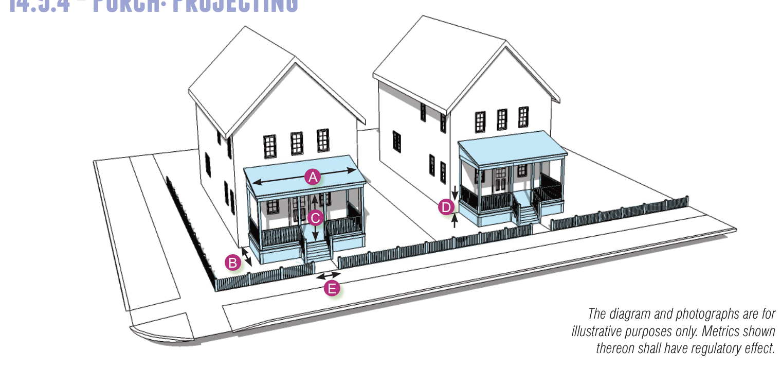
The diagram and photographs are for illustrative purposes only. Metrics shown thereon shall have regulatory effect.
14.5.4-A - Description
A Private Frontage where the Building Facade is set back from the Frontage Line, and includes an attached open porch that Encroaches into the First Lot Layer which may be planted and include a fence to maintain spatial definition with the public right-of-way. The porch contains a Principal Entrance sufficiently elevated from the Sidewalk to secure privacy for the first story from a busy public Sidewalk. This type is commonly associated with ground-floor Residential use.
14.5.4-B - Building Types
Multi-Family: Small
Multi-Family: Large
14.5.4-C - Standards
14.5.4-D - Miscellaneous
Projecting porches must have three sides open and a roof, and may not be enclosed.
Projecting porches may Encroach into the First Lot Layer, and extend a maximum required front yard setback to an amount equal to the minimum depth required in Sec. 14.5.4-C plus the run of the stairs.
Multi-Story porches shall not be interconnected by an external stairway.
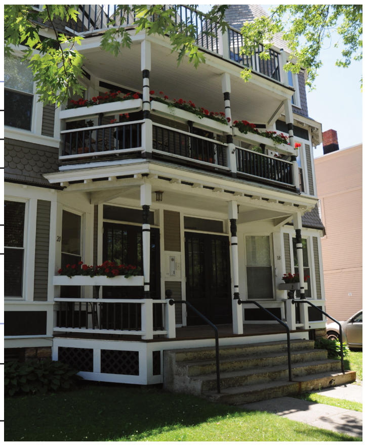
§ 14.5.5Porch: Engaged
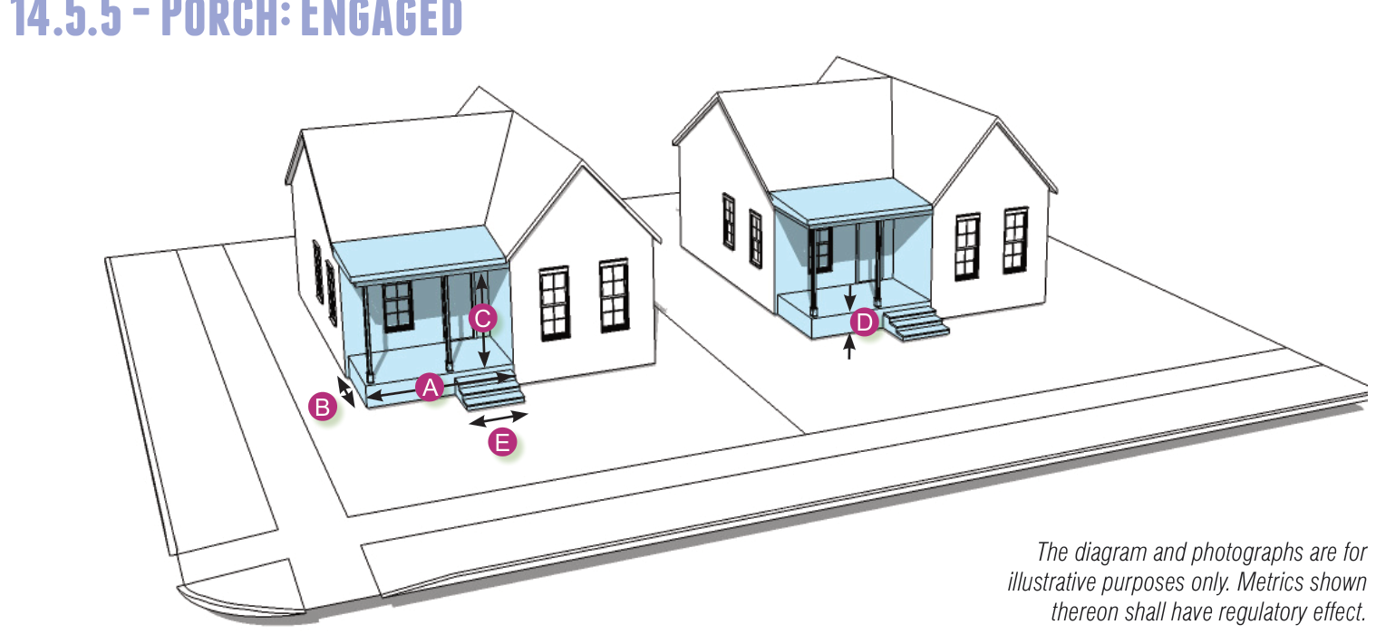
The diagram and photographs are for illustrative purposes only. Metrics shown thereon shall have regulatory effect.
14.5.5-A - Description
A Private Frontage where the Building Facade may or may not be set back from the Frontage Line, and includes an open porch with two adjacent sides that are engaged to the Building while two sides remain open. The porch does not Encroach into the First Lot Layer, which may be planted and include a fence to maintain spatial definition with the public right-of-way. The porch contains a Principal Entrance sufficiently elevated from the Sidewalk to secure privacy for the first story from a busy public Sidewalk. This type is commonly associated with ground-floor Residential use.
14.5.5-B - Building Types
Multi-Family: Small
Multi-Family: Large
14.5.5-C - Standards
14.5.5-D - Miscellaneous
Engaged porches must have two open sides and a roof, and may not be enclosed. Engaged porches extending along a side elevation may be enclosed beyond the first 6-ft of depth.
Engaged porches are not allowed to Encroach into the First Lot Layer.
Upper Story porches shall not be connected with porches below by an external stairway.
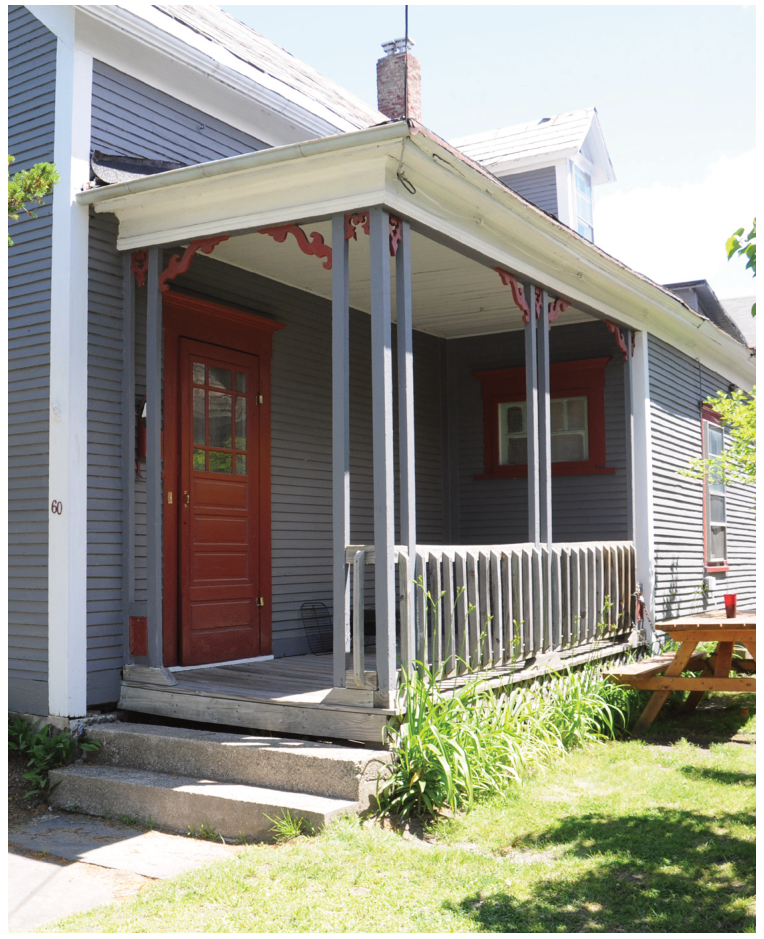
§ 14.5.6Porch: Integral
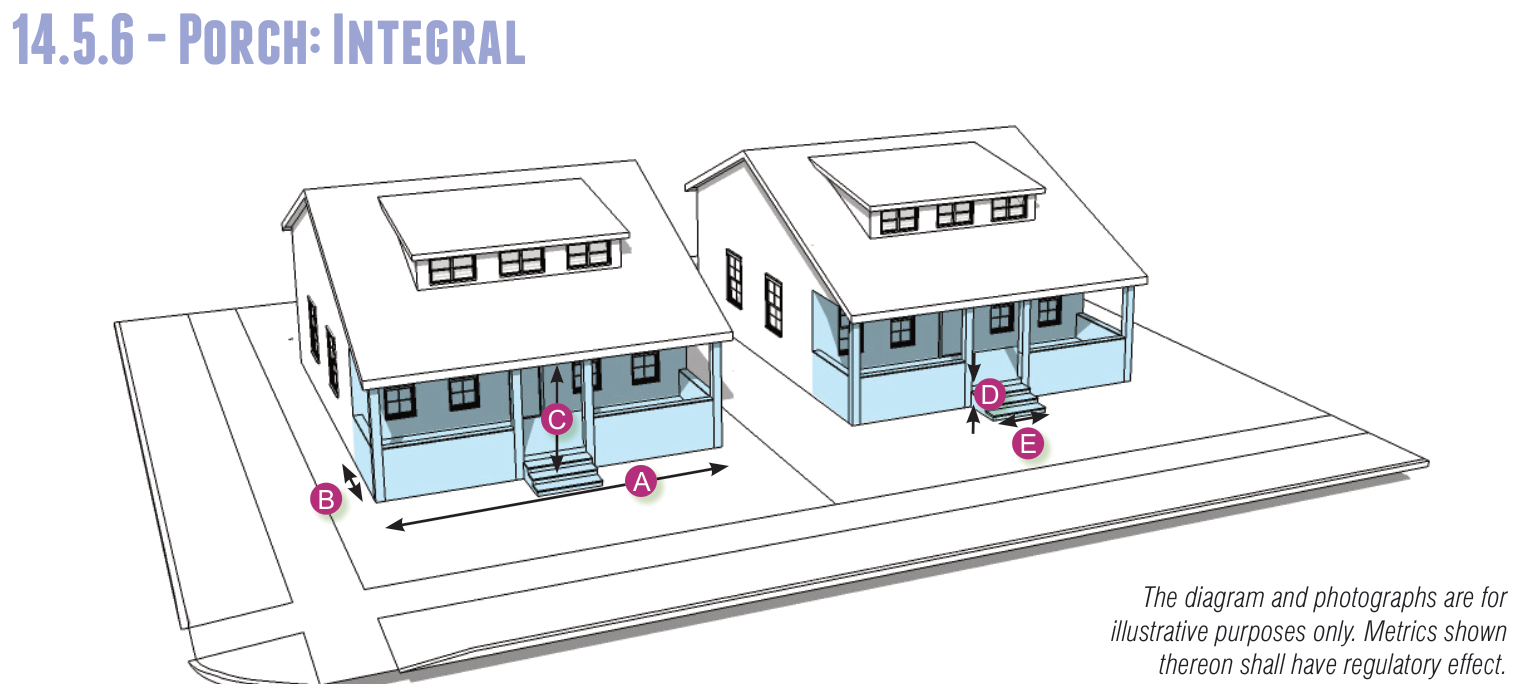
The diagram and photographs are for illustrative purposes only. Metrics shown thereon shall have regulatory effect.
14.5.6-A - Description
A Private Frontage where the Building Facade may or may not be set back from the Frontage Line, and includes a porch integral to the overall massing and roof form of the Building and open on one, two or three sides. The porch does not Encroach into the First Lot Layer, which may be planted and include a fence to maintain spatial definition with the public right-of-way. The porch contains a Principal Entrance sufficiently elevated from the Sidewalk to secure privacy for the first story from a busy public Sidewalk. This type is commonly associated with ground-floor Residential use.
14.5.6-B - Building Types
Multi-Family: Small
14.5.6-C - Standards
14.5.6-D - Miscellaneous
Integral porches must be open on one, two or three sides and may not be enclosed.
Integral porches are not allowed to Encroach within the First Lot Layer.
Upper Story porches shall not be connected with porches below with an external stairway.
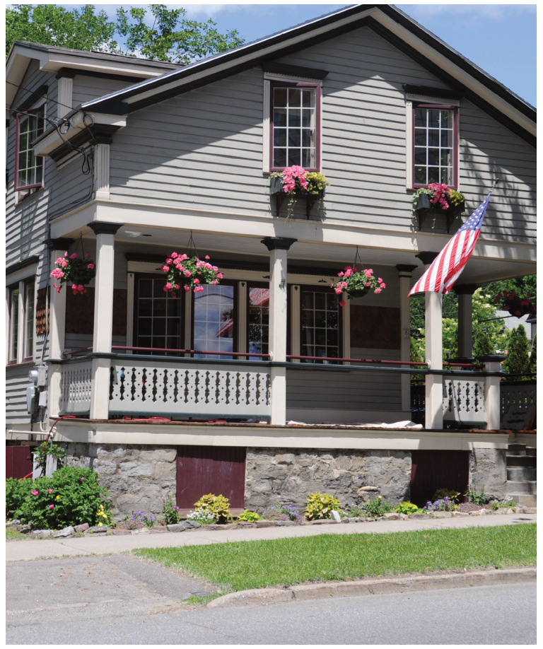
§ 14.5.7Stoop
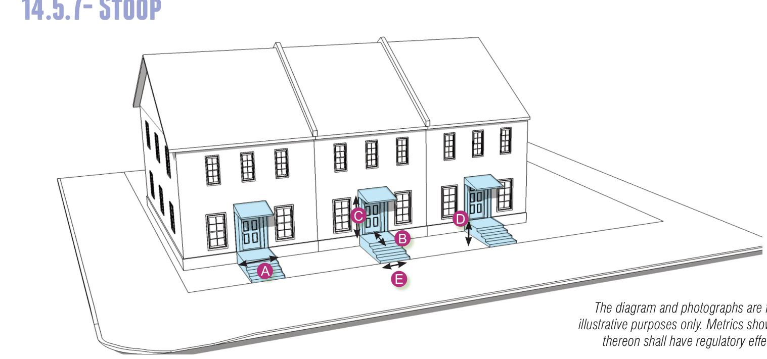
The diagram and photographs are for illustrative purposes only. Metrics shown thereon shall have regulatory effect.
14.5.7-A - Description
A Private Frontage where the Building Facade is aligned very close to the Frontage Line, and the first Story is elevated from the Sidewalk sufficiently to secure privacy for the windows from a busy public Sidewalk. The elevated street-facing Principal Entrance is accessed by an exterior stair and small landing that is permitted to Encroach into the First Lot Layer. The remainder of the First Lot Layer may be planted, or paved to join with the adjoining public Sidewalk. This type is commonly associated with ground-floor Residential use.
14.5.7-B - Building Types
Multi-Family: Small
Multi-Family: Large
14.5.7-C - Standards
| Landing Width | 4 inches min. | (A) |
| Landing Depth | 3-ft min - 6-ft max | (B) |
| Clear Height above Landing | 8-ft min. | (C) |
| Finish Level above Sidewalk | 18-in min. - 4-ft max. | (D) |
| Depth of recessed entry | 4-ft max from the facade | |
| Clear Path of Travel to a Principal Entrance | 3-ft wide min. | (E) |
14.5.7-D - Miscellaneous
Stoops may Encroach into the First Lot Layer, and extend a maximum required front yard setback to an amount equal to the maximum depth required in Sec. 14.5.7-C.
Stairs may be perpendicular or parallel to the Building Façade.
The entry doors are encouraged to be covered and/or recessed to provide shelter from the elements.
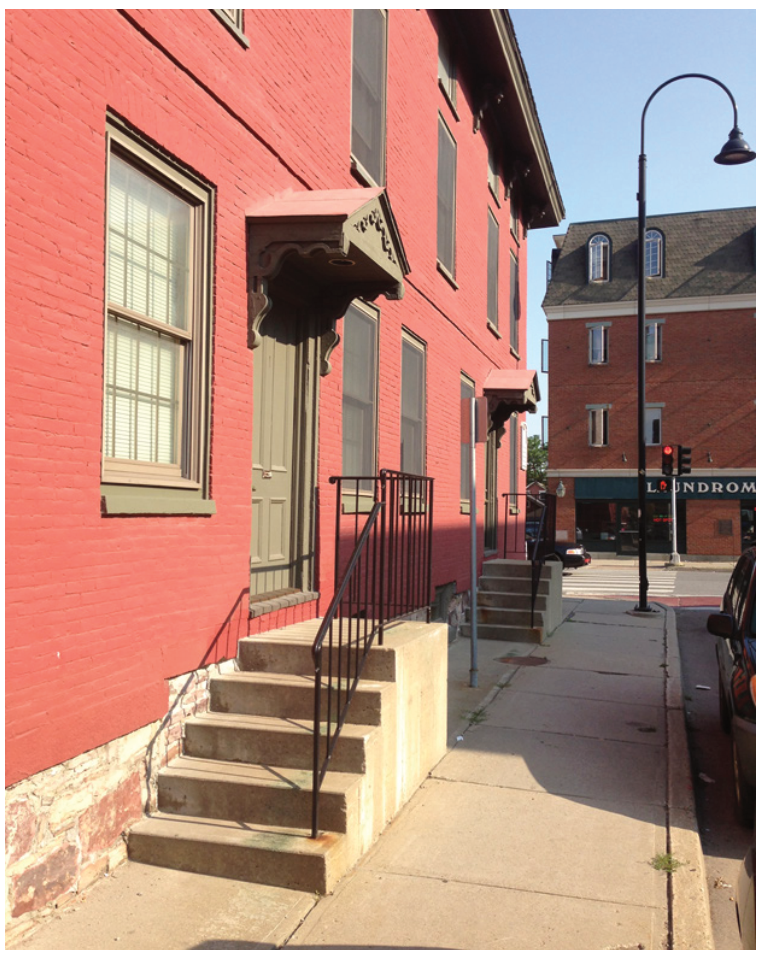
§ 14.5.8Courtyard
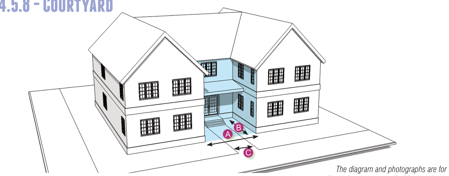
The diagram and photographs are for illustrative purposes only. Metrics shown thereon shall have regulatory effect.
14.5.8-A - Description
A Private Frontage where a portion of the Facade is aligned close to or at the Frontage Line, and the central portion of the Façade is set back to create a courtyard with a Principal Entrance at-grade and space for gathering and circulation, outdoor shopping and/or restaurant seating. The First Lot Layer and courtyard must be planted or paved to join with the adjoining public Sidewalk. This type should be used sparingly, and must be used in conjunction with another Frontage type to define individual or shared entries at least one of which faces the street.
14.5.8-B - Building Types
Multi-Family: Small
Multi-Family: Large
14.5.8-C - Standards
| Courtyard Width | - 12-ft min. - lessor of 1/3 the total Building width or 35-ft max | (A) |
| Courtyard Depth | 12-ft min.- 35-ft max | (B) |
| Canopy/Awning; Projection | 10-ft from Façade max | |
| Clear Path of Travel to a Principal Entrance | 3-ft min. | (C) |
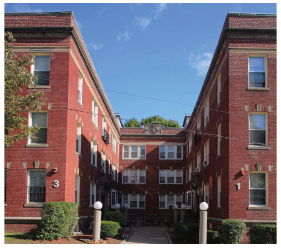
14.5.8-D - Miscellaneous
A maximum of one Courtyard is permitted per Principal Building.
A Courtyard shall remain open to the sky, and may not contain Driveways, parking, loading or service areas, or mechanical equipment or vents.
A Courtyard may include a free-standing Canopy, Awning, umbrellas or pergola, but they shall not be enclosed.
The Courtyard shall be activated as a space for gathering, circulation, outdoor shopping, and/or restaurant seating.
The proportions and orientation of a Courtyard should be carefully considered for solar orientation and user comfort.
A Courtyard is considered as part of the Building for the purpose of measuring the Frontage Buildout.
All faces of the recessed Courtyard shall be considered to be part of the Façade.
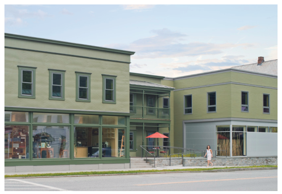
§ 14.5.9Dooryard
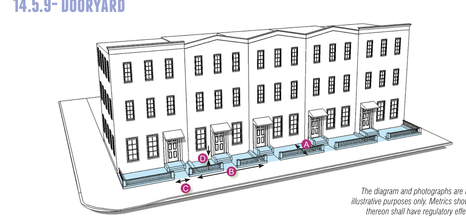
The diagram and photographs are for illustrative purposes only. Metrics shown thereon shall have regulatory effect.
14.5.9-A - Description
A Private Frontage where the Building Facade is aligned close to the Frontage Line, and the Frontage Line is defined by a low wall, decorative fence or hedge providing a strong spatial definition from the public Sidewalk. The result is a small semi-private dooryard defining the First Lot Layer containing a street-facing Principal Entrance accessed by a Stoop for an elevated entry or a Doorway for at-grade entry. The remainder of the First Lot Layer may be planted or serve as a small patio. This type is commonly associated with ground-floor Residential use.
14.5.9-B - Building Types
Multi-Family: Small
Multi-Family: Large
14.5.9-C - Standards
14.5.9-D - Miscellaneous
This Frontage Type must be used in conjunction with another Frontage Types such as a Stoop or Doorway to define the street-facing Principal Entrance.
Each Dooryard shall provide access to only one individual or shared entry.
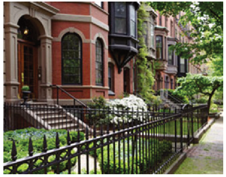
The entry doors are encouraged to be covered and/or recessed to provide shelter from the elements.
Dooryards occupy the First Lot Layer, and may extend the depth of a maximum required front yard setback to an amount equal to the maximum yard depth permitted in Sec. 14.5.9-C.
The Frontage Line shall defined by a low wall, decorative fence, or hedge providing a strong spatial definition from the public Sidewalk.
Dooryards may not contain Driveways, parking, loading or service areas, or mechanical equipment or vents.
§ 14.5.10Doorway
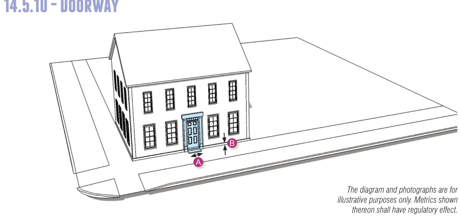
The diagram and photographs are for illustrative purposes only. Metrics shown thereon shall have regulatory effect.
14.5.10-A - Description
A Private Frontage where the Building Facade is aligned close to or at the Frontage Line, and the street-facing Principal Entrance provides an at-grade entry. To the extent there is a First Lot Layer, it may be planted or paved to join with the adjoining public Sidewalk. This type is commonly associated with ground-floor Residential use.
14.5.10-B - Building Types
Multi-Family: Small
Multi-Family: Large
14.5.10-C - Standards
| Depth of recessed entries | 4-ft max. from Facade | |
| Clear Path of Travel to a Principal Entrance | 3-ft wide min. | (A) |
| Finish level above Sidewalk | 18 inches max. | (B) |
14.5.10-D - Miscellaneous
Each Doorway shall provide access to only one individual or shared entry.
The entry doors are encouraged to be covered and/or recessed to provide shelter from the elements.
Stairs providing access to a Doorway may occupy the First Lot Layer.
§ 14.5.11Lightwell & Landing
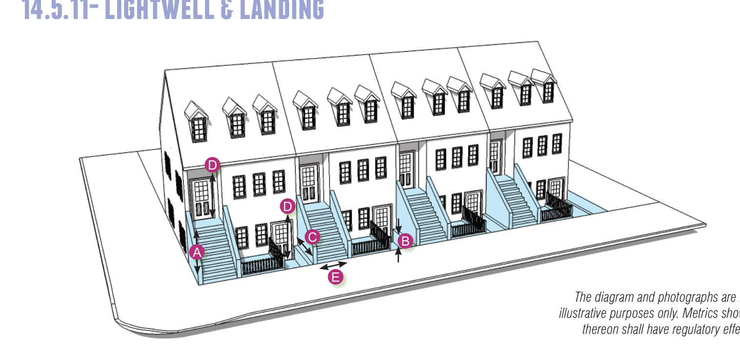
The diagram and photographs are for illustrative purposes only. Metrics shown thereon shall have regulatory effect.
14.5.11-A - Description
A Private Frontage where the Building Facade is set back from the Frontage line, and a street-facing Principal Entrance is elevated and accessed by an exterior stair with or without a small landing, and/or sunken and accessed via a Lightwell. The Frontage Line adjoining the Lightwell is partially defined by a low wall, decorative fence, or hedge providing a strong spatial definition from the public Sidewalk and safety for pedestrians passing by. This type is particularly well-suited for accommodating grade changes along a Frontage Line, allows for activation of below grade spaces, and buffering residential uses from busy public Sidewalks. The First Lot Layer and Lightwell may be planted or serve as a small patio.
14.5.11-B - Building Types
Multi-Family: Small
Multi-Family: Large
14.5.11-C - Standards
| Height | ||
| Landing (above Sidewalk) | 6-ft max. | (A) |
| Lightwell (below Sidewalk) | 6-ft max. | (B) |
| Depth | 5-ft min. 8-ft max. | (C) |
| Height, Clear | 8-ft min. | (D) |
| Clear Path of Travel to a Principal Entrance | 3-ft wide min. | (E) |
14.5.11-D - Miscellaneous
A short fence shall be placed along the Frontage Line at the Lightwell for the safety of pedestrians and to provide a strong spatial definition from the public Sidewalk.
Each Lightwell or Landing shall provide access only one individual or shared entry for a maximum of two entries where both are employed.
The Lightwell and Landing occupies the First Lot Layer, and may extend the depth of a maximum required front yard setback to an amount equal to the maximum depth permitted in Sec. 14.5.11-C.
The entry doors are encouraged to be covered and/or recessed to provide shelter from the elements.
§ 14.5.12Officefront
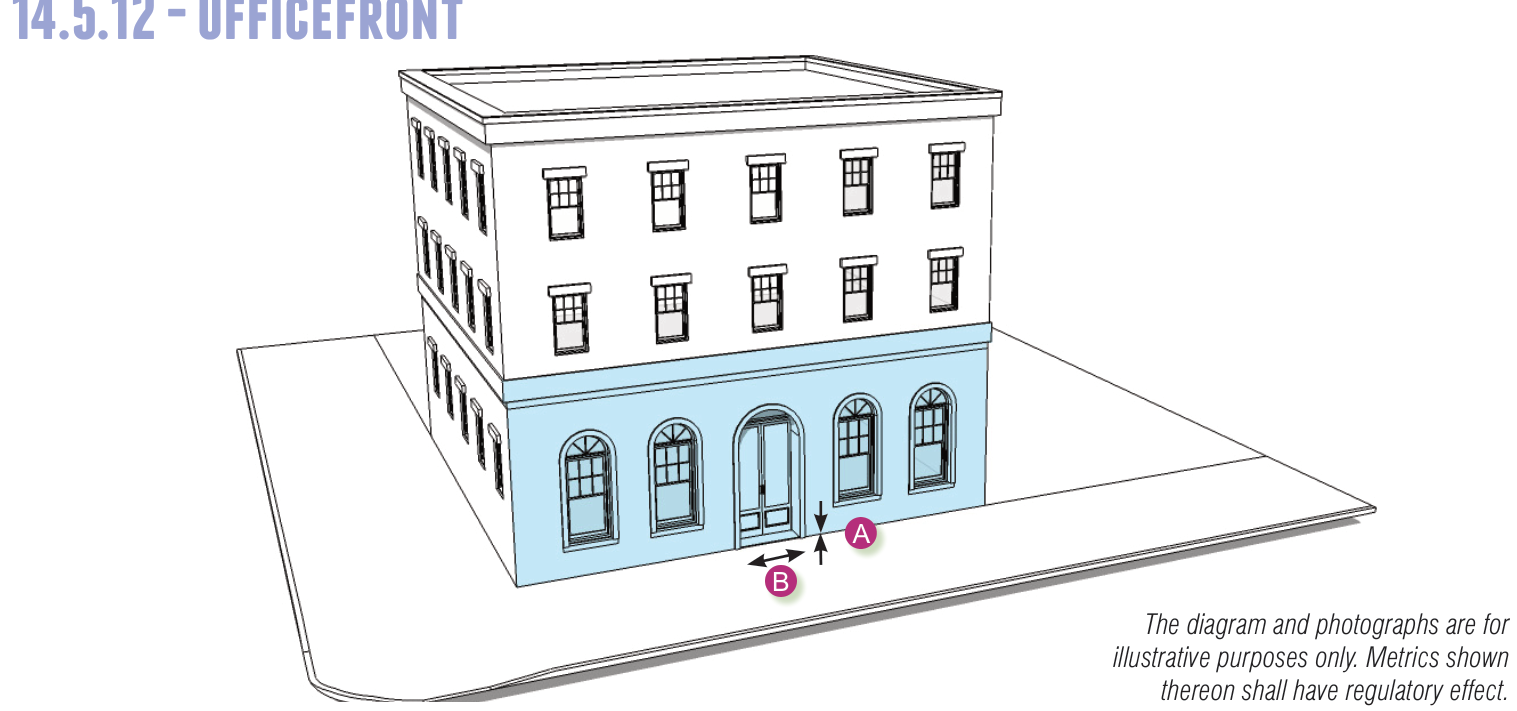
The diagram and photographs are for illustrative purposes only. Metrics shown thereon shall have regulatory effect.
14.5.12-A - Description
A Private Frontage where the Building Facade is aligned close to or at the Frontage Line with street-facing individual and/or shared entries that provide at-grade directly onto the public Sidewalk. This type is commonly associated with office, retail, service, and/or hospitality uses; has ample glazing on the Sidewalk level; and, may include an Awning and/or Canopy that may Encroach into the First Lot Layer and over-lap the Sidewalk. To the extent there is a First Lot Layer, it is paved to join with the adjoining public Sidewalk with or without outdoor shopping or restaurant seating.
14.5.12-B - Building Types
14.5.12-C - Standards
| Principal Entrance level | At-grade | (A) |
| Clear Path of Travel to a Principal Entrance | 3-ft wide min. | (B) |
| Ground floor Facade voids (rough opening for windows and doors) | 50% min. between 3-ft and 10-ft above the Principal Entrance level | |
| Depth of recessed entries | 6-ft max. from Facade |
14.5.12-D - Miscellaneous
The entry doors are encouraged to be covered and/or recessed to provide shelter from the elements.
Recessed entries shall provide access to no more than 3 individual or shared entries.
Street-facing, street-level window area must remain unobstructed up to a minimum interior depth of 8-feet, with the exception of obstructions such as street-facing window signs or product displays that do not take up more than 25% of the total window area.
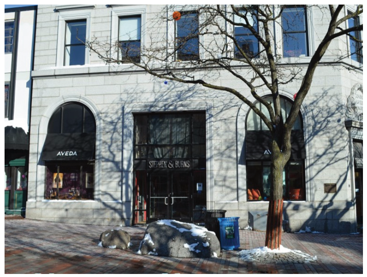
Windows cannot be made opaque by window treatments except for operable sunscreen devices within the conditioned space.
External security shutters are not permitted.
§ 14.5.13Shopfront
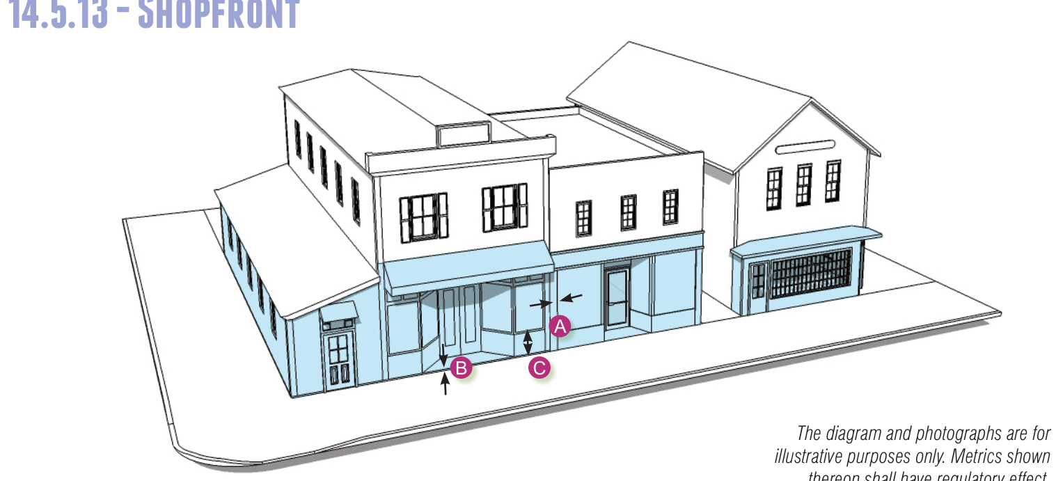
The diagram and photographs are for illustrative purposes only. Metrics shown thereon shall have regulatory effect.
14.5.13-A - Description
A Private Frontage where the Building Facade is aligned close to or at the Frontage Line with street-facing individual and/or shared entries that provide at-grade access directly onto the public Sidewalk. This type is commonly associated with retail, service, and/or hospitality uses; has substantial glazing on the Sidewalk level; and may include an Awning and/or Canopy that may Encroach into the First Lot Layer and over-lap the Sidewalk. To the extent there is a First Lot Layer, it is paved to join with the adjoining public Sidewalk and activated with outdoor shopping and/or restaurant seating.
14.5.13-B - Building Types
14.5.13-C - Standards
| Distance between voids | 4-ft max. | (A) |
| Principal Entrance level | At grade, unless used with a Lightwell & Landing or Terrace Frontage Type | (B) |
| Sill Height | 3-ft max. | (C) |
| Ground floor Facade voids (rough opening for windows and doors) | 70% min. between 3-ft and 10-ft above the sidewalk. | |
| Depth of recessed entries | 6-ft max. from Facade | |
| Clear Path of Travel to a Principal Entrance | 3-ft wide min. |
14.5.13-D - Miscellaneous
Street-facing, street-level window area must remain unobstructed up to a minimum interior depth of 8-feet, with the exception of obstructions such as street-facing window signs or product displays that do not take up more than 25% of the total window area.
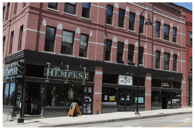
Windows cannot be made opaque by window treatments except for operable sunscreen devices within the conditioned space.
Shopfront doors, windows, awnings, signs, and lighting shall be designed as a unified whole.
Accordion-style doors/windows or other operable windows that allow the interior space to open to the street are encouraged.
External security shutters are not permitted.
Areas where a Shopfront Frontage Type is required are as depicted on Downtown and Waterfront District Regulating Plan - Map 3 - Shopfront Frontage Required opposite. Piers separating individual Shopfronts may not exceed 4-feet in width.
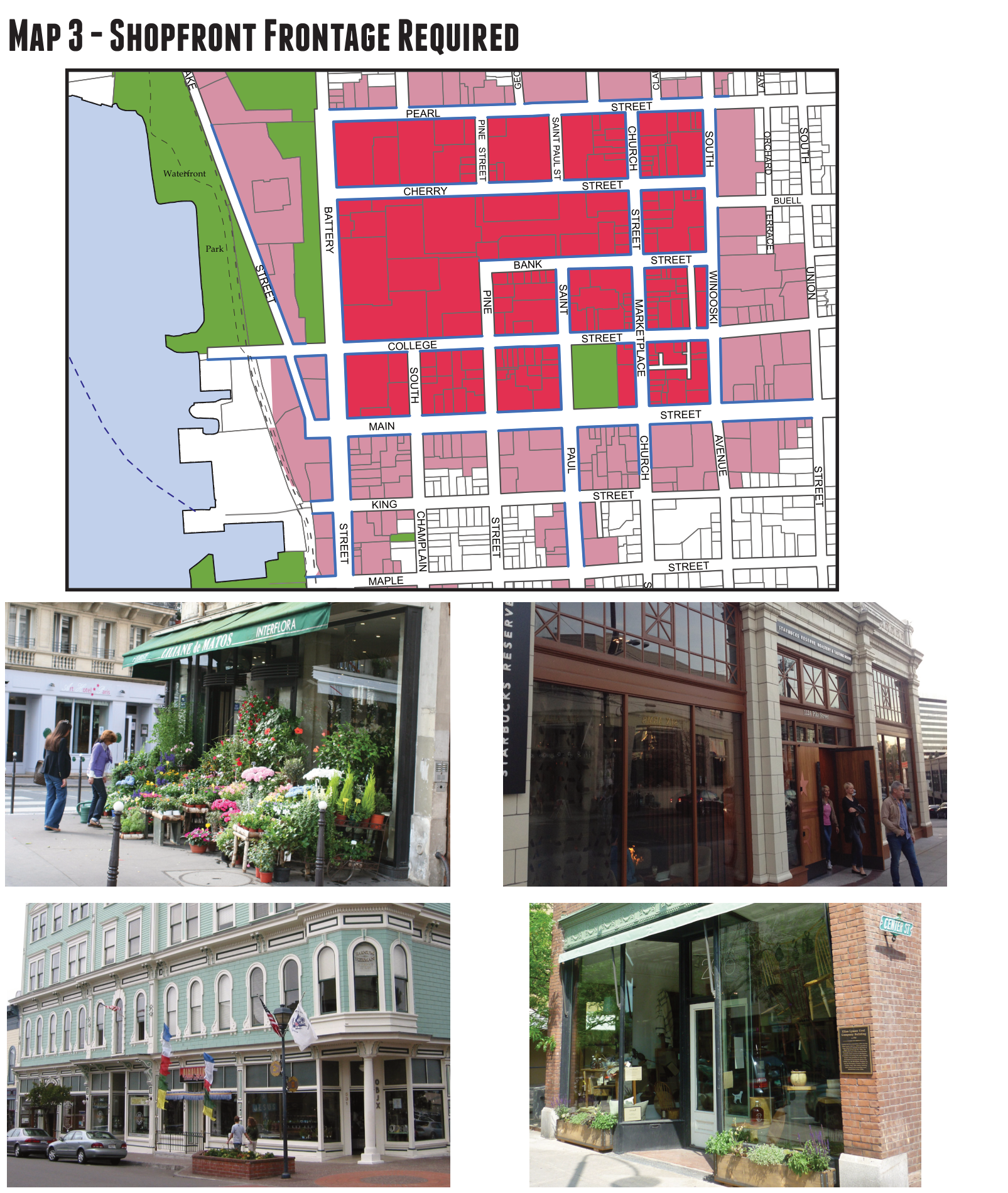
§ 14.5.14Terrace
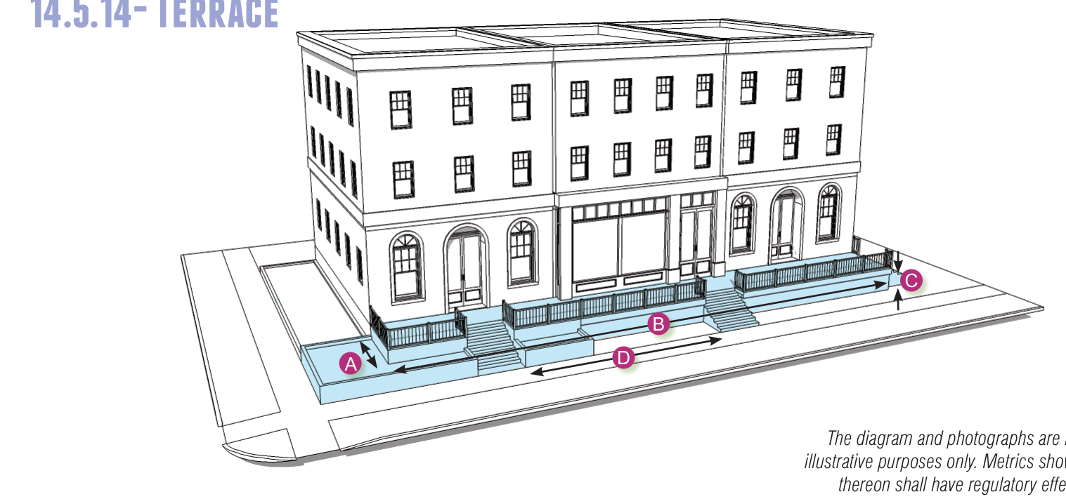
The diagram and photographs are for illustrative purposes only. Metrics shown thereon shall have regulatory effect.
14.5.14-A - Description
A Private Frontage where the Building Facade is aligned close to or at the Frontage Line with an elevated terrace that may Encroach into the First Lot Layer providing level or terraced public circulation along the Façade. This type provides at-grade access to first story uses and shared entries for upper story uses while accommodating a grade change along a Frontage Line. Frequent steps up to the terrace are necessary to avoid overly tall terrace walls, and the Frontage Line along the terrace edge is defined by a low wall or decorative fence providing a strong spatial definition from the public Sidewalk and safety for pedestrians. Awnings and Canopies may Encroach into the First Lot Layer but shall not cross the Frontage Line. This type is required to be used in conjunction with other Frontage Types to define individual or shared entries facing the street.
14.5.14-B - Building Types
Multi-Family: Small
Multi-Family: Large
14.5.14-C - Standards
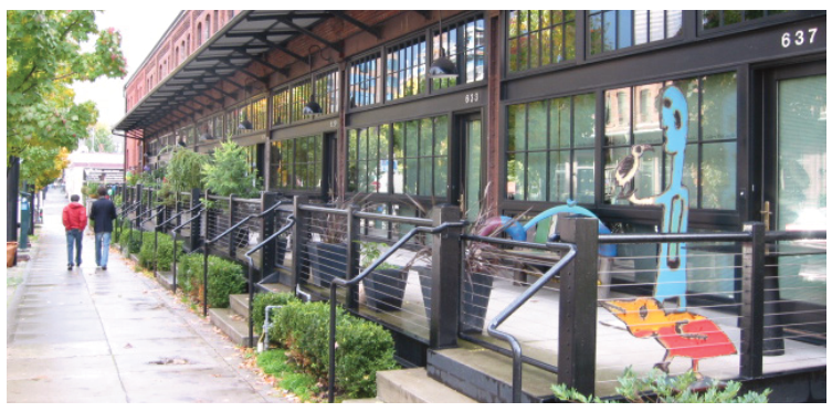
14.5.14-D - Miscellaneous
Terraces occupy the First Lot Layer, and may extend the depth of the a required front yard setback to an amount equal to the maximum depth permitted in Sec. 14.5.14-C.
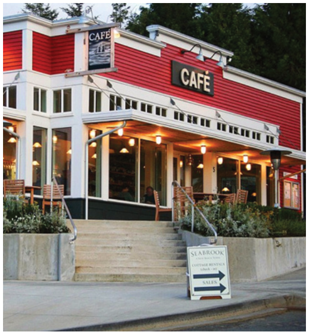
§ 14.5.15Forecourt
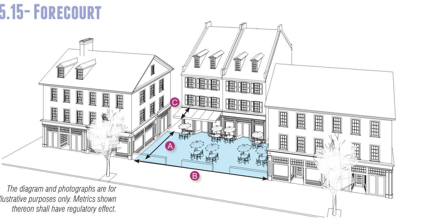
The diagram and photographs are for illustrative purposes only. Metrics shown thereon shall have regulatory effect.
14.5.15-A - Description
A Private Frontage where the Building Facade is setback from the Frontage Line with individual at-grade entries for ground level uses and shared entries for upper story uses provide access directly onto a permanent outdoor patio. The First Lot Layer must include a low wall or decorative fence at the Frontage Line to maintain spatial definition with the public right-of-way, and shall be paved to support outdoor seating and dining. Awnings and Canopies may Encroach into the First Lot Layer but shall not cross the Frontage Line. This type should be used sparingly; is intended to serve ground floor commercial, hospitality, or retail uses; and requires the use of the Shopfront Frontage Type to define individual or shared first floor entries facing the street.
14.5.15-B - Building Types
14.5.15-C - Standards
14.5.15-D - Miscellaneous
A Forecourt occupies the First Lot Layer, and may extend the depth of a maximum required front yard setback to an amount equal to the maximum depth permitted in Sec. 14.5.15-C.
A Forecourt shall remain open to the sky, and may not contain Driveways, parking, loading or service areas, or mechanical equipment or vents.
A Forecourt may include a free-standing Canopy, Awning, umbrellas or pergola, but they shall not be enclosed.
Hardscape coverage requirement may be achieved through a combination of pervious and impervious surface materials.
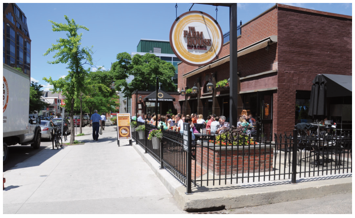
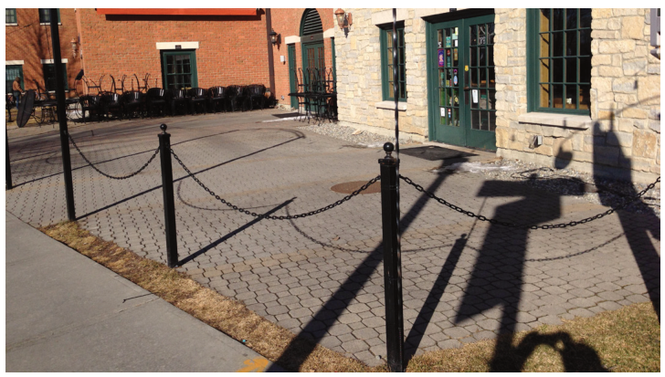
§ 14.5.16Gallery
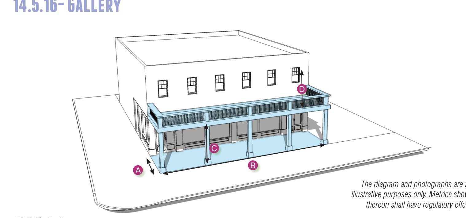
The diagram and photographs are for illustrative purposes only. Metrics shown thereon shall have regulatory effect.
14.5.16-A - Description
A Private Frontage where the Building Facade is set back from the Frontage Line with an attached cantilevered porch with a lightweight colonnade that fully Encroaches into the First Lot Layer. The First Lot Layer is paved to join with the adjoining public Sidewalk which may be activated with outdoor shopping and/or restaurant seating. Upper story porches are also intended to be activated with outdoor use such as seating and/or dining. This type is required to be used in conjunction with a Shopfront or Officefront Frontage Type to define individual or shared at-grade entries facing the street.
14.5.16-B - Allowed With
Multi-Family: Small
Multi-Family: Large
14.5.16-C - Standards
14.5.16-D - Miscellaneous
Upper Story porches must not be connected with porches below with an external stairway.
Galleries must remain open on three sides, and may have a roof or Awning covering the upper-most porch deck.
Galleries must have a consistent depth along the Frontage, and shall completely occupy the First Lot Layer. But in no case shall they extend into the public ROW.
Galleries may extend the depth of the a required front yard setback to an amount equal to the maximum depth permitted in Sec. 14.5.16-C.
Galleries may not contain mechanical equipment or vents.
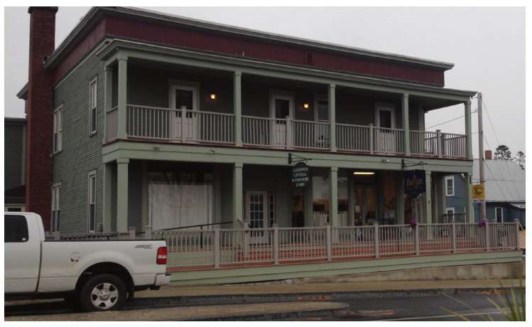
§ 14.5.17Arcade
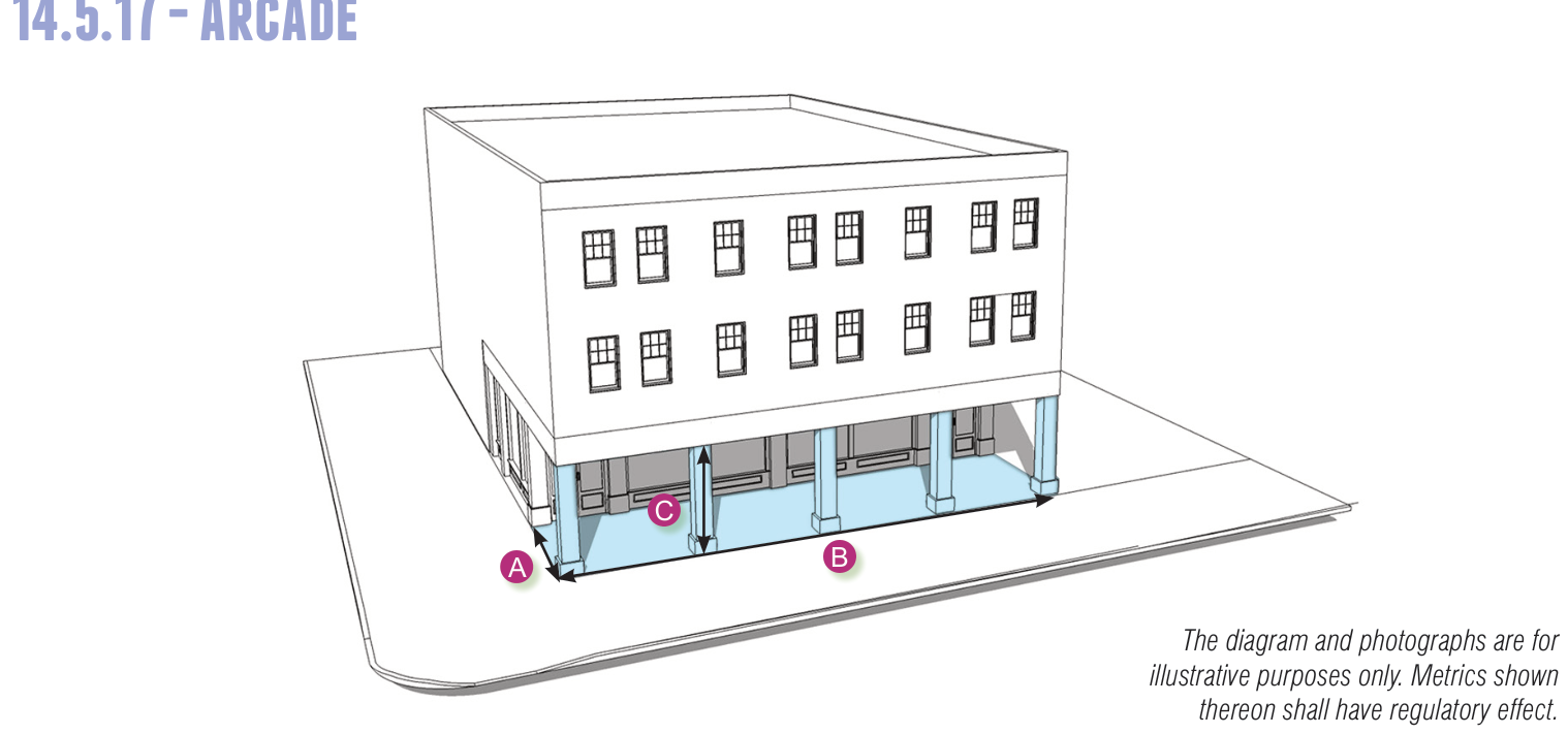
The diagram and photographs are for illustrative purposes only. Metrics shown thereon shall have regulatory effect.
14.5.17-A - Description
A Private Frontage where only the ground floor level of the Building Facade is set back from the Frontage Line. The Building Facade for the upper floors is at the Frontage Line and is supported by a colonnade supporting habitable space above. The ground surface is paved to join with the adjoining public Sidewalk which may be activated with outdoor shopping and/or restaurant seating. This type is intended to serve ground floor commercial, hospitality, or retail uses; and, is required to be used in conjunction with a Shopfront or Officefront Frontage Type to define individual or shared first floor at-grade entries facing the street.
14.5.17-B - Building Types
14.5.17-C - Standards
14.5.17-D - Miscellaneous
Arcades must have a consistent depth across the entire Facade and remain open on three sides.
An Arcade is considered part of the Building for the purpose of measuring the Frontage Buildout.
Arcades may not contain Driveways, parking, loading, or service areas, or mechanical equipment or vents.
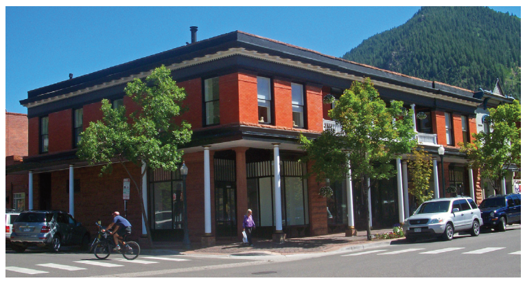
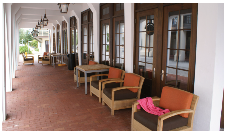
Part 6Applicable in all Form Districts
§ 14.6Applicable in all Form Districts
SubSections:
14.6.1 Purpose
14.6.2 Applicability
14.6.3 Yard Types & Lot Layers
14.6.4 Building Height
14.6.5 Historic Building and Districts
14.6.6 Special Use Regulations
14.6.7 Parking and Circulation
14.6.8 Site and Landscape Standards
14.6.9 Stormwater Management
14.6.10 Outdoor Lighting and Telecommunications Equipment
§ 14.6.1Purpose
This Section establishes standards that supplement the regulations of each Form District. The standards are specific to particular aspects of development, and are intended to promote development that complements and reinforces the vibrant, mixed-use pedestrian environment of Burlington.
§ 14.6.2Applicability
This Section applies to all development in applicable Form Districts. The specific standards and requirements applicable to a Form District (Section 14.3 Specific to Form Districts), Building Type (Section 14.4 Specific to Building Types) and a Frontage Type (Section 14.5 Specific to Frontage Types) shall modify and take precedence without limitation over any duplicative or conflicting provisions of this Section. Each Subsection within this Section further refines the applicability of the standards.
§ 14.6.3Yard Types and Lot Layers
Purpose. This Subsection establishes Yard Types and Lot Layers used to determine the placement of buildings on a Lot within each Form District.
Yard Types. Buildings and Lots shall conform to the Yard Type standards within each Form District, as set forth in Table 14.6.3-A (Yard Types).
Table 14.6.3-A - Yard Types
| Edgeyard | Sideyard | Rearyard |
|---|---|---|
| A Lot where a Principal Building occupies the center of its Lot with Setbacks on all sides. This is the least urban of types as the front yard sets back from the Frontage. | A Lot where a Principal Building occupies one side of the Lot with the Setback to the other side. A shallow frontage Setback defines a more urban condition. | A Lot where a Principal Building occupies the full frontage, leaving the rear of the Lot as the sole yard. This is a very urban type as the continuous Façade defines the Public Frontage/realm. |
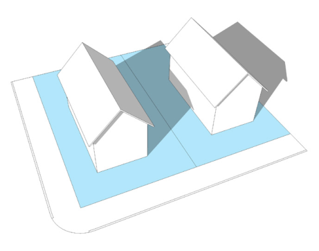
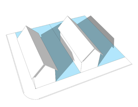
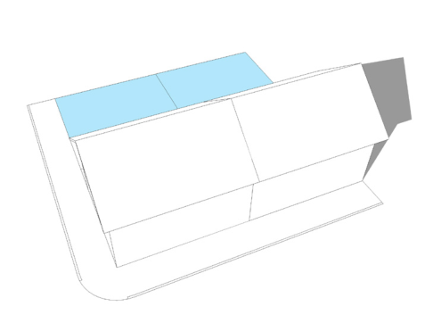
Lot Layers. Lots are composed of three Lot Layers as shown in Illustration 14.6.3-A (Lot Layers).
First Lot Layer: that portion of a Lot between the Frontage Line and the Façade of a Principal Building.
Second Lot Layer: that portion of a Lot extending 20 feet back from and parallel to the Façade of a Principal Building.
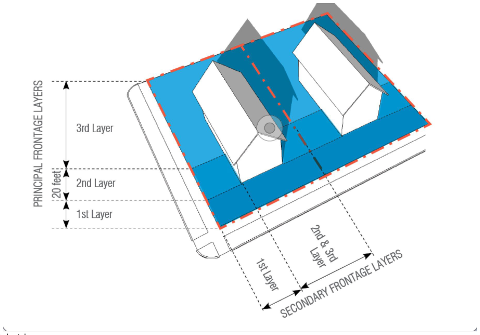
Illustration 14.6.3-A Lot Layers
§ 14.6.4Building Height
Purpose and Applicability. This Subsection shall apply to all Form Districts and establishes the methodology used to measure and calculate the height of a Building to ensure that new development is consistent with the character and scale of Burlington. The maximum and minimum height of a Building shall be as determined by Section 14.3 Specific to Form Districts and Section 14.4 Specific to Building Types where applicable.
Building Height in Feet. Building height shall be measured in accordance with Sec. 5.2.6 (a) Height Measurement of the BCDO.
Building Height by Story. A Story or floor shall be measured as follows for purposes of regulating the height of a Building:
Upper floors, mezzanines, or lofts having a clear height of more than 7½ feet measured from finished floor to finished ceiling must extend beyond 33% of the floor area below to be counted as an additional Story.
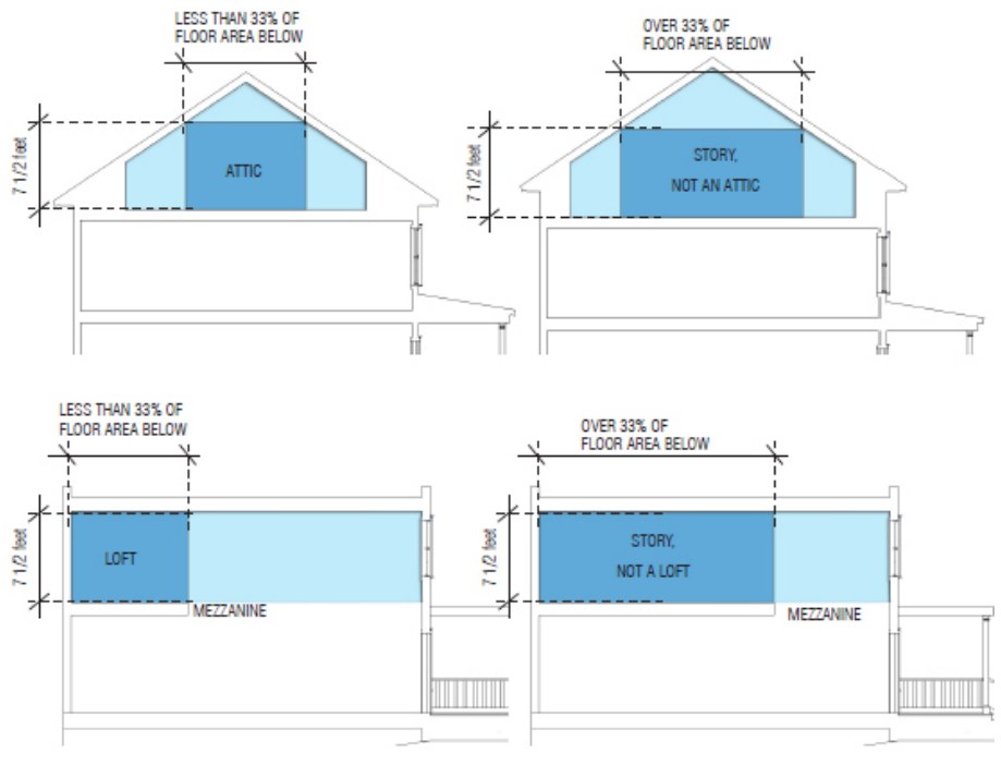
Basement floors with 50% or more of its exterior perimeter wall greater than 4 (four) feet in height shall count as a Story. The height of the exterior wall shall be measured from the finished grade to the finished floor of the story above.
Where a Lot slopes downward from the Frontage line, one story that is additional to the specified maximum number of stories may be built on the lower, rear portion of the lot.
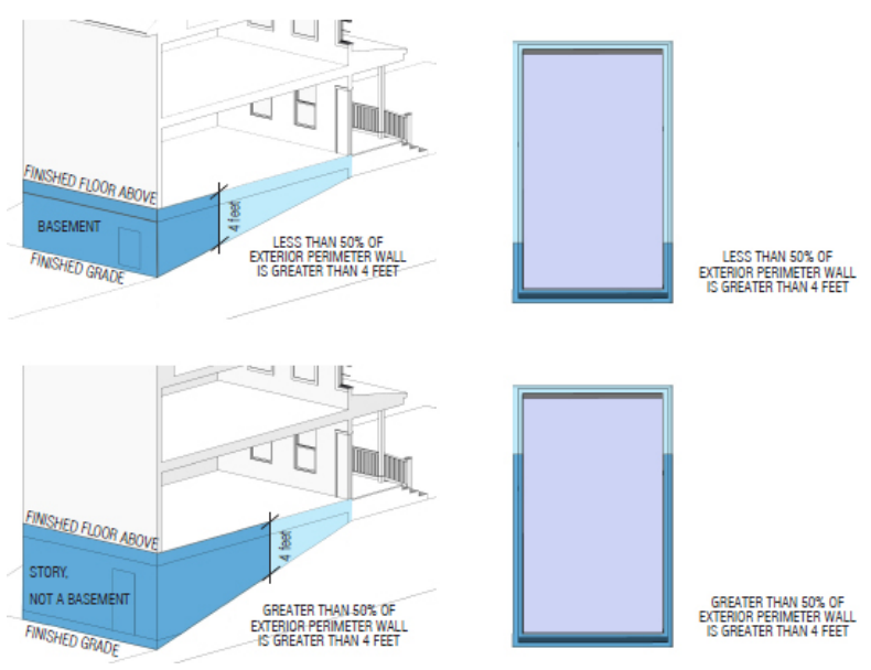
Basements and Crawl Spaces
Exposed basement walls visible along any Frontage shall not exceed 8 (eight) feet in height measured from the exterior finished grade to the finished floor of the Story above.
Unfinished crawl spaces taller than 3 (three) feet shall be screened from view from public Thoroughfares with landscaping.
Unfinished crawl spaces shall not exceed 5 (five) feet in height measured from the exterior finished grade to the finished floor of the Story above.
Grading or Regrading of Sites. Sites with uneven topography present unique issues in relation to Building height. Buildings on steep slopes shall reflect the pre-construction topography of the site. When a site’s topography is modified, the site shall be graded in such a way to avoid the following features:
Retaining walls or unfinished blank walls taller than 4 feet in height along required Principal or Secondary Frontage;
Retaining walls taller than 8 feet in height along the rear or side setbacks; and
The construction of Buildings that do not reflect the preconstruction topography of the site. Illustrations below show appropriate site grading methods.
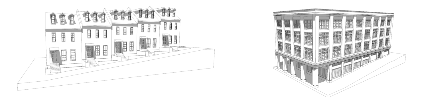
Design and Public Space Standards Required for Additional Building Height: Applications seeking approval from the Development Review Board for Building Height above that which may be permitted administratively in a Form District shall comply with the following:
Design Standards: The maximum Building height and mass is permitted By-Right by the underlying Form District, as may be modified by the chosen Building Type and Frontage Type. However, there are a number of ways that Building shape, articulations, and choice of materials can be used to reduce the perceived height and mass of taller Buildings, and ensure a high quality of design that complements the character of the Downtown and Waterfront area.
After consultation with the Design Advisory Board and a Public Hearing, the Development Review Board shall evaluate any proposal seeking additional Building height under each of the following additional design standards, and affirmatively find that:
The proposed Building presents a design that emphasizes slender, vertically-oriented proportions to assure a rich visually interesting experience as viewed within the context of the downtown skyline; reinforces opportunities for establishing points of reference for visual orientation; and, provides visual interest and human scale at the pedestrian level through the use of a variety of scales, materials, fenestration, massing, or other architectural design techniques;
Step backs, horizontal and vertical variation, selection of materials, and/or other architectural design technics are used to reinforce the street wall, create transitions from Buildings of a smaller mass and height, and reduce the perceived height and mass of upper stories from the street level; and,
Upper story proportions of the Building are oriented and tapered and/or separated into separate masses in order to retain sky view between individual Building elements from the public Thoroughfare.
The DRB may condition approval of additional Building height by reducing the By-Right Building mass by no more than 10% of the total floor area of the new floors enabled by granting the additional Building height. In no case shall the maximum By-Right Building height be reduced.
Active Public Space and Restrooms: A minimum of 20 sqft/1,000 sqft of the gross floor area above 85-feet shall be dedicated to active and publicly accessible upper story rooftops and terraces, and/or street-level public restrooms as follows:
Upper story rooftops and terraces must incorporate active public use such as outdoor dining with seating or other uses and activities that invite use by the public, and be located above the 7th floor. At least 25% of the space must be accessible to the general public during all regular business hours without expectation of payment or purchase.
Public restrooms may count towards the public space requirement above at a ratio of 10:1. Public restrooms must be located on the ground floor, have a minimum size of 50 sqft, be signed from the public street, be actively monitored and maintained, and be open to the public during all regular business hours. Placement of a public restroom in partnership with the City within an adjacent public space or the public ROW may be acceptable with the concurrence of the respective responsible City department and provided actual development costs and projected 20-yr maintenance costs are paid by the applicant.
§ 14.6.5Historic Buildings and Districts
The regulations found in the Burlington Comprehensive Development Ordinance (BCDO), Article 5, Section 5.4.8 (Historic Buildings and Sites) shall apply in all Form Districts following the process for receiving a Certificate of Appropriateness under Sec. 3.2.7 and Sec 3.2.8. To the extent that any Form District, Building Type, Urban Design, or Frontage Type standards threaten or conflict with the ability to maintain the historic integrity of a Historic Building or Site, and the ability to meet the standards found in Sec. 5.4.8 (b), the process for granting relief by the Development Review Board in Sec. 14.7.3 b) shall be followed in order to provide for suitable alternate compliance as applicable.
§ 14.6.6Special Use Regulations
Purpose and Applicability. This Subsection provides specific site planning, development, and operating standards for certain land uses and activities to ensure their compatibility with existing uses. The following shall apply in all cases where such uses listed below are otherwise permitted or conditionally permitted pursuant to Section 14.3 - Specific to Form Districts.
Day Care Centers and Preschools. The following shall be applicable to an application involving day care centers or preschools:
No playground equipment shall be located within the First Lot Layer;
Adequate and safe drop-off and pickup space shall be provided;
Any modifications, additions, signs, or site Improvements shall conform to the requirements of the Form District;
Such facilities shall be licensed by the State of Vermont where required;
No more than one residential unit on any parcel may be converted for the creation of a single day care center or preschool. Such a conversion shall be exempt from the requirements of BCDO Article 9, Part 2- Housing Replacement; and,
Where a day care center or preschool is treated as a Conditional Use in any Form District, the DRB shall also consider the extent to which a neighborhood may be overburdened by a concentration of such uses.
Historic Inns. The following shall be applicable to an application involving a historic inn:
The Principal Building shall be listed, or eligible for listing, on the State or National Register of Historic Places, and located on a Lot of record as of January 1, 2007 with a minimum of one-half (1/2) acre (21,780 Square feet) in size and located on a major street;
In Form Districts where a Historic Inn is a conditional use, the premises shall be occupied by a person as their primary residence who is an owner or resident manager of the property or of the business;
The maximum number of guest rooms allowed shall be limited by the existing gross square floor area of the pre-existing Principal Building including additions of up to an additional 20%;
Common dining facilities, and ancillary events limited to indoor business meetings and meals served in conjunction with those meetings, for overnight guests and their guests may be included;
Any additions or exterior modifications to the Principal Building shall be subject to the standards for Historic Buildings in Sec 5.4.8 of the BCDO; and,
Any additional modifications, additions, signs, or site Improvements shall conform to the requirements of the Form District.
Motorized Vehicle Service, Repair, and Fuel Sales. The following shall be applicable to any application involving motorized vehicle service, repair, and/or fuel sales:
Fuel pumps shall be located at least 15-feet from any Lot Line;
Access to a public street shall be located a minimum of 50-feet from any intersection between public Thoroughfares and shall be approved by the City Engineer. Shared Access between Adjacent properties is encouraged in order to reduce congestion and improve safety;
The width of any Curb-cut shall be limited to no more than 24-feet;
Where canopies are proposed over gas pump islands, they shall not be located in the First Lot Layer or be within 5-feet of a side or rear Lot Line.
No outdoor vending, display or storage of materials, goods, supplies, or equipment shall be permitted; and,
Community House. The following shall be applicable to an application involving a Community House:
Density shall not exceed 1 person per 200 square feet of gross floor area;
All standards for the underlying Form District shall continue to be applicable; and,
The minimum distance (Lot Line to Lot Line) between any two Community Houses shall not be less than the following:
| Total Occupancy (beds) | Distance (feet) between Community Houses |
|---|---|
| 6 or less | 0 ft |
| 7 – 12 | 500 ft |
| 13 – 20 | 1,000 ft |
| 21 or more | 1,500 ft |
Home Occupation. The following shall be applicable to an application involving a Home Occupation:
Any Home Occupation shall clearly be secondary or incidental to a Principal residential use;
The Home Occupation shall be conducted only inside the Dwelling or inside an Accessory Building;
No outdoor display or storage of materials, goods, supplies, or equipment shall be permitted in connection with any Home Occupation;
No Home Occupation may increase traffic flow or parking by more than one additional vehicle at a time for customers or deliveries;
No Home Occupation shall utilize flammable, toxic, or hazardous materials in quantities not customary to a residential use;
No Home Occupation shall create any sound, noise, dust, vibration, smell, smoke, heat, humidity, glare, radiation, electrical interference, fire hazard, or any other hazard, nuisance or unsightliness which is discernible beyond the boundaries of the property that is not customarily associated with a residential use; and,
All standards for the underlying Form District shall continue to be applicable.
Crisis Counseling Center. The following shall be applicable to an application involving a Crisis Counseling Center:
A Crisis Counseling Center may only be permitted on Lots fronting the following streets: Main St., St. Paul St., and Pearl St.;
A Crisis Counseling Center may only be permitted in a Principal Building existing as of January 1, 2007;
Secondary residential use in the same Building and/or on the same Lot may be permitted; and,
All standards for the underlying Form District shall continue to be applicable.
Outdoor Dining and Entertainment Areas. The following shall be applicable to an application involving outdoor dining and entertainment for restaurants and drinking establishments:
With the exception of the Frontage Line, decorative walls or fencing shall be used to enclose the outdoor area;
Furniture and fixtures provided for use in an outdoor area may consist only of movable tables, chairs, umbrellas, planters, lights, and heaters. Lighting fixtures may be permanently affixed onto the exterior of the building. All movable furniture and fixtures shall be removed off-season.
Outdoor liquor consumption and entertainment requires a permit from the City Council. Any outdoor activity on any public Sidewalk or Alley also requires an encumbrance permit from the City Council.
Any outdoor area located within 100-feet of a boundary with a residential zoning district requires Conditional Use approval from the Development Review Board;
Any outdoor area located within 500-feet of a boundary with a residential zoning district:
may not exceed 50 percent of the indoor area Accessible to the public. Any additional outdoor dining area requires Conditional Use approval from the Development Review Board; and,
may not include the use of audio/visual equipment or amplified sound without Conditional Use approval from the Development Review Board.
§ 14.6.7Parking and Circulation
Purpose. This Subsection regulates and ensures the provision of parking spaces and Access drives designed for motor vehicles. The Subsection also provides options for adjusting parking requirements and providing parking alternatives. These standards ensure that parking needs of new land uses and development are met, while ensuring parking spaces and Access drives are designed and located in a manner consistent with the desired character and development patterns of walkable communities as outlined in planBTV - Downtown & Waterfront Master Plan.
Applicability. In addition to the provisions of this Subsection, the provisions of Article 8 of the Burlington Comprehensive Development Ordinance regarding parking shall be applicable in all Form Districts. Pursuant to Sec. 8.1.3 Parking Districts, Form Districts 5 and 6 shall be included in the Downtown Parking District.
General Parking, Loading, Service and Driveway Standards
Portable cargo or freight storage containers, trucks, tractors, or tractor-trailers having a capacity of more than a one-and one-half-ton load, front- and rear-end loaders, or any commercial, industrial, agricultural, recreational, or transportation vehicles or equipment shall not be parked or stored within any district for purposes other than short-term unloading, loading or delivery services, or temporary construction within the district.
Automobiles, small trucks, vans, vehicle trailers permitted in conjunction with an approved Home Occupation (one per Home Occupation),regularly utilized for personal or business use may be allowed.
Automotive vehicles, trailers, or vehicles of any kind or type, requiring licenses, but without current plates or inoperable, shall not be parked in any Form District unless completely enclosed within a Building.
Loading and service areas, overhead doors, and other service entries shall not be located on a Primary Frontage or Facade where a rear Alley or Secondary Frontage is available, and shall be screened from view by a Building or Streetscreen. Where no alternative to a Primary Frontage or Facade is available, loading and service doors shall not exceed 12-feet in width and 16-feet clear height.
Drive-thrus are not allowed.
On-Site Parking Spaces Required
The minimum and maximum number of parking spaces, including modifications thereof and bicycle parking requirements, will be determined as required in Article 8 of the Burlington Comprehensive Development Ordinance unless specified otherwise in each Form District. Each parking space provided in an underground structure may be counted as 1.75 of the spaces required in Article 8.
All onsite parking shall participate in any Downtown Parking and Transportation Management District in order to minimize the amount of parking provided and maximize the efficiency of its utilization.
Previously permitted on-site parking requirements applicable to any Lot or Building prior to the effective date of this Article that exceed those listed in Table 8.1.8-1 Minimum Off-Street Parking Requirements found in Article 8 of the Burlington Comprehensive Development Ordinance may be reduced to comply with the standards for the Form District by the Administrative Officer without fee upon application.
Parking Structures and Garages
With the exception of individual Garages serving a Rowhouse Building Type which shall be located in the Third Lot Layer, all Parking Structures and Garages shall be located:
within a Principal Building Type and located Underground, at or above the second Story, and/or in the ground floor when located in the Third Lot layer and separated from the street by an Active Street-level Use; or,
behind a Perimeter Building (See Section 14.4.11).
At least one pedestrian route shall lead directly to a Frontage Line (i.e., not directly into a Building). When portions of a Building containing parking front on more than one street, multiple pedestrian routes to the Frontage are strongly encouraged.
Facade treatments (materials, fenestration patterns, and architectural detailing) must be continued on stories containing parking in a manner consistent with the overall architectural design of the Building, and such that levels of parking are not clearly distinguishable from other uses in a Building.
Parking Lots and Parking Areas
All parked vehicles, vehicle headlights, and interior lighting shall be screened from view from the street and Civic Spaces by a Building or a landscaped area as follows:
A minimum 10-foot wide landscaped area, or a 36-inch high wall within a minimum 5-foot wide landscaped area, with a continuous row of trees and/or shrubs must be provided between the street and the parking lot within the First or Second Lot Layer, or at the perimeter of the parking in the case of the 11 adjacency to a Civic Space or any lot in a residential district..
Plantings must be a minimum of 18-inches in height when planted and must reach a minimum size of 36 inches in height within 3-years of planting.
Breaks for pedestrian and vehicle access are allowed.
All Parking Lots and Parking Areas shall be setback a minimum of 5-feet from any side or rear property line that abuts any lot in a residential district or Civic Space.
Parking Spaces, Lot Design and Layout
Lot Design and Layout. The dimensions of parking spaces shall be determined as required in Article 8 of the Burlington Comprehensive Development Ordinance.
Access. The following are applicable to off-street parking design unless modified by Section 14.3 (Specific to Form Districts).
All off-street parking facilities shall be designed with an appropriate means of vehicular Access to a Thoroughfare or to an Alley to cause the least interference with traffic flow. Access from developments of two or fewer Dwelling Units onto public Thoroughfares shall be, where practicable, by forward motion of the vehicle. Access from all other developments shall be by forward motion of the vehicle only.
Parking spaces shall not be designed or located so as to permit a vehicle to enter or exit a parking space directly from a public Thoroughfare. Ingress to and egress from parking spaces shall be from an on-site aisle or driveway. Parking spaces within Lots of up to eight spaces may be designed or located so as to permit a vehicle to enter or exit a parking space directly from a public Alley or rear lane.
Parking, loading, and service areas shall be Accessed by a Rear Alley or Lane, or from a Secondary Frontage where such is available and functional.
The location, design, and construction of all off-street parking Access points to a public Thoroughfare shall meet the requirements of the City Engineer.
Angled spaces may be configured as either head-in or back-in.
Stacked and Tandem Parking. Except as otherwise provided below, all parking facilities shall be designed so that each motor vehicle may proceed to and from the parking space provided for it without the moving of any other motor vehicle.
Tandem Parking may be provided for an individual Dwelling Unit and dedicated employee-only parking where designed as such.
Materials and Markings
All off-street parking, Loading Areas, Drive Aisles, and Driveways shall be surfaced with an impervious surfacing material. The use of pervious or semi-pervious surfacing materials including, but not limited to “grasscrete,” or recycled materials such as glass, rubber, used asphalt, brick, block, and concrete, may be approved pending review and recommendation by the Department of Public Works, provided such areas are properly maintained. Where possible, such materials should be used in areas in proximity to and in combination with other stormwater control devices.
Off-Street parking of 4 or more spaces and all Loading Areas shall include painted lines, wheel stops, Curbing or other methods of identifying individual parking spaces and Loading Areas, while distinguishing such spaces from aisle and other circulation features and physically separating them from Landscape Areas and pedestrian walkways.
All parking and Loading Areas shall provide a physical separation between moving and parked vehicles and pedestrians in a manner that minimizes conflicts and gives pedestrians a safe and unobstructed route to Building entrance(s) or a public sidewalk. Where pedestrian and vehicular routes meet, the Sidewalk shall be clearly marked by differentiated ground materials and/or pavement markings.
Accessible Parking. All parking facilities that require Accessible parking spaces shall ensure that a portion of the total number of required parking spaces shall be specifically designated, located, and reserved for use by persons with physical disabilities, in accordance with the standards in the Federal Americans with Disabilities Act (ADA) as administered by the Dept. of Public Works. Parking Access aisles shall be part of an Accessible route to the Building or facility entrance. Accessible parking spaces shall be designated as reserved for the disabled by a sign showing the symbol of Accessibility. Painting of the paved area for the dedicated parking spaces alone shall not be sufficient as the sole means of identifying these spaces.
Landscaping
Parking Areas and Parking Lots with ten (10) or more spaces shall be planted with 2 Trees for every 10 spaces. Each row of parking shall be terminated with a landscape island (see Sec. 14.6.8 Site and Landscape Standards) for Tree specifications.
Parking Area and Parking Lot landscape islands may be combined as a component of a stormwater management plan to facilitate water harvesting.
Where a pedestrian walkway is provided in a Parking Area or Parking Lot, it shall be at least 5-feet wide, and the pavement shall be differentiated from the pavement of the Parking Area or Parking Lot through a change in surface texture, material, style, and/or color.
§ 14.6.8Site and Landscape Standards
Purpose and Applicability. Landscaping shall be used to add visual interest, scale, and color to the development site and to provide specific functions and benefits to the uses and Buildings on the site. These include but are not limited to stormwater retention and erosion control, winter windbreaks and summer shade, recreational and habitat corridors, buffers and screening of parking areas, and creating privacy for and from adjacent property. The following are required in each Form District.
Site Standards:
All utility service connections shall be underground for new construction, and is recommended for existing Buildings undergoing Substantial Modification.
The following items are prohibited in the First Lot Layer: electrical transformers, exhaust vents, HVAC, and other mechanical equipment unless they are placed underground; utility or gas meters; solar collection devices and wind turbines; antennas, satellite dishes, and other telecommunications equipment; solid waste containers, swimming pools, dog houses and runs, hot tubs, and spas.
Ground level electrical transformers, HVAC, and other mechanical equipment; antennas, satellite dishes and other telecommunications equipment; and utility boxes and gas meters shall be designed so they do not Encroach on walkways or parking areas, and shall be screened from view from any Public Frontage. They shall not be obstructed by landscaping or hardscape such that meter readers and maintenance personnel are unable to open or Access utilities devices.
Utility boxes and gas meters located Adjacent to Driveways, Parking Areas, Rear Lanes, Alleys, or Rear Access Easements, shall require 2 48-inch high, 6-in x 6-in bollards set in concrete to protect them from damage from vehicles.
Fences and Free-standing Walls:
Fences and Free-standing Walls placed within the First Lot Layer shall not exceed 4-feet in height. Fences and Free-standing Walls placed within the Second or Third Lot Layer shall not exceed 8-feet in height unless a different height limit is specified under the applicable Form District or Frontage Type.
Materials used for Fences and Free-standing Walls shall be limited to Brick and tile masonry; Native or sintered stone; Wood – panels, clapboard or shingles; Cementitious siding, metal, and woven or braided cable wire. Chain-link and welded-wire fencing shall not be used along any Frontage Line with the exception of the temporary 20 enclosure of a construction site, or where required by the Building Official to protect public safety. Barbed or razor wire shall not be used in any application. Alternate materials may be approved by the Administrative Officer after seeking input from the Design Advisory Board. Alternate materials must be considered equivalent or better than the materials listed above, and must demonstrate successful, high quality local installations. Regionally-available materials are preferred.
All fences and free-standing walls shall be installed so that a finished side faces outward towards the adjacent property or public Frontage.
Landscape Standards:
The installed landscape shall consist primarily of durable species tolerant of urban conditions, and pre-existing noxious or invasive plants species identified on the prohibited plant list shall be removed.
The spacing and placement of all installed plants shall be adequate and appropriate for the typical size, shape, and habit of the plant species at maturity.
Bare and exposed ground on the site and/or in landscaped areas shall be covered with live plant materials and/or Mulch, with the exception of naturally occurring dunes, creek beds, rock outcroppings, or similar landscape features typically lacking in vegetation; and clay or sand surfaces associated with recreation fields and facilities.
Pervious paving materials are encouraged for any paved areas in order to increase storm water infiltration on site.
Constructed water features, such as fountains, streams, and ponds that operate with water recirculation systems, shall be designed to prevent seepage and leaks.
Plantings should be placed at or slightly below grade, and not be mounded up, in order to provide opportunities for storm water infiltration on site.
Ground vegetation or Shrub plantings with spines, thorns, or needles that may present hazards to pedestrians, bicyclists or vehicles are prohibited in the first 2 feet of the First Lot Layer.
Trees and Understory Trees proposed to be installed shall be centered horizontally, and at a minimum shall be located:
Two (2) feet from walkways, Curbing, and other impervious pavements when planted in a Tree well or continuous planter.
Three (3) feet from walkways, Curbing, and other impervious pavements when planted in a continuous Swale.
Five (5) feet from underground utilities, utility meters and service lines, fences, walls, and other ground level obstructions.
Fifteen (15) feet from streetlight poles so not to impact the light spread of the fixture.
At the time of installation, all:
Where planting space is limited, Structural Soil or soil cell systems shall be utilized in and Adjacent to planting wells and strips.
Solid Waste Storage Areas. Solid waste and recycling containers and enclosures for all multi-family residential and non-residential developments shall comply with the following:
Solid waste and recycling enclosures and containers may not be located or stored in the First Lot Layer, or within or block access to any required Access, parking, or Landscape Areas or any other area required by law to be maintained.
Solid waste and recycling containers shall be enclosed or screened so as not to be visible from the right-of-way or other publicly Accessible areas. Storage within a Principle Building is preferred.
Detached solid waste and recycling enclosures shall consist of solid wood or masonry walls in a manner consistent with the overall architectural design of the Building; wooden stockade, picket or lattice fencing; or screened by landscaping. They shall be enclosed on all sides, one of which includes a gate or door that can be secured, and be a minimum of one foot taller than the solid waste and recycling container(s) within; and,
All containers and/or enclosures shall be covered and maintained in a manner that prevents blowing trash and be secured from rodents or other pests.
§ 14.6.9Stormwater Management
All development and projects involving land disturbance that require a zoning permit shall be required to demonstrate compliance with the standards in Article 3, Stormwater & Erosion Control of Chapter 26 of the City Code of Ordinances: Wastewater, Stormwater, and Pollution Control as applicable.
Stormwater runoff from 100% of all net new and substantially redeveloped impervious area (or an equivalent area of impervious)) must be captured and managed in such a way as to mimic pre-development (meadow in good condition, Hydrologic Soil Group B) runoff (or discharge) ratio for the 1 year, 24-hour design storm subject to review and approval by the DPW Water Resources Div.
The feasibility of implementing runoff volume reduction practices must be evaluated in consultation with the DPW Water Resources Division and shall include an evaluation of the engineering feasibility of techniques including, but not limited to runoff reduction through stormwater reuse, green stormwater infrastructure such as green roofs, bioretention, tree planting, and sewer separation of roof water for sites currently discharging to the combined sewer system. Storage and detention methods may be used to meet pre-development flow targets. When and where detention systems are the primary mode of stormwater management, “smart” precipitation integrated detention systems must be evaluated and are strongly preferred. On-site stormwater management must be maximized; however, off-site stormwater management may also be used in consultation with DPW Water Resources.
Additionally:
Stormwater detention and retention ponds shall be:
integrated as landscape features, rather than single-purpose flood control and stormwater management ponds; and
planted with appropriate Trees, Shrubs and grasses, with hydrophilic Plants in basin areas prone to submersion or boggy conditions.
Cisterns may be used to capture and recirculate stormwater from Buildings.
Where appropriate, Rain Gardens and Bioswales should be installed to infiltrate runoff from Parking Lots, Thoroughfares, Plazas, and other Impervious Surfaces.
Pervious paving materials are encouraged for any paved areas in order to increase storm water infiltration on site.
Where vegetative solutions for natural drainage accommodation are not feasible, porous paving is encouraged for Sidewalks, Parking Lots, and Plazas to infiltrate stormwater.
§ 14.6.10Outdoor Lighting & Telecommunications Equipment
The regulations found in the Burlington Comprehensive Development Ordinance (BCDO), Article 5, Section 5.2.2 (Outdoor Lighting) shall apply in all Form Districts, and the regulations found in the Burlington Comprehensive Development Ordinance (BCDO), Article 5, Section 5.4.7 (Wireless Telecommunications Facilities) shall apply in all Form Districts to the extent not limited by state or federal law.
Part 7Administration and Procedures
§ 14.7Administration and Procedures
Subsections:
14.7.1 Applying for a Zoning Permit: Submission Requirements and Review
14.7.2 Non-Conformities
14.7.3 Varying the Form: : Administrative Relief, DRB Alternative Compliance, and Variances
§ 14.7.1Applying for a Zoning Permit: Submission Requirements and Review
Improvements Authorized. Any and all subdivision of land, development and construction or modification of all Improvements, land, Buildings, and Structures in the Downtown and Waterfront District not otherwise exempt under Sec. 3.1.2 (c) of the Burlington Comprehensive Development Ordinance shall occur only in accordance with the Downtown and Waterfront Regulating Plan and this Article 14-planBTV Downtown Code as in effect on the date of acceptance of a completed application submitted for approval pursuant to this Section.
Application Submission. Each application shall be submitted to the Department of Permitting and Inspections along in a form to be provided by the Department. Upon its determination that an application is complete, the Department shall process each application in accordance with this Section.
Application Requirements. An application shall be prepared by or on behalf of the Property Owner(s) in accordance with this Section and submitted to the Department for processing, review, and approval. Each application shall include the following:
A demonstration of compliance with this Article 14-planBTV Downtown Code and all standards applicable thereunder including but not limited to:
the Downtown and Waterfront District Regulating Plan and any applicable Special Requirements (Section 14.2 Regulating Plan);
the Form District and/or Civic Space(s) where the proposed Project is located (Section 14.3: Specific to Form Districts and Civic Spaces);
the Building Type(s) proposed as part of the Project (Section 14.4: Specific to Building Types);
the Frontage Type(s) proposed as part of the Project (Section 14.5: Specific to Frontage Types); and,
all applicable requirements of Section 14.6: Applicable to all Form Districts.
a tabular comparison of each applicable standard and the corresponding standards for the proposed project;
one or more maps identifying the project site on the Downtown and Waterfront District Regulating Plan and and any applicable Special Requirements;
one or more project plans of the project site drawn to a scale accurately indicating each applicable proposed element of the project in compliance with the standards listed above, including without limitation as applicable:
Identifying information including the owner(s) of record, north arrow, date (including any revision dates), and scale (recommended at not smaller than 1 inch equals 40 feet);
The location of all property lines, rights-of-way or easements affecting the property, and Abutting streets;
Where applicable a plan of all proposed property lines, rights-of-way or easements affecting the property satisfying the submission requirements for a Preliminary Plat pursuant to Sec. 10.1.8 Preliminary Plat Review of the Burlington Comprehensive Development Ordinance;
A plan indicating the location, types and dimensions of all proposed grading, drainage, stormwater management, and erosion control demonstrating compliance with the standards in Article 3, Stormwater & Erosion Control of Chapter 26 of the City Code of Ordinances: Wastewater, Stormwater, and Pollution Control;
The location and dimensions of all existing and proposed Buildings, Structures, Streetscreens, walkways, Driveways, and other Significant features; with dimensions and distances from the front, side, and rear property lines to each proposed new Building, Structure, and/or site Improvement;
The location, types and dimensions of all proposed Improvements within and Encroachments into the public right-of-way including without limitation Building footings, Cornices, steps, terraces, walls, walkways, street Trees, street lights, vehicular Parking Lanes, and travel lanes;
A parking and circulation plan indicating the location, layout, dimensions and design of all existing and proposed Driveways, Parking Areas, Parking Lots, Garages, and Parking Structures. Plans for all Parking Areas, Parking Lots, Garages, and Parking Structures shall also include the number, type, layout, dimensions, and design of spaces;
A landscaping plan indicating all existing vegetation and proposed plant materials, landscape islands, landscaping of Parking Areas and Parking Lots, fencing, furniture, pavement, and other landscape and hardscape elements including all screening of parking, dumpsters, and ground mounted mechanical/electrical equipment. Size, species, and spacing shall be clearly indicated; and,
A lighting plan indicating the location, layout, dimensions, and design of all existing and proposed ground and Building/Structure mounted lighting subject to the requirements of Sec. 5.5.2 (d) of the BCDO.
Photographs of the subject and neighboring properties.
Color rendered elevations (drawings to scale) of all elevations of all proposed and/or modified Buildings and any related Buildings including Building height and how it was measured. Building elevations of each exterior wall and the façade shall indicate all architectural details, window and door openings with dimensions and trim details, and materials, siding (wood clapboard, brick, etc.), roof, trim, colors to be used, and actual color samples for wall and roof materials;
At least two architectural wall cross-sections (one front wall and one side wall), at a scale of 1 inch equals 1 foot, illustrating the relief (e.g. projections and Setbacks) of the other architectural features shown in the Building elevations; and,
Modification of Submission Requirements. The Administrative Officer may allow the modification of the application and submission requirements listed above, including reducing and/or combining existing and proposed information on the same site plan, provided that any modification enables adequate review of the application. The Administrative Officer may also require the submission of additional information when deemed necessary to make a decision on the request. Such additional information may include but is not limited to the following:
Evidence and documentation of existing or suspected environmental contamination including but not limited to environmental assessments, corrective action plans, and deed restrictions;
Materials specifications;
Floor plans;
Shadow impact diagrams based on the spring or fall equinox; and,
Phasing schedule.
Application Review.
Administrative Review: An application that conforms to the Downtown and Waterfront District Regulating Plan and all standards applicable to such application pursuant to this Article 14-planBTV Downtown Code without the necessity of any additional approval by the Development Review Board as indicated below, shall be entitled to administrative review and approval By Right by the Department pursuant to Sec. 3.2.7(c) of the BCDO.
Development Review Board (DRB) Review: Applications subject to any of the following as applicable shall require review and approval by the Development Review Board pursuant to Sec. 3.2.8 of the BCDO:
Conditional Use Review or Major Impact Review pursuant to Sec. 3.5.2 of the BCDO;
Request regarding the Alteration or Demolition of a Historic Building pursuant to Sec. 5.4.8 of the BCDO;
Civic Buildings and Civic Spaces pursuant to Section 14.7.1 f);
Applicable provisions of Article 10 of the BCDO regarding Subdivision review;
Applicable provisions of Article 9 of the BCDO regarding Inclusionary and Replacement Housing;
Request for additional Building Height pursuant to Sec. 14.6.4 f);
Request for DRB Relief pursuant to Sec. 14.7.3 b);
Request for a Variance pursuant to Article 12, Part 1 of the BCDO; and,
any other section of the BCDO that specifically requires DRB review and approval.
In such cases, the Development Review Board’s review shall be limited to making findings only under the specific review criteria for the required approval listed above. All other elements and aspects of the application shall remain entitled to administrative review and approval by the Department.
Review and Approval of Civic Spaces and Civic Buildings. The creation of new Civic Spaces or Civic Buildings, or the Substantial Modification of an existing Civic Space or Civic Building, shall follow the process as defined below. Any other proposed alteration to an existing Civic Space or Civic Building shall be reviewed and approved by the Administrative Officer who shall ensure ongoing compliance with the intent and standards of this Chapter as applicable.
Because of their important civic nature and public use, the design and form of a new or Substantial Modified Civic Space or Civic Building shall be determined after:
pre-application review and consultation with the departments of City Planning, Permitting and Inspections, Community and Economic Development, and Parks, Recreation, Waterfront;
a pre-application Neighborhood Public Meeting pursuant to Sec. 3.2.1 (d) of the BCDO;
review and recommendation of the Design Advisory Board; and,
final review and approval by the Development Review Board.
In its discretion to approve a new Civic Space or Civic Building, the Development Review Board, after a Public Hearing, shall consider and reach an affirmative finding on each of the following:
Conformance with the adopted land use and development plans for the area as identified in the Municipal Development Plan;
Consistency with:
the purpose of this ordinance;
the intent of the Form District where the project is located;
the purpose of Civic Spaces generally; and,
the intent of the Civic Space Type being proposed; and,
that the proposed Civic Space or Civic Building as designed provides a positive public benefit and enhancement to the community and the context within which it is proposed.
§ 14.7.2Non-Conformities
In addition to that as specified in Article 5, Part 3 Non-Conformities of the Burlington Comprehensive Development Ordinance, any Building, Structure, Frontage, Development, Site, Improvement, or other appurtenance thereto which lawfully existed at the time of adoption of the applicable provisions of this Article or any amendment thereto may be continued subject to the following provisions:
Nothing in these regulations are intended to prevent normal repair and maintenance necessary to keep a Building, Structure, Site, Improvement or other appurtenance thereto in a safe and sound condition;
Any Building, Structure, Frontage, Development, Site, Improvement, or other appurtenance thereto which legally existed on the effective date of this Article that does not conform to the requirements of this Article may continue until a Substantial Modification is requested or Abandonment occurs.
Any nonconforming structure may be enlarged, maintained, repaired or altered; provided, however, that no enlargement, maintenance, repair or alteration shall either create an additional nonconformity or increase the degree of the existing nonconformity of all or any part.
At such time when a Substantial Modification is requested or Abandonment occurs, only the affected portion(s) of the Building, Structure, Frontage, Development, Site, Improvement, or other appurtenance thereto shall be required to comply with all applicable provisions of this Article and to the greatest extent practicable in the determination of the Administrative Officer or unless relief is provided by the DRB pursuant to Sec. 14.7.3 below; and,
Buildings listed or eligible for listing on the State or National Register of Historic Places shall not be required to make any modifications under this section that would threaten their historic integrity.
§ 14.7.3Variation from the Form: Administrative Relief, DRB Alternative Compliance, and Variances
The planBTV Downtown Code is intended to result in By-Right approval where development occurs strictly in conformance with the requirements of the applicable Form District. In some instances, however, it may be necessary to vary the prescribed form in order to accommodate unique site and/or building circumstances in order to promote context-sensitive development. In such instances, an applicant may seek Administrative or Development Review Board approval for relief from the requirements as set forth below. Any and all relief from the prescribed standards shall run with the land and be binding on the Property Owner and its/their successor and assigns. Applications requesting relief shall be made in writing and in the form as determined by the Department.
Administrative Relief. The Administrative Officer shall have the authority to authorize modification of up to 10% from any numerical standard set forth in this Article inclusive of any specific relief set forth in Table 14.7.3-A Administrative Relief below. No other relief from the prescribed standards shall be permitted except as approved by the Development Review Board in b) below.
Any request for Administrative Relief shall extend the requirements of 24 VSA 4448(d) regarding Administrative decisions for an additional 30 days in order to provide for opportunities for public notice and comment pursuant to Departmental procedures.
Decisions by the Administrative Officer regarding any Relief granted shall be made in writing and upon affirmative findings that:
The relief granted is the minimum necessary to achieve the desired result;
Granting the relief will yield a result equal to or better than in strict compliance with the standard:
The property will otherwise be developed consistent the purpose of this ordinance, the intent of the Form District, the intent and purpose of the section that the relief is being sought, and all other applicable standards; and,
Any additional findings as may be required by Table 14.7.3-A Administrative Relief as follows:
Table 14.7.3-A - Administrative Relief
| Type of Relief | Limits of Relief Granted | Required Findings | Standards Reference |
|---|---|---|---|
| Building Setbacks: A Building Setback may vary from the maximum or minimum Front and Side Setback requirements. | Maximum relief of 20% from the required maximum or minimum | The variation is necessary to allow the proposed Building to blend with existing Adjacent buildings along the Primary street Frontage. | Section 14.3: Specific to Form Districts and Civic Spaces |
| Depth of Recessed Entries: Allows for a deeper entry recess. | Maximum entry recess of 10-feet | A deeper entry is necessary for improved visitability. | Section 14.5: Specific to Frontage Types |
| Frontage Buildout: A reduction in the amount of the Principal Frontage that is occupied by a Building or a Streetscreen. | Maximum of 10% from the required Frontage Buildout | The relief is necessary to enable Access to the rear of the Lot because of constraints due to existing Lot Width and/or Buildings. | Section 14.3: Specific to Form Districts and Civic Spaces; |
| Frontage Buildout & Setback: A reduction in the amount of the Principal Frontage that is occupied by a Building or a Streetscreen. | Minimum necessary to satisfy the requirements of the Building and Fire Safety Codes. | An adjacent pre-existing Building has doors and/or windows on a side elevation and a greater setback is required. The relief is necessary to satisfy the requirements of the Building and Fire Safety Codes. | Section 14.3: Specific to Form Districts and Civic Spaces |
| Frontage: A reduction in the minimum elevation of the finished level above the sidewalk | Maximum relief of 6-inches | The relief is necessary for improved visitability. | Section 14.5: Specific to Frontage Types |
| Voids: A reduction in the amount of required minimum voids on Primary and Secondary Facades | Maximum of 10% from the required voids | The relief is necessary to meet the requirements of a High Performance Building Energy Code or program. | Section 14.4: Specific to Building Types, Table 14.4.13-A Street Activation - Primary and Secondary Facade, and Section 14.5: Specific to Frontage Types |
| Voids: A reduction in the maximum linear distance between voids | Maximum of 10% of the required linear distance between voids | The relief is necessary for the creation of stronger distinctions between individual Frontage Types and/or at Building corners. | Section 14.4: Specific to Building Types, Table 14.4.13-A Street Activation |
| Ground Floor Floor-to-Floor Height: The minimum floor-to-floor height may be reduced. | Maximum relief of 12-inches | The relief is necessary to better align floors with a pre-existing adjacent Building. | Section 14.4: Specific to Building Types, Sec.14.4.9-C, Sec. 14.4.11-C and Sec. 14.4.12-C |
| Parking Area Location: Parking Areas may be located in the Second Lot Layer. | The lesser of 25% or 20-feet of a Frontage may be occupied by parking. | The relief is necessary because of constraints due to existing Lot Width and/or Buildings. Parking shall be screened from view along the Frontage. | Section 14.3: Specific to Form Districts and Civic Spaces |
| Parking Space Dimensions: Parking space(s) size may be reduced by increasing the proportion of Compact Cars. | Up to 30% of the total parking spaces may be designed and designated for compact cars. | The relief is necessary due to constraints created by existing Lot and/or Building dimensions, and to better meet on-site parking demands. | Section 14.6.7: Parking, Loading, Service and Drive-ways |
| Type of Relief | Limits of Relief Granted | Required Findings | Standards Reference |
|---|---|---|---|
| Porch Dimensions: The width and depth of a Porch may vary from the maximum or minimum requirements. | Maximum relief of 10% from the required maximum or minimum width and/ or depth provided a 5-ft minimum depth and 36 sqft minimum total floor area is maintained. | The relief is necessary due to constraints created by existing Lot and/or Building dimensions. | Section 14.5: Specific to Frontage Types |
Alternative Compliance Granted by the Development Review Board. Additional relief from the prescribed standards may be granted by the Development Review as provided below:
DRB Alternative Compliance: Relief from any non-numerical standard, and any numerical standard by no more than 20% of such requirement or an additional 10% beyond any Administrative Relief permitted above, may be granted by the Development Review Board after review and recommendation by the Design Advisory Board and a Public Hearing. Decisions by the DRB regarding any Alternative Compliance granted shall be made in writing and upon affirmative findings that:
the relief sought is necessary in order to accommodate unique site and/or Building circumstances or opportunities;
the relief if granted is the minimum necessary to achieve the desired result;
the property will otherwise be developed consistent the purpose of this ordinance, the intent of the Form District, the intent and purpose of the section that the relief is being sought, and all other applicable standards;
the relief if granted will not impose an undue adverse burden on existing or future development of adjacent properties; and,
the relief if granted will yield a result equal to or better than strict compliance with the standard being relieved.
Relief for Brownfield Remediation: Subject to the requirements set forth below, the DRB may waive or modify any relevant dimensional and use standards of the applicable Form District and other limitations imposed by this Chapter based on a demonstrated nexus with specific development limitations imposed by an approved corrective action plan, record of decision, or deed restriction limiting potential reuse and redevelopment or an eligible property.
Applicability: The provisions of this Section shall only be available to the following types of properties:
Properties eligible to participate in the Redevelopment of Contaminated Properties Program (RCPP) within the Agency of Natural Resources, Department of Environmental Conservation created pursuant to 10 VSA §6615a or are otherwise impacted by a VT DEC approved Corrective Action Plan (CAP) for such a property;
Property listed on the national priorities list of superfund sites established under the federal Comprehensive Environmental Response Compensation and Liability Act (“CERCLA”) or otherwise impacted by a US EPA approved Record of Decision (ROD) for such a property; and/or,
Properties which have a hazardous waste certificate under 10 VSA §6606 and which are undergoing corrective action under the federal Resource, Conservation and Recovery Act (“RCRA”) pursuant to the Vermont Hazardous Waste Management Regulations (VHWMR) §7-105(b) or are otherwise impacted by a VT DEC approved Corrective Action Plan (CAP) for such a property.
Additional Application Requirements: In addition to the submission requirements listed in Sec. 14.7.1., the following information as applicable specifying any and all use and development limitations of the site shall also be provided at the time of application:
A VT DEC Approved Corrective Action Plan (CAP) pursuant to 10 VSA §6615a (h);
A Record of Decision (ROD) issued by the US EPA;
A VT DEC Approved Corrective Action Plan (CAP) pursuant to VHWMR) §7-105(b); and/or,
Any Warranty Deed specifying any and all use and development limitations of the site.
Review Standards: Any and all variations from the prescribed form for Project Plans involving an eligible Brownfield Remediation shall only be authorized by the DRB upon an affirmative finding that:
Any waiver or modification so granted is based on a demonstrated nexus with the development limitations imposed by an approved corrective action plan, record of decision, or deed restriction limiting potential use and redevelopment;
Any waiver or modification so granted is the minimum necessary to grant relief from the specific limitations imposed by an approved corrective action plan, record of decision, or deed restriction that would prevent the site from being redeveloped in strict conformance with the underlying requirements of the ordinance; and,
The redevelopment of the effected site as proposed satisfies the goals of the municipal development plan, furthers the intent of the Form District in which it is located, and addresses the form-based standards of this article more effectively than redevelopment in strict conformance with the underlying standards of this ordinance.
Variances: Any other deviation from the prescribed standards of this Article shall require a Variance, which may be granted by the Development Review Board in accordance with Article 12, Part 1 Variances of the Burlington Comprehensive Development Ordinance.
Part 8Glossary
§ 14.8Glossary
This Section provides definitions for certain terms found in this Article 14. Additional definitions are to be found in Article 13 of the BCDO.
The following terms, as used in this Article 14, shall have the following meanings:
Abutting or Adjacent: having any distance of real property boundary in common with, or being separated from such a common real property boundary by a right-of-way, Alley or Easement.
Access: way or means of approach to provide vehicular or pedestrian entrance to, and/or exit from, a Building or a Lot or other parcel of real property.
Active Street-level Use: a use or activity within a space that is regularly frequented and actively utilized by workers, residents, guests, and/or patrons of the Principal Use; invites direct access from the public sidewalk or Civic space; and, provides visual interest and engagement to pedestrians on the adjacent sidewalk. Active street level uses generally include, but are not limited to retail, restaurants, bars, entertainment, hospitality, professional and personal services, libraries, institutional, educational and cultural facilities, office, residential, and entrance lobbies. Active Street-level Uses do not include those intended for parking, storage, mechanicals, utilities, and other substantially similar secondary or accessory uses and spaces.
Alley: a secondary means of vehicular Access to the rear or side of properties otherwise Abutting a street; an Alley may connect to a vehicular Driveway located to the rear of Lots providing Access to Outbuildings, service areas and parking, and containing utility Easements.
Architectural Features: accessory and decorative elements of a building exterior, including but not limited to: cornices, eaves, brackets and other roofline embellishments; lintels, sills, keystones, arches and other door and window embellishments; minor wall projections, etc.
Attic: the interior space between the ceiling joists and roof rafters of a pitched roof Building or Structure. An Attic may be finished into habitable space.
Awning: A fixed or retractable wall mounted frame covered with fabric or other pliable material that provides decoration and shade and weather protection over a patio, window, storefront, or Building entrance.
Backbuilding: a single-Story Structure connecting a Principal Building to an Outbuilding.
Balcony: A wall-mounted projecting platform with a railing accessible from an upper story doorway that provides outdoor amenity space above the first floor.
Basement: the part of a Building or Structure that is fully or partly below ground level.
Bed and Breakfast: an owner-occupied Lodging type offering 1 to 5 bedrooms, permitted to serve breakfast in the mornings to guests.
Bicycle Locker: an enclosed and secured locker that provides bicycle parking for long term use.
Bicycle Shelter: a roofed shelter that provides multiple bicycle racks for public use.
Bicycle Station: a Building that provides self-service, attended indoor valet, or automated bicycle parking services, often accompanied by showers, lockers, bicycle repair, and rental facilities.
Bioswale: an extended Rain Garden that sometimes runs the length of the Block.
Block: the aggregate of private Lots, Passages, Rear Alleys, and Rear Lanes, circumscribed by Thoroughfares.
Brownfield: Abandoned, idled, or under-used industrial and commercial facilities where expansion or redevelopment is complicated by real or perceived environmental contamination.
Building: See definition for “Building” in Article 13.
Building Envelope: collectively, all components of a Building that enclose conditioned or unconditioned above-ground space, including foundation, roof, walls, doors and windows.
By Right Development: Development which complies with all applicable requirements of the planBTV Downtown Code and are entitled to receive a permit without additional discretionary review.
Caliper: measurement of the diameter of a Tree trunk for Trees less than twelve (12) inches in diameter. For Trees twelve (12) inches or more, see Diameter at Breast Height. For Trees less than four (4) inches in diameter, it its measured six (6) inches from the ground. For Trees between four (4) inches and twelve (12) inches in diameter, it is measured twelve (12) inches from the ground.
Canopy: A fixed wall mounted or stand-alone rigid structure that provides decoration and shade and weather protection over a patio, window, storefront, or building entrance.
Civic: the term defining public or quasi-public activities dedicated to arts, culture, education, recreation, government, places of workshop, public assembly, and public transportation.
Civic Space: an outdoor area dedicated for public use. Civic Space types are defined by the combination of certain physical constants including the relationships among their intended use, their size, their landscaping, and their Enfronting Buildings.
Clear Sight Triangle: an area formed to provide safe sight distances for pedestrians, bicycles, and vehicles at street intersections and Driveways.
Clearance or Height, Clear: the height above the walkway, or other surface if specified, from the bottom edge of an element.
Column: a vertical construction element, having an actual or apparent purpose of carrying weight of a structural element above (such as an entablature or lintel) to another structural element below; consisting of a base, a shaft and a capital.
Commercial Vehicle: a vehicle the Tare Weight of which exceeds 5 tons (10,000 lbs), or a vehicle having more than two axles, or vehicle greater than 8’ in height. Construction equipment and farming equipment of any type is included in this definition.
Complete Streets: are designed and operated to enable safe access for all users, including pedestrians, bicyclists, motorists, and transit riders of all ages and abilities.
Cornice: a crowning projecting molded horizontal top of a Building or some part of a Building, such as a wall (a wall-Cornice); a trimmed eave on the gable end of a gable-roofed Building creates a Cornice, consisting or two raking (or sloping) Cornices with connected horizontal Cornice.
Curb: the edge of the vehicular pavement that may be raised or flush to a Swale. It usually incorporates the drainage system.
Deck: A roofless, raised platform on the ground or on top of a roof that is accessible from a secondary entrance that provides outdoor amenity space.
Department: The Department of Permitting and Inspections.
Depth, Ground-Floor Space: The distance from the street-facing Facade to the rear interior wall of the ground-floor space available for an allowed use.
Diameter at Breast Height (DBH): diameter in inches of a Tree trunk, measured four and one-half feet (4 ½) above existing grade or, in the event of multiple trunks, the accumulated total of diameters measured.
Drive Aisle: that part of a Parking Lot, Parking Area, Parking Structure, or Garage accommodating the movement and circulation of vehicles between points of Access and individual parking spaces.
Elevation: an exterior wall of a Building not along a Frontage Line. Not synonymous with Facade.
Encroach: to break the plane of a vertical or horizontal regulatory limit with a structural element, so that it extends into a Setback, into the Public Frontage, or above a height limit.
Expression Line: a line prescribed at a certain level of a Building for the major part of the width of a Facade, expressed by a variation in material or by a limited projection such as a molding or balcony. (Syn: transition line.)
Facade: the exterior wall or walls of a Building that face a Frontage Line. Not synonymous with Elevation.
First Lot Layer: that portion of a Lot between the Frontage Line and the Façade of the Principal Building situated on or to be situated on the Lot.
Foot-candle: a unit of illumination equal to the light flux falling on one Square foot of area one foot away from the light source of one candlepower.
Form District: one of several geographic areas indicated on the Downtown and Waterfront District Regulating Plan within which uniform zoning and land regulations apply. See Table 14.3-A The Burlington Form Districts Summary Table.
Frontage: the area between a Facade and a Thoroughfare, lakeshore, or Civic Space, inclusive of its built and planted components. Frontage is divided into Private Frontage and Public Frontage separated by a Frontage Line.
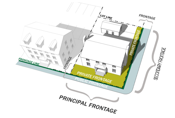
Frontage Buildout: the required percentage of a Building Façade or Streetscreen located within the maximum and minimum front Setback, excluding vehicular entrances and Driveways. The required Frontage Buildout may be satisfied by one or more of the following: a Building Facade; a Streetscreen occupying no more than the lessor of 20 feet or 20% of the Frontage; or, a Civic Space.
Frontage Line: a Lot Line separating a Public Frontage from a Private Frontage.
Frontage, Private: the Layer between the Frontage Line and the Principal Building Facade. (Syn: First Lot Layer)
Frontage, Public: the area between the Curb of the vehicular lanes and the Frontage Line. Elements of the Public Frontage include the Curb, Sidewalk, planter, street Tree, streetlight, street furniture, etc. .
Garage: an enclosed area integral to a Principal Building or an Outbuilding that provides as an Accessory Use space for parking or storage of vehicles incidental to the Principal Use of the Lot or Principal Building on the Lot. Not synonymous with Parking Structure.
Green: a Civic Space Type for unstructured recreation, spatially defined by landscaping rather than Building Frontages.
Green Roof: a roof of a Building or Structure partially or completely covered with vegetation and soil or a growing medium, over a waterproofing membrane.
Green Wall: a wall partially or completely covered with vegetation that includes a growing medium, such as soil. Most green walls also feature an integrated water delivery system. Green walls are also known as living walls or vertical gardens.
Habitable Space: Areas designed and used for living, sleeping, eating, cooking, or working or combinations thereof. Bathrooms, toilet compartments, closets, halls, storage rooms, laundry and utility spaces, basement recreation rooms, and similar areas are not considered Habitable Space.
Historic Inn: A Building which has the Principal Use of housing overnight guests, subject to the criteria of Sec. 14.6.6 c), that is listed or eligible for listing on the State or National Register of Historic Places.
Home Occupation: An Accessory Use of a Dwelling Unit for employment involving the provision of services or the fabrication of goods. Home Occupations are subject to all the procedures, conditions, and standards of Sec. 14.6.6 f).
Impervious Surface: any surface that substantially reduces or prevents the infiltration of stormwater, including but not limited to Buildings, roofs, concrete, asphalt, and other paved surfaces that do not use porous materials.
Improvement: planning for, carrying out or the resulting man-made change in the characteristics of land, including but not limited to construction of Buildings, Structures, Infrastructure, subdivision of land, and filling, grading, and excavation of land.
Infrastructure: any physical system, facility, or capital Improvement, that provides or facilitates services or Utilities for Improvements, regardless of whether publicly or privately owned, operated, or maintained, such as transportation, potable water, sanitary sewer, storm water management, and waste disposal, and other Improvements or facilities as generally described above that may not be specifically enumerated in this definition.
Initial Lumens: a measure of how much light a Lamp is emitting near the beginning of its life.
Liner Building: a Building specifically designed to mask a Parking Lot, Garage, or a Parking Structure from a Frontage. (syn. Perimeter Building).
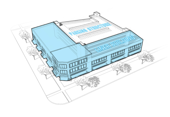
Loading Area: A parking space or berth, directly serving a Building for the loading or unloading of merchandise or material, and which has Access to a street, Alley, or other appropriate means of ingress and egress.
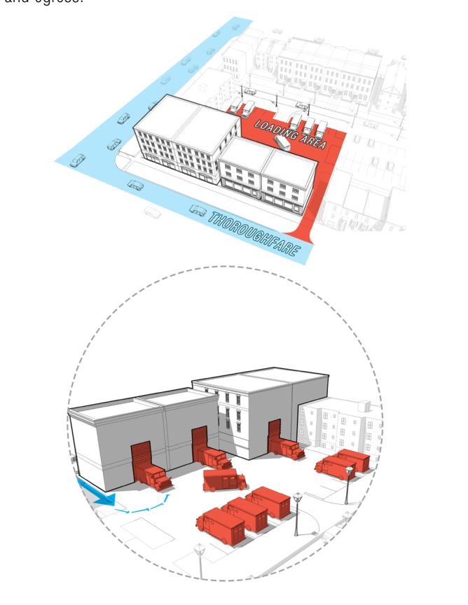
Lot Area: the area within the boundaries of a Lot.
Lot Coverage: The total at grade area or footprint of all Buildings, Structures, and Impervious Surfaces including but not limited to parking, walkways, drives, etc.; expressed as a percent of the total Lot Area.
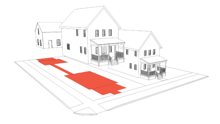
Lot Layer: a range of depth of a Lot within which certain elements are permitted. See Sec. 14.6.3 c).
Lot Line: the boundary that legally and geometrically demarcates a Lot.
Lot Width: the length of the Frontage Line of a Lot, or of the Principal Frontage Line of a corner Lot.
Mixed Use: multiple Functions or Uses within the same Building or on the same Lot through superimposition or adjacency, or in multiple Buildings by adjacency.
Mulch: a protective covering consisting of organic materials customarily used in landscaping and placed around plants to retain soil moisture, retard erosion, shield roots from freezing, and inhibit weed growth.
Native Species: a plant occurring within local jurisdictional boundaries prior to foreign contact, according to the best scientific and historical documentation. This includes species that are considered indigenous, occurring in natural associations with habitats that existed prior to Significant anthropogenic impacts and alteration to the landscape.
Nonconformity: A Building, Structure, Lot or use that does not conform to the present requirements of this Article but was in conformance with all applicable laws, ordinances, and regulations at the time at which it was established. See Sec. 14.7.2.
Open Space: land intended to remain undeveloped; it may be for Civic Space.
Outbuilding: an Accessory Building, usually located toward the rear of the same Lot as a Principal Building, and sometimes connected to the Principal Building by a Backbuilding.
Parking Area: an off-street, ground-level, open area within a Lot for parking vehicles as an Accessory Use incidental to a Principal Use of the Lot. Not synonymous with Parking Lot.
Parking Lot: an off-street, ground level, open area within a Lot for parking vehicles as an independent commercial Principal Use. Not synonymous with Parking Area.
Parking Structure: a Structure that provides space for parking vehicles as a independent commercial Principal Use. Not synonymous with Garage.
Pervious Area: The area of a lot covered by surfaces or materials that allow for the movement or passage of water into soils below. Pervious areas include, but are not limited to, areas of a lot covered by soil/mulch, vegetative matter, permeable pavers/pavement, bio-retention areas, or other materials that allow for the infiltration of at least the first inch (1”) of rainfall. For the purposes of this definition, green roofs that capture and attenuate at least the first inch (1”) of rainfall are also considered pervious area.
Plaza: a Civic Space Type designed for Civic Principal Function and/or Commercial Principal Function in the more urban Form Districts, generally paved and spatially defined by Building Frontages.
Post: a relatively small strong piece of timber, metal, or the like set vertically as a an actual or apparent support or firm point of attachment.
Principal Frontage: the Private Frontage designated to bear the address and Principal Entrance to the Building, and the measure of Lot Width on non-corner Lots, the Private Frontage.
Private Frontage: the privately held Lot Layer between the Frontage Line and the Principal Building façade; the First Lot Layer.
Property Owner: Any person, firm, partnership, association, joint venture, corporation or other entity or combination of entities who alone, jointly or severally with others hold(s) legal or equitable title to any real property. (Synonymous with “Owner.”)
Public Frontage: the area between the Curb of the Vehicular Lanes and the Frontage Line.
Rain Garden: a sunken garden that utilizes plants, Trees and other vegetation for the retention and/or absorption of stormwater.
Secondary Frontage: on corner Lots, the Private Frontage that is not the Principal Frontage.
Setback: The open, unobstructed area required to be provided between the furthermost projection of a Building or Structure and an Adjacent property line or Form District Boundary.
Shrub: a multi-trunked, woody plant that usually attains a mature height of no more than fifteen feet (15’) and has foliage flush from its height to the ground.
Sidewalk: the paved portion of the Public Frontage dedicated exclusively to pedestrian activity.
Square: a Civic Space Type designed for unstructured recreation and Civic purposes, spatially defined by Building Frontages and consisting of paths, lawns and Trees, formally disposed.
Story: a habitable level within a Building, excluding those elements described in Sec. 14.6.4.
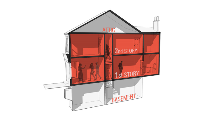
Streetscreen: a freestanding hedge, fence or wall of between 3.5 and 8 feet in height built (a) along the Frontage Line or (b) on the same plane as the Façade of the Building to Screen a Parking Lot, Parking Area or Loading Area, provide privacy to a side yard or rear yard, and/or strengthen the spatial definition of the public realm. A Streetscreen may include an opening no larger than 4-feet to enable pedestrian Access.
Structural Soil: a load-bearing soil that resists compaction to allow for healthier Tree root growth. Angular gravel within the soil mix allows air and water to permeate while supporting pavement loads.
Structure: any vertical man-made Improvement that is not intended for habitation, including without limitation a park shed, bicycle storage facility, transit stop, ticket booth, Utility facilities, and boathouses. Not synonymous with Building or Outbuilding.
Substantial Modification: Any demolition, deconstruction, relocation, rehabilitation, or redevelopment of an existing Building, Structure, Frontage, Development, Improvement, Site, Lot, or other appurtenance thereto that, as determined by the Zoning Administrative Officer:
(1) exceeds fifty percent (50%) or more of the pre-development assessed value of the Structure or Building;
(2) involves an improvement or modification of fifty percent (50%) or more of the Lot Area exclusive of any Building or Structure; or,
(3) modifies thirty percent (30%) or more of a Building Façade located within the maximum required Front Setback.
This term does not include normal maintenance or repairs or any modifications required to correct violations of state or local health, sanitary, or building code specifications which have been identified by a code enforcement or building official, and which are the minimum necessary to correct such violations.
Swale: a low or slightly depressed natural area for drainage.
Thoroughfare: a public or private way for use by public vehicular, pedestrian, and bicycle traffic that provides Access to Lots and Open Spaces, and incorporates vehicular lanes and Public Frontages.
Tree: a woody plant with an expected mature height of thirty feet or more and possessing either a single trunk or multiple trunks. Trees are often described in subcategories by common attributes and the functions they serve:
Canopy Tree: analogous to the term Shade Tree.
Coniferous Tree: any Tree with needle leaves and a woody cone fruit.
Deciduous Tree: a Tree which sheds its foliage at the end of each growing season.
Evergreen: a Tree or Shrub whose foliage persists year round. Plants typically associated with the upright conical or pyramidal Tree forms and needle foliage of Coniferous Trees (i.e. pine, spruce, fir, etc.), but which may also include plants with broadleaf foliage and rounded or spreading Tree forms.
Ornamental Tree: an Understory Tree planted primarily for its aesthetic value and as a landscape focal point, as opposed to its function of shading or screening even though it may perform all three functions.
Shade Tree: typically a Deciduous Tree - rarely an evergreen - planted primarily for its overhead canopy and the quality of the shade it provides.
Small/ Medium/ Large (Tree or Shrub): a means of categorizing Trees or Shrubs based upon their canopy or spread at maturity assuming proper maintenance and normal growing conditions and which serves the purpose of allowing for their proper spacing in landscape plans.
Specimen Tree: a particularly impressive or unusual example of a species due to its size, shade, age, or any other trait that epitomizes the character of the species.
Understory Tree: a small to medium sized Tree with an expected mature height less than thirty feet and a canopy which may or may not offer a sufficient Clearance height for pedestrians beneath.
Turfgrass: a continuous plant coverage consisting of a grass species that is regularly mowed to maintain a desired height.
Unit: a discrete portion of a Building or Structure dedicated by lease or ownership to an individual use.
Urban Agriculture Structure: a Structure related to the production of food in an urban environment, including but not limited to greenhouses, hoophouses, cold frames, tool sheds, etc.
Urbanism: collective term for the condition of a compact, Mixed Use settlement, including the physical form of its development and its environmental, functional, economic, and sociocultural aspects.
Appendix AUse Table – All Zoning Districts
Appendix AUse Table – All Zoning Districts
| Urban Reserve | Recreation, Conservation & Open Space | Institutional | Residential | Downtown Mixed Useⁱ | Downtown Form Districts (See Article 14) | Neighborhood Mixed Use | Enterprise | ||||||||||
|---|---|---|---|---|---|---|---|---|---|---|---|---|---|---|---|---|---|
| USES | UR | RCO - A | RCO - RG | RCO - C | I | RL | RM | RH | RC | DW-PT¹⁶ | Downtown FDs | NMU | NAC | NAC-R | NAC-CR | E-AE | E-LM³⁴ |
| RESIDENTIAL USES | UR | RCO - A¹ | RCO - RG | RCO - C | I | RL | RM | RH | RC | DW-PT¹⁶ | Downtown FDs | NMU | NAC | NAC-R | NAC-CR | E-AE | E-LM |
| Single Detached Dwelling | N | N ¹ | N | N | Y | Y² | Y² | N³⁰ | N³⁰ | N | N³⁰ | N³⁰ | N³⁰ | N | N | N | |
| Attached Dwellings - Duplex | N | N¹ | N | N | Y | Y² | Y² | Y | Y | N | Y ³ | N | Y | N | N | N | |
| Attached Dwellings - Multi-Family (3 or more) | N | N¹ | N | N | Y | Y² | Y² | Y | Y | N | Y | Y | Y | Y | N | N | |
| RESIDENTIAL SPECIAL USES | UR | RCO – A | RCO - RG | RCO - C | I | RL | RM | RH | RC | DW-PT¹⁶ | Downtown FDs | NMU | NAC | NAC-R | NAC-CR | E-AE | E-LM |
| Assisted Living | N | N | N | N | CU | CU | Y | Y | Y | N | Y | Y | Y | Y | N | N | |
| Boarding House ⁶ (4 persons or less) | N | N | N | N | CU | CU | Y | Y | Y | N | Y | Y | Y | N | N | N | |
| Boarding House ⁶ (5 persons or more) | N | N | N | N | CU | CU | CU | CU | CU | N | CU | CU | CU | N | N | N | |
| Community House (See Sec.5.4.4) | N | N | N | N | CU | CU | CU | CU | CU | N | CU | CU | CU | CU | N | N | |
| Convalescent /Nursing Home | N | N | N | N | CU | CU | Y | Y | Y | N | Y | Y | Y | Y | N | N | |
| Dormitory⁵ | N | N | N | N | CU | N | N | N | N | N | N²⁵ | CU | CU | N | N | N | |
| Emergency Shelter³¹ | N | N | N | N | N | CU | CU | CU | CU | N | CU | CU | CU | CU | N | N | |
| Group Home | N | N | N | N | Y | Y | Y | Y | Y | N | Y | Y | Y | Y | N | N | |
| Historic Inn (See Sec.5.4.2) | N | N | N | N | CU | CU | CU | CU | CU | N | CU | Y | Y | Y | N | N | |
| Mobile Home Park | N | N | N | N | N | CU | CU | N | N | N | N | N | N | N | N | N | |
| Sorority/Fraternity⁵ | N | N | N | N | CU | N | N | N | N | N | N | N | N | N | N | N | |
| Short Term Rental³³ | N | N | N | N | Y | Y | Y | Y | Y | N | Y | Y | Y | Y | N | N | |
| NON-RESIDENTIAL USES | UR²¹ | RCO - A | RCO - RG | RCO - C | I | RL | RM | RH | RC | DW-PT¹⁶ | Downtown FDs | NMU | NAC | NAC-R | NAC-CR | E-AE | E-LM |
| Adult Day Care | N | N | N | N | CU | N | N | N | N | N | Y | Y | Y | Y | N | N | |
| Agricultural Use²⁰ | N | Y | Y | CU | Y | N | N | N | N | N | N | N | N | N | Y | N | |
| Amusement Arcade | N | N | N | N | N | N | N | N | N | N | N | CU | CU | CU | N | N | |
| Animal Boarding/Kennel/Shelter | N | CU | N | N | N | N | N | N | N | N | N | CU | CU | CU | CU | CU²⁷ | |
| Animal Grooming | N | N | N | N | N | N | N | N | Y | N | Y | Y | Y | Y | CU | CU²⁷ | |
| Animal Hospitals/Veterinarian Office | N | CU | N | N | CU | N | N | N | N | N | CU | CU | CU | CU | Y | Y²⁷ | |
| Appliance Sales/Service | N | N | N | N | N | N | N | N | Y | N | Y²⁴ | Y | Y | Y²⁴ | N | Y²⁷ | |
| Aquarium | N | N | CU | N | CU | N | N | N | N | (See Sec.4.4.1(d) 1) | N | N | N | N | N | N | |
| Art Gallery/Studio | N | N | N | N | Y | N | N | CU¹³ | N | (See Sec.4.4.1(d) 1) | Y | Y | Y | Y | Y | Y | |
| Auction House | N | N | N | N | N | N | N | N | N | N | N | Y | Y | N | N | CU²⁷ | |
| Automobile Body Shop | N | N | N | N | N | N | N | N | N | N | N | N | Y | N | N | Y²⁷ | |
| Automobile & Marine Parts Sales | N | N | N | N | N | N | N | N | N | (See Sec.4.4.1(d) 1) | CU | Y | Y | Y | N | Y²⁷ | |
| Automobile/Vehicle Repair | N | N | N | N | N | N | N | N | N | N | CU⁹, ¹², ¹⁴ | CU⁹, ¹², ¹⁴ | CU¹⁴ | N | N | Y²⁷ | |
| Automobile Sales – New & Used | N | N | N | N | N | N | N | N | N | N | N | Y | Y | N | N | CU²⁷ | |
| Automobile/Vehicle Salvage Yard | N | N | N | N | N | N | N | N | N | N | N | N | N | N | N | N | |
| Bakery | N | N | N | N | N | N²² | N²² | CU¹³ | Y | N | Y | Y | Y | Y | Y | Y²⁷ | |
| Bank, Credit Union | N | N | N | N | CU | N²² | N²² | N²² | Y | N | Y | Y | Y | Y | N | Y | |
| Bar, Tavern | N | N | N | N | N | N | N | N | Y | N | CU | CU | CU | CU | N | N | |
| Beauty/Barber Shop | N | N | N | N | CU | N²² | N²² | CU¹³ | Y | N | Y | Y | CU | Y | N | N | |
| Bicycle Sales/Repair | N | N | N | N | CU | N | N | N | Y | N | Y | Y | Y | Y | N | Y²⁷ | |
| Billiard Parlor | N | N | N | N | N | N | N | N | N | N | CU | Y | CU | Y | N | N | |
| Boat Repair/Service | N | N | CU | N | N | N | N | N | N | (See Sec.4.4.1(d) 1) | N | CU | CU | N | N | Y²⁷ | |
| Boat Sales/Rentals | N | N | CU | N | N | N | N | N | N | (See Sec.4.4.1(d) 1) | N | Y | Y | N | N | Y²⁷ | |
| Boat Storage | N | N | CU | N | N | N | N | N | N | N | N | CU | CU | N | N | Y²⁷ | |
| Bowling Alley | N | N | N | N | N | N | N | N | N | N | CU | Y | Y | Y | N | Y | |
| Building Material Sales | N | N | N | N | N | N | N | N | N | N | N | Y¹⁰ | Y | N | N | Y²⁷ | |
| Café | N | CU¹⁷ | CU | N | CU | N²² | N²² | CU¹³ | Y | (See Sec.4.4.1(d) 1) | Y | Y | Y | Y | CU | CU²⁷ | |
| Camp Ground | N | Y | Y | N | N | N | N | N | N | (See Sec.4.4.1(d) 1) | N | N | N | N | N | N | |
| Car Wash | N | N | N | N | N | N | N | N | N | N | N | CU | Y | CU | N | CU²⁷ | |
| Cemetery | N | N | Y | N | N | N | N | N | N | N | N | N | N | N | N | N | |
| Cinema | N | N | N | N | Y | N | N | CU | N | N | CU¹⁴ | Y | N | Y¹⁴ | N | N | |
| Club, Membership | N | N | Y | N | CU | N | Y | Y | Y | N | CU | CU | N | CU | N | N | |
| Community Center | N | N | CU | N | CU | CU¹³ | CU¹³ | Y¹³ | Y | N | Y | Y | Y | Y | N | CU²⁷ | |
| Community Garden | N | Y | Y | N | Y | Y | Y | Y | Y | N | Y | Y | Y | Y | Y | Y²⁷ | |
| Conference Center | N | N | N | N | CU | N | N | N | N | N | N | N | N | N | N | N | |
| Composting | N | CU | N | N | N | N | N | N | N | N | N | N | N | N | N | N | |
| Contractor Yard | N | N | N | N | N | N | N | N | N | N | N | N | Y ¹⁰ | N | N | Y | |
| Convenience Store (See Sec.5.4.3) | N | N | N | N | N | N | N | CU¹² | Y¹² | N | Y¹² | Y | Y | Y¹² | N | Y²⁷ | |
| Convention Center | N | N | N | N | N | N | N | N | N | N | N | N | N | N | N | N | |
| Courthouse | N | N | N | N | Y | N | N | CU | N | N | N | N | N | N | N | N | |
| Crematory | N | N | N | N | N | N | N | N | N | N | N | N | CU | N | N | N | |
| Crisis Counseling Center | N | N | N | N | CU | CU | CU | CU | Y | N | Y | Y | Y | Y | N | N | |
| Daycare (See Sec.5.4.1) | N | CU⁸ | CU⁸ | CU⁸ | CU | CU¹³ | CU¹³ | CU¹³ | Y | N | Y | Y | Y | Y | CU | CU¹⁷,²⁷ | |
| Daycare – Family Home | N | N | N | N | Y | Y | Y | Y | Y | N | Y | Y | Y | Y | N | N | |
| Dental Lab | N | N | N | N | CU | N | N | N | N | N | Y | Y | Y | Y | N | Y | |
| Distribution Center | N | N | N | N | N | N | N | N | N | N | N | N | CU | N | N | CU | |
| Dry Cleaning Plant | N | N | N | N | N | N | N | N | N | N | N | N | CU | N | N | CU | |
| Dry Cleaning Service | N | N | N | N | CU | N²² | N²² | N²² | Y | N | Y²⁴ | Y | Y | Y²⁴ | N | CU²⁷ | |
| Film Studio | N | N | N | N | Y | N | N | N | N | N | N | CU | Y | CU | N | CU | |
| Fire Station | N | N | Y | N | Y | CU | CU | CU | Y | N | Y | Y | Y | Y | Y | Y | |
| Food & Beverage Processing | N | N | N | N | N | N | N | N | N | N | CU¹⁴ | CU¹⁴ | CU | CU¹⁴ | Y | Y | |
| Fuel Service Station⁹ | N | N | N | N | N | N | N | N | N | N | CU¹¹ | Y ¹¹ | Y | N | N | N | |
| Funeral Home | N | N | N | N | N | CU ⁷ | CU ⁷ | CU⁷ | Y | N | CU | Y | Y | N | N | N | |
| Garden Supply Store | N | N | N | N | CU | N | N | N | Y | N | CU²⁴ | Y | Y | N | Y | Y²⁷ | |
| General Merchandise/Retail – Small <4,000sqft | N | N | N | N | CU | N²² | N²² | N²² | Y | (See Sec.4.4.1(d) 1) | Y | Y | Y | Y | N | Y²⁷ | |
| General Merchandise/Retail – Large ≥4,000sqft | N | N | N | N | N | N | N | N | N | (See Sec.4.4.1(d) 1) | N | CU¹⁸ | CU | CU | N | CU¹⁷,²⁷ | |
| Grocery Store – Small ≤10,000sqft | N | N | N | N | N | N | N | CU | Y | N | Y | Y | Y | Y | CU | CU²⁸ | |
| Grocery Store – Large >10,000sqft | N | N | N | N | N | N | N | N | N | N | N | Y | Y | N | N | CU²⁸ | |
| Hazardous Waste Collection/Disposal | N | N | N | N | N | N | N | N | N | N | N | N | N | N | N | CU | |
| Health Club | N | N | N | N | Y | N | N | CU | N | N | CU | Y | Y | Y | N | CU²⁷ | |
| Health Studio | N | N | N | N | Y | N²² | N²² | CU | Y | N | Y | Y | Y | Y | N | Y²⁷ | |
| Hospitals | N | N | N | N | CU | N | N | CU | N | N | N | N | N | N | N | N | |
| Lodging | N | N | N | N | CU | N | N | N | N | (See Sec.4.4.1(d) 1) | N | Y | N | Y | N | N | |
| Junkyard | N | N | N | N | N | N | N | N | N | N | N | N | N | N | N | N | |
| Laundromat | N | N | N | N | CU | N²² | N²² | CU¹³ | Y | N | Y¹³ | Y | Y | Y | N | Y²⁷ | |
| Library | N | N | N | N | Y | CU | CU | Y | Y | N | Y | Y | Y | Y | N | N | |
| Lumber Yard | N | N | N | N | N | N | N | N | N | N | N | CU¹⁰ | Y | N | N | Y | |
| Manufacturing-Light | N | N | N | N | N | N | N | N | N | N | CU¹⁴ | CU¹⁴ | CU | CU¹⁴ | CU | Y | |
| Manufacturing | N | N | N | N | N | N | N | N | N | N | N | N | CU | N | CU | Y | |
| Marina | N | N | Y | N | N | N | N | N | N | (See Sec.4.4.1(d) 1) | N | N | N | N | N | N | |
| Medical Lab | N | N | N | N | CU | N | N | N | N | N | CU | Y | Y | N | CU | CU | |
| Mental Health Crisis Center | N | N | N | N | N | N | CU (See §5.4.11) | N | N | N | CU | N | N | N | N | N | |
| Museum–Small < 10,000 sqft | N | CU | CU | CU | Y | CU¹³ | CU¹³ | CU⁸,¹³ | N | (See Sec.4.4.1(d) 1) | Y | Y | Y | Y | CU | Y²³ | |
| Museum-Large >10,000 sqft | N | N | N | N | CU | N | N | N | N | (See Sec.4.4.1(d) 1) | N | CU | CU | N | CU | CU²³ | |
| Office - General | N | N | N | N | N | N | N | N | N | N | Y | Y | Y | Y | CU | Y²⁷ | |
| Office - Medical, Dental | N | N | N | N | CU | N²² | N²² | N²² | Y | N | Y | Y | Y | Y | N | Y²⁷ | |
| Office-Technical | N | N | N | N | N | N | N | N | N | N | Y | Y | Y | Y | CU | Y | |
| Open Air Markets | N | Y | Y | N | Y | CU | CU | CU | N | (See Sec.4.4.1(d) 1) | Y | Y | Y | Y | Y | Y²⁷ | |
| Operations Center – Taxi/Bus⁹ | N | N | N | N | N | N | N | N | N | N | N | N | CU¹¹ | N | N | Y | |
| Operations Center - Trucking⁹ | N | N | N | N | N | N | N | N | N | N | N | N | Y¹¹ | N | CU¹¹ | CU | |
| Park | N | Y | Y | Y | Y | Y | Y | Y | Y | (See Sec.4.4.1(d) 1) | Y | Y | Y | Y | CU | CU²⁷ | |
| Parking Garage ⁹ | N | N | N | N | Y | N | N | CU | N | N | CU | Y | N | CU | N | CU | |
| Parking Lot ⁹ | N | N | N | N | N | N | N | N | N | N | N | CU | N | N | N | CU | |
| Performing Arts Center | N | N | N | N | Y | N | N | N | N | (See Sec.4.4.1(d) 1) | CU | Y | N | CU | N | CU²⁷,³² | |
| Performing Arts Studio | N | N | N | N | Y | N | N | CU¹³ | N | (See Sec.4.4.1(d) 1) | CU | CU | CU | Y | N | Y²⁷ | |
| Pet Store¹⁰ | N | N | N | N | N | N | N | N | N | N | CU | Y | Y | Y | N | N | |
| Pharmacy | N | N | N | N | CU | N²² | N²² | N²² | Y | N | Y | Y | Y | Y | N | N | |
| Photo Studio | N | N | N | N | N | N²² | N²² | N | N | N | Y | Y | Y | Y | N | Y | |
| Photography Lab | N | N | N | N | N | N | N | N | N | N | CU | Y | Y | Y | CU | Y | |
| Police Station - Central | N | N | N | N | CU | N | N | N | N | N | Y | Y | Y | N | N | N | |
| Police Station - Local | N | N | CU | N | Y | CU | CU | CU | Y | N | Y | Y | Y | Y | Y | Y | |
| Post Office – Central Distribution Center | N | N | N | N | N | N | N | N | N | N | N | Y | Y | N | N | Y | |
| Post Office - Local | N | N | N | N | Y | N²² | N²² | N²² | Y | N | Y | Y | Y | Y | N | N | |
| Printing Plant | N | N | N | N | N | N | N | N | N | N | N | N | CU | N | N | Y | |
| Printing Shop | N | N | N | N | CU | N²² | N²² | N | N | N | CU | Y | Y | Y | N | Y | |
| Public Transit Terminal | N | N | N | N | Y | N | N | N | N | (See Sec.4.4.1(d) 1) | N | CU | CU | Y | CU | Y | |
| Public Works Yard/Garage⁹ | N | N | N | N | CU¹¹ | N | N | N | N | N | N | CU¹¹ | Y¹¹ | N | CU | Y | |
| Radio & TV Studio | N | N | N | N | N | N | N | N | N | N | N | Y | Y | Y | N | Y | |
| Rail Equip. Storage & Repair | N | N | N | N | N | N | N | N | N | (See Sec.4.4.1(d) 1) | N | N | N | N | CU | CU²⁷ | |
| Recording Studio | N | N | N | N | N | N | N | CU | N | N | CU | CU | Y | Y | N | Y | |
| Recreational Facility - Indoor | N | N | CU | N | CU | N | CU | CU | N | (See Sec.4.4.1(d) 1) | N | Y | CU | N | N | CU²⁷¹ | |
| Recreational Facility - Outdoor Commercial | N | N | CU | N | CU | N | N | N | N | (See Sec.4.4.1(d) 1) | N | N | CU | N | N | N | |
| Recreational Facility - Outdoor | N | N | Y | N | Y | N | N | N | N | (See Sec.4.4.1(d) 1) | N | Y | Y | CU | N | N | |
| Recreational Vehicle Sales – New and Used | N | N | N | N | N | N | N | N | N | N | N | CU | CU | N | N | Y²⁷ | |
| Recycling Center – Large ¹⁰ (above 2,000 sf) | N | N | N | N | N | N | N | N | N | N | N | N | N | N | CU | CU | |
| Recycling Center - Small ¹⁰ (2,000 sf or less) | N | N | N | N | CU | N | N | N | N | N | CU | CU | CU | CU | CU | Y | |
| Research and Development Facility | N | N | N | N | CU | N | N | N | N | N | CU | CU | CU | CU | CU | Y | |
| Research Lab | N | CU | N | N | CU | N | N | N | N | (See Sec.4.4.1(d) 1) | N | CU | CU | CU²⁴ | CU | Y | |
| Restaurant | N | N | N | N | N | N²² | N²² | CU ⁸, ¹³ | Y | (See Sec.4.4.1(d) 1) | Y¹³ | Y | Y | Y¹³ | N | N | |
| Restaurant – Take Out | N | N | N | N | CU¹³ | N²² | N²² | N | Y | (See Sec.4.4.1(d) 1) | Y¹³ | Y | Y | Y¹³ | N | Y¹³,²⁷ | |
| Salon/Spa | N | N | N | N | CU | N²² | N²² | N | Y | N | Y | Y | Y | Y | N | N | |
| School - Post-Secondary &Community College | N | N | Y | N | CU | N | CU | CU | CU | N | CU | CU | CU | CU | N | N | |
| School – Preschool (see Sec. 5.4.1) | N | CU⁸ | CU⁸ | CU⁸ | CU | CU¹³ | CU¹³ | CU¹³ | Y | N | Y | Y | Y | Y | CU | CU¹⁷,²⁷ | |
| School - Primary | N | N | N | N | CU | CU | CU | CU | CU | N | CU | CU | CU | CU | N | N | |
| School - Secondary | N | N | N | N | CU | CU | CU | CU | CU | N | CU | CU | CU | CU | N | N | |
| School, -Trade, or Professional | N | N | N | N | CU | N | N | N | N | N | CU | N | N | CU | N | CU²⁷ | |
| Solid Waste Facility - Incinerator, Landfill, Transfer Station | N | N | N | N | N | N | N | N | N | N | N | N | N | N | CU | CU | |
| Tailor Shop | N | N | N | N | N | N²² | N²² | CU | Y | N | Y | Y | Y | Y | N | N | |
| Warehouse | N | CU | N | N | CU | N | N | N | N | (See Sec.4.4.1(d) 1) | N | N | Y¹⁵ | N | Y | Y | |
| Warehouse, Retail⁹ | N | N | N | N | N | N | N | N | N | N | N | CU¹⁵ | CU¹⁵ | N | CU | CU | |
| Warehouse, Self-Storage⁹ | N | N | N | N | N | N | N | N | N | N | N | N | Y¹⁵ | N | N | CU | |
| Wholesale Sales⁹ | N | CU | N | N | N | N | N | N | N | N | N | N | Y ¹⁵ | N | Y | Y | |
| Worship, Place of | N | N | N | N | CU | CU | CU | Y | CU | N | Y | CU | CU | CU | N | N | |
| Legend: | |
|---|---|
| Y | Permitted Use in this district |
| CU | Conditional Use in this district |
| N | Use not permitted in this district |
| Abbreviation | Zoning District |
|---|---|
| RCO – A | RCO - Agriculture |
| RCO – RG | RCO – Recreation/Greenspace |
| RCO – C | RCO - Conservation |
| I | Institutional |
| RL | Residential Low Intensity |
| RM | Residential Medium Intensity |
| RH | Residential High Intensity |
| RC | Residential Corridors |
| DW-PT | Downtown Waterfront-Public Trust |
| NMU | Neighborhood Mixed Use |
| NAC | Neighborhood Activity Center |
| NAC-RC | NAC – Riverside Corridor |
| NAC-CR | NAC – Cambrian Rise |
| E-AE | Enterprise – Agricultural Processing and Energy |
| E-LM | Enterprise – Light Manufacturing |
Residential uses are not permitted except only as an accessory use to an agricultural use.
Subject to applicable limits on the number of units per structure in Table 4.4.5-2.
Reserved.
An existing fraternity, sorority, or other institutional use may be converted to dormitory use subject to conditional use approval by the DRB.
Must be owner-occupied.
Must be located on a major street.
Daycare centers and preschools in the RCO zones shall only be allowed when a small museum is the principal use.
Automobile sales not permitted other than as a separate principal use subject to obtaining a separate zoning permit.
Exterior storage and display not permitted.
All repairs must be contained within an enclosed structure.
No fuel pumps shall be allowed other than as a separate principal use subject to obtaining a separate zoning permit.
Permitted hours of operation 5:30 a.m. to 11:00 p.m.
Such uses not to exceed ten thousand (10,000) square feet per establishment.
Excludes storage of uncured hides, explosives, and oil and gas products.
See Sec.4.4.1(d) 2 for more explicit language regarding permitted and conditional uses in the Downtown Waterfront – Public Trust District.
Allowed only as an accessory use.
A permitted use in the Shelburne Rd Plaza and Ethan Allen Shopping Center.
[Reserved].
Accepted agricultural and silvicultural practices, including the construction of farm structures, as those practices are defined by the secretary of agriculture, food and markets or the commissioner of forests, parks and recreation, respectively, under 10 VSA §1021(f) and 1259(f) and 6 VSA §4810 are exempt from regulation under local zoning.
See Sec. 4.4.7 (c) for specific allowances and restrictions regarding uses in the Urban Reserve District.
See Sec. 4.4.5 (d) 3 for specific allowances and restrictions regarding Neighborhood Commercial Uses in Residential districts.
Allowed only on properties with frontage on Pine Street.
Such uses shall not exceed 4,000 square feet in size.
Dormitories are only allowed on properties contiguous to a school existing as of January 1, 2010.
The mixed uses shall be limited to those that are either permitted, conditional, or pre-existing nonconforming in the zoning district.
For lots south of Home Avenue, this use is only permitted or conditionally permitted when one or more Industrial or Arts Production use(s) exists on the lot, and when the combined Gross Floor Area of all uses unrelated to Industrial or Arts production and with this footnote does not exceed 49 percent of the Gross Floor Area. For lots north of Home Avenue within the EL-M district, this footnote does not apply. Grocery Stores up to but not to exceed 35,000 square feet may be permitted subject to conditional use approval by the DRB in that portion of the Enterprise-Light Manufacturing District between Flynn and Home Avenue.
Grocery Stores up to but not to exceed 35,000 square feet may be permitted subject to conditional use approval by the DRB in that portion of the Enterprise-Light Manufacturing District between Flynn and Home Avenue.
Must be fully enclosed within a building.
See special use standards of Sec. 5.4.13, Emergency Shelters.
Performing Arts Centers in the ELM zone shall be limited to properties with frontage on Pine Street up to 5,000 square feet in size, and to properties with frontage on Industrial Parkway up to 15,000 square feet in size. Performing Arts Centers may contain accessory space for preparation and serving food and beverages, including alcohol, provided this accessory space comprises less than 50% of the entire establishment.
Short term rentals are permitted by right, subject to per building limitations and rental registration requirements pursuant to Chapter 18: Minimum Housing Standards of the City Code of Ordinances.
See Sec. 4.5.6(c) 5 for permitted uses in the Enterprise – Innovation District (SEID) Overlay
ⁱ For permitted and conditional uses within the Downtown and Waterfront Form Districts, refer to Article 14.