
City of Portsmouth Zoning Ordinance
Article 1Purpose and Applicability
§ 10.110Title
Chapter 10 of the Ordinances of the City of Portsmouth shall be known as the Zoning Ordinance.
§ 10.120Purpose
General Purpose and Intent
The purpose of this Ordinance is to promote the health, safety and the general welfare of Portsmouth and its region in accordance with the City of Portsmouth Master Plan. The Ordinance is intended to implement the goals and objectives of the Master Plan by regulating:
The intensity of land use, including lot sizes, building coverage, building height and bulk, yards and open space;
The design of facilities for vehicular access, circulation, parking and loading;
The impacts on properties of outdoor lighting, noise, vibration, stormwater runoff and flooding;
The preservation and enhancement of the visual environment;
The preservation of historic districts, and buildings and structures of historic or architectural interest; and
The protection of natural resources, including groundwater, surface water, wetlands, wildlife habitat, and air quality.
Sustainability Objectives
This Ordinance is intended to promote sustainable and balanced development in support of the following sustainability objectives:
Reduce dependence upon fossil fuels, extracted underground metals and minerals and promote and preserve the use of alternative energy sources such as solar and wind;
Reduce dependence on chemicals and other manufactured substances that accumulate in nature;
Reduce dependence on activities that harm life-sustaining ecosystems; and
Meet the hierarchy of present and future human needs fairly and efficiently.
§ 10.130Applicability
The requirements of this Ordinance shall apply to all areas within the boundaries of the City of Portsmouth except where specifically exempted.
§ 10.140Relationship to Other Requirements
The provisions of this Ordinance shall be held to be minimum requirements for the promotion of the public safety, health, convenience, comfort, prosperity and general welfare. Whenever a provision of this Ordinance is more restrictive or imposes a higher standard or requirement upon the use or dimensions of a lot, building or structure than is imposed or required by another ordinance, regulation, rule or permit, the provision of this Ordinance shall govern.
This Ordinance is not intended to abrogate, annul or interfere with any easement, covenant, deed restriction or other private agreement. However, whenever a provision of this Ordinance is more restrictive or imposes a higher standard or requirement than such easement, covenant, deed restriction or other private agreement, the provision of this Ordinance shall govern.
§ 10.150Changes and Amendments
This Ordinance may be amended in accordance with the provisions of State law.
All petitions or requests for amendments to the Zoning Ordinance shall be referred to the Planning Board for its consideration and the Board shall submit its recommendations concerning such petitions and requests to the City Council.
In addition, the Planning Board may, upon its own initiative from time to time, consider amendments to the Zoning Ordinance and submit recommendations thereon to the City Council.
§ 10.160Separability
Should any provision of this Zoning Ordinance be declared invalid by a final court decision the same shall not affect the validity of the Ordinance as a whole or any part thereof, other than the part so declared to be invalid.
Article 2Administration and Enforcement
§ 10.210General
Enforcement Officer
This Ordinance shall be administered and enforced by the Code Official.
Violations
When it is determined that a violation of this Ordinance exists in any building, structure, property or premises, the Code Official may issue to the owner and/or occupant an order to cease and desist such violation, or take any other action authorized by law.
§ 10.220Building Permit
Requirements
No construction, reconstruction or alteration of a building or change of use or intensification in use of a structure or parcel of land requiring the issuance of a building permit by the Code Official shall be commenced without such permit.
No building permit may be issued for any premises unless all buildings, structures and uses of the premises comply in all respects with (a) the provisions of this Ordinance, (b) the terms of any special exception or conditional use permit granted under this Ordinance, (c) the terms of any variance granted from the provisions of this Ordinance; provided that:
A lawful nonconforming building, structure or use may be continued or extended to the extent permitted under Article 3.
A building permit may be issued when the effect of the construction, reconstruction or alteration is to eliminate all violations of this Ordinance on the premises.
No building permit may be issued unless all required local approvals have been met, including, but not limited to the following: subdivision approvals, variances, special exceptions, conditional use permits, Historic District Commission approvals and site plan approval.
The Code Official shall not issue any building permit where application for such permit is made after the first legal notice of the second reading and public hearing by the City Council on proposed changes in the Zoning Ordinance has been posted in accordance with the provisions of State law, if the proposed changes in the Zoning Ordinance would, if adopted, justify refusal of such a permit. After final action has been taken on the proposed changes in the Zoning Ordinance, the Code Official shall issue or refuse such a permit which has been held in abeyance pursuant to this subsection.
Applications for Building Permits
Applications for building permits must be made by the owner of the premises or the owner’s authorized agent.
Applications for building permits shall be on forms prescribed by Code Official.
An application for a building permit shall state the existing and intended use of each building or structure, and shall be accompanied by adequate plans, accurately drawn, showing the following minimum information:
the actual shape and dimensions of the lot to be built upon;
the exact location and size of all buildings or other structures already on the lot;
the location of new buildings or other structures to be constructed, together with the lines within which all buildings or other structures are to be created;
such other information as may be necessary to provide for the administration and enforcement of this Ordinance.
If determined appropriate by the Code Official, such plans shall be based on a surveyed plot plan.
§ 10.230Zoning Board of Adjustment
* By Act of the Legislature, the Portsmouth Zoning Board of Adjustment consists of 7 members and 2 alternates.
Powers
The Board shall have all powers granted by State law to Zoning Boards of Adjustment.
Special Exceptions
The Board shall hear and decide requests for special exceptions as provided for in this Ordinance. The Board shall grant requests for special exceptions which are in harmony with the general purpose and intent of this Ordinance and meet the standards of Subsection 10.232.20.
Appropriate conditions of the sort set forth in Subsection 10.232.30 may be placed on special exception approvals when necessary to meet the standards of Subsection 10.232.20. The Board shall deny requests for special exceptions that do not meet the standards of this Section.
Special exceptions shall meet all of the following standards:
Standards as provided by this Ordinance for the particular use permitted by special exception;
No hazard to the public or adjacent property on account of potential fire, explosion or release of toxic materials;
No detriment to property values in the vicinity or change in the essential characteristics of any area including residential neighborhoods or business and industrial districts on account of the location or scale of buildings and other structures, parking areas, accessways, odor, smoke, gas, dust, or other pollutant, noise, glare, heat, vibration, or unsightly outdoor storage of equipment, vehicles or other materials;
No creation of a traffic safety hazard or a substantial increase in the level of traffic congestion in the vicinity;
No excessive demand on municipal services, including, but not limited to, water, sewer, waste disposal, police and fire protection and schools; and
No significant increase of stormwater runoff onto adjacent property or streets.
Special exception approvals may be subject to appropriate conditions, including but not limited to the following:
Front, side and rear yards in excess of the minimum requirements of this Ordinance;
Landscaping and/or screening of the premises from the street or adjacent property in excess of the minimum requirements of this Ordinance;
Modification of the exterior features, buildings or other structures;
Limitations on the size of buildings and other structures more stringent than the minimum or maximum requirements of this Ordinance;
Limitations on the number of occupants and methods and times of operation;
Grading of the premises for proper drainage;
Regulation of design of access drives, sidewalks, crosswalks and other traffic features;
Off-street parking in excess of the minimum requirements of this Ordinance;
Regulation of the number, size, lighting of signs more stringent than the requirements of the Ordinance; and
Other performance standards.
Variances
The Board may authorize upon appeal in specific cases a variance from the terms of this Ordinance.
In order to authorize a variance, the Board must find that the variance meets all of the following criteria:
The variance will not be contrary to the public interest;
The spirit of the Ordinance will be observed;
Substantial justice will be done;
The values of surrounding properties will not be diminished; and
Literal enforcement of the provisions of the Ordinance would result in an unnecessary hardship.
For purposes of section 10.233.25, “unnecessary hardship” means that one of the following conditions exists:
Owing to special conditions of the property that distinguish it from other properties in the area, (a) no fair and substantial relationship exists between the general public purposes of the Ordinance provision and the specific application of that provision to the property; and (b) the proposed use is a reasonable one. (Under this provision, an unnecessary hardship shall be deemed to exist only if both elements of the condition are based on the special conditions of the property.)
Owing to special conditions of the property that distinguish it from other properties in the area, the property cannot be reasonably used in strict conformance with the Ordinance, and a variance is therefore necessary to enable a reasonable use of it. (Under this provision, an unnecessary hardship shall not be deemed to exist if any reasonable use, including an existing use, is permitted under the Ordinance.)
The definition of “unnecessary hardship” set forth in Section 10.233.30 shall apply whether the provision of the Ordinance from which a variance is sought is a restriction on use, a dimensional or other limitation on a permitted use, or any other requirement of the Ordinance.
Where this Ordinance contains a more stringent requirement or higher standard than is reflected by existing conditions, it shall be deemed that the intent of the Ordinance is to promote compliance with such requirement or conformance to such standard rather than a continuation of existing conditions. Accordingly, whether surrounding properties violate a provision or standard for which a variance is requested shall not be a factor in determining whether “the spirit of the Ordinance would be observed” by the granting of a variance, as required by Section 10.233.22.
Because “special conditions of the property that distinguish it from other properties in the area” must be present for a variance to be granted (Section 10.233.30), the existence in the surrounding area of conditions that are similar to the proposed nonconformity shall not be a basis for the granting of a variance.
The Board may attach to a variance any conditions that it deems necessary to ensure that the variance satisfies the criteria set forth in Section 10.233.20.
Procedures for Variances, Special Exceptions and Appeals from Decisions of the Code Official
Requests for variances and special exceptions must be made by persons authorized by state law.
Appeals from decisions or orders of the Code Official may be made by any person within 30 days after the date on which the written decision was actually filed.
Requests for variances and special exceptions and appeals from decisions of the Code Official shall be in writing on forms prescribed by the Board of Adjustment. Such requests and appeals shall refer to the specific provisions of the Ordinance involved and shall set forth the interpretation claimed and reasons why the request of appeal should be granted.
Requests for variances and special exceptions shall include layout or plot plans conforming to the Board’s rules and regulations.
In any case in which the Board of Adjustment is required to give notice of a public hearing, such notice shall be provided in accordance with State law.
Certain Representations Deemed Conditions
Representations made at public hearings or materials submitted to the Board by an applicant for a special exception or variance concerning features of proposed buildings, structures, parking or uses which are subject to regulations pursuant to Subsection 10.232 or 10.233 shall be deemed conditions upon such special exception or variance.
Expiration of Approvals
Variances and special exceptions shall expire unless a building permit is obtained within a period of two year from the date granted. The Board may, for good cause shown, extend such period by as much as one years if such extension is requested and acted upon prior to the expiration date. No other extensions may be requested.
Outstanding Violations
No variance or special exception may be granted for premises on which outstanding violations of this Ordinance exist, unless the effect of such variance or special exception would be to remedy all such violations.
§ 10.240Conditional Use Permits
General
A conditional use is a use of land or buildings within a zoning district that may be authorized by this Ordinance subject to additional requirements. A conditional use permit allows the Planning Board or other such Board or person as may have jurisdiction to consider uses which may be desirable or appropriate in particular cases, but which are not allowed as a matter of right within a zoning district.
This Ordinance authorizes the following general types of conditional use permits:
Conditional use approval is required for any use designated “CU” in Section 10.440 – Table of Uses.
Conditional use approval is required for most uses, activities and alterations in a wetland or wetland buffer (Article 10, Section 10.1010 – Wetlands Protection).
Conditional use approval may be granted to allow flexibility of site or building design where specifically authorized by the Ordinance but not listed in Section 10.440. These include the following provisions:
Character Districts (Article 5A)
Increase in allowed building footprint subject to specified development standards;
Provision of required community space on a different lot than the development;
Crediting or assignment of excess community space in an Incentive Overlay District.
Gateway Districts (Article 5B)
More than 24 dwelling units in a building;
More than one principal building or building type on a development site;
Increased housing density, building height, or footprint.
Basis for Approval
The Planning Board or other such Board or person as may have jurisdiction may grant a conditional use permit if the application is found to be in compliance with the general approval criteria in Section 10.243 or, if applicable, the specific standards or criteria as set forth in this Ordinance for the particular use or activity. The Planning Board or other such Board or person as may have jurisdiction shall make findings of fact, based on the evidence presented by the applicant, City staff, and the public, respecting whether the conditional use is or is not in compliance with the approval criteria of Section 10.243.
The applicant shall provide, through the introduction of sufficient evidence, through testimony, or otherwise, that the proposed use, development, or activity, if completed as proposed, will satisfy the general and specific requirements as contained in the Ordinance.
Approval Criteria
A conditional use permit shall be granted only if the Planning Board or other such Board or person as may have jurisdiction determines that the proposal conforms to all applicable conditional use permit criteria, as set forth below or in other sections of this Ordinance.
Conditional uses designated in Section 10.440 – Table of Uses, as well as other conditional uses for which no specific criteria are set forth in the Ordinance, shall comply with all of the following criteria:
The design of proposed structures, their height and scale in relation to the site’s surroundings, the nature and intensity of the proposed use or activity, and the layout and design of the site will be compatible with adjacent and nearby properties, buildings and uses, will complement or enhance the character of surrounding development, and will encourage the appropriate and orderly development and use of land and buildings in the surrounding area.
All necessary public and private utility infrastructure and services will be available and adequate to serve the proposed use.
The proposed structures, uses, or activities will not have significant adverse impacts on abutting and surrounding properties on account of traffic, noise, odors, vibrations, dust, fumes, hours of operation, and exterior lighting and glare.
The proposed structures and uses will not have significant adverse impacts on natural or scenic resources surrounding the site, including wetlands, floodplains, and significant wildlife habitat.
Where specific standards or criteria are set forth in this Ordinance for the particular use permitted by conditional use permit, those standards and criteria shall apply in lieu of the general standards in Section 10.243.20.
Conditions of Approval
Conditional use permits may be granted subject to appropriate conditions, including but not limited to the following:
Front, side and rear yards in excess of the minimum requirements of this Ordinance;
Landscaping and/or screening of the premises from the street or adjacent property in excess of the minimum requirements of this Ordinance;
Modification of the exterior features, buildings or other structures;
Limitations on the size of buildings and other structures more stringent than the minimum or maximum requirements of this Ordinance;
Regulation of the number, size, lighting of signs more stringent than the requirements of the Ordinance; and
Other performance standards as may relate to the standards and criteria for approval.
Certain Representations Deemed Conditions
Representations made at public hearings or materials submitted to the Board by an applicant for a conditional use permit concerning features of proposed buildings, structures, parking or uses shall be deemed conditions upon such conditional use permit.
Expiration and Abandonment of Approvals
Except as otherwise allowed in this section, a conditional use permit shall expire unless a building permit is obtained within a period of one year from the date granted, unless otherwise stated in the conditions of approval.
Failure to use a property for a use authorized by a conditional use permit for a period exceeding eight months shall result in the termination of the conditional use permit.
Where a conditional use permit is approved in conjunction with a site plan, the conditional use permit shall remain valid for the duration of the associated site plan approval, including any extensions granted under the Site Plan Review Regulations. Additional extensions beyond the initial one-year extension may be granted only when concurrent with a Planning Board extension of the associated site plan approval.
For any conditional use permit not approved in conjunction with a site plan under Article 10, the Planning & Sustainability Director may, for good cause shown, grant the first extension of up to one (1) year, provided the request is submitted prior to the expiration date. Any subsequent extension shall require approval following a public hearing by the Planning Board and shall not exceed one (1) additional year.
Repetitive Application
If an application for a conditional use permit is denied by the Planning Board or other such Board or person as may have jurisdiction, no application for a conditional use permit for the same or similar use may be made for one year from the date of said denial, unless the applicant demonstrates to the satisfaction of the Board that the circumstances have altered and that further consideration of the application is warranted. In such an event, the resubmitted application shall follow the same procedures as the original and shall be treated as a new application.
§ 10.250Penalty
Any person violating any provisions of this Ordinance, any of the conditions under which a permit is issued, or any decision rendered by the Board of Adjustment or Historic District Commission, may be fined in accordance with state law. Each day that such violation continues shall constitute a separate offense.
Article 3Nonconforming Lots, Buildings, Structures and Uses
§ 10.310Nonconforming Lots
Notwithstanding the provision of Section 10.311, a lot that has the minimum lot area but has less than the minimum street frontage required by this Ordinance shall be considered to be in compliance with respect to the frontage requirement if one of the following conditions applies:
The lot was shown on a recorded plan or described in a recorded deed on or before March 21, 1966, and the Planning Board has approved a plat demonstrating that such lot and all adjoining or contiguous lots under common ownership have been combined to create a lot or lots most nearly consistent with the minimum street frontage requirement; or
The lot was shown on a plan or described in a deed recorded after March 21, 1966, and such lot was created in compliance with the Zoning Ordinance, Subdivision Rules and Regulations and such other ordinances and regulations which properly apply and were in effect at the time of recording in the Rockingham County Registry of Deeds.
§ 10.320Nonconforming Buildings and Structures
A lawful nonconforming building or structure may continue and be maintained or repaired, but may not be extended, reconstructed or enlarged unless such extension, reconstruction or enlargement conforms to all the regulations of the district in which it is located.
A lawful nonconforming building or structure that is damaged or destroyed by any cause other than the willful act of the owner or the owner’s agent may be restored or reconstructed, provided that such restoration or reconstruction shall not enlarge the overall floor space or height of the building or cause the building to become more non-conforming. A building permit must be applied for within eighteen months of the damage. Nothing in this Section shall prevent the demolition of the remains of any building so damaged or destroyed.
Notwithstanding the preceding paragraphs, the following modifications to a lawful nonconforming building or structure may enlarge or expand the nonconformity, provided that the modification is the minimum necessary to comply with the applicable code:
Installation or replacement of components required for egress purposes pursuant to the Building Code; or
Installation or replacement of accessible egress components.
Any restoration, reconstruction, maintenance or repair work on a non-conforming building or structure in the Historic District shall comply with Section 10.630.
§ 10.330Nonconforming Uses
A lawful nonconforming use may continue, but may not be extended, enlarged or changed except in conformity with this Ordinance.
A lot, building or structure in which a lawful nonconforming use is discontinued for a period exceeding eight months, or which is superseded by a conforming use, may not again be devoted to a nonconforming use. Failure to use a property for a nonconforming use for a period of eight months shall create a presumption of abandonment of the use.
A nonconforming use located in a portion of a building or structure shall not be extended throughout other parts of the building or structure.
A nonconforming use of land may not be extended into any part of the remainder of a lot of land.
A lawful nonconforming use may be changed to another nonconforming use, provided that the proposed use is equally or more appropriate to the district than the existing use, and the impact on adjacent properties is less adverse than the impact of the existing use. Such determination shall be made by application for a special exception from the Board of Adjustment.
A nonconforming use of land which is incidental to or accessory to a nonconforming use within a building shall be discontinued at the same time the nonconforming use of the building is discontinued.
Article 4Zoning Districts and Use Regulations
§ 10.410Establishment and Purpose of Districts
The City of Portsmouth is hereby divided into the following zoning districts (the statements of purpose are for descriptive purposes and are not regulatory):
| District | Purpose | |
|---|---|---|
| Residential Districts | ||
| Rural Residential | R | To provide areas for single-family dwellings and appropriate accessory uses at rural densities (up to one dwelling per five acres), and limited agricultural uses. |
| Single Residence A Single Residence B | SRA SRB | To provide areas for single-family dwellings at low to medium densities (approximately 1 to 3 dwellings per acre), and appropriate accessory uses. |
| General Residence A General Residence B General Residence C | GRA GRB GRC | To provide areas for single-family, two-family and multifamily dwellings, with appropriate accessory uses, at moderate to high densities (ranging from approximately 5 to 12 dwelling units per acre), together with appropriate accessory uses and limited services. |
| Garden Apartment/Mobile Home Park | GA/MH | To provide areas for garden apartment development at moderate densities (up to 4 dwelling units per acre), and to accommodate existing developed mobile home parks. |
| Mixed Use Districts | ||
| Mixed Residential Office | MRO | To provide areas where a limited range of business establishments, including live/work units, can be located near or adjacent to residential development, providing a transition between residential neighborhoods and commercial districts. |
| Mixed Residential Business | MRB | |
| Gateway Neighborhood Mixed Use Corridor | G1 | The purpose of this district is to facilitate a broad range of housing types together with compatible commercial, fabrication, and civic uses in a high-quality pedestrian environment with moderate to high density. |
| Gateway Neighborhood Mixed Use Center | G2 | This district is intended to facilitate a broad range of residential and mixed use development at a pedestrian scale and moderate density providing commercial uses that benefit residents of the district and surrounding neighborhoods along major corridors. |
| Character Districts | ||
| Character District 4-L1 Character District 4-L2 | CD4-L1 CD4-L2 | To promote the development of walkable, mixed-use, human-scaled places by providing standards for building form and placement and related elements of development. |
| Character District 4-W | CD4-W | |
| Character District 4 | CD4 | |
| Character District 5 | CD5 | |
| Business Districts | ||
| General Business | GB | To provide for a wide range of retail and commercial uses in areas with excellent regional highway access. |
| Business | B | To provide for a mix of retail, commercial and residential uses in areas of the City where a mix of such uses is desirable. |
| Waterfront Business | WB | To accommodate and support business uses that depend on the ocean or the Piscataqua River for transport or resources. |
| Office Research | OR | To provide for campus-style development of offices buildings, research and development facilities, and complementary uses. |
| Industrial Districts | ||
| Industrial | I | To accommodate industrial, wholesale and storage uses whose operational and physical characteristics do not have detrimental impacts on surrounding areas. |
| Waterfront Industrial | WI | To provide for industrial and related uses that depend on direct access to the Piscataqua River. |
| Pease/Airport Districts | ||
| Airport | AIR | To provide for uses associated with the operation of an airport, including aviation-related facilities, structures and activities. |
| Airport Industrial | AI | To provide for industrial uses requiring proximity to an airport and aviation-related facilities, structures and activities servicing industrial users. |
| Pease Industrial | PI | To provide for industrial uses which do not require direct access to an airport. |
| Airport Business Commercial | ABC | To provide for business, commercial and trade-related enterprises in a campus setting. |
| Other Districts | ||
| Civic District | CIVIC | To preserve existing buildings and uses that are open to the general public and owned and operated by a not-for-profit entity other than the City of Portsmouth. |
| Municipal | M | To recognize areas that are in municipal ownership for governmental, civic, service, educational or recreational use. |
| Natural Resource Protection | NRP | To recognize areas that are in governmental or nonprofit ownership and are dedicated to protection and enhancement of the City’s natural resources and ecology. |
| Transportation Corridor | TC | To provide for future transportation uses and related facilities as well as recreational trail use. |
§ 10.420District Location and Boundaries
District Location and Boundaries
Zoning districts are located and bounded as shown on a map entitled “City of Portsmouth Zoning Map,” copies of which are on file in the offices of the City Clerk and Planning Department. The Zoning Map, with all explanatory matter thereon, is hereby made a part of this Zoning Ordinance and may be reissued by the Planning Board to incorporate such amendments as may be made by the City Council.
Any property owned or leased by the City of Portsmouth and not shown on the Zoning Map as being in the Municipal or Natural Resource Protection district shall be deemed to be in the Municipal district, and when so identified shall be placed in that district.
The following maps are incorporated by reference in the Zoning Map:
The Regulating Plan and Special Requirements Maps for the Character Districts (Maps 10.5A21A through 10.5A21C), as most recently amended.
The Flood Insurance Rate Maps (FIRM) for the City of Portsmouth, prepared by the Federal Emergency Management Agency (FEMA), as most recently amended.
The “FAR Part 77 Imaginary Surfaces Plan” for Pease International Tradeport, dated May 1995.
Interpretation of District Bounds
The location of district boundary lines shown upon the Zoning Map shall be determined as follows:
Where a boundary is shown as following a street, railroad or utility, the boundary shall be the center line thereof unless otherwise indicated.
Where a boundary is shown outside of a street, railroad or utility and approximately parallel thereto, it shall be deemed parallel to the nearest line thereof, and the figure placed on the Zoning Map between the boundary and such line shall be the distance in feet between them as measured at a right angle from such line, unless otherwise indicated.
Where a boundary is shown as following a water course, the boundary shall coincide with the center line thereof as said center line existed at the date of the Zoning Map as amended.
In case of uncertainty, the Planning Board shall determine the exact location of the zoning district boundary.
§ 10.430Use Regulations
Buildings, structures and land owned or leased by the City of Portsmouth shall be exempt from all provisions of this Ordinance except Article 10, Environmental Protection Standards. Nevertheless, the City is urged to comply with all relevant land use controls whenever possible and feasible.
The use regulations for all zoning districts are listed in Section 10.440 (Residential, Mixed Residential, Business and Industrial Districts), Section 10.450 (Pease/Airport Districts) and Section 10.460 (Municipal and Conservation Districts).
The following key applies to the Tables of Uses in Sections 10.440, 10.450 and 10.460:
| Symbol | Meaning |
|---|---|
| AP | use is permitted by right through Administrative Approval |
| P | use is permitted in the district |
| S | use is allowed in the district upon the granting by the Board of Adjustment of a special exception |
| CU | use is allowed in the district upon the granting by the Planning Board of a conditional use permit |
| N | use is prohibited in the district |
More than one use category on one lot:
When a proposed development includes different uses on one lot, the use which triggers the higher level of review for the zoning district shall determine the level of review for the entire application. (For example, in the MRB district multifamily dwellings are permitted and retail sales require a special exception; therefore, a proposed development including both these uses would require a special exception.)
In addition to the basic use regulations by district as described in 10.434.10, a particular use may be subject to additional standards or requirements specified in other sections of the Ordinance. The last column of the Table of Uses provides cross-references to some key supplemental standards and requirements; however, this column is provided for informational purposes and is not regulatory. In the case of any conflict between this reference column and any other section of the Zoning Ordinance, such other section of the Ordinance shall apply.
Any use not specifically authorized in Article 4 (including uses defined in Article 15 but not listed in Article 4), shall be deemed prohibited in all zoning districts.
§ 10.440Table of Uses – Residential, Mixed Residential, Business and Industrial Districts
P = Permitted AP = Administrative Approval S = Special Exception CU = Conditional Use Permit N = Prohibited
| Use | R | SRA SRB | GRA GRB | GRC (A) | GA/MH | MRO CD4-L1 | CD4-L2 | MRB | CD5 CD4 | GB | G1 | G2 | B CD4-W | WB | OR | I | WI | Supplemental Regulations |
|---|---|---|---|---|---|---|---|---|---|---|---|---|---|---|---|---|---|---|
| 1. Residential Uses | ||||||||||||||||||
| 1.10 Single family dwelling | P | P | P | P | N | P | P | P | N | N | P | P | N | N | N | N | N | |
| 1.20 Accessory dwelling unit (Attached or Detached) up to 750 sq. ft. GLA | P | P | P | P | N | P | P | P | N | N | P | P | N | N | N | N | N | 10.814 (Accessory Dwelling Units) |
| 1.30 Two-family dwelling | N | N | P | P | P | P | P | P | P | N | P | P | N | N | N | N | N | 10.640 (Downtown Overlay district) |
| 1.40 Townhouse | N | N | S | P | P | P | P | P | P | N | P | P | P | N | N | N | N | 10.640 (Downtown Overlay district) |
| 1.50 Multifamily dwelling | 10.5A32 (Character district permitted uses) 10.640 (Downtown Overlay district) 10.813 (Multifamily Dwellings in the Business District) | |||||||||||||||||
| 1.51 3 or 4 dwelling units | N | N | S | P | P | P | P | P | P | N | P | P | P | N | N | N | N | |
| 1.52 5 to 8 dwelling units | N | N | N | S | P | P | P | P | P | N | P | P | P | N | N | N | N | |
| 1.53 More than 8 dwelling units | N | N | N | N | P | N | N | N | P | N | P | P | P | N | N | N | N | |
| 1.60 Conversion of a building existing on January 1, 1980, with less than the required minimum lot area per dwelling unit specified in Article 5 | 10.640 (Downtown Overlay District) 10.812 (Conversion of Existing Dwelling to Multifamily Dwelling) | |||||||||||||||||
| 1.61 To 2 dwelling units | N | N | S | S | N | P | P | P | S | N | N | N | N | N | N | N | N | |
| 1.62 To 3 or 4 dwelling units | N | N | S | S | N | P | P | P | S | N | N | N | N | N | N | N | N | |
| 1.63 To 5 to 8 dwelling units | N | N | N | S | N | S | S | S | S | N | N | N | N | N | N | N | N | |
| 1.64 To more than 8 dwelling units | N | N | N | N | N | N | N | N | N | N | N | N | N | N | N | N | N | |
| 1.70 Live/work unit | N | N | N | N | N | P | P | P | P | N | P | P | P | N | N | N | N | |
| 1.71 Coliving | N | N | N | N | N | N | N | N | CU | N | CU | CU | CU | N | N | N | N | 10.815 Coliving |
| 1.80 Manufactured housing park | N | N | N | N | P | N | N | N | N | N | N | N | N | N | N | N | N | 10.816 (Manufactured Housing Park Dimensional Standards) |
| 1.90 Planned unit development (PUD) | 10.720 (Planned Unit Developments) | |||||||||||||||||
| 1.91 Open space PUD | CU | CU | N | N | N | N | N | N | N | N | N | N | N | N | N | N | N | |
| 1.92 Residential density incentive PUD | N | N | CU | N | N | N | N | N | N | N | N | N | N | N | N | N | N | |
| 2. Institutional Residence or Care Facilities | ||||||||||||||||||
| 2.10 Assisted living facility | ||||||||||||||||||
| 2.11 Assisted living center | N | N | N | N | N | N | N | N | P | P | S | S | P | N | N | N | N | |
| 2.12 Assisted living home | S | S | S | S | S | S | S | S | N | N | S | S | N | N | N | N | N | |
| 2.20 Residential care facility | ||||||||||||||||||
| 2.21 5 or fewer residents | S | S | S | S | S | S | S | S | N | N | S | S | S | N | N | N | N | |
| 2.22 More than 5 residents | N | N | N | N | N | S | S | S | P | S | S | S | S | N | S | N | N | |
| 3. Educational, Religious, Charitable, Cultural and Public Uses | ||||||||||||||||||
| 3.10 Place of assembly | ||||||||||||||||||
| 3.11 Religious | S | S | S | N | N | S | S | S | S | S | S | S | S | N | N | N | N | |
| 3.12 Other nonprofit | N | N | N | N | N | S | S | S | S | S | S | S | S | N | N | N | N | |
| 3.20 School | ||||||||||||||||||
| 3.21 Primary or secondary | N | N | N | N | N | S | S | P | P | P | S | S | P | P | N | N | N | |
| 3.30 Post-secondary | N | N | N | N | N | S | S | P | P | P | S | S | P | N | P | P | N | |
| 3.30 Historic preservation building | S | S | S | S | S | P | P | P | P | P | P | P | P | N | P | N | N | 10.821 (Historic Preservation Buildings and Museums) |
| 3.40 Museum | N | N | N | N | N | P | P | N | P | P | P | P | P | N | P | N | N | 10.821 (Historic Preservation Buildings and Museums) |
| 3.50 Performance facility | 10.592 (location) 10.860 (hours of operation) | |||||||||||||||||
| 3.51 Indoor performance facility | ||||||||||||||||||
| 3.511 Occupancy up to 500 persons | N | N | N | N | N | N | N | N | P | P | S | S | S | N | N | N | N | |
| 3.512 Occupancy more than 500 | N | N | N | N | N | N | N | N | S | P | N | N | N | N | N | N | N | |
| 3.52 Outdoor performance facility | 10.592 (location) 10.822 (yards) 10.860 (hours of operation) | |||||||||||||||||
| 3.521 Occupancy up to 500 persons | N | N | N | N | N | N | N | N | S | S | S | S | N | N | N | N | N | |
| 3.522 Occupancy more than 500 | N | N | N | N | N | N | N | N | S | S | N | N | N | N | N | N | N | |
| 3.60 Cemetery | S | S | N | N | N | N | N | N | N | N | N | N | N | N | N | N | N | |
| 3.70 Club, fraternal or service organization | N | N | N | N | N | N | S | S | P | S | S | S | S | N | N | N | N | |
| 3.80 Municipally operated park and related activities | P | P | P | P | P | P | P | P | P | P | P | P | P | P | P | P | P | For other municipal uses see Section 10.460 (Municipal districts) |
| 4. Recreational Uses | ||||||||||||||||||
| 4.10 Religious, sectarian or private non-profit recreational use | N | S | N | N | N | S | S | N | P | P | S | S | P | N | N | N | N | |
| 4.20 Cinema or similar indoor amusement use with no live performance | N | N | N | N | N | N | N | N | P | P | S | S | P | N | N | N | N | 10.825 (noise) 10.860 (hours of operation) |
| 4.30 Indoor recreation use, such as bowling alley or arcade | N | N | N | N | N | N | N | N | P | P | S | S | P | N | N | N | N | 10.825 (noise) 10.860 (hours of operation) |
| 4.40 Health club, yoga studio, martial arts school, or similar use | ||||||||||||||||||
| 4.41 Up to 2,000 sq. ft. GFA* | N | N | N | N | N | S | S | P | P | P | P | P | P | N | N | S | N | |
| 4.42 More than 2,000 sq. ft. GFA | N | N | N | N | N | N | N | N | S | P | S | S | S | N | N | S | N | |
| 4.50 Outdoor recreation use | N | N | N | N | N | N | N | N | N | S | P | P | N | N | N | N | N | 10.592 (location) 10.860 (hours of operation) |
| 4.60 Amusement park, water park or theme park | N | N | N | N | N | N | N | N | N | N | N | N | N | N | N | N | N | |
| *GFA = gross floor area. | ||||||||||||||||||
| 5. Office Uses, Non-Medical | ||||||||||||||||||
| 5.10 Professional office | N | N | N | N | N | P | P | S | P | P | P | P | P | N | P | P | N | 10.833 (Mixed Residential districts) |
| 5.20 Business office (incl. real estate office) | N | N | N | N | N | P | P | P | P | P | P | P | P | N | P | P | N | 10.833 (Mixed Residential districts) |
| 5.30 Financial institution | ||||||||||||||||||
| 5.31 Financial services office | N | N | N | N | N | P | P | P | P | P | P | P | P | N | P | P | N | |
| 5.32 Retail bank | N | N | N | N | N | N | S | P | P | P | P | P | P | N | S | N | N | |
| 5.40 Social service campus | 10.823 | |||||||||||||||||
| 5.41 Nonresidential | N | N | N | N | N | N | N | N | N | N | N | N | N | N | N | P | N | |
| 5.42 Residential | N | N | N | N | N | N | N | N | N | N | N | N | N | N | N | S | N | |
| 5.50 Media studio | 10.834 | |||||||||||||||||
| 5.51 Excluding any transmitting antenna tower | N | N | N | N | N | S | S | S | P | P | S | S | P | N | N | P | N | |
| 5.52 Including accessory transmitting antenna tower | N | N | N | N | N | N | N | N | N | S | N | N | S | N | N | S | N | |
| 5.60 Publishing facility or similar electronic production operation | N | N | N | N | N | S | S | S | P | P | P | P | P | N | P | P | N | |
| 5.70 Call Center | N | N | N | N | N | N | N | N | N | P | N | N | N | N | N | S | N | |
| 6. Medical Services and Health Care | ||||||||||||||||||
| 6.10 Hospital | N | N | N | N | N | N | N | N | N | N | N | N | N | N | P | N | N | |
| 6.20 Medical offices and clinics (outpatient only) | N | N | N | N | N | S | S | S | P | P | P | P | P | N | P | N | N | |
| 6.30 Clinics with inpatient care | N | N | N | N | N | N | N | N | N | S | S | N | S | N | S | N | N | |
| 6.40 Ambulatory surgical center | N | N | N | N | N | N | N | N | N | S | S | N | S | N | S | N | N | |
| 6.50 Substance abuse treatment facility | N | N | N | N | N | N | N | N | N | N | N | N | N | N | N | N | N | |
| 6.60 Psychiatric hospital for the criminally insane | N | N | N | N | N | N | N | N | N | N | N | N | N | N | N | N | N | |
| 7. Services, Other Than Health Care | ||||||||||||||||||
| 7.10 Day Care | 10.824 (group day care facilities) 10.860 (hours of operation) | |||||||||||||||||
| 7.11 Family day care facility | P | P | P | N | N | P | P | P | N | N | P | P | N | N | N | N | N | |
| 7.12 Group day care facility including private preschool and kindergarten | S | S | S | S | N | S | S | P | P | P | S | S | P | N | N | N | N | |
| 7.20 Personal services | N | N | N | N | N | N | S | S | P | P | P | S | P | N | N | N | N | |
| 7.30 Consumer services such as copy shop, bicycle repair, and pet grooming | N | N | N | N | N | N | S | S | P | P | P | S | P | N | N | N | N | |
| 7.40 Trade, craft and general service establishments, such as shops for plumbers, electricians, painters, paper hangers, upholsterers, sign painters and printers | N | N | N | N | N | N | N | S | P | P | P | S | P | N | P | P | P | All storage of materials and equipment shall be located within a building |
| 7.50 Veterinary Care | N | N | N | N | N | N | N | S | N | S | S | S | S | N | S | S | N | 10.832 |
| 7.60 Laundry and dry cleaning establishments | ||||||||||||||||||
| 7.61 Drop-off/pick-up only for items to be dry cleaned or laundered off site | N | N | N | N | N | P | P | P | P | P | P | P | P | N | S | N | N | |
| 7.62 Self-service laundry for use by the general public | N | N | N | N | N | S | S | P | S | P | P | S | P | N | N | N | N | |
| 7.63 Dry cleaning establishment with on-site cleaning facilities. | N | N | N | N | N | N | N | N | N | N | N | N | N | N | N | P | N | |
| 7.70 Undertaking establishment, funeral parlor or mortuary chapel, excluding crematorium | N | N | N | N | N | N | N | P | N | P | S | S | P | N | N | N | N | |
| 8. Retail Trade | ||||||||||||||||||
| 8.10 Convenience goods | 10.860 (hours of operation) | |||||||||||||||||
| 8.11 Convenience `goods 1 | ||||||||||||||||||
| 8.111 Hours of operation between 6:00 AM and 11:00 PM | N | N | N | N | N | N | P | P | P | P | P | P | P | N | N | N | N | |
| 8.112 24 hours per day operation | N | N | N | N | N | N | N | N | P | P | S | N | S | N | N | N | N | |
| 8.12 Convenience goods 2 | ||||||||||||||||||
| 8.121 Hours of operation between 6:00 AM and 11:00 PM | N | N | N | N | N | N | P | S | P | P | P | P | P | N | N | N | N | |
| 8.122 24 hours per day operation | N | N | N | N | N | N | N | N | S | S | S | N | S | N | N | N | N | |
| 8.30 Retail sales conducted within a building | ||||||||||||||||||
| 8.31 Not marine-related | N | N | N | N | N | N | P | S | P | P | P | P | P | N | N | N | N | |
| 8.32 Marine-related | N | N | N | N | N | N | N | N | P | P | P | P | P | P | N | N | N | |
| 8.40 Shopping center | N | N | N | N | N | N | N | N | P | P | P | P | S | N | N | N | N | |
| 8.50 Retail sales, large format | N | N | N | N | N | N | N | N | N | S | N | N | N | N | N | N | N | |
| 8.60 Fish market | N | N | N | N | N | N | N | N | P | P | P | P | P | P | N | N | N | 10.860 (hours of operation) |
| 8.70 Manufacture of goods sold at retail on the premises, such as crafts, coffee roasting and bakery goods | N | N | N | N | N | N | S | S | P | P | P | P | P | N | N | P | N | Maximum of 5 persons employed in manufacture |
| 8.80 Sexually oriented business | N | N | N | N | N | N | N | N | N | S | N | N | N | N | N | N | N | 10.930 (Sexually Oriented Businesses) |
| 9. Eating and Drinking Places | ||||||||||||||||||
| 9.10 Nightclub or bar | 10.590 (location) | |||||||||||||||||
| 9.11 Occupant load less than 250 | N | N | N | N | N | N | N | N | P | P | P | S | N | N | N | N | N | |
| 9.12 Occupant load from 250 to 500 | N | N | N | N | N | N | N | N | S | S | S | S | N | N | N | N | N | |
| 9.13 Occupant load greater than 500 | N | N | N | N | N | N | N | N | N | N | N | N | N | N | N | N | N | |
| 9.20 Restaurant, take-out only | N | N | N | N | N | N | N | N | P | P | P | P | P | N | N | N | N | |
| 9.30 Restaurant, fast food | N | N | N | N | N | N | N | N | P | P | P | P | P | N | N | N | N | |
| 9.40 Restaurant, place of public assembly or function room | 10.590 (location) 10.860 (hours of operation) | |||||||||||||||||
| 9.41 Occupant load less than 50 | N | N | N | N | N | N | P | N | P | P | P | P | P | N | N | N | N | |
| 9.42 Occupant load from 50 to 250 | N | N | N | N | N | N | N | N | P | P | P | S | S | N | N | N | N | |
| 9.43 Occupant load from 250 to 500 | N | N | N | N | N | N | N | N | P | S | S | S | N | N | N | N | N | |
| 9.44 Occupant load greater than 500 | N | N | N | N | N | N | N | N | S | S | N | N | N | N | N | N | N | |
| 9.50 Permanently moored vessel used as restaurant or bar , with occupant load less than 250 | N | N | N | N | N | N | N | N | N | N | N | N | N | N | N | N | N | |
| 10. Lodging Establishments | ||||||||||||||||||
| 10.10 Boarding house | N | N | N | N | N | N | N | N | N | S | S | N | S | N | N | N | N | |
| 10.20 Bed and breakfast | ||||||||||||||||||
| 10.21 Bed and Breakfast 1 | N | N | S | N | N | S | S | P | P | N | S | S | P | N | N | N | N | |
| 10.22 Bed and Breakfast 2 | N | N | N | N | N | S | S | P | P | N | S | S | P | N | N | N | N | |
| 10.30 Inn | N | N | N | N | N | N | S | S | P | P | S | S | P | N | N | N | N | |
| 10.40 Hotel or motel | 10.836 (Office Research districts) | |||||||||||||||||
| 10.41 Up to 125 rooms | N | N | N | N | N | N | N | N | P | S | S | S | N | N | P | N | N | |
| 10.42 126 to 250 rooms | N | N | N | N | N | N | N | N | P | S | S | S | N | N | S | N | N | |
| 10.42 251 to 500 rooms | N | N | N | N | N | N | N | N | P | S | S | N | N | N | N | N | N | |
| 10.43 More than 500 rooms | N | N | N | N | N | N | N | N | P | S | S | N | N | N | N | N | N | |
| 10.50 Conference hotel | N | N | N | N | N | N | N | N | P | P | S | N | N | N | N | N | N | |
| 10.60 Conference center | N | N | N | N | N | N | N | N | P | P | S | N | N | N | N | N | N | |
| 11. Motor Vehicle-Related Uses | ||||||||||||||||||
| 11.10 Sales, renting or leasing of passenger cars and light trucks, motorcycles, tractors, snowmobiles and small power equipment (e.g., lawnmowers), including accessory repair services | N | N | N | N | N | N | N | N | N | P | S | N | S | N | N | N | N | 10.592 (location) 10.843 (motor vehicle related uses) |
| 11.20 Motor vehicle service station | N | N | N | N | N | N | N | N | N | CU | CU | CU | CU | N | N | CU | N | 10.581 (lot area) 10.592 (location) 10.843 (motor vehicle related uses) |
| 11.21 Car wash | N | N | N | N | N | N | N | N | N | CU | CU | N | CU | N | N | CU | N | |
| 11.30 Sales, rental, leasing, distribution, and repair of trucks over 10,000 lb gross vehicle weight (GVW), recreational vehicles, marine craft or manufactured housing, and related equipment | N | N | N | N | N | N | N | N | N | S | S | N | S | N | N | S | N | 10.581 (lot area) 10.592 (location) 10.843 (motor vehicle related uses) |
| 11.40 Impound lot (principal or accessory use) | N | N | N | N | N | N | N | N | N | N | N | N | N | N | N | S | N | |
| 11.50 Truck fueling facility | N | N | N | N | N | N | N | N | N | N | N | N | N | N | N | S | N | 10.581 (lot area) 10.592 (location) 10.843 (motor vehicle related uses) |
| 11.60 Truck terminal | N | N | N | N | N | N | N | N | N | N | N | N | N | N | N | S | N | 10.592 (location) 10.843 (motor vehicle related uses) |
| 12. Marine Craft Related Uses | ||||||||||||||||||
| 12.10 Boat landings, boat docks, boathouses and associated marine uses | 10.837.10 (Residential districts) | |||||||||||||||||
| 12.11 Non-commercial | P | P | P | P | P | P | P | P | P | P | P | P | P | N | N | N | N | |
| 12.12 Fishing boat landing 1 | N | S | S | N | N | N | N | N | P | P | N | N | N | P | N | N | P | |
| 12.13 Fishing boat landing 2 | N | N | N | N | N | N | N | N | N | S | N | N | N | S | N | N | P | |
| 12.20 Marina | 10.581 (lot area) 10.592 (location) 10.860 (hours of operation) | |||||||||||||||||
| 12.21 With no repair, servicing or fueling facilities | N | N | N | N | N | N | N | N | N | N | N | N | N | P | N | N | N | |
| 12.22 With repair, servicing or fueling facilities | N | N | N | N | N | N | N | N | N | N | N | N | N | S | N | N | N | |
| 12.30 Repair of commercial marine craft and marine-related structures | N | N | N | N | N | N | N | N | N | N | N | N | N | S | N | S | P | 10.581 (lot area) 10.592 (location) 10.860 (hours of operation) |
| 12.40 Landside support facility for commercial passenger vessel | N | N | N | N | N | N | N | N | N | N | N | N | N | P | N | N | P | |
| 13. Wholesale Trade, Warehousing and Distribution | ||||||||||||||||||
| 13.10 Wholesale use | ||||||||||||||||||
| 13.11 Not marine-dependent | N | N | N | N | N | N | N | N | N | N | N | N | N | N | N | P | N | |
| 13.12 Marine-dependent | N | N | N | N | N | N | N | N | N | N | N | N | N | N | N | P | P | |
| 13.20 Wholesale sales devoted to, and in the same establishment as, a permitted retail use | ||||||||||||||||||
| 13.21 Occupying up to 20% of gross floor area of establishment | N | N | N | N | N | N | N | N | P | P | S | N | P | N | N | N | N | |
| 13.22 Occupying 21% to 40% of gross floor area of establishment | N | N | N | N | N | N | N | N | N | P | N | N | P | N | N | N | N | |
| 13.30 Wholesale lumber yards, lumber and contractor sales | ||||||||||||||||||
| 13.31 Not marine-dependent | N | N | N | N | N | N | N | N | N | N | N | N | N | N | N | P | N | |
| 13.32 Marine-dependent | N | N | N | N | N | N | N | N | N | N | N | N | N | N | N | P | S | |
| 13.40 Warehousing or distribution of non-flammable, non-hazardous materials, not classified as a high hazard use | ||||||||||||||||||
| 13.41 Not marine-dependent | N | N | N | N | N | N | N | N | N | N | N | N | N | N | N | P | N | |
| 13.42 Marine-dependent | N | N | N | N | N | N | N | N | N | N | N | N | N | N | N | P | P | |
| 14. Industrial Uses | ||||||||||||||||||
| 14.10 Light industry | ||||||||||||||||||
| 14.11 Not marine-dependent | N | N | N | N | N | N | N | N | N | S | S | S | N | N | N | P | N | |
| 14.12 Marine-dependent | N | N | N | N | N | N | N | N | N | S | N | N | N | N | N | P | P | |
| 14.20 Research and development | ||||||||||||||||||
| 14.21 Not marine-dependent | N | N | N | N | N | N | N | P | N | S | S | N | S | N | S | P | N | |
| 14.22 Marine-dependent | N | N | N | N | N | N | N | N | N | S | N | N | S | P | S | P | P | |
| 14.30 Food processing | 10.592 (location) 10.851 (use contained in building) | |||||||||||||||||
| 14.31 Not including seafood processing | N | N | N | N | N | N | N | N | N | P | S | N | N | N | N | P | P | |
| 14.32 Including seafood processing | N | N | N | N | N | N | N | N | N | S | N | N | N | N | N | S | S | |
| 14.40 Electronics manufacturing | N | N | N | N | N | N | N | N | N | S | S | N | S | N | N | P | N | |
| 14.50 General manufacturing | ||||||||||||||||||
| 14.51 Not marine-dependent | N | N | N | N | N | N | N | N | N | N | S | S | N | N | N | P | N | |
| 14.52 Marine-dependent | N | N | N | N | N | N | N | N | N | N | N | N | N | P | N | P | S | |
| 14.60 Biological or chemical laboratory | ||||||||||||||||||
| 14.61 Not marine-dependent | N | N | N | N | N | N | N | N | N | N | N | N | N | N | N | S | N | |
| 14.62 Marine-dependent | N | N | N | N | N | N | N | N | N | N | N | N | N | N | N | S | S | |
| 14.70 Recycling facility or recycling plant | N | N | N | N | N | N | N | N | N | N | N | N | N | N | N | S | N | 10.592 (location) 10.853 |
| 14.80 High hazard use, including other uses listed in this section but not including uses described in 14.90 | N | N | N | N | N | N | N | N | N | N | N | N | N | N | N | S | N | 10.593 (location) |
| 14.90 Storage (other than normal accessory use), processing, disposal, or transfer of petroleum, petrochemicals, natural gas and liquid petroleum products, coal, alcohol, wood pulp, solid or liquid waste, junk or hazardous waste as classified by Federal or State law | N | N | N | N | N | N | N | N | N | N | N | N | N | N | N | N | N | |
| 15. Transportation and Utilities | ||||||||||||||||||
| 15.10 Public or private transformer station, substation, pumping station or automatic telephone exchange, not including any business office, storage yard or storage building | ||||||||||||||||||
| 15.11 Essential to service the area in which it is located | S | S | S | S | S | S | S | S | S | S | S | S | S | S | S | P | S | |
| 15.12 Providing community-wide or regional service | N | N | N | N | N | N | N | N | N | S | N | N | N | N | N | S | S | |
| 15.20 Heliport or helipad | ||||||||||||||||||
| 15.21 Helipad, as an accessory use to a permitted hospital use | N | N | N | N | N | N | N | N | N | N | N | N | N | N | S | S | S | |
| 15.22 Heliport | N | N | N | N | N | N | N | N | N | N | N | N | N | N | N | N | N | |
| 15.30 Ground-mounted Solar Energy System | CU | CU | N | N | N | N | N | CU | N | CU | CU | CU | N | N | CU | CU | CU | Installations that exceed the footprint area of the principal structure on a lot or those installed as a principal use. |
| 16. Wireless Telecommunications Facilities | ||||||||||||||||||
| 16.10 Satellite dish receiver 42 inches or less in diameter: | ||||||||||||||||||
| 16.11 Building-mounted, maximum height less than or equal to 4 feet from the roof surface | P | P | P | P | P | P | P | P | P | P | P | P | P | P | P | P | P | |
| 16.12 Ground-mounted, complying with all yard requirements for the district | P | P | P | P | P | P | P | P | P | P | P | P | P | P | P | P | P | |
| 16.20 Satellite dish receiver more than 42 inches in diameter: | ||||||||||||||||||
| 16.21 Building-mounted, maximum height less than or equal to 4 feet from the roof surface | S | S | S | S | S | S | S | S | S | S | S | S | S | S | S | S | S | |
| 16.22 Ground-mounted, complying with all yard requirements for the district | S | S | S | S | S | S | S | S | S | S | S | S | S | S | S | S | S | |
| 16.30 Whip antenna not more than 30 feet in height | S | S | S | S | S | S | S | S | P | P | S | S | P | P | P | P | P | |
| 16.40 Other wirelesss telecommunications facility not included above | N | N | N | N | N | N | N | N | N | N | N | N | N | N | N | N | N | 10.460 (Municipal districts) 10.920 (Wireless telecommunications facilities) |
| 17. Agricultural Uses | ||||||||||||||||||
| 17.10 Farm, not including the keeping of farm animals | P | P | N | N | N | N | N | N | N | N | N | N | N | N | N | N | N | |
| 17.20 Keeping of farm animals | S | S | N | N | N | N | N | N | N | N | N | N | N | N | N | N | N | |
| 18. Temporary Uses | ||||||||||||||||||
| 18.10 Construction trailer | P | P | P | P | P | P | P | P | P | P | P | P | P | P | P | P | P | |
| 18.20 Temporary structure | ||||||||||||||||||
| 18.21 Up to 30 days | P | P | P | P | P | P | P | P | P | P | P | P | P | P | P | P | P | |
| 18.22 31 to 90 days | S | S | S | S | S | S | S | S | S | S | S | S | S | S | P | P | P | |
| 18.23 91 to 180 days | N | N | N | N | N | N | N | N | N | N | N | N | N | N | S | S | S | |
| 18.24 More than 180 days | N | N | N | N | N | N | N | N | N | N | N | N | N | N | N | N | N | |
| 18.30 Manufactured housing not on a foundation, as temporary replacement housing for a dwelling on the same lot destroyed by natural causes, provided that there is an active building permit for rebuilding the destroyed dwelling | ||||||||||||||||||
| 18.31 Up to 180 days | P | P | P | P | P | P | P | P | P | P | P | P | P | P | P | P | P | |
| 18.32 More than 180 days | S | S | S | S | S | S | S | S | S | S | S | S | S | S | P | P | P | |
| 18.40 Carts or trailers, including outdoor display area, used for the seasonal sale of dry goods, Christmas trees, flowers, fruits, vegetables, seasonal products and prepared food | N | N | N | N | N | N | N | N | P | P | S | N | P | N | P | P | P | |
| 19. Accessory Uses | ||||||||||||||||||
| 19.10 Accessory use to a permitted principal use, but not including any outdoor storage | P | P | P | P | P | P | P | P | P | P | P | P | P | P | P | P | P | 10.811 (residential accessory uses) |
| 19.20 Home occupation | ||||||||||||||||||
| 19.21 Home occupation 1 | P | P | P | P | P | P | P | P | P | P | P | P | P | N | N | N | N | |
| 19.22 Home occupation 2 | CU | CU | CU | CU | N | CU | CU | P | P | P | P | P | P | N | N | N | N | |
| 19.30 Concessions and services located within the principal building | N | N | N | P | P | P | P | P | P | P | P | P | P | P | P | P | P | |
| 19.40 Drive-through facility, as accessory use to a permitted principal use | N | N | N | N | N | N | N | N | N | CU | CU | N | CU | N | CU | N | N | 10.835 (accessory drive-through uses) |
| 19.50 Outdoor dining or drinking area, as accessory use to a permitted principal use | N | N | N | N | N | N | CU | N | P | P | P | P | CU | N | N | N | N | |
| 19.60 EV fueling space A | P | P | P | P | P | P | P | P | P | P | P | P | P | P | P | P | P | 10.811 (Accessory uses to permitted residential uses) |
| 19.70 EV fueling space B | N | N | N | N | N | CU | N | N | N | P | CU | CU | CU | N | CU | P | N | 10.843 (motor vehicle related uses) |
| 20. Accessory Storage | ||||||||||||||||||
| 20.10 Indoor storage of motor vehicles or boats as an accessory use | P | P | P | P | P | P | P | P | P | P | P | P | P | P | P | P | P | |
| 20.20 Outdoor storage of registered motor vehicles owned by residents of the premises or business. Such vehicles may include only one commercial vehicle, which shall be limited to no more than 2 axles and 6 wheels. | P | P | P | P | P | P | P | P | P | P | P | P | P | P | P | P | P | |
| 20.30 Outdoor storage for not more than 9 consecutive months of boats owned by residents of the property: | ||||||||||||||||||
| 20.31 Not more than one motorboat or sailboat longer than 12 feet | P | P | P | P | P | P | P | P | P | P | P | P | P | P | P | P | P | |
| 20.32 Any number of (a) motorboats or sailboats up to 12 feet in length, or (b) hand-powered craft (canoes and kayaks) without restriction as to length | P | P | P | P | P | P | P | P | P | P | P | P | P | P | P | P | P | |
| 20.40 Outdoor storage of lobster traps, lobster buoys and associated rope | P | P | P | P | P | P | P | P | N | P | P | P | P | P | N | P | P | 10.811.20 |
| 20.50 Outdoor storage of raw or partially finished material | ||||||||||||||||||
| 20.51 Not marine-dependent | N | N | N | N | N | N | N | N | N | N | N | N | N | N | N | S | N | |
| 20.52 Marine-dependent | N | N | N | N | N | N | N | N | N | N | N | N | N | S | N | S | S | |
| 20.60 Outdoor storage of machinery, equipment and vehicles | ||||||||||||||||||
| 20.61 Not marine-dependent | N | N | N | N | N | N | N | N | N | S | N | N | S | N | N | S | N | |
| 20.62 Marine-dependent (other than allowed by 20.30 or 20.40 above) | N | N | N | N | N | N | N | N | N | S | N | N | S | S | N | S | S | |
§ 10.450Table of Uses – Pease/Airport Districts
P = Permitted S = Special Exception CU = Conditional Use Permit N = Prohibited
| Use | AIR | AI | PI | ABC | Supplemental Regulations |
|---|---|---|---|---|---|
| A. Airport-Related Uses | |||||
| A1 Military aviation (activities associated with the US Department of Defense, NH National Guard, or other State or Federal defense related activities) and related airport activities | P | P | P | P | |
| A2 Medical emergency flights, provided that any arrivals or departures between 11:00 PM and 6:00 AM shall be limited to locations designated for emergency use during such hours | P | P | N | P | |
| A3 Civil aviation, with no arrivals or departures permitted between 11:00 PM and 6:00 AM: | |||||
| A3.1 Commercial cargo/freight air transportation for Stage III aircraft and aircraft with a gross weight of less than 75,000 pounds | P | P | N | N | |
| A3.2 General Aviation (all aviation activity except commercial passenger service and the military) | P | P | N | N | |
| A3.3 Limited commercial passenger service for no more than 30 passengers per flight | P | P | N | N | |
| A3.4 Air charter service for no more than 30 passengers per flight | P | P | N | N | |
| A4 Operation and maintenance activities associated with the airport runway and apron | P | P | N | N | |
| A5 Aircraft servicing, maintenance and retrofitting | |||||
| A5.1 Operations that require direct access to the aircraft, including aircraft fueling | P | P | N | N | |
| A5.2 Operations that do not require direct access to the aircraft, including but not limited to servicing and maintenance of avionics, flight recorders, tires, brakes, sheet metal, batteries and other aircraft components | P | P | P | N | |
| A6 Maintenance, replacement and operation of underground fuel storage and distribution systems that were in existence prior to January 1, 1989, provided the following requirements are satisfied: (a) To protect the underlying aquifer, no additional fuel storage or distribution systems shall be placed underground; (b) Periodic inspections of not less than every six months shall be conducted by the responsible authority and the results shall be reported to appropriate Federal, State and Local authorities; and (c) Operation shall conform to all applicable federal, state and local statutes, ordinances, regulations and procedures. | P | P | N | N | |
| A7 Above-ground fuel storage tank facility, provided that: (a) Storage tanks shall be either double lined or vaulted; (b) Storage tanks shall be diked with an impervious retention basin capable of containing 1.3 times the holding capacity of the tanks; and (c) All applicable federal, state and local statutes, ordinances and regulations shall be complied with. | P | S | N | N | |
| A8 Airport terminal with associated ticket sales, food and beverage services, retail sales and services, located within the structure, including car rental agencies | P | P | N | N | |
| A9 Aircraft hangers, servicing and repair facilities, aircraft administration buildings, freight terminals, retrofitting facilities and offices for on-board equipment activities | P | P | N | N | |
| A10 Air freight terminal operations and activities | P | P | N | N | |
| A11 Aerospace and aviation-related training facility | P | P | P | N | |
| A12 Aircraft sales and leasing facility | P | P | S | S | |
| A13 Aircraft and aircraft parts manufacture and retrofitting; aircraft parts and components storage; and aviation research and testing laboratories and activities | N | P | P | N | |
| 3. Educational, Religious, Charitable, Cultural and Public Uses | |||||
| 3.30 School, post-secondary (including training center or similar educational facility) | N | N | N | P | |
| 3.60 Performance facility | 10.592 (location) 10.860 (hours of operation) 10.592 (location) 10.822 (yards) 10.860 (hours of operation) | ||||
| 3.61 Indoor performance facility | |||||
| 3.611 Occupancy for up to 500 persons | N | N | N | P | |
| 3.612 Occupancy for more than 500 persons | N | N | N | S | |
| 3.62 Outdoor performance facility | |||||
| 3.621 Occupancy for up to 500 persons | N | N | N | P | |
| 3.622 Occupancy for more than 500 persons. | N | N | N | S | |
| 4. Recreational Uses | |||||
| 4.40 Outdoor recreational use | N | P | P | P | |
| 4.50 Health club, yoga studio, martial arts school. or similar use | N | N | N | P | |
| 5. Office Uses, Non-Medical | |||||
| 5.20 Business office | N | N | P | P | |
| 5.50 Media studio, including accessory transmitting antenna tower | N | S | S | P | 10.834 |
| 5.80 Trade-related exhibition/conference center, offices and support activities | N | N | N | P | |
| 6. Medical Services and Health Care | |||||
| 6.10 Hospital | N | N | N | P | |
| 6.20 Medical office or clinic | N | N | N | P | |
| 9. Eating and Drinking Places | |||||
| 9.50 Restaurant, place of public assembly or function room | 10.590 (location) | ||||
| 9.52 Occupant load up to 500 persons | N | N | N | P | |
| 9.53 Occupancy greater than 500 persons | N | N | N | S | |
| 10. Lodging Establishments | |||||
| 10.40 Hotel or motel | N | N | N | P | 10.590 (location) |
| 14. Industrial Uses | |||||
| 14.10 Research and development, including high hazard uses | N | P | P | P | |
| 14.30 Food processing, including seafood processing | N | S | S | S | 10.592 (location) 10.851 (use contained in building) |
| 14.50 General manufacturing (a) with equal to or less than 40 percent associated warehousing (b) with greater than 40 percent associated warehousing. | P S | P S | P S | P S | |
| 14.99 Foreign trade zone | S | S | S | S | |
| 15. Transportation and Utilities | |||||
| 15.10 Public or private transformer station, substation, pumping station, or automatic telephone exchange, not including any business office, storage yard or storage building | |||||
| 15.11 Essential to service the area in which it is located | S | S | S | S | |
| 15.12 Providing community-wide or regional service | S | S | S | S | |
| 15.30 Ground transportation of non-flammable and non-hazardous materials, and related activities and operations, provided that such use is located at least 100 feet from all property lines | N | P | S | N | |
| 15.40 Passenger transportation terminal, including bus terminal, rail terminal, commuter van, taxi and limousine services | P | P | N | P | |
| 15.50 Shared vehicular parking garage as a principal use, subject to the following: (a) Dimensional standards shall be as specified in Article 5 except as follows: (1) Minimum lot area: 3 acres (2) Minimum open space: 25% (3) Maximum building/structure height: 70 feet (b) Permitted accessory uses shall be limited to: (1) Group day care facility (no age restriction) with associated outdoor fenced recreation areas (2) Car rental agency (3) Drop off/pick up only for items to be dry cleaned or laundered off site (4) News stand (5) Convenience goods 1, Convenience goods 2 (6) Coffee shop | P | P | P | P | |
| 16. Wireless Telecommunications Facilities | |||||
| 16.10 Satellite dish receivers 42 inches or less in diameter | |||||
| 16.11 Building-mounted, maximum height less than or equal to 4 feet from the roof surface | P | P | P | P | |
| 16.12 Ground-mounted, complying with all yard requirements for the district | P | P | P | P | |
| 16.20 Satellite dish receiver larger than 42 inches in diameter | |||||
| 16.21 Building-mounted, maximum height less than or equal to 4 feet from the roof surface | S | S | S | S | |
| 16.22 Ground-mounted, complying with all yard requirements for the district | S | S | S | S | |
| 16.30 Whip antenna not greater than 30’ in height | P | P | P | P | |
| 18. Temporary Uses | |||||
| 18.10 Construction trailer | P | P | P | P | |
| 19. Accessory Uses | |||||
| 19.10 The following accessory uses to a permitted principal use, provided said uses combined occupy less than 20% of the total gross floor area of the building: | P | P | P | P | 10.824 (group day care facilities) |
| 19.11 Car rental agency. | |||||
| 19.12 Laundry and dry cleaning establishment | |||||
| 19.13 Personal services | |||||
| 19.14 News stand | |||||
| 19.15 Convenience goods 1, Convenience goods 2 | |||||
| 19.16 Restaurant/coffee shop | |||||
| 19.17 Group day care facility (no age restriction) for employees located within the building | |||||
| 19.18 Recreational facility | |||||
| 19.19 Retail bank | |||||
| 20. Accessory Storage | |||||
| 20.50 Outdoor storage of raw or partially finished material | S | S | S | S | |
| 20.60 Outdoor storage of machinery, equipment and vehicles | S | S | S | S | |
§ 10.460Table of Uses – Municipal and Conservation Districts
| use | Municipal | NRP |
|---|---|---|
| M1 Municipal activities including, but not limited to, police, government, fire department, library, and other public activities | P | N |
| M2 Public facilities, including parking facilities and garages | P | N |
| M3 Temporary activities as authorized by municipal agencies having jurisdiction | P | P |
| M4 Tree farms and related forestry activities | P | P |
| M5 Wildlife refuge | P | P |
| M6 Public parks and playgrounds | P | P |
| M7 Public nature trails, provided that no off road vehicles or bicycles of any type shall be allowed | P | P |
| M8 Airport related equipment, communications and navigational aids and activities | S | S |
| M9 uses of property which are expressly recognized in conservation easement or conservation restriction deeds by which the City of Portsmouth has acquired conservation rights in the property which is the subject of the deed | N | P |
| M10 Telecommunications equipment including towers, attached and detached antenna and cabinets, provided that the City Council approves such installation | P | N |
Note: No septic tank or leach field shall be constructed, reconstructed or enlarged closer than 75 feet to any wetland lying within an NRP district.
§ 10.470Uses Permitted in the Transportation Corridor District
Land in the Transportation Corridor District may be used for the following purposes:
Rail-trail or rail-with-trail
Underground utility lines, including but not limited to water, sewer, drainage, natural gas, electric and telecommunications
Article 5Dimensional and Intensity Standards
§ 10.510General Requirements
Interpretation
When this Article specifies two requirements for the same dimension (for example, maximum building height stated both in feet and in stories, or minimum side yard stated both in feet and as a percentage of building height), the more restrictive requirement shall apply unless explicitly stated otherwise.
Street Access
Every structure hereafter erected or moved shall be on a lot with access to a public street or an approved private street, and all structures shall be so located so as to provide safe and convenient access for servicing, fire protection, and required off-street parking. This requirement shall not apply to lots in the Natural Resource Protection district.
No more than one free-standing dwelling shall be built on any lot in a Rural, Single Residence A or B, or General Residence A or B district, except where specifically exempted by other provisions of this Ordinance.
Contiguous Lots in Common Ownership
Contiguous lots in common ownership shall not be separated or transferred in ownership so as not to be in compliance with the provisions of this Ordinance except as provided in Section 10.514.20.
Contiguous lots in common ownership may be separated or transferred in ownership, and such separation or transfer shall not be treated as a subdivision, if all of the following apply:
The lots are located in Atlantic Heights and are identified on the Plat recorded in the Rockingham County Registry of Deeds on July 17, 1919, and filed under the Recording Number of D-0247; and
The property owners provide prior written notification to the Planning Director, who shall notify the Planning Board, Building Inspector and Assessors Office.
Measurement Rules
For a corner lot or through lot, all requirements related to the front yard shall apply to the principal front yard and all secondary front yards.
Determinations of yards shall not include:
gutters, cornices or eaves projecting not more than 30 inches from a vertical wall; or
balconies, bay windows or awnings projecting not more than 2 feet from a vertical wall, not exceeding 4 feet in width, and cumulatively not exceeding 50% of the width of the building face; or
structures (such as decks and patios) less than 18 inches above ground level.
Fences not over 4 feet in height shall be exempt from front yard requirements, and fences not over 8 feet in height shall be exempt from side and rear yard requirements.
Power generators shall be setback a minimum of 5 feet from any lot line in all Districts.
Required Open Space
The calculation of open space on a lot shall not include any area with a horizontal dimension that is 5 feet or less, unless the perimeter of the open space connecting the endpoints of the 5-foot dimension line is less than 15 feet in length.
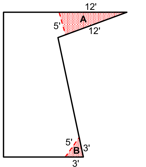
Area “A” does not count toward required open space requirement because the perimeter connecting the endpoints of the 5’ dimension line is more than 15’ in length.
Area “B” does count toward required open space because the perimeter connecting the endpoints of the 5’ dimension line is less than 15’ in length.
Exceptions to Yard Requirements
Front Yard Exception for Existing Alignments
If existing principal buildings on the same side of the same street, in the same zoning district, and within 200 feet of a lot are located closer to the street than the minimum required front yard specified in this Article, the required front yard for the principal building on such lot shall be the average of the existing alignments of all such principal buildings, rounded to the nearest foot. For the purpose of this provision, buildings on the subject lot shall not be included in the average of existing alignments.
Corner Lot Vision Obstruction
On a corner lot, no structure, accessory structure, landscaping, or screening which obstructs visibility shall be erected or maintained between the heights of 2.5 feet and 10 feet above the edge of pavement grades within the area bounded by the sidelines of the intersecting street rights-of-way and a straight line joining points along said street sidelines 20 feet from the point of intersection of such sidelines or extensions thereof. This provision shall not apply in the Character Districts 4-W, 4 and 5 (CD4-W, CD4 and CD5).
Corner Lot Vision Obstruction (Sec. 10.516.30)
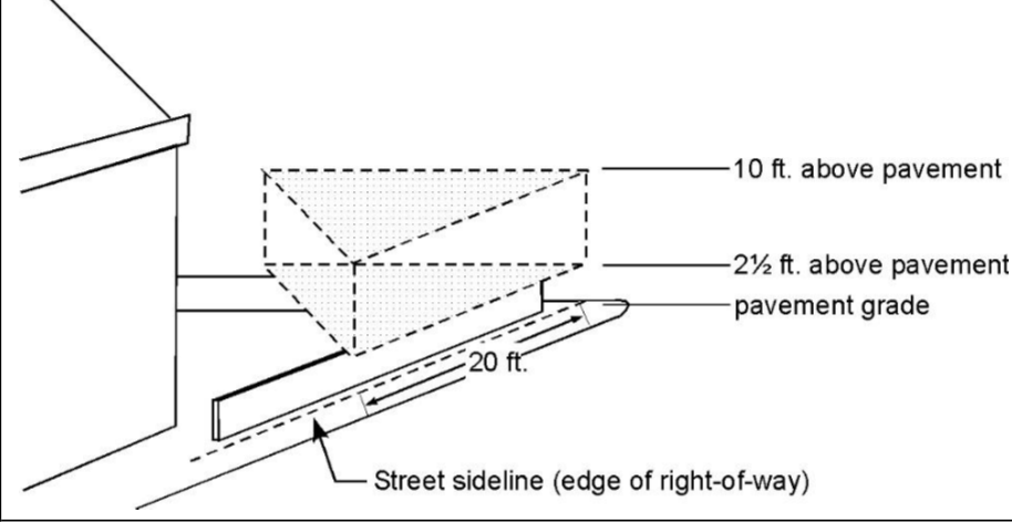
Projections Into Required Yards
In the Single Residence, General Residence and Mixed Residential districts, building elements may project into required yards by the amounts indicated in the following table:
| SRA, SRB | GRA | GRB, GRC, MRO, MRB | ||||
|---|---|---|---|---|---|---|
| Front Yard | Side or Rear Yard | Front Yard | Side or Rear Yard | Front Yard | Side or Rear Yard | |
| Building Elements | Maximum Projection Into Required Yard | |||||
| Terraces, decks, steps and stoops that are uncovered and unenclosed and are less than 3 feet in height and less than 100 square feet in area | 5’ | 5’ | 0’ | 5’ | 10’ | 0’ |
| Porches, porticos, steps or stoops that are covered and unenclosed and are less than 12 feet in height (to top of roof) and less than 50 square feet in area | 5’ | 5’ | 0’ | 5’ | 5’ | 0’ |
| Porches and porticos that are covered and enclosed and are less than 12 feet in height (to top of roof) and less than 20 square feet in area | 5’ | 5’ | 0’ | 5’ | 5’ | 0’ |
0’ = No projection allowed into required yard
Roof Appurtenances and Other Rooftop Features
A roof appurtenance may exceed the maximum allowed structure height for the zoning district by up to the additional height allowed in Section 10.521 or Section 10.531, as applicable, subject to the provisions of Section 10.517.
In the Gateway Neighborhood Mixed Use Districts, features for rooftop access and use may exceed the maximum allowed structure height for the zoning district as follows:
An elevator enclosure for an elevator providing rooftop access may extend an additional 5 feet above the allowed appurtenance height, provided that it is set back at least 30 feet from all edges of the roof and that the combined area of all such enclosures shall not exceed 300 square feet in area.
Elevator vestibules and partial shelters such as trellises and pergolas may extend up to the height allowed for rooftop appurtenances, provided that all such features shall be set back from all edges of the roof a distance at least equal to their height above the allowed structure height, and that the total area of such features shall not exceed 15 percent of the total roof area of the structure.
Railings around rooftop use areas may extend above the allowed structure height provided that they are less than 4 feet above the roof and that they are set back at least twice their height from the edge of the roof.
All roof appurtenances and other features that exceed the allowed structure height for the zoning district shall not exceed 33 percent of the total roof area of the structure and, except for elevators and stair towers, shall be set back at least 10 feet from any edge of the roof.
Solar energy panels shall not be subject to the 33 percent limitation provided that they are not visible from a point 20 feet above the edge of the street right-of-way on the opposite side of the street.
The area of roof appurtenances shall not be considered as part of the building’s gross floor area calculations.
§ 10.520Residential and Mixed Residential Districts
Table of Dimensional Standards – Residential and Mixed Residential Districts¹
| R | SRA | SRB | GRA | GRB | GRC | GA/MH | MRO | MRB | |
|---|---|---|---|---|---|---|---|---|---|
| Minimum Lot Dimensions | |||||||||
| Lot area | 5 acres | 1 acre | 15,000 sf | 7,500 sf | 5,000 sf | 3,500 sf | 5 acres | 7,500 sf | 7,500 sf |
| Lot area per dwelling unit | 5 acres | 1 acre | 15,000 sf | 7,500 sf | 5,000 sf | 3,500 sf | 10,000 sf | 7,500 sf | 7,500 sf |
| Continuous street frontage | NA | 150’ | 100’ | 100’ | 80’ | 70’ | N/A | 100’ | 100’ |
| Depth | NA | 200’ | 100’ | 70’ | 60’ | 50’ | N/A | 80’ | 80’ |
| Minimum Yard Dimensions | |||||||||
| Front | 50’ | 30’ | 30’² | 15’ | 5’ | 5’ | 30’²,⁴ | 5’ | 5’² |
| Side | 20’ | 20’ | 10’ | 10’ | 10’ | 10’ | 25’ | 10’ | 10’ |
| Rear | 40’ | 40’ | 30’ | 20’ | 25’ | 20’ | 25’ | 15’ | 15’ |
| Maximum Structure Dimensions | |||||||||
| Structure height | |||||||||
| Sloped roof | 35’ | 35’ | 35’ | 35’ | 35’ | 35’³ | 35’³,⁴ | 40’ | 40’ |
| Flat roof | 35’ | 30’ | 30’ | 30’ | 30’ | 30’ | 35’³,⁴ | 30’ | 30’ |
| Roof appurtenance height | 8’ | 8’ | 8’ | 8’ | 8’ | 8’ | 8’ | 10’ | 10’ |
| Building coverage | 5% | 10% | 20% | 25% | 30% | 35% | 20%⁴ | 40% | 40% |
| Minimum open space | 75% | 50% | 40% | 30% | 25% | 20% | 50% | 25% | 25% |
NA = Not Applicable NR = No Requirement Notes: 1. See Article 5A and Article 5B for dimensional standards in Character and Gateway Neighborhood Mixed Use Districts. 2. See Section 10.533 for special front yard requirements on Lafayette Road. 3. Within the General Residence C and Garden Apartment/Mobile Home Park districts an additional 8’ of height may be added to the maximum structure height in order to provide for multifamily dwellings that include vehicular parking spaces located within the residential building itself, if the additional height results in increased open space when compared to a site plan showing what open spaces would remain if required parking spaces were located in the open and in accessory structures. 4. See Section 10.816 for requirements within a manufactured housing park.
The maximum building length of a multifamily dwelling shall not exceed 160 feet.
§ 10.530Business and Industrial Districts
Table of Dimensional Standards – Business and Industrial Districts¹
| B | GB | WB | I | WI | OR | |
|---|---|---|---|---|---|---|
| Minimum Lot Dimensions | ||||||
| Lot Area | 20,000 sf | 43,560 sf | 20,000 sf | 2 acres | 2 acres | 3 acres² |
| Lot Area per dwelling unit | 2,500 sf | NR | NR | NA | NA | NA |
| Continuous street frontage | 100’ | 200’ | 100’ | 200’ | 200’ | 300’² |
| Depth | 80’ | 100’ | 100’ | 200’ | 200’ | 300’² |
| Minimum Yard Dimensions | ||||||
| Front | 20’ | 30’ | 30’ | 70’ | 70’ | 50’² |
| Side | 15’ | 30’ | 30’ | 50’ | 50’ | 75’² |
| Rear | 15’ | 50’ | 20’ | 50’ | 50’ | 50’ |
| Maximum Structure Dimensions | ||||||
| Structure height | 50’ | 60’ | 35’ | 70’³ | 70’³ | 60’³ |
| Roof appurtenance height | 10’ | 10’ | 10’ | 10’ | 10’ | 10’ |
| Building coverage | 35% | 30% | 30% | 50% | 50% | 30% |
| Floor Area Ratio | NR | NR | NR | NR | NR | NR |
| Minimum open space | 15% | 20% | 20% | 20% | 20% | 30% |
Notes: NA = Not Applicable NR = No Requirement 1. See Article 5A and Article 5B for dimensional standards in Character and Gateway Neighborhood Mixed Use Districts.
2. See Section 10.532.10 for requirements for lots adjacent to North Mill Pond.
3. See Section 10.532.20 for reduced structure height within 200’ of North Mill Pond or Piscataqua River.
Exceptions to Dimensional Standards for Certain Lots in the Industrial and OR Districts
North Mill Pond
In the Office Research district, lots in the area bounded by North Mill Pond, Maplewood Avenue, Islington Street and Bartlett Street shall be subject to the requirements of the Industrial district with respect to minimum lot area, street frontage, lot depth, and yards.
Building Height Setback from Waterfront
In the Industrial, Waterfront Industrial and Office Research districts, no portion of a building that is less than 200 feet from the highest observable tide line of the Piscataqua River or the North Mill Pond shall exceed 45 feet in height. Docking and offloading structures and equipment (such as cranes) are exempt from this restriction.
Special Yard Requirements on Lafayette Road
Notwithstanding the minimum front yard requirements specified in Section 10.521 or Section 10.531, for any lot adjoining Lafayette Road between the Route 1 Bypass and the Rye town line, no building, structure, parking area, or display or storage area shall be located less than 80 feet from the centerline of Lafayette Road or 30 feet from the sideline of Lafayette Road, whichever represents the greater setback, except as otherwise permitted by this Ordinance.
Inclusion of Waterfront Public Access in Open Space
In a Business or Industrial District, a portion of a lot that is used to provide public access along a waterfront shall be counted as open space for the purpose of satisfying the requirement for minimum open space on a lot, as follows:
Each square foot of lot area that is duly recorded and enforceable by the City as waterfront public access shall be counted as 1.5 square feet of required open space.
Each square foot of lot area that is used for, but not enforceable by the City as, waterfront public access shall be counted as 1.0 square foot of required open space.
§ 10.540Airport Districts
In the Airport, Airport Industrial, Pease Industrial and Airport Business Commercial districts, land use controls are governed by State statute. The statute provides that land acquired by the Pease Development Authority (PDA) from the federal government is not subject to the City of Portsmouth’s land use controls, including the Zoning Ordinance, but instead is subject to land use controls adopted by the PDA, consistent with the City’s Master Plan. The dimensional regulations in the following table therefore have no direct regulatory effect, but do represent the City’s land use policy for these districts and thus are set forth as guidance for the PDA.
| Air | PI | AI | ABC | |
|---|---|---|---|---|
| Minimum Lot Dimensions | ||||
| Area | NR | 5 acres | 5 acres | 10 acres |
| Continuous street frontage | NR | NR | 100’ | 300’ |
| Depth | NR | NR | 100’ | 200’ |
| Minimum Yard Dimensions | ||||
| Front | NR | 70’ | 70’ | 70’ |
| Side | NR | 50’ + 50’ | 50’ + 50’ | 30’ + 30’ |
| Rear | NR | 50’ | 50’ | 50’ |
| Maximum Structure Dimensions | ||||
| Structure height | 85’ | 85’ | 85’ | 85’ |
| Roof appurtenance height | 10’ | 10’ | 10’ | 10’ |
| Building coverage | NR | 30% | 50% | 60% |
| Minimum open space | NR | 50% | 50% | 50% |
NR = No requirement.
§ 10.550Conservation Districts
| NRP | |
|---|---|
| Minimum Lot Dimensions | |
| Area | NR |
| Continuous street frontage | NR |
| Depth | NR |
| Minimum Yard Dimensions | |
| Front | 70’ |
| Side | 70’ |
| Rear | 70’ |
| Maximum Structure Dimensions | |
| Structure height | 35’ |
| Roof appurtenance height | 10’ |
| Building coverage | NR |
| Minimum open space | 95% |
NR = No requirement.
§ 10.560Municipal District
§ 10.570Accessory Buildings, Structures and Uses
No accessory building, structure or use shall be located in any required front yard, or closer to a street than the principal building.
In a Character, Business or Industrial district, all accessory buildings and structures shall conform to the side yard and rear yard requirements of the applicable zoning district.
In a Residential or Mixed Residential district, an accessory building or structure may be located in a required side yard or rear yard subject to the following:
An accessory building or structure not more than 10 feet in height and not more than 100 square feet in area shall be set back at least 5 feet from any lot line.
An accessory building or structure more than 10 feet in height or more than 100 square feet in area shall be set back from any lot line at least the height of the building or the applicable yard requirement, whichever is less.
All accessory buildings and structures shall be included in the computation of building coverage.
No dumpster shall be located within 20 feet of a Residential or Mixed Residential zoned lot nor within 10 feet of any lot line. (See also Section 10.1130, Landscaping and Screening.)
An accessory use that does not include a structure shall be set back at least 10 feet from a side or rear lot line.
§ 10.580Special Dimensional Requirements for Certain Uses
When this Section 10.580 specifies a minimum lot area or minimum yard requirement for a specific use that is different from a lot area or yard requirement specified elsewhere in this Article, the use shall comply with the more stringent requirement.
Minimum Lot Area
Lots shall conform to the following minimum lot area requirements:
| Use | Minimum Lot Area |
|---|---|
| Social service campus | 25 acres |
| Hotel or motel in Industrial district | 10 acres |
| Motor vehicle service station | 1 acre |
| Sales, rental, leasing, distribution, and repair of vehicles, recreational vehicles, marine craft, manufactured housing and related equipment | 2 acres |
| Marine vessel repair | 2 acres |
| Truck fueling facility | 5 acres |
| Truck terminal | 2 acres |
| Recycling facilities and recycling plants | 2 acres |
Minimum Yards
| Use | Minimum Yard |
|---|---|
| Social service campus | 50 feet |
| Hotel or motel in Industrial districts | |
| Front | 175 feet |
| Side | 100 feet |
| Rear | 175 feet |
| Motor vehicle service station | 50 feet |
§ 10.590Minimum Distance Between Nonresidential Uses and Residential and Mixed Residential Districts
Minimum Distance Between Structures in Nonresidential Districts and Residential or Mixed Residential Districts
In a General Business District, Industrial District (I, WI, OR) or Airport District (A, PI, AI, ABC), no structure or additions to a structure shall be located within 100 feet of a parcel in a Residential or Mixed Residential district or Character District 4-L1.
Additional Distance Between Specific Nonresidential Uses and Residential or Mixed Residential Districts
Based on the location of the lot
A lot containing one of the following uses shall be separated from a Residential or Mixed Residential district or Character District 4-L1 by the distance indicated:
| Use No. | Use | Minimum distance between lot and any Residential or Mixed Residential district or Character District 4-L1 |
|---|---|---|
| 3.51 | Performance facility, indoor | 200 feet |
| 3.52 | Performance facility, outdoor | 500 feet |
| 4.50 | Outdoor recreation use | 500 feet |
| 7.50 | Veterinary hospital with kennels | 200 feet |
| 9.10 9.50 9.60 | Nightclub or bar (as a principal or accessory use) | 200 feet * |
| 11.20 | Motor vehicle service station | 200 feet |
| 11.50 | Truck fueling facility | 500 feet |
| 11.60 | Truck terminal | 500 feet |
| 12.20 12.30 | Marine vessel repair | 500 feet |
| 14.30 | Food processing | 500 feet |
| 14.70 | Recycling facility or recycling plant | 500 feet |
* In Character District 4 or 5 (CD4 or CD5) or the Downtown Overlay District, a lot containing a nightclub or bar may be located less than 200 feet from a Residential or Mixed Residential district but shall not abut such district.
Based on the location of the use
The following uses shall be separated from a Residential or Mixed Residential district or Character District 4-L1by the distance indicated:
| Use No. | Use | Minimum distance between use and any Residential or Mixed Residential district or Character District 4-L1 |
|---|---|---|
| Outdoor entertainment | 200 feet | |
| 8.90 | Sexually oriented business | See Section 10.930 |
| 10.40 10.50 | Parking and access ways for hotel or motel in an Industrial district | 100 feet |
| 11.10 12.30 | Sales, rental, leasing, distribution and repair of vehicles, recreational vehicles, marine craft, manufactured housing and related equipment, including areas for parking, display or storage of vehicles, equipment, goods or materials | 200 feet |
Required Distances Between Nonresidential Uses and Residential and Mixed Residential Districts (Sections 10.591 and 10.592)
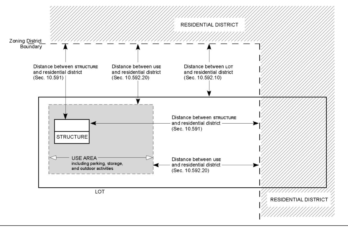
Additional Location Restrictions for Certain Nonresidential Uses
Any restaurant with an accessory use, such as a bar, place of public assembly or function room, in a General Business or Gateway district shall be located at least 200 feet from a residential district.
Any high hazard use shall be located at least 500 feet from any other high hazard use (or a greater distance if deemed necessary by the Planning Board), and shall include a vegetated buffer area at least 500 feet in depth to screen such use from any Residential or Mixed Residential district.
Article 5ACharacter-Based Zoning
§ 10.5A10General
Purpose and Intent
The purpose of Article 5A is to encourage development that is compatible with the established character of its surroundings and consistent with the City’s goals for the preservation or enhancement of the area. This is accomplished by providing a range of standards for the elements of development and buildings that define a place.
Applicability
Article 5A shall apply to the Character districts and Civic districts as shown on the Regulating Plan.
Municipal districts are shown on the Regulating Plan for reference but are governed by other sections of the Zoning Ordinance (specifically, Sections 10.460 and 10.560) and not by Article 5A.
Compliance with Regulating Plan
In the Character districts and Civic districts, all lots, buildings, structures, uses, and development shall comply with the requirements of Article 5A, as well as with all other provisions of this Zoning Ordinance that are not superseded by Article 5A.
No development, subdivision, re-subdivision or construction of or on any building, lot or parcel of land shall occur except pursuant to the Regulating Plan and in compliance with all standards and requirements for the district.
Relationship to Other Provisions of the Zoning Ordinance
The provisions of Article 5A shall take precedence over all other provisions of the Zoning Ordinance that are in conflict with Article 5A.
All provisions of the Zoning Ordinance that are not specifically modified or superseded by Article 5A, or that are not in conflict with Article 5A, shall apply to lots, buildings and uses in the Character districts and Civic districts.
Relationship to Other Regulations, Codes and Ordinances
Any proposed subdivision of land shall comply with the Subdivision Rules and Regulations, in addition to the requirements of Article 5A.
Any development that requires Site Plan Review under the Site Plan Review Regulations shall comply with such Regulations, in addition to the requirements of Article 5A.
The provisions of Article 5A do not modify or supersede any provision of the Building Code, other City ordinances or regulations, or State laws relating to the development of land.
Figures
The standards and definitions in the following figures are an integral part of Article 5A:
Figure 10.5A41.10A – Development Standards: Character District 4–Limited (CD4-L1/CD4-L2) Figure 10.5A41.10B – Development Standards: Character District 4–West End (CD4-W) Figure 10.5A41.10C – Development Standards: Character District 4 (CD4) Figure 10.5A41.10D – Development Standards: Character District 5 (CD5) Figure 10.5A43.10 – Façade Types Figure 10.5A43.60 – Building Types Figure 10.5A45.10 – Community Spaces
The diagrams, photographs and illustrations contained in the above figures are provided only to provide reference to certain regulating elements and indicate general character within the various districts and shall have regulatory force and effect only to that extent.
Definitions
Terms used throughout Article 5A may be defined in the figures (Façade Types, Building Types, and Community Spaces), in Section 10.5A60, in Article 15 or elsewhere in the Zoning Ordinance. Terms not so defined shall be accorded their commonly accepted meanings. In the event of any conflict between the definitions in Article 5A, those in Article 15, other sections of the Zoning Ordinance, the Subdivision Rules and Regulations, or any other local land use ordinances, rules or regulations, those of Article 5A shall take precedence unless the context clearly indicates otherwise.
§ 10.5A20Regulating Plan
General
Contents of Regulating Plan
The Regulating Plan is the Zoning Map for the Character districts and Civic districts. The Regulating Plan consists of the following maps:
Map 10.5A21A – Character Districts and Civic Districts
Map 10.5A21B – Building Height Standards
Map 10.5A21C – Special Requirements for Façade Types, Front Lot Line Buildout, and Uses
Building Height Standards
Assignments for specific building heights require a building to have no more than the designated maximum number of stories or the maximum height in feet (whichever is lower) and no less than the designated minimum number of stories. Subject to Section 10.635.70 – Review Criteria, within the Historic District, the approved building height may be lower than the maximum designated number of stories or the maximum height in feet provided in Section 10.5A43.30 but shall not be lower than the minimum designated number of stories or the minimum height in feet provided.
When a lot is assigned to more than one building height standard the lot shall be apportioned as follows:
A building height standard designated along a front lot line on a public place shall apply to the portion of the lot that is 50 feet or less from such lot line along a public place.
A building height standard designated along a water body shall apply to the portion of the lot that is 100 feet or less from the mean high water line.
More than 50 feet from a front lot line along a public place and more than 100 feet from a water body, the building height may increase to the highest building height standard designated for the lot.
Where a lot has less depth from a front lot line, along a public place or water body than the required minimum distances stated above, the lowest building height standard for the lot shall be applied to the required linear distance from the lot line, public place, or water body.
Special Requirements for Façade Types, Front Lot Line Buildout, and Uses
The following standards shall apply when so designated by the Regulating Plan:
For waterfront lots on Ceres Street, the maximum front lot line buildout shall be 50%, and buildings shall have a wood-sided appearance.
Specific use requirements apply to designated properties along the waterfront area (see Sections 10.5A34-35).
Regulating Plan Amendment
General
The Regulating Plan may be amended in accordance with the provisions of Section 10.150 (Changes and Amendments), subject to the further provisions of Section 10.5A22.20.
Application Requirements
An application for a Regulating Plan amendment initiated by or on behalf of the owner of property shall be accompanied by a site plan for such property that complies with the requirements for a request for Design Review under the Site Plan Review Regulations.
§ 10.5A30Character District Use Standards
Buildings, structures and land within a Character district shall comply with the use regulations set forth for the applicable district in Section 10.440, except as specified below:
A lot within the Downtown Overlay District shall comply with the requirements of Section 10.642 Ground Floor Uses.
In addition to the uses permitted in Character District 4, waterfront lots on Ceres Street as shown on Map 10.5A21C shall also permit the uses permitted in the Waterfront Industrial district as set forth in Section 10.440.
§ 10.5A40Character District Development Standards
Development Standards
Development, structures and lots within Character districts shall comply with the applicable general description and standards set forth in Figures 10.5A41.10A-D (Development Standards) and elsewhere in Article 5A.
FIGURE 10.5A41.10A DEVELOPMENT STANDARDS CHARACTER DISTRICT 4—LIMITED (CD4-L1/CD4-L2)
These districts consist of medium density areas with a mix of medium to large houses. Upper floor uses are almost entirely residential. Ground floors include some commercial office uses; areas zoned CD4-L2 also allow some restaurant and retail uses on the ground floor. There are shallow front yards and shallow to medium side yards, with variable private landscaping, and on-site accessory parking. Streets have sidewalks and street trees, and define medium to large blocks.
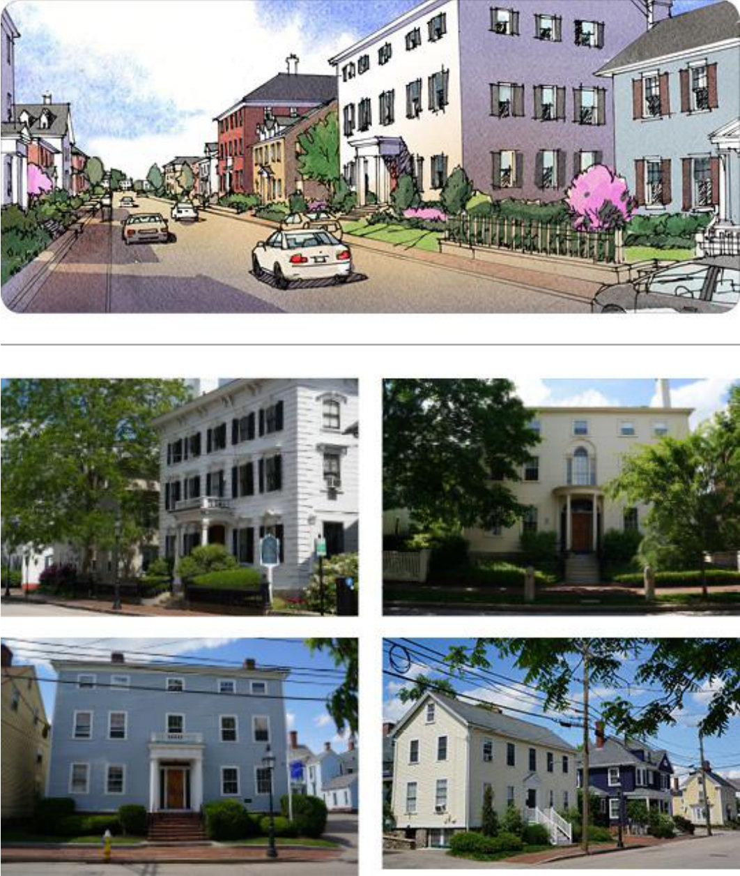
FIGURE 10.5A41.10A DEVELOPMENT STANDARDS CHARACTER DISTRICT 4—LIMITED (CD4-L1/CD4-L2)
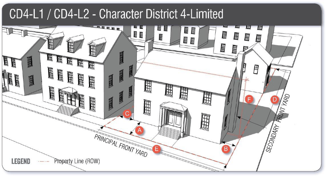
| BUILDING PLACEMENT — PRINCIPAL BUILDING | |
|---|---|
| Maximum principal front yard | 15 ft A |
| Maximum secondary front yard | 12 ft B |
| Side yard | 5 ft min. to 20 ft max. C |
| Minimum rear yard | Greater of 5 ft from rear lot line or 10 ft from center line of alley D |
| Front lot line buildout | 60% min. to 80% max. |
| BUILDING AND LOT OCCUPATION | |
| Maximum building block length | 80 ft E |
| Maximum façade modulation length | 50 ft (see Section 10.5A43.20) |
| Maximum entrance spacing | NR |
| Maximum building coverage | 60% |
| Maximum building footprint | 2,500 sf |
| Minimum lot area | 3,000 sf |
| Minimum lot area per dwelling unit | 3,000 sf |
| Minimum open space | 25% |
| Maximum ground floor GFA per use | NR |
| BUILDING FORM — PRINCIPAL BUILDING | |
|---|---|
| Building height | See Map 10.5A21.B & Section 10.5A43.30 F |
| Maximum finished floor surface of ground floor above sidewalk grade | 36” |
| Minimum ground story height | 11 ft |
| Façade glazing: | |
| Shopfront façade | 70% min. |
| Other façade types | 20% min. to 40% max. |
| Roof type | flat, gable, hip, gambrel, mansard |
| Roof pitch, if any | |
| Gable | 6:12 min. to 12:12 max |
| Hip | 3:12 min. |
| Mansard/gambrel | 6:12 min. to 30:12 max. |
FIGURE 10.5A41.10A DEVELOPMENT STANDARDS CHARACTER DISTRICT 4—LIMITED (CD4-L1/CD4-L2)
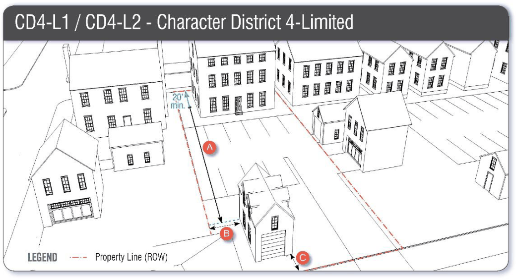
| BUILDING PLACEMENT — OUTBUILDING | |
|---|---|
| Minimum front yard | 20 ft behind a façade of a principal building A |
| Minimum side yard | 3 ft B |
| Minimum rear yard | 3 ft C |
| BUILDING TYPES | |
| See Figure 10.5A43.60 for building type definitions | |
| House | permitted* |
| Duplex | permitted* |
| Rowhouse | permitted* |
| Apartment building | permitted* |
| Live/work building | permitted** |
| Small commercial building | CD4-L1: not permitted CD4-L2: permitted |
| Large commercial building | not permitted |
| Cottage | not permitted |
| Paired House | permitted* |
| Gateway Townhouse | not permitted |
| Mixed-Use Building | permitted** |
| Flex Space Building | permitted |
| Community Building | permitted |
| *Not permitted in the Downtown Overlay District | |
| **Residential uses are not permitted on the ground floor in the Downtown Overlay District | |
| BUILDING & LOT USE | |
| See Sections 10.5A30 and 10.440 | |
| FAÇADE TYPES | |
|---|---|
| See Figure 10.5A43.10 for façade type definitions | |
| Except where required façade types are indicated on Map 10.5A21C, the below standards apply: | |
| Porch | permitted |
| Stoop | permitted* |
| Step | only permitted where indicated on Map 10.5A21C |
| Shopfront | CD4-L1: only permitted where indicated on Map 10.5A21C CD4-L2: permitted |
| Officefront | only permitted where indicated on Map 10.5A21C |
| Forecourt | permitted* |
| Recessed-entry | permitted |
| Dooryard | permitted |
| Terrace | not permitted |
| Gallery | not permitted |
| Arcade | not permitted |
| *Not permitted in the Downtown Overlay District | |
| PARKING | |
| See Section 10.5A44.30 | |
| COMMUNITY SPACE | |
| See Section 10.5A45 | |
FIGURE 10.5A41.10B DEVELOPMENT STANDARDS CHARACTER DISTRICT 4—WEST END (CD4-W)
This district consists of a medium-to-high density area with a mix of building types and residential, retail, and other commercial uses. There are shallow or no front yards and medium to no side yards, with variable private landscaping and on-site accessory parking. Streets have sidewalks and street trees or other pedestrian amenities, and define medium blocks.
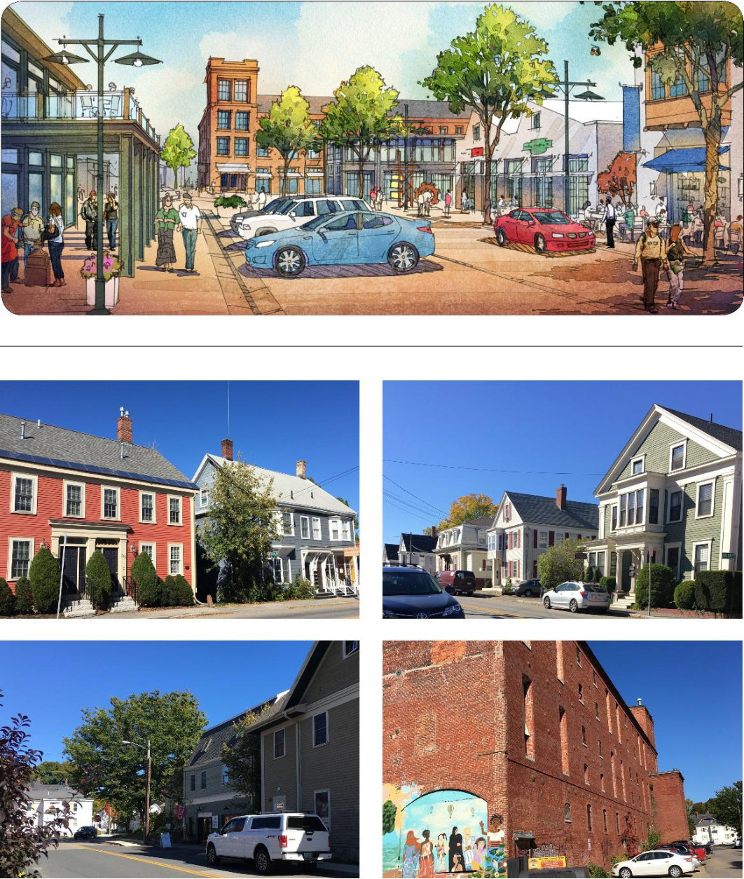
FIGURE 10.5A41.10B DEVELOPMENT STANDARDS CHARACTER DISTRICT 4—WEST END (CD4-W)
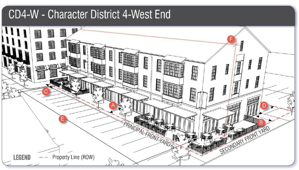
| BUILDING PLACEMENT — PRINCIPAL BUILDING* | |
|---|---|
| Maximum principal front yard | 10 ft A |
| Maximum secondary front yard | 15 ft B |
| Side yard | NR C |
| Minimum rear yard | Greater of 5 ft from rear lot line or 10 ft from center line of alley D |
| Minimum front lot line buildout | 50% |
| * Except for items listed under Section 10.5A42.12 | |
| BUILDING AND LOT OCCUPATION | |
| Maximum building block length | 200 ft E |
| Maximum façade modulation length | 80 ft (see Section 10.5A43.20) |
| Maximum entrance spacing | 50 ft |
| Maximum building coverage | 60% |
| Maximum building footprint | 15,000 sf (or as allowed by Section 10.5A43.40) |
| Minimum lot area | 5,000 sf |
| Minimum lot area per dwelling unit | 2,500 sf |
| Minimum open space | 15% |
| Maximum ground floor GFA per use | 15,000 sf |
| BUILDING FORM — PRINCIPAL BUILDING | |
|---|---|
| Building height | See Map 10.5A21.B & Section 10.5A43.30 F |
| Maximum finished floor surface of ground floor above sidewalk grade | 36” |
| Minimum ground story height | 12 ft |
| Façade glazing: | |
| Shopfront façade | 70% min. |
| Other façade types | 20% min. to 50% max. |
| Roof type | flat, gable, hip, gambrel, mansard |
| Roof pitch, if any | |
| Gable | 6:12 min. to 12:12 max |
| Hip | 3:12 min. |
| Mansard/gambrel | 6:12 min. to 30:12 max. |
FIGURE 10.5A41.10B DEVELOPMENT STANDARDS CHARACTER DISTRICT 4—WEST END (CD4-W)
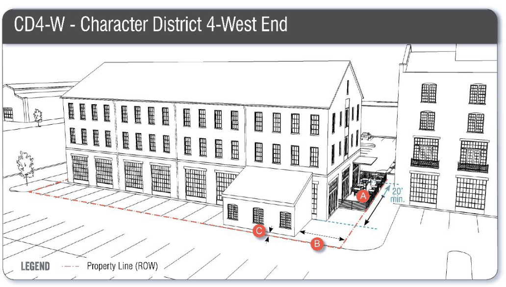
| BUILDING PLACEMENT — OUTBUILDING | |
|---|---|
| Minimum front yard | 20 ft behind a façade of a principal building A |
| Minimum side yard | 0 ft B |
| Minimum rear yard | 3 ft C |
| BUILDING TYPES | |
| See Figure 10.5A43.60 for building type definitions | |
| House | not permitted |
| Duplex | not permitted |
| Rowhouse | permitted |
| Apartment building | permitted |
| Live/work building | permitted* |
| Small commercial building | permitted |
| Large commercial building | permitted |
| Cottage | not permitted |
| Paired House | not permitted |
| Gateway Townhouses | not permitted |
| Mixed-Use Building | permitted* |
| Flex Space Building | permitted |
| Community Building | permitted |
| *Residential uses are not permitted on the ground floor | |
| BUILDING & LOT USE | |
| See Sections 10.5A30 and 10.440 | |
| FAÇADE TYPES | |
|---|---|
| See Figure 10.5A43.10 for façade type definitions | |
| Except where required façade types are indicated on Map 10.5A21C, the below standards apply: | |
| Porch | not permitted |
| Stoop | permitted |
| Step | permitted |
| Shopfront | permitted |
| Officefront | permitted |
| Forecourt | not permitted |
| Recessed-entry | permitted |
| Dooryard | permitted |
| Terrace | not permitted |
| Gallery | permitted |
| Arcade | permitted |
| PARKING | |
| See Section 10.5A44.30 | |
| COMMUNITY SPACE | |
| See Section 10.5A45 | |
FIGURE 10.5A41.10C DEVELOPMENT STANDARDS CHARACTER DISTRICT 4 (CD4)
This district consists of a medium-to-high density transitional area with a mix of building types and residential, retail, and other commercial uses. There are shallow or no front yards and medium to no side yards, with variable private landscaping. Streets have sidewalks and street trees or other pedestrian amenities, and define small to medium blocks.
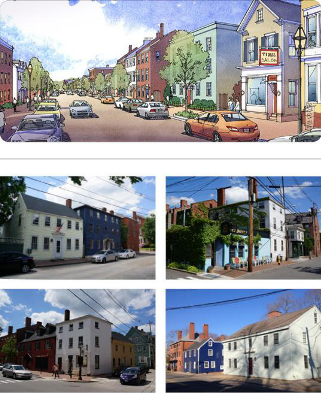
FIGURE 10.5A41.10C DEVELOPMENT STANDARDS CHARACTER DISTRICT 4 (CD4)
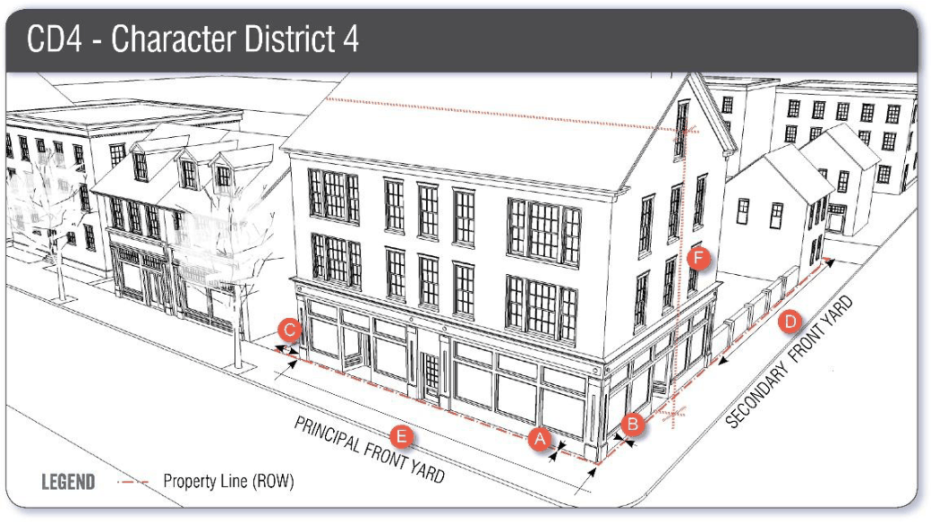
| BUILDING PLACEMENT — PRINCIPAL BUILDING* | |
|---|---|
| Maximum principal front yard | 10 ft A |
| Maximum secondary front yard | 15 ft B |
| Side yard | NR C |
| Minimum rear yard | Greater of 5 ft from rear lot line or 10 ft from center line of alley D |
| Front lot line buildout | |
| On Ceres Street | 50% max. (See Map 10.5A21C) |
| Everywhere else | 50% min. |
| * Except for items listed under Section 10.5A42.12 | |
| BUILDING AND LOT OCCUPATION | |
| Maximum building block length | 200 ft E |
| Maximum façade modulation length | 80 ft (see Section 10.5A43.20) |
| Maximum entrance spacing | 50 ft |
| Maximum building coverage | 90% |
| Maximum building footprint | 15,000 sf (or as allowed by Section 10.5A43.40) |
| Minimum lot area | NR | |
| Minimum lot area per dwelling unit | NR | |
| Minimum open space | 10% | |
| Maximum ground floor GFA per use | 15,000 sf | |
| BUILDING FORM — PRINCIPAL BUILDING | ||
|---|---|---|
| Building height | See Map 10.5A21.B & Section 10.5A43.30 F | |
| Maximum finished floor surface of ground floor above sidewalk grade | 36” | |
| Minimum ground story height | 12 ft | |
| Minimum second story height | 10 ft | |
| Façade glazing: | ||
| Shopfront façade | 70% min. | |
| Other façade types | 20% min. to 50% max. | |
| Roof type | flat, gable, hip, gambrel, mansard | |
| Roof pitch, if any | ||
| Gable | 6:12 min. to 12:12 max | |
| Hip | 3:12 min. | |
| Mansard/gambrel | 6:12 min. to 30:12 max. | |
FIGURE 10.5A41.10C DEVELOPMENT STANDARDS CHARACTER DISTRICT 4 (CD4)
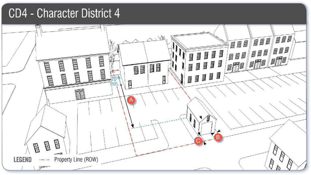
| BUILDING PLACEMENT — OUTBUILDING | |
|---|---|
| Minimum front yard | 20 ft behind a façade of a principal building A |
| Minimum side yard | 0 ft B |
| Minimum rear yard | 3 ft C |
| BUILDING TYPES | |
| See Figure 10.5A43.60 for building type definitions | |
| House | not permitted |
| Duplex | not permitted |
| Rowhouse | permitted* |
| Apartment building | permitted* |
| Live/work building | permitted** |
| Small commercial building | permitted |
| Large commercial building | permitted |
| Cottage | not permitted |
| Paired House | not permitted |
| Gateway Townhouses | not permitted |
| Mixed-Use Building | permitted** |
| Flex Space Building | permitted |
| Community Building | permitted |
| *Not permitted in the Downtown Overlay District | |
| **Residential uses are not permitted on the ground floor in the Downtown Overlay District | |
| BUILDING & LOT USE | |
| See Sections 10.5A30 and 10.440 | |
| FAÇADE TYPES | |
|---|---|
| See Figure 10.5A43.10 for façade type definitions | |
| Except where required façade types are indicated on Map 10.5A21C, the below standards apply: | |
| Porch | not permitted |
| Stoop | permitted |
| Step | permitted |
| Shopfront | permitted |
| Officefront | permitted |
| Forecourt | not permitted |
| Recessed-entry | permitted |
| Dooryard | permitted |
| Terrace | not permitted |
| Gallery | permitted |
| Arcade | permitted |
| PARKING | |
| See Section 10.5A44.30 | |
| COMMUNITY SPACE | |
| See Section 10.5A45 | |
FIGURE 10.5A41.10D DEVELOPMENT STANDARDS CHARACTER DISTRICT 5 (CD5)
This district consists of a high density center with a mix of building types and residential, retail and other commercial uses. There are no front yards or side yards, and limited landscaping and public parking facilities. Streets have sidewalks and trees or other pedestrian amenities, and define small to medium blocks.
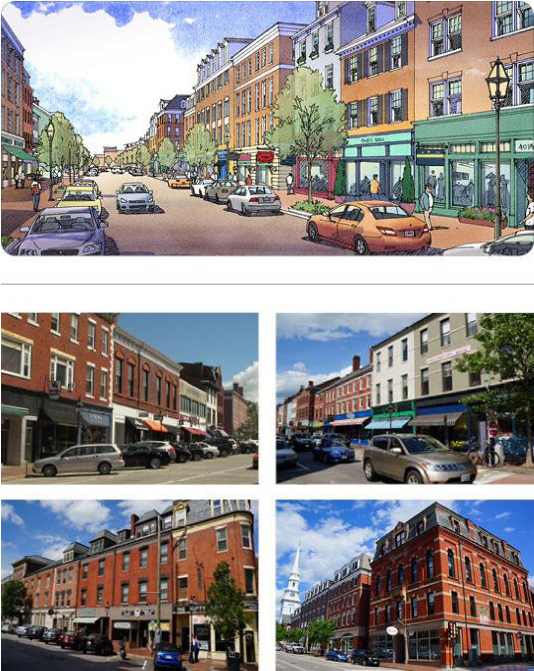
FIGURE 10.5A41.10D DEVELOPMENT STANDARDS CHARACTER DISTRICT 5 (CD5)
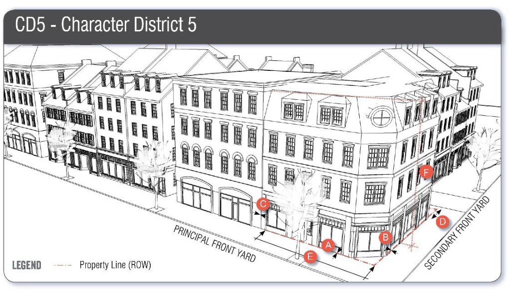
| BUILDING PLACEMENT — PRINCIPAL BUILDING* | |
|---|---|
| Maximum principal front yard | 5 ft A |
| Maximum secondary front yard | 5 ft B |
| Side yard | NR C |
| Minimum rear yard | Greater of 5 ft from rear lot line or 10 ft from center line of alley D |
| Minimum front lot line buildout | 80% |
| * Except for items listed under Section 10.5A42.12 | |
| BUILDING AND LOT OCCUPATION | |
| Maximum building block length | 225 ft E |
| Maximum façade modulation length | 100 ft (see Section 10.5A43.20) |
| Maximum entrance spacing | 50 ft |
| Maximum building coverage | 95% |
| Maximum building footprint | 20,000 sf (or as allowed by Section 10.5A43.40) |
| Minimum lot area | NR |
| Minimum lot area per dwelling unit | NR |
| Minimum open space | 5% |
| Maximum ground floor GFA per use | 15,000 sf |
| BUILDING FORM — PRINCIPAL BUILDING | |
|---|---|
| Building height | See Map 10.5A21.B & Section 10.5A43.30 F |
| Maximum finished floor surface of ground floor above sidewalk grade | 36” |
| Minimum ground story height | 12 ft |
| Minimum second story height | 10 ft |
| Façade glazing: | |
| Shopfront façade | 70% min. |
| Other façade types | 20% min. to 50% max. |
| Roof type | flat, gable, hip, gambrel, mansard |
| Roof pitch, if any | |
| Gable | 6:12 min. to 12:12 max |
| Hip | 3:12 min. |
| Mansard/gambrel | 6:12 min. to 30:12 max. |
FIGURE 10.5A41.10D DEVELOPMENT STANDARDS CHARACTER DISTRICT 5 (CD5)
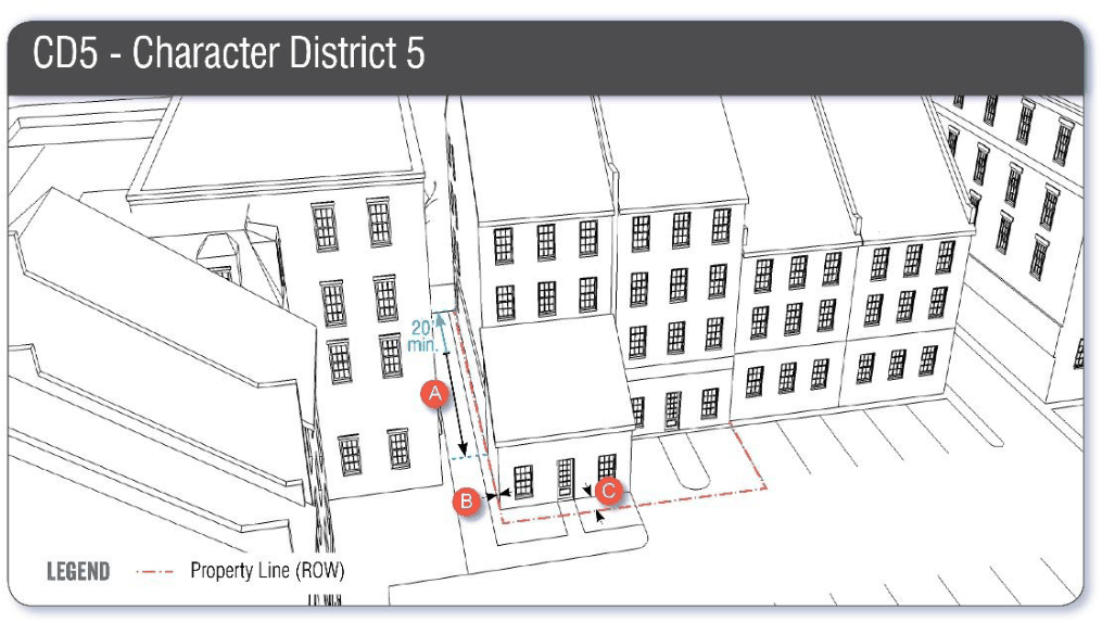
| BUILDING PLACEMENT — OUTBUILDING | |
|---|---|
| Minimum front yard | 20 ft behind a façade of a principal building A |
| Minimum side yard | 0 ft B |
| Minimum rear yard | 3 ft C |
| BUILDING TYPES | |
| See Figure 10.5A43.60 for building type definitions | |
| House | not permitted |
| Duplex | not permitted |
| Rowhouse | not permitted |
| Apartment building | not permitted |
| Live/work building | permitted* |
| Small commercial building | permitted |
| Large commercial building | permitted |
| Cottage | not permitted |
| Paired House | not permitted |
| Gateway Townhouses | not permitted |
| Mixed-Use Building | permitted* |
| Flex Space Building | permitted |
| Community Building | permitted |
| *Residential uses are not permitted on the ground floor in the Downtown Overlay District | |
| BUILDING & LOT USE | |
| See Sections 10.5A30 and 10.440 | |
| FAÇADE TYPES | |
|---|---|
| See Figure 10.5A43.10 for façade type definitions | |
| Except where required façade types are indicated on Map 10.5A21C, the below standards apply: | |
| Porch | not permitted |
| Stoop | permitted |
| Step | permitted |
| Shopfront | permitted |
| Officefront | permitted |
| Forecourt | not permitted |
| Recessed-entry | permitted |
| Dooryard | not permitted |
| Terrace | not permitted |
| Gallery | permitted |
| Arcade | permitted |
| PARKING | |
| See Section 10.5A44.30 | |
| COMMUNITY SPACE | |
| See Section 10.5A45 | |
Building Placement
Yards shall be as required in Figures 10.5A41.10A-D (Development Standards).
Yards may be increased above the maximum permitted for truncated corners or other subtractive massing techniques, alleys, vehicular accessways, increased sidewalk width or community spaces.
Façade Alignment
The façade facing the principal front yard shall be parallel to the front lot line. Where the front lot line is curved, the façade shall be parallel to a straight line connecting the points of intersection of the front lot line and the side lot lines.
Outbuildings and Backbuildings
A detached outbuilding, or an outbuilding attached to a principal building with a backbuilding, may be built on each lot to the rear of the principal building, as illustrated generally in Figure 10.5A42.10 (Principal Building/Backbuilding/Outbuilding).
FIGURE 10.5A42.10 PRINCIPAL BUILDING/BACKBUILDING/ OUTBUILDING
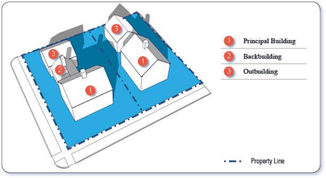
North Mill Pond Public View Corridors
All new buildings or structures located within 400’ of the North Mill Pond shall be located in such a way as to maintain existing public views with a terminal vista of the North Mill Pond from the intersecting streets of Dover Street, Cabot Street, Cornwall Street and Langdon Street. Except for existing obstructions, the public view corridor shall be maintained for a minimum width of the existing public right-of-way of the nearest intersecting street as listed above.
Building Form and Façades
Façade Types
The façade facing the principal front yard shall conform to Figure 10.5A43.10 (Façade Types) and Figures 10.5A41.10A-D (Development Standards), and to any applicable façade type requirements indicated on the Regulating Plan. Permitted building form and façade types may be combined.
FIGURE 10.5A43.10 FAÇADE TYPES
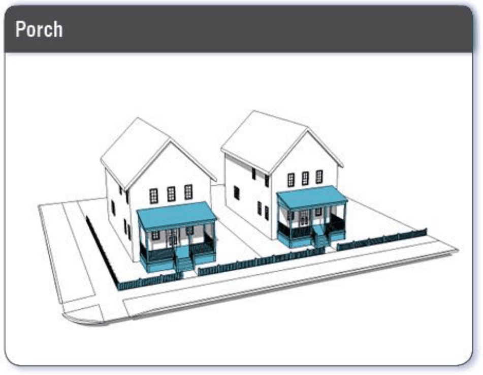
The façade is set back from the front lot line with an attached porch or stoop permitted to encroach. This may be used with or without a fence to maintain street spatial definition.
Permitted districts: CD4-L1, CD4-L2, G1, G2
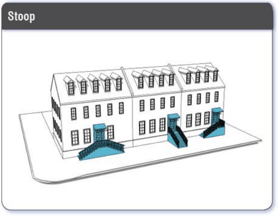
The façade is aligned close to the front lot line with the ground floor elevated from the sidewalk for privacy. The entrance has an exterior stair and landing.
This type is recommended for ground floor residential use.
Permitted districts: CD5, CD4, CD4-W, CD4-L1, CD4-L2, G1, G2
FIGURE 10.5A43.10 FAÇADE TYPES (CONTINUED)
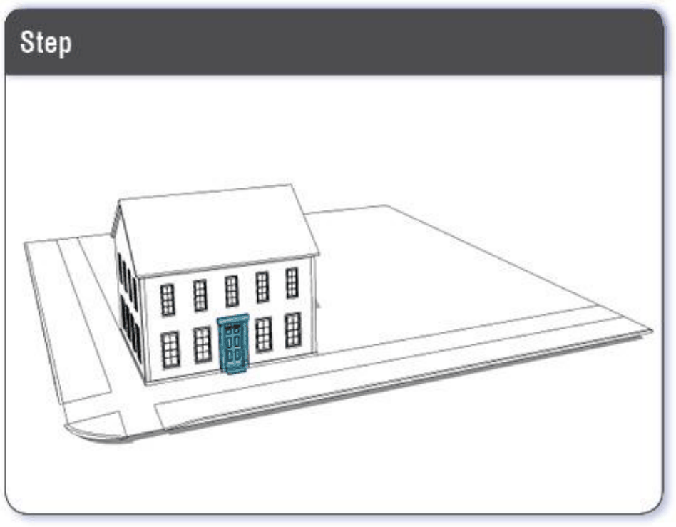
The façade is aligned close to the front lot line with the ground floor elevated from the sidewalk for privacy. The entrance has an exterior single step without a landing.
This type is recommended for ground floor residential, office or retail use.
Permitted districts: CD5, CD4, CD4-W, G1, G2 Only permitted in CD4-L1 & CD4-L2 where indicated on Map 10.5A21C.
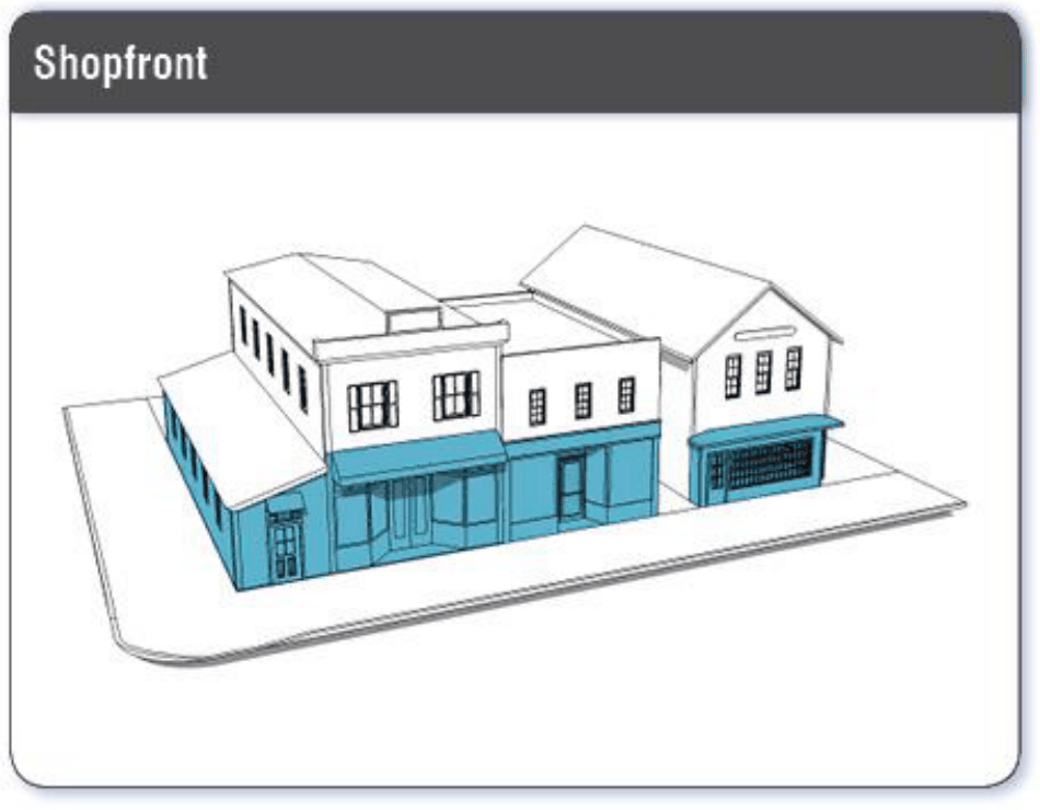
The façade is aligned close to the front lot line with the building entrance at sidewalk grade and with substantial glazing on the ground floor.
This type is conventional for retail, office or restaurant use.
Permitted districts: CD5, CD4, CD4-W, CD4-L2, G1, G2 Only permitted in CD4-L1 where indicated on Map 10.5A21C.
FIGURE 10.5A43.10 FAÇADE TYPES (CONTINUED)
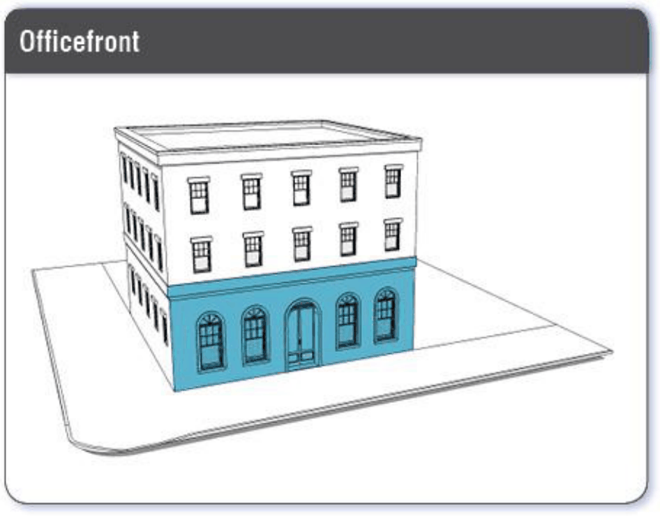
The façade is aligned close to the front lot line with the building entrance at or elevated above sidewalk grade. It may have substantial glazing on the sidewalk level.
This type is conventional for office use.
Permitted districts: CD5, CD4, CD4-W, G1, G2 Only permitted in CD4-L1 & CD4-L2 where indicated on Map 10.5A21C.
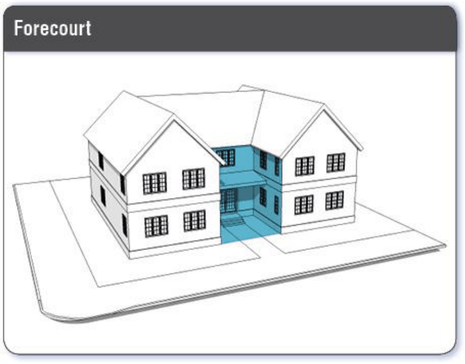
The two ends of the façade are close to the front lot line and the central portion is set back.
Permitted districts: CD4-L1, CD4-L2, G1, G2 This façade type is not permitted in the Downtown Overlay District.
FIGURE 10.5A43.10FAÇADE TYPES (CONTINUED)
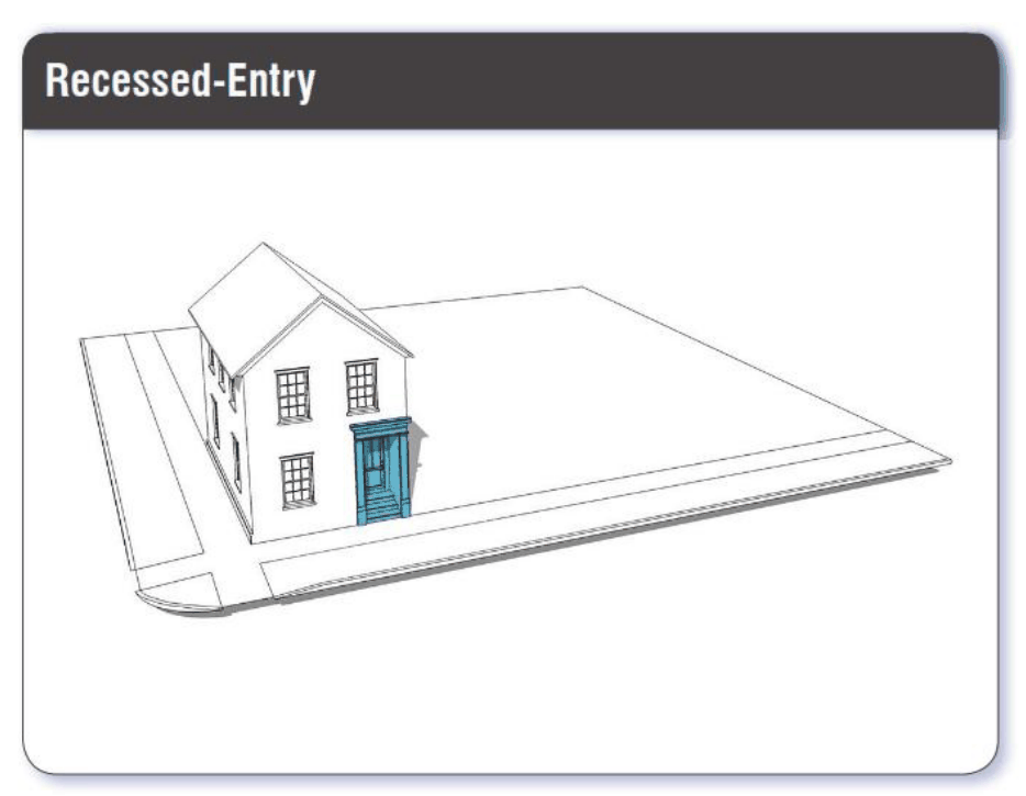
The façade is aligned close to the front lot line and the primary building entrance is recessed within the façade.
This type is conventional for residential use.
Permitted districts: CD4-L1, CD4-L2, CD4, CD4-W, CD5, G1, G2
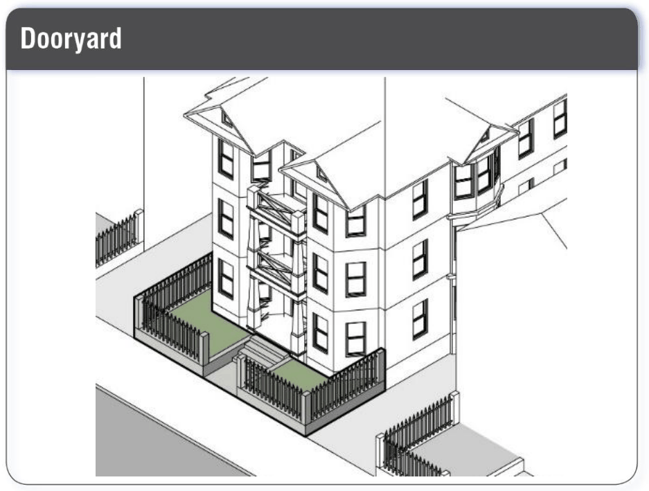
The building facade is aligned close to the street line, and the frontage is defined by a low wall, decorative fence or hedge providing a strong spatial definition from the public sidewalk. The result is a small semi-private yard containing the principal entrance. The yard may be slightly raised, sunken, or at-grade, and may be planted or landscaped. A paved walkway from the sidewalk to the front door is required. This type is commonly associated with ground floor residential use.
Permitted districts: G1, G2, CD4-L1, CD4-L2, CD4-W, CD4 This façade type is not permitted in the Downtown Overlay District.
FIGURE 10.5A43.10 FAÇADE TYPES (CONTINUED)
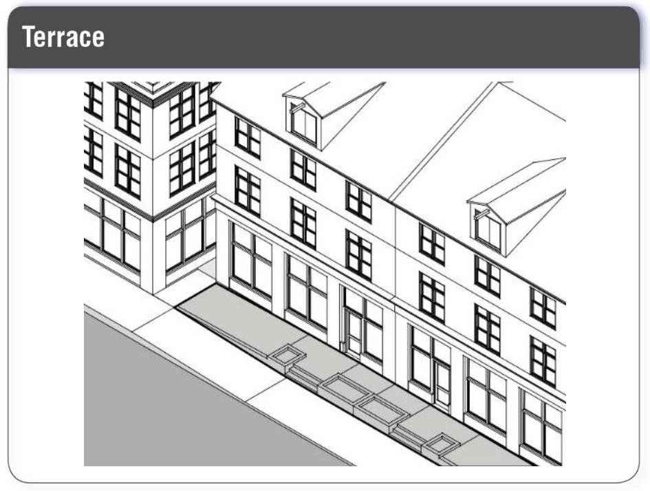
Building facade is at or near the street line with an elevated terrace that may encroach into the front yard or setback providing level or terraced public circulation along the façade. This type can be used to provide at-grade access while accommodating a grade change along a street line. Frequent steps up to the terrace are necessary to avoid dead walls and maximize access. This type is required to be used in conjunction with other facade types to define individual or shared entries facing the street.
Permitted districts: G1, G2, CD4-W
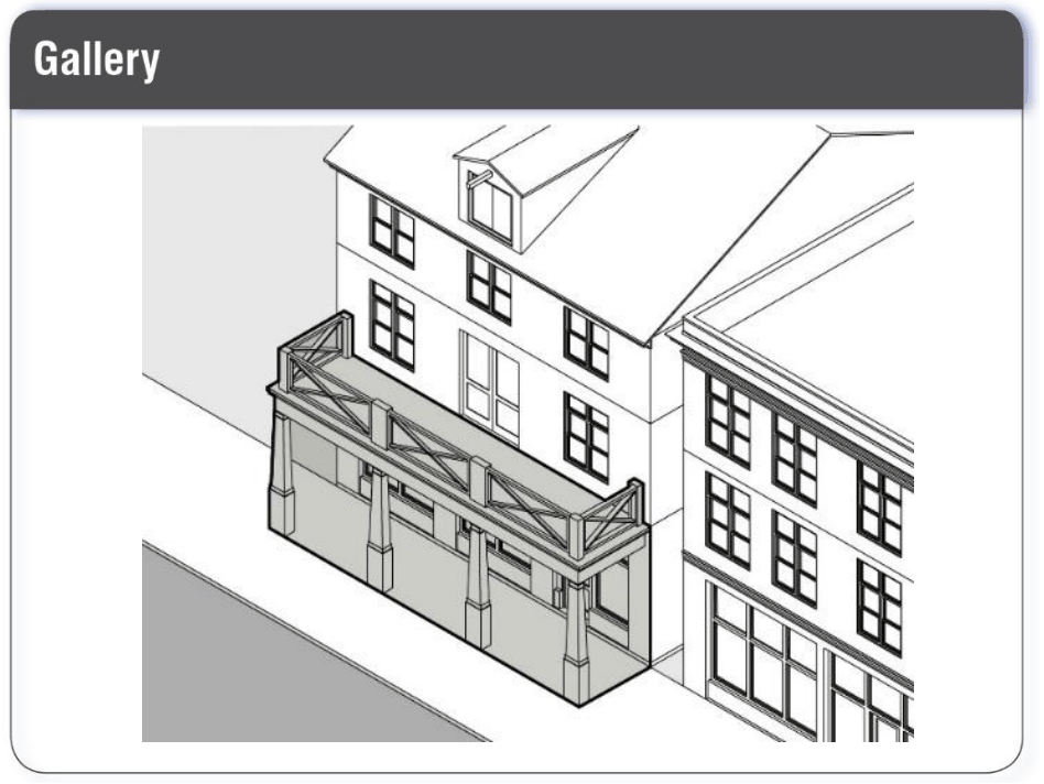
The building facade is set back from the street line with an attached one or two story cantilevered shed or a lightweight colonnade that is built to the street line. This type is intended for buildings with ground floor commercial, hospitality or retail uses. This facade type is required to be used in conjunction with other types to define individual or shared first floor entries facing the street.
Permitted districts: G1, G2, CD4-W
FIGURE 10.5A43.10 FAÇADE TYPES (CONTINUED)
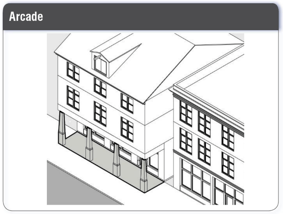
Only the ground floor level of the building facade is set back from the street line. The building facade for the upper floors is at the street line and is supported by a colonnade with habitable space above. This façade type is intended for buildings with ground floor commercial, hospitality or retail uses. This type is required to be used in conjunction with other facade types to define individual or shared first floor entries facing the street.
Façade Modulation
Except as listed in 10.5A43.22, a façade shall be modulated by major breaks in the façade plane and/or changes in exterior materials or rooflines. No individual section of a façade shall be longer than the maximum façade modulation length listed in Figures 10.5A41.10A-D (Development Standards).
In the Historic District, Façades that have a high degree of fenestration, traditional masonry detailing, and traditional window styling (including windows recessed in the openings and with multiple panes) shall be exempt from the façade modulation requirements listed in Figures 10.5A41.10A-D (Development Standards).
Building and Story Heights
Specific height requirement areas are designated on Map 10.5A21B. The maximum building height in each height requirement area shall be as follows:
A roof appurtenance may exceed the maximum allowed building height as specified on Map 10.5A21B (Building Height Standards) by 10 feet, subject to the following:
All roof appurtenances and other features that exceed the allowed building height for the zoning district shall not exceed 33 percent of the total roof area of the structure and, except for elevators, stair towers, and decorative railing no taller than four feet in height, shall be set back at least 10 feet from any edge of the roof.
Solar energy panels shall not be subject to the 33 percent limitation provided that they are not visible from a point 20 feet above the edge of the street right-of-way on the opposite side of the street.
The area of roof appurtenances that comply with this section shall not be considered as part of the building’s gross floor area calculations.
For a development with a mix of residential and non-residential uses located within a CD4, CD4W, or CD5 Character District that is not located in an incentive overlay district and that contains at least one acre of lot area, the Planning Board may grant a conditional use permit to allow an additional story in height (up to 15 feet) for houses, duplexes, or mixed-use buildings where the building type is otherwise permitted by this Ordinance and if all of the following requirements are met:
Community Space – The development shall have at least 50% of the property assigned and improved as a community space. Given the large scale of the development, the community space shall include a Plaza or Square of at least 5,000 sq. ft. per acre and any combination of the following: a Pedestrian Passage; a Wide Pedestrian Sidewalk; a Pedestrian Arcade; a Pocket Park; a Playground, or a Public Observation Deck, as further described and depicted in Figure 10.5A45.10. Such community space shall count toward the required open space listed in Figures 10.5A41.10A-D (Development Standards). The size, shape, location and type of the community space shall be determined by the Planning Board and be based on the proposed land use and the size and location of the buildings within the development, and the adjacent uses and public amenities.
Workforce Housing – The development shall have either: 1) 10% of any proposed for sale dwelling units within a development shall be workforce housing units (affordable to a household with an income of no more than 100 percent of the area median income for a 4-person household); or 2) 5% of any proposed for rent dwelling units within a development shall be workforce housing units (affordable to a household with an income of no more than 60 percent of the area median income for a 3-person household). Any workforce housing units shall be at least 600 sq. ft. in gross floor areas and be distributed throughout the building wherever dwelling units are located.
Calculations for workforce housing unit requirements shall be rounded to the nearest whole number, with 0.5 and below being rounded down.
The proposal is consistent with the findings, goals, and objectives of the Portsmouth Master Plan.
Maximum Building Footprint
No building or structure footprint shall exceed the applicable maximum building footprint listed in Figures 10.5A41.10A-D (Development Standards) except as provided in Sections 10.5A43.42-44 below.
In the CD5 district, a detached liner building may have a building footprint of up to 30,000 sq. ft. if it meets all other development standards and is integrated into a parking structure through the provision of community space or shared access.
For a building that contains ground floor parking, a parking garage or underground parking levels, and is not subject to Section 10.5A43.42, the Planning Board may grant a conditional use permit to allow a building footprint of up to 30,000 sq. ft. in the CD4 or CD4-W districts, and up to 40,000 sq. ft. in the CD5 district, if all of the following criteria are met:
No story above the ground floor parking shall be greater than 20,000 sq. ft. in the CD4 or CD4-W districts or 30,000 sq. ft. in the CD5 district.
All ground floor parking areas shall be separated from any public or private street by a liner building.
At least 50% of the gross floor area of the ground floor shall be dedicated to parking.
For developments with more than five (5) dwelling units at least 10% of the property shall be assigned and improved as community space and comply with the workforce housing requirements listed in (e). For developments with 5 or less dwelling units, 30% of the property shall be assigned and improved as community space. Such community space shall count toward the required open space listed under Figures 10.5A41.10A-D (Development Standards) and community space required under Section 10.5A46.20. The size, location and type of the community space shall be determined by the Planning Board based on the size and location of the development, and the proposed and adjacent uses.
For developments with more than five (5) dwelling units, the dwelling units within a building shall be workforce housing units in compliance with state law for either: 1) 10% of any proposed for sale dwelling units within a development shall be workforce housing units (affordable to a household with an income of no more than 100 percent of the area median income for a 4 person household) or 2) 5% of any proposed for rent dwelling units with in a development shall be workforce housing units (affordable to a household with an income of no more than 60 percent of the area median income for a 3 person household). Such units shall be at least 600 sq. ft. The workforce housing units shall be distributed throughout the building wherever dwelling units are located.
The development shall comply with all applicable standards of the ordinance and the City’s land use regulations.
Calculations for workforce housing unit requirements shall be rounded to the nearest whole number, with 0.5 and below begin rounded down.
The proposal is consistent with the findings, goals, and objectives of the Portsmouth Master Plan.
The building footprint of a parking structure shall be no greater than 40,000 sq. ft., and the façade length shall be no greater than 300 feet.
Any streetscreen in a front yard shall be built on the same plane as the façade of the principal building and shall be between 3.5 and 4.0 feet in height.
Building Types
Buildings in each Character district shall be of one or more of the building types specified for such Character district in Figure 10.5A43.60 (Building Types).
FIGURE 10.5A43.60 BUILDING TYPES
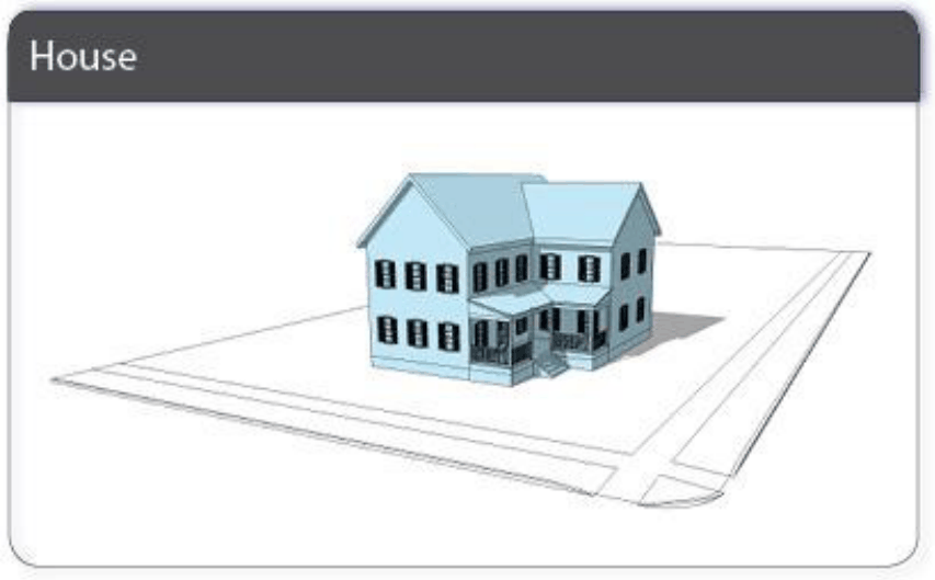
A residential building that has the appearance of a single-family dwelling, with yards on all sides.
Permitted districts: CD4-L1, CD4-L2 This building type is not permitted in the Downtown Overlay District.
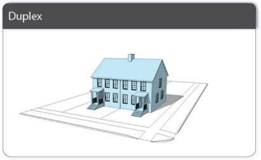
A residential building with two vertically-separated units with separate entrances. The building may have yards/setbacks on all sides, or it may be divided along the party wall by a lot line where permitted by the standards of the Character district.
Permitted districts: CD4-L1, CD4-L2 This building type is not permitted in the Downtown Overlay District.
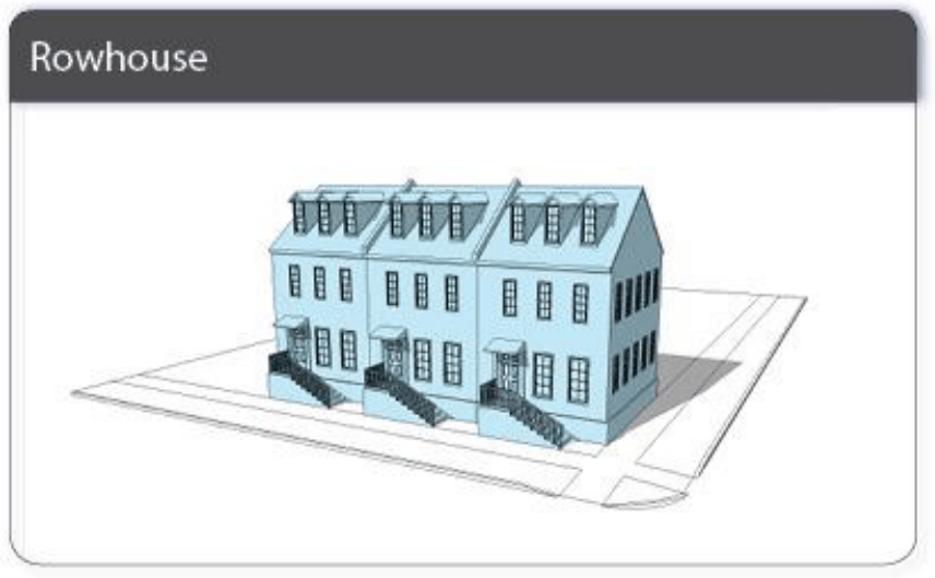
A building that may occupy the full width of the lot and shares a party wall with one or more buildings of the same type, with a minimal yard/setback along the front of the lot or development site.
Permitted districts: CD4, CD4-W, CD4-L1, CD4-L2 This building type is not permitted in the Downtown Overlay District.
FIGURE 10.5A43.60 BUILDING TYPES (CONTINUED)
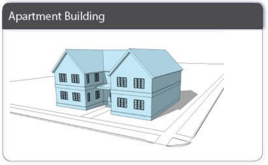
A building designed for residential use that has the appearance of a multifamily dwelling, with yards/setbacks on all sides.
Permitted districts: CD4, CD4-W, CD4-L1, CD4-L2, G1, G2 This building type is not permitted in the Downtown Overlay District.
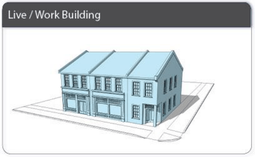
A building designed to accommodate a ground floor commercial use and a residential use above or beside.
Permitted districts: CD5, CD4, CD4-W, CD4-L1, CD4-L2, G1, G2 Residential uses are not permitted on the ground floor in the Downtown Overlay District.
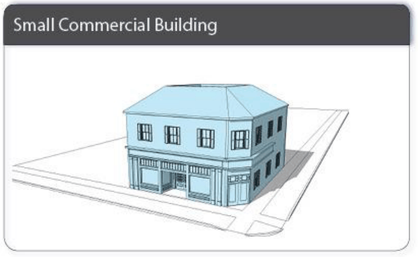
A building designed for non-residential use with a shopfront or officefront façade type and minimal or no front yard/setback along the front of the lot or development site, and that is no more than 3 stories in height.
Permitted districts: CD5, CD4, CD4-W, CD4-L2, G1, G2
FIGURE 10.5A43.60 BUILDING TYPES (CONTINUED)
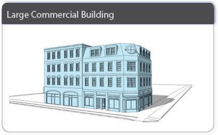
A building with a shopfront or officefront façade type and minimal or no yard/setback along the front of the lot or development site, and that is 4 or more stories in height.
Permitted districts: CD5, CD4, CD4-W, G1, G2
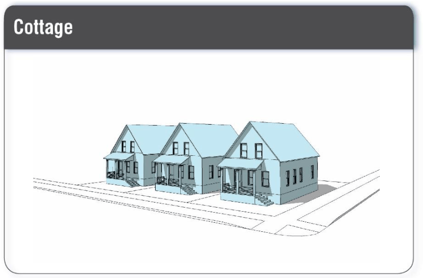
A small detached single family dwelling with narrow massing.
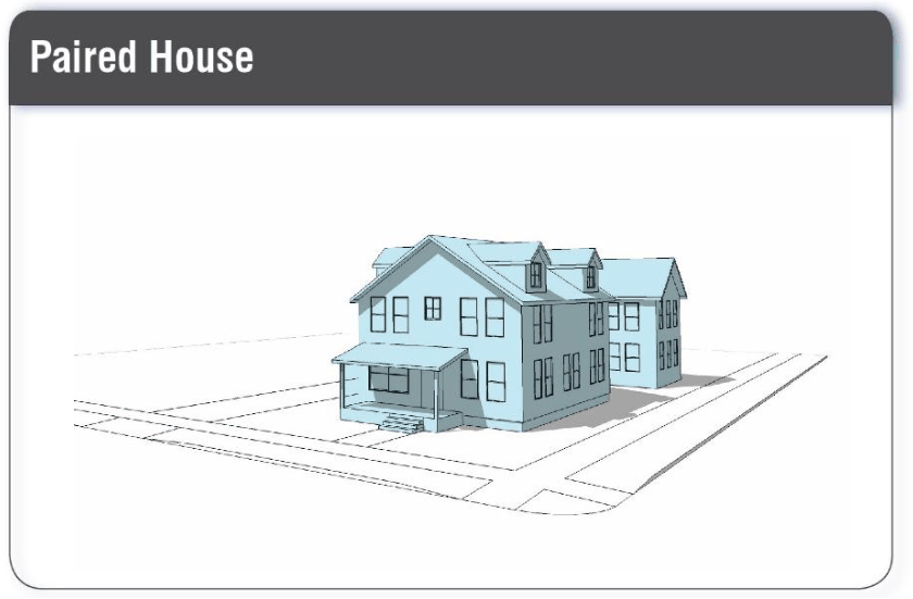
A building designed for residential use with narrow massing and horizontally attached or semi-attached dwelling units generally perpendicular to the front of the lot or development site. These buildings contain up to 3 dwelling units and are often designed to resemble large farmhouses with attached carriage houses.
Permitted districts: G1, G2, CD4-L1, CD4-L2 This building type is not permitted in the Downtown Overlay District.
FIGURE 10.5A43.60 BUILDING TYPES (CONTINUED)
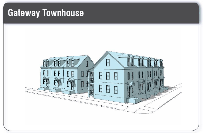
These small footprint attached single family residential buildings have narrow massing and may be located on individual or common lots. Each unit is separated horizontally by a common wall and groups of buildings may be separated by a common driveway or community space.
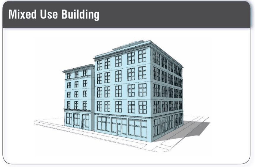
A variable footprint building type that typically accommodates a variety of ground floor commercial uses and upper residential and office uses at the scale that compliments the historic character of the neighborhood.
Permitted districts: G1, G2, CD-4, CD4-W, CD5, CD4-L1/L2
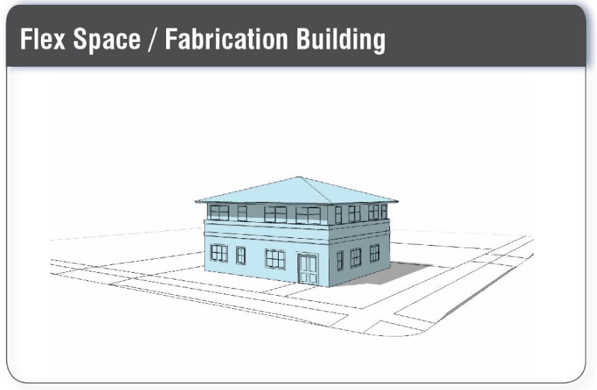
A building located and designed to accommodate a small footprint for fabrication and light industrial uses. Flex buildings are also used to provide affordable space to small and creative business enterprises.
Permitted districts: G1, G2, CD4-W, CD4-L1/L2
FIGURE 10.5A43.60 BUILDING TYPES (CONTINUED)
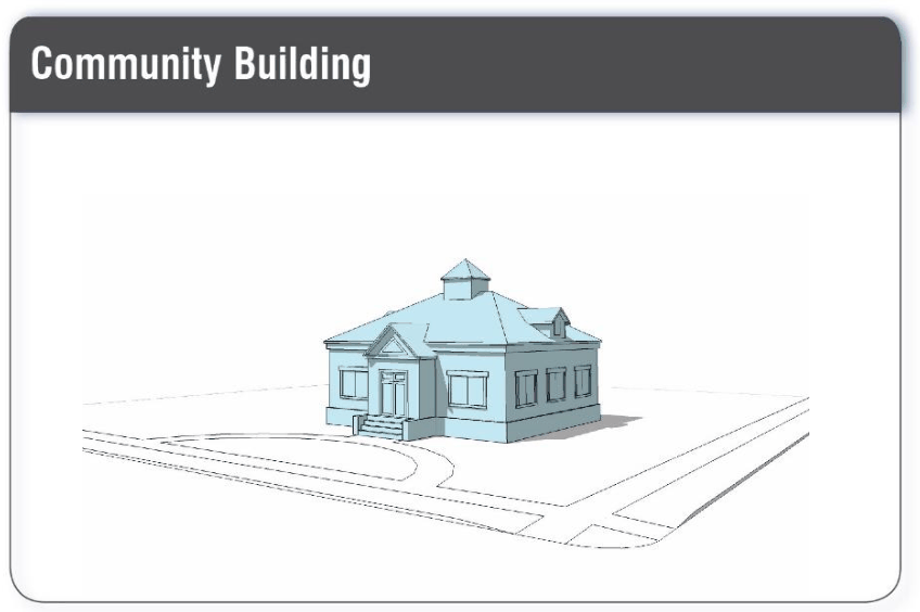
A building located and designed to accommodate public or civic uses such as a neighborhood center and similar public gathering facilities and spaces. Community Buildings may be privately owned and operated as an accessory building and amenity for a residential and mixed use developments.
Permitted districts: All Districts
Off-Street Parking and Loading Requirements
General
The number of required parking spaces shall be provided in accordance with the Site Plan Review Regulations.
Buildings, structures and uses in the Character districts and Civic districts that are also within the Downtown Overlay District shall comply with the additional standards in Section 10.643.
Number of Required Spaces
Uses in the Character districts and Civic districts that are not located in the Downtown Overlay District shall provide off-street parking in accordance with the Site Plan Review Regulations.
Uses in the Character districts and Civic districts that are included in the Downtown Overlay District shall comply with the off-street parking requirements for the Downtown Overlay District in accordance with the Site Plan Review Regulations.
Subject to approval by the Planning Board, any portion of the required off-street parking spaces may be dedicated to public use.
Parking, Loading, and Driveway Locations and Standards
All off-street parking spaces shall be located at least 20 feet behind any façade of a principal building, except when in an underground parking level. This restriction shall not apply to off-street parking for a single-family or two-family dwelling.
Parking lots and loading areas shall be screened from the street by a building or streetscreen except for any driveway.
Driveways at the street and within a required front yard shall be no wider than 24 feet.
All parking lots, garages, and parking structures shall include a pedestrian exit directly to a front lot line.
The above-ground portion of a parking structure or garage shall have a liner building at least the height of the ground floor along the entire width of any front yard except for driveways and pedestrian entrances.
A parking lot containing more than 75 parking spaces shall have least one internal pedestrian walkway at least 8 feet wide that is paved differently from the parking spaces with respect to texture, material, style, and/or color.
Parking Lot Landscaping
Parking lots that contain 10 or more spaces shall conform to the following:
Landscape islands:
Parking lots shall contain one landscaped island for every 10 parking spaces.
A parking lot with more than one landscaped island shall have such islands distributed throughout the parking lot.
Each landscaped island shall be a minimum of 325 square feet.
Trees:
Parking lots shall contain at least one tree for every 7 parking spaces.
No parking space shall be more than 75 feet from a tree within the lot, as measured from the center of the tree to the nearest line demarcating the space.
All trees shall be separated from paved surfaces by at least 3 feet.
All landscaping required pursuant to this Section 10.5A44.40 shall be located and designed in a manner to protect the vegetation from vehicular damage.
Loading Docks, Storage and Service Areas
Loading docks, storage and service areas shall not be permitted between the principal building and any front lot line.
Figure 10.5A45.10 (Community Spaces) describes the types of community spaces that may be provided as part of a development in accordance with Sections 10.5A42, 10.5A43 or 10.5A46.10.
A community space that is provided on site and otherwise qualifies as open space shall count towards the open space requirement for the development.
FIGURE 10.5A45.10 COMMUNITY SPACES
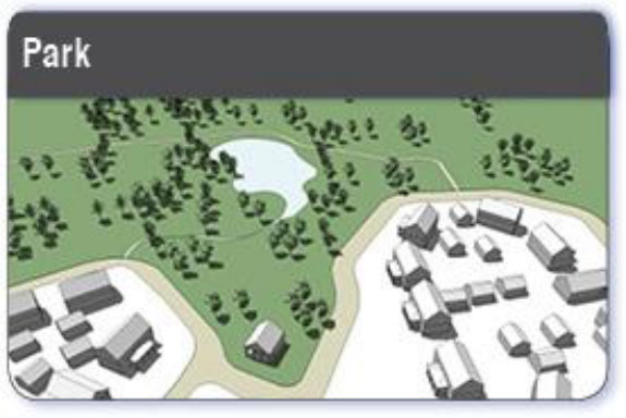
An area of natural, semi-natural, or planted space set aside for human enjoyment and recreation or for the protection of wildlife or natural habitats. A park may consist of grassy areas, trees and other natural or planted landscape features, and may also contain walking paths and trails, monuments, fountains, playground equipment, benches, picnic tables and similar amenities.
Permitted Districts: All Districts
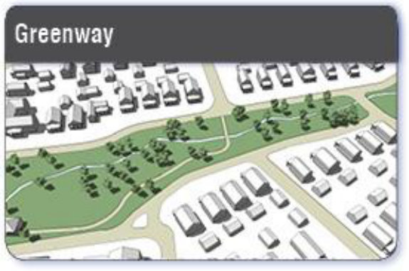
A linear community space that may follow natural corridors providing unstructured and limited amounts of structured recreation. A greenway may be spatially defined by landscaping rather than buildings. Its landscape shall consist of paths and trails, waterbodies, and trees, naturalistically disposed.
Permitted Districts: All Districts
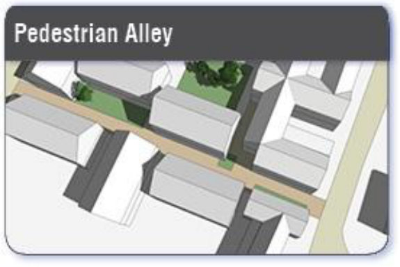
A paved/brick pedestrian connector between buildings. Pedestrian alleys provide shortcuts through long blocks and connect community spaces and parking areas with streets. Pedestrian alleys may be covered by a roof and/or lined by shopfronts. The minimum width shall be 15 feet.
Permitted Districts: All Districts
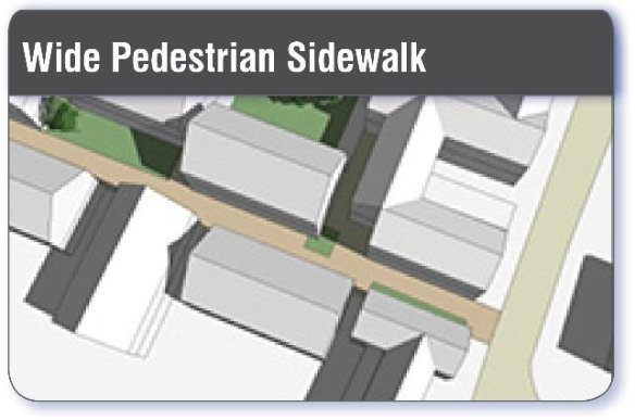
A wide pedestrian sidewalk (a minimum of 10’ in width unless otherwise defined by the Ordinance) located between the building façade and the public right of way. Wide pedestrian sidewalks provide space between the façade and the curbline for comfortable pedestrian movement, street trees and street furniture.
Permitted Districts: All Districts
FIGURE 10.5A45.10 COMMUNITY SPACES (CONTINUED)
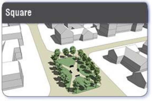
A community space available for unstructured recreation and community purposes. A square is spatially defined by buildings. Its landscape shall consist of paths, ground cover and trees, formally disposed. Squares shall be located at the intersection of important streets. The minimum size shall be 1/8 acre.
Permitted Districts: All Districts
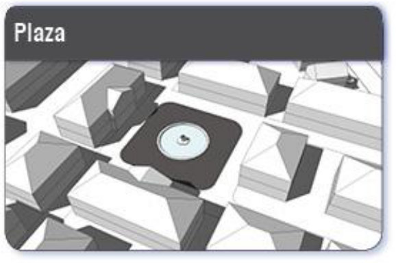
A community space available for community purposes and commercial activities. A plaza should be spatially defined by buildings. Its landscape should consist primarily of pavement. Trees are optional. Plazas should be located at the intersection of important streets. The minimum size shall be 1/8 acre.
Permitted Districts: All Districts
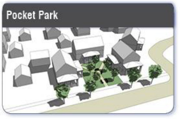
A community space available for informal activities in close proximity to neighborhood residences. A pocket park is spatially defined by buildings. Its landscape shall consist of paths, lawns and trees, formally disposed. The minimum size shall be 500 sq. ft.
Permitted Districts: All Districts
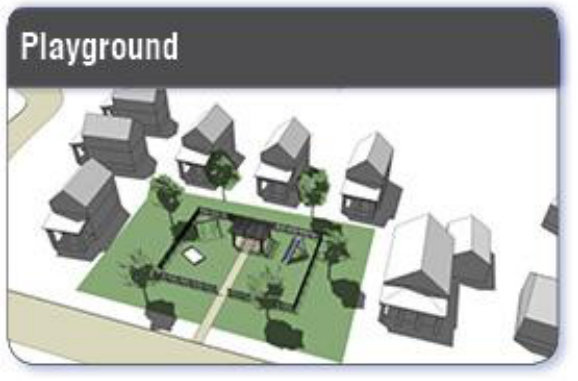
A community space designed and equipped for the recreation of children. A playground should be fenced and may include an open shelter. Playgrounds shall be interspersed within residential areas and may be placed within a block. Playgrounds may be included within parks and greens. The minimum size shall be 500 sq. ft.
Permitted Districts: All Districts
FIGURE 10.5A45.10 COMMUNITY SPACES (CONTINUED)
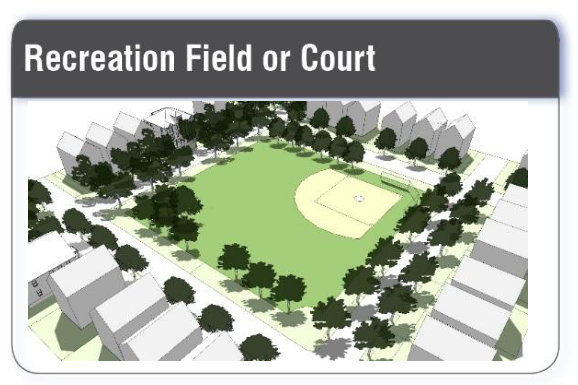
A publicly accessible open space designed and equipped for active recreation and organized sports. Playing fields and courts may include grass, artificial turf, clay, dirt, stone dust, concrete, asphalt, ice or other pervious or impervious materials to support various sporting events.
Permitted districts: All Districts
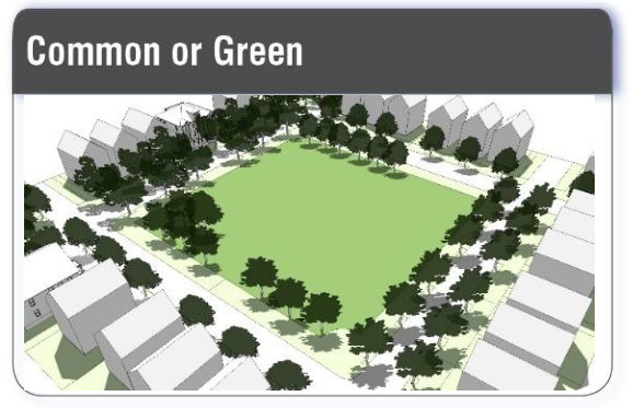
A space for active and passive recreation and gathering purposes. A common or green is a free-standing site with thoroughfares on all sides and landscape consisting of naturally disposed lawns, paths, and trees.
Permitted districts: All Districts
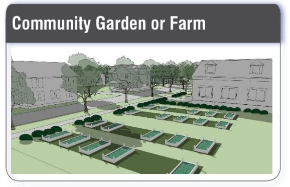
A space designed as individual garden plots available to residents for urban agriculture purposes, including storage facilities for necessary equipment. Community gardens may be freestanding or incorporated as a subordinate feature of a community park, neighborhood park, or pocket park.
Permitted districts: All Districts
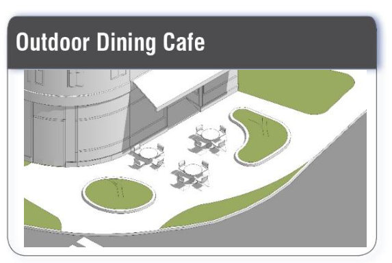
An outdoor dining cafe community space is permitted as an ancillary activity of a food and drink establishment where the principal use is otherwise allowed in the district. The area must provide deeded public access to qualify as Community Space in the Character Districts.
Permitted districts: G1, G2, CD4-L2, CD4, CD4-W, CD-5
FIGURE 10.5A45.10 COMMUNITY SPACES (CONTINUED)
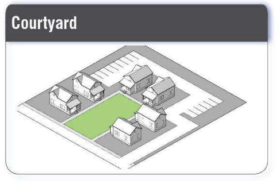
A courtyard or court is an enclosed area, often surrounded by a building or complex that is open to the sky.
Permitted districts: All Districts
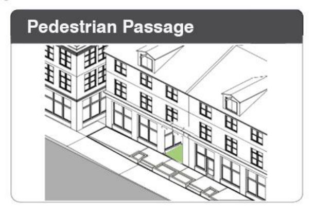
A pedestrian passage (a minimum of 8 feet in width if less than 75 feet in length and a minimum of 12 feet in width if longer than 75 feet in length)), covered by and through a building or buildings, located on the same level as, and open to, the adjacent sidewalk and any community space interior to the block. Pedestrian Passageways shall connect community space and public areas within the development to adjacent public ways. Pedestrian Passageways shall not exceed 125 feet in length.
Permitted Districts: All Districts
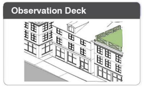
An open or covered observation deck that provides public access and amenities on either a waterfront boardwalk or deck on the roof of a building. The minimum size shall be 500 SF.
Permitted Districts: All Districts
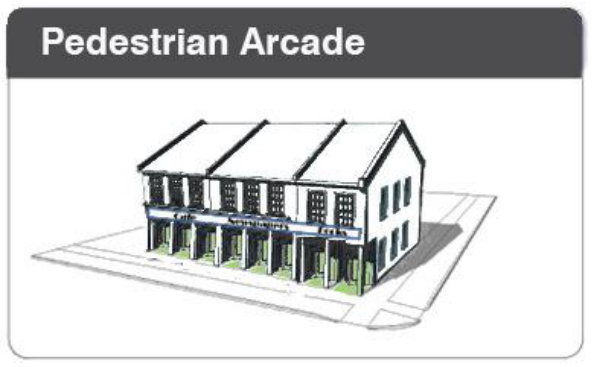
A covered pedestrian arcade, a minimum of 10 feet in width within the ground floor or street level of a building that is otherwise generally open to the adjacent sidewalks and storefronts and that provides public access to the storefronts and connects to community space areas within the development and to adjacent public ways.
Permitted Districts: All Districts
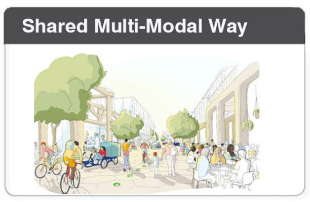
A pedestrian priority way where pedestrians, cyclists and motorists all share the multimodal way that shall be designed to promote slow vehicle travel through the use of decorative pavers, street furniture, signage and plantings commensurate to allow the entire street to function effectively as shared public space.
Permitted Districts: All Districts
Incentive Overlay Districts
The Incentive Overlay Districts are designated on Map 10.5A21B. In such areas, certain specified development standards may be modified as set forth in Section 10.5A46.10 below, if the development provides community space or workforce housing in accordance with Section 10.5A46.20, as applicable:
Incentives to Development Standards
| DEVELOPMENT STANDARDS | INCENTIVES | |
|---|---|---|
| North End Incentive Overlay District | West End Incentive Overlay District | |
| Maximum building coverage | No Change | 80% |
| Maximum building footprint | 30,000 sf | 30,000 sf¹,² |
| Maximum building block length | No Change | No Change³ |
| Minimum lot area | No Change | 2,000 sf |
| Minimum lot area per dwelling unit | No Change | No minimum |
| Maximum building height | Plus 1 story up to 10 ft⁴ | Plus 1 story up to 10 ft⁴,⁵ |
| Minimum ground story height | No Change | 9 feet |
| Minimum off-street parking | No Change | Non-residential: 25% reduction from underlying standard |
| Ground story parking | Permitted with a liner building⁶ | Permitted with a liner building⁶ |
1 In CD4-L1 and CD4-L2 the maximum building footprint shall be 3,500 SF. Where the building footprint exceeds 2,500 SF, individual building blocks shall be separated by open space, community space, or surface parking areas of at least 30 feet in width. Parking areas located between buildings are not required to be set back from the building façade.
2 For properties located within 200 feet of the North Mill Pond in the CD4-W District, the maximum building footprint shall be 20,000 sq. ft.
3 In CD4-L1 and CD4-L2 the maximum building block length shall be 100 feet.
4 In order to receive the building height incentive, the sidewalk width in front of any façade shall be at least 10 feet plus two feet for each story of building height above three stories. Any property area needed to comply with this requirement shall count as open space as required in Figures 10.5A41.10A-D (Development Standards) and as community space; even if less than 15 feet in width.
5 For parcels over 80,000 sq. ft. in area that are located south of Islington Street, up to two stories or 20 feet may be added to the maximum building height provided both requirements listed under Section 10.5A46.22 (1) and (2) are met.
6 If ground story parking is proposed, at least 50% of the ground story facing a street shall include a liner building.
Requirements to Receive Incentives to the Development Standards
For a lot located adjacent to, or within 100 feet of, North Mill Pond, Hodgson Brook or the Piscataqua River, the Planning Board may grant a conditional use permit to allow the incentive to the development standards listed under 10.5A46.20, provided the development shall include community space equal to 20% of the lot area that includes a continuous public greenway at least 20 feet in width with a multi-use path and that is parallel and located within 50 feet of the waterfront with at least a 10 foot setback from adjacent buildings. Trail connections to abutting street(s) and sidewalks shall be provided and there shall be no buildings between the waterfront and the greenway unless otherwise approved by the Planning Board. The greenway shall include legal and physical access to abutting lots or public ways. When access is not available due to current conditions on an abutting lot, provisions shall be made for future access in a location determined by the Planning Board.
For a lot that is more than 100 feet from North Mill Pond, Hodgson Brook or the Piscataqua River, the Planning Board may grant a conditional use permit to allow the incentive to the development standards listed under Section 10.5A46.20, provided the development shall include both community space and workforce housing as specified below:
Community space option – All of the following criteria shall be met:
The community space shall be a community space type that is permitted within the applicable Character district.
For developments with more than 5 dwelling units the community space shall constitute at least 10% of the gross area of the lot and shall not have any dimension less than 15 feet. For developments with five (5) or less dwelling units, 20% of the property shall be assigned community space.
The community space shall adjoin the public sidewalk and shall be open on one or more sides to the sidewalk.
The community space shall include trees and other landscaping to provide shade and reduce noise, and pedestrian amenities such as overlooks, benches, lighting and other street furniture.
The proposal is consistent with the findings, goals, and objectives of the Portsmouth Master Plan.
The community space shall be located on or adjacent to the same lot as the development, except as provided in (g) below.
The Planning Board may grant a conditional use permit to allow a proposed community space to be located on a different lot than the development if it finds that all of the following criteria will be met:
An appropriate community space cannot feasibly be provided on the same lot as the development.
The proposed community space is within the same Incentive Overlay District as the development.
The proposed community space is suited to the scale, density, uses and character of the surrounding properties.
The proposal is consistent with the findings, goals, and objectives of the Portsmouth Master Plan.
Workforce housing option – One of the following criteria shall be met:
For developments with five (5) or less dwelling units, no workforce housing units are required. For a development with more than five (5) dwelling units, at least 20% of the dwelling units within a building, shall be workforce housing units for sale (affordable to a household with an income of no more than 100 percent of the area median income for a 4-person household). Such units shall be at least 600 sq. ft. The workforce housing units shall be distributed throughout the building wherever dwelling units are located; or at least 10% of the dwelling units within a building shall be workforce housing units for rent (affordable to a household with an income of no more than 60 percent of the area median income for a 3-person household). Such units shall be at least 600 sq. ft. The workforce housing units shall be distributed throughout the building wherever dwelling units are located.
Calculations for workforce housing unit requirements shall be rounded to the nearest whole number, with 0.5 and below being rounded down.
The proposal is consistent with the findings, goals, and objectives of the Portsmouth Master Plan.
When a proposed development in an Incentive Overlay District includes community space in excess of the amount required to support a proposed incentive under Section 10.5A43.43 or Sections 10.5A46.10 through 10.5A46.22, the Planning Board may grant a conditional use permit to allow the excess community space to be credited to the developer or its assigns for use in another development in the same Incentive Overlay District.
The conditional use permit shall specify the total amount of community space provided, the portion of such community space to be credited toward incentives in the proposed development, and the amount of excess community space that may be credited toward a future project in accordance with the standards set forth in Section 10.5A43.43 or Sections 10.5A46.10 through 10.5A46.22.
The conditional use permit may allow for conveyance to the City of unimproved land in lieu of community space that conforms to the types shown in Figure 10.5A45.10, subject to the following:
The application for a conditional use permit to credit unimproved land in lieu of community space shall include a complete site plan and design for the proposed community space.
In order for a future development to receive incentive credit for the excess unimproved land, the future developer will be required to improve the land to be a conforming community space as determined by the Planning Board at the time of site plan approval, except as provided in (c) below.
At any time after receiving title to such unimproved land, the City may, at its option, improve such land to be a conforming community space. If the City exercises this option, in order for a future development to receive the incentive credit, the future developer shall pay to the City an amount representing the cost to the City of carrying out the improvements that were required to improve the land to be a conforming community space.
The terms of the conditional use permit shall be documented in a Prospective Development Incentive Agreement (PDIA) to be entered into between the developer and the Planning Department. The maximum term of a PDIA shall not exceed fifteen (15) years, following which the rights to any unused incentive shall become null and void.
The only effect of a conditional use permit and PDIA under this section shall be to increase the allowable building footprint or building height, or to reduce the required off-street parking, in accordance with Section 10.5A43.43 or Sections 10.5A46.10 through 10.5A46.22.
The granting of a conditional use permit and the execution of a PDIA under this Section 10.5A46.23 shall not be deemed to supersede or waive any of the other provisions of this Article 5A or other applicable provisions of this Ordinance, nor shall such approval be considered to represent the granting of land use approval for any future development.
Future use of the excess community space to support a future project shall require the granting of a conditional use permit by the Planning Board, whether or not the community space is on the same parcel as the future project.
§ 10.5A50Civic Districts
Purpose
Civic districts are designated to preserve existing buildings and uses which are open to the general public and owned and operated by a not-for-profit organization or entity other than the City of Portsmouth.
Standards
Permitted uses in the Civic district are uses open to the general public and dedicated to arts, culture, education, religion, recreation, government, transit, gardening, horticulture, public gathering, assembly or meeting.
Structures may be converted to other civic uses permitted under 10.5A52.10.
When specified in the Site Plan Review Regulations, Site Plan approval is required for changes made to existing structures or the lot.
New structures, alterations and expansions of existing structures in the Civic district are exempt from the requirements of 10.5A42 and 10.5A43 provided that all uses remain civic.
Structures in the Civic district that are proposed for and/or converted to non-civic uses permitted under 10.5A30 shall require Regulating Plan amendment as set forth in Section 10.5A22.
§ 10.5A60Definitions
This Section provides definitions for certain terms in Article 5A and Article 5B that are not otherwise defined in Article 5A, Article 5B, or Article 15:
Backbuilding A single-story structure connecting a principal building to an outbuilding. See Figure 10.5A42.10 (Principal Building/Backbuilding/Outbuilding).
Block The aggregate of private lots, service streets/rear alleys and rear lanes, circumscribed by streets, paths or pedestrian alleys.
Building Stepback The step-like recession in the profile of a building from the street right-of-way line to control the enclosure of the street and allow light to reach the public realm. Where height limitation requires, buildings must be setback or stepbacked from the street right-of-way line a specified distance for every added height interval.
Community space As applicable to Article 5B, an area that is privately-owned and oriented and accessible to the public, or as applicable to Article 5A, an area dedicated for public use with permanent deeded access to the City of Portsmouth. Such areas must conform to the types shown in Figure 10.5A45.10.
Development Site Any lot or group of contiguous lots owned or controlled by the same person or entity, assembled for the purpose of a single development.
Development Site Area The cumulative area of all contiguous lots that the site is composed of. Site area does not include existing or proposed right-of-way, whether dedicated or not dedicated to public use.
Entrance spacing The distance between any two publicly accessible pedestrian entrances to a building along a façade.
Façade The side of a building facing a front yard.
Façade glazing The portion of a façade that consists of transparent windows and doors.
Front lot line buildout The portion of the width of the required front yard or front building setback that is occupied by a building.
Liner building A building that is at least 20 feet deep measured from the façade and is specifically designed to mask a parking lot or a parking structure from the street. A liner building may be separated from a parking structure by community space if directly integrated with subsurface parking or vehicular access to a parking structure.
Outbuilding A building, usually located toward the rear of the same lot as a principal building, and sometimes connected to the principal building by a backbuilding. See Figure 10.5A42.10 (Principal Building/Backbuilding/Outbuilding).
Path A pedestrian way traversing a park, square or other open space, or otherwise separated from streets by landscaped areas, and ideally connecting directly with the urban sidewalk network.
Public Realm Includes exterior open spaces and linkages that are physically and/or visually accessible to the general public, during all business hours, or the majority of the day for residential buildings, regardless of ownership.
Regulating Plan The zoning map or set of maps that shows the Character districts, Municipal districts, Civic districts and any additional requirements of areas subject to, or potentially subject to, regulation by Article 5A.
Streetscreen A freestanding wall or fence built on the same plane as a façade to mask a parking lot, structure or use from the street, provide privacy to a side yard, and/or strengthen the spatial definition of the public realm.
Article 5BGateway Neighborhood Mixed Use Districts
§ 10.5B10General
Purpose
The purpose of Article 5B is to implement and support the goals of the City’s Master Plan and Housing Policy to encourage walkable mixed-use development and continued economic vitality in the City’s primary gateway areas, ensure that new development complements and enhances its surroundings, provide housing stock that is suited for changing demographics, and accommodate the housing needs of the City’s current and future workforce.
The standards set forth herein are intended to:
Promote development that is consistent with the goals of the Master Plan to create vibrant, authentic, diverse, connected and resilient neighborhoods;
Encourage high quality housing for a variety of household types and income ranges.
Guide the physical character of development by providing a menu of building and site development types that are based on established community design principles;
Create quality places by allowing for whole site development with meaningful public spaces and neighborhood centers.
Applicability
Article 5B shall apply to the Gateway Neighborhood Mixed Use Corridor (G1) and Gateway Neighborhood Mixed Use Center (G2) (collectively referred to as Gateway Neighborhood Mixed Use Districts) as shown on the City of Portsmouth Zoning Map.
No development, subdivision, re-subdivision or construction of or on any building, lot or parcel of land shall occur except in compliance with all standards and requirements for these districts.
Relationship to Other Provisions of the Zoning Ordinance
The provisions of Article 5B shall take precedence over all other provisions of the Zoning Ordinance that conflict with Article 5B.
All provisions of the Zoning Ordinance that are not specifically modified or superseded by Article 5B, or that are not in conflict with Article 5B, shall apply to lots, buildings and uses in the Gateway Neighborhood Mixed Use Districts.
Relationship to Other Regulations, Codes and Ordinances
Any proposed subdivision of land shall comply with the Subdivision Rules and Regulations, in addition to the requirements of Article 5B.
Any development that requires Site Plan Review under the Site Plan Review Regulations shall comply with such Regulations, in addition to the requirements of Article 5B.
The provisions of Article 5B do not modify or supersede any provision of the Building Code, other City ordinances or regulations, or State laws relating to the development of land.
Figures and Tables
The standards and definitions included in the figures and tables in this Article are an integral part of Article 5B.
The diagrams, photographs and illustrations contained in the figures in this Article are provided only to provide reference to certain regulating elements and indicate general character within the various districts and shall have regulatory force and effect only to that extent.
Allowed Uses
Buildings, structures, and land within the Gateway Neighborhood Mixed Use Districts shall comply with the use regulations set forth in Section 10.440, Table of Uses. The Planning Board shall be the Conditional Use Permit Granting Authority for all uses requiring a Conditional Use Permit in the Gateway Neighborhood Mixed Use Districts.
Definitions
Terms used throughout Article 5B may be defined in the figures, Section 10.5A60, Article 15 or elsewhere in the Zoning Ordinance. Terms not so defined shall be accorded their commonly accepted meanings. In the event of any conflict between the definitions in Article 5B, Article 5A, Article 15, other sections of the Zoning Ordinance, or any other local land use ordinances, rules or regulations, those of Article 5A shall take precedence unless the context clearly indicates otherwise.
§ 10.5B20General Standards for All Buildings and Development
Building Setback Encroachments
Determination of building setbacks from lot lines shall not include the exceptions specified in Section 10.515 and 10.516 as well as the following:
Chimneys and flues may encroach up to four (4) feet, provided that at least two (2) feet is maintained from the vertical plane of any lot line.
Certain Building Façade Types as permitted in 10.5B60.
Building Height, Setback and Stepback
Building Height Exceptions: Roof decks, roof gardens, and related structures and appurtenances shall not be counted in the building height limits. All other building height exceptions shall comply with Section 10.517.
Building Stepback and Street Enclosure: Buildings taller than 35 feet that front on streets with right-of-way widths of 60’ or less shall be required to be set back or stepped back from the right-of-way line in accordance with Figure 10.5B22.10. The purpose of this requirement is to enhance the pedestrian environment and prevent excessive shadowing on narrower streets in the district.
| Distance from street right-of-way line | Maximum building height |
|---|---|
| 0’ to 24’ | 35’ |
| 25’ to 49’ | 45’ |
| 50’ or more | 60’ |
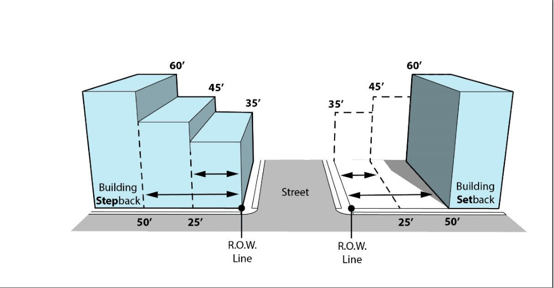
Building Setbacks and Separation: Front, side, and rear building setbacks from lot lines are specified by building type. Where buildings are located on the same lot and not attached by a common wall, the minimum separation between buildings shall be 10 feet unless otherwise specified in this Section.
Special Setback Requirements on Lafayette Road: For all lots and development sites with frontage on Lafayette Road buildings shall be setback a minimum of 70 feet and a maximum of 90 feet from the centerline of the road. For all lots and development sites with frontage on the Route 1 Bypass buildings shall be setback a minimum of 30 feet and a maximum of 50 feet from the sideline of the road.
Façade Composition Standards
Façade Glazing: For building types with specific Façade Glazing requirements as defined in Section 10.5B34, the following general standards shall apply:
Façades shall have windows and doors with highly transparent, low reflectivity glass for a percentage of the total area of a façade, measured for each story independently.
Façade glazing of a ground story façade is measured between two (2) feet and twelve (12) feet above the abutting sidewalk.
Façade glazing requirements are only applicable to façades facing a front lot line.
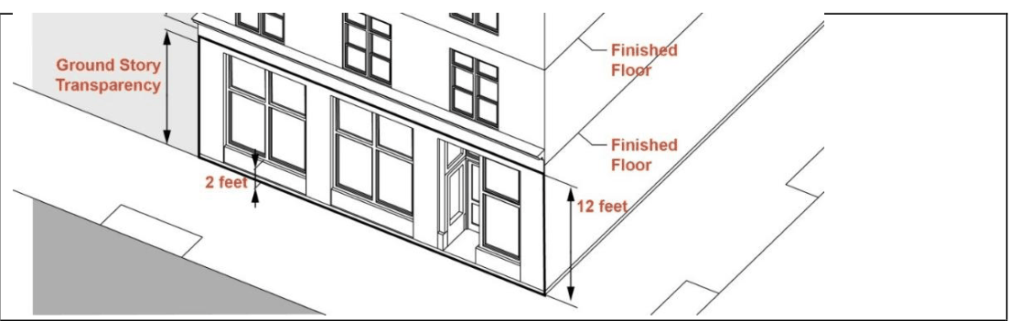
Façade Modulation (a) Building façades shall be vertically articulated with architectural bays between six (6) feet and fifty (50) feet in width to create an equal, central, and/or ends focused composition as illustrated in Figure 10.5B23.30.
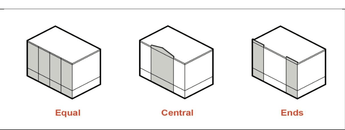
Buildings greater than one hundred (100) feet in width shall be designed to read as a series of smaller buildings with varied architectural design and façade glazing patterns or include a change in vertical plane of the façade of at least four (4) feet (in depth or projection) for at least one (1) bay in width for every one hundred (100) feet of total façade width. This change in plane applies to the entire height of the façade.
Horizontal Articulation and Massing Elements: Building façades shall be horizontally articulated with a clearly defined base, middle, and top.
Pedestrian Access: Where pedestrian access is required for specific building types, entrances shall be located on the street-facing façade of a building, provide both ingress and egress, and be operable and accessible. This requirement does not exclude the building from providing pedestrian access to the side or rear of the building.
Roof Types and Design
Roof Shapes and Rooflines: The shape and proportion of the roof shall be visually compatible with the architectural style of the building and with those of neighboring buildings. Pitched roofs shall have a minimum slope as follows:
Shed: 2:12 minimum
Hip: 3:12 minimum
Gable: 6:12 minimum to 12:12 maximum.
Gambrel: 6:12 minimum to 30:12 maximum.
Flat Roofs: Buildings with flat roofs shall be capped by an articulated parapet wall design that acts as a structural expression of the building façade and its materials, visible from all sides of the building.
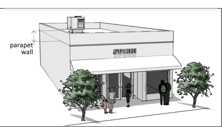
Building Length and Number of Dwelling Units
The maximum building length for residential and mixed use building types shall be no more than 200 linear feet.
Unless otherwise specified in Section 10.5B34, no more than 24 dwelling units per building shall be allowed without a conditional use permit from the Planning Board as provided in Section 10.5B72.
§ 10.5B30Building Types and Standards
General
All new buildings in the Gateway Neighborhood Mixed Use Districts shall be building types specified in this Section and defined in Section 10.5A43.60.
Building Lots
Number of Buildings: No more than one principal building type is allowed on a lot except where otherwise specified in Section 10.5B40.
Building Placement and Orientation
Building Placement: All buildings and structures must be located outside of any required front, side, or rear building setbacks from lot lines except as otherwise permitted by this Ordinance. The façade of a principal building must be built at or in front of any required maximum front building setback from the lot line for each story of a building.
Front Lot Line Build Out: All buildings must have a front lot line build out of at least 50% for residential and community building types, and 75% for commercial and mixed use buildings types.
Figure 10.5B33.21 – Front Building Setback and Front Lot Line Build Out
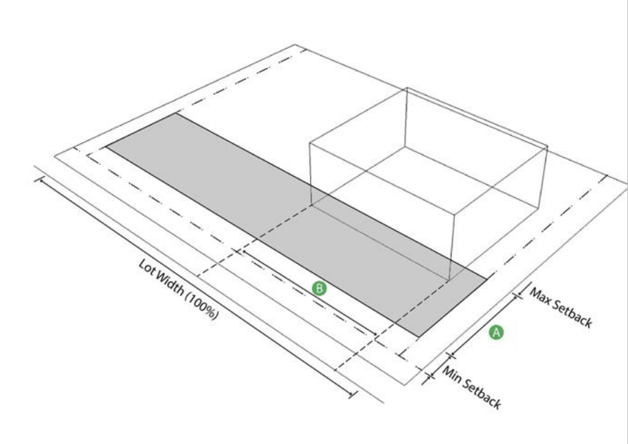
A: Minimum and maximum building front setback from lot lines; B: front lot line buildout is the width of the front façade of the building or buildings as a percentage of the total lot width.
Façade Orientation: The primary façade of a principal building must be built parallel to a front lot line or to the tangent of a curved front lot line. On a corner lot, the façade may be retracted at a 45-degree angle between the curb radius to allow for community space and for safe sight distance at the corner. All other requirements pertaining to corner visibility in Section 10.516.30 shall apply.
Building Type Standards
Cottage
| LOT STANDARDS | |
|---|---|
| Minimum lot depth | NR |
| Minimum street frontage | 30 ft |
| Front building setback from lot line | 5 ft min. to 20 ft max. |
| Minimum side building setback from lot line | 5 ft |
| Minimum rear building setback from lot line | 10 ft |
| Minimum open space coverage | 20% |
| BUILDING AND LOT USE | |
| Maximum dwelling units per building | 1 |
| Maximum dwelling unit size | 1,400 GFA; 2 Bedrooms |
| DESIGN STANDARDS | |
| Maximum building height | 1.5 stories or 20 ft |
| Minimum street facing façade height | 10 ft |
| Maximum finished floor surface of ground floor above sidewalk grade | 36” |
| Maximum building coverage | 50% |
| Maximum building footprint | 1,000 sf |
| Maximum façade modulation length | 18 ft (see Section 10.5A43.20) |
| Minimum street facing façade glazing | 20% ground floor |
| Street facing entrance | required |
| Maximum street facing entrance spacing | NR |
| Roof type | gable, hip |
| Façade types | dooryard, stoop, step, porch |
| ADDITIONAL STANDARDS | |
| Only allowed in a Pocket Neighborhood | |
| Development (see Section 10.5B41) | |
Paired House
| LOT STANDARDS | |
|---|---|
| Minimum lot depth | NR |
| Minimum street frontage | 50 ft |
| Front building setback from lot line | 10 ft min. to 30 ft max. |
| Minimum side building setback from lot line | 10 ft |
| Minimum rear building setback from lot line | 20 ft |
| Minimum open space coverage | 20% |
| BUILDING AND LOT USE | |
| Maximum dwelling units per building | 3 |
| Dwelling unit size | NR |
| DESIGN STANDARDS | |
| Maximum building height | 2.5 stories or 35 ft |
| Minimum street facing façade height | 12 ft |
| Maximum finished floor surface of ground floor above sidewalk grade | 36” |
| Maximum building coverage | 50% |
| Maximum building footprint | NR |
| Maximum façade modulation length | 18 ft (see Section 10.5A43.20) |
| Minimum street facing façade glazing | 20% ground floor |
| Street facing entrance | required |
| Maximum street facing entrance spacing | NR |
| Roof type | gable, hip, gambrel |
| Façade types | dooryard, stoop, step, porch |
| ADDITIONAL STANDARDS | |
| Only allowed in a Pocket Neighborhood | |
| Development (see Section 10.5B41) | |
Gateway Townhouse
| LOT STANDARDS | |
|---|---|
| Minimum lot depth | 50 ft |
| Minimum street frontage | 20 ft |
| Front building setback from lot line | 5 ft min. to 15 ft max. |
| Minimum side building setback from lot line | 10 ft |
| Minimum rear building setback from lot line | 15 ft |
| Minimum open space coverage | 20% |
| BUILDING AND LOT USE | |
| Maximum dwelling units per building | 1 |
| Maximum dwelling unit size | NR |
| DESIGN STANDARDS | |
| Maximum building height | 2.5 stories or 35 ft |
| Minimum street facing façade height | 12 ft |
| Maximum finished floor surface of ground floor above sidewalk grade | 36” |
| Maximum building coverage | 50% |
| Maximum building footprint | NR |
| Maximum façade modulation length | required every 4th Unit (see Section 10.5A43.20) |
| Minimum street facing façade glazing | 20% ground floors |
| Street facing entrance | required |
| Maximum street facing entrance spacing | NR |
| Roof type | all |
| Façade types | dooryard, stoop, recessed entry, step, porch |
| ADDITIONAL STANDARDS | |
| A maximum of 8 units can be attached by a common wall before a separation of 20 feet or more is required. | |
Apartment Building
| LOT STANDARDS | |
|---|---|
| Minimum lot depth | NR |
| Minimum street frontage | 50 ft |
| Front building setback from lot line | 10 ft min. to 30 ft max. |
| Minimum side building setback from lot line | 15 ft |
| Minimum rear building setback from lot line | 20 ft |
| Minimum open space coverage | 20% |
| BUILDING AND LOT USE | |
| Dwelling units per building | 4 min. to 24 max. |
| Maximum dwelling unit size | NR |
| DESIGN STANDARDS | |
| Maximum building height | 4 stories or 50 ft |
| Minimum street facing façade height | 24 ft |
| Maximum finished floor surface of ground floor above sidewalk grade | 36” |
| Maximum building coverage | 50% |
| Maximum building footprint | NR |
| Maximum façade modulation length | 50 ft (see Section 10.5A43.20) |
| Minimum street facing façade glazing | 20% ground floor |
| Street facing entrance | required |
| Maximum street facing entrance spacing | NR |
| Roof type | All |
| Façade types | forecourt, recessed entry, dooryard, step, porch |
Live/Work Building
| LOT STANDARDS | |
|---|---|
| Minimum lot depth | NR |
| Minimum street frontage | 20 ft |
| Front building setback from lot line | 0 ft min. to 15 ft max. |
| Minimum side building setback from lot line | 10 ft |
| Minimum rear building setback from lot line | 20 ft |
| Minimum open space coverage | 15% |
| BUILDING AND LOT USE | |
| Maximum dwelling units per building | 1 |
| Maximum dwelling unit size | NR |
| DESIGN STANDARDS | |
| Maximum building height | 2.5 stories or 35 ft |
| Minimum street facing façade height | 18 ft |
| Finished floor surface of ground floor above sidewalk grade | 0” min. to 24” max. |
| Maximum building coverage | 50% |
| Maximum building footprint | NR |
| Maximum façade modulation length | 18 ft (see Section 10.5A43.20) |
| Minimum street facing façade glazing | 50% ground floor |
| Street facing entrance | required |
| Maximum street facing entrance spacing | NR |
| Roof type | all |
| Façade types | dooryard, recessed entry, porch, shopfront, terrace |
Small Commercial Building
| LOT STANDARDS | |
|---|---|
| Minimum lot depth | NR |
| Minimum street frontage | 50 ft |
| Front building setback from lot line | 0 ft min. to 20 ft max. |
| Minimum side building setback from lot line | 10 ft |
| Minimum rear building setback from lot line | 15 ft |
| Minimum open space coverage | 10% |
| BUILDING AND LOT USE | |
| Maximum dwelling units per building | NR |
| Maximum dwelling unit size | NR |
| DESIGN STANDARDS | |
| Maximum building height | 3 stories or 40 ft |
| Minimum street facing façade height | 18 ft |
| Maximum finished floor surface of ground floor above sidewalk grade | 24” |
| Maximum building coverage | 70% |
| Maximum building footprint | 10,000 sf |
| Maximum façade modulation length | 50 ft (see Section 10.5A43.20) |
| Minimum street facing façade glazing | 50% ground floor |
| Street facing entrance | required |
| Maximum street facing entrance spacing | NR |
| Roof type | all |
| Façade types | forecourt, recessed entry, porch, officefront, shopfront, terrace, gallery, arcade |
Large Commercial Building
| LOT STANDARDS | |
|---|---|
| Minimum lot depth | NR |
| Minimum street frontage | 100 ft |
| Front building setback from lot line | 0 ft min. to 50 ft max. |
| Minimum side building setback from lot line | 15 ft |
| Minimum rear building setback from lot line | 15 ft |
| Minimum open space coverage | 10% |
| BUILDING AND LOT USE | |
| Maximum dwelling units per building | NR |
| Maximum dwelling unit size | NR |
| DESIGN STANDARDS | |
| Maximum building height | 4 stories or 50 ft |
| Minimum street facing façade height | 18 ft |
| Maximum finished floor surface of ground floor above sidewalk grade | 24” |
| Maximum building coverage | 70% |
| Maximum building footprint | 40,000 sf |
| Maximum façade modulation length | 100 ft (see Section 10.5A43.20) |
| Minimum street facing façade glazing | 50% ground floor |
| Street facing entrance | required |
| Maximum street facing entrance spacing | NR |
| Roof type | all |
| Façade types | forecourt, recessed entry, porch, officefront, shopfront, terrace, gallery, arcade |
Mixed Use Building
| LOT STANDARDS | |
|---|---|
| Minimum lot depth | NR |
| Minimum street frontage | 50 ft |
| Front building setback from lot line | 0 ft min. to 50 ft max. |
| Minimum side building setback from lot line | 15 ft |
| Minimum rear building setback from lot line | 20 ft |
| Minimum open space coverage | 20% |
| BUILDING AND LOT USE | |
| Maximum dwelling units per building | 24 |
| Maximum dwelling unit size | NR |
| DESIGN STANDARDS | |
| Maximum building height | 4 stories or 50 ft |
| Minimum street facing façade height | 18 ft |
| Maximum finished floor surface of ground floor above sidewalk grade | 24” |
| Maximum building coverage | 60% |
| Maximum building footprint | 20,000 sf |
| Maximum façade modulation length | 100 ft (see Section 10.5A43.20) |
| Minimum street facing façade glazing | 50% ground floor |
| Street facing entrance | required |
| Maximum street facing entrance spacing | NR |
| Roof type | all |
| Façade types | forecourt, recessed entry, porch, officefront, shopfront, terrace, gallery, arcade |
Flex Space/Fabrication Building
| LOT STANDARDS | |
|---|---|
| Minimum lot depth | NR |
| Minimum street frontage | 50 ft |
| Front building setback from lot line | 0 ft min. to 30 ft max. |
| Minimum side building setback from lot line | 20 ft |
| Minimum rear building setback from lot line | 20 ft |
| Minimum open space coverage | 10% |
| BUILDING AND LOT USE | |
| Maximum dwelling units per building | NR |
| Maximum dwelling unit size | NR |
| DESIGN STANDARDS | |
| Maximum building height | 2.5 stories or 40 ft |
| Minimum street facing façade height | 12 ft |
| Maximum finished floor surface of ground floor above sidewalk grade | 24” |
| Maximum building coverage | 70% |
| Maximum building footprint | 20,000 sf |
| Maximum façade modulation length | 100 ft (see Section 10.5A43.20) |
| Minimum street facing façade glazing | 20% ground floor |
| Street facing entrance | required |
| Maximum street facing entrance spacing | NR |
| Roof type | all |
| Façade types | dooryard, recessed entry, officefront, shopfront, terrace |
Community Building
| LOT STANDARDS | |
|---|---|
| Minimum lot depth | NR |
| Minimum street frontage | 50 ft |
| Front building setback from lot line | 10 ft min. to 40 ft max. |
| Minimum side building setback from lot line | 15 ft |
| Minimum rear building setback from lot line | 20 ft |
| Minimum open space coverage | 20% |
| BUILDING AND LOT USE | |
| Maximum dwelling units per building | NR |
| Maximum dwelling unit size | NR |
| DESIGN STANDARDS | |
| Maximum building height | 3 stories or 45 ft |
| Minimum street facing façade height | 18 ft |
| Finished floor surface of ground floor above sidewalk grade | 2 ft min. to 6 ft max. |
| Maximum building coverage | NR |
| Maximum building footprint | NR |
| Maximum façade modulation length | 100 ft (see Section 10.5A43.20) |
| Minimum street facing façade glazing | 30% ground floor |
| Street facing entrance | required |
| Maximum street facing entrance spacing | NR |
| Roof type | all |
| Façade types | dooryard, forecourt, stoop, recessed entry, step, porch, terrace, gallery, arcade |
§ 10.5B40Development Site Standards
General
Allowed by Conditional Use Permit approval from the Planning Board, a development site is any lot or group of contiguous lots owned or controlled by the same person or entity, assembled for the purpose of a single development and including more than one principal building or building type. Unless otherwise specified by this Ordinance, development site standards as provided in this Section supersede lot dimensional standards for individual building types provided in Section 10.5B34 including lot depth, street frontage, building coverage, and open space coverage. Where no equivalent development site standard is provided, the building type standards shall apply.
Site Area: Development site area is the cumulative area of all contiguous lots that the site is composed of.
Site Width: Development site width is the cumulative width of all contiguous lots that the site is composed of and measured along the front lot line between the side lots of the development site.
Site Depth: Development site depth is the distance between the front and rear property lines measured along a line midway between the outside edge of all contiguous lots.
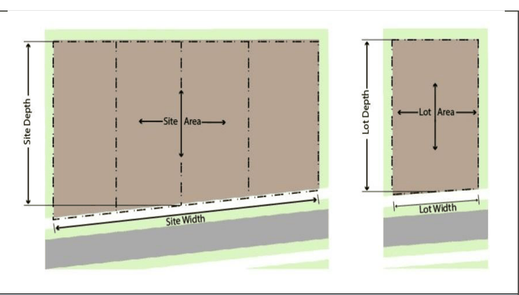
Permitted Building Types: A development site may include a combination of building types as permitted in Section 10.5B43 that are assembled on an individual lot or group of contiguous lots for the purpose of a single development.
Perimeter Buffer: The perimeter buffer requirements apply to the outside boundary of the development site where the site abuts adjoining properties that are not part of the development site, but not along the primary street frontage. In addition to the minimum perimeter buffer required, the Planning Board may require landscaping, fencing, or an increase in the building setback from lot lines where adjacent land uses may be incompatible. Perimeter buffer requirements supersede parking setback requirements and building setbacks from lot lines requirements for individual building types.
Development Block Standards: These standards establish maximum block length along public streets or private accessways within a development site as a method to ensure that access and walkability are integrated into the placement of buildings, community spaces, and site utility areas. Generally, blocks are laid out in order to orient buildings to the street and public realm while concentrating utility elements such as electrical service, parking, and refuse collection to the center of blocks, at the rear of the buildings.
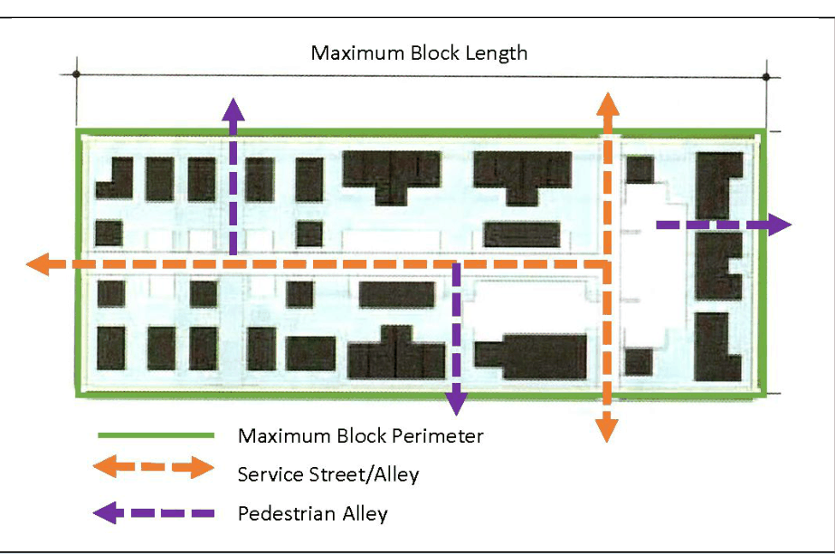
Size and Dimension: Each development site has a standard for the maximum block length and block perimeter under Section 10.5B42 and illustrated in Figure 10.5B41.70 above.
Access and Service: Where shared parking areas or community spaces are located within the interior of the block, a vehicular and/or pedestrian accessway shall be provided every 200 linear feet along a block face.
Open Space and Community Space Coverage
Unless otherwise specified in this Ordinance, community space coverage shall be counted toward the minimum required open space coverage for the development site.
Public Street Frontage: All development sites must have a minimum of 50 feet of frontage on a public street providing access to internal accessways located within the development sites. All development sites with direct access to Lafayette Road must have a minimum of 100 feet of frontage along the corridor.
Development Site Standards
Pocket Neighborhood Development
A Pocket Neighborhood is a cohesive cluster of homes gathered around a variety of common open space amenities. In the Gateway Neighborhood Mixed Use Districts, the following Pocket Neighborhood Development Sites are permitted:
Cottage Court: This Pocket Neighborhood consists of multiple small, detached single family dwellings, arranged around a courtyard. The shared courtyard takes the place of private yard space and becomes an important community-enhancing element of this development site. The cottage court is appropriately scaled to fit within or nearby medium-density neighborhoods. The pocket neighborhood enables appropriately scaled, well-designed, higher density developments important for providing a broad choice of housing types in a walkable environment. Cottage courts consist of cottages, paired houses, and community building types meeting the design standards in Table 10.5B34 and the density thresholds in Section 10.5B70.
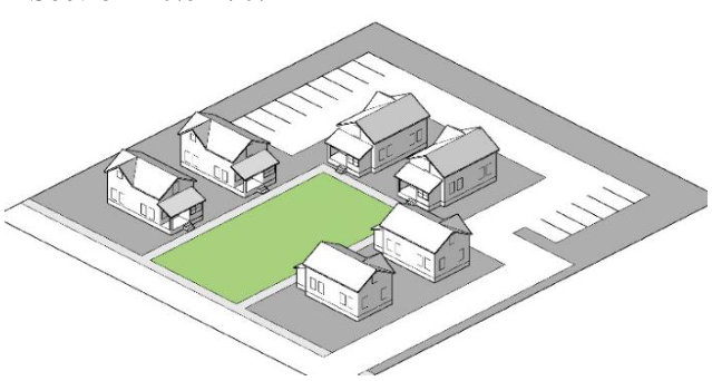
Cohousing/Housing Cooperative: Cohousing is a community of private dwellings clustered around shared building and community spaces. Each attached or single family dwelling has traditional residential amenities, including a private kitchen. Shared spaces typically feature a common house, which may include a large kitchen and dining area, laundry, and recreational spaces. Other shared spaces include community garden plots, recreational fields, and shared work spaces. Cohousing developments consists of cottages, paired houses, and community building types meeting the design standards in Table 10.5B33 and the density thresholds in Section 10.5B70.
| DEVELOPMENT STANDARDS | |
|---|---|
| Minimum development site area | 10,000 sf |
| Minimum site width | 75 ft |
| Minimum site depth | 100 ft |
| Minimum perimeter buffer | NR |
| Maximum development block dimensions | block length 300 ft; block perimeter 1,200 linear ft |
| Maximum building coverage | 50% |
| Minimum open space coverage | 20% |
| Community space types | greenway, courtyard, park, pocket park, playground, recreation field or court, community garden, common or green |
| PERMITTED BUILDING TYPES | |
| Cottages, paired houses, community buildings | |
| ADDITIONAL STANDARDS | |
| Maximum cottage unit size | 1,400 GFA and 2 bedrooms |
| Maximum cohousing unit size | 1,800 GFA and 3 bedrooms |
| Minimum courtyard design | 3,000 GFA and 40 ft width |
| Minimum courtyard area per dwelling unit | 600 sf |
| Buildings shall be centered on a common courtyard in groups of 16 or less. | |
| Cottage courts and cohousing developments may include a community garden, common house, co-work space, and other common access site amenities. | |
| For cottage court development blocks, the cottages will face a central courtyard in the interior areas of the block, and a service road will provide access to parking areas and building lots along the perimeter of the block. | |
A development project containing multiple residential, nonresidential, and mixed use building types. Mixed Use Developments may include a combination of horizontally and vertically mixed buildings and uses on site subject to all applicable building type standards in Section 10.5B30.
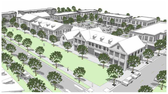
| DEVELOPMENT STANDARDS | |
|---|---|
| Minimum development site area | 20,000 sf |
| Minimum site width | 100 ft |
| Minimum site depth | 100 ft |
| Minimum perimeter buffer | 75 ft from a Residential District, Mixed Residential District, or Character District 4-L1 |
| Maximum development block dimensions | block length 800 ft; block perimeter 2,200 linear ft |
| Maximum building coverage | 70% |
| Minimum open space coverage | 20% |
| Community space types | all |
| PERMITTED BUILDING TYPES | |
| apartment building, gateway townhouse, live/work building, small commercial building, large commercial building, mixed use building, small flex space/fabrication building, community building | |
General Residential Development
A development project containing one or more residential building types in accordance with allowed building types and design standards in Section 10.5B34.
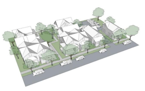
| DEVELOPMENT STANDARDS | |
|---|---|
| Minimum development site area | 10,000 sf |
| Minimum site width | 75 ft |
| Minimum site depth | 100 ft |
| Minimum perimeter buffer | 75 ft from a Residential District, Mixed Residential District, or Character District 4-L1 |
| Maximum development block dimensions | block length 500 ft; block perimeter 1,500 linear ft |
| Maximum building coverage | 50% |
| Minimum open space coverage | 20% |
| Community space types | greenway, park, pocket park, playground, recreation field or court, common or green, community garden, square, plaza |
| PERMITTED BUILDING TYPES | |
| apartment building, gateway townhouse, live/work building, community building | |
General Commercial Development
A development project containing one or more commercial building types in accordance with allowed building types and design standards in Section 10.5B34.
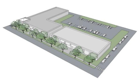
| DEVELOPMENT STANDARDS | |
|---|---|
| Minimum development site area | 10,000 sf |
| Minimum site width | 75 ft |
| Minimum site depth | 100 ft |
| Minimum perimeter buffer | 100 ft from a Residential District, Mixed Residential District, or Character District 4-L1 |
| Maximum development block dimensions | block length 700 ft; block perimeter 2,000 linear ft |
| Maximum building coverage | 70% |
| Minimum open space coverage | 10% |
| Community space types | park, pedestrian alley, wide pedestrian sidewalk, common or green, outdoor dining café, greenway, square, plaza, courtyard |
| PERMITTED BUILDING TYPES | |
| small commercial building, large commercial building, small flex space/fabrication building | |
Review and Approval Process
Conditional Use Permit Criteria: Prior to granting a conditional use permit for development sites in the Gateway Neighborhood Mixed Use Districts according to the requirements of this Article, the Planning Board shall make the following findings.
The development project is consistent with the Portsmouth Master Plan.
The development project has been designed to allow uses that are appropriate for its context and consistent with City’s planning goals and objectives for the area.
The project includes measures to mitigate or eliminate anticipated impacts on traffic safety and circulation, demand on municipal services, stormwater runoff, natural resources, and adjacent neighborhood character.
The project is consistent with the purpose and intent set forth in Section 10.5B11.
§ 10.5B50Pre-Existing Buildings and Lots
Purpose
The purpose of this section is to establish standards for the continued utilization of existing buildings in Gateway Neighborhood Mixed Use Districts constructed prior to the effective date of Article 10.5B. Where the provisions of this section conflict with Article 3: Non-Conforming Lots, Buildings, Uses and Structures, this section shall apply.
Non-Conforming Building Additions and Retrofits
A building in the Gateway Neighborhood Mixed Use Districts that existed prior to the effective date of Article 5B may be expanded or altered without complying with all of the standards of Section 10.5B34, but shall comply with the following minimum standards for the allowed building type as defined in 10.5A36.60 that is most similar to the existing building:
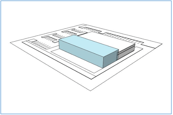
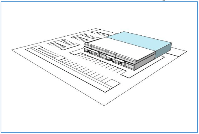
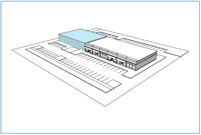
Story Addition: Story additions are allowed up to the maximum story and building height for the specified building type.
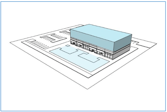
Residential Density: Maximum density is 1 dwelling unit per 2,000 gross floor area of the existing building being converted or expanded for residential use.
New Buildings
New building(s) that are constructed on a lot or development site that includes one or more non-conforming buildings that existed prior to the effective date of Article 5B, shall comply with the standards for development sites as required by Section 10.5B40 except as follows:
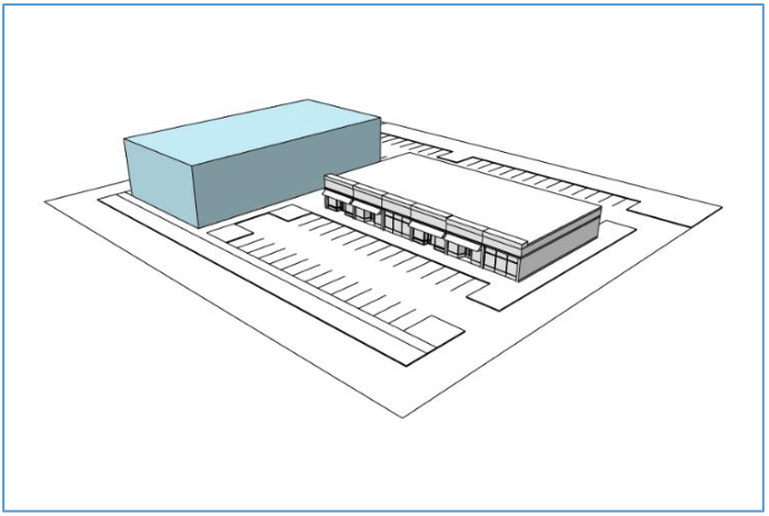
§ 10.5B60Building Façade Types
General
At least one (1) façade type as defined in Section 105A43.10 is required for each principal building type.
Permitted Building Façade Types by Building Type
Building Façade Types
| BUILDING TYPES | ||||||||
|---|---|---|---|---|---|---|---|---|
| FAÇADE TYPES | A. Cottage | B. Paired House | C. Apartment Building | D.Gateway Townhouse | E. Live/Work Building | F. Large and Small Commercial Building | G. Mixed-Use Building | H. Flex Space/ Fabrication Building |
| A. Dooryard | P | P | P | P | P | P | ||
| B. Forecourt | P | P | P | |||||
| C. Stoop | P | P | P | |||||
| D. Recessed Entry | P | P | P | P | P | P | ||
| E. Step | P | P | P | P | ||||
| F. Porch | P | P | P | P | P | P | P | |
| G. Officefront | P | P | P | |||||
| H. Shopfront | P | P | P | P | ||||
| I. Terrace | P | P | P | P | ||||
| J. Gallery | P | P | ||||||
| K. Arcade | P | P | ||||||
P = Permitted
§ 10.5B70Density Thresholds and Bonuses
Residential Density
New development or redevelopment that consists of one principal residential or mixed residential building according to the standards for building type in Section 10.5B34 on a single lot shall comply with the following density requirements for the maximum number of dwelling units per acre.
Dwelling Units Per Acre
P = Permitted CU = Conditional Use Permit under the provisions for Density Bonuses in Section 10.5B72
New development or redevelopment that is constructed according to the standards for a development site in Section 10.5B43 shall comply with the density requirement for the maximum number of dwelling units per acre for all of the buildings in the development.
Dwelling Units Per Acre
| Development Sites | Gateway Corridor (G1) | Gateway (G2) | Center | |
|---|---|---|---|---|
| P | CU | P | CU | |
| Pocket Neighborhood | 16 | 20 | 12 | 16 |
| Mixed Use Development | 20 | 36 | 20 | 36 |
| General Residential Development | 20 | 36 | 20 | 36 |
P = Permitted CU = Conditional Use Permit under the provisions for Density Bonuses in Section 10.5B72
Density Bonus Incentives
A conditional use permit may be granted by the Planning Board for increased housing density or for increased building height and footprint as described in this section. Such conditional use permit shall be contingent upon satisfying the requirements of Section 10.5B73.
Dwelling Units Per Building: The Planning Board may, by conditional use permit, allow up to a maximum of 36 dwelling units per building.
Dwelling Units per Acre: The Planning Board may, by conditional use permit, allow higher density up to the maximum established in Section 10.5B71.
Building Height and Building Footprint: The Planning Board may, by conditional use permit, allow an increase in the maximum building height by one (1) story or 10’ and an increase in the maximum building footprint and square footage by 20 percent.
Bonus Incentive Requirements
In order to be eligible one of the bonus incentives outlined in section 10.5B72, a development shall include workforce housing according to the requirements of 10.5B73.10. In order to be eligible for multiple bonus incentives outlined in Section 10.5B72 a development shall also provide public realm improvements according to the requirements of 10.5B73.20. Required documentation for these improvements must be submitted with the application as outlined in Section 10.5B74.
Workforce Housing Requirement: At least 20% of the dwelling units in the development, but no less than three units, shall be workforce housing units for sale or rent complying with the following criteria:
For sale units shall be at least the average gross floor area of the proposed units in the building or 1,000 sq. ft., whichever is greater.
Rental units shall be at least the average gross floor area of the proposed units in the building or 800 sq. ft., whichever is greater.
The workforce housing units shall be distributed throughout the building wherever dwelling units are located.
Public Realm Improvements: All public realm improvements used for a density bonus shall be recommended in plans adopted by the City of Portsmouth including but not limited to the Master Plan, Bicycle and Pedestrian Plan, and Capital Improvement Program. Eligible improvements include the following:
Design and construction of an off-road trail or path that is at least equal to the linear public street frontage of the site and expands the Portsmouth Bicycle and Pedestrian Network consistent with the Portsmouth Bicycle and Pedestrian Plan. The trail or path shall be located on or adjacent to the project’s building lot or development site, except as provided in (4) below.
Design and construction of a public park or athletic facility that is designed for active or passive recreation equal to at least 20% of the project’s gross floor area that is located on or adjacent to the project’s building lot or development site, except as provided in (d) below.
On-site public realm improvements provided for the purpose of satisfying the requirements of this section shall not be counted toward the required minimum community space coverage.
The Planning Board may allow a proposed public realm improvement to be located on a different lot than the development it if finds that all of the following criteria will be met:
An appropriate public realm improvement cannot feasibly be provided on the same lot as the development.
The proposed public realm improvement is within the same Zoning District as the development.
Approval of Density Bonus Incentives
Required Information: In order to be eligible for bonus incentives as described in 10.5B72, the following submissions must be included with an application for a Conditional Use Permit:
A description of the workforce housing units, identifying quantity, location, and type;
Documentation that the proposed units qualify as workforce housing units as defined by this Ordinance;
Proposed covenant or other legally binding documents that provide enforceable restrictions as to price and occupancy to ensure long-term availability and affordability of the units.
Public Realm Improvements:
A written description of the intended site development or District improvements, the relevant City plan, the public benefit provided, provision for design, construction, management and maintenance if required, and plans showing the location and type, size and extent of each of the eligible improvements.
A specific time frame for the completion of all required on-site and off-site improvements shall be incorporated as a condition of approval of the Planning Board.
A list of all permits and approvals required in connection with any proposed public realm improvements with the application. These approvals shall be obtained prior to approval of the development, unless authorized by the Planning Board.
Any requests by the applicant for the Planning Board to modify specific standards and requirements set forth in this Section 10.5B70 as allowed under Section 10.5B74.30 and a detailed justification for the requested modification.
Planning Board Findings: Prior to granting a conditional use permit for density bonus incentives under this section, the Board shall make the following findings:
The proposed project (and any conditions of approval) satisfies the requirements in Section 10.5B73;
The proposed project is consistent with the purpose and intent set forth in Section 10.5B11.
Modification of Standards: In granting a conditional use permit, the Planning Board may modify specific standards and requirements set forth in Section 10.5B20, 10.5B30, 10.5B40 and 10.5B70 provided that the Planning Board finds such modification will promote design flexibility and overall project quality, or that such modification is required for the development to provide a proposed workforce housing component, and that such modification is consistent with the purpose and intent set forth in Section 10.5B11.
In considering a request for a modification of the standards and requirements, the Planning Board may request that the applicant provide additional documentation and information from the applicant demonstrating that the requirements of this Ordinance are prohibitive to the successful completion of the project as proposed. Such information shall include, but not be limited to, project cost factors related to land acquisition, improvements for roads, utilities & drainage, insurance, labor, building materials, and profit to identify a total gross cost of the project and per unit gross costs.
§ 10.5B80Parking and Loading Requirements and Standards
General
Except as otherwise provided in this Section, all buildings, structures, uses, and development sites in the Gateway Neighborhood Mixed Use Districts shall comply with the off-street parking and loading requirements set forth in Section 10.1110 and Section 10.1120.
Number of Required Spaces
Uses in the Gateway Neighborhood Mixed Use Districts shall provide off-street parking in accordance with the Site Plan Review Regulations, except as follows:
For developments located on a public transit route with year-round, 5-days-per-week, fixed-route service and where at least 50% of the building(s) are within ¼ mile of a transit stop, the minimum off-street parking required for motor vehicles shall be reduced by 20% of the total required for all uses.
Location of Motor Vehicle Parking Facilities
Required off-street parking spaces shall not be located between a principal building and a street or within any required perimeter buffer area.
Development sites that include multiple lots shall not be subject to requiring off-street parking spaces to be located on the same lot as the principal use. Off-street parking spaces shall be located within the same development site for the principal use they are intended to serve.
§ 10.5B90Pedestrian Access and Circulation
At least one 8-foot wide pedestrian walkway shall be provided throughout the lot/site, connecting adjacent streets, accessways, sidewalks and off-street parking areas to the entrances of all principal buildings.
Pedestrian areas shall be clearly distinguished from vehicular and bicycle traffic areas through the use of paving materials, landscaping, or other means.
A lot/site with more than one principal building or off-street parking area shall include an internal pedestrian network that provides logical and direct routes for pedestrians throughout site.
Parking lots shall include internal walkways spaced not more than 150 feet apart. Where possible, these walkways shall be aligned to connect with major building entries or other destinations.
§ 10.5B100Community Space
General Requirements
Community spaces meeting one or more of the types described in Figure 10.5A45.10 must be provided according to the standards for development sites as described in Section 10.5B40.
A community space that is provided on-site and otherwise qualifies as open space as defined by this Ordinance shall count towards the open space coverage requirement for the development.
Permitted Community Spaces by Development Site Type
Only community space Types that are listed as permitted shall count toward the required community space coverage requirement specified for the development site.
| COMMUNITY SPACE TYPES | DEVELOPMENT SITES | |||
|---|---|---|---|---|
| Mixed Use Development | Pocket Neighborhood | General Residential Development | General Commercial Development | |
| Park | P | P | P | P |
| Greenway | P | P | P | P |
| Pedestrian Alley | P | P | P | |
| Wide Pedestrian Sidewalk | P | P | P | |
| Pocket Park | P | P | P | P |
| Playground | P | P | P | |
| Recreation Field | P | P | P | |
| Common or Green | P | P | P | P |
| Community Garden | P | P | P | |
| Outdoor Dining Cafe | P | P | ||
| Square | P | P | P | |
| Plaza | P | P | P | |
| Courtyard | P | P | P | P |
P = Permitted
Article 6Overlay Districts
§ 10.610Overlay Districts Generally
Relationship to Underlying Zoning Districts
Overlay districts apply special rules to manage land use in specific areas that may be portions of a single zoning district or that may overlap two or more zoning districts. The rules for overlay districts supplement the regulations contained in other sections of this Ordinance. Except as specifically provided otherwise in the regulations for an overlay district, all regulations of the underlying zoning district shall apply. Where there is a conflict between the regulations of an overlay district and those of the underlying district, the overlay district regulations control.
Establishment of Overlay Districts
The following overlay districts are established:
¹ Administrative note: See Section 10.5A46 for North End Incentive Overlay District and West End Incentive Overlay District descriptions and requirements.
Overlay District Locations
The Floodplain District (FP) consists of:
all lands designated as special flood hazard areas by the Federal Emergency Management Agency (FEMA) in its “Flood Insurance Study for the County of Rockingham County, NH” dated January 29, 2021 or as amended, together with associated Flood Insurance Rate Maps (FIRM) dated January 29, 2021 or as amended, which are declared to be part of this Ordinance and are hereby incorporated by reference; and
all extended flood hazard areas as defined in Section 10.622.20, each of which shall be contiguous and adjacent to a special flood hazard area and shall be delineated on the basis of mapped or surveyed elevations.
The Historic District is identified on the Zoning Map.
The Downtown Overlay District (DOD) is identified on the Zoning Map.
The Osprey Landing Overlay District (OL) is identified on the Zoning Map.
The Airport Approach Overlay District (AA) consists of:
the Approach Zones shown on the Airport Obstruction Chart AOC 678 with the associated Obstruction Data Sheet ODS 678 (Surveyed October 1990, 1st Edition, for Pease Air Force Base, Portsmouth, NH), along with two detailed drawings (Exhibits 1 and 2), a legend (Exhibit 3), and the accompanying FAR Part 77.25, Civil Airport Imaginary Surfaces (Exhibit 4), all of which documents collectively are hereinafter called the “Airport Obstruction Chart” or “AOC”; and
all the land within a distance of two miles from the airport reference point shown on the Pease International Tradeport Approach Map.
The Highway Noise Overlay District (HN) is identified on the Zoning Map.
§ 10.620Floodplain District
Purpose
The regulations in this Section shall apply to land in the Floodplain District, and shall overlay and supplement the regulations of any underlying district.
If any provision of this Section differs or appears to conflict with any other provision of the Zoning Ordinance or other ordinance or regulation, the provision imposing the greater restriction or more stringent standard shall be controlling.
Definitions
Rules of Construction
The definitions of words and terms in Section 10.622.20 apply to the Floodplain District regulations (Section 10.620).
When a term is used in the Floodplain District Regulations and is defined in Section 10.622.20, it shall have that meaning, which shall supersede any definition in Article 15.
When a term is used in Section 10.620 and is not defined in Section 10.622.20, its meaning shall be determined in accordance with Article 15.
When a term appears in a section of the Zoning Ordinance other than Section 10.620, its meaning for the purpose of that section shall be determined in accordance with Article 15.
Terms Defined for the Floodplain District
Area of special flood hazard The land in the floodplain within the City of Portsmouth subject to a one percent or greater possibility of flooding in any given year. The area is designated on the FIRM as Zones A and AE.
Base flood The flood having a one percent possibility of being equaled or exceeded in any given year.
Base flood elevation (BFE) The water surface elevation having a one percent possibility of being equaled or exceeded in any given year as defined on the flood insurance rate map (FIRM) currently in effect.
Basement Any area of a building having its floor subgrade on all sides.
Building See structure in this Section.
Development Any man-made change to improved or unimproved real estate, including but not limited to buildings or other structures, mining, dredging, filling, grading, paving, excavation, or drilling operation or storage of equipment or materials. For the purposes of this Ordinance, only storage of equipment or materials that has the potential to increase flood levels is included in this definition.
Extended flood hazard area Any contiguous area of land adjacent to a special flood hazard area and less than two feet above the base flood elevation in that special flood hazard area.
FEMA The Federal Emergency Management Agency.
FIRM See flood insurance rate map.
Flood or flooding A general and temporary condition of partial or complete inundation of normally dry land areas from the overflow of inland or tidal waters or the unusual and rapid accumulation or runoff of surface waters from any source.
Flood insurance rate map (FIRM) An official map, incorporated with this Ordinance, on which FEMA has delineated both the special flood hazard areas (SFHAs) and the Risk Premium Zones applicable to the City of Portsmouth.
Flood insurance study An examination, evaluation, and determination of flood hazards and if appropriate, corresponding water surface elevations, or an examination and determination of mudslide or flood-related erosion hazards.
Floodplain or flood-prone area Any land area susceptible to being inundated by water from any source.
Flood proofing Any combination of structural and non-structural additions, changes, or adjustments to structures which reduce or eliminate flood damage to real estate or improved real property, water and sanitation facilities, structures and their contents.
Floodway See regulatory floodway.
Highest adjacent grade The highest natural elevation of the ground surface prior to construction next to the proposed walls of a structure.
Historic structure Any structure that is:
a. Listed individually in the National Register of Historic Places or preliminarily determined by the Secretary of the Interior as meeting the requirements for individual listing on the National Register;
b. Certified or preliminarily determined by the Secretary of the Interior as contributing to the historical significance of a registered historic district or a district preliminarily determined by the Secretary to qualify as a registered historic district; or
c. Individually listed on the New Hampshire State Register of Historic Places.
Lowest floor The lowest floor of the lowest enclosed area (including basement). An unfinished or flood resistant enclosure, usable solely for parking of vehicles, building access or storage in an area other than a basement area is not considered a building’s lowest floor, provided that such an enclosure is not built so as to render the structure in violation of the applicable non-elevation design requirements of this Ordinance.
Manufactured home A structure, transportable in one or more sections, which is built on a permanent chassis and is designed for use with or without a permanent foundation when connected to the required utilities. For floodplain management purposes the term “manufactured home” includes park trailers, travel trailers, and other similar vehicles placed on site for greater than 180 days. This includes manufactured homes located in a manufactured home park or subdivision.
Manufactured home park or subdivision For the purposes of the Floodplain District, a parcel (or contiguous parcels) of land divided into two or more manufactured home lots for rent or sale.
Mean sea level The National Geodetic Vertical Datum (NGVD) of 1929, North American Vertical Datum (NAVD) of 1988, or other datum, to which base flood elevations (BFE) shown on a community’s FIRM are referenced.
New construction A structure for which the start of construction commenced on or after the effective date of this floodplain management regulation and includes any subsequent improvements to such structure.
Recreational vehicle A vehicle that is:
(a) built on a single chassis;
(b) 400 square feet or less when measured at the largest horizontal projection;
(c) designed to be self-propelled or permanently towable by a light duty truck; and
(d) designed primarily not for use as a permanent dwelling but as temporary living quarters for recreational, camping, travel or seasonal use.
Regulatory floodway The channel of a river or other watercourse and the adjacent land areas that must be reserved in order to discharge the base flood without cumulatively increasing the water surface elevation more than a designated height.
Special flood hazard area (SFHA) See Area of special flood hazard.
Start of construction (including substantial improvement) The date on which the building permit was issued, provided the actual start of construction, repair, reconstruction, rehabilitation, addition, placement, or other improvement was within 180 days of the permit date.
(a) The “actual start” means either the first placement of permanent construction of a structure on site, such as the pouring of slab or footings, the installation of piles, the construction of columns, or any work beyond the stage of excavation; or the placement of a manufactured home on a foundation.
(b) “Permanent construction” does not include any of the following: (1) land preparation, such as clearing, grading and filling; (2) the installation of streets and/or walkways; (3) excavation for a basement, footings, piers, or foundations or the erection of temporary forms; (4) the installation on the property of accessory buildings, such as garages or sheds not occupied as dwelling units or part of the main structure.
Structure For floodplain management purposes, a walled and roofed building, including a gas or liquid storage tank, that is principally above ground, as well as a manufactured home.
Substantial damage Damage of any origin sustained by a structure whereby the cost of restoring the structure to its before damaged condition would equal or exceed 50 percent of the market value of the structure before the damage occurred.
Substantial improvement Any combination of repairs, reconstruction, additions, rehabilitation, alterations, or improvements to a structure in which the cost equals or exceeds 40 percent of the market value of the structure. The market value of the structure should equal:
(a) the appraised value at the time of the submission of a building permit application for the repair or improvement; or
(b) in the case of damage, the value of the structure prior to the damage occurring.
For the purposes of this definition, substantial improvement is considered to occur when the first alteration of any wall, ceiling, floor, or other structural part of the building commences, whether or not that alteration affects the external dimensions of the structure. This term includes structures which have incurred substantial damage, regardless of actual repair work performed. The term does not, however, include any project for improvement of a structure required to comply with existing health, sanitary, or safety code specifications which are solely necessary to assure safe living conditions or any alteration of a historic structure, provided that the alteration will not preclude the structure’s continued designation as a historic structure.
Violation The failure of a structure or other development to be fully compliant with the floodplain management regulations. A structure or other development without the elevation certificate, other certifications, or other evidence of compliance required under this ordinance is presumed to be in violation until such time as that documentation is provided.
Water surface elevation The height, in relation to the National Geodetic Vertical Datum (NGVD) of 1929, North American Vertical Datum (NAVD) of 1988, (or other datum, where specified) of floods of various magnitudes and frequencies in the floodplains.
All proposed development in a special flood hazard area or extended flood hazard area shall require a building permit.
The Code Official shall review all building permit applications for new construction or substantial improvements to determine (a) whether the proposed building site will be in a special flood hazard area and (b) if so, that all new construction or substantial improvements will comply with the requirements of this section.
The Code Official shall not grant a building permit until the applicant certifies that all necessary permits have been received from those governmental agencies from which approval is required by Federal or State law, including Section 404 of the Federal Water Pollution Control Act Amendments of 1972, 33 U.S.C. 1334.
Water and Sewer Systems
Where new or replacement water and sewer systems (including on-site systems) are proposed in a special flood hazard area, the applicant shall provide the Code Official with assurance that these systems will be designed to minimize or eliminate infiltration of flood waters into the systems and discharges from the systems into flood waters, and on-site waste disposal systems will be located to avoid impairment to them or contamination from them during periods of flooding.
Flood Information
For all new or substantially improved structures located in Zones A or AE the applicant shall furnish the following information to the Code Official:
A completed and certified copy of a FEMA Elevation Certificate that includes the as-built elevation (in relation to mean sea level) of the lowest floor of the structure and whether or not the structure has a basement.
If a non-residential structure includes floodproofing, a completed and certified copy of the FEMA Floodproofing Certificate for Non-Residential Structures that includes the as-built elevation (in relation to mean sea level) to which the structure was floodproofed and certification of floodproofing.
The Code Official shall maintain the above information for public inspection and shall furnish such information upon request.
Watercourse Alteration, Relocation or Encroachment
In riverine situations, prior to the alteration or relocation of a watercourse the applicant for such authorization shall notify the Wetlands Bureau of the New Hampshire Department of Environmental Services and submit copies of such notification to the Code Official in addition to the copies required by provisions of State law. Further, the applicant shall be required to submit copies of said notification to those adjacent communities as determined by the Code Official, including notice of all scheduled hearings before the Wetlands Bureau.
The applicant shall submit to the Code Official certification provided by a registered professional engineer assuring that the flood carrying capacity of an altered or relocated watercourse can and will be maintained.
The Code Official shall obtain, review, and reasonably utilize any floodway data available from Federal, State, or other sources as criteria for requiring that all development located in Zone A meet the following floodway requirement:
“No encroachments, including fill, new construction, substantial improvements, and other development are allowed within the floodway that would result in any increase in flood levels within the community during the base flood discharge.”
Along watercourses that have not had a regulatory floodway designated, no new construction, substantial improvement or other development (including fill) shall be permitted within Zone AE on the FIRM, unless it is demonstrated by the applicant that the cumulative effect on the proposed development, when combined with all existing and anticipated development, will not increase the water surface elevation of the base flood more than one foot at any point within the community.
Determination of Base Flood Elevation
In a special flood hazard area (SFHA) the Code Official shall determine the base flood elevation in the following order of precedence according to the data available:
In Zone AE, refer to the elevation data provided in the community’s flood insurance study and accompanying FIRM;
In Zone A, the Code Official shall obtain, review, and reasonably utilize any base flood elevation data available from any Federal, State or other source including data submitted for development proposals submitted to the community (i.e. subdivisions, site approvals);
In Zone A where a base flood elevation is not available, the base flood elevation shall be at least two feet above the highest adjacent grade.
Construction Standards in Special Flood Hazard Areas and Extended Flood Hazard Areas
In Zones A and AE, any new construction or substantial improvement shall be reasonably safe from flooding and:
be designed (or modified) and adequately anchored to prevent floatation, collapse, or lateral movement of the structure resulting from hydrodynamic and hydrostatic loads, including the effects of buoyancy;
be constructed with materials resistant to flood damage;
be constructed by methods and practices that minimize flood damage; and
be constructed with electrical, heating, ventilation, plumbing, and air conditioning equipment, and other service facilities that are designed and located so as to prevent water from entering or accumulating within the components during conditions of flooding.
Any new construction of a residential structure shall have the lowest floor (including basement) elevated to at least two (2) feet above the base flood elevation if in Zone A or AE, and to at least two (2) feet above the base flood elevation of the adjacent special flood hazard area if in an extended flood hazard area.
Any substantial improvement of a residential structure shall have the lowest floor (including basement) elevated to at least one (1) foot above the base flood elevation if in Zone A or AE.
Any new construction of a nonresidential structure shall have the lowest floor (including basement) elevated to at least two (2) feet above the base flood elevation if in Zone A or AE, and to at least two (2) feet above the base flood elevation of the adjacent special flood hazard area if in an extended flood hazard area; or together with attendant utility and sanitary facilities, shall:
be floodproofed so that below two (2) feet above the base flood elevation in Zone A or AE, or below two (2) feet above the base flood elevation of the adjacent special flood hazard area in an extended flood hazard area, the structure is watertight with walls substantially impermeable to the passage of water;
have structural components capable of resisting hydrostatic and hydrodynamic loads and the effects of buoyancy; and
be certified by a registered professional engineer or architect that the design and methods of construction are in accordance with accepted standards of practice for meeting the provisions of this section.
Any substantial improvement of a nonresidential structure shall have the lowest floor (including basement) elevated to at least one (1) foot above the base flood elevation if in Zone A or AE; or together with attendant utility and sanitary facilities, shall:
be floodproofed so that areas below one (1) foot above the base flood elevation in Zone A or AE, the structure is watertight with walls substantially impermeable to the passage of water;
have structural components capable of resisting hydrostatic and hydrodynamic loads and the effects of buoyancy; and
be certified by a registered professional engineer or architect that the design and methods of construction are in accordance with accepted standards of practice for meeting the provisions of this section.
Any manufactured home to be placed or substantially improved within a special flood hazard area shall be elevated on a permanent foundation such that the lowest floor of the manufactured home is at least two (2) feet above the base flood elevation; and be securely anchored to resist floatation, collapse, or lateral movement. Methods of anchoring may include, but are not limited to, use of over-the-top or frame ties to ground anchors. This requirement is in addition to applicable State and local anchoring requirements for resisting wind forces;
For any new construction or substantial improvement, fully enclosed areas below the lowest floor that are subject to flooding are permitted provided they meet the following requirements:
the enclosed area is unfinished or flood resistant, usable solely or the parking of vehicles, building access or storage;
the area is not a basement;
the area shall be designed to automatically equalize hydrostatic flood forces on exterior walls by allowing for the entry and exit of floodwater certified by a registered professional engineer or architect, or must meet or exceed the following minimum criteria:
A minimum of two openings having a total net area of not less than one square inch for every square foot of enclosed area subject to flooding shall be provided.
The bottom of all openings shall be no higher than one foot above grade.
Openings may be equipped with screens, louvers, or other coverings or devices provided that they permit the automatic entry and exit of floodwater.
Any recreational vehicle placed on a site within Zones A and AE for 180 or more consecutive days shall either:
be fully licensed, on wheels or jacking system, attached to the site only by quick disconnect type utilities and security devices, and have no permanently attached additions, or
meet all standards of Section 10.623.10 of this ordinance and the elevation and anchoring requirements for manufactured homes in Section 10.628.60 of this ordinance.
A recreational vehicle is ready for highway use if it is on its wheels or jacking system, is attached to the site only by quick disconnect type utilities and security devices, and has no permanently attached additions.
Variances and Appeals
Any order, requirement, decision or determination of the Code Official made under this Section 10.620 may be appealed to the Board of Adjustment as set forth in accordance with the provisions of State law.
If the applicant, upon appeal, requests a variance as authorized by the provisions of State law, the applicant shall have the burden of showing in addition to the usual variance standards under State law:
That the variance will not result in increased flood heights, additional threats to public safety, or extraordinary public expense;
That if the requested variance is for activity within a designated regulatory floodway, no increase in flood levels during the base flood discharge will result; and
That the variance is the minimum necessary considering the flood hazard, to afford relief.
The Board of Adjustment shall notify the applicant in writing that:
The issuance of a variance to construct below the required elevation may result in increased premium rates for flood insurance up to amounts as high as $25 for $100 of insurance coverage; and
Such construction below the required elevation increases risks to life and property.
Such notification shall be maintained with a record of all variance actions.
The community shall:
Maintain a record of all variance actions, including their justification for their issuance, and
Report such variances issued in its annual or biennial report submitted to FEMA’s Federal Insurance Administrator.
§ 10.630Historic District
Purpose, Objectives and Applicability
The Historic District is established to preserve the architectural and historic resources of the City of Portsmouth; to foster its architectural and historic character and its sense of place; to conserve property values; to strengthen the local economy; and to promote the use of the District for education, pleasure and welfare of residents and visitors.
This Section is intended to achieve the following objectives:
To preserve the integrity of the Historic District;
To maintain the special character of the District as reflected in the scale, mass, location and style of buildings;
To assess the historical and architectural value of buildings and structures, their settings, and their local or national significance in terms of the represented time period, visible architecture, construction materials, or relationship to a historically recognized individual or event;
To foster Portsmouth’s heritage and economic well-being through the conservation and enhancement of property values; and
To promote the District’s contribution to the education, pleasure and welfare of the City’s residents and visitors.
Within the Historic District, demolition, new construction or additions, some signs, and most alterations are all subject to review by the Commission or Code Official. In each instance, the appropriate level of review shall be based upon the scope of the proposed activities.
The provisions of this Section shall apply to lots and structures located within the Historic District, and are in addition to all other regulations contained in the Zoning Ordinance. Nothing contained in this Section shall be interpreted to permit a use or activity which is contrary to any other provision of the Zoning Ordinance.
Where the Historic District boundary bisects a portion of a structure, the entire structure shall be deemed to be within the Historic District. In case of uncertainty, the Planning Board shall determine the District’s boundary.
Guiding Principles for Review
The Historic District includes most of the City’s oldest structures. While not every structure in the District has historic significance on its own, the District’s architectural value and its sense of place are shaped by the inter-action and focus of many and varied structures, and the City’s architectural and historic character is derived from the combination of features that have gained significance over time. Therefore, it is in the public interest to ensure architectural review and approval of all new structures and significant changes to existing structures within the District.
A tension often exists between the public’s interest in preserving and enhancing the City’s historic fabric and sense of place, and other interests that might damage that goal. Therefore, the Commission’s role includes assisting applicants to understand and respect the Historic District and its relationship to the heritage and economic well-being of the City.
The Design Guidelines adopted by the Commission and approved by the City Council are intended as a tool to help manage change and protect the City’s architectural and historical resources. They are used in the review process to encourage the retention and repair of the existing historic fabric and to provide a framework for the review of new construction within the historic context of the surrounding neighborhood.
Scope of Review
Activities Requiring a Certificate of Approval
A Certificate of Approval from the Commission is required for any construction, demolition, repair, renovation or alteration of a building or structure except as specifically exempted under Section 10.633.20.
Staff Level Exemptions from Certificate of Approval
The following activities shall not require a Certificate from the Commission but require review and certification by the Code Official:
Ordinary maintenance and repair of any exterior architectural feature, which does not involve a change in design, materials or outer appearance thereof;
Painting or repainting structures without regard to color;
Maintenance and repair of exterior walls, chimney repairs, entryway repairs, or deck repairs provided these are of the same design and material (including the use of lime-based mortar for repointing historic brick);
Replacement roofing on existing structures provided that (1) the roof plane and remains the same and the material remains the same regardless of color, or (2) asphalt roofing is replaced with slate, composite-slate, or wood shingles;
Replacement of an exterior door, window or storm window, provided that (1) the same design and materials are used, or (2) materials are used that restore the original architectural features, including but not limited to the number and arrangement of window lights; using true and non-removable divided lights; and ensuring that the size of the opening does not change;
Placement or replacement of roof-mounted mechanical or electrical equipment and ventilation terminators or roof-mounted solar energy systems where the equipment (1) is not located on a roof surface that faces or is visible from a public way, (2) does not exceed 27 cubic feet, and (3) does not extend more than 3 feet above the roof plane;
Placement or replacement of wall-mounted mechanical or electrical equipment and ventilation terminators where the equipment (1) is painted a similar color to match or blend with the wall color, (2) does not extend more than six inches out from the wall plane, and (3) does not vent directly into a public way; and where (4) all duct work or equipment feeds enter the building’s interior at ground level so as not to be visible;
Placement or replacement of ground-mounted mechanical or electrical equipment (including a generator) where (1) the equipment is located behind the structure and is not in public view, and (2) all duct work or equipment feeds are located in the building’s interior or immediately adjacent to the equipment;
Placement or replacement of storm windows, storm doors, screen windows and screen doors, provided they are constructed with wood frames, with any metal or vinyl tracks concealed by the wood frames. Window guards provided they are constructed with bars or rods of wrought iron, or metal formed and painted to resemble wrought iron. Mesh guards are not exempt;
Placement or replacement of chimney caps or bishop pots that are constructed of masonry or bluestone, or of other material with a black, dark brown or copper finish;
Placement or replacement of gas and electric meters if mounted on an exterior wall, not facing or visible from a public way. Landscaping or fencing may be used as a visual screen;
Construction, alteration or demolition of any structure or element of a structure that the Code Official documents as being necessary to avoid an immediate health or safety emergency prior to the Commission convening a meeting to consider the matter. In such instance, the Code Official shall immediately provide written notification to the Commission of such action;
Awning replacement if a canvas fabric is used and no alterations (including but not limited to the wall fittings and fastenings) are made to the structure;
Placement of a temporary toilet, trailer, tent or tensile structure;
Accessible ramp systems on single-family or two-family dwellings provided the ramp and rail system consists of black metal modular components;
The placement, removal or replacement of wood or metal fence (except for chain-link which may only be removed) provided the replacement fence is in substantially the same location with substantially the same height, material, and design;
The replacement of exterior lighting provided the replacement lighting is substantially in the same in location with substantially the same height, material, and design;
The replacement or restoration of wood siding (including removal of non-wood materials) provided the replacement siding is the same exposure, material, and design;
Placement or replacement of terraces, walks, driveways, and sidewalks and in-ground swimming pools provided that any such element is substantially at the existing grade plane of the property;
Placement or replacement of building accessories and décor, such as window-mounted portable air conditioning units, play equipment, residential trash enclosures, snow guards, benches, trellises, non-commercial boat rack storage structures, window boxes, raised planters, mailboxes less than 18” in all dimensions, flags, hose reels, door bells and knockers, weathervanes, bells, wind chimes, birdfeeders, artwork, sculpture, and other similar exterior décor;
New or replacement piers, floats, docks or gangways for single-family and two-family dwellings provided any vertical handrail support systems are constructed with metal, wire, rope or wood;
Placement or replacement of wood, brick or granite steps or landings;
Placement or replacement of a commercial solid waste enclosure provided the enclosure: (1) is fully enclosed with the use of gates; (2) is constructed of wood or stone material; and (3) is no greater than 60” in height or 100 sq. ft. in area;
Placement or replacement of wood or copper gutters and downspouts.
Parking ticket kiosks, freestanding signs and other site elements related to public parking in private parking lots when authorized under a permit from the Department of Public Works.
Installation of roof-mounted solar energy systems, and any associated support structures and conduit lines provided that the application satisfies all of the following requirements:
The elements of the proposed roof-mounted solar energy system will be placed in a regular manner with no disjointed panels (example: symmetrically placed or in even rows and columns) and shall be minimally visible;
The accessory elements of the roof-mounted solar energy system including associated support structures and conduit lines shall be minimally visible and not cause damage to or alteration of character defining architectural features of the structure (such as the removal of slate or wood shingled roofs, chimneys, dormers or altering exiting roof lines);
Any roof-mounted solar energy systems proposed to be mounted on a sloped roof will be flush mounted and minimally visible;
Any roof-mounted solar energy systems proposed to be mounted on a flat roof shall be set back from the edge of the roof, and angled as necessary, to be minimally visible;
The applicant has provided a statement from a licensed architect or engineer that the roof proposed for the roof-mounted solar energy system is adequate to support the proposal without significant external modification to the structure; and
Any proposed roof-mounted solar energy system that does not satisfy all of the above requirements shall be reviewed with an application submission to the Commission, as elaborated in 10.634.
Administrative Approval
The Code Official may grant administrative approval for minor modifications to an existing structure for work for which a Certificate of Approval has previously been issued, provided that the Code Official determines that the modifications do not alter the overall quality or character structure and the determination is certified as appropriate by the Commission. In the case of work for a modification to a prior approval the Code Official shall indicate compliance with this section as a written addendum to an existing Certificate of Approval. Such approval shall be subject to Historic District Commission approval at the next meeting of the Historic District Commission. A list of the administrative approvals shall be submitted to the Historic District Commission prior to the meeting and the administrative approvals shall be automatically ratified unless rejected specifically by the Historic District Commission at that meeting.
Application Procedure
Application Submission
The property owner or authorized representative shall submit to the Commission, through the Code Official, a written application for a Certificate of Approval (Certificate) as elaborated in Section 10.634.20, along with all required fees. The application shall be accompanied by a completed Building / Change of Use Permit Application, where required. The applicant shall also be required to submit digital files in Portable Document Format (PDF) of all application materials including the application form, plans, photos, renderings, and other supporting documents used at both a Work Session(s) and Public Hearing. The applicant may request a waiver from this requirement if they are unable to comply due to undue financial burden or other hardship.
Application Contents
An application for a Certificate of Approval shall state the location and nature of the matter or item for which the Certificate is sought and shall include scaled site plans, building plans, elevations, samples, photographs, sketches or other information reasonably required by the Code Official to determine the aptness of the application under this Section. Such plans shall clearly state the overall height, width and depth of the proposed building.
For a project whose cost of exterior renovations would exceed $50,000, the application shall include scaled and dimensioned plans of the project, and streetscapes showing the project as viewed from any side having frontage on or access to a public street or public walkway, or having waterfront frontage, unless otherwise waived by the Commission following a work session. Where possible, the view shall include an architectural rendering of the existing structure. The Commission may require that a view be submitted showing the project as viewed from abutting properties.
For a project whose cost of exterior renovation would be $50,000 or less, the application shall include photographs showing existing conditions as viewed from a public street or public walkway or from the water, and perspective drawings superimposed on the photographs in a manner which shows the proposed work.
An electronic and/or physical scale massing model shall be required for new construction of any proposed building or addition over 10,000 s.f. gross floor area. Said model shall include the proposed building and all existing and approved buildings within 250 feet of the proposed building on every street which the proposed building abuts. Said model shall accurately reflect the scale and relationships of the project and its surrounding buildings. Electronic or physical models of buildings may be required for smaller projects at the discretion of a majority of the Commission. The type, scale and details shall be stated, if said model is required.
A letter of certification from a licensed architect or engineer may be required for any application proposing elements that will create a new structural load by the addition to or removal of elements from a structure. Such a letter will certify that the proposal will not require significant external modification to the structure, or if the proposal will require such modification, then the details of those modifications shall be furnished to the Commission for inclusion in its review.
Entry Onto Site
By virtue of applying for a Certificate, the applicant authorizes Code Officials and Commissioners to enter onto the subject site to view existing conditions and structures.
Review by the Commission
No Ex Parte Communication
Commissioners shall not receive information about an application or potential application from or on behalf of an applicant or a pending applicant except during a duly convened Commission meeting. If information should be given to a Commissioner, it shall be disclosed at the next meeting of the Commission. (This prohibition on ex parte communication does not apply to information provided by City officials as part of the administration of this Section.)
Work Sessions
Applicants may always request a work session with the Commission to explore design alternatives. Applicants are strongly encouraged to request a work session when the cost of exterior improvements exceeds $25,000.
Upon receipt of a written request (containing a conceptual site plan and conceptual level information listed under 10.634.20) by a potential applicant for a work session, either prior to or after the submission of an application for a Certificate, the Commission shall, at a regularly scheduled public hearing or other authorized time, convene into a work session. The purpose of this session shall be to consider and comment on various design alternatives, issues and options for any project coming under this Section with the aim of providing guidance in preparing an application for public hearing.
A notice of a work session, containing the information set forth in Section 10.635.50, shall be published and posted in the same fashion as a public hearing before the Board of Adjustment, and shall be mailed to all persons required to be notified of a public hearing before the Board of Adjustment. The work session shall be included as part of the Commission’s agenda for that meeting.
At the work session, the requesting party shall present the project and then seek Commission comments and sugges-tions which will be made by those members who are in attendance. No vote, decision or action shall be made at a work session. These are advisory only.
Work sessions can be continued and can be convened at any point in the Commission’s process.
Public Hearings
Public hearings shall be advertised, abutters notified and legal notices posted in accordance with State law regarding hearings by the Board of Adjustment. A decision by the Commission is only binding following a duly convened public hearing.
Public hearings may include a Consent Agenda for consideration of applications for which Commission approval is anticipated to be routine or expeditious, subject to the following:
An application may be included on the consent agenda if (a) the Code Official and the Chair of the Commission jointly recommend in favor of approval; and (b) the applicant concurs in writing with any stipulations or limitations included in the Code Official’s recommendation.
Applications included on the consent agenda shall be considered, voted on and approved as a group rather than individually.
Any person wishing to address the Commission on a matter contained on the consent agenda shall be permitted to do so during the public hearing on the consent agenda or, if the application is removed from the consent agenda as provided in paragraph (5) below, during the hearing on that matter.
Applicants are encouraged to attend the Commission meeting in the event that the Commission or a member of the public has questions or concerns.
An application may be removed from the consent agenda and considered separately as a regular agenda item by majority vote of the Commissioners present.
Site Visits
Site visits are encouraged when feasible, and when they are appropriate to meet the objectives of this Section.
The Commission may schedule a site visit on its own initiative or at the request of an applicant or other person. A site visit shall comply with state law regarding public meetings. The applicant shall be responsible for any expense required to accommodate the public on a site visit.
During a site visit, Commission members shall observe the premises or site and shall direct questions or comments solely towards the applicant and/or City officials. A site visit is not the forum for a public discussion of an application with the Commission as a whole or Commissioners individually.
In a site visit, questions and comments by the applicant shall be directed to the Commission as a whole. Comments shall be limited to identifying significant architectural features and responding to any questions that the Commission may have.
Notices
Notices of public hearings and work sessions shall provide the following information.
Identification of the Applicant.
Identification of work site by Assessor Plan and lot number and street address.
Zoning District.
A brief description of work using one or more of the following statements:
The application entails exterior renovations to an existing structure.
The application entails new construction to an existing structure.
The application entails a new free standing structure.
The application entails a request for demolition.
The application entails a request concerning signs.
The application includes a request for a partial approval.
The application entails an adjustment to a previous approval.
The application is for work otherwise authorized under this Section.
An invitation to all interested parties to attend the work session or public hearing and hear testimony by providing the time, date, and location of the Commission meeting.
An invitation to the public to review the complete application.
Review Factors
In conducting reviews under this Section, the Commission shall consider factors that render a site architecturally or historically significant, including:
the historical time period, context or immediate setting;
the structure’s architecture, including stylistic features, design elements and mass;
construction materials, including technological systems and features; and
importance relative to a historically recognized individual or event.
Review Criteria
The Commission shall review an application for a Certificate of Approval and determine whether the application is consistent with and furthers the purpose and objectives set forth in Section 10.631. In making this determination, the Commission shall make Findings of Fact by referring to the following criteria:
The special and defining character of surrounding properties, including architectural details, design, height, scale, mass, width of surrounding structures, street frontages, types of roofs, façades and openings.
The significant historical or architectural value of an existing structure for which a Certificate is sought, including its setting, scale and mass; and the general size of new construction with consideration of such factors as height, width, materials and architectural details.
The extent to which a proposed project’s exterior design, scale, arrangement, texture, detailing and materials complement or enhance the existing structure and are compatible with surrounding properties and the Commission’s adopted Design Guidelines.
Encouraging the innovative use of technologies, materials and practices provided these are compatible with the character of surrounding properties.
Decision by the Commission
Approval or Disapproval
At the conclusion of its review, the Commission shall issue in writing one of the following:
Certificate of Approval: If the majority of the Commission members present and voting decides that the applicant’s proposal meets the objectives of this Section, and after the consideration of each element of the Scope of Review, the Commission shall issue a Certificate of Approval signed by the Chair together with any changes, conditions or stipulations necessary to secure the objectives of this Section.
Notice of Disapproval: If the majority of the Commission members present and voting decides that the applicant’s proposal does not meet the objectives of this Section, the Commission shall issue a Notice of Disapproval signed by the Chair of the Commission and which states the manner in which the proposal does not comply with the purpose and objectives set forth in Section 10.631, or the review criteria set forth in Section 10.635.70. The issuance of such a denial shall prohibit the Code Official from issuing a demolition permit, building permit, change of use permit or other permits for the specified work.
Partial Approval
Except as authorized by this Section, the Code Official shall not allow construction work to commence on any application coming under the Commission’s review until the Commission has granted a Certificate for the entire application before it. The only partial approvals the Commission may consider must meet all of the following stipulations.
A request to consider a partial approval must be scheduled, advertised and conducted as part of a public hearing.
In order to approve a request for a partial approval, the Commission must grant a waiver of this requirement by a two-thirds majority of the members present, voting and constituting a quorum. In considering this waiver, the Commission shall consider such factors as:
Site safety if this would become a concern due to delays in commencing the project;
Demolition where such demolition has been approved or where public safety is a concern; and
Other mitigating factors where, in the opinion of the Commission, the public interest is better served by the project proceeding in phases.
Where the Commission has acted to grant a waiver, the Commission shall state what actions are authorized to commence and which still require Commission consideration. Prior to the start of any activity coming under a partial approval, the applicant shall place on file in the application for a Building/Change of Use Permit a statement indicating an awareness of an obligation to complete this application process and that all outstanding work has not been approved and is still subject to review under this Section.
Time Period for Review
The Commission shall file a Certificate of Approval or a Notice of Disapproval within 30 days after the filing of a complete application for the Certificate unless the applicant agrees to a longer time period.
Application to Commission for Rehearing
Any party may apply to the Commission for a rehearing in respect to any matter determined, covered or included in its decision or order, specifying in the application for rehearing the ground therefor; and the Commission may grant such rehearing if in its opinion good reason therefor is stated in the application.
An application for a rehearing shall set forth fully every ground upon which it is claimed that the decision or order complained of is unlawful or unreasonable.
An application for a rehearing shall be made within 30 days after the decision of the Commission. The 30-day period shall begin on the day after the date of the Commission’s vote; except that if the minutes of the meeting at which the vote was taken, including the written decision, are not filed within five business days after the vote, the 30-day period shall begin on the date on which the written decision was filed.
Upon the filing of an application for a rehearing, the Commission shall within 30 days either grant or deny the application for a rehearing, or suspend the order or decision complained of pending further consideration. Any order of suspension may be upon such terms and conditions as the Commission may prescribe.
Appeals of Commission’s Decision
Any party aggrieved by a decision of the Commission may appeal such decision to the Board of Adjustment; provided that no appeal from any order or decision of the Commission shall be taken unless the appellant has first made application for rehearing as provided in this Section.
An appeal to the Board of Adjustment shall be made within 30 days after the decision of the Commission. The 30-day period shall begin on the day after the date of the Commission’s vote; except that if the minutes of the meeting at which the vote was taken, including the written decision, are not filed within five business days after the vote, the 30-day period shall begin on the date on which the written decision was filed.
No ground not set forth in an application to the Commission for rehearing shall be given consideration by the Board of Adjustment unless the Board for good cause shown allows the appellant to specify additional grounds.
Reapplication After Disapproval
An applicant who has received a Notice of Disapproval may, and is encouraged to, make modifications to the proposed plans based on the Notice of Disapproval and submit a revised application.
Within one year after the date of the Commission’s denial the applicant may reapply to the Commission with no additional filing fees other than incurred costs for posting, publishing and abutter notification. Following that one-year period, a new application shall be submitted, along with all required fees.
Expiration of Approvals
A Certificate of Approval shall lapse one year from date of the Commission’s action unless the applicant requests an extension of no more than one year prior to the expiration of the original action. Such extensions may be granted without a public hearing unless the Commission deems one to be in the public interest.
No more than one extension shall be granted unless authorized following a public hearing convened to consider such a request.
Review of Permit Applications Within the District
The Planning Board shall consult with Code Officials and the Commission upon a request to review applications for Certificates to determine that the Ordinance’s objectives are being properly followed.
Code Officials shall make themselves available to discuss any proposed changes with citizens or anyone contemplating work in the district.
§ 10.640Downtown Overlay District
Establishment and Purpose
The Downtown Overlay District (DOD) is an overlay district applied to portions of the Character Districts. All properties located in the DOD must satisfy the requirements of both the DOD and the underlying districts.
Within the DOD, the ground floor of any building shall consist entirely of the following uses:
Nonresidential principal uses permitted in the underlying zoning district.
Entries, lobbies, stairs, and elevators providing pedestrian access to permitted upper-floor residential uses, not exceeding 20 percent of the ground floor area.
§ 10.650Osprey Landing Overlay District
Purpose
The purpose of the Osprey Landing Overlay District is to assure conformance with the requirements for rental housing and affordable housing that are set forth in the covenants and regulatory documents of the New Hampshire Housing Finance Authority and the U.S. Department of Housing & Urban Development, all as previously approved by the City of Portsmouth and set forth in agreements of record at the Rockingham County Registry of Deeds.
The intent of this Section is to recognize the requirements set forth in said covenants and regulatory documents as particularly applied to the “Apartment Component.”
Rental Housing Requirements
At least two-thirds of all dwelling units in the Osprey Landing Overlay District, and at least 329 dwelling units in parcels 213-2-1500, 217-2-1300 and 218-2-1100, shall be rental housing.
Affordable Housing Requirements
The following percentages of rental units in the Osprey Landing Overlay District shall be maintained as affordable housing for the periods indicated:
| Maximum income for occupancy, as percentage of area median income adjusted for family size | Minimum percentage of rental units in Osprey Landing Overlay District | ||
|---|---|---|---|
| Through November 8, 2014 | Through November 8, 2024 | Through November 8, 2034 | |
| 50% | 20% | 20% | 20% |
| 60% | 16% | 16% | 0% |
| 80% | 14% | 0% | 0% |
| Total required affordable units | 50% | 36% | 20% |
The dwelling units intended to meet the affordability criteria specified herein shall be interspersed with the market rate rental dwelling units.
§ 10.660Airport Approach Overlay District
Purpose
The purpose of this Section is to regulate the height of structures and trees for the protection of life and property in relation to use of the aerial approaches to the runways of the Pease International Tradeport.
Applicability
The regulations of this Section apply to all land within the Airport Approach Overlay District as defined in Section 10.613.50.
Civil Airport Imaginary Surfaces
The following information, based on Federal Aviation Regulation (FAR) Part 77, Objects Affecting Navigable Airspace, describes the “civil airport imaginary surfaces” for Pease International Tradeport:
Horizontal surface: A horizontal plane 150 feet above the established airport elevation, the perimeter of which is constructed by swinging arcs with a radius of 10,000 feet from the center of each end of the primary surface of the runway and connecting the adjacent arcs by lines tangent to those arcs [FAR 77.25(a)(2)].
Conical surface: A surface extending outward and upward from the periphery of the horizontal surface at a slope of 20 to 1 for a horizontal distance of 4,000 feet [FAR 77.25(b)].
Primary surface: A surface longitudinally centered on the runway. The primary surface has a width of 1,000 feet and extends 200 feet beyond each end of the runway. The elevation of any point on the primary surface is the same as the elevation of the nearest point on the runway centerline [FAR 77.25(c)(3)(iii)].
Approach surface: A surface longitudinally centered on the extended runway centerline and extending outward and upward from each end of the primary surface. An approach surface is applied to each end of the runway based upon the type of approach available or planned for that runway end.
The inner edge of the approach surface is the same width as the primary surface and it expands uniformly to a width of 16,000 feet [FAR 77.25(d)(1)(vi)].
The approach surface extends for a horizontal distance of 10,000 feet at a slope of 50 to 1 with an additional 40,000 feet at a slope of 40 to 1 [FAR 77.25(d)(2)(iii)].
Transitional surface: These surfaces extend outward and upward at right angles to the runway centerline and the runway centerline extended at a slope of 7 to 1 from the sides of the primary surface and from the sides of the approach surfaces. Transitional surfaces for those portions of the precision approach surface which project through and beyond the limits of the conical surface, extend a distance of 5,000 feet measured horizontally from the edge of the approach surface and at right angles to the runway centerline [FAR 77.25(e)].
Restrictions
No structure shall be erected or altered, and no tree shall be allowed to grow, within the civil airport imaginary surfaces defined in Section 10.663.
No use may be made of land in the Airport Approach Overlay District in such manner as to create electrical interference with radio aids or communications between the airport and aircraft, make it difficult for flyers to distinguish between airport lights and others, result in glare in the eyes of flyers using the airport, impair visibility in the vicinity of the airport by the creation and discharge of smoke, steam, dust or other obstructions to visibility or otherwise endanger the landing, taking off or maneuvering of aircraft.
Permits and Variances
Within the Airport Approach Overlay District, no variance or permit shall be granted that would allow the establishment or creation of an airport hazard or that would permit a nonconforming use, structure or tree to be made or become higher, or become a greater hazard to air navigation, than it was on December 12, 1957, or than it is when application for a permit is made.
Within the Airport Approach Overlay District, the authorization of a variance by the Board of Adjustment shall be required for any material change (including erecting new structures; replacing, rebuilding or substantially altering or repairing existing structures; planting new trees; or allowing the growth of existing trees) in violation of Section 10.664.
In granting a variance under this Section, the Board shall impose such conditions as it deems advisable to effectuate the purposes of this Ordinance and reasonable in the circumstances, including requiring the owner of the structure or tree in question at its own expense to install, operate and maintain thereon, such marker and lights as may be necessary to indicate to flyers the presence of an airport hazard. Said marker or lights shall be subject to approval by the Pease Development Authority.
Nonconforming Uses, Structures and Trees
The regulations of this Section 10.660 shall not be construed to require the removal, lowering or other change or alteration of any structure or tree not conforming to the regulations as of December 12, 1957, or otherwise interfere with the continuance of any nonconforming use.
Pease International Tradeport Approach Plan
This Airport Approach Plan is based upon the ultimate development of the following:
Runway dimensions 11,318 feet long, 150 feet wide.
Airport Reference Point Lat 43 04’ 40.328” N (center of runway) Lon 70 49’ 25.604” W coordinates
Airport elevation 101’ MSL
Width of primary surface 1000’
Width of transitional a) 1,050’ from edge of primary surface (slopes surface from airport elevation up to 251’ MSL) b) 5,000’ from edge of the approach surface
Width of horizontal surface 8,450’ from the edge of the primary transitional surface
Width of conical surface 4,000’ from the edge of the horizontal surface (slopes from 251’ MSL up to 451’ MSL)
Dimensions of approach a) 50:1 surface - 1,000’ wide centered on surfaces extended runway centerline starting 200’ from the end of the runway, then extending 10,000’ horizontally at which point it is 4,000’ wide.
40:1 surface - starts at the end of the 50:1 surface (4,000 wide) then extends horizontally 40,000’ at which point it is 16,000’ wide.
South end of runway: 50:1 - starts at 85’MSL and slopes up to 285’MSL 40:1 starts at 285’MSL and slopes up to 1,285’MSL
North end of runway: 50:1 - starts at 95’MSL and slopes up to 295’MSL 40:1 starts at 295’MSL and slopes up to 1,295’MSL
§ 10.670Highway Noise Overlay District
Purpose
The purpose of this Section is to minimize the impact of highway traffic noise on individuals, businesses and other activities, and to protect the general health, safety and welfare of the City by regulating certain uses, activities, and development within areas subject to projected intense highway traffic noise. This Section is adopted specifically to make the City of Portsmouth eligible for participation in the New Hampshire Department of Transportation’s Type II noise abatement program.
Applicability
The provisions of this Section shall apply to all land within the Highway Noise Overlay District as defined in Section 10.613.60, except land subject to the land use regulations of the Pease Development Authority.
The provisions of this Section shall overlay and supplement the regulations of any underlying district. If any provision of this Section differs from or appears to conflict with any other provision of the Zoning Ordinance or other ordinance or regulation, the provision imposing the greater restriction or more stringent standard shall be controlling.
Standards
Noise sensitive land uses within the Highway Noise Overlay District shall be planned, designed and constructed to comply with the following standards:
| Structures and Uses | Loudest Traffic Hour Sound Level |
|---|---|
| Interior of dwelling, institutional residence or residential care facility, hospital or lodging establishment | 45 dBA |
| Interior of other noise sensitive use | 55 dBA |
| Uses with outdoor activity areas, measured at edge of the active use area closest to the highway | 65 dBA |
Conditional Use
Within the HNOD, noise sensitive land uses shall require a conditional use permit from the Planning Board.
An addition or extension to a single-family or two-family dwelling that lawfully existed prior to the effective date of this Ordinance, or that was constructed subject to a validly issued conditional use permit, shall be exempt from the standards in Section 10.675 and from the requirement for a conditional use permit, provided that the building footprint area of the addition or extension, together with the footprint area of all prior such additions and extensions, shall not exceed 25 percent of the area of the building footprint of the principal heated structure existing prior to the effective date of this Ordinance or constructed pursuant to a validly issued conditional use permit. This 25 percent threshold shall not be based on pre-existing attached or detached garages, sheds, decks, porches, breezeways, or similar buildings or structures.
A noise analysis prepared in compliance with Section 10.675 must be submitted with any application for a conditional use permit under this section.
An application for a conditional use permit for a noise sensitive land use in the Highway Noise Overlay District may be approved only if a noise analysis prepared in compliance with Section 10.675 demonstrates that any applicable exterior and interior sound level standards established in Section 10.673 will be met through one or more of the following measures:
Site design to ensure that noise sensitive land uses are placed outside of the applicable noise contour;
Site design that achieves noise mitigation through placement of accessory structures between the noise source and the noise receiver;
Installation of a noise barrier; or
Superinsulated building design and construction.
The Planning Board shall grant a conditional use permit for a noise sensitive land use only upon finding that any applicable exterior and interior sound level standards will be met as demonstrated by a noise analysis.
Noise Analysis
A noise analysis must be prepared by a registered engineer or qualified professional transportation noise analyst who has been trained in the use of the Federal Highway Administration (FHWA) Transportation Noise Model or a replacement model that has been approved by the FHWA. A noise analysis must include the following:
A description of the proposed development.
A narrative description of the proposed site configuration and any proposed noise mitigation measures.
A diagram showing the proposed site configuration including the location of noise sensitive land uses and any proposed noise mitigation measures.
Unadjusted 60, 65 and 70 dBA noise contours for the loudest traffic hour sound levels shown as an overlay on the site diagram. Noise contours must be developed using the FHWA Transportation Noise Model (or a replacement model that has been approved by the FHWA).
If the noise analysis shows that projected noise levels will exceed the sound level standard for the applicable activity at the location specified, the noise analysis must include:
Any adjusted noise contours and site-specific analyses used to adjust the noise contours based on improved topography;
Calculations to support the noise level reduction of any proposed noise mitigation measure;
A description of the width, depth, height, length, and materials used in any proposed noise barrier; and
A description of construction methods and materials used in any proposed superinsulated building design. The sound transmission class must be provided for materials used.
(e)
§ 10.680Gateway Neighborhood Overlay District
Purpose
The Gateway Neighborhood Overlay District is hereby created for the purpose of creating additional housing opportunities in certain neighborhoods and is referred to herein as the GNOD. This overlay shall allow for higher density housing in order to create neighborhoods where residents can live and work. A proposed development electing to use the provisions of the GNOD is referred to below as a GNOD development.
Applicability
The provisions of the GNOD shall apply to all land identified on the Zoning Map as the Gateway Neighborhood Overlay District (GNOD).
The requirements and provisions of the GNOD shall apply to any development containing residential uses, and/or any development electing any of the incentives of the GNOD. If the GNOD overlay options are not a part of a proposed development, then the underlying provisions of the zoning district shall apply.
Standards
All residential or mixed-use GNOD developments that include a residential use shall comply with the provisions of Article 5B of this Ordinance, with the following exceptions:
No more than 24 dwelling units per building shall be allowed without providing Incentive Bonus Option(s) as provided herein.
Maximum building height for any apartment building or mixed-use building containing residential uses shall not exceed 4 stories or 50 feet without providing Incentive Bonus Option(s) as provided herein.
Maximum building length shall not exceed 400 linear feet without an approved conditional use permit.
Maximum building coverage shall not exceed 75%.
Minimum open space coverage shall be 10%.
Except for the above setback requirements, the requirements of Sections 10.5B22.20, .30 and .40, 10.5B33, and 10.5B71 shall not apply to land within the GNOD.
A development within the GNOD may include multiple lots owned or controlled by the same person or entity and assembled for a GNOD development site without a CUP. A GNOD development may contain more than one principal building or building type on the same lot.
Allowed Uses
In addition to the uses permitted in the underlying district, the following uses shall be permitted within the GNOD:
Retail Sales conducted within a building
Restaurant, place of public assembly or function room
Consumer services such as copy shop, bicycle repair, and pet grooming.
Health club, yoga studio, martial arts school or similar use.
Parking
In the GNOD, the shared parking provisions of Section 4.4 of the Site Plan Review Regulations shall apply, and shared parking shall be permitted on separate lots, whether in common ownership or separate ownership. The provisions of Section 4.6 of the Site Plan Review Regulations (Location of Vehicular Use Facilities) shall not apply to a GNOD development.
Optional Density Bonus Incentives
Buildings in the GNOD containing residential dwelling units are permitted to be up to four stories and to contain up to 24 units per building as a matter of right. In order to encourage multifamily housing within the GNOD, additional opportunities are provided through the optional incentives below that permit increased building heights and increased numbers of dwelling units per building.
The following incentives apply to residential developments and mixed-use developments that include residential uses in the GNOD, with allowable bonuses as indicated in Table 1.
| 10.686.10 Table 1: Optional Density Bonus Incentives Maximums (If Requirements Are Met) | |||
|---|---|---|---|
| Incentive Option | Building Height Stories/Feet | Dwelling Units/Building | Approval Requirements |
| For All GNOD Developments over 4 Stories, 50 Feet and 24 Units Per Building: | |||
| 10.686.10 Public Realm Improvements | 5/68 | 80 | Director of Planning and Sustainability |
| And For Additional Height and Density, One of the Following : | |||
| 10.686.20 Workforce Housing | 6/80 | 120 | Conditional Use Permit by the Planning Board |
| 10.686.20 Payment in Lieu | 6/80 | 120 | Conditional Use Permit by the Planning Board |
| 10.686.30 Land Transfer | 6/80 | 120 | City Council Approval |
Public Realm Improvements Incentive Option
In order to qualify for a public realm improvements incentive bonus in the GNOD, as described here and in Section 10.5B73.20, the proposed public realm improvements shall be reviewed by the Planning Board as a part of site plan approval. The Planning Board shall then make written comments regarding the proposed public realm improvements to the Director of Planning and Sustainability. To the extent that the Planning Board’s comments are not followed or incorporated into the Director of Planning and Sustainability’s decision, the Director shall set forth findings relative to the Planning Board’s comments.
All public realm improvements shall be subject to administrative approval by the Director of Planning and Sustainability. The Director of Planning and Sustainability shall review all proposed public realm improvements for compliance with Section 10.5B73.20, ensure that proposed public realm improvements are constructed to City standards, and are in the public interest. Public realm improvements under this section shall be permitted on a different lot than the development, and the remaining requirements of Section 10.5B73.20 (4) shall not apply to public realm improvements within the GNOD.
Workforce Housing or Payment in Lieu Incentive Option
The Planning Board may grant a conditional use permit for this optional bonus in accordance with Sections 10.240, et. seq. To qualify for this bonus, a development shall include either or a combination of the following:
Workforce Housing may be provided in accordance with Section 10.5B73.10.
A payment to the City in lieu of providing workforce housing in an amount based on the particular makeup of the development and in accordance with the fees established annually by the Fee Committee and the City Council in the fee schedule.
Land Transfer Incentive Option
In order to facilitate future development of below-market rate housing, there may be appropriate circumstances where applicants may convey real property to the City in lieu of or in conjunction with meeting the other requirements for workforce housing of the GNOD. However, recognizing the unique nature of land, not all property may be suitable or desirable for this purpose. Therefore, any real property offered to the City pursuant to this section shall be subject to acceptance by the City Council, and in accordance with the following requirements.
In lieu of constructing workforce housing units within a GNOD Development, an applicant may offer real property to the City. Any real property offered to the City shall be suitable for developing workforce housing of a size set forth in section 10.686.40 and shall not require a conditional use permit from the Planning Board. Instead, the conveyance shall be subject to approval and acceptance by the City Council. In exchange for transferring land to the City, the developer shall be permitted to construct buildings up to six stories and 80 feet in height, and to construct up to 120 units per building.
Any applicant must, at their own expense, provide a certificate of title and a Phase One environmental report for any property offered to the City Council. All closing costs shall be borne by the applicant. The City Council may request any additional information regarding the offered real property or the proposed transfer, the preparation of which shall be by the applicant.
Any applicant must, at their own expense, demonstrate the suitability of the proposed land to be conveyed to the City for workforce housing purposes. This requirement shall be met by submitting a constraints site plan to the Director of Planning and Sustainability depicting: boundaries, existing and proposed; the setbacks; wetlands and wetlands buffers, if any; rights of way; utility easements; and, other identifiable development constraints. The Director of Planning and Sustainability shall provide comments on the proposed site’s suitability based on the constraints site plan to the City Council prior to acceptance.
Prior to acceptance by the City Council, the Planning Board shall provide written comments to the City Council regarding the offered real property and its compliance with this Article. Any comments offered by the Planning Board shall be advisory in nature only, but the City Council shall, to the extent that the Planning Board’s comments are not followed or incorporated into the City Council’s decision, set forth findings relative to the Planning Board’s comments.
The City Council shall not accept any real property offered if acceptance would subject the municipality to potential liability as an owner of property under the Comprehensive Environmental Response, Compensation and Liability Act of 1980, 42 U.S.C. section 9601 et seq., the Resource Conservation and Recovery Act, 42 U.S.C. section 6901 et seq., RSA 147-A and 147-B, and any other federal or state environmental statute which imposes strict liability on owners for environmental impairment of the real estate involved.
In addition to the circumstances described in paragraph 2, the City Council may refuse to accept any offered real property whenever in its judgment acceptance and ownership of the real estate would subject the municipality to undesirable obligations or liability risks, including obligations under real estate covenants or obligations to tenants, or for any other reason would be contrary to the public interest.
In order to qualify for this optional incentive, the amount of the proposed land transfer will be dependent on the size of the proposed GNOD development as follows:
The developer shall convey at least one contiguous acre of Developable Upland to the City for up to twenty acres of Developable Upland in a proposed GNOD (the Parcel). For a GNOD larger than twenty acres, the size of the Parcel shall increase in the proportion of one acre of Developable Upland per each additional twenty acres of Developable Upland in the proposed GNOD.
The City Council, at its sole discretion and following a recommendation by the Planning Board, may accept multiple parcels of not less than one acre each, if the City Council determines it is in the best interest of the City.
Any property acquired by the City pursuant to this section shall be primarily utilized for below-market rate housing. The City Council shall designate the appropriate method for procurement, development, form of ownership, disposition and administration of individual parcels of land acquired pursuant to this section.
Any land conveyed under this section may be conveyed as a condition subsequent to final Planning Board approval(s) and execution of the site review agreement, but in any event shall be conveyed prior to the issuance of a building permit for any project.
If land is conveyed under this section, there shall be no further requirement to meet any specific percentage of workforce housing units in a GNOD as provided in Section 10.5B73.10, unless a building is proposed over 400 linear feet in length, in which case the Bonus Incentive Requirements of Section 10.5B73.10 shall apply.
Transfer of Development Rights Acquired through Land Transfer
Land may be conveyed in conjunction with, or separately from a proposed development (GNOD conveyance). In the event that a GNOD conveyance exceeds the amount required in order to support a proposed development, or when land is conveyed separately from any proposed development, the developer or its assigns will receive future credit for a future project or projects in accordance with the standards set forth below.
Following any acceptance of real property by the City Council and successful transfer of fee ownership with warranted title, if there is any excess acreage above what is necessary for a proposed GNOD development, the Director of Planning and Sustainability shall notify the Planning Board and the transferor of land of the amount of Land Credit the developer shall receive, which shall be memorialized in a Proposed Development Incentive Agreement (PDIA), as defined below.
Contemporaneous with any GNOD conveyance, the City and the developer shall enter into a PDIA, which shall specify the amount of land conveyed to the City, the amount if any used for a pending development, and the amount of excess land that may be credited toward a future project in accordance with the GNOD. Any excess land credit may only be used within the GNOD but may be sold or transferred without limitation for GNOD purposes. A sale or transfer of excess credits pursuant to this section is only valid upon written notice of the transfer to the Director of Planning and Sustainability.
The maximum term of any PDIA shall not exceed fifteen (15) years, following which the rights to any unused incentive shall automatically expire and become null and void.
Entering into a PDIA under this section shall not be deemed to supersede or waive any of the other provisions of the GNOD or Article 5B or other applicable provisions of this Ordinance, nor shall any approval be considered to represent the granting of land use approval or vesting for any future development.
Future use of the excess land credit to support a future project shall require administrative approval of the Director of Planning and Sustainability, who shall certify to the Planning Board both the amount of land credit used as a part of a development and the remaining land credit pursuant to the PDIA.
Excess land credits may be used in full or partial fulfillment of the requirements of a future development set forth in section 10.686.20.
Definitions
Developable Upland Net land area of property suitable for, or used for, development, excluding any public rights of way or street rights of way platted as a part of the development, wetlands, and wetland buffers.
Article 7Flexible Development
§ 10.710General
Purpose
The purpose of this Article is to permit large parcels to be developed in a more flexible manner than would otherwise be allowed in the underlying zoning district, provided that the development advances specific goals of the Master Plan and addresses community and environmental impacts. In order to achieve these objectives, the Planning Board is authorized to grant conditional use permits for specific types of development that consider the entire site as an integrated project and give broad consideration to impacts and relationships to surrounding areas.
Conditional Use Permit
The Planning Board may grant a conditional use permit for a development authorized in this Article, in accordance with the specific provisions and standards set forth herein for the particular development type.
The Planning Board shall adopt appropriate rules and regulations to implement the conditional use permit review and approval processes.
The applicant is encouraged to request a work session with the Planning Board prior to submitting an application for a conditional use permit.
While the intent of this Article is to provide flexibility in the design and review of developments, not every parcel is suitable for a particular flexible development option. Nothing contained herein shall compel the Planning Board to approve a conditional use permit under this Article.
A development authorized by conditional use permit under this Article shall comply with all applicable zoning, site plan and subdivision regulations other than those waived or modified hereunder.
§ 10.720Planned Unit Developments
Planned Unit Development Types and Purposes
This Section provides for two types of planned unit development (PUD), each intended to advance specific community goals:
An open space planned unit development (OS-PUD) permits the clustering of residential dwelling units so as to preserve natural features and create usable open space.
A residential density incentive planned unit development (RDI-PUD) permits an increase in the allowable residential development intensity of a parcel based on the provision of dwelling units that will be restricted for sale or rental at below-market prices, in order to further the housing goals of the Portsmouth Master Plan.
The provisions of Sections 10.722 through 10.724 and Section 10.727 apply to all PUDs.
Permitted Uses
A PUD may include the following uses, provided that each dwelling unit has direct access to the ground with no shared or common hallways or stairwells:
A PUD may include the following accessory uses provided that they serve only the residents of the PUD and their guests and not the community at large:
Recreational facilities;
Up to 3,000 square feet of space for a self-service laundry and for pickup and delivery, on a periodic basis only, for dry cleaning, tailoring or shoe repair. Such use shall conform to the off-street parking requirements of Article 11.
A dwelling unit in a PUD may include accessory uses as permitted in the underlying zoning district, including home occupations, except that the following accessory uses are not permitted in an RDI-PUD: family day care facility; home occupation 2.
An OS-PUD may include a group day care facility.
The base residential density in a PUD shall be either of the following, at the option of the applicant:
The number obtained by dividing the developable area of the parcel by the minimum lot area per dwelling unit required in the underlying zoning district.
Where the PUD includes area in more than one zoning district, the number of dwelling units for each district shall be calculated separately, and the number from each district shall be added together to determine the maximum number of units that could be placed in the overall project site.
Streets and Infrastructure
Vehicular circulation within a PUD may be provided by public or private streets or by private accessways.
Public and private streets shall comply with the requirements of the City’s Subdivision Rules and Regulations and Site Review Regulations for residential streets. If the PUD is developed with private accessways such that there is insufficient width to accommodate said requirements, the conditional use permit shall include a condition prohibiting a future petition for acceptance as a public street.
Utilities shall be placed underground and shall comply with the requirements of the City’s Subdivision Rules and Regulations and Site Review Regulations. Facilities shall be designed to meet City standards and specifications as indicated by the Department of Public Works.
The Planning Board may, at its sole discretion, grant waivers to street design standards or utility standards according to procedures established in the City’s Subdivision Rules and Regulations. If such a waiver is granted, the conditional use permit shall include a condition prohibiting a future petition for acceptance as a public street.
Open Space Residential PUD
Maximum Residential Density
The maximum residential density of an OS-PUD shall be the base residential density as determined under Section 10.723.
Dimensional Requirements
Minimum separation between structures: 30 feet
Common Open Space
A minimum of 25 per cent of the total site area shall be permanently dedicated for common open space.
The percentage of the minimum required open space that is developable area shall not be less than the percentage of developable area in the OS-PUD as a whole.
Common open space shall be preserved in perpetuity by restrictive covenant which shall be enforceable by the City of Portsmouth and such common open space shall be owned by one of the following:
A public body (such as the City) which shall maintain the land as open space for the benefit of the general public; or
A private non-profit organization (such as The Nature Conservancy) which has as a purpose the preservation of open space through ownership and control, provided that the residents of the PUD shall have access to the common open space for appropriate recreational uses.
Linear open space that connects or contributes to other public or private open space is encouraged.
Regulated public access to the common open space is encouraged. Suitable controls governing such public access shall be considered as part of the conditional use permit review.
Residential Density Incentive Planned Unit Development (RDI-PUD)
Residential Density Incentive
An RDI-PUD conditional use permit shall permit an increase in the total number of dwelling units based on the number of affordable units provided, as set forth in this Section 10.726.20. The number of dwelling units in excess of the base residential density determined under Section 10.723 are referred to as “incentive units.”
The preliminary number of incentive units shall be equal to the number of affordable units multiplied by 1.50. For the purpose of this computation, “affordable unit” shall mean a dwelling unit affordable to, and restricted to occupancy by, households with annual incomes at or below 120 percent of the area median family income, adjusted for household size, as of the date of application.
Fractional incentive units shall be rounded to the nearest whole number (i.e., fractions less than 0.5 shall be rounded down, and fractions of 0.5 or more shall be rounded up).
The total number of dwelling units permitted through an RDI-PUD conditional use permit shall be the sum of (1) the preliminary number of incentive units computed in accordance with paragraph 10.726.22 above, and (2) the base residential density as determined under Section 10.723, provided that the total number of dwelling units shall not exceed 150 percent of the base residential density.
Maximum number of dwelling units per building and per lot
A free-standing building in an RDI-PUD may contain up to 6 dwelling units.
An RDI-PUD shall not be subject to the requirements of the underlying zoning district as to maximum number of dwelling units per lot.
Dimensional Requirements
Minimum side yard and rear yard dimensions at the perimeter of the site shall be increased by two times the percentage increase in density over the base residential density. For example, if the density of the RDI-PUD is 25 percent greater than the base residential density, the side yards and rear yards shall be increased by 50 percent (two times 25 percent) over the requirements in the applicable zoning district.
Minimum separation between structures: 30 feet
Recreational Open Space
The Planning Board may require that common open space be reserved for recreational use for the residents of the RDI-PUD, in addition to the open space which will result from the minimum external and internal yard requirements. Such recreational uses may include, but not be limited to, children’s play areas, walking trails, and picnic and seating areas.
Design Requirements
The development shall be constructed in a manner that is harmonious with neighboring developments, housing, and natural surroundings.
Affordable units shall be dispersed throughout the development to ensure a true mix of market-rate and affordable housing.
The exterior design of units within the development shall be comparable and, to the extent possible, indistinguishable, regardless of restrictions on price or occupancy.
Application, Review and Approval Procedure
Application
An application for a conditional use permit under this Section shall include all information required under the Subdivision Regulations and Site Plan Review Regulations.
Planning Board Review
The Planning Board shall afford the Conservation Commission an opportunity to comment on the particulars of a proposed PUD, including but not limited to the natural features of the parcel and how these may be impacted by the proposed project.
A conditional use permit by the Planning Board shall be subject to Site Plan Review under the City’s Site Plan Review Regulations.
As appropriate to verify compliance with this Section, the Legal Department may review as to content and form any restrictive covenants, cooperative agreements or similar instruments requiring the participation of the City, and any condominium or cooperative agreements that are enacted as part of a project.
Planning Board Findings
Prior to granting a conditional use permit for an PUD, the Planning Board shall make the following findings:
The site is appropriate for an OS-PUD or RDI-PUD, as applicable.
The anticipated impacts of the proposed PUD on traffic, market values, stormwater runoff or environmental factors will not be more detrimental to the surrounding area than the impacts of conventional residential development of the site.
In addition to the above findings, prior to granting a conditional use permit for an RDI-PUD, the Planning Board shall make the following findings:
The proposed RDI-PUD includes affordable units as required in this Section, and the residential density increase authorized by the conditional use permit is consistent with the level of housing affordability provided.
Covenants or other legally binding documents have been executed restricting the affordable units as to (a) rental costs or sale and resale prices, and (b) occupancy restrictions. Said covenants shall be for the longest legally binding term, and shall be recorded at final approval of the development.
Planning Board Action
At its discretion, the Planning Board shall consider one of the following courses of action when considering a project under this Section:
To grant a conditional use permit for the maximum number of allowable dwelling units authorized under this Section;
To grant a conditional use permit for a number of dwelling units which is less than the maximum number authorized under this Section; or
To deny the conditional use permit for a Residential Density Incentive.
Conditions of Approval
The Planning Board may attach such conditions as it finds necessary to further the purposes of this Ordinance, in addition to those conditions required elsewhere in this Ordinance. Such conditions may include form and recording of covenants or deed restrictions and, if applicable, long-term monitoring of affordability restrictions.
Representations made at public hearings or in materials submitted to the Planning Board by an applicant for a conditional use permit for a PUD (including specifications for exterior building design and features; dwelling types, e.g., garden style, townhouse, free standing; dwelling unit sizes; number of buildings on lot; mix of market rate and affordable units; and parking) shall be deemed conditions and shall be documented in a development agreement entered into between the applicant and the City. Said development agreement shall be reviewed and approved by the City Attorney prior to Planning Board approval of a conditional use permit.
Article 8Supplemental Use Standards
§ 10.810Residential and Institutional Residence or Care Uses
Accessory Uses to Permitted Residential Uses
The following uses are permitted as accessory uses to permitted residential uses, in addition to those accessory uses listed in Section 10.440:
The keeping of dogs and cats and other household pets, but not including kennels.
The outdoor storage of one travel trailer or camper that is not used for occupancy or business purposes. The connection of any utility or service such as electrical, water, gas or sewage to the travel trailer or camper for any continuous period exceeding 48 hours shall be prima facie evidence that it is being used for habitation or business purposes.
Roadside stand or display area in conjunction with a farm for the sale of products raised on the premises by the owner or lessee thereof provided that all the following conditions are met:
Such stand or display area shall not cover more than 150 square feet of gross floor area or ground area.
Such stand or display area shall be located at least 30 feet from the street right-of-way.
Adequate off-street parking shall be provided and arranged in such a way that vehicles will not back into the street.
Roof-mounted Solar Energy Systems, less than or equal in area to the roof area of the structures on the lot.
Ground-mounted Solar Energy Systems, provided: 1) Its solar panels are less than or equal in area to 25% of the footprint (SF) of the principal structure on the lot; and 2) that the area for the structural portion attached directly to the ground, together with the other coverage for existing and any proposed buildings and structures, does not exceed the maximum lot coverage allowed in that zone.
The outdoor storage of lobster traps, lobster buoys and associated rope is permitted as an accessory use to a permitted residential use, provided that all the following conditions are met:
All traps, buoys and rope shall be owned by a resident of the property who holds a New Hampshire lobstering license.
No more than 800 traps may be stored outside at any one time.
All traps, buoys and rope shall be located at least 10 feet from side and rear property lines, except that on a lot abutting salt water storage may extend to the property line abutting the shoreline in compliance with all state regulations.
Traps, buoys and rope shall not be stored within the required front yard, nor extend closer to the street than the horizontal face of the residence. In case of conflict, the greater distance shall apply.
All traps, buoys and rope shall be screened from the public way in accordance with Section 10.1130 and the Planning Board’s Site Plan Review Regulations.
Traps shall not be stacked higher than six traps high.
Repair of traps is limited to only the traps that are being stored on the property.
The accessory uses listed in Sections 10.811.10 and 10.811.20, when incidental and subordinate to a permitted principal use, shall not require a separate use permit but shall be subject to all other requirements of this Ordinance.
All accessory storage of vehicles and boats shall comply with the yard requirements of the zoning district.
Where an accessory use is specifically regulated by another provision of this Ordinance, such other provisions shall prevail over this section 10.811.
Other accessory uses and accessory structures, may be permitted if the Code Official determines that such uses or structures are customarily associated with and subordinate to a principal permitted use.
Any lot containing one or two dwelling units is permitted to construct and maintain one-story detached accessory structure used as a tool or storage shed, playhouse, treehouse, or similar use per dwelling unit on the property, with a square footage not greater than 120 square feet. Accessory structures permitted by this section shall not require any permit and shall be generally exempt from all provisions of this ordinance except Article 10, Environmental Protection Standards, Section 10.516.30, Corner Lot Vision Obstruction, and Section 10.630 Historic District.
Swings and other playground equipment as well as above-ground prefabricated pools and hot tubs are permitted as accessory to single- and two-family dwellings and are generally exempt from all provisions of this ordinance except Article 10, Environmental Protection Standards and Section 10.516.30, Corner Lot Vision Obstruction.
Conversion of Existing Dwelling to Multifamily Dwelling
The conversion of a dwelling existing on January 1, 1980, to additional dwelling units as a permitted use or by special exception with less than the minimum required lot area per dwelling unit (per Section 10.440, use 1.50) shall comply with all the following requirements:
The conversion shall not include any change to the exterior of the building except for minimum egress components required for Building Code compliance.
The lot shall comply with the applicable minimum open space and maximum building coverage requirements in Article 5 and the off-street parking requirements in Article 11.
Multifamily Dwellings in the Business (B) District
In the Business (B) district, multifamily dwellings are allowed as provided in Section 10.440 provided that at least one-third of the gross floor area of the building shall be nonresidential uses.
Purpose and Eligibility
The purpose of this section is to provide for additional dwelling units within single-family neighborhoods in order to: increase the supply of smaller, more affordable housing units with less need for more municipal infrastructure or further land development; contribute to local housing needs; and provide opportunities for adapted reuse of existing accessory structures. The standards in this section are intended to integrate more housing options into the community with minimal impact on the surrounding neighborhood.
Only one accessory dwelling unit (ADU) (either an attached accessory dwelling unit (AADU) or a detached accessory dwelling unit (DADU)) shall be allowed on any lot containing a single-family dwelling. An accessory dwelling unit shall not be allowed under this Section 10.814 on a lot that contains more than one dwelling unit, multi-family dwellings or on rented or leased land.
Except as provided elsewhere in this Section 10.814, in order for a lot to be eligible for an accessory dwelling unit, the lot and all proposed structures and additions to existing structures shall conform to all zoning regulations as follows:
Any municipal regulation applicable to single-family dwellings shall also apply to the combination of a principal dwelling unit and an accessory dwelling unit . However, an accessory dwelling unit shall be allowed without additional requirements for lot area, lot area per dwelling unit, or frontage beyond those required for a single-family dwelling without an ADU in the same zoning district.
An attached accessory dwelling unit is permitted on existing nonconforming lots and within an existing nonconforming building provided no increased or new nonconformity is created.
Newly constructed detached accessory dwelling units shall be governed by the provisions of this Ordinance and the side and rear yard requirements for the applicable zoning or Character District.
Notwithstanding all of the above provisions, an accessory building existing on the effective date of this ordinance may be converted to a detached accessory dwelling unit as provided in this Ordinance.
Standards for All Accessory Dwelling Units
All accessory dwelling units shall comply with the following standards:
The principal dwelling unit and the accessory dwelling unit shall not be separated in ownership (including by condominium ownership).
Either the principal dwelling unit or the accessory dwelling unit shall be occupied by the owner’s principal place of residence. The owner shall provide documentation demonstrating compliance with this provision to the satisfaction of the City.
When the property is owned by an entity, one of the dwelling units shall be the principal place of residence of one or more principals of that entity, such as a member or beneficiary.
Accessory dwelling units shall not have more than two bedrooms.
Neither the principal dwelling unit nor the accessory dwelling unit shall be used for any business, except that the property owner may have a home occupation use in the unit that he or she occupies as allowed or permitted elsewhere in this Ordinance.
Where municipal sewer service is not provided, the septic system shall meet NH Water Supply and Pollution Control Division requirements for the combined system demand for total occupancy of the premises.
1 off-street parking space shall be provided for an ADU in addition to the spaces that are required for the principal single-family dwelling.
Accessory dwelling units shall comply with the drainage requirements of this Ordinance.
Accessory dwelling units shall comply with the lighting requirements of this Ordinance.
Accessory dwelling units located in the Historic District are subject to review and approval by the Historic District Commission.
An attached accessory dwelling unit shall have either an independent means of ingress and egress or ingress and egress through a common shared space with the principal dwelling.
All accessory dwelling units shall not be larger than 750 sq. ft.in gross living area (GLA). For the purpose of this provision, the gross living area of the AADU shall not include storage space, shared entries, or other spaces not exclusive to the AADU.
A newly constructed DADU shall be separated no less than 5 feet from the principal structure or as required by the Building Code, whichever is greater.
A certificate of use issued by the Planning Department is required to verify compliance with the standards of this Section, including the owner-occupancy and principal residency requirements. Said certificate shall be issued by the Planning Department upon issuance of a certificate of occupancy by the Inspection Department. A certificate of use shall not be issued prior to recording of documentation as required by this Ordinance.
The certificate of use shall be renewed annually upon submission of such documentation as the Planning Department may require to verify continued compliance with the standards of this Section. Failure to comply with this requirement shall be deemed a violation of the ordinance and may be enforced as provided in Article 2.
Coliving
Purpose and Eligibility
In order to provide additional affordable and innovative living options within the City, and to allow the adaptive reuse of some existing buildings, Coliving is hereby defined and created as a special use, subject to the provisions and requirements of this Section.
Standards and Requirements
Coliving Units shall not be rented for less than 30 days continuous occupancy.
Coliving Units shall be for not more than two-person (double) occupancy.
Coliving Units may include private sanitation facilities but shall not include permanent cooking facilities.
Coliving Units shall be at least 100 square feet of Gross Living Area (GLA) for single occupancy and 120 square feet of GLA for double occupancy. GLA for Coliving Units shall be measured in the same manner as for Accessory Dwelling Units.
Coliving Facilities shall include at least one full-time manager on site at all times for every 40 residents.
Coliving Facilities shall not exceed: 80 residents per building; or 40 residents/floor.
Ownership of a Coliving Facility shall include all of the Coliving Units within that Coliving Facility.
Coliving Units may be rented or leased by the owner of a Coliving Facility but the ownership of Coliving Units shall not be severed from the Coliving Facility of which they are a part.
Coliving Common Areas shall comprise at least 1,200 square feet of gross floor area plus 20 square feet per Coliving Unit.
Review and Approval Process
In granting a conditional use permit for a Coliving Facility, the Planning Board may modify a specific standard set forth in Sections 10.815.20 and 10.815.30, provided that the Board finds such modification will promote design flexibility and overall project quality.
Permitting System for Coliving Facilities
Permit Requirement
No Coliving Facility shall operate in the City without a valid permit issued by the City Clerk’s office. Permits will only be issued for lawfully existing Coliving Facilities that comply with the standards and requirements outlined in this Section 10.815, as well as all other applicable laws, ordinances, and regulations. Receipt of a permit under this section shall be a condition precedent to issuance of a Certificate of Occupancy for any Coliving Facility. This shall be a requirement whether or not it is made an express condition of approval by the Planning Board in granting a CUP for a Coliving Facility.
Permit Administration
The permitting system for a Coliving Facility shall be administered by the City Clerk’s office. The City Clerk shall maintain records of all issued permits and ensure compliance with all necessary conditions outlined in this Section.
Application Process
An application for a Coliving Facility permit shall be submitted to the City Clerk’s office shall include the following: A. A copy of the validly issued CUP for the Coliving Facility, accompanied by an affidavit certifying compliance with any conditions contained within the CUP. B. Contact information for the full-time manager or managers who are located on site at all times, including verification that the minimum number of on-site managers is met.
Proof that exterior signage in compliance with Section 10.815.55.
Affidavit certifying compliance with all applicable health, safety, zoning, and building codes.
Any necessary inspection reports confirming compliance with City regulations.
An annual inspection report by the property manager(s) indicating continuing compliance with the Conditional Use Permit (CUP) and the requirements of this Section.
The City Clerk shall not issue a permit or renew any permit for a Coliving Facility unless the City Clerk has received certification from the Director of Planning and Sustainability, or their designee, certifying that application in question complies with the provisions of Article 10.815 and the conditions, if any, of the CUP. The Code Official may make such investigation as necessary to confirm the property is in compliance with this section.
Issuance of Permit
The City Clerk may issue the permit only upon confirmation that the Coliving Facility complies with all applicable City regulations, and after any necessary inspections or investigations by the City.
Signage and Property Management Contact
A permanent sign must be posted on the Coliving Facility that includes the name and contact information of the property management responsible for the facility. This contact must be available on a 24-hour, 7-day a week basis for the duration of the facility's operation. This contact information must be on file with the City Clerk and updated within 7 days of any change. Signage required by this section shall be in a form acceptable to the Director of Planning and Sustainability and shall be exempt from the requirements of Article 12.
Enforcement and Penalties
General Enforcement
Violations of this Section may be enforced by the City in accordance with the provisions contained in Article 2 of this Ordinance. This authority shall be in addition to any other authority provided by law, including but not limited to authority contained within the Building Code, Fire Code, and Life Safety Code.
Inspection Requirements
Coliving Facilities shall be inspected in accordance with local Fire and Housing Codes and subject to fees as outlined in Chapter 1 of the City Code. These inspections shall occur regularly to ensure that the facility is compliant with all applicable safety standards.
Relationship to Other Provisions of this Zoning Ordinance
In the event of a conflict with any other provisions of the Zoning Ordinance, the provisions of this Section shall take precedence; otherwise, all other applicable provisions shall apply.
Manufactured Housing Park Dimensional Standards
In addition to the minimum yard dimensions in Table 10.521, the following standards shall apply:
The minimum separation between any two structures, excluding sheds, shall be 20 feet.
Where the existing separation between any two structures, excluding sheds, is less than 20 feet on an approved site plan, the existing separation may be maintained or reduced to 10 feet provided that the manufactured housing unit is replaced in-kind or is no greater than 14 feet wide.
Maximum building coverage shall comply with Table 10.521 and with the following standards:
Maximum building coverage per dwelling unit including any associated garage or carport...................................2,250 sf Maximum building coverage by all other structures (decks, sheds, porches, etc.) per dwelling unit............................225 sf
§ 10.820Educational, Religious, Charitable, Cultural, Public and Recreational Uses
Historic Preservation Buildings and Museums
The following shall be permitted as accessory uses to historic preservation buildings or museums:
In any zoning district:
Exhibitions, displays and similar events directly related to the mission of the facility.
Accessory office space for activities related to the operation of the facility.
Outdoor seating or use shall not be located in a required yard area.
Outdoor recreation areas and play spaces shall be located at least 50 feet from any lot line.
The Board of Adjustment shall not approve a residential social service use unless the City Manager has submitted a finding that the municipal fiscal impact of the proposed use will not be more adverse than the fiscal impact of any use permitted in the Industrial district. The fiscal impact shall be determined by an analysis of the municipal costs likely to be generated by the proposed use on such services as schools, public safety and social services.
Adequate parking shall be available to allow safe passage from the parking area to the facility.
Outdoor recreation areas shall be fenced.
Indoor Recreation and Amusement
Noise shall be confined to the inside of the building.
§ 10.830Business Uses
Greenhouses and nurseries with retail sales
All outdoor displays shall be set back at least 30 feet from the street right-of-way
Offices in Mixed-Use Districts
An office use in a MRB or MRO district shall meet the following standards:
No exterior storage of equipment and/or machinery is allowed.
Overnight parking of business and/or office vehicles shall be limited to no more than 5 vehicles, each having no more than two axles or six wheels. The storage of tractor trailers or utility trailers is prohibited.
The maximum gross floor area for any individual use shall be 5,000 square feet.
Media Studios with Antenna Towers
Antenna towers shall comply with all FCC and FAA regulations, and certificates from said Commissions shall be filed with the City.
Antenna towers shall be set back from all property lines a distance at least equal to the combined height of the tower and antennae.
Accessory Drive-Through Uses
Applicability
This section applies to any lot, parcel, building or structure that contains a drive-through facility.
All drive-through facilities shall be shall be subject to Site Plan Review.
Performance Standards
A drive-through canopy shall not project more than 26 feet from the principal building and shall be consistent with the architectural style of the building.
Illuminated menu boards or other signs associated with the drive-through facility shall be shielded from public streets and residential properties.
All drive-through lanes, bypass lanes, and stacking lanes shall be located a minimum of 50 feet from any residential zoning district, and 30 feet from any lot line.
Traffic Capacity and Safety
In addition to the standards and conditions for special exceptions set forth in Section 10.233, the Planning Board may grant a conditional use permit for a drive-through facility under this section only if it determines that the level of service and traffic safety conditions of all streets and intersections to be impacted by the project will be the same as, or better than, predevelopment conditions.
In making its determination, the Board shall consider the traffic impact analysis and additional available information, including review by independent consultants if deemed necessary.
Lodging
Hotels and Motels in Office Research District
Marine Related Uses
Fishing Boat Landings in Residential Districts
No fish processing or fish preparation or sales of sea-related products shall take place in a residential district.
Landings, sheds, structures, holding tanks and such equipment as lobster traps, associated with a use, shall be located no less than 75 feet from a lot line.
§ 10.840Motor Vehicles and Motor Vehicle Uses
Construction trailers may be located on a site prior to and during construction pursuant to a site plan approved by the Planning Board.
Unregistered Vehicles
No vehicle with two or more axles, designed for on-road use, which is unregistered, uninspected, or inoperable shall be permitted to remain on a lot within the City for more than 60 days in any 12-month period unless such vehicle and its parts are enclosed within a conforming building, except as permitted in 10.842.20. This requirement shall not apply to a legally existing junk yard, motor vehicle service station or motor vehicle repair facility.
A two-axle vehicle or motorcycle that is over 25 years old and is maintained for use in exhibitions, club activities, parades and other functions of public interest and which possesses one or more of the characteristics in 10.842.10 may be permitted provided that it is located at least 10 feet from the side and rear lot lines, and meets the front yard for the district in which it is located.
No more than one unregistered motorized vehicle for off-road or recreational use, including but not limited to snowmobiles, all-terrain vehicles, recreational campers and ultralight aircraft, shall be permitted to remain on any property within the City for more than 180 days in any 12-month period unless such vehicle and its parts are enclosed within a conforming building.
Motor Vehicle, Marine Craft and Equipment Sales, Service and Related Uses
General
There shall be no more than two 40-foot wide curb cuts or access or egress points on each abutting street.
All repair and service work shall take place within an enclosed building or in a defined area approved by the Board of Adjustment. Any such exterior area shall be no less than 50 feet from a side or rear lot line, and shall not be located in a required front yard.
No vehicles in an inoperative condition shall remain on the site for more than the period specified below, unless enclosed in a building:
Motor vehicle service station 14 days
Other use 90 days
Sales, Rental, Leasing, Distribution and Repair of Vehicles, Recreational Vehicles, Marine Craft, Manufactured Housing and Related Equipment
All areas for parking, outdoor storage and outdoor display of vehicles or equipment shall be set back from lot lines as follows:
Business districts: at least 40 feet from the street right-of-way
Industrial districts: at least 50 feet from the street right-of-way and from all lot lines
All accessory uses shall be located within a building.
Motor Vehicle Service Stations
All repairs and service work shall take place within an enclosed building.
Repaired or rebuilt vehicles shall not be sold upon the premises.
All pump islands shall be set back at least 40 feet from all lot lines.
Except for EV fueling space A, all above ground EV charging support equipment shall be set back 10 feet from all lot lines.
Sale of convenience goods 1 and 2 as an accessory use
Truck Fueling Facility or Truck Terminal
All queuing areas, docking areas and outdoor vehicle parking areas shall be located at least 50 feet from all lot lines.
All repair and service work shall be accessory to the principal use.
§ 10.850Industrial Uses
Food Processing Facilities
Industrial Occupancy
Industrial uses shall comply with the following standards:
An industrial occupancy that is classified as a high hazard use requires a special exception (see Section 10.440, use 14.80).
Average daily use of less than 20,000 gallons per day of water from the City water supply system.
Average daily output of less than 5,000 gallons per day of wastewater into the City sewerage system.
Recycling Facilities and Recycling Plants
Applicable to Recycling Facilities and Recycling Plants
No liquid or solid hazardous waste material (as classified by federal or state law) shall be recycled, processed or transferred.
Applicable to Recycling Facilities
The facility shall be located no less than 100 feet from the street and from all property lines.
Transfer facilities shall comply with New Hampshire Statutes regarding such operation.
§ 10.860Hours of Operation
The following uses are limited to operation during the times specified:
| Use No.* | Use | District with time limitations | From | To |
|---|---|---|---|---|
| 3.51 | Performance facility, indoor | CD5, CD4, CD4-W, GB, G1, G2, B | 8 AM | 11 PM |
| 3.52 | Performance facility, outdoor | CD5, CD4, CD4-W, GB, G1, G2, B | 4 PM | 11 PM |
| 4.50 | Outdoor recreation use | GB, G1, G2 | 9 AM | 11 PM |
| 7.12 | Group day care facility (non-accessory) | R, SRA, SRB, GRA, GRB, GRC | 7 AM | 7 PM |
| 8.111 8.121 | Convenience goods 1 & Convenience goods 2 | MRB, CD5, CD4, CD4-W, GB, G1, G2, B | 6 AM | 11 PM |
| 8.60 | Fish market | WB | 8 AM | 9 PM |
| 12.30 | Repair of marine craft and marine-related structures | WB, I, WI | 7 AM | 7 PM |
| 19.22 | Home occupation 2 | R, SRA, SRB, GRA, GRB, GRC | 8 AM | 5 PM |
* Refer to Section 10.440, Table of Uses.
The above time limitations apply unless different time limitations are established under a special exception or conditional use permit.
Article 9Special Uses
§ 10.910Small Wind Energy Systems
Purpose
The purposes of this Section are:
To accommodate small wind energy systems in appropriate locations, while protecting the public’s health, safety and welfare; and
To provide a permitting process for small wind energy systems to ensure compliance with the provisions of the requirements and standards established herein.
Definitions
Meteorological tower (met tower) A temporary structure for monitoring or transmitting environmental data needed to assess the potential of a small wind energy system. A met tower includes a tower, base plate, anchors, guy wires and hardware, anemometers (wind speed indicators), wind direction vanes, booms to hold equipment for anemometers and vanes, data loggers, instrument wiring, and any telemetry devices that are used to monitor or transmit wind speed and wind flow characteristics over a period of time either for instantaneous wind information or to characterize the wind resource at a given location.
Modification Any change to the small wind energy system that materially alters the size, type or location of the small wind energy system. A like-kind replacement shall not be construed to be a modification.
Net metering The difference between the electricity supplied to a customer over the electric distribution system and the electricity generated by the customer’s small wind energy system that is fed back into the electric distribution system over a billing period.
Power grid The transmission system, managed by ISO New England, created to balance the supply and demand of electricity for consumers in New England.
Shadow flicker The visible flicker effect when rotating blades of the wind generator cast shadows on the ground and nearby structures causing a repeating pattern of light and shadow.
Small wind energy system (SWES) A wind energy conversion system consisting of a wind generator, a tower, and associated control or conversion electronics, which has a rated capacity of 100 kilowatts or less and will be used primarily for onsite consumption.
System height The vertical distance from ground level to the tip of the wind generator blade when it is at its highest point.
Tower The monopole, guyed monopole or lattice structure that supports a wind generator.
Tower height The height above grade of the fixed portion of the tower, excluding the wind generator.
Wind generator The blades and associated mechanical and electrical conversion components mounted on top of the tower whose purpose is to convert kinetic energy of the wind into rotational energy used to generate electricity.
Development Standards
The small wind energy system shall be set back from all lot lines, utility lines, streets and buildings in proportion to the system height, as follows:
The small wind energy system must meet all setbacks for principal structures for the zoning district in which the system is located.
Guy wires used to support the tower are exempt from the small wind energy system setback requirements.
The maximum tower height shall be the lesser of (a) 35 feet above the tree canopy within 300 feet of the small wind energy system, or (b) 150 feet.
All signs, including flags, streamers and decorative items, both temporary and permanent, are prohibited on the small wind energy system, except for manufacturer identification or appropriate warning signs.
Clearing of natural vegetation shall be limited to that which is necessary for the construction, operation and maintenance of the small wind energy system and as otherwise prescribed by applicable laws, regulations, and ordinances.
The tower shall be designed and installed so as not to provide step bolts or a ladder readily accessible to the public for a minimum height of 8 feet above the ground. All ground-mounted electrical and control equipment shall be labeled and secured to prevent unauthorized access.
The manufacturer and model of the wind generator to be used in the proposed small wind energy system must have been approved by the California Energy Commission or the New York State Energy Research and Development Authority, or a similar list approved by the state of New Hampshire, if available.
Compliance with other laws:
The small wind energy system shall comply with all applicable sections of the Building Code.
The small wind energy system shall comply with all applicable federal and state regulations regarding installations close to airports.
If the proposed small wind energy system is to be connected to the power grid through net metering, it shall adhere to RSA 362-A:9.
Performance Standards
A small wind energy system shall not exceed 60 decibels using the A scale (dBA), as measured at the site property line, except during short-term events such as severe wind storms and utility outages.
A small wind energy system shall be sited in a manner that does not result in significant shadow flicker impacts. Significant shadow flicker is defined as more than 30 hours per year on abutting occupied buildings. The applicant has the burden of proving that the shadow flicker will not have significant adverse impact on neighboring or adjacent uses. Potential shadow flicker will be addressed either through siting or mitigation measures.
A small wind energy system may create some visual impacts due to the tower height needed to access wind resources. The purpose of this section is to reduce such visual impacts without restricting the owner’s access to the optimal wind resources on the property.
The applicant shall demonstrate through project site planning and proposed mitigation that the small wind energy system’s visual impacts will be minimized for surrounding neighbors and the community. This may include, but not be limited to, information regarding site selection, wind generator design or appearance, buffering, and screening of ground mounted electrical and control equipment. All electrical conduits shall be underground, except when the financial costs are prohibitive.
The color of the small wind energy system shall either be the stock color from the manufacturer or painted with a non-reflective, unobtrusive color that blends in with the surrounding environment. Approved colors include but are not limited to white, off-white or gray.
A small wind energy system shall not be artificially lit unless such lighting is required by the Federal Aviation Administration (FAA). If lighting is required, the applicant shall provide a copy of the FAA determination to establish the required markings and/or lights for the small wind energy system.
Procedure for Review
Small wind energy systems and met towers are permitted accessory uses in all zoning districts.
The erection, construction, installation or physical modification of a small wind energy system or met tower shall require a building permit from the building inspector. Any such facility that is not accessory to a residential use shall also require site plan review and approval by the Planning Board.
A building permit for a met tower shall be for a temporary basis not to exceed 3 years from the date the permit was issued.
An application for a building permit for a small wind energy system or met tower shall include the following information:
Location of the proposed small wind energy system, foundations, guy anchors and associated equipment.
Tower foundation blueprints or drawings.
Tower blueprints or drawings.
Location of buildings and utility lines within 300 feet of the proposed small wind energy system or met tower.
Small wind energy system specifications, including manufacturer, model, rotor diameter, tower height, tower type, nameplate generation capacity.
Electrical components in sufficient detail to allow for a determination that the manner of installation conforms to the Building Code.
Sound level analysis prepared by the wind generator manufacturer or qualified engineer.
Copy of the application for interconnection with the electric utility provider for a small wind energy system that will be connected to the power grid.
The building inspector shall notify all abutters and the local governing body by certified mail upon application for a building permit to construct a SWES. The public will be afforded 30 days to submit comments to the building inspector prior to the issuance of the building permit.
The building inspector shall review the application for regional impacts as set forth in state law. If the proposal is determined to have potential regional impacts, the building inspector shall follow the notification and public hearing procedures for a development of regional impact as set forth in state law.
Abandonment
At such time that a small wind energy system is scheduled to be abandoned or discontinued, the applicant will notify the building inspector by certified U.S. mail of the proposed date of abandonment or discontinuation of operations.
The property owner shall physically remove the small wind energy system within 90 days after the date of abandonment or discontinuation of use. This period may be extended at the request of the owner and at the discretion of the building inspector. “Physically remove” shall include, but not be limited to, removal of the wind generator and tower and related above-grade structures; and restoration of the location of the small wind energy system to its natural condition, except that any landscaping, grading or below-grade foundation may remain in its same condition at initiation of abandonment.
In the event that an applicant fails to give such notice, the system shall be considered abandoned or discontinued if the system is out of service for a continuous 12-month period. After the 12 months of non-use, the building inspector may issue a Notice of Abandonment to the owner of the small wind energy system. The owner shall have the right to respond to the Notice of Abandonment within 30 days from Notice receipt date. After review of the information provided by the owner, the code official shall determine if the small wind energy system has been abandoned. If it is determined that the small wind energy system has not been abandoned, the building inspector shall withdraw the Notice of Abandonment and notify the owner of the withdrawal.
If the owner fails to respond to the Notice of Abandonment or if, after review by the building inspector, it is determined that the small wind energy system has been abandoned or discontinued, the owner of the small wind energy system shall remove the wind generator and tower at the owner’s sole expense within 3 months of receipt of the Notice of Abandonment. If the owner fails to physically remove the small wind energy system after the Notice of Abandonment procedure, the building inspector may pursue legal action to have the small wind energy system removed at the owner’s expense.
Violation
It is unlawful for any person to construct, install, or operate a small wind energy system that is not in compliance with this Ordinance. Small wind energy systems installed prior to the adoption of this Ordinance are exempt from this Ordinance except when modifications are proposed to the small wind energy system.
§ 10.920Wireless Telecommunications Facilities
Purpose
The purpose of this Section is to regulate the siting, construction and removal of wireless telecommunications facilities so as to promote the safety, welfare and aesthetic interests of the City of Portsmouth. It is the intent of this Section to:
encourage the concealment of wireless telecommunications facilities within pre-existing structures, other than dwellings or accessory structures thereto;
encourage the camouflaging of wireless telecommunications facilities attached to pre-existing structures;
encourage, where location on pre-existing structures is not feasible, the co-location of wireless telecommunications facilities on free-standing towers currently in existence or for which special exceptions have been issued as of the effective date of this Ordinance;
encourage the use of wireless communications facilities which employ the least visually intrusive technology available in the industry;
discourage the construction or location of free-standing towers;
maintain and preserve the residential character of the City by eliminating or minimizing the adverse visual and aesthetic impact of all wireless telecommunications facilities; and
encourage competition among the providers of wireless telecommunication services to develop creative solutions to the particular and unique problems associated with the providing of wireless telecommunications services within the City that do not detract from the aesthetic qualities of the City generally and the neighborhoods in particular where such facilities are proposed to be located.
Definitions
The following definitions shall apply to wireless communications facilities under this Section 10.920, in addition to the general definitions in Article 15.
Antenna Any apparatus designed for telephonic, radio, or television communications through the sending or receiving of electromagnetic waves.
Co-location The use of a single free-standing wireless telecommunications facility by more than one carrier.
Provider or carrier Any person, corporation or other entity engaged in the business of providing wireless telecommunication services.
Wireless telecommunications facility A facility consisting of the structures, including towers and antennas mounted on towers and buildings, equipment and equipment shelters, accessory buildings and structures, and site improvements, involved in sending and receiving telecommunications or radio signals from a mobile communications source and transmitting those signals to a central switching computer which connects the mobile unit with land based or other telephone lines.
Wireless telecommunications facility, camouflaged A wireless telecommunications facility that is disguised, shielded, hidden, or made to appear as an architectural component of an existing or proposed structure the use of which is otherwise permitted under this Ordinance. No wireless telecommunications facility attached to an existing structure shall be deemed camouflaged for the purpose of this Ordinance where it extends vertically more than 10 feet above the height of the structure nor horizontally more than 10 feet beyond the face of any exterior side wall or the exterior of any surface of a structure with no side walls.
Wireless telecommunications facility, concealed A wireless telecommunications facility that is entirely contained within the architectural features of an existing or proposed structure the use of which is otherwise permitted under this Ordinance such that no part of the facility is visible from the exterior of the structure. Antennas and other components of a wireless telecommunications facility situated within a free-standing wireless telecommunications facility shall not be deemed concealed or camouflaged for the purpose of this Ordinance.
Wireless telecommunications facility, free-standing Any structure that is designed and constructed primarily to support one or more antennas including without limitation self-supporting lattice towers, guy towers or monopole towers, radio and television transmission towers, microwave towers, common carrier towers, cellular and personal communication service towers.
Use Regulations
Facilities Permitted in All Zoning Districts
Wireless telecommunications facility providing safety or emergency services for any federal, state or municipal body.
Home television or internet access antennae.
Medical facilities for transmittal of clinical medical information.
Facilities Permitted in All Business and Industrial Districts
Facilities Allowed by Special Exception
Any other wireless telecommunications facility the use of which is not permitted under Section 923.10 or 923.20 and which is not prohibited under Section 923.40.
Prohibited Facilities
Free-standing wireless telecommunications facility within the Historic District or any area listed in the National Registry of Historic Places.
Concealed wireless telecommunications facility or camouflaged wireless telecommunications facility within any residential structure or any accessory structure to a residential use.
Indemnification
Any building permit or special exception issued for a facility pursuant to Section 10.923 shall require the holder of such building permit or special exception to indemnify and hold harmless the City of Portsmouth and its boards, commissioners, committees, officers, employees, agents and representatives from and against all claims, causes of action, suits, damages, costs and liability of any kind which arise out of the construction, location, operation or use of the subject wireless telecommunications facility in the City.
Standards for Facilities
Standards for Towers
[Reserved]
Standards for Building-Mounted Facilities
[Reserved]
Special Exception Procedures
Contents of application
Each applicant for a special exception under Section 10.923.30 shall include in the application the following information:
Evidence of the applicant’s ownership of the lot where a proposed facility is to be located; or evidence of the applicant’s right to possession and/or control of the premises where the applicant is not the owner of record;
A narrative description of the proposed facility including the location and identification of all components together with a statement describing the purpose of each component and its intended function plus photographs or other graphic illustrations fairly depicting the physical appearance of the proposed components;
A locus plan prepared and certified by a professional engineer depicting all lot lines, the exact location and dimension of all components of the proposed facility including all structures, streets, landscape features including contours, dwellings and all buildings within 500 feet of the proposed facility;
An itemized description of other wireless telecommunications facilities owned or operated by the applicant or for which the applicant is currently seeking approval, and which are located in the City of Portsmouth or within a two-mile radius of the City or are capable of providing service to customers operating within the City;
A description of all federal, state and local licenses, permits, or other approvals obtained by the applicant to date or to be obtained by the applicant prior to construction of the proposed facility;
A statement as to whether an Environmental Assessment (EA), a Draft Environmental Impact Statement (DEIS) or Environmental Impact Statement (EIS) is or will be required under the National Environmental Protection Act or the National Historic Preservation Act, and if so, a copy of the said EA, DEIS, or EIS;
A description in both geographical and radio frequency terms of the scope and quality of the service currently being provided to the City of Portsmouth by the applicant’s existing facilities, if any;
A description in both geographical and radio frequency terms as to the need to be addressed by the proposed facility;
A description in both geographical and radio frequency terms as to precisely the manner in which the proposed facility addresses the needs identified in item (8) above;
A statement describing the current state of technology available to provide wireless telecommunications services, and whether any such technology is available and feasible for the purpose of addressing the proposed need described in item (8) above.
A statement as to whether the applicant considered any alternatives to a free-standing facility including but not limited to co-locating on an existing facility and, if so, the reason(s) such alternatives are not being proposed;
A statement as to why there exists no feasible alternative to a free-standing facility to address the need identified by the applicant in item (8) above;
A statement as to whether the need identified in item (8) above may be adequately met by siting a facility on other property;
A description of the radio frequency testing procedures conducted by the applicant in connection with the proposed facility, if any, and the results thereof;
A statement as to whether the proposed facility will have any impact on an environmentally, historically or archaeologically significant area in the vicinity of the proposed facility;
A statement setting forth the applicant’s projected future needs for wireless telecommunication facilities within the City of Portsmouth;
A description of the terms of any co-location agreements between the applicant and any other provider of wireless telecommunication services to the City of Portsmouth; and
Whether the applicant is seeking approval of co-location facilities on the proposed free standing facility, and if so, a detailed description in compliance with the preceding items of all components of the co-location facility for which the applicant is seeking approval.
Pre-hearing Procedures
After notice of the public hearing has been published but prior to the hearing for which notice has been given thereunder, the applicant shall conduct a balloon or crane test, or such other reasonable equivalent, of the height of the proposed free standing facility. The applicant shall provide at least 48 hours written notice of said test to the Board and to all abutters and persons required by state law to be notified of a public hearing; and shall submit to the Board prior to the hearing a photographic representation from a suitable number of locations so as to depict the visual impact of the proposed facility on the neighborhood and the abutters to the site.
Independent Consultants
The Board may at any time assess fees against the applicant for the purpose of employing an independent consultant to evaluate any aspect of the proposed facility, including current service coverage. The applicant shall cooperate fully with the independent consultant selected by the Board and shall provide all information reasonably requested by the consultant including but not limited to radiological testing.
Standard for Issuance of Special Exception
The Board shall issue a special exception for the construction of a free-standing wireless telecommunications facility only where it finds that:
Existing facilities do not adequately address the need for service,
There exists no feasible alternative to the proposal that would adequately address the need in a less intrusive manner, and
The proposed use is in harmony with the general purpose and intent of this Ordinance.
Conditions of Issuance of Special Exception
The Board may attach such terms and conditions to any special exception issued hereunder in order to protect the safety and welfare of the City and to mitigate the visual impact of any free-standing facility to be constructed pursuant to a special exception issued hereunder. Such terms and conditions may relate to, but shall not be limited to,
Appearance including color, style and materials;
The type and dimensions of any fencing surrounding all or part of the facility;
Landscaping requirements at and around the facility;
Establishing noise limitations so as not to unreasonably disturb residents surrounding the facility during construction, operation or maintenance of the facility;
Hours of access to the facility for the purpose of conducting routine maintenance and inspections;
Limits as to the permissible height of any component of the facility;
Provisions to assure adequate lighting and lighting that is not intrusive to neighbors;
Safety provisions to guard against damage to persons or property in the event of a collapse or structure failure of any component of the facility;
Provisions for the removal of the facility upon abandonment or expiration of the special exception, including without limitation a bond or other surety. Such bond or other surety shall be maintained throughout the period of construction, location, operation and use of the subject wireless telecommunications facility; the Building Inspector shall receive 30 days prior written notice of any cancellation, non-renewal or material amendment of such bond or other surety; and
Whether co-locations will be pre-approved, and if so, the terms and conditions of any such co-location pre-approval.
Duration of Special Exception
Unless and earlier expiration date is specified by the Board in a special exception, all special exceptions issued under this Section 920 shall expire automatically upon the expiration of 5 years from the date of issuance. Prior to expiration the applicant may apply for renewal of the special exception for another 5-year period, said application to comply with all of the provisions of Section 10.926.10 of this Ordinance. In determining whether the special exception shall be renewed, the Board shall take into consideration whether there now exist any structures and/or technology available to the applicant which would enable the applicant to provide functionally equivalent services in a less intrusive manner. Upon expiration of a special exception which has not been renewed, the applicant shall disassemble and remove the entire facility forthwith at its expense, and any such facility not removed in its entirety within 30 days of the expiration of the special exception shall be deemed abandoned within the meeting of Section 10.927 below.
Modification of Approved Facility
[Reserved]
Non Use
Any wireless telecommunications facility that is not operated or that is not in compliance with this Section for a continuous period of 30 days shall be considered to be abandoned, and the Code Official may, by written notice sent by certified mail, order that such facility be removed within 30 days. At the time of removal the facility and all associated debris shall be removed from the premises.
Any building permit or special exception issued for a wireless telecommunications facility shall require the holder of such building permit or special exception to post a bond or other surety, specifically approved by City Attorney, in an amount and for a term both sufficient to guarantee the removal of the facility in accordance with this section and the lawful disposal of any components thereof. Such bond or other surety shall be maintained throughout the period of construction, location, operation and use of the subject wireless telecommunications facility; the code official shall receive 30 days prior written notice of any cancellation, non-renewal or material amendment of such bond or other surety. In the event that the posted amount does not cover the cost of such removal and disposal, the City may place a lien upon the premises covering the difference in costs.
§ 10.930Sexually Oriented Businesses
Findings
Sexually oriented businesses present special concerns related to public health and the safety and welfare of the citizenry:
Sexually oriented businesses are frequently used for unlawful sexual activities, including prostitution, and for sexual liaisons of a casual nature.
Such activities are contributing factors in the spread of sexually transmitted diseases, which is a significant public health concern.
Sexually oriented businesses have been documented to have a deleterious effect on the existing businesses around them, causing increased crime and the downgrading of property values.
Sexually oriented businesses have serious objectionable operational characteristics, particularly when they are located in proximity to each other, thereby contributing to urban blight and downgrading the quality of life in the adjacent area.
Because of the above impacts, sexually oriented businesses require special supervision in order to protect and preserve the health, safety, and welfare of both the patrons of such businesses and the residents of the communities where they locate; protect the citizens from increased crime;
preserve the quality of life; preserve property values and character of surrounding neighborhoods; and deter the spread of urban blight.
Permitting and/or licensing is a legitimate and reasonable means of accountability to ensure that operators of sexually oriented businesses comply with reasonable regulations and to ensure that operators do not knowingly allow their establishments to be used as places of illegal sexual activity or solicitation.
Purpose and Intent
The purpose of this Section is to regulate sexually oriented business and related activities to promote the health, safety, morals, and general welfare of the citizens of the City, and to establish reasonable and uniform regulations to prevent the deleterious location and concentration of sexually oriented businesses within the City.
It is not the intent of this Ordinance to suppress any speech activities protected by the First Amendment, but to enact a content neutral Ordinance which addresses the secondary effects of sexually oriented businesses as well as the health problems associated with such businesses.
It is neither the intent nor the effect of this Section to limit or restrict the content of any communicative materials, including sexually oriented materials; nor to restrict or deny access by adults to sexually oriented materials protected by the First Amendment; nor to deny access by the distributors and exhibitors of sexually oriented entertainment to their intended market.
It is neither the intent nor the effect of this Section to condone or legitimize the distribution of obscene materials. This Ordinance does not supplant or override any State or Federal laws prohibiting the distribution of obscene materials, which are enforced by the City under its police powers.
Definitions
The following definitions shall apply to sexually oriented businesses under this Section 10.930. Where a term is defined both in this Section 10.930 and in Article 15, the definition in this Section shall apply for purposes of regulation under this section, and the definition in Article 15 shall apply for other provisions of this Ordinance.
Adult arcade Any place to which the public is permitted or invited wherein coin-operated or slug-operated or electronically, electrically, or mechanically controlled still or motion picture machines, projectors, or other image-producing devices are maintained to show images to five or fewer persons per machine at any one time, and where the images so displayed are distinguished or characterized by the depicting or describing “specified sexual activities” or “specified anatomical areas”.
Adult bookstore or Adult video store A commercial establishment which, as one of its principal business purposes, offers for sale or rental for any form of consideration any one or more of the following:
1. Books, magazines, periodicals or other printed matter, or photographs, films, motion picture, video cassettes or video reproductions, slides, or other visual representations which depict or describe “specified sexual activities” or “specified anatomical areas”; or
2. Instruments, devices or paraphernalia which are designed for use in connection with “specified sexual activities.” A commercial establishment may have other principal business purposes that do not involve the offering for sale or rental of material depicting or describing “specified sexual activities” or “specified anatomical areas” and still be categorized as adult bookstore or adult video store. Such other business purposes will not serve to exempt such commercial establishment from being categorized as an adult bookstore or adult video store so long as one of its principal business purposes is the offering for sale or rental for consideration the specified materials which depict or describe “specified sexual activities” or “specified anatomical areas”.
Adult cabaret A nightclub, bar, restaurant, or similar commercial establishment which regularly features: 1. Persons who appear in a State of nudity or Semi-Nudity; or 2. Live performances which are characterized by the exposure of “specified anatomical areas” or by “specified sexual activities”; or 3. Films, motion pictures, video cassettes, slides, or other photographic reproductions which are characterized by the depiction or description of “specified sexual activities” or “specified anatomical areas”.
Adult theater A theater, concert hall, auditorium, or similar commercial establishment which regularly features persons who appear in a state of nudity or semi-nudity or live performances which are characterized by the exposure of “specified sexual anatomical areas” or by “specified sexual activities”.
Establishment Any of the following: 1. The opening or commencement of any sexually oriented business as a new business; 2. The conversion of an existing business whether or not a sexually oriented business, to any sexually oriented business; 3. The additions of any sexually oriented business to any other existing sexually oriented business; or 4. The relocation of any sexually oriented business.
Nudity or state of nudity The appearance of a human bare buttock, anus, male genitals, female genitals, or full female breast.
Permittee or Licensee A person in whose name a permit or license to operate a sexually oriented business has been issued, as well as the individual listed as an applicant on the application for a permit or license.
Semi-nude A state of dress in which clothing covers no more than the genitals, pubic region, and areola of the female breast, as well as portions of the body covered by supporting straps or devices.
Sexual encounter center A business or commercial enterprise that, as one of its primary business purposes, offers for any form of consideration:
1. Physical contact in the form of wrestling or tumbling between persons of the opposite sex; or
2. Activities between two or more people when one or more of the persons is in a state of nudity or semi-nude.
Sexually oriented business An adult arcade, adult bookstore or adult video store, adult cabaret, adult theater, or sexual encounter center.
Specified anatomical areas The male genitals in a state of sexual arousal or the vulva or more intimate parts of the female genitals.
Specified sexual activities Any of the following: 1. The fondling or other erotic touching of human genitals, pubic region, buttocks, anus, or female breasts; 2. Sex acts, normal or perverted, actual or simulated, including intercourse, oral copulation, or sodomy; 3. Masturbation, actual or simulated; or 4. Excretory functions as part of or in connection with any of the activities set forth in 1 through 3 above.
Substantial enlargement (of a sexually oriented business) The increase in floor areas occupied by the business by more than 25%, as the floor areas exist on the date of the adoption of this Article.
Procedure
For a use to be established under this Section, the applicant must demonstrate to the Code Official that the proposed site satisfies all the site requirements of Section 10.935 and secure a special exception from the Board of Adjustment subject to the requirements and procedures of Sections 10.233 and 10.936.
Site Requirements
A sexually oriented business, in addition to all other requirements of this Ordinance, shall, prior to a request for a special exception, demonstrate compliance with the following requirements:
No sexually oriented business shall be located within 500 feet from any property line of the following uses:
A public, religious or private nursery school, kindergarten school, elementary school, middle school, junior high school, high school or similar education facility.
Licensed group day care facility (no age restriction).
A public park, public recreational field or similar publicly owned facility.
A religious institution or place of worship.
Any residential district or use.
A Mixed Residential Office District.
A Mixed Residential Business District.
The proposed site shall be screened by a stockade fence that is no less than 6 feet in height which is to be erected in a manner that limits pedestrian and vehicular access to adjacent properties, but which does not restrict adequate lines of sight or create unsafe site conditions. This visual barrier shall be placed no closer than 3 feet to any adjacent lot line and shall be maintained by the party to whom the Certificate of Occupancy has been issued.
There shall be a minimum of 1,000 feet between any two sexually oriented businesses.
Special Exceptions
In addition to the conditions for special exceptions contained in Section 10.233 the following conditions shall also apply:
The hours of operation shall only be between 10 AM and 11 PM Monday through Saturday and 12 noon to 9 PM on Sundays.
Parking shall be one space per patron based on the occupancy load as established by local and state fire, building, or health codes, whichever is greater, plus one space per employee on the largest shift.
The site shall be maintained daily in a condition that is free and clear of any sexual paraphernalia or packaging.
Article 10Environmental Protection Standards
§ 10.1010Wetlands Protection
Purpose
The purposes of this Section are:
To maintain, and where possible improve, the quality of surface waters and ground water by controlling the rate and volume of stormwater runoff and preserving the ability of wetlands to filter pollution, trap sediment, retain and absorb chemicals and nutrients, and produce oxygen.
To prevent the destruction of, or significant changes to, wetlands, related water bodies and adjoining land which provide flood protection, and to protect persons and property against the hazards of flood inundation by assuring the continuation of the natural or existing flow patterns of streams and other water courses within the City.
To protect, and where possible improve, potential water supplies and aquifers and aquifer recharge areas.
To protect, and where possible improve, wildlife habitats and maintain ecological balance.
To protect, and where possible improve, unique or unusual natural areas and rare and endangered plant and animal species.
To protect, and where possible improve, shellfish and fisheries.
To prevent the expenditure of municipal funds for the purpose of providing and/or maintaining essential services and utilities which might be required as a result of misuse or abuse of wetlands.
To require the use of best management practices and low impact development in and adjacent to wetland areas.
Relationship to Other Regulations
The provisions and criteria set forth in this Section are in addition to the provisions of applicable state and federal laws and regulations, other sections of this Zoning Ordinance, and other local ordinances and regulations.
Where any provision of this Section conflicts with a state or federal law or regulation, another section of this Zoning Ordinance, or another local ordinance or regulation, the more restrictive provision shall apply.
Nothing in this Section shall permit a use or activity which is contrary to any other provision of the Zoning Ordinance.
Notwithstanding any other provisions of the Zoning Ordinance, the City of Portsmouth and its administrative and operating agencies and instrumentalities shall comply with the provisions of this Section.
Jurisdictional Areas
The provisions of this Section 10.1010 apply to the following jurisdictional areas:
Any inland wetland, other than a vernal pool, that is 10,000 square feet or more in area;
Any vernal pool regardless of area.
Any non-tidal perennial river or stream.
The tidal wetlands of Sagamore Creek, Little Harbour, North Mill Pond, South Mill Pond and part of the Piscataqua River, defined as follows:
Sagamore Creek: Bounded by the easterly side of Peverly Hill Road and the southerly side of Greenleaf Avenue as these cross Sagamore Creek, and extending along the Creek to Little Harbour.
Little Harbour: Extending along the Little Harbour shoreline from the municipal line with the Town of Rye to the southerly side of New Castle Avenue, and including Goose Island, Belle Island, Pest Island and that portion of Shapleigh Island lying south of New Castle Avenue.
South Mill Pond: Extending along the entire shoreline of South Mill Pond west of the tide gate at Pleasant Street.
Piscataqua River: Extending along the shoreline of the Piscataqua River from the northwest side of the I-95 bridge up to and including the waterfront parcel fronting on Porpoise Way.
Identification and Delineation of Wetlands and Wetland Buffers
Wetlands shall be identified by use of the Federal Manual and/or Field Indicators, and shall be delineated by on-site inspection of soil types, vegetation, and hydrology by a certified wetland scientist at a time when conditions are favorable for such determination.
A created wetland shall be considered a wetland for the purposes of this section.
Any area which may have been a wetland but was filled prior to January 1, 1970 or pursuant to properly issued federal, state and local permits granted prior to the adoption of this Ordinance shall be judged according to the conditions existing at the time an application for a building permit or subdivision is filed or submitted.
The purpose of a wetland buffer is to reduce erosion and sedimentation into the adjacent wetland, vernal pool or water body, to aid in the control of nonpoint source pollution, to provide a vegetative cover for filtration of runoff, to protect wildlife habitat, and to help preserve ecological balance.
The required wetland buffer for a jurisdictional wetland or water body shall be defined as all land within 100 feet of the jurisdictional area.
Wetland buffers, including vegetated buffer strips and limited cut areas, shall be parallel to and measured from the reference line for the applicable jurisdictional area on a horizontal plane.
Inland wetland buffers shall be measured from the edges of inland wetlands and surface water bodies.
Tidal wetland buffers shall be measured from the edges of tidal wetlands and highest observable tide lines.
Notification to Planning Director
Notice shall be provided to the Planning Director prior to any construction, demolition, tree cutting, vegetation removal, or other alteration in a wetland or wetland buffer.
Permitted Uses
The following uses, activities and alterations are permitted in wetlands and wetland buffers:
Any use that does not involve the erection or construction of any structure or impervious surface, will not alter the natural surface configuration by the addition of fill or by dredging, will not result in site alterations, and is otherwise permitted by the Zoning Ordinance. Examples of such uses include forestry and tree farming, wildlife refuges, parks and recreational uses, conservation and nature trails, and open spaces as permitted or required by the Zoning Ordinance or Subdivision Regulations.
Improvements to existing public rights-of-way and sidewalks.
The construction of piers or docks, provided that all required local, state and federal approvals have been granted.
The construction of an addition or extension to a one-family or two-family dwelling that lawfully existed prior to the effective date of this Ordinance or was constructed subject to a validly issued conditional use permit, provided that:
The footprint area of the addition or extension, together with the area of all prior such additions and extensions, shall not exceed 25 percent of the area of the footprint of the principal heated structure existing prior to the effective date of this Ordinance or constructed pursuant to a validly issued conditional use permit (this 25 percent limit shall not be based on pre-existing attached or detached garages, sheds, decks, porches, breezeways, or similar buildings or structures);
The addition or extension shall conform with all other provisions of the Zoning Ordinance and with all other applicable ordinances and regulations of the City of Portsmouth.
The use of motor vehicles, except for all-terrain vehicles, when necessary for any purpose permitted by this Ordinance.
Emergency power generator outside the wetland and vegetated buffer strip, provided that the total coverage by equipment and any mounting pad shall not exceed 10 square feet.
Construction of fences outside the vegetated buffer strip, provided that any posts are no wider than 3” in any dimension, and that there are no footings and no ground disturbance beyond the installation of the posts.
Any use, activity or alteration not specifically permitted by Section 10.1016.10 above is prohibited unless authorized by the Planning Board through the grant of a conditional use permit.
When the Planning Director reasonably believes that an existing or proposed use, activity or alteration that is not specifically permitted by Section 10.1016.10 is located in a wetland or wetland buffer, and a conditional use permit has not been granted for such use, activity or alteration, the Planning Director may require a wetland delineation complying with Section 10.1014 in order to verify the location or absence of wetlands and determine whether the use, activity or alteration requires a conditional use permit.
Conditional Uses
General
The Planning Board is authorized to grant a conditional use permit for any use not specifically permitted in Section 10.1016.10, subject to the procedures and findings set forth herein.
Application Requirements
The application shall be in a form prescribed by the Planning Board, and shall include the following information:
Location and area of lot and proposed activities and uses;
Location and area of all jurisdictional areas (vernal pool, inland wetland, tidal wetland, river or stream) on the lot and within 250 feet of the lot;
Location and area of wetland buffers on the lot;
Description of proposed construction, demolition, fill, excavation, or any other alteration of the wetland or wetland buffer;
Setbacks of proposed alterations from property lines, jurisdictional areas and wetland buffers;
Location and area of wetland impact, new impervious surface, previously disturbed upland;
Location and description of existing trees to be removed, other landscaping, grade changes, fill extensions, rip rap, culverts, utilities;
Dimensions and uses of existing and proposed buildings and structures.
Any other information necessary to describe the proposed construction or alteration.
Where the proposed project will involve the temporary or permanent alteration of more than 250 sq. ft. of wetland and/or wetland buffer, the application shall provide information about the affected wetland and wetland buffer as follows:
Up to 1,000 sq. ft. of alteration to the wetland: a wetland characterization that describes the type of wetland (e.g., emergent, scrub-shrub, forested), the percent of invasive species, and whether the wetland is seasonally flooded.
More than 1,000 sq. ft. of alteration to the wetland: a functions and values assessment equivalent to the model set forth in Appendix A of The Highway Methodology Workbook Supplement – Wetland Functions and Values: A Descriptive Approach, NAEEP-360-1-30a, US Army Corps of Engineers, New England Division, September 1999, as amended.
More than 250 sq. ft. of alteration to the wetland buffer (regardless of the amount of alteration to the wetland): a description of the 100-foot buffer including vegetation type, the percent of the buffer with invasive species, and the percent of the buffer that is paved or developed.
The application shall describe the impact of the proposed project with specific reference to the criteria for approval set forth in Section 10.1017.50 (or Section 10.1017.60 in the case of utility installation in a right-of-way), and shall demonstrate that the proposed site alteration is the alternative with the least adverse impact to areas and environments under the jurisdiction of this Ordinance.
Where feasible, the application shall include removal of impervious surfaces at least equal in area to the area of impervious surface impact. The intent of this provision is that the project will not result in a net loss of pervious surface within a jurisdictional wetland buffer. If it is not feasible to remove impervious surfaces from the wetland buffer at least equal in area to the area of new impervious surface impact, the application shall include a wetland buffer enhancement plan that describes how the wetland functions and values will be enhanced to offset the proposed impact.
A wetland buffer enhancement plan shall be designed to enhance the functions of the jurisdictional wetland and/or wetland buffer on the lot, and to offset the impact of the proposed project.
The wetland buffer enhancement plan shall include a combination of new plantings, invasive species removal, habitat creation areas, improved site hydrology, or protective easements provided offsite.
Where the vegetated buffer strip contains grass or non-native plantings, or is otherwise not intact, the first priority of the wetland buffer enhancement plan shall be to include revegetation of the vegetated buffer strip with native, low-maintenance shrubs and other woody vegetation.
Where the proposed project involves a use, activity or alteration in a tidal wetland or tidal wetland buffer, the application shall include a living shoreline strategy to preserve the existing natural shoreline and/or encourage establishment of a living shoreline through restoration, as applicable. Said living shoreline strategy shall be implemented unless the Planning Board determines that it is not feasible.
Application Review Procedure
The application for a conditional use permit shall be submitted to the Planning Director.
The Planning Director shall refer the application to the Conservation Commission for review and comment.
The Planning Board or the Planning Director may require the findings of an independent New Hampshire certified wetland scientist or other additional special investigative studies, and may assess the owner reasonable fees to cover the costs of such studies and for the review of documents required by application.
The Planning Board shall hold a public hearing on the application within 90 days of the initial submittal to the Planning Board, and shall issue a letter of decision within 10 days of the public hearing. The time requirements stated herein may be waived by the applicant.
Public notice for public hearings shall be made in accordance with State law.
The application process pursuant to this section may proceed prior to and/or run concurrent with the State and Federal permit processes, but the conditional use permit shall not become effective until the State and Federal permits are received.
Conditional Use Approval
The Planning Board shall grant a conditional use permit provided that it finds that all other restrictions of this Ordinance are met and that proposed development meets all the criteria set forth in section 10.1017.50 or 10.1017.60, as applicable.
The Planning Board shall evaluate an application for a conditional use permit in accordance with The Highway Methodology Workbook Supplement – Wetland Functions and Values: A Descriptive Approach, NAEEP-360-1-30a, US Army Corps of Engineers, New England Division, September 1999, as amended.
The burden of proof that the criteria required for approval of the conditional use permit exist or are met shall be the responsibility of the applicant.
Economic considerations alone are not sufficient reason for granting a conditional use permit.
Where new impervious surface is proposed in a wetland or wetland buffer, the submission of a plan to compensate for such new impervious surface does not guarantee that a conditional use permit will be granted.
Criteria for Approval
Any proposed development, other than installation of utilities within a right-of-way, shall comply with all of the following criteria:
The land is reasonably suited to the use, activity or alteration.
There is no alternative location outside the wetland buffer that is feasible and reasonable for the proposed use, activity or alteration.
There will be no adverse impact on the wetland functional values of the site or surrounding properties;
Alteration of the natural vegetative state or managed woodland will occur only to the extent necessary to achieve construction goals; and
The proposal is the alternative with the least adverse impact to areas and environments under the jurisdiction of this Section.
Any area within the vegetated buffer strip will be returned to a natural state to the extent feasible.
Public and Private Utilities within Rights-of-Way in Wetlands and Wetland Buffers
The installation of utilities (including power lines and pipelines) within a right-of-way in an inland wetland or wetland buffer shall comply with all of the following criteria instead of the criteria set forth in section 10.1017.50:
The proposed construction is in the public interest;
Design, construction, and maintenance methods will utilize best management practices to minimize any detrimental impact of such use upon the wetland and will include restoration of the site as nearly as possible to its original grade, condition and vegetated state;
Alterations of natural vegetation or managed woodland will occur only to the extent necessary to achieve construction goals.
Expiration and Extension
A conditional use permit shall expire one year after the date of approval by the Planning Board unless a building permit is issued prior to that date.
Extensions of a Wetland Conditional Use Permit may be granted in accordance with Section 10.246.10.
Wetland Protection Plan
General
The owner of a parcel that contains more than 5 acres and more than 5 residential structures may apply for a conditional use permit for pre-approval of multiple individual projects over a multi-year time frame by submitting a Wetland Protection Plan conforming to the requirements of this section.
Submission Requirements and Procedures
Plan Contents: A Wetland Protection Plan shall include the following information:
Wetland delineation, wetland buffers (100 feet), limited cut areas (50 feet) and vegetated buffer strips (25 feet).
Existing buildings, structures, streets, driveways and other site improvements.
Calculations of existing impervious surface areas (total and within the wetland buffer). For a manufactured housing park these calculations shall be provided for each dwelling site and for the park as a whole.
Proposed protective measures (e.g., rain gardens, tree plantings, shrub plantings).
Calculations of areas of protective measures and proposed or potential future impervious surfaces.
Initial Submission, Review and Approval Procedures: The initial Wetland Protection Plan shall be submitted to the Planning Department and shall be processed following the procedures for an application for a conditional use permit under Section 10.1017.30 and 10.1017.40.
Effect of Plan Approval: The grant of a conditional use permit for a Wetland Protection Plan represents an overall pre-approval of impacts within the wetland buffer as described on the Plan, subject to the submission of individual site plans in connection with application for a building permit that represents a change or increase in impervious surface within the wetland buffer.
Permit Site Plans:
Following the approval of a Wetland Protection Plan, each application for a building permit that proposes a relocation of or increase in impervious surface within the wetland buffer shall be accompanied by a permit site plan showing the specific impervious surface changes and the specific protective measures proposed as compensation. Said protective measures shall be completed prior to or concurrently with the proposed impervious surface impact for which they provide compensation.
The Planning Director may approve a permit site plan that is consistent with an approved Wetland Protection Plan.
If the Planning Director determines that a permit site plan proposes a significant change from the approved Wetland Protection Plan, the owner shall submit an application to the Conservation Commission and Planning Board for an amendment to the conditional use permit.
Plan Updates: After every 10 building permits have been issued under an approved Wetland Protection Plan, whether authorized administratively or by conditional use permit, the owner shall submit an updated Wetland Protection Plan showing the new existing site conditions and including updated calculations. The updated Plan shall also serve as an application for administrative site plan approval for all site changes that have been made since the previously approved Plan or Plan amendment.
Wetland Protection Plan Standards
No net increase in impervious surface within the wetland buffer: Buildings, structures or other impervious surfaces may be constructed, expanded or relocated within the wetland buffer provided that (1) no new impervious surface shall be within 25 feet of the wetland boundary, and (2) any new area converted to impervious surface shall be compensated for at a 1:1 ratio by the conversion of existing impervious surface within the wetland buffer to vegetated open space (lawn or planted areas). Such compensatory open space does not need to be shown on the approved Wetland Protection Plan, but shall be shown on the permit site plan submitted with the building permit application.
Net increase in impervious surface within the wetland buffer with compensation: Buildings, structures or other impervious surfaces may be constructed, expanded or relocated within the wetland buffer provided that (1) no new impervious surface shall be within 25 feet of the wetland boundary, and (2) the net increase in impervious surface shall be compensated for by protective measures that are shown on the approved Wetland Protection Plan at the following ratios:
| Protective Measure | Ratio of protective measure area to net impervious surface area | |
|---|---|---|
| 25’-50’ from wetland | 50’-100’ from wetland | |
| Rain garden | 3.0:1 | 2.0:1 |
| Tree plantings | 3.0:1 | 2.0:1 |
| Shrub plantings | 3.0:1 | 2.0:1 |
Any increase in permanent impervious surface permitted through the provision of compensating protective measures shall also permit a temporary impact within the wetland buffer equal to two times the area of the permanent impact.
Performance Standards
Stormwater Management
All construction activities and uses of buildings, structures, and land within wetlands and wetland buffers shall be carried out so as to minimize the volume and rate of stormwater runoff, the amount of erosion, and the export of sediment from the site. All such activities shall be conducted in accordance with Best Management Practices for stormwater management including but not limited to:
New Hampshire Stormwater Manual, NHDES, current version.
Best Management Practices to Control Non-point Source Pollution: A Guide for Citizens and City Officials, NHDES, January 2004.
Vegetation Management
The required wetland buffer includes two smaller areas where additional standards and criteria apply: a vegetated buffer strip and a limited cut area. The width of these areas shall be based on the type of jurisdictional area, as follows:
| Jurisdictional Area | Vegetated Buffer Strip | Limited Cut Area |
|---|---|---|
| Vernal pool | 0’ - 50’ | 50’ - 75’ |
| Inland wetland, other than vernal pool | 0’ - 25’ | 25’ - 50’ |
| Non-tidal perennial stream or river | 0’ - 25’ | 25’ - 75’ |
| Inter-tidal area or tidal wetland as specified in section 10.1013.40 | 0’ - 25’ | 25’ - 50’ |
If the vegetated buffer strip specified in Section 10.1018.21 contains an area that has a slope of 10% or more for at least 10 feet in a direction perpendicular to the edge of the jurisdictional area, the required width of the vegetated buffer strip shall be increased to 55 feet from the edge of a vernal pool and to 40 feet from the edge of any other wetland.
Removal or cutting of vegetation:
Chemical control of vegetation is prohibited in all areas of a wetland or wetland buffer.
The removal or cutting of vegetation is prohibited in a wetland or vegetated buffer strip, except that non-chemical control of plants designated by the State of New Hampshire as “New Hampshire Prohibited Invasive Species” is permitted.
The removal of more than 50% of trees greater than 6" diameter at breast height (dbh) is prohibited in the limited cut area.
Fertilizers:
The use of any fertilizer is prohibited in a wetland, vegetated buffer strip or limited cut area.
The use of fertilizers other than low phosphate and slow release nitrogen fertilizers is prohibited in any part of a wetland buffer.
Pesticides and herbicides:
The use of pesticides or herbicides is prohibited in a wetland or wetland buffer, except that application of pesticides by a public agency for public health purposes is permitted.
Porous Pavement in Wetland Buffer
All new pavement installed in a wetland buffer shall be porous pavement. The Planning Board may allow exceptions to this requirement where it can be demonstrated that the height of ground water, condition of soil, or other factors as described in the application are not appropriate for porous pavement.
An application that proposes porous pavement in a wetland buffer shall include a pavement maintenance plan addressing erosion control, periodic removal of sediment and debris from the porous surfaces, snow management, and repairs.
§ 10.1020Earth Products Removal and Placement
Applicability and Permit Requirements
The removal or placement of more than 100 cubic yards of sod, loam, sand, gravel or quarried stone at any premises in any 1 year shall require a permit from the Planning Board except when incidental to and in connection with the construction of a building, street or other activity authorized by this Ordinance.
Any removal or placement of earth products shall comply with State law regardless of whether a permit from the Planning Board is required.
Application Requirements
An application for a permit for earth products removal or placement shall be submitted to the Planning Board in a form specified by the Board.
The application shall be accompanied by a plan of land, prepared and stamped by a registered land surveyor or civil engineer, showing the following information for the property where the proposed removal or placement of materials is to take place and for all land located within 100 feet of the property:
property lines;
vegetative cover;
all man-made features;
existing topography by 4-foot contour intervals;
proposed temporary and permanent drainage;
proposed topography at 2-foot contours upon completion of the excavation project.
The estimated quantity of material to be removed or placed and topsoil to be stripped, stockpiled and replaced shall be determined by average end area methods or as approved by the Department of Public Works.
Criteria for Approval
The Planning Board shall grant a permit for earth products removal or placement only if a majority of the Board finds that the application complies with all of the following criteria:
The application is complete and provides sufficient information upon which to base an action; and
The proposed earth products removal or placement activity will not result in any hazard to the public or to adjacent properties; and
The proposed earth products removal or placement activity will not create a safety hazard due to traffic or other cause; and
The proposed earth products removal or placement activity will not result in a reduction in property values or a change in the character of a residential neighborhood.
Conditions of Approval
A permit for earth products removal or placement shall specify conditions pertaining to:
Control of drainage so as to prevent any adverse impact on adjoining parcels during and after work;
Disposition of boulders, vegetation, stumps and other debris including unused material and any structures used in connection with the operations;
The construction of necessary fencing to protect against hazards;
Vegetation to remain as a visual barrier;
Hours of operation;
Routes for transportation of materials and method of transportation so as to minimize impact on surrounding parcels;
The finished level and grading; and
The placing of topsoil for purposes of seeding and planting to prevent erosion or dust.
A permit for earth products removal, except in a stone quarry, shall specify the following additional conditions for restoring the site upon completion of excavation:
The finished slope shall not exceed a grade of 1 foot vertical distance for each 2 feet of horizontal distance unless stabilized in a manner approved by the Planning Board, which may include the use of rip-rap or retaining walls.
Topsoil shall be placed on finished slopes to a depth of at least 6 inches and shall be seeded and planted with materials approved by the Planning Board and the Conservation Commission.
A permit for earth products removal or placement shall require the provision of a security in a form and amount approved by the Planning Board, sufficient to guarantee completion of the work in accordance with the conditions in 10.1024.10 and 10.1024.20.
Performance Standards
Earth products removal and placement activities shall respect the existing elevations at all lot lines with abutting properties, and shall not raise or lower the finished grades at a side or rear lot line in such a way as to create any condition that may be detrimental or depreciating to abutting lots or uses.
Any raising or lowering of finished grades or construction of drainage facilities, swales or retaining walls at a property line shall be subject to review and approval by the Code Official.
Earth products removal and placement activities shall be designed and carried out so that stormwater either will be infiltrated on site or will flow to a public surface drainage system or existing natural drainage course, both during the activity and upon completion and final grading. Such activities shall utilize stormwater Best Management Practices as set forth in the Planning Board’s Site Plan Review Regulations.
No material used in the filling or raising of land within residential lots shall include any garbage, ash or organic material, or any material detrimental to the stability of the structure, as determined by the Code Official.
Expansion of Pre-Existing Earth Products Removal Activities
Where an earth products removal operation legally existed on a lot prior to December 18, 1995, the extension of such activity beyond the required yards of the lot, or onto an adjacent lot in the same ownership, shall require a permit under this section and shall not be considered an extension of a nonconforming use.
Article 11Site Development Standards
§ 10.1110Off-Street Parking
General
The purpose of this Article, as amended, is to (a) retain off-street parking requirements for single-family and two-family dwellings; and (b) delegate all other off-street parking requirements to the Site Plan Review Regulations.
All new buildings and structures, as well as additions to or changes in use or intensification of use in existing buildings and structures, shall be provided with off-street parking spaces in accordance with this Section.
A use that is nonconforming as to the requirements for off-street parking shall not be enlarged or altered unless off-street parking is provided for the original building, structure or uses and all expansions, intensifications or additions sufficient to satisfy the requirements of this Section.
For all other uses including multifamily, nonresidential, and mixed‐use development, or a change of use, the number of required off‐street parking spaces and all related provisions (including shared/off‐site parking, reserve parking, bicycle parking, and electric‐vehicle parking) are established and administered under the Site Plan Review Regulations.
Number of Required Parking Spaces
Off-Street Parking Requirements
The required minimum number of off-street parking spaces for single- and two-family dwellings shall be based on the gross floor area of each dwelling unit, as follows:
| Dwelling Unit Floor Area | Required Parking Spaces |
|---|---|
| 500 Sq. ft. or less | 0.5 spaces per unit |
| Over 500 sq. ft. | 1.0 space per unit |
Location of Vehicular Use Facilities
Location of Parking Facilities on a Lot
Required off-street parking spaces may be located in any required front yard, or between a principal building and a street (including on a corner lot) for a single-family dwelling (including the combination of a single-family dwelling and an accessory dwelling unit) or two-family dwelling.
Design of Off-Street Parking Facilities
Vehicular Circulation
Off-street parking for one-family and two-family dwellings, all off-street parking areas shall be designed so that:
Vehicles can enter and leave each parking space without passing over any other parking space or requiring the moving of any other vehicle, and
Vehicles can enter and leave the parking area without backing into or from a public street or way.
§ 10.1120Reserved
§ 10.1130Landscaping and Screening
General
All multifamily residential and nonresidential development of land shall provide landscaping and screening as required by the Site Plan Review Regulations.
Screening of Dumpsters
All dumpsters shall be screened as follows:
Natural screening shall consist of evergreen shrubs/trees planted in a line to form a continuous screen and growing to a height of 6 feet within 3 years. The remaining portion of the screening area shall consist of large and small trees, grass, flower beds, or other vegetative groundcover planted to fully cover the ground surface of the area within 3 years.
A 6-foot high fence or masonry wall may be substituted for natural screening if approved by the Planning Board. The wall or fence shall be placed on the exterior side of any landscaping.
§ 10.1140Outdoor Lighting
Purpose
The purpose of this section is to enhance public safety and welfare by providing for adequate and appropriate outdoor lighting, providing for lighting that will complement the character of the City, reduce glare, minimize light trespass, reduce the cost and waste of unnecessary energy consumption, and prevent the degradation of the night sky.
General Requirement and Applicability
All public and private new or replacement outdoor lighting installed in the City of Portsmouth shall be in conformance with the requirements established by this Ordinance.
Any luminaire that does not conform to the standards of this Ordinance but was lawfully in place prior to the adoption of these standards shall be permitted to remain. However, any luminaire that replaces a nonconforming luminaire, or any nonconforming luminaire that is moved, must meet the standards of this Ordinance.
The following types of lighting are exempt from the requirements of this section:
All temporary lighting required for construction projects related to road construction and repair, installation of sewer and water facilities, and other public infrastructure.
All temporary emergency lighting needed by the police or fire departments or other emergency services, as well as all vehicular luminaires.
State or Federal regulated lighting such as airports, towers requiring lighting, highway signage and traffic signals, etc.
Low wattage or low voltage temporary decorative lighting used for holidays, festivals and special events, provided they do not pose a safety or nuisance problem due to light trespass or glare.
Total Outdoor Light Output Allowance
Total outdoor light output for a parcel shall not exceed the lumen limits given in the following table. Values in this table are upper limits and not design goals; design goals should be the lowest levels that meet requirements of the task.
| Zoning Districts | Maximum Mean Lumens Per Net Acre |
|---|---|
| Airport District (AIR) | Exempt |
| All Business Districts, except within the Historic District All Industrial Districts Airport Industrial, Pease Industrial, Airport Business Commercial | 300,000 |
| All Residential Districts All Mixed Residential Districts All Conservation Districts Historic District | 55,000 |
The total lumens shall be 100 percent of the lumens from outdoor light fixtures installed on grade, on poles, and on the top or sides of buildings or other structures.
“Net acres” shall mean the total parcel area excluding the area of (a) proposed and existing streets within the parcel, and (b) sports playing fields exempted from the lumens per acre cap under Section 10.1143.50.
Outdoor lighting fixtures meeting one of the following conditions shall not be counted in determining the total light output:
Full cut-off fixtures installed under canopies, building overhangs, or roof eaves.
Light fixtures shielded by the canopy, building overhang, or roof eaves in such a manner that no lamp or vertical element of a lens or diffuser is visible from off-site.
Sports venue lighting is exempt from any lumens per acre standard for the playing field only.
Luminaire Design and Height
Any luminaire with a lamp or lamps rated at a total of more than 1,800 lumens (and any flood or spot luminaires of more than 900 lumens) shall be a full-cutoff fixture and shall not emit any direct light above a horizontal plane passing through the lowest part of the light-emitting luminaire.
Any luminaire, regardless of lumen rating, shall be equipped with whatever additional shielding, lenses, or cutoff devices are required to prevent light trespass onto any residential property that adjoins or is directly across a street, highway or stream from the lot on which the luminaire is located, and to prevent glare perceptible to persons on such residential property.
Building façades may be illuminated with low intensity lighting as follows:
The light source for the building façade illumination shall be concealed.
Direct lighting of limited exterior building areas is permitted when necessary for security purposes.
Increased lighting interrupts or changes the natural duration of night light and can prevent some trees from going into dormancy, thereby making them more susceptible to winter weather and can decrease their effectiveness in tolerating pollution.
Wherever possible, placement of lighting should be done in such a way as to direct light away from trees.
When planting trees where supplemental lighting already exists, trees shall be selected that have low sensitivity to light.
A flood or spot luminaire with a lamp or lamps rated at 900 lumens or less may be used without restriction to light distribution, provided that it is aimed, directed, or focused so as not to cause direct light from the luminaire to be directed toward any residential property that adjoins or is directly across a street, highway or stream from the lot on which the luminaire is located, or to create glare perceptible to persons operating motor vehicles on public ways.
The maximum mounting height of a luminaire shall be 20 feet above grade except as follows:
Flood or spot luminaires with a lamp or lamps rated at 900 lumens or less, and other luminaires with a lamp or lamps rated at a total of 1800 lumens or less, may be used without restriction to mounting height.
Luminaires used for public-roadway illumination may be installed at a maximum height of 25 feet and may be positioned at that height up to the edge of any bordering property.
Luminaires used primarily for sign illumination may be mounted at any height to a maximum of 25 feet, regardless of lumen rating.
Luminaires used for athletic fields are exempt from the height limitations.
Hours of Operation
Outdoor lighting shall not be illuminated between 11:00 p.m. and 6:00 a.m. with the following exceptions:
If the use is being operated, such as a business open to customers, or where employees are working or where an institution or place of public assembly is conducting an activity, normal illumination shall be allowed during the activity and for not more than one hour after the activity ceases.
Low level lighting sufficient for the security of persons or property on the lot may be in operation between 11:00 p.m. and 6:00 am, provided the average illumination on the ground or on any vertical surface is not greater than 0.5 foot-candles.
Recreational Facilities
Any light source permitted by this Ordinance may be used for lighting of outdoor recreational facilities (public or private), such as, but not limited to, football fields, soccer fields, baseball fields, softball fields, tennis courts, or show areas, provided all of the following conditions are met:
All fixtures used for lighting recreational fields and facilities shall be full-cutoff fixtures.
All lighting installations shall be designed to achieve no greater than the minimal illuminance levels for the activity as recommended by the Illuminating Engineering Society of North America (IESNA).
All events shall be scheduled so as to complete all activity before or as near to 11:00 pm as practical, but under no circumstances shall any illumination of the playing field, court, or track be permitted after 11:00 pm except to conclude a scheduled event that was in progress before 11:00 pm and circumstances prevented concluding before 11:00 pm.
Outdoor Display Lots
Any light source permitted by this Ordinance may be used for lighting of outdoor display lots as defined by this Ordinance, provided that both of the following conditions are met:
All fixtures used for lighting the display lots shall be full-cutoff fixtures.
All lighting installations shall be designed to achieve no greater than the minimal illuminance levels for the activity as recommended by the Illuminating Engineering Society of North America (IESNA).
Temporary Outdoor Lighting
Any temporary outdoor lighting that conforms to the requirements of this Ordinance shall be allowed. Nonconforming temporary outdoor lighting may be permitted by the Board of Adjustment after considering:
the public and/or private benefits that will result from the temporary lighting;
any annoyance or safety problems that may result from the use of the temporary lighting; and
the duration of the temporary nonconforming lighting.
The applicant shall submit a detailed description of the proposed temporary nonconforming lighting to the Board of Adjustment and shall comply with all procedures for special exceptions as stated in Article 2.
Prohibitions
The following uses and types of lighting are prohibited:
The use of laser source light or any similar high intensity light for outdoor advertising or entertainment, when projected above the horizontal.
The operation of searchlights except by civil authorities for public safety.
The nighttime use of white or white strobe lighting on communication towers unless written proof of FAA requirement is provided.
Article 12Signs
§ 10.1210Purpose and Intent
The purpose of this Article is to regulate the type, number, location, size and illumination of signs on private property in order to maintain and enhance the character of the city’s commercial districts and residential neighborhoods and to protect the public from hazardous and distracting displays.
This Article is intended to permit signs only as accessory uses to a permitted use on the same lot and not as principal uses on a lot. When a principal commercial use or activity is not open to the public or has been abandoned, all allowed accessory signs shall be removed regardless of their content.
This Article is not intended to regulate the content of signs except as follows:
§ 10.1220General Sign Regulations
Sign Permits
No sign shall be erected without a sign permit issued by the Code Official except in accordance with the provisions of this Ordinance or a decision by the Board of Adjustment.
No sign permit will be issued for any premises on which there is an outstanding violation of any part of this Ordinance.
In the Historic District, a sign that violates any requirement of this Article, including the design standards set forth in Section 10.1274, shall require a Certificate of Appropriateness from the Historic District Commission (HDC) under Section 10.630, in addition to the sign permit issued by the Code Official.
Any sign located within a public right of way, including a projecting sign that extends over the public right of way, requires City Council approval and license in accordance with Chapter 8 of the municipal code.
Signs Not Requiring A Permit
The following signs are permitted without a sign permit and shall not be included in the calculation for aggregate signage on a lot:
Signs required, or deemed necessary for the public welfare and safety, by a municipal, state or federal agency, such as traffic control devices.
Signs with a sign area up to 4 square feet containing only content of a general directive or informational nature such as the following:
Identifying a building address or unit number;
Directing or guiding to entrances, exits or parking areas;
Identifying handicapped parking, no parking, or loading areas;
Identifying or directing to a public service facility or accommodation;
Identifying an official inspection station;
Notices concerning restrictions on access to private property (e.g., no trespassing, no hunting, etc.).
All such signs shall be located so as not to create a traffic safety hazard or to block line of sight from a motor vehicle.
A freestanding sign under this provision shall comply with the height standards for freestanding signs in Section 10.1223.33.
A sign pertaining to public parking in a private parking lot that has been authorized under a permit from the Department of Public Works is exempt regardless of sign area.
One building identification sign per lot, composed of either (a) unpainted letters carved into, embedded in or embossed on the material of the building wall above the first story with a sign area up to 12 square feet; or (b) a metal plaque affixed to the building wall no more than 5 feet above ground level, with a sign area up to 4 square feet. Such signs are typically used to provide historical information about the building such as the name of the building or the date of its construction.
Miscellaneous signs mounted on a wall, window or door at a building entrance, provided that (a) there shall be only one group of such signs per entrance; (b) each group of such signs shall not exceed 4 square feet in area (measured as a single sign in accordance with Section 10.1252) and shall be placed within 3 feet of the entrance; (c) no individual sign in the sign group shall exceed one square foot in area; and (d) no letter, character, image or graphic shall be more than 2 inches in height. The intent of this provision is to allow for the provision of information that is not intended to be read from more than 3 feet from the sign, including but not limited to restaurant menus, credit card stickers, hours of operation, owner and contact information, etc.
Flags that are either (a) attached to a building or to a pole projecting no more than 6 feet from a building or (b) mounted on a flagpole. These shall be limited in number and size as follows:
In addition to the above, each dwelling unit or condominium unit on a lot may have up to one flag not exceeding 6 sq. ft. in area attached to the dwelling unit or condominium unit.
Low wattage or low voltage temporary decorative lighting and displays used for holidays, festivals and special events, provided they do not pose a safety or nuisance problem due to light trespass or glare.
The following temporary signs are allowed without a sign permit and shall not be included in the calculation for aggregate signage on a lot:
One temporary sign placed on a lot while the lot (or a dwelling unit or commercial unit on the lot) is being offered for sale or lease by a real estate agent or through advertising in a local newspaper of general circulation, and for a period of 14 days following the date on which a contract of sale or lease has been executed.
Temporary signs placed on a lot that is under active development, to be removed within 14 days after issuance of the first certificate of occupancy.
Temporary signs placed on a lot for a period of 120 days prior to, and 14 days after, an election.
Temporary signs with the following square footage or less:
Sign District 1 or 2 6 sq. ft. Sign District 3 16 sq. ft. Sign District 4, 5 or 6 32 sq. ft.
The following temporary signs are allowed with the issuance of a sign permit:
One temporary sign placed on a lot for more than 90 days while the lot (or a dwelling unit or commercial unit on the lot) is being offered for sale or lease.
Temporary signs placed on a lot that is under active development for more than 14 days after issuance of the first certificate of occupancy, but not to exceed 60 days after the issuance of said certificate.
The following provisions apply to all temporary signs whether requiring a sign permit or allowed without a permit:
The maximum sign area of a temporary sign allowed by this section shall be as follows:
Sign District 1 or 2 16 sq. ft. Sign District 3 32 sq. ft. Sign District 4, 5 or 6 64 sq. ft.
The maximum height of a temporary freestanding sign shall be as follows:
Sign District 1, 2 or 3 4 ft. Sign District 4, 5 or 6 12 ft.
A temporary freestanding sign shall comply with the required setback for the applicable sign district as set forth in Section 10.1253.
A property owner may not accept a fee for posting or maintaining a temporary sign allowed by this Section 10.1223, and any sign that is posted or maintained in violation of this provision is not authorized.
Special Event Signs
In addition to other permanent and temporary signs allowed by this Article, one sign may be placed on a lot immediately preceding and during a special event on that lot, subject to the following conditions:
A sign permit for the special event sign shall be obtained from the Code Official. Only one permit for a special event sign shall be issued for a lot in any 3-month period.
The special event sign shall not be limited to size or location, but shall not be placed in such a manner as to create a traffic safety problem.
The special event sign shall be removed at the end of the event.
Signs Prohibited in All Districts
The following signs are prohibited in all sign districts:
Signs that move or flash, or give the appearance of such motion (for example, by means of traveling lights). Beacons, rotating and flashing lights are prohibited except where such lighting devices are deemed necessary for the public safety and welfare by federal, state or municipal authorities.
Banners, pennants or flags (except as permitted by Section 10.1222.70) which are signs under the definition of “sign” herein.
Balloons or other inflated devices displayed more than one day per month.
Signs mounted, attached or painted on vehicles, trailers or boats, except as permitted by Section 10.1222.90.
Any sign emitting sound.
Any sign projected via illumination on the exterior of any structure, or on or above a surface such as a driveway, sidewalk or street, regardless of the technology used to project the sign. This prohibition shall not apply where the structure or surface on which the sign is projected is within the same lot as the principal use to which the sign is accessory.
Maintenance of Signs
All signs and sign structures shall be properly maintained and kept in a neat and proper state of maintenance and appearance.
Any sign of any type and located within any district which is found by the Code Official to be in a state of disrepair, illegible or dangerous, shall be repaired or removed.
Upon failure to comply with an order to repair or remove a sign within thirty days, the Code Official is authorized to cause removal of the sign at the expense of the owner of the property on which the sign is located.
§ 10.1230Sign Districts
The City is hereby divided into sign districts for the purpose of establishing standards for the number, type, size, location and illumination of signs. These sign districts are overlay districts. A property shall be subject to the regulations of both the sign district and the underlying zoning district.
Unless otherwise specified by ordinance, the sign districts shall correspond to underlying zoning districts as follows:
| Sign Districts | Underlying Zoning Districts |
|---|---|
| Sign District 1 | All Rural and Residential Districts Natural Resource Protection |
| Sign District 2 | Mixed Residential Office Mixed Residential Business Waterfront Business Character District 4-L1 Character District 4-L2 |
| Sign District 3 | Character District 4-W Character District 4 Character District 5 |
| Sign District 4 | Business Office Research |
| Sign District 5 | General Business Gateway Neighborhood Mixed Use Corridor Gateway Neighborhood Mixed Use Center |
| Sign District 6 | Industrial Waterfront Industrial Airport Districts |
In order to address the characteristics of a specific area or its surroundings, an area may be changed to a different sign district than specified in Section 10.1232 following the same procedures as for a change in the underlying zoning district. (For example, a portion of the General Business district may be changed from Sign District 5 to Sign District 2 in order to protect an adjacent neighborhood from excessive light.)
§ 10.1240Permitted Sign Types
The types of signs permitted in each sign district shall be as set forth in the following table, except as otherwise provided herein.
Table of Permitted Sign Types
| Sign District | ||||||
|---|---|---|---|---|---|---|
| 1 | 2 | 3 | 4 | 5 | 6 | |
| Freestanding sign | N | P | P | P | P | P |
| Wall sign | P | P | P | P | P | P |
| Projecting sign | P | P | P | P | P | P |
| Parapet sign | N | N | N | N | P | P |
| Roof sign | N | N | N | N | P | P |
| Awning sign | N | P | P | P | P | P |
| Marquee sign | N | P | P | P | P | P |
| Canopy sign | N | N | N | P | P | P |
| Changeable or animated signs | ||||||
| Animated sign | N | N | N | N | N | N |
| Changeable sign | N | P | P | P | P | P |
P = Permitted N = Prohibited
Each side of a building facing a street may have one parapet sign (if permitted by Section 10.1241) or one wall sign above the ground floor.
Only one freestanding sign shall be permitted per lot, except that a lot with more than one driveway may have one freestanding sign at the site’s primary driveway and one smaller freestanding sign at each additional driveway complying with the area and height standards in Section 10.1251.30.
§ 10.1250Sign Dimensional Standards
The maximum aggregate sign area shall be as follows:
| Sign District | ||||||
|---|---|---|---|---|---|---|
| 1 | 2 | 3 | 4 | 5 | 6 | |
| Per linear foot of building frontage per establishment | 0.5 | 1.0 | 2.0 | 1.5 | 1.5 | 2.0 |
The maximum sign area for individual signs shall be as follows:
| Sign District | ||||||
|---|---|---|---|---|---|---|
| 1 | 2 | 3 | 4 | 5 | 6 | |
| Freestanding sign | n/a | 20 | 20 | 100 | 100 | 150 |
| Wall sign | 4 | 16 | 40 | 200 | 200 | 100 |
| Projecting sign | ||||||
| Ground floor use | 2 | 16 | 12 | 16 | 16 | 16 |
| Upper-floor use | n/a | 0 | 8 | 8 | 8 | 8 |
| Parapet sign | n/a | n/a | n/a | n/a | 100 | 150 |
| Roof sign | n/a | n/a | n/a | n/a | 200 | 100 |
| Awning sign | n/a | 16 | 20 | 20 | 20 | 20 |
| Marquee sign | n/a | 16 | 20 | 20 | 20 | 20 |
| Canopy sign | n/a | n/a | n/a | 20 | 20 | 20 |
All dimensions in square feet n/a = not applicable (sign type not permitted) n.r = no requirement
When a lot has more than one freestanding sign, the freestanding sign at the site’s primary driveway shall comply with the maximum sign area specified in Section 10.1251.20 and the maximum sign height specified in Section 10.1253.10; and the freestanding signs at other driveways shall comply with the following standards:
| Sign District | On same street as primary driveway | On different street from primary driveway | ||
|---|---|---|---|---|
| Maximum Sign Area | Maximum Sign Height | Maximum Sign Area | Maximum Sign Height | |
| 2 | 10 sq. ft. | 5 ft. | 10 sq. ft. | 5 ft. |
| 3 | 10 sq. ft. | 5 ft. | 20 sq. ft. | 5 ft. |
| 4 | 20 sq. ft. | 12 ft. | 40 sq. ft. | 12 ft. |
| 5 | 40 sq. ft. | 12 ft. | 75 sq. ft. | 15 ft. |
| 6 | 40 sq. ft. | 12 ft. | 75 sq. ft. | 15 ft. |
Measurement of Sign Area
The sign area of a freestanding sign shall include all structural supports whether or not they contribute through shape, color or otherwise to the sign’s message, except as follows:
The base of a monument sign, up to one foot above the ground, shall not be included in the computation of sign area provided that such base is not illuminated in any way.
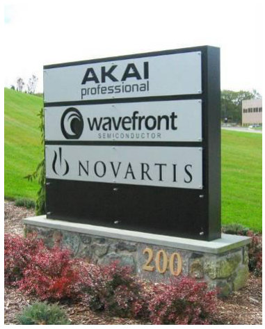
The vertical supports of a pole sign shall not be included in the computation of sign area, provided that (1) the total width of all such supports is less than one-third of the width of the sign, and (2) the supports are not illuminated in any way.
The sign area of a canopy sign shall include all text and symbols, whether or not illuminated, and all illuminated areas; but shall not include non-illuminated areas that are distinguished from the background only by color stripes.
The sign area of a projecting sign shall not include the area of supporting brackets with no text, images or graphics.
Decorative lighting on a building or structure, including neon and other accent lighting, and any illuminated building panel, shall be considered a wall sign for the purposes of this section, and shall be counted as part of the aggregate sign area allowed.
Sign Height and Setback
The maximum and minimum heights and minimum setbacks for signs in each sign district shall be as set forth in the following table, except as otherwise provided herein.
Table of Sign Height and Setback Requirements
| Sign District | ||||||
|---|---|---|---|---|---|---|
| 1 | 2 | 3 | 4 | 5 | 6 | |
| Projecting sign | ||||||
| Minimum clearance (ground to bottom of sign) | 7 | 7 | 7 | 7 | 7 | 7 |
| Freestanding sign | ||||||
| Minimum setback from lot line | n/a | 5 | 5 | 20 | 10 | 20 |
| Maximum height (ground to top of sign) | n/a | 7 | 12 | 20 | 20 | 20 |
All dimensions in feet n/a = not applicable
Where a driveway intersects with a street, no sign shall be erected or maintained between the heights of 2.5 feet and 10 feet above the edge of pavement grades within the area bounded by (a) the side lines of the driveway and street and (b) lines joining points along said side lines 20 feet from the point of intersection.
The height of a freestanding sign shall be measured with respect to the elevation of the centerline of the adjacent public right-of-way.
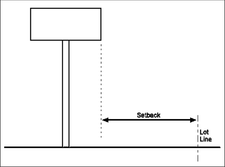
A projecting sign shall project no closer than 1 foot to the edge of the vehicular travel way, if any.
§ 10.1260Sign Illumination
Types of Illumination
Signs may only be illuminated as set forth in the following table, except as otherwise provided herein.
Table of Sign Illumination Requirements
| Sign District | ||||||
|---|---|---|---|---|---|---|
| 1 | 2 | 3 | 4 | 5 | 6 | |
| External illumination | N | P | P | P | P | P |
| Halo lettering | N | P | P | P | P | P |
| Internal illumination | ||||||
| Freestanding sign | N | P | N | P | P | P |
| Wall sign | N | P | P | P | P | P |
| Projecting sign | N | N | N | N | N | N |
| Parapet sign | n/a | N | N | N | P | P |
| Roof sign | n/a | N | N | N | P | P |
| Awning sign | n/a | N | P | N | P | P |
| Marquee sign | n/a | N | P | N | P | N |
| Canopy sign | n/a | n/a | n/a | P | P | P |
| Direct illumination | N | N | P | P | P | P |
P = Permitted N = Prohibited n/a = not applicable (sign type not permitted)
Temporary signs shall not be illuminated.
Signs in the Historic District shall be illuminated only by external illumination, notwithstanding anything to the contrary in Section 10.1261.
Hours of Illumination
Signs shall not be illuminated between 11:00 p.m. and 6:00 a.m., except that signs may be illuminated during the operation of a use or activity that is open to customers or the public, and for not more than one hour after the activity ceases.
Illumination Standards
A light source for external illumination of a sign shall be mounted and shielded so that said light source is not visible three feet above grade at the lot line and so that the lighting is confined to the area of the sign.
A light source for internal illumination of a sign constructed of translucent materials and wholly illuminated from within shall not require shielding.
A sign or its illuminator shall not by reason of its location, shape or color interfere with pedestrian or vehicular traffic or be confused with or obstruct the view or effectiveness of any official traffic signal or traffic marking.
Illuminance of the sign face shall not exceed the following standards:
External illumination: 50 foot-candles as measured on the sign face.
Internal illumination: 5,000 nits (candelas per square meter) during daylight hours, and 500 nits between dusk and dawn, as measured at the sign’s face.
Direct illumination: 5,000 nits during daylight hours, and 500 nits between dusk and dawn, as measured at the sign’s face.
Light sources shall utilize energy efficient fixtures to the greatest extent practicable. Light fixtures including bulbs or tubes used for sign illumination shall be selected and positioned to achieve the desired brightness of the sign with the minimum possible wattage, while ensuring compliance with all applicable requirements of this Ordinance.
A sign using direct illumination shall consist only of letters, numbers and other common typographical characters, all of which shall be in no more than three colors against a dark background, and the total illuminated area shall not exceed 30 percent of the total area of the sign.
§ 10.1270Additional Sign Regulations
Signs on More Than One Façade of a Building
An establishment with a public entrance on a side of the building not facing a street may have signs on that side as well as on the street-facing wall(s).
Regardless of the location of signs, the maximum sign area per establishment shall be based only on the building frontage as defined in Section 10.1290.
A roof sign on a pitched, hip, gambrel or mansard roof shall not extend above the elevation midway between the level of the eaves and the highest point of the roof. A roof sign is not permitted on a flat roof.
The maximum height of a roof sign shall not exceed the lesser of 36 inches or 25% of the vertical height of the roof.
All text, images and other graphics on a marquee sign shall be displayed on the outside vertical faces of the marquee, and shall be no more than 1.5 feet tall.
The sign area of a marquee sign shall be included in the maximum aggregate sign area allowed for the lot.
Relation of Sign to Building Façade in the Historic District
In the Historic District, a wall sign or projecting sign should align with some horizontal element on the façade. For example, the top of the sign may align with the top of the window, the bottom of the sign may align with the bottom of the window, the bottom of sign may align with the top of the lintel, etc.
Interim Signs
An interim sign may be erected while awaiting arrival of a permanent sign for which a sign permit has been issued. -The interim sign shall conform to the same dimensional and other requirements as the approved permanent sign and shall be allowed only until the permanent sign is installed or for 60 days, whichever is the shorter period of time. A sign permit for an interim sign must be obtained from the Code Official.
§ 10.1280Nonconforming Signs
A nonconforming sign or sign structure shall be brought into conformity with this Ordinance if it is altered, reconstructed, replaced, or relocated. For the purpose of this provision, the alteration of a sign or sign structure includes any change in size, shape, materials or technology. A change in text or graphics is not an alteration or replacement for purposes of this subsection.
Nonconforming signs must be maintained in good condition. Maintenance required by this Subsection shall include replacing or repairing of worn or damaged parts of a sign or sign structure in order to return it to its original state, and is not a change or modification prohibited by Subsection 10.1281.
§ 10.1290Sign Definitions
Aggregate sign area See under sign area.
Animated sign A sign that uses movement or a change of lighting to depict action or create a special effect or scene. See also changeable sign.
Awning A cloth, plastic or other nonstructural covering that either is permanently attached to a building or can be raised or retracted to a position against the building when not in use.
Awning sign A sign that is painted on or otherwise applied or attached to an awning. An internally illuminated awning shall be considered an awning sign whether or not it contains any text or graphics.
Banner sign or banner A sign that consists of text or other graphic elements on a non-rigid material either enclosed or not enclosed in a rigid frame and secured or mounted to allow motion caused by the atmosphere. See also temporary sign.
Building frontage The maximum horizontal width of the ground floor of a building that approximately parallels and faces a public street or right of way.
(a) Where an individual occupant’s main entrance faces a driveway or parking lot, the width of the occupant’s ground floor space facing the occupant’s entrance shall be considered that occupant’s separate and distinct building frontage.
(b) Where two or more uses occupy the ground floor of a building, the portion of the building frontage occupied by each use will be that use’s separate and distinct building frontage for the purpose of calculating allowed sign area.
(c) A corner lot or through lot shall be considered to have a separate and distinct building frontage on each street.
(d) When a building is not parallel to the street, or has a front wall that is angled or curved, the building frontage shall include any portion of the front wall that is oriented at an angle of 30 degrees or less from the front lot line.
Canopy A freestanding structure constructed of rigid materials, providing protective cover over an outside service area.
Changeable sign A sign or portion thereof with characters, letters or symbols that can be changed, whether electronically or manually without altering the face or surface of the sign. A sign on which the message changes more than once per day shall be regulated as an animated sign. A sign on which the only changes are mechanical or electronic indication of time or temperature is not considered a changeable or animated sign.
Direct illumination Illumination of a sign by light emitted directly from a lamp, luminary or reflector, and not diffused through translucent materials or reflected or projected from an external source. Examples include, but are not limited to, signs using luminous gas-filled tubes (e.g., neon) or light-emitting diodes (LED). (See also external illumination, externally illuminated sign, internal illumination, internally illuminated sign.)
External illumination Illumination of a sign by a source of light not contained within, or on the surface of, the sign itself. (See also direct illumination, externally illuminated sign, internal illumination, internally illuminated sign.)
Externally illuminated sign A sign that is illuminated by a light source that is not contained within, or on the surface of, the sign itself
Flag A piece of durable fabric or other flexible material containing distinctive colors, patterns, standards, words, or emblems which hangs loose from a staff or pole or is attached directly to a building.
Flagpole A permanent, free-standing structure or a structure attached to a building and used for the sole purpose of displaying flags. A free-standing flagpole shall not exceed the maximum building height allowed in the zoning district in which it is located.
Freestanding sign A sign that is permanently erected in a fixed location and supported by 1 or more columns, upright poles or braces extended from the ground or from an object on the ground, or that is erected on the ground, where no part of the sign is attached to any part of a building, structure, or other sign. Examples include, but are not limited to, monument signs and pole signs.
Halo lettering. An externally illuminated sign in which light sources are placed out of direct view behind opaque sign elements (letters or graphics), creating a glow around the sign elements.
Halo Lettering
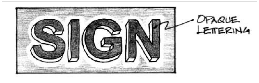
Internal sign A sign that is not intended to be viewed from outside the property, and that is located so as not to be visible from any street or from any adjacent lot. Examples include, but are not limited to, signs in the interior areas of shopping centers, non-illuminated signs inside a building and more than 3 feet inside any window or door, and signs located completely within a building and not visible from outside the building.
Internal illumination Illumination of a sign by light that is diffused through a translucent material from a source within the sign. (See also direct illumination, external illumination, externally illuminated sign, internally illuminated sign.)
Internally illuminated sign A sign that is illuminated by light from a source within the sign through a translucent material. (See also direct illumination, external illumination, externally illuminated sign, internal illumination, halo lettering.)
Examples of internally illuminated signs include:
- (a) Internally illuminated translucent sign, which may have opaque surfaces with translucent letters or translucent surfaces with opaque letters. An opaque surface with translucent letters is preferred to a translucent surface with opaque lettering.
- (b) Internally illuminated awning signs.
- (c) Internally illuminated channel letters.
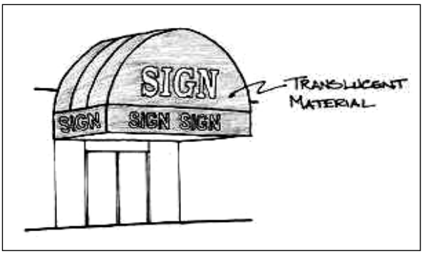

Marquee A structure other than a roof that is attached to, supported by and projecting from a building, and that provides shelter for pedestrians.
Mobile sign A sign on a trailer or other wheeled apparatus, whether or not self-propelled, that is not permanently affixed to the ground. (See also: temporary sign.)
Monument sign A freestanding sign constructed of a solid material and mounted on a solid base that is placed directly on the ground.
Nit A unit of luminance, equal to one candela per square meter.
Parapet An extension of a vertical building wall above the line of the structural roof.
Pennant sign or pennant See banner sign.
Parapet sign A sign attached to a parapet wall, with its face parallel to the plane of the parapet wall and extending no more than 18 inches from such wall.
Pole sign A freestanding sign that is permanently supported in a fixed location by a structure of poles, uprights or braces from the ground and not supported by a building or base structure.
Projecting sign A sign attached to and projecting from the wall of a building with the face of the sign at an interior angle of more than 45 degrees to the building wall to which it is attached.
Roof sign A sign that is located: (a) above the level of the eaves on pitched or gambrel roofs; (b) above the roof deck of a building with a flat roof; or (c) above the top of the vertical wall of a building with a mansard roof.
Sign Any symbol, design or device used to identify or advertise any place, business, product, activity, service, person, idea or statement. Any representation that is illuminated and consisting wholly or in part, of text, images or graphics shall be considered a sign. Signs need not include text, and may consist of stripes, spots, or other recognizable designs, shapes or colors. Displays comprising of merchandise, figurines, mannequins, decorations and other similar articles, arranged inside a building and visible outside of a window, shall not be considered a sign.
Sign area The total surface area of a sign display, including all text, images and graphics, and any distinctive surface, board, frame or shape on or within which the text, images and graphics are displayed. For a double-sided sign, the area shall be calculated to be the total surface area of one side of the sign.
Aggregate sign area The total sign area of all signs on a lot or building, as indicated by the context, excluding the area of freestanding signs allowed by Article 12.
Sign band A painted stripe or otherwise distinct scheme which indicates the establishment’s logo by use of certain colors or patterns.
Temporary sign A sign, other than a mobile sign, that is not permanently affixed to a building or structure or permanently mounted in the ground. (See also mobile sign.)
Wall sign A sign attached to, erected against or hanging from the wall of a building, with the face in a parallel plane to the plane of the building wall, and extending no more than 18 inches from such wall. A wall sign may also be inside of a building if it is illuminated and visible through the window from a private of public right of way.
Article 13Performance Standards
§ 10.1310Applicability
All uses hereafter established in all districts, with the exception of the Municipal district, shall comply with the performance standards of this Article. Violations of these standards in such manner or quantity as to be detrimental to or endanger the public health, safety, comfort or welfare is hereby declared to be a public nuisance and shall be unlawful.
No use already established on the date this Article is adopted or amended shall be altered or modified so as to violate these performance standards.
A lawful nonconforming use that complies with applicable performance standards shall continue to so comply. A lawful nonconforming use that does not comply with an applicable performance standard shall not be varied or changed in such a way as to increase the degree of such violation.
§ 10.1320Drainage
§ 10.1330Noise and Vibration
General
Excessive noise at unreasonable hours shall be controlled so as not to be objectionable due to intermittence, beat frequency, shrillness, vibration, or volume.
No inherent and recurrently generated vibration shall be allowed to create a nuisance or hazard that is perceptible, without the use of instruments, at the property line.
Noise Limits
The maximum permissible sound pressure level of any activity regulated by this Ordinance shall be established by the time period and type of zoning district listed below. Sound pressure levels shall be measured at all major lot lines, at a height of at least 4 feet above the ground surface, but not greater than 4 feet above the floor surface of the upper most level of the building.
Sound from any source controlled by this Ordinance shall not exceed the following sound pressure levels at the lot line of the “sender” premises.
| Districts | 7 AM to 9 PM | 9 PM to 7 AM |
|---|---|---|
| Industrial and Waterfront Industrial Districts | 65 dBA* | 60 dBA |
| All Airport Districts, except civil aviation uses (Section 10.450, use A3) | 65 dBA* | 60 dBA |
| All Business and Office Research Districts | 60 dBA* | 50 dBA |
| All Mixed Residential Districts | 55 dBA | 45 dBA |
| All Residential Districts | 55 dBA | 45 dBA |
| All other Districts | 55 dBA | 45 dBA |
* 55 dBA on Saturday and Sunday.
For civil aviation uses (Section 10.450, use A3) in the Airport districts only, the following standards shall replace those in 10.1332.20:
| 6 AM to 11 PM | 11 PM to 6 AM | |
|---|---|---|
| Civil aviation (Section 10.450, use A3) | 65 dBA* | 60 dBA |
* 55 dBA on Saturday and Sunday.
Where the emitting and receiving premises are in different districts, the limits in 10.1332.20 governing the stricter district shall apply to any regulated noise entering that district.
Construction activities pursuant to an active building permit shall be subject to the maximum permissible sound level specified for Industrial districts in place of any lower level specified in Section 10.1332.20. For construction activities on a lot in a Residential district or adjacent to a residential use this provision shall only apply between 7 AM and 6 PM on weekdays (i.e., in such locations the standards in Section 10.1332.20 shall govern on weekends and between 6 PM and 7 AM on weekdays).
Noise shall be measured with a sound meter meeting the standards of the American National Standards Institute (ANSI S1.4-1983 American Standard Specification for General Purpose Sound Level Meters). The instrument shall be set to the A-weighted response scale and the meter to the slow response. Measurements shall be conducted in accordance with ANSI S 12.31 and S 12.32 American Standard Meter for the Physical Measurement of Sound.
Exemptions
The following uses and activities shall be exempt from the sound pressure level regulations:
Home maintenance activities (i.e., mowing lawns, cutting one’s own firewood, etc.) between the hours of 7:00 AM and 9:00 PM;
Timber harvesting (felling trees and removing logs from the woods);
Noises created by construction and maintenance activities between 7:00 AM and 9:00 PM Monday through Friday in all Business, Industrial, and Airport districts (including all subdistricts).
Noises created by construction and maintenance activities between 7:00 AM and 9:00 PM in all other districts;
The noises of safety signals, warning devices and emergency pressure relief valves and any other public emergency activity;
Traffic noise on existing public streets, railways or river traffic;
Legal preexisting uses between the hours of 7:00 AM and 9:00 PM;
Occasional outdoor gatherings, street sales, public dances, shows, sporting events and entertainment events, provided that these are regulated pursuant to this Ordinance or by permit or by license by the City; and
Public events as authorized by the City Council, School Board, Police Commission, Fire Commission, Prescott Park Trustees and other such Boards who in the conduct of their activities represent the City.
Emergency power generating equipment that is used in situations where the usual power source is no longer available due to some unanticipated situation and whose unavailability is temporary (supplemental power sources are not considered to be an emergency power source).
Enforcement
These noise regulations are enforceable by law enforcement officers and by the Code Official (who may measure noise levels, and who shall report documented violations to the police). For the purposes of enforcement, sound exceeding the above limits shall be deemed to constitute “Unreasonable Noise” under the City Noise Ordinance.
Article 14Impact Fees
§ 10.1410Purpose
The purpose of this Article is to authorize the assessment of impact fees as a condition of subdivision or site plan approval, in order to help meet the needs occasioned by a development for the construction or improvement of capital facilities owned or operated by the City.
§ 10.1420General
The Planning Board may, as a condition of approval of any Site Plan or Subdivision, and when consistent with regulations adopted by the Board, require an applicant to pay an impact fee for the applicant’s fair share of off-site improvements to public facilities affected by the development, in accordance with state law.
§ 10.1430Amount of Impact Fee
The amount of any impact fee shall be calculated by the Planning Board to be a proportional share of municipal capital improvement costs which is reasonably related to the capital needs created by the development, and to the benefits accruing to the development from the capital improvements financed by the fee. Upgrading of existing facilities and infrastructure, the need for which is not created by new development, shall not be paid for by impact fees.
§ 10.1440Accounting
Any impact fee shall be held in a separate, non-lapsing account, shall be segregated from the City’s general fund, and shall be used solely for the capital improvements for which it was collected, or to recoup the cost of capital improvements made in anticipation of the needs which the fee was collected to meet. Such fees shall be paid out only upon order of the Planning Board or its designated agent.
§ 10.1450Assessment and Payment
An impact fee imposed under this section shall be assessed prior to, or as a condition for, final subdivision or site plan approval, and shall be collected prior to the issuance of any building permit, or at such other time as specified by the Planning Board in its decision. In the interim between assessment and collection, the Planning Board may require a developer to provide a bond, letter of credit or other suitable security so as to guarantee future payment of assessed impact fee.
§ 10.1460Refund
Any portion of an impact fee which has not become encumbered, or otherwise legally bound to be spent for the purpose for which it was collected, shall be refunded, with accrued interest:
When the subdivision or site plan approval expires under the respective rules of the Planning Board, or under the terms of a decision, without having become vested under state law, and without any extension being granted by the Planning Board; or
When such approval is revoked in accordance with state law; or
Six years after its collection, or if any extension of approval is granted by the Planning Board, six years after such extension is granted.
§ 10.1470Appeals
The assessment of any impact fee by the Planning Board under the authority of this section may be appealed to the superior court as provided by State law. Notwithstanding Section 10.230 of this Ordinance, the Board of Adjustment shall not have authority to hear appeals of, or grant variances from, such an assessment.
§ 10.1480Relationship to Other Regulations
The provisions of this Article 14 shall not be construed to limit the authority of the Planning Board to require the developer to pay an exaction for the cost of off-site improvements determined by the Planning Board to be necessary for the occupation of any portion of the development; or, as an alternative to paying such an exaction, to construct the necessary improvements subject to bonding and timing conditions as required by the Planning Board.
The provisions of this Article 14 shall not be construed to limit the authority of the Planning Board to impose other conditions of approval.
The provisions of this Article 14 shall not be construed to limit the authority of the Planning Board to disapprove a proposed development which is scattered and premature, or which would require an excessive expenditure of public funds, or which would otherwise violate applicable ordinances and regulations.
The provisions of this Article 14 shall not be construed to affect types of fees governed by other statutes, City ordinances or regulations.
Article 15Definitions
§ 10.1510Rules of Construction
Unless otherwise expressly stated, the following words and terms shall have the meanings shown in this Article.
When a term is defined both in this Article 15 and in another Article of this Ordinance, the definition in the other Article shall supersede the definition in Article 15. Examples include the definitions relating to Sexually-Oriented Businesses and Telecommunications Facilities in Article 5, and to the Floodplain District and Airport Approach Overlay District in Article 6.
Where terms are not defined in this Ordinance and are defined in the Building Code, such terms shall have the meanings ascribed to them therein.
Where terms are not defined in this Ordinance or in the Building Code, such terms shall have ordinarily accepted meanings such as the context implies.
§ 10.1520Terms With Specialized Applications
Terms that are used primarily in Section 10.620, Floodplain District, are defined in Section 10.622, including:
Area of special flood hazard area
Base flood
Base flood elevation (BFE)
Basement
Building *
Extended flood hazard area
FEMA
FIRM
Flood insurance rate map
Flood insurance study
Flood or flooding
Floodplain
Flood-prone area
Flood proofing
Floodway
Highest adjacent grade
Historic structure
Lowest floor
Manufactured home
Manufactured home park or subdivision
Mean sea level
New construction
Regulatory floodway
Special flood hazard area
Start of construction
Substantial damage
Substantial improvement *
Violation
Water surface elevation
* These terms are defined differently for Section 10.622 than for other sections of this Ordinance.
Terms that are used primarily in Section 10.920, Wireless Telecommunications Facilities, are defined in Section 10.922, including:
Antenna
Co-location
Provider or carrier
Wireless telecommunications facility
Wireless telecommunications facility, camouflaged
Wireless telecommunications facility, concealed
Wireless telecommunications facility, free-standing
Terms that are used primarily in Section 10.930, Sexually-Oriented Businesses, are defined in Section 10.933, including:
Adult arcade
Adult bookstore or Adult video store
Adult cabaret
Adult theater
Nudity or state of nudity
Permittee or Licensee
Semi-nude
Sexual encounter center
Sexually oriented business
Specified anatomical areas
Specified sexual activities
Substantial enlargement
Terms that are used primarily in Article 12, Signs, are defined in Section 10.1290, including:
Animated sign
Awning sign
Banner sign or banner
Canopy sign
Changeable sign
Direct illumination
Directional sign
Directory sign
External illumination
Externally illuminated sign
Freestanding sign
Halo sign
Hanging sign
Informational sign
Internal illumination
Internally illuminated sign
Marquee
Marquee sign
Monument sign
New business sign
Pennant sign or pennant
Pole sign
Projecting sign
Roof sign
Sign area
Sign band
Special event sign
Temporary mobile sign
Temporary sign
Window sign
Terms that are used primarily in Article 5A, Character Districts, are defined in Sections 10.5A43.10, 10.5A43.70, 10.5A45.10 and 10.5A60, including:
Section 10.5A43.10 – Façade Types
Forecourt
Officefront
Porch
Recessed entry
Shopfront
Step
Stoop
Dooryard
Terrace
Gallery
Arcade
Section 10.5A43.70 – Building Types
House
Duplex
Rowhouse
Apartment building
Live/work building
Small commercial building
Large commercial building
Cottage
Paired House
Gateway Townhouse
Mixed Use Building
Small Flex Space/Fabrication Building
Community Building
Section 10.5A46.10 – Community Spaces
Greenway
Park
Pedestrian Alley
Playground
Plaza
Pocket Park
Square
Recreation Field or Court
Common or Green
Community Garden
Outdoor Dining Café
Courtyard
Section 10.5A60 – Definitions
Backbuilding
Block
Community space
Entrance spacing
Façade
Façade glazing
Front lot line buildout
Liner building
Outbuilding
Path
Regulating Plan
Streetscreen
§ 10.1530Terms of General Applicability
Accessory building or structure A subordinate building located on the same lot with the principal building, occupied by or devoted to an accessory use. Where an accessory building is attached to the main building in a substantial manner, as by a wall or roof, such accessory building shall be considered part of the main building. For the purpose of this Ordinance, a detached accessory dwelling unit that is not created within an existing accessory building is not an accessory building or structure.
Accessory dwelling unit (ADU) An attached or detached dwelling unit that is constructed on the same lot as a single-family dwelling and complies with the standards for accessory dwelling units set forth in this Ordinance.
Attached accessory dwelling unit (AADU) An accessory dwelling unit that is constructed within or attached to a single-family dwelling. For the purpose of this definition, “attached” means:
- (a) located within the dwelling and separated from the principal dwelling unit either horizontally or vertically, or
- (b) sharing a common wall for at least 25 percent of the length of the side of the single-family dwelling.
- “Attached” does not include connection to the single-family dwelling solely by an unenclosed structure (such as a breezeway) or by an enclosed but unconditioned space.
Detached accessory dwelling unit (DADU) An accessory dwelling unit that is constructed within a detached building on a lot containing one single-family dwelling. A detached accessory dwelling unit may be connected to the single-family dwelling by an unenclosed structure (such as a breezeway) or by an unconditioned space.
Accessory use A use that is incidental and subordinate to the principal use and located on the same lot with such principal use or building.
Accessway A privately owned roadway, sidewalk or passageway, whether improved or unimproved, utilized as a principal or accessory means of ingress or egress in connection with any use. An accessway shall be classified in the same manner as the use it serves. If an accessway serves more than one use, the accessway shall be deemed to serve the more intensive use and shall be classified accordingly.
Active Use Area The land area within 35 feet of a dwelling unit, or other principal use, on the sides closest to the highway where patios, children’s play areas, and outdoor activities are common.
Adjacent Touching or sharing a common lot line, or separated from a lot line by a street, right-of-way, alley or easement.
Affordable Housing with combined rental and utility costs or combined mortgage loan debt service, property taxes, and required insurance that do not exceed 30% of a household’s gross annual income.
Affordable unit A dwelling unit that is restricted for sale, lease or rental to households within specific income ranges and available at prices affordable to households within such income ranges.
Age-restricted housing A residential development consisting of independent dwelling units restricted to occupancy by persons at least 55 years old, which may contain limited social or recreational facilities or services for the residents but which do not include centralized dining and on-site medical services. (See also: assisted living facility; congregate care facility; continuing care retirement community.)
Airport An airstrip/landing strip where aircraft can land and take off and which is usually equipped with hangers, facilities for refueling and repair, accommodations for passengers, freight, etc.
Alteration Any change, addition or modification in construction, use or occupancy of an existing structure.
Amusement Park A commercially operated enterprise that offers rides, games, and other forms of amusement. (See also: water park, theme park.)
Area median family income The median family income for the Portsmouth-Rochester NH HUD Metro Fair Market Rent Area (HMFA) published by the U.S. Department of Housing and Urban Development, as updated yearly and adjusted for family size.
Assisted living facility A building or group of buildings providing housing and supportive services and care for persons who require assistance with daily living activities but do not require the skilled nursing and medical care provided in a nursing home or other residential care facility. Such supportive services include the provision of meals, housekeeping, laundry, transportation, daily personal care, dispensing of medications and 24 hours per day staffing. An assisted living facility includes one or more community dining rooms in which meals are provided to all residents, and each individual assisted living unit may also have a kitchenette. Other than any accommodations provided for use by the facility’s staff, only assisted living units are permitted as part of an assisted living facility. (See also: age-restricted housing, congregate care facility, continuing care retirement community, residential care facility.)
Assisted living center An assisted living facility that provides resident rooms or residential units to six or more residents.
Assisted living home An assisted living facility that provides resident rooms to five or fewer residents
Assisted living unit A unit in an assisted living facility or continuing care retirement community (CCRC) that provides housing and support services for one or more persons who may require assistance with daily living activities but do not require 24-hour skilled nursing and medical care. Such supportive services may include the provision of meals, housekeeping, laundry, transportation, daily personal care, programmed social activities, dispensing of medications and around the clock staffing. (See also: independent living unit.)
Attic The interior part of a building contained within a gable, gambrel, or hip-roof mansard roof, or within a penthouse on a flat roof.
Average existing grade For all buildings located outside the urban districts, the average existing grade shall be the average ground levels adjoining the building at all exterior walls measured every five feet around the perimeter of the building. For all buildings located inside the urban districts, the average existing grade shall be the average existing ground level measured every five feet along the street-facing façade of all lot lines adjoining a public place. (See also: building height.)
Average finished grade For all buildings located outside the urban districts the average finished grade shall be the average ground levels adjoining the building at all exterior walls measured every five feet around the perimeter of the building. For all buildings located inside the urban districts, the average finished grade shall be the average finished ground level measured every five feet along street-facing façade of all lot lines adjoining a public place. (See also: building height).
Bank See financial institution.
Bar See drinking establishment.
Base residential density The number of dwelling units which could be constructed on a parcel by means of a conventional development plan, calculated as set forth in Section 10.723.
Bed and breakfast The provision of short-term lodging and breakfast within an owner-occupied dwelling. The capacity of the dining facilities shall accommodate no more than 25 persons. (See also: hotel, motel, inn.)
Bed and Breakfast 1 A bed and breakfast with between 1 and 5 guest rooms.
Bed and Breakfast 2 A bed and breakfast with between 6 and 10 guest rooms.
Best management practice (BMP) A practice or combination of practices that is determined to be the most technologically and economically feasible means of preventing or minimizing potential adverse impacts to natural and cultural resources. BMPs include structural and nonstructural controls and operation and maintenance procedures.
With respect to wetlands management, BMPs are practices to minimize disturbances and impact to the wetland resulting from activities that alter the natural character of the wetland.
Board The Planning Board or the Zoning Board of Adjustment of the City of Portsmouth, New Hampshire. If not clear based on the context, the term shall refer to the Zoning Board of Adjustment.
Boarding house A residential structure, other than a bed and breakfast, in which rooms are rented, leased or otherwise made available for compensation to more than two but not more than 10 individuals, and where such rooms do not contain separate cooking or bathroom facilities. There must be posted at all times at the front entrance of the facility a sign indication 24 hour, seven days a week, valid and effective contact information for the management of the facility.
Building Any structure having a roof supported by columns or walls and intended for the shelter, housing or enclosure of persons, animals or chattel. Each portion of a building separated either horizontally or vertically from other portions by a fire wall shall be considered as a separate structure. (See also: structure.)
Building block length Measured along a street, public way, or public greenway, the building block length shall be the total length of a continuous building façade regardless of fire separation, common walls, or property lines. Individual building blocks shall be separated by open space or community space areas of at least 15 feet in width.
Building Code The International Building Code and/or the International Residential Code, as applicable to the particular structure type.
International Building Code (IBC) The International Building Code, published by the International Code Council, Inc., as adopted with amendments, additions and deletions as Chapter 12, Part I, of the Ordinances of the City of Portsmouth, and as amended from time to time by the City.
International Residential Code (IRC) The International Residential Code, published by the International Code Council, Inc., as adopted with amendments, additions and deletions as Chapter 12, Part II, of the Ordinances of the City of Portsmouth, and as amended from time to time by the City.
Building coverage The aggregate horizontal area or percentage (depending on context) of a lot or development site covered by all buildings and structures on the lot, excluding (a) gutters, cornices and eaves projecting not more than 30 inches from a vertical wall, and (b) structures less than 18 inches above ground level (such as decks and patios); (c) balconies, bay windows or awnings projecting not more than 2 feet from a vertical wall, not exceeding 4 feet in width, and cumulatively not exceeding 50% of the width of the building face; (d) fences; and (e) mechanical system (f) power generator Building footprint The total area of a building at or above 18 inches in elevation as measured from the outside walls at the grade plane of a detached building, or of two or more buildings separated only by fire walls, common walls or property lines.
Uncovered community space located immediately above a building’s story below the grade plane shall not constitute building footprint, provided it is not more than 10 feet above the adjacent street grade.
Building height The greatest vertical measurement between the lower and upper reference points as defined below. This measurement shall be the building height for the purposes of the Ordinance.
(a) For buildings located outside the urban districts, the lower reference point shall be the average existing grade or average finished grade, whichever is lower, measured along the perimeter of the entire building. For buildings located inside the urban districts the lower perimeter of the reference point shall be established from the average existing grade or average finished grade, whichever is lower, along street-facing façade of all lot lines adjoining a public place. In the case of a corner lot, through lot or waterfront lot the provisions of Section 5A.21.21 shall apply. The vertical distance between the lower and upper reference points shall not exceed the maximum number of stories or building height.
(b) The upper reference point shall be any of the following:
- (1) For a flat or flat-topped mansard roof, the highest point of the roof surface;
- (2) For a gambrel, hip, hip-topped mansard roof, or penthouse, the elevation midway between the level of the eaves, or floor in the case of a penthouse, and highest point of the roof. For this purpose, the “level of the eaves” shall mean the highest level where the plane of the roof intersects the plane of the outside wall on a side containing the eaves, but at no time shall this level be lower than the floor level of the uppermost story or attic
- (c) A parapet wall, fence, railing, decorative cornice, or similar structure that extends more than four feet above the roof surface shall be included in the determination of the building height, but shall not be included if it does not extend more than four feet above the roof surface. (See also: average existing grade and average finished grade, parapet wall, mansard roof, penthouse and urban districts)
- (See also: grade plane, parapet wall.)
Building length The longest horizontal dimension of a building, as measured in a single straight direction parallel to an elevation of the building, except as follows:
- (a) Where buildings on the same site are separated by a distance of less than 10 feet, the building length shall be the total of the building lengths of each individual building, including the distance between them.
- (b) Where the interior angle between two elevations of a building, or between the elevations of two buildings separated by less than 10 feet, is 135 degrees or more, the building length shall be the total of the building lengths measured individually.
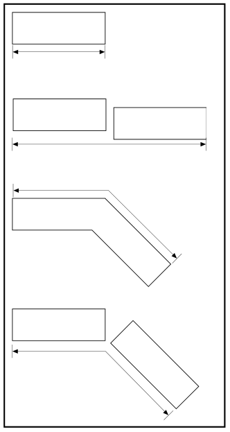
Building permit A permit issued by a code official indicating that a proposed construction, alteration or reconstruction of a structure complies with the Building Code, and that a proposed use, building or structure is accordance with the Zoning Ordinance; and authorizing an applicant to proceed with said use, building or structure.
Bypass lane A circulation lane to permit vehicles to circulate around a drive-through facility without conflicting with access to transaction windows or devices.
Call center A centralized office used for the purpose of receiving and transmitting a large volume of telephone calls, such as incoming product support or information inquiries from consumers, or outgoing calls for telemarketing or debt collection. A call center does not include use of a facility for less than 6 months in a two-year period for a political campaign.
Car wash An establishment for washing and waxing private automobiles, light trucks and vans including auto detailing services.
Caretaker residence A dwelling unit that is accessory to and on the same lot as a nonprofit use, and that is provided for and limited to occupancy by a person employed to provide maintenance and security 24 hours per day for the principal use.
Certified wetland scientist A person qualified to perform wetland delineation and certified by the New Hampshire Board of Natural Scientist pursuant to State law.
Character Defining Architectural Features Tangible aspects of a building and its setting, including the overall shape of the building, its materials, craftsmanship, decorative details, the character of its site, its history and related aspects its site and environment.
Clinic A facility providing care and treatment for sick or injured human patients, not including a medical office, hospital or substance abuse treatment facility.
Outpatient clinic A clinic providing care and treatment on an outpatient basis, including ambulatory care or similar medical services that generally require a stay of less than 24 hours, that does not include overnight care facilities.
Inpatient clinic A clinic that may include overnight care facilities.
Club, fraternal or service organization A building for gathering and entertainment by members of a non-profit membership organization, not to include rooms for overnight lodging or rooming.
Code official Any employee of the City of Portsmouth authorized to administer or enforce the Zoning Ordinance, including but not limited to the Director of Planning and Sustainability, the Chief Building Inspector, and their designees.
Coliving A use that combines private resident Coliving Units used primarily for living and sleeping with shared resident Coliving Common Areas that provide common areas for resident’s other daily needs as described herein.
Coliving Common Area Those shared portions of a Coliving Facility containing permanent provisions for resident’s living, eating, cooking, sanitation, bathing, laundry, recreation, resident meetings and wellness.
Coliving Facility A building or portion thereof containing the combination of Coliving Units and Coliving Common Areas for more than 10 individuals.
Coliving Unit A private living and sleeping area for not more than 2 people in a Coliving Facility.
Commercial fishing craft Any marine craft used for commercial fishing.
Commercial vehicle Any vehicle having a commercial license plate or used commercially.
Commercial passenger vessel Any vessel carrying passengers for hire, such as a cruise ship, ferry, water taxi, excursion boat, party boat, charter boat or sport fishing boat (provided that the fish caught are not sold commercially); but not including a vessel used primarily for commercial carrying cargo, towing, dredging or salvage, or a vessel used for commercial fishing.
Congregate care facility A residential development consisting of individual dwelling units with centralized amenities such as dining, housekeeping, transportation and organized social and recreational activities, and which may include limited medical services on site. (See also: assisted living facility; continuing care retirement community; age-restricted housing.)
Construction trailer A structure used in conjunction with construction activities. Such structure shall include tractor trailers and similar structures which are used or are constructed in a manner as to permit daily occupancy and/or the storage of equipment and materials.
Contiguous Adjoining or touching at a point or along a boundary.
Continuing care retirement community (CCRC) A residential development that provides multiple elements of senior adult living including independent living units, assisted living units and skilled nursing care, enabling residents to live at a single location as their medical needs change over time. A CCRC includes common dining, recreation and health facilities and other common areas; provides services such as medical, programmed social activities; and may include limited accessory retail and personal services. A CCRC is intended for and solely occupied by persons 62 years of age or older and thereby qualifies as “housing for older persons” under state law. (See also: assisted living facility, congregate care facility, age-restricted housing.)
Contributing structure A structure identified as a contributing structure in “An Architectural Survey of the Historic District of Portsmouth, NH”, dated June–September, 1982, prepared by the Portsmouth Advocates Inc., Woodard D. Openo, Survey Director.
Convenience goods A retail establishment offering for sale prepackaged food products, household items and other goods and having a gross floor area of less than 2,500 square feet.
Convenience goods 1 A convenience goods establishment that does not sell food prepared on the premises for consumption off the premises.
Convenience goods 2 A convenience goods establishment that sells food prepared on the premises (excluding fried food) for consumption off the premises.
Cornice A crowning projected molded horizontal top of a building or some part of a building. A trimmed eave on the gable end of a gable-roofed building creates a cornice, consisting of two raking or sloping cornices with connected horizontal cornice.
Coverage See building and open space coverage.
Day care facility A facility operated daily where care, protection, and supervision are provided for persons regardless of age but excluding any psychiatric care.
Family day care facility A day care facility, as an accessory use in a single residence, for up to 6 persons.
Group day care facility A day care facility for more than 6 persons.
dBA The sound pressure level in decibels that is frequency weighted to the A-scale according to a frequency response established by the American National Standards Institute (ANSI S1.4-1971) and that approximates the frequency response of the human ear.
Demolition Razing or destruction, entirely or in part, of any exterior surface of a building or structure (including a monument, statue or memorial), whether or not reconstruction is planned after demolition. Demolition shall also include the removal of any building or structure in whole or in part from its present location.
Developable area The total area of a single development site, which may include one or more lots, excluding all open water bodies, wetlands subject to this Ordinance, 100-year floodplains, slopes exceeding 15 percent, and areas subject to existing valid open space restrictions.
Development Any man-made alteration of land, a lot, a building or other structure whether horizontal, vertical, surface or subsurface.
Depth of lot See lot depth.
Drinking establishment An establishment, other than a restaurant, serving alcoholic or non-alcoholic beverages for consumption on the premises. For purposes of this Ordinance, a drinking establishment may be a principal use or an accessory use, and a portion of the premises may be devoted to entertainment, which may include a dance floor, with either live or recorded music.
Bar or Tavern A drinking establishment with an occupancy of less than 250 persons.
Nightclub A drinking establishment with an occupancy of 250 or more persons.
Drive-through facility A building, attached structure or portion thereof that provides products or services directly to a customer in a motor vehicle by means of a window or mechanical device.
Drive-through lane A lane in which vehicles obtain service from transaction windows or devices at a drive-through facility.
Driveway The area between the travelled portion of a street or road and a parking area used by motor vehicles for access to and from the parking area. A driveway does not include any maneuvering aisle or other circulation area within the interior of a parking area. Except for parking lots containing fewer than 7 off-street parking spaces, a driveway has no abutting parking spaces.
Dwelling A building or portion thereof containing one or more dwelling units.
Single-family dwelling A building consisting of a single dwelling unit.
Two-family dwelling A building consisting of two dwelling units.
Multifamily dwelling A building consisting of three or more dwelling units.
See also: townhouse, manufactured housing.
Dwelling, principal A single-family dwelling on a lot on which an accessory dwelling unit is allowed.
Dwelling unit A building or portion thereof providing complete independent living facilities for one or more persons, including permanent provisions for living, sleeping, eating, cooking and sanitation. This use shall not be deemed to include such transient occupancies as hotels, motels, rooming or boarding houses.
Dwelling unit, accessory See accessory dwelling unit.
Dwelling unit, principal A dwelling unit in a single-family dwelling that is not an attached accessory dwelling unit.
Electronics manufacturing See under Manufacturing.
Establishment A single physical location where business is conducted or where services or industrial operations are performed. A company may have one or many establishments, and a building may contain one or many establishments.
EV (Electric Vehicle) An EV is a motor vehicle that derives some or all of its primary motive power from an electric motor that draws electricity from a battery and is charged from an external source.
EV fueling space A A public or private parking space with adjacent above ground charging support equipment that uses customary residential electric service for charging EVs.
EV fueling space B A public or private parking space with adjacent above ground charging support equipment that uses greater than customary residential electric service for charging EVs.
Family day care facility See under day care facility.
Farm animal Any animal other than a household pet as defined in this Ordinance.
Federal Manual Corps of Engineers Wetland Delineation Manual, Wetlands Research Program Technical Report Y-87-1, U.S. Army Corps of Engineers.
Field Indicators Field Indicators for Identifying Hydric Soils in New England, New England Interstate Water Pollution Control Commission (current edition).
Financial institution An establishment where the principal business is the provision of financial, banking or lending services to consumers or clients including the receipt, disbursement or exchange of funds and currencies. May include all or one of the following uses:
Financial services office An office associated with the operation of a financial institution that provides banking, lending, or investment services, but does not include teller services, automated teller machines, or similar high-volume customer functions.
Retail bank An office associated with the operation of a financial institution that provides walk-in and/or drive-in teller services to customers primarily for depository banking and related services.
Automated teller machine (ATM) An unattended electronic device that is activated by customers to conduct financial transactions. An ATM may be located on the outside of a building, or in an access-controlled entrance to a building, or within a principal use in a building, and may serve pedestrians or patrons in motor vehicles. An ATM servicing patrons in motor vehicles must meet the standards for drive-through establishments provided in this Ordinance. An ATM is permitted only as an accessory use to a related principal use, and is not permitted as a principal use or in a free-standing structure not attached to a principal use.
Fish market Retail sales of (a) fresh or frozen fish, shellfish or lobster; or (b) baked, boiled or steamed fish, shellfish or lobster, or fish or seafood chowder, which may be prepared on the premises but shall not be consumed on the premises.
Fish preparation The secondary preparation of fin fish by filleting, skinning and/or cutting. (See also: fish processing.)
Fish processing The primary preparation of fin fish by gutting and/or heading in preparation for the secondary preparation of filleting, skinning and cutting. (See also: fish preparation, food processing.)
Fishing boat landing Landing of commercial fishing craft.
Fishing boat landing 1 Landing of no more than two commercial fishing craft used by no more than two persons per boat, with no fish preparation, fish processing, or sales of fish or sea-related products.
Fishing boat landing 2 Landing of commercial fishing craft, without limitation on either the number of boats or the number of persons per boat, which may include fish preparation in an enclosed building by no more than five persons.
Flat roof A roof with a slope of less than 1:4 for more than 50% of the roof area.
Floodlight or spotlight Any lighting fixture or lamp that is that incorporates a reflector or a refractor to concentrate the light output into a directed beam in a certain direction.
Floor area ratio (FAR) The ratio of the gross floor area of all buildings on a lot to the lot area.
Food processing The preparation or processing of food or beverage products, but not including consumption on the premises. Examples include bakeries, dairies, canneries, bottling plants and similar businesses. (See also: fish processing.)
Foot-candle A measure of light falling on a given surface. One foot-candle is equal to the amount of light generated by one candle shining on a square foot surface one foot away. One foot-candle is one lumen per square foot.
Foreign trade zone An area established wherein component parts for electric products, watches, automobiles, etc. may be imported initially duty free, such duty being postponed until the finished product enters the larger American market.
Frontage The horizontal distance measured along a lot line dividing a lot from a street. Such measurement shall refer to a continuous line except where otherwise specified.
Full-cutoff A lighting fixture with a shield such that all of its light output is aimed below horizontal to the ground. Full-cutoff fixtures cut off all upward transmission of light.
Furniture and home furnishing store An establishment for retail sales of home or office furniture, carpets, mattresses, or similar items that require extensive floor area for the display of merchandise.
Garage An area within a principal building or outbuilding that provides space for parking vehicles as an accessory use. Not synonymous with parking structure. (See also: parking lot, parking structure, underground parking level.)
Glare Excessive brightness in the field of view that is sufficiently greater than the brightness to which the eyes are adapted, to cause annoyance or loss in visual performance and visibility, so as to jeopardize health, safety or welfare.
Grade plane A reference plane representing the average of finished ground levels adjoining the building at all exterior walls. When the finished ground level slopes away from exterior walls, the reference plane shall be established by the lowest points within the area between the building and the lot line or, when the lot line is more than 6 feet from the building, between the building and a point 6 feet from the building. (See also building height.)
Gross floor area (GFA) The sum of the areas of the several floors of a building or buildings as measured by the exterior faces of the walls, but excluding the areas of fire escapes, unroofed porches or terraces, and areas such as basements and attics exclusively devoted to uses accessory to the operation of the building. If the exterior walls are greater than 6 inches thick, then the gross floor area shall be adjusted to a maximum of a 6-inch thick wall.
Gross living area (GLA) The total area of finished residential space in an accessory dwelling unit, including all conditioned living space, but excluding unconditioned space such as decks, porches, garages, or other such spaces that have not been converted into living space. GLA is calculated by measuring the interior perimeter of the accessory dwelling unit.
Ground floor or story Any floor or story of a building in which the floor is less than six feet above or below the finished grade at any street entrance of the building. Under this definition a building may have more than one ground floor or story.
Group day care facility See under day care facility.
Helipad An area of land, water, or a structure designated for the occasional landing and takeoff of helicopters but not used solely for that purpose, and not including facilities for helicopter fuel, service, maintenance or overhaul, or sale of products.
Heliport An area of land, water, or a structure used or intended to be used for the landing and takeoff of helicopters, together with appurtenant buildings and facilities.
High hazard use Any use which is defined by the Building Code as H-1, H-2, H-3, H-4 or H-5.
High hazard use A A high hazard use which presents a detonation hazard (Use Group H-1) or which presents a deflagration hazard or a hazard from accelerated burning (Use Group H-2).
High hazard use B A high hazard use which contains materials that readily support combustion or present a physical hazard (Use Group H-3), or which contain materials that are a health hazard (Use Group H-4).
High hazard use C A semiconductor fabrication facility or comparable research and development area in which hazardous process materials are used (Use Group H-5).
Highest observable tide line A line defining the furthest landward limit of tidal flow, not including storm events, which can be recognized by indicators such as the presence of a strand line of flotsam and debris, the landward margin of salt tolerant vegetation, or a physical barrier that blocks further flow of the tide.
Historic preservation building or structure A building or structure that has historic significance and is owned or maintained by a non-profit agency for the purposes of preservation.
Home occupation An office or other use customarily conducted as an accessory use to a dwelling, complying with all the following standards: (a) Conducted entirely within a dwelling or an existing accessory building, and with no change to the character of the dwelling or accessory building; (b) Maximum floor area of 300 square feet; (c) No outdoor storage of materials or products; (d) Outdoor parking of no more than one vehicle related to the home occupation; (e) No deliveries by vehicles with more than two axles.
Home occupation 1 A home occupation with no nonresident employees; no sign related to the business; no more than 2 client, vendor or general public visitations at one time; and no deliveries other than by regular postal service and no more than one package delivery service truck (e.g., FedEx, UPS, etc.) per day.
Home occupation 2 A home occupation with not more than one nonresident employee and not more than 6 client, vendor or general public visitations at one time.
Hospice See residential care facility.
Hospital A facility licensed to provide care and treatment for sick or injured patients, primarily while they are acutely ill or chronically ill, containing facilities for diagnostic treatment and major surgery, and providing nursing care 24 hours a day. The term does not include nursing home, rest home, home for the aged, sanatorium, convalescent hospital or facility for treating alcohol or drug abuse, or beds set aside for any of these purposes in a hospital. The term includes a psychiatric hospital but does not include a psychiatric hospital for the care and treatment of the criminally insane. A hospital may include other uses customarily associated with the principal use, including medical offices, pharmacies, gift shops and cafeterias. (See also: clinic, residential care facility.)
Hotel A building in which the primary use is transient lodging accommodations offered to the public on a daily rate for compensation and where ingress and egress to the sleeping rooms is made primarily through an inside lobby or office, supervised by a person in charge at all hours. Such facilities may include, where allowed, such accessory uses as restaurants, bars, taverns, nightclubs, function rooms, places of public assembly or recreational facilities, but shall not include casino gambling, keno or other forms of gambling. (See also: motel.)
Household pet A small animal that is customarily kept on residential premises for company or pleasure. Examples include dogs, cats, rabbits, birds and fish.
Hydric soil Soil that is saturated or flooded during a sufficient portion of the growing season to develop anaerobic conditions in the upper soil layers, as further defined in the Federal Manual.
Hydrophytic vegetation Macrophytic plant life growing in water, in soil, or on a substrate that is at least periodically deficient in oxygen as a result of excess water content, as further defined in the Federal Manual.
IBC The International Building Code (see Building Code).
Illuminance The amount of light falling on a surface measured in foot-candles.
Illumination The act of lighting a surface or area.
Impact fee An impact fee as defined by state law, as may be amended from time to time.
Impervious surface Any modified surface that cannot effectively absorb or infiltrate water. Impervious surfaces include, but are not limited to, roofs and paved areas such as driveways, parking areas and walkways. Impervious surfaces also include decks, patios and gravel or crushed stone surfaces unless such structures or surfaces have been designed to effectively absorb or infiltrate water.
Impound lot A facility that provides temporary outdoor storage for vehicles that are to be claimed by titleholders or their agents.
Independent living unit A dwelling unit in a continuing care retirement community (CCRC), in which residents live independently while having access to all common facilities and services of the CCRC, but without the inclusive supportive services typically associated with Assisted Living or Skilled Nursing units. (See also: assisted living unit, continuing care retirement community.)
Industrial use The use of a building, structure or lot for assembling, fabricating, finishing, manufacturing or packaging. Industrial uses are classified as electronics manufacturing, general manufacturing, light industry, or research and development.
Electronics manufacturing Research and development, engineering and manufacturing of electronic products and components, including communications equipment, data systems equipment and precision instruments; pharmaceutical, medical and dental supplies and equipment; architectural and engineering supplies and equipment; and additive research. No such use shall be classified as high hazard use A or high hazard use B.
General manufacturing A facility for industrial use that is not classified as light industry, electronics manufacturing, or research and development.
Light industry A facility that (a) works predominantly with previously prepared, manufactured, or processed materials or parts; (b) may include assembly, fabrication, accessory research and development, office uses, most high technology production, packaging, or combinations of such uses;
(c) does not result in significant noise, glare, odor, dust, smoke, or vibration which could be detectable beyond the building; and (d) does not include uses classified as H3 or H4 in the Building Code.
Research and development Laboratories and related facilities for research, development and testing, excluding biological or chemical laboratories and high hazard uses. Prototype production facilities and related assembly of high technology equipment or components may be included, but shall not exceed 40 percent of the gross floor area of the building.
Inn A building offering lodging for transient boarders with up to 15 sleeping rooms. An inn may have a caretaker residence but does not have to be occupied by the owner, and shall not serve food to the public. (See also: bed and breakfast, hotel, motel.)
IRC The International Residential Code (see Building Code).
Junk Scrap iron, scrap tin, scrap brass, scrap copper, scrap lead or scrap zinc and all other scrap metals and their alloys, and bones, rags, used cloth, used rubber, used rope, used tinfoil, used bottles, old or used machinery, used tools, used appliances, used fixtures, used utensils, used lumber, used boxes or crates, used pipe or pipe fittings, used automobiles or airplane tires, and other manufactured goods that are so worn, deteriorated or obsolete as to make them unusable in their existing condition, but are subject to being dismantled.
Junk yard The use of any lot, whether inside or outside a building, for the storage, keeping or abandonment of junk.
Kennel An establishment in which a primary use is housing dogs, cats, or other household pets, and/or grooming, breeding, boarding, training, or selling of animals.
Landside support facility A facility on land for supporting the operation of a commercial passenger vessel, including vehicular parking for employees and customers, passenger ticketing and processing, administrative office space, baggage handling, shower and restroom facilities, docking, maintenance and utility extensions.
Large format retail sales See retail sales, large format.
Lamp The component of a luminaire that produces the actual light.
Landscaping The improvement of a lot, parcel or tract of land with grass and shrubs and/or trees. Landscaping may include pedestrian walks, flower beds, ornamental objects such as fountains and statuary, and other similar natural objects.
Leg(h) [hourly equivalent sound level] The equivalent, steady-state A-weighted sound level that in one hour contains the same acoustic energy as the time-varying sound level during the same period. This is the average noise over one hour adjusted for human hearing.
Loudest traffic hour sound level The Leg(h) associated with the loudest highway traffic hour.
Lawful nonconforming See nonconforming.
Light, Lighting
Accent lighting Directional lighting to emphasize a particular object or to draw attention to a part of the field of view.
Decorative lighting Any exterior lighting used for decorative effects, including, but not limited to architectural illumination, flag and monument lighting, holiday decoration, and illumination of landscaping.
Direct light Light emitted directly from the lamp, off of the reflector or reflector diffuser, or through the refractor or diffuser lens of a luminaire.
Indirect light Direct light that has been reflected or scattered off of other surfaces.
Light trespass The shining of light produced by a luminaire beyond the boundaries of the property on which it is located.
Lighting fixture The assembly that houses the lamp or lamps.
Outdoor lighting The illumination of an outside area or object by any man-made device located outdoors that produces light by any means.
Temporary lighting Lighting which will not be used for more than one thirty (30) day period with at least 180 days passing before being used again. Temporary lighting is intended for uses which by their nature are of limited duration including, but not limited to, holiday decoration, civic events, or construction projects.
Light truck A truck of 10,000 pounds gross vehicle weight rating or less, including a pickup, van, truck-based station wagon or sport utility vehicle.
Live/work unit A dwelling unit which includes a nonresidential use that is otherwise allowed in the zoning district in which the unit is located and that is operated by the resident of the dwelling unit, and which complies with the following standards: (a) The live/work unit shall not exceed 3,000 sq. ft. gross floor area. (b) The nonresidential area shall be between 25 percent and 50 percent of the gross floor area of the unit. (c) The nonresidential area shall be limited to the first or main floor only of the live/work unit. (d) No workers shall be employed or occupied in the nonresidential use other than residents of the live/work unit. (e) The live/work unit shall not include any high hazard use, and shall not include any storage use exceeding 10 percent of the space dedicated to nonresidential activities.
Living shoreline Any shoreline management system using native vegetation, alone or in combination with offshore sills, to stabilize the shoreline without interrupting the natural water/land continuum to the detriment of natural shoreline ecosystems.
Lot A single parcel of land in the same ownership throughout as shown or defined on a recorded instrument or defined by metes and bounds and having its principal frontage on a street or on such other means of access as may be determined in accordance with the provisions of law to be adequate as a condition of the issuance of a building permit for building on such land.
Corner lot A lot having frontage on two intersecting streets, including their point of intersection.
Through lot A lot having frontage on two more or less parallel streets. On a through lot, both street lines shall be deemed to be front lot lines.
Lot area The total horizontal area included within the property lines.
Lot depth The average horizontal distance between the front lot line and the rear lot line as measured along both side property lines.
Lot line A property line bounding a lot.
Lot line, front A boundary of lot that separates the lot from a public place. A corner lot, through lot or a waterfront lot shall have multiple front lot lines. In the case of a corner lot, through lot or a waterfront lot, the principal front yard shall be the line bordering a public place on which the lot has its address as defined by the City.
Lot line, rear A boundary of a lot that is opposite and most distant from the front lot line. If the rear lot line is less than 10 feet in length, or if the lot forms a point at the rear, the rear lot line shall be deemed to be a line 10 feet in length within the lot, parallel to and at the maximum distance from the front lot line.
Lot line, side Any boundary of a lot that is not a front lot line or a rear lot line.
Low impact development (LID) A stormwater management approach that emphasizes conservation and use of natural features integrated with engineered, small-scale hydrologic controls to mimic predevelopment hydrologic conditions. LID is applied at the parcel and subdivision scale and uses design techniques that infiltrate, filter, store, evaporate, and detain runoff close to its source.
Lumen A measure of light energy generated by a light source. One foot candle is one lumen per square foot. For the purposes of this Ordinance, the lumen output values shall be the initial lumen output rating of a lamp.
Luminaire A complete lighting system including lamp or lamps and a lighting fixture.
Luminaire height The vertical distance from the ground directly below the centerline of a luminaire to the lowest direct-light-emitting part of the luminaire.
Mansard roof A building with either a flat- or hip-topped mansard roof as follows:
- (a) Flat-topped mansard Four sided flat-top mansard roof, characterized by one slope on each side of its sides, where the sloped rood may be punctured by dormer windows and higher roof surface is a flat roof.
- (b) Hip-topped mansard A roof characterized by two slopes on each side with the lower slope punctured by dormer windows. The upper slope of the roof may not be visible from street level when viewed from close to the building and the highest rood structure shall not be a flat roof as defined herein.
Maneuvering aisle A travel lane located within the perimeter of a parking lot by which motor vehicles directly enter and leave parking spaces.
Manufactured housing Any structure, transportable in one or more sections, which, in the traveling mode, is 8 body feet or more in width and 40 body feet or more in length, or when erected on site, is 320 square feet or more, and which is built on a permanent chassis and designed to be used as a dwelling with or without a permanent foundation when connected to required utilities, which include plumbing, heating and electrical systems contained therein. Manufactured housing does not include housing built in conformance with the United States Department of Housing and Urban Development minimum property standards or the IBC.
Manufactured housing park A single lot containing more than one manufactured housing unit, with or without an internal road system or amenities.
Manufacturing, electronics See under IndustrIal use.
Marina A waterfront facility that provides docking, mooring, and/or wet or dry storage of pleasure boats for a fee, and that may also provide one or more of the following:
(a) sales of marine supplies, parts and fuel; (b) boat service and repair; (c) boat sales, rental or charter; and (d) as an accessory use, sales of provisions for pleasure boats. A yacht club shall be considered a marina. Boat docks accessory to a dwelling shall not be considered a marina.
Marine dependent Dependent on the ocean or the Piscataqua River for transport, resources, processing, production or cooling.
Maximum occupancy The occupant load of a building or portion thereof as determined in accordance with the Building Code.
Mechanical system Equipment used to provide a structure’s heating, cooling, ventilation or electrical services.
Medical office See office, medical.
Micro-unit A dwelling unit with a gross floor area of 400 square feet or less in a multifamily dwelling.
Minimally Visible Minimally visible from those portions of any public way immediately adjacent to and abutting the property, and not blocking any Character Defining Architectural Features.
Mixed-use development A development project that includes a mix of (a) residential and non-residential uses, or (b) office and retail/service uses. The uses may be combined in one building (“vertical mixed use”) or may consist of multiple buildings with different uses on one development site (“horizontal mixed use”).
Motel A building or group of detached or connected buildings intended or used primarily to provide sleeping accommodations to the public on a daily rate for compensation and having a parking space generally located adjacent to a sleeping room with each sleeping room discharging directly outdoors. Such facilities may include, where allowed, such accessory uses as restaurants, bars, taverns, nightclubs, function rooms, places of public assembly or recreational facilities, but shall not include casino gambling, keno or other forms of gambling. (See also: hotel.)
Motor vehicle accessory sales and service The sales, installation, and repair of interior motor vehicle accessories such as audio, alarm and navigation systems.
Motor vehicle painting or body work The repair or straightening of motor vehicle bodies or frames, or painting of motor vehicles or motor vehicle parts. Maintenance, service and engine repair may be performed as an ancillary function of the body work.
Motor vehicle repair The repair, overhaul, removing, adjusting, replacing or assembling, disassembling, or installing new or used motor vehicle parts such as mufflers, brakes, or tires.
Motor vehicle service station An establishment that sells fuel (including but not limited to gasoline, diesel, natural gas, electricity or hydrogen) to EVs and motor vehicles. A motor vehicle service station may include:
- ▪ motor vehicle repair;
- ▪ convenience goods 1 or 2.
- ▪ retail sale of propane and kerosene;
- ▪ retail sale of motor vehicle and EV maintenance products;
- ▪ EV fueling spaces A and B;
- ▪ the sale and exchange of EV batteries; and
- ▪ electric charging facilities for electric mobility devices.
A motor vehicle service station shall not include any of the following:
- ▪ motor vehicle painting or body work;
- ▪ motor vehicle sales, leasing or rental; and
- ▪ outdoor storage or display of vehicles, boats, automobile parts or other merchandise, except for: (a) small sample displays of motor vehicle accessory items; or (b) batteries or tires located adjacent to the principal building or on islands or designated areas that support fueling infrastructure.
Municipal trail A full public right-of-way of indefinite duration subject to public trail use restrictions, and classified as a Class A or Class B trail by the City Council pursuant to RSA Chapter 231-A.
Museum A non-profit permanent institution, open to the public, which acquires, conserves, researches, exhibits, and interprets objects having scientific, historical or artistic value. Museums may include exhibit and display areas, libraries and research areas, administrative offices, areas for constructing exhibits, and storage areas for museum materials, artifacts and objects. Accessory uses may include retail sales, food services for museum visitors or others, manufacturing for museum purposes, and events such as craft demonstrations, receptions, and periodic celebrations, provided that all such accessory uses are incidental and subordinate to the primary non-profit museum use.
Nightclub See drinking establishment.
Noise barrier A noise wall, an earth berm, or a noise wall in combination with an earth berm, that obstructs the path of sound from the sound source to the sound receiver.
Noise mitigation Reduction of the noise that is transmitted from a noise source to a receiver as a result of distance, natural features, noise barriers, or other structures.
Noise sensitive land use Residential use, institutional residence or residential care facility, hospital, lodging establishment, places of assembly, library, school, and day care facility.
Nonconforming lot, building, structure, or use
Lawful nonconforming lot A single lot of record which does not conform to a dimensional requirement set forth in this Ordinance and applicable to the district in which it is located (such as minimum lot area or frontage), but which con-formed to all requirements of the Zoning Ordinance in effect at the time the lot was created; or a single lot of record created by legislative or judicial decision which does not conform to a dimensional requirement.
Lawful nonconforming building or structure A building or structure which does not conform to a dimensional requirement set forth in this Ordinance and applicable to the district in which it is located (such as maximum building height or building coverage, or minimum yards or open space), but was legally existing at the time that such requirement took effect.
Lawful nonconforming use A use of land, building, structure or parts thereof, which does not conform to the use requirements of this Ordinance or its amendments but was legally existing prior to the adoption of this Ordinance, or at the time a district was changed by amendment thereafter.
Not Visible Not visible from those portions of any public way immediately adjacent to and abutting the property.
Nursing home See residential care facility.
Occupant load The total number of persons that may occupy a building or portion thereof (including outdoor decks) at any one time, calculated in accordance with the Building Code.
Office A place of business where professional or clerical duties are performed.
General office An office for the carrying on, conducting or managing of a business or for the practice of a profession, except for a medical office as defined in this Article.
Medical office An office of a physician, dentist, psychologist, optometrist or other licensed health care provider, which does not include any hospital or ambulatory surgical care facilities.
Off-street parking Parking that is totally located off the public right-of-way.
Open space Land area vertically open to the sky, free of all structures, parking area/lots, driveways and other uses which preclude attractive landscaping in such area. Open space shall be predominantly pervious, may be landscaped with lawn, trees, shrubs or other planting, and may include walks and terraces. For the purposes of this definition, water areas are considered to constitute open space.
Open space coverage The aggregate horizontal area or percentage (depending on context) of a lot or development site covered by open space.
Outdoor activity areas Residential yards, gardens, patios, pools, etc.; private and public play areas.
Outdoor recreation use An area designed and intended to be used for active outdoor recreation, including but not limited to athletic fields, golf courses, tennis courts and swimming pools; but not including activities involving the use of motorized equipment or firearms, and not including amusement parks, theme parks, water parks or similar establishments.
Outdoor lighting See under lighting.
Outdoor storage Storage of materials on a lot without benefit of a structure with four walls and a roof to protect said material from the elements. This definition shall not be deemed to include the outside storage of junk (regulated separately) or as a temporary structure.
Overlay district A zoning district that is superimposed over portions of one or more underlying zoning districts in order to apply additional or modified standards addressing a special purpose, such as historic preservation or floodplain protection.
Parapet wall That part of an exterior wall extending entirely above the roof surface.
Parking lot A ground-level open area within a lot for parking vehicles as a principal use or accessory use. (See also: garage, parking structure, underground parking level.)
Parking structure A structure containing multiple stories of parking as a principal use or accessory use. (See also: garage, parking lot, underground parking level.)
Penthouse A habitable space within the uppermost portion of a building above the cornice which is set back at least 20 feet from all edges of the roof adjoining a public place and at least 15 feet from all other edges. The total floor area of the penthouse shall not exceed 50% of the area of the story below and the height of the penthouse shall not exceed 10 feet above the story below the flat roof or 14 feet for a gable, hip or hip-topped mansard roof surface. Except for elevator or stairwell access allowed under Section 10.517, no other roof appurtenance shall exceed the maximum allowed height of a penthouse. For internal courtyards at least 40 feet from a street or vehicular right-of-way or easement, the penthouse shall be setback at least 8 feet from the edge of the roof of the story below. (See also: building height)
Performance facility A building or an area that is designed, intended or used primarily for musical, dance, dramatic or other performances.
Indoor performance facility A performance facility located entirely within a building or structure, such as a theater (excluding a commercial cinema) or auditorium.
Outdoor performance facility A performance facility not located entirely within a building or structure.
Permanently moored vessel (PMV) A vessel that has been removed from navigation and is not inspected by the Coast Guard. A PMV is either “substantially a land structure” or cannot be moved except on a deliberate basis where extensive effort and equipment would be required. PMVs include both vessels that would have received a Coast Guard certificate of inspection had they stayed in navigation, and vessels whose utilities and services (e.g., water, sewage, electrical, etc.) are tied directly to facilities on land.
Person An individual, proprietorship, partnership, corporation, association, or other legal entity.
Personal services Establishments providing frequent or recurrent services related to personal needs, and including accessory retail sales of products related to the services offered. Examples include beauty and barber shops, nail salons, tanning salons, clothing rental, tailors, dry cleaning pick-up shops, garment and shoe repair shops, and similar businesses.
Place of assembly A building used in whole or in part for the gathering together of persons for such purposes as deliberation, entertainment, amusement, or religious services, or for awaiting transportation. A place of worship is a place of assembly.
Place of worship A church, synagogue, temple, mosque or other facility that is used primarily for conducting formal religious services on a regular basis.
Planned unit development (PUD) A coordinated development of a large parcel that allows more flexibility than a conventional subdivision in the siting of buildings, open space, streets and infrastructure.
Open space planned unit development (OS-PUD) A PUD in which residential dwelling units are clustered so as to preserve natural features and create usable open space.
Residential density incentive planned unit development (RDI-PUD) A PUD in which the allowable residential development intensity is increased based on the provision of dwelling units that will be restricted for sale or rental at below-market prices.
Portico A small porch composed of a roof supported by columns, often found in front of a doorway.
Power generator A stationary or portable mechanical device using an internal combustion engine to generate electrical power to a structure.
Principal use The primary use on a lot, which may have accessory uses.
Public Place A streetway, park, pedestrian alleyway or community space that provides public access.
Quarry, Sand Pit, Gravel Pit, Top Soil Stripping A lot or land or part thereof used for the purpose of extracting stone, sand, gravel or top soil for sale, as an industrial operation, and exclusive of the process of grading a lot preparatory to the construction of a building, for which application for a building permit has been made to the Code Official.
Rail transport The transportation by rail of goods or passengers, including such infrastructure and facilities as tracks, sidings, signals, shops and yards for maintenance and storage of rail machinery, loading platforms, and passenger and freight terminals.
Rail trail A multi-purpose public path (paved or natural) created within an abandoned rail corridor right-of-way.
Rail with trail A shared-use path that is located on or directly next to an active railroad corridor.
Recreational vehicle A vehicle which is (a) built on a single chassis; (b) 400 square feet or less when measured at the largest horizontal projection; (c) designed to be self-propelled or permanently towable by a light duty truck; and (d) designed primarily not for use as a permanent dwelling but as temporary living quarters for recreational, camping, travel or seasonal use.
Recycling facility A building or yard area in which used material is separated and processed prior to shipment to others who will use those materials to manufacture products. A junk yard is not deemed to be a recycling facility. A recycling facility shall not be a high hazard use B.
Recycling plant A facility that is not a junk yard and in which recoverable resources such as newspapers, magazines, books, other paper products, glass, aluminum, metal cans, plastic, and other similar products are recycled, reprocessed and treated to return such products to a condition in which these may be used for production. A recycling plant shall not be a high hazard use B.
Reference line For a fresh water body, the natural mean high water level as defined by state law; for coastal waters, the highest observable tide line; and for a river or stream, the ordinary high water mark as defined by State law.
Research and development See under Industrial use.
Residential care facility A facility providing room and board together with continuing medical or nursing supervision, or medical care or treatment, but not including a facility that is primarily for the provision of alcohol, drug abuse or mental health services. Examples include nursing home, rest home, convalescent home, rehabilitation hospital, and hospice. (See also: assisted living facility, continuing care retirement community, hospital.)
Restaurant An establishment in which food is prepared on the premises and served to customers. (See also: bar, nightclub and tavern)
Fast food restaurant A restaurant where food or beverage is sold for consumption on-site or off-premises within a short period of time, orders are made at either a walk-up window or counter, payment is made prior to consumption, and packaging of food is done in disposable containers, or is otherwise not a “full service restaurant.” A fast food restaurant may provide, as secondary activities, delivery service or related retail sales items.
Full-service restaurant A restaurant where prepared food is sold for consumption on the premises, customers are provided an individual menu, and a restaurant employee serves customers at the same table or counter where the items are consumed. A full-service restaurant may also provide, as secondary activities, delivery service, take out service (except drive-up customer service) or related retail sales items.
Take-out restaurant A restaurant that offers prepared food for consumption entirely off the premises, with no drive-through facility.
Retail sales The sale or rental of goods or merchandise directly to the consumer, including services incidental to the sale of such goods or merchandise, but excluding sale or rental of motor vehicles, recreational vehicles, marine craft and manufactured housing.
Large format retail sales A retail sales building, other than a shopping center, that is larger than 50,000 square feet gross floor area.
Roof appurtenance A device or structure not designed for human occupancy, attached to the exterior of the roof of a building, such as a stair or elevator tower, cooling tower, mechanical equipment housing, storage tank, antenna, roof-mounted solar energy system, or similar equipment.
Roof-mounted solar energy system A solar energy system that converts solar energy directly into electricity, the primary components of which are solar panels, mounting devices, inverters, and wiring that is attached to the roof of a building or structure.
School, Post-Secondary A facility or establishment providing full-time or part-time education or training beyond the high school level or whose students are usually age 18 or older. Examples include colleges, community colleges, business schools and trade schools.
School, Primary or Secondary A school approved by the New Hampshire State Board of Education in which the subjects taught are those prescribed by the state board for the grades kindergarten through 12 of the public schools, including any schools recognized by the state board as an elementary, middle, junior high or high school.
Self-service storage facility A building or group of buildings in a fenced compound with controlled access and which contains varying sizes of individual, compartmentalized stalls or lockers that are used for the storage of customer’s personal property, goods or wares.
Setback The required distance between a structure or use and a specified reference point such as a use, lot line, zoning district boundary, wetland or water body. (See also: yard.)
Shopping center An integrated group of commercial establishments that is planned, developed, owned and managed as a unit. Uses in a shopping center may be in one or more buildings and on one or more lots, provided that all buildings and lots are developed with a unified approach to access and circulation, parking, truck loading, vehicular entrances and exits, drainage, utilities, and management of landscaped and buffer areas.
Sidewalk A pedestrian way paved with concrete, bricks, pavers or other material, which is parallel and adjacent or close to the front lot line, and which is either within the public right-of-way or within an easement for public access.
Sign See Section 10.1290 for all sign-related definitions.
Skilled nursing care unit A nursing bed or individual room in a continuing care retirement community (CCRC) or residential care facility which provides board, shelter and 24-hour skilled nursing and medical care to a single chronic or convalescent patient.
Sloped roof A roof with a slope of 1:4 or more for at least 50% of the roof area.
Social service campus A facility owned by a not-for-profit entity, containing one or more uses in a planned campus, designed to support or promote the welfare of the community and the health and well-being of individuals within the community.
Social service campus, residential A social service campus which includes dwelling units or other overnight living facilities.
Solar Energy Systems Any device or structural design feature, including accessory equipment associated with the system, whose primary purpose is to provide for the collection, generation, storage, or distribution of solar energy. This includes Roof-mounted Solar Energy Systems and Ground-mounted Solar Energy Systems.
Roof-mounted Solar Energy System A solar energy system that is structurally mounted to the roof of a building or structure.
Ground-mounted Solar Energy System A solar energy system that is structurally mounted to the ground and is not roof-mounted. The horizontal setback requirement shall be to that part of the Ground-Mounted Solar Energy System nearest to a property line, but not less than the vertical height of the highest element of the Ground-Mounted Solar Energy System.
Stacking lane An area of stacking spaces and driving lane(s) provided for vehicles waiting for drive-through service, which is physically delineated and distinct from other traffic and pedestrian circulation on the site.
Stacking space An area within a stacking lane for vehicles waiting to initiate and/or complete a drive-through transaction.
Street A thoroughfare or roadway which is either (a) formally accepted by the City, or (b) shown on a subdivision plan approved by the Planning Board and constructed to City subdivision specifications or for which surety has been posted to guarantee construction of all improvements required by the Planning Board.
Storage trailer Any operable or inoperable vehicle, truck or tractor trailer (with or without the cab) located on a lot for more than 30 days in a calendar year.
Story That portion of a building included between the upper surface of a floor and the upper surface of the floor or roof next above. It is measured as the vertical distance from top to top of two successive tiers of beams or finished floor surfaces and, for the topmost story, from the top of the floor finish to the top of the ceiling joists or, where there is not a ceiling, to the top of the roof rafters. For the purpose of determining the number of stories in a building, a story above grade plane shall count as a full story. An attic, half story or penthouse shall not be counted as a story, but a short story shall be counted as a story. (See also: building height, grade plane, half story, short story, and story above grade plane)
Half Story A story immediately below a roof in which the floor area with a ceiling height of 7 feet or more is not greater than 50 percent of the total floor area of the story below.
Short story Either (1) a top story that is below the cornice line of a sloped roof and is at least 20% shorter in height than the story below; or (2) a story within a flat-topped mansard roof with a pitch no greater than 30:12.
Story Above Grade Plane Any story having its finished floor surface entirely above grade plane, or in which the finished surface of the floor next above is more than 6 feet above grade plane, or more than 12 feet above the finished ground level at any point.
Story height The floor to floor distance between finished floors.
Structure (including roof structure) Any production or piece of work, artificially built up or composed of parts and joined together in some definite manner. Structures include, but are not limited to, buildings, fences over 4 feet in height, signs, and swimming pools and Ground-mounted Solar Energy Systems. (See also: temporary structure.) Structures shall not include mechanical systems or power generators.
Structure height See building height.
Substance abuse treatment facility A facility that represents or advertises itself as an alcohol abuse or drug abuse treatment program and that provides treatment, care or rehabilitation for individuals who show the effects of drug abuse or alcohol abuse.
Superinsulated Designed and constructed to achieve a noise level reduction of more than 20 dBA Leq(h) between outdoor and indoor noise levels.
Sustainability The characteristics defined for sustainable development.
Sustainable Having the characteristics of sustainable development.
Sustainable development Development that conserves land, protects natural and historic resources, combines multiple land uses at various scales (site, neighborhood, and city), and promotes equitable sharing of the benefits and burdens of development. Sustainable development includes the following characteristics:
- (1) Efficient use of land, energy, water, and materials;
- (2) Reuse of existing sites, structures, and infrastructure, including remediation where necessary;
- (3) Protection and restoration of environmentally sensitive lands, natural resources, wetlands and water resources, and cultural and historic landscapes;
- (4) Promotion of pedestrian-friendly districts and neighborhoods;
- (5) Provision of housing to meet the needs of people of all abilities, income levels, and household types;
- (6) Maintenance and expansion of the quantity, quality and accessibility of open spaces and recreational opportunities;
- (7) Support for transportation options that maximize mobility, reduce congestion, conserve fuel and improve air quality; and
- (8) Maximizing energy efficiency and renewable energy opportunities, and minimizing greenhouse gas emissions and consumption of fossil fuels.
Tavern See drinking establishment.
Temporary structure A structure which by type and materials of its construction is erected for not more than 180 days, but not including (a) a construction trailer or (b) a structure erected in conjunction with a licensed circus or carnival or a nonprofit fundraising activity. (See also: construction trailer.)
Theme park An amusement park whose attractions are organized around one or more themes.
Townhouse A dwelling unit in a group of three or more attached units, foundation to roof, open space on at least two sides, separated by a fire-rated wall.
Truck fueling facility A facility primarily used for the fueling of trucks which may include such accessory uses as service, repair, a convenience store and/or public bathrooms.
Truck, light See light truck.
Truck stop A facility for fueling and repair of trucks and which contains one or more of the following: brokerage of loads, convenience goods, restaurant, public bathrooms with showers and laundry facilities, the overnight parking of trucks, storage of cabs or trailers and sleeping facilities.
Truck terminal Land and buildings used as a relay station for the transfer of a load from one vehicle to another or one party to another. The terminal cannot be used for permanent or long-term accessory storage for principal land uses at other locations. The terminal facility may include storage areas for trucks and buildings or areas for the repair of trucks associated with the terminal.
Underground parking level A story used for off-street parking that is below the grade plane.
Upland Land that is not a wetland.
Urban District For the purpose of grade definitions and building height determinations, the urban districts are defined as the Character and Civic Districts.
Use Any purpose for which a lot, building or other structure or a tract of land may be designated, arranged, intended, maintained or occupied; or any activity, occupation, business or operation carried on or intended to be carried on in a building or other structure or on a tract of land.
use, nonconforming See nonconforming use.
Vegetated buffer strip An area retained in its natural state or replanted along the banks of watercourses, water bodies or wetlands, for the purpose of preventing erosion, trapping the sediment in overland runoff, and allowing for periodic flooding without damage to structures. (see also: wetland buffer)
Vehicular use area An accessway, driveway, maneuvering aisle, or off-street parking or loading area.
Vernal pool A surface water or wetland, excluding areas resulting from man-made activities such as gravel pit operations, logging equipment rutting, sedimentation ponds, or detention ponds but including areas intentionally created for purposes of compensatory mitigation, which provides breeding habitat for amphibians and invertebrates that have adapted to the unique environments provided by these pools and which: (a) Cycle annually from flooded to dry conditions, although their hydroperiod, size, and shape might vary from year to year; and (b) Typically have the following characteristics: (1) Formed in a shallow depression or basin; (2) Have no permanently flowing outlet; (3) Hold water for at least 2 continuous months following spring ice-out; (4) Lack a viable fish population; and (5) Support one or more primary vernal pool indicators, or 3 or more secondary vernal pool indicators.
Vessel, permanently moored See permanently moored vessel.
Veterinary care facility An establishment for the diagnosis and treatment of animals, which may include animal boarding or animal crematory as accessory uses.
Water Park An amusement park whose attractions include slides, fountains, pools and other recreational settings involving water.
Way The entire width between the wider of either the rights of way or boundary lines of any public highway, street, avenue, road, alley, park or parkway.
Wetland An area that is inundated or saturated by surface or ground water at a frequency and duration sufficient to support, and that under normal conditions does support, a prevalence of vegetation typically adapted for life in saturated soil conditions. Wetlands include, but are not limited to, swamps, marshes, bogs, vernal pools and similar areas. The following are specifically included in the definition of wetland:
Created wetland An area that has been transformed from upland to wetland where the upland was not created by human activity such as by filling or water diversion.
Inland wetland A wetland that is not subject to periodic inundation by tidal waters.
Tidal wetland A wetland whose vegetation, hydrology or soils are influenced by periodic inundation of tidal waters.
Wetland buffer An upland area, adjacent to a wetland or water body, which is subject to special regulations and reviews in order to protect the adjacent wetland or water body. (see also: vegetated buffer strip)
Wetland hydrology Permanent or periodic inundation, or soil saturation to within 6 inches of the soil surface for at least 7 consecutive days during the growing season and as further defined in the Federal Manual.
Wholesale use A facility that sells goods and materials to customers who are other business entities or that sells by mail. Unless specifically allowed in the Table of Use regulations, wholesale uses do not include retail sales or direct sales to consumers.
Workforce housing A dwelling, or group of dwellings developed as a single project, containing workforce housing units, provided that a housing development that excludes minor children from more than 20 percent of the units, or in which more than 50 percent of the dwelling units have fewer than two bedrooms, shall not constitute workforce housing for the purposes of this Ordinance. All workforce housing units shall include a restrictive covenant that ensures affordability as specified in RSA 674:58,IV, for the maximum allowable term but no less than 30 years.
Workforce housing unit A housing unit which qualifies as “workforce housing” under RSA 674:58, IV, including: (a) housing which is intended for sale and which is affordable to a household with an income of no more than 100 percent of the median income for a 4-person household for the Portsmouth-Rochester HUD Metropolitan Fair Market Rent Area (HMFA) as published annually by the United States Department of Housing and Urban Development (HUD), or (b) rental housing which is affordable to a household with an income of no more than 60 percent of the median income for a 3-person household for the Portsmouth-Rochester HMFA as published annually by HUD. To qualify as a workforce housing unit under this Ordinance, the unit must be subject to enforceable restrictions as to price and occupancy, such as a recorded land lease or deed restriction, as determined by the Planning Board, in order to ensure its long-term availability and affordability. A workforce housing unit is a specific type of affordable unit as defined in this Ordinance. (See also: affordable unit.)
Xeriscape Landscape design that incorporates drought-tolerant native plants to conserve water.
Yard An open space from the ground upward and open to the sky on the same lot with a building or structure. (See also: setback)
Yard, front A yard extending across the full width of a lot between the street right of way line and nearest point of any building. Front yard dimensions are to be measured from the street where a plan of the street is on file with the Rockingham County Registry of Deeds or in City records, or in the absence of such plan, from a line 25 feet from and parallel to the center line of the traveled way.
Principal front yard On a lot with more than one front yard, the front yard designated to bear the address. On a lot with one front yard, that front yard may be referred to as the principal front yard.
Secondary front yard On a lot with more than one front yard, the front yard that is not the principal front yard.
Yard Designations
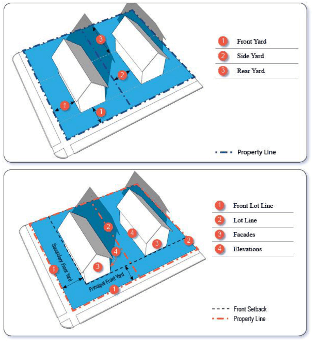
Yard, rear A yard extending the full width of the lot along the rear lot line and extending in depth from the nearest point on the rear lot line to the nearest point of the principal building or buildings.
Yard, side A yard extending from a front yard to the rear yard and from the nearest point of a side lot line to the nearest point of the principal building or buildings.
Yard sale The temporary sale of second hand goods held on a residential property and limited to 3 days in any 6-month period per residential building. Such sales are not considered to be commercial in character.
AppendixZoning Ordinance and Map Amendments
AppendixZoning Ordinance and Map Amendments
ZONING ORDINANCE AMENDMENTS
April 5, 2010
Ordinance # 04-2010
Section 10.1115.42 – Optional Payment In Lieu of Providing Required Off-Street Parking Spaces
▪ Changed “$5,000.00” to $2,000.00”
September 20, 2010
Ordinance # 07-2010
Section 10.1010 – Wetlands Protection
▪ In Sections 10.1016.10, 10.1016.20, 10.1016.30 and 10.1016.50, changed “use” to “use, activity and alteration” (or “use, activity or alteration” where appropriate), including plural forms
▪ In Section 10.1016.10 – Permitted Uses, inserted new item (6) for emergency power generator
▪ In Section 10.1017.30 – Application Review Procedure, subsection 10.1017.33, changed “The Planning Board” to “The Planning Board or the Planning Director”
▪ In Section 10.1018.10 – Stormwater Management, deleted reference to Innovative Stormwater Treatment Technologies Best Management Practices Manual and insert reference to New Hampshire Stormwater Manual
▪ In Section 10.1018.21, deleted the words “greater than 5,000 square feet” and replaced the words “As required by the Comprehensive Shoreland Protection Act, as amended” with “ 0’ – 25’ ” under “Vegetated Buffer Strip” and “ 25’ – 50’ ” under “Limited Cut Area”
October 18, 2010
Ordinance # 09-2010
Article 4 – Zoning Districts and Use Regulations
▪ In Section 10.440 – Table of Uses – Residential, Mixed Residential, Business and Industrial Districts, changed “N” to “P” for use #1.43 in the GA/MH district
Article 5 – Dimensional and Intensity Standards
▪ Insert new Section 10.522 – Multifamily Dwellings
▪ In Section 10.533 – Special Yard Requirements on Lafayette Road, inserted reference to Section 10.521
▪ In Section 10.570 – Accessory Buildings, Structures and Uses, replaced subsection 10.572 with new subsections 10.572, 10.573 and 10.576
Article 15 - Definitions
▪ Inserted new definition of “building length”
December 6, 2010
Ordinance # 11-2010
Article 5 – Dimensional and Intensity Standards
▪ Revised Section 10.517 – Roof Appurtenances and Other Rooftop Features
March 7, 2011
Ordinance # 03-2011
Article 7 – Flexible Development
▪ In Section 10.730 – Gateway Planned Development, revised subsection 10.735 – Sustainability Standards
May 21, 2012
Ordinance # 8-2012
Article 5 – Zoning Districts and Use Regulations
▪ In Section 10.440 – Table of Uses – Residential, Mixed Residential, Business and Industrial Districts, changed “S” to “CU” for Use #19.40 – Drive-through facility, as accessory use to a permitted use, in the GB, GW, B and OR districts
Article 8 – Supplemental Use Standards
▪ In Section 10.836 – Accessory Drive-Through Uses, revised subsections 10.836.20 and 10.836.30
May 21, 2012
Ordinance # 9-2012
Article 15 – Definitions
▪ In Section 10.1530 – Terms of General Applicability, revised the definition of “Museum”
August 6, 2012
Ordinance # 10-2012
Article 11 – Site Development Standards,
Section 10.1115 – Off-Street Parking Provisions in the Downtown Overlay District
▪ Deleted former paragraph 10.1115.12 and renumbered paragraph 10.1115.13 as 10.1115.12
▪ Revised subsection 10.1115.20 – Number of Required Off-Street Parking Spaces, paragraph 10.1115.21
▪ Deleted subsections 10.1115.30 – Optional Payment in Lieu of Providing Required Off-Street Parking Spaces, 10.1115.40 – Amount of Payment in Lieu, and 10.1115.50 – Procedure and Administration, and 10.1115.60 – Application of Provisions
January 7, 2013
Ordinance # 01-2013
Article 6 – Overlay Districts
Section 10.630 – Historic District
▪ Revised Section 10.633.20 – Exemptions from Certificate of Approval
Article 15 – Definitions
▪ In Section 10.1530 – Terms of General Applicability, inserted a definition for “contributing structure”
January 22, 2013
Ordinance # 02-2013
Article 5 – Dimensional and Intensity Standards
▪ In Section 10.535 – Exceptions to Dimensional Standards in the Central Business District, inserted new Section 10.535.12 – Central Business A and B – Maximum Elevation Above Street
April 15, 2013
Ordinance # 04-2013
Article 12 – Signs
▪ In Section 10.1230 – Sign Districts, moved the Business district from Sign District 3 to Sign District 4
▪ Revised Section 10.1242 – parapet signs and wall signs
▪ Revised Section 10.1251.10 – maximum aggregate sign area
▪ Revised Section 10.1251.20 – sign area for projecting signs in Sign District 3
▪ Revised Section 10.1271.10 – signs on building facing more than one street
▪ In Section 10.1290 – Sign Definitions, revised definition of “aggregate sign area”
April 15, 2013
Ordinance # 05-2013
Article 5 – Dimensional and Intensity Standards
▪ In Section 10.515.10 – Building Coverage and Yards, inserted new paragraph (c) re: mechanical systems
▪ Inserted new Section 10.516.40 – Projections Into Required Yards
Article 15 – Definitions
▪ In Section 10.1530 – Terms of General Applicability, inserted a definition for “portico”
April 15, 2013
Ordinance # 06-2013
Article 6 – Overlay Districts, Section 10.630 – Historic District
▪ Revised Section 10.635.20 – Work Sessions
September 16, 2013
Ordinance # 07-2013
Article 5 – Dimensional and Intensity Standards
▪ Revised Section 10.531 – Table of Dimensional Standards – Business and Industrial Districts (maximum structure height in the CBA and CBB districts)
▪ Inserted new Section 10.535.13 – Increased Building Height by Conditional Use Permit
Article 15 – Definitions, Section 10.1530 – Terms of General Applicability
▪ Inserted definitions for “story,” “half story” and “story above grade plane”
December 16, 2013
Ordinance # 13-2013
Article 6 – Overlay Districts, Section 10.630 – Historic District
▪ Inserted new Section 10.633.30 – Administrative Approval
▪ Amended Section 10.634.10 – Application Submission, to require electronic (PDF) submissions
▪ Amended Section 10.634.20 – Application Contents, regarding scaled plans and massing models
▪ Inserted new Section 10.635.35 regarding Consent Agendas
April 7, 2014
Ordinance # 01-2014
Article 5 – Dimensional and Intensity Standards
▪ Amended Section 10.535.13 – Increased Building Height by Conditional Use Permit
April 21, 2014
Ordinance # 02-2014
Article 5A – Character Districts
▪ Added entire new Article 5A including Regulating Plan maps
April 21, 2014
Ordinance # 03-2014
Articles 4, 6, 12 and 15 – Miscellaneous Amendments to Conform to Article 5A
▪ Amended Section 10.410 – Establishment and Purpose of Districts by adding references to the Character Districts.
▪ Inserted new Section 10.421.30 regarding maps incorporated in the Zoning Map by reference, including Character District Regulating Plan and Special Requirements Maps, Flood Insurance Rate Maps, and the “FAR Part 77 Imaginary Surfaces Plan.”
▪ Amended Section 10.641.10 by adding a reference to the Character Districts.
▪ Amended Sections 10.643.20 and 10.643.30 regarding off-street parking facilities on certain streets in the Downtown Overlay District.
▪ Amended Section 10.1230 by adding references to the Character Districts in Sign Districts 2 and 3.
August 18, 2014
Ordinance # 05-2014
Article 15 – Definitions
▪ Added definition of “building footprint”
November 17, 2014
Ordinance # 08-2014
Article 4 – Zoning Districts and Use Regulations
▪ Amended Section 10.440, use #1.30 Townhouses and #1.41 Multifamily Dwellings with 3 or 4 units to require a Special Exception within the GRA and GRB districts
January 5, 2015
Ordinance # 01-2015
Article 4 – Zoning Districts and Use Regulations
▪ Amended Section 10.440, use #15.20 – helipads and heliports
Article 15 – Definitions
▪ Added definitions of “helipad” and “heliport”
January 5, 2015
Ordinance # 02-2015
Article 11 – Site Development Standards
▪ Inserted new Section 10.1115.24 to exempt properties in the Downtown Overlay District from the required maximum number of parking spaces
July 20, 2015
Ordinance # 03-2015
Article 7 – Flexible Development
Section 10.730 – Gateway Planned Development
▪ Revised Section 10.734.20, front yard requirements
▪ Revised Section 10.734.33, maximum building height
▪ Revised Section 10.738.30, Modification of Standards
Article 15 – Definitions
▪ Added definitions of “affordable,” “workforce housing” and “workforce housing unit”
August 17, 2015
Ordinance # 06-2015
Article 5A – Character Districts
▪ Replace entire Article
▪ Articles 4, 6, 12 and 15 – Miscellaneous Amendments to Conform to Article 5A
December 21, 2015
Ordinance # 09-2015
Article 15 – Definitions
▪ Amended the definitions of “hotel” and “motel” to exclude gambling
January 25, 2016
Ordinance # 01-2016
Article 4 – Zoning Districts and Use Regulations
▪ Amended Section 10.440, use #1.70 – Manufactured housing park by adding a reference to supplemental regulations in Section 10.814
Article 5 – Dimensional and Intensity Standards
▪ Revised Section 10.531 – Table of Dimensional Standards – GA/MH by adding a reference to dimensional standards for manufactured housing parks in Section 10.814
Article 8 – Supplemental Use Standards
▪ Added Section 10.814 – Manufactured Housing Park Dimensional Standards
January 25, 2016
Ordinance # 02-2016
Article 10 – Environmental Protection Standards
▪ Amended Section 10.1016 Permitted Uses by adding uses on an approved Wetland Protection Plan
▪ Amended Section 10.1017 Conditional Uses by adding Section 10.1017.80 – Wetland Protection Plan
Article 15 – Definitions
▪ Amended the definition of “impervious surface”
April 25, 2016
Ordinance # 04-2016
Article 4 – Zoning Districts and Use Regulations
▪ Added Section 10.470 – Uses Permitted in the Transportation Corridor District
July 11, 2016
Ordinance # 05-2016
Article 5A – Character Districts
▪ Replaced entire Article
Articles 2, 4, 5, 6, 8, 11, 12 and 15
▪ Miscellaneous amendments to conform to revised Article 5A
January 9, 2017
Ordinance # 01-2017
Article 2 – Administration and Enforcement
▪ Section 10.236 – Extended the term of variances and special exceptions to two years
Article 3 – Nonconforming Lots, Buildings, Structures and Uses
▪ Section 10.320 – Amended provisions regarding nonconforming buildings and structures
Article 11 – Site Development Standards
▪ Sections 10.1113.31 and 10.1113.41 – Added the Gateway district to the tables of setback requirements for parking areas
Article 15 – Definitions
▪ Section 10.1530 – Amended the definition of “structure”
January 9, 2017
Ordinance # 02-2017
Article 5 – Dimensional and Intensity Standards
▪ Section 10.515.10 – Revised provisions related to measurement of yards
▪ Section 10.516.30 – Updated the district references for corner lot vision obstruction
▪ Section 10.516.40 – Revised the provisions regarding projections into required yards
Article 15 – Definitions
▪ Section 10.1530 – Amended the definition of “building coverage”
January 9, 2017
Ordinance # 03-2017
Article 5 – Dimensional and Intensity Standards
▪ Section 10.521 – Reduced the maximum building height for buildings with flat roofs from 35 feet to 30 feet in the Residential districts, and from 40 feet to 30 feet in the Mixed Residential districts
▪ Section 10.1530 – Added definitions for “flat roof” and “sloped roof”
January 9, 2017
Ordinance # 04-2017
Article 4 – Zoning Districts and Use Regulations
▪ Section 10.440 – Added accessory dwelling units and garden cottages as uses allowed by conditional use permit from the Planning Board
Article 8 – Supplemental Use Standards
▪ Added Sections 10.814 – Accessory Dwelling Units and 10.815 – Garden Cottages
Article 15 – Definitions
▪ Added definitions for “accessory dwelling unit”, “attached accessory dwelling unit”, “detached accessory dwelling unit”, and “garden cottage”
January 9, 2017
Ordinance # 05-2017
Article 5A – Character Districts
▪ Deleted Section 10.5A45 – Architectural Design Guidelines
Article 6 – Overlay Districts
▪ Added Section 10.632.30 referencing the design guidelines adopted by the Historic District Commission
▪ Amended Section 10.635.70(3) to reference the HDC’s design guidelines
▪ Amended Section 10.633.20 to revise and expand the list of activities that are exempt from HDC review and approval, and to clarify that such activities require administrative review and approval
January 9, 2017
Ordinance # 06-2017
Article 10 – Environmental Protection Standards
▪ Added Section 10.1013.40(e), to include a portion of the Piscataqua River shoreline as a jurisdictional area
▪ Amended Section 10.1016.10(4)(a) to clarify the allowance for expansion of single or two-family dwellings
▪ Added Section 10.1017.50(6) to require restoration of a vegetated buffer strip to the extent feasible
January 9, 2017
Ordinance # 07-2017
Article 12 – Signs
▪ Added Section 10.1263.60 regarding the type and manner of illumination of signs using direct illumination
▪ Amended definition of “changeable sign” in Section 10.1290
June 19, 2017
Ordinance 16-2017
Article 5A – Character-Based Zoning
▪ Added Section 10.5A46.23 to allowing for excess community space to be credited to another development in the same Incentive Overlay District
June 19, 2017
Ordinance 17-2017
Article 6 – Overlay Districts
▪ Amended Section 10.633.20 to add an exemption for kiosks, signs, and other site elements related to public parking in private parking lots authorized by a permit from the Department of Public Works
Article 12 – Signs
▪ Amended Section 10.1222.20 to exempt directional or information signs pertaining to public parking in a private lot authorized by a permit from the Department of Public Works
▪ Amended definition “Information Sign” in Section 10.1290
December 4, 2017
Ordinance 25-2017
Article 8 – Supplemental Use Standards
▪ Amend Section 10.814 and 10.815 by deleting the separate off-street parking requirements for accessory dwelling units and garden cottages.
▪ Amend Sections 10.814.80 and 10.815.60 to allow the Planning Board to require additional off-street parking spaces when granting a conditional use permit.
Article 11 – Site Development Standards
▪ Insert new section 10.1111.10 and renumber the existing sections 10.1111.10 and 10.1111.20 accordingly.
▪ Replace Section 10.1112 – Number of Required Parking Spaces.
▪ Amend the table in subsection 10.1115.21 of the Off-Street Parking Provisions for the Downtown Overlay District to reduce parking space requirements for residential uses and add a requirement for conference or banquet facilities that are part of a hotel or motel.
▪ Insert a new Section 10.1116 – Bicycle Parking
Article 15 – Definitions
▪ Amend Section 10.1530 – Terms of General Applicability by deleting “single-family” from the definition of townhouse and adding new definitions for driveway, maneuvering aisle, and maximum occupancy.
December 4, 2017
Ordinance 26-2017
Article 4 – Zoning Districts and Use Regulations
▪ Delete Gateway (GW) under Business Districts from Section 10.410 Establishment and Purpose of Districts and add new Districts as follows: Gateway Neighborhood Mixed Use Corridor (G1) and Gateway Neighborhood Mixed Use Center (G2).
▪ Remove Gateway (GW) and add G1 and G2 to Section 10.440 Table of Uses – Residential, Mixed Residential, Business and Industrial Districts.
Article 5 – Dimensional and Intensity Standards
▪ Amend Table 10.531 Table of Dimensional Standards to remove references to Gateway District.
▪ Remove reference to Section 10.730 in Section 10.533.
Article 5A – Character-Based Zoning
▪ Add the following new building types to Figure 10.5A43.60: Cottage, Paired House, Gateway Townhouse, Mixed Use Building, Small Flex Space/Fabrication Building, and Community Building
▪ Add the following Façade Types to Figure 105A43.10: Dooryard, Terrace, Gallery, and Arcade
▪ Add the following Community Space Types to Figure 10.5A45.10: Recreation Field or Court, Common or Green, Community Garden, Outdoor Dining Café, and Courtyard
▪ Amend the Definitions in Section 10.5A60 to revise the definitions of block, community space, and front building setback, and add new definitions for building stepback, development site, development site area, and public realm.
Article 5B – Gateway Neighborhood Mixed Use Districts
▪ Add new Article and amend Zoning Map.
Article 7 – Flexible Development
▪ Delete Section 10.730 Gateway Planned Development.
Article 15 – Definitions
▪ Amend the definitions for building coverage and coverage and add new definition for open space coverage.
August 20, 2018
Ordinance # 03-2018
Article 4 – Zoning Districts and Use Regulations
▪ Change use 3.512 (indoor performance facility with occupancy less than 500 to be allowed by Special Exception in the Business District and Character District 4-West End
▪ Add new accessory use #19.50 Outdoor dining or drinking area to be permitted permitted (P) in CD5, CD4, GB, G1, and G2 and allowed by conditional use permit (CUP) in CD4-L2, B, and CD4-W
Article 5A – Character-Based Zoning
▪ Insert new section 10.5A42.40 North Mill Pond Public View Corridors to be located at Dover Street
▪ Amend Table 10.5A46.10 – Incentives to Development Standards regarding minimum ground story height, minimum off-street parking, ground story parking, and maximum building footprint for properties in the CD4-W district within 200’ of the North Mill Pond.
▪ Amend Section 10.5A46.20 – Requirements to Receive Incentives to the Development Standards to clarify 10.5A46.21 public greenway requirements for lots within 100 feet of the North Mill Pond or Piscataqua River.
Article 15 – Definitions
▪ Amend definition of building block length to include public greenway.
August 20, 2018
Ordinance # 04-2018
Article 5A – Character-Based Zoning
▪ Amend Table 10.5A46.10 – Incentives to Development Standards regarding maximum building block length and maximum building footprint in the CD4-L1 and CD4-L2 Districts.
▪ Amend section 10.5A42.40 North Mill Pond Public View Corridors to include Cabot Street, Cornwall Street, and Langdon Street.
August 20, 2018
Ordinance # 05-2018
Article 5A – Character-Based Zoning
▪ Amend Figure 10.5A41.10A Development Standards to add new building and façade types originally added for the Gateway Districts to the Character Districts
▪ Amend the definitions of Façade Types in Figure 10.5A43.10
▪ Amend the definitions of Building Types in Figure 10.5A43.60
▪ Amend the definitions of Community Spaces in Figure 10.5A45.10
October 15, 2018 (effective date January 1, 2019)
Ordinance #09-2018
Article 6 – Overlay Districts
▪ Insert a new Section 10.613.60 for Highway Noise Overlay District
▪ Insert a new Section 10.670 for Highway Noise Overlay District
▪ Ordinance to be in effect as of January 1, 2019
Article 15 – Definitions
▪ Amend terms of general applicability to insert new definitions related to the Highway Noise Overlay District.
▪ Ordinance to be in effect as of January 1, 2019
February 4, 2019
Ordinance #01-2019
Article 11 – Site Development Standards, Section 10.1110 – Off Street Parking
▪ Delete existing Section 10.1112.52 and insert a new Section 10.1112.14 regarding requirements for granting of a conditional use permit
▪ Amend Section 10.1112.21 to remove reference to shopping center
▪ Amend Section 10.1112.323 to remove reference to Site Plan Review process
▪ Amend Section 10.1115.21 to apply same residential requirements to Downtown Overlay District as listed in Section 10.1112.30
February 4, 2019
Ordinance #02-2019
Article 2 – Administration and Enforcement
▪ Insert a new Section 10.240 for Conditional Use Permits
February 4, 2019
Ordinance #03-2019
Article 12 – Signs
▪ Amendments to Sections 10.1210, 10.1222, 10.1224, 10.1225 regarding content neutrality
▪ Insert new Section 10.1223 regarding Temporary Signs
▪ Add Gateway Neighborhood Mixed Use Districts to Sign Districts Section 10.1232
▪ Amendments to Section 10.1242 to clarify parapet and walk sign requirements for buildings facing multiple streets
▪ Amend Section 10.1243 to remove reference to shopping center
▪ Amend Section 10.1251.30 to add dimensional requirements for multiple freestanding signs on a lot
▪ Insert new Section 10.1251.40 regarding illuminated projection signs
▪ Amend Section 10.1271 to clarify requirements regarding signs on more than one façade of a building
▪ Amend Section 10.1290 Sign Definitions to incorporate changes made for content neutrality
March 4, 2019
Ordinance #05-2019
Article 8 – Supplemental Use Standards
▪ Delete existing Sections 10.814 – Accessory Dwelling Units and 10.815 – Garden Cottages and insert in their place new Sections 10.814 and 10.815 with revisions to clarify and adjust zoning compliance requirements for lots, design standards, Planning Board findings, and owner-occupancy.
Article 15 – Definitions
▪ Revise definitions for accessory building or structure, attached accessory dwelling unit, detached accessory dwelling unit, and principal building.
▪ Add new definitions for principal dwelling and principal dwelling unit.
December 2, 2019
Ordinance #19-2019
Article 10 – Environmental Protection Standards
▪ Amendments to Section 10.1010 – Wetlands Protection including requirements for fencing clarifying the characterization of impacts to the wetland and buffer, adding information related to the compensatory removal of impervious surface and the requirements for a wetland buffer enhancement plan, providing guidance on living shorelines for tidal areas and use of porous pavement in the wetland buffer, and delineating wetland buffer areas.
December 16, 2019
Ordinance #20-2019
Article 6 – Overlay Districts
▪ Add new “extended flood hazard area” and requirements and standards for this area.
▪ Update definitions and other sections to be consistent with requirements of National Flood Insurance Program.
▪ Add requirement for new construction in the special flood hazard to be built 2-feet above the BFE.
▪ Amend definition of “substantial improvement” to lower the value of improvements from 50% of market value to 40% of market value.
Article 15 – Definitions
▪ Amend list of definitions to conform with Article 6.
January 11, 2021
Ordinance #1-2021
Article 6 – Overlay Districts
▪ Update study and map references to January 29, 2021.
▪ Change definition of new construction to comply with National Flood Insurance Program requirements.
▪ Add reasonableness qualifier to construction standards requirements.
October 24, 2022
Ordinance #06-2022
Amendments to Article 5A – Character-Based Zoning
▪ Amended Section 10.5A21B to change the building height standards map.
▪ Amended Section 10.5A2120 to clarify apportioning the building height standards.
▪ Amended Section 10.5A43.32 to modify roof appurtenances.
Amendments to Article 15 – Terms of General Applicability
▪ Amended Section 10.1530 to modify the definition on building height, lot line, mansard roof, penthouse, and short story.
▪ Amended Section 10.1530 to add new definitions for average existing and finished grade planes, public place, and Urban Districts.
May 1, 2023
Ordinance #04-2023
Amendments to Article 4 – Zoning Districts and Use Regulations
▪ Amended Section 10.430 to add Administrative Approval.
▪ Amended Section 10.440 to add Accessory Dwelling Unit Categories and remove Garden Cottage.
Amendments to Article 8 – Supplemental Use Standards
▪ Amended Section 10.814 to revise section on accessory dwelling units.
▪ Amended Section 10.815 to delete section on garden cottages.
Amendments to Article 11 – Site Development Standards
▪ Amended Section 10.1113.20 to include language referencing accessory dwelling units.
▪ Amended Section 10.1116.14 to delete garden cottage reference
Amendments to Article 15 – Terms of General Applicability
▪ Amended Section 10.1530 to modify the definition on building height, lot line, mansard roof, penthouse, and short story.
▪ Amended Section 10.1530 to add new definitions for average existing and finished grade planes, public place, and Urban Districts.
▪ Amend Section 10.1530 to delete definition for garden cottage.
August 7, 2023
Ordinance #07-2023
Amendments to Article 5A – Character-Based Zoning
▪ Amended Section 10.5A43.30 subsection 10.5A43.33 to revise section on incentives for building and story heights.
▪ Amended Section 10.5A.43.40 subsections 10.5A43.41-44 to revise section on incentives for maximum building footprint.
▪ Amended Section 10.5A45 subsection Figures 10.5A45.10 Community Spaces to add four new community space types.
▪ Amended Section 10.5A46.20 subsections 10.5A46.21-22 to revise the requirements to receive incentives.
Amendments to Article 15 – Terms of General Applicability
▪ Amended Section 10.1530 to modify the definition of building footprint.
May 6, 2024
Ordinance #04-2024
Amendments to Article 4 – Zoning Districts and Use Regulations
▪ Amended Section 10.0440, Table of Uses, Section 11.20, 11.21, 19.60 and 19.70.
Amendments to Article 8 – Supplemental Use Standards
▪ Amended Section 10.810 and Section 10.843.
Amendments to Article 11 – Site Development Standards
▪ Amended Section 10.11112.20 and Section 10.1112.32 to add language about electric vehicle parking requirements.
Amendments to Article 15 – Terms of General Applicability
▪ Amended Section 10.1530 to add definitions for EV, EV fueling space A and B and modify definition for motor vehicle service station.
June 17, 2024
Ordinance #05-2024
Amendments to Article 4 – Zoning Districts and Use Regulations
▪ Amended Section 10.0440, Table of Uses, Section 19.22.
Amendments to Article 15 – Terms of General Applicability
▪ Amended Section 10.1530 to revise the definitions of home occupation 1 and home occupation 2.
July 15, 2024
Ordinance #06-2024
Amendments to Article 6 – Overlay Districts
▪ Amended Section 10.633.20, Exemptions from Certificate of Approval subsection (7) and added subsection (28).
▪ Amended Section 10.633.30 Administrative Approvals, Section 10.634.20 Application Contents, adding Section 10.634.24, amended Section 10.636.32(1) – Public Hearings and Section 10.636.12 – Notice of Disapproval.
Amendments to Article 15 – Terms of General Applicability
▪ Amended Section 10.1530 to revise the definition of Code Official and add definitions for Character Defining Architectural Features, Minimally Visible, Not Visible, Roof-mounted solar energy system, and Way.
August 19, 2024
Ordinance #08-2024
Amendments to Article 5A – Character-Based Zoning
▪ Amended Section 10.5A43.33, Building and Story Heights to revise section on incentives for lots over one acre in size.
November 18, 2024
Ordinance #11– 2024
Amendments to Article 6 – Overlay Districts
▪ Added Section 10.680 Gateway Neighborhood Overlay District
March 17, 2025
Ordinance #03- 2025
Amendments to Article 5, Measurement Rules
▪ Delete Section 10.515.14
▪ Amend Section 10.515.13 to change 6 feet in height to 8 feet in height for fences.
Amendments to Article 8, Supplemental Use Standards
▪ Added Section 10.811.60 and 10.811.61 relating to Accessory Uses to Permitted Residential Uses
May 5, 2025
Ordinance #06- 2025
Amendments to Article 8 – Supplemental Use Standards
▪ Added Section 10.815 to add standards for Coliving.
Amendments to Article 15 – Definitions
▪ Delete definition of Family and add definitions for coliving, coliving facility, coliving common area and coliving unit.
February 17, 2026
Ordinance #01- 2026
Amendments to Article 5- Dimensional and Intensity Standards
▪ Added mechanical system as exempt from yards and building coverage
▪ Added 5-foot setback for power generators
Amendments to Article 15 – Definitions
▪ Added definitions for mechanical system and power generator.
▪ Revised definition of structure.
February 17, 2026
Ordinance #02- 2026
Amendments to Article I - Purpose and Applicability, Section 10.122 (1), Sustainability Objectives
▪ Revised Goal 1
Amendments to Article 4- Zoning and Use Regulations
▪ Section 10.440 - amending Table of Uses by adding Ground Mounted Solar Energy Systems
Amendments to Article 8- Supplemental Use Standards, Section 10.811 – amending Accessory Uses to Permitted Residential Uses
▪ Added roof- and ground-mounted solar energy systems to this section
Amendments to Article 15 – Definitions
▪ Added definitions for solar energy system, roof-mounted and ground-mounted solar energy system
February 17, 2026
Ordinance #03- 2026
Amendments to Article 8- Supplemental Use Standards, Section 10.814 – Accessory Dwelling Units, to comply with state law
Amendments Article 4- Zoning and Use Regulations, Section 10.440- amending Table of Uses for Accessory Dwelling Units to comply with state law
February 17, 2026
Ordinance #04- 2026
Amendments to Article 11 Site Development Standards, Section 10.1112.311
▪ Revise parking requirements for dwelling units to comply with state code
March 16, 2026
Ordinance #05- 2026
Amendments to Article 4 Zoning Districts and Use Regulations, Section 10.440, Use 3.40 “Museum” to be changed from “S” Special Exception to “P”, Permitted in Gateway Neighborhood Mixed Use Corridor (G1) and G2.
September 28, 2026
Ordinance #15- 2026
Amendments to Article 2 regarding notice requirements for Zoning Board of Adjustment. Amendments to Article 2 and Article 10 related to expiration and extension of Conditional Use Permits.
October 26, 2026
Ordinance # - 2026
Amendments related to moving parking regulations to the Site Plan Review Regulations include the following sections: Article 2, Administration and Enforcement, Section 10.232, Special Exceptions, Section 10.240, Conditional Use Permits and Section 10.244, Conditions of Approval; Article 5A, Character-Based Zoning, Section 10.5A44, Off-Street Parking and Loading Requirements, Section 10.5A44.20, Number of Required Spaces; Article 5B, Gateway Neighborhood Mixed Use District, Section 10.5B80, Parking and Loading Requirements and Standards, Section 10.5B82, Number of Required Spaces, Section 10.5B83, Location of Motor Vehicle Parking Facilities; Article 6, Overlay Districts, Section 10.685, Parking; Article 8, Supplemental Standards, Section 10.815.30, Parking Requirements; Article 11, Site Development Standards, Section 10.1110, Off-Street Parking, Section 10.1112, Number of Required Spaces, Section 10.1113, Location of Vehicular Use Facilities, Section 10.1114, Design of Off-Street Parking Facilities, Section 10.1115, Off-Street Parking Provisions in the Downtown Overlay District, Section 10.1116, Bicycle Parking and Section 10.1120, Off-Street Loading.
ZONING MAP AMENDMENTS
June 21, 2010
Ordinance # 06-2010
Map 201, Lots 3, 4, 5, 6, 7 and 8 (1–6 Sagamore Grove) rezoned from Waterfront Business to Single Residence B
October 18, 2010
Ordinance # 08-2010
Map 285, Lot 12 (2700 Lafayette Road) rezoned from Municipal to Gateway
June 6, 2011
Ordinance # 8-2011
Portion of Map 116, Lot 44 rezoned from Municipal to Mixed Residence Office
November 13, 2012
Ordinance # 17-2012
Map 105, Lot 19 (143 Daniel Street) rezoned from Municipal to Central Business B and Downtown Overlay District
April 21, 2014
Ordinance # 02-2014
New Zoning Map adopted for Character Districts, comprising the following maps:
▪ Map 10.5A21A – Regulating Plan
▪ Map 10.5A21B – Special Requirements: Specific Building Height Requirement Areas
▪ Map 10.5A21C – Special Requirements: Shopfront, Officefront, Step Frontage, and Frontage Buildout and Special Use Requirement Areas
July 20, 2015
Ordinance # 03-2015
Rezoned the following lots from Industrial, Office Research and Municipal to Gateway:
▪ Assessors Map 163, Lots 33, 34 and 37
▪ Assessors Map 165, Lots 1, 2 and 14
▪ Assessors Map 172, Lots 1 and 2
▪ Assessors Map 173, Lots 2 and 10
August 17, 2015
Ordinance # 06-2015
New Zoning Map adopted for Character Districts, comprising the following maps:
▪ Map 10.5A21A – Character Districts and Civic Districts
▪ Map 10.5A21B – Building Height Standards
▪ Map 10.5A21C – Special Requirements for Façade Types, Front Lot Line Buildout & Uses
December 21, 2015
Ordinance # 08-2015
Portion of Map 201, Lot 1 rezoned from Waterfront Business to Single Residence B
April 25, 2016
Ordinance # 04-2016
Amend the Zoning Map by rezoning the following lots or parts thereof to the Transportation Corridor District:
▪ Assessors Map 165 Lot 14
▪ Assessors Map 234 Lot 2A
▪ Part of Assessors Map 164 Lot 4 (100-foot wide corridor, measured from the southeasterly property line)
▪ Assessors Map 125 Lot 20
▪ Assessors Map 124 Lot 13
▪ Assessors Map 119 Lot 3
▪ Part of Assessors Map 119 Lot 5 (50-foot wide corridor, measured from the southwesterly property line)
July 11, 2016
Ordinance # 05-2016
New Zoning Map adopted for Character Districts, comprising the following maps:
▪ Map 10.5A21A – Character Districts and Civic Districts
▪ Map 10.5A21B – Building Height Standards
▪ Map 10.5A21C – Special Requirements for Façade Types, Front Lot Line Buildout & Uses
Rezoned the following lots from Character District 4-L1, Mixed Residence Business, Business and Central Business B to General Residence C:
▪ Assessors Map 126, Lots 27, 28, 31 and 32
▪ Assessors Map 138, Lots 34, 48, 48-1, 48-2, 49, 50, 51, 52, 53, 55, 56, 57, 58 and 59
▪ Assessors Map 139, Lots 2, 3, 4, 5 and 6
▪ Assessors Map 144, Lot 40
▪ Assessors Map 145, Lots 14, 19, 20, 21, 29 and 30
▪ Assessors Map 146, Lots 19, 20, 21, 22 and 23
▪ Assessors Map 147, Lots 22, 23,24, 25, 26, 27, 28, 29, 30 and 30A
▪ Assessors Map 156, Lots 24 and 35
▪ Assessors Map 157, Lots 10, 11, 12,13 and 14
December 4, 2017
Ordinance # 26-2017
Rezoned the following lots from Gateway to Gateway Neighborhood Mixed Use Corridor (G1):
▪ Assessors Map 163 Lot 33
▪ Assessors Map 163 Lot 34
▪ Assessors Map 163 Lot 37
▪ Assessors Map 165 Lot 2
▪ Assessors Map 172 Lot 1
▪ Assessors Map 172 Lot 2
▪ Assessors Map 173 Lot 2
▪ Assessors Map 173 Lot 10
▪ Assessors Map 229 Lot 8
▪ Assessors Map 229 Lot 9
▪ Assessors Map 229 Lot 8B
▪ Assessors Map 243 Lot 1
▪ Assessors Map 243 Lot 2
▪ Assessors Map 243 Lot 5
▪ Assessors Map 243 Lot 6
▪ Assessors Map 243 Lot 67
▪ Assessors Map 243 Lot 67-1
▪ Assessors Map 244 Lot 3
▪ Assessors Map 244 Lot 5
▪ Assessors Map 244 Lot 6
▪ Assessors Map 244 Lot 8
▪ Assessors Map 245 Lot 1
▪ Assessors Map 245 Lot 2
▪ Assessors Map 245 Lot 3
▪ Assessors Map 245 Lot 4
▪ Assessors Map 267 Lot 0
▪ Assessors Map 267 Lot 2
▪ Assessors Map 267 Lot 28
▪ Assessors Map 268 Lot 98
▪ Assessors Map 272 Lot 2
▪ Assessors Map 272 Lot 3
▪ Assessors Map 272 Lot 4
▪ Assessors Map 272 Lot 6
▪ Assessors Map 272 Lot 7
▪ Assessors Map 272 Lot 9-4
▪ Assessors Map 272 Lot 9-5
▪ Assessors Map 272 Lot 9-6
▪ Assessors Map 272 Lot 10
▪ Assessors Map 273 Lot 0
▪ Assessors Map 273 Lot 1
▪ Assessors Map 273 Lot 2-1
▪ Assessors Map 273 Lot 2-2
▪ Assessors Map 273 Lot 2-4
▪ Assessors Map 273 Lot 2-50
▪ Assessors Map 273 Lot 3
▪ Assessors Map 273 Lot 6
▪ Assessors Map 285 Lot 2
▪ Assessors Map 285 Lot 12
▪ Assessors Map 285 Lot 13
▪ Assessors Map 285 Lot 15
▪ Assessors Map 285 Lot 16-1
▪ Assessors Map 285 Lot 16-2
▪ Assessors Map 285 Lot 15A
▪ Assessors Map 286 Lot 0
▪ Assessors Map 286 Lot 2
▪ Assessors Map 286 Lot 17
▪ Assessors Map 286 Lot 18
▪ Assessors Map 286 Lot 19
▪ Assessors Map 286 Lot 20
▪ Assessors Map 286 Lot 21
▪ Assessors Map 286 Lot 22
▪ Assessors Map 286 Lot 23
▪ Assessors Map 286 Lot 26-1
▪ Assessors Map 286 Lot 26-3
▪ Assessors Map 286 Lot 22A
▪ Assessors Map 291 Lot 1
▪ Assessors Map 291 Lot 4
▪ Assessors Map 291 Lot 5
▪ Assessors Map 291 Lot 6
▪ Assessors Map 291 Lot 8
▪ Assessors Map 291 Lot 9
▪ Assessors Map 297 Lot 0
▪ Assessors Map 297 Lot 1
▪ Assessors Map 297 Lot 2
▪ Assessors Map 297 Lot 3
▪ Assessors Map 297 Lot 4-1
▪ Assessors Map 297 Lot 4-2
▪ Assessors Map 297 Lot 5
▪ Assessors Map 297 Lot 6
▪ Assessors Map 297 Lot 8
▪ Assessors Map 297 Lot 9
▪ Assessors Map 297 Lot 10
▪ Assessors Map 298 Lot 7
▪ Portions of Assessors Map 297 Lot 11, Map 297 Lot 5A, Map 298 Lot 1, Map 298 Lot 2, Map 298 Lot 3, Map 298 Lot 4, Map 298 Lot 5, Map 298 Lot 6, Map 215 Lot 9, Map 239 Lot 8, Map 272 Lot 1, Map 272 Lot 9, Map 273 Lot 5, Map 244 Lot 1, Map 244 Lot 2
Rezoned the following lots from Gateway to Gateway Neighborhood Mixed Use Center (G2):
▪ Assessors Map 251 Lot 124
▪ Assessors Map 251 Lot 125
▪ Assessors Map 252 Lot 2
▪ Assessors Map 252 Lot 3
▪ Assessors Map 252 Lot 4
▪ Assessors Map 252 Lot 5
▪ Assessors Map 252 Lot 7
▪ Assessors Map 252 Lot 8
▪ Assessors Map 253 Lot 1
▪ Assessors Map 253 Lot 2
▪ Assessors Map 253 Lot 3
▪ Assessors Map 253 Lot 4
▪ Assessors Map 253 Lot 5
▪ Assessors Map 253 Lot 5-1
▪ Assessors Map 253 Lot 9
▪ Assessors Map 253 Lot 11
▪ Assessors Map 253 Lot 12
▪ Assessors Map 253 Lot 13
▪ Assessors Map 253 Lot 14
▪ Assessors Map 253 Lot 2A
Rezoned the following lots from General Business to Gateway Neighborhood Mixed Use Corridor (G1):
▪ Assessors Map 215 Lot 5
▪ Assessors Map 215 Lot 7
▪ Assessors Map 215 Lot 10
▪ Assessors Map 215 Lot 11
▪ Assessors Map 215 Lot 12
▪ Assessors Map 215 Lot 13
▪ Assessors Map 215 Lot 14
▪ Assessors Map 216 Lot 3
▪ Assessors Map 238 Lot 2
▪ Assessors Map 238 Lot 3
▪ Assessors Map 238 Lot 10-2
▪ Assessors Map 238 Lot 15
▪ Assessors Map 238 Lot 16
▪ Assessors Map 238 Lot 17
▪ Assessors Map 238 Lot 20
▪ Assessors Map 239 Lot 2
▪ Assessors Map 239 Lot 3
▪ Assessors Map 239 Lot 7-1
▪ Assessors Map 239 Lot 7-2
▪ Assessors Map 239 Lot 7-3
▪ Assessors Map 239 Lot 9
▪ Assessors Map 239 Lot 10
▪ Assessors Map 239 Lot 11
▪ Assessors Map 239 Lot 13
▪ Assessors Map 239 Lot 13-1
▪ Assessors Map 239 Lot 13-2
▪ Assessors Map 239 Lot 15
▪ Assessors Map 239 Lot 16
▪ Assessors Map 239 Lot 18
▪ Assessors Map 267 Lot 1
▪ Assessors Map 267 Lot 3
▪ Assessors Map 272 Lot 8
▪ Assessors Map 285 Lot 14
▪ Assessors Map 286 Lot 1
▪ Portions of Assessors Map 217 Lot 1, Map 217 Lot 2A
Rezoned the following lots from General Business to Gateway Neighborhood Mixed Use Center (G2):
▪ Assessors Map 218 Lot 22
▪ Assessors Map 218 Lot 24
▪ Assessors Map 218 Lot 25
▪ Assessors Map 218 Lot 28
▪ Assessors Map 218 Lot 29
▪ Assessors Map 218 Lot 30
▪ Assessors Map 218 Lot 32
▪ Assessors Map 218 Lot 33
▪ Assessors Map 218 Lot 34
▪ Assessors Map 218 Lot 38
▪ Assessors Map 218 Lot 39
Rezoned the following lots from Single Residence B to Gateway Neighborhood Mixed Use Center (G2):
▪ Assessors Map 210 Lot 2
▪ Assessors Map 210 Lot 3
▪ Assessors Map 210 Lot 4
▪ Assessors Map 210 Lot 5
Rezoned the following lots from Garden Apartment / Mobile Home to Gateway Neighborhood Mixed Use Corridor (G1):
▪ Assessors Map 239 Lot 12
Rezoned the following lots from Single Residence A to Gateway Neighborhood Mixed Use Corridor (G1):
▪ A portion of Assessors Map 239 Lot 8
August 20, 2018
Ordinance # 03-2018
Amendments to the Character-Based Zoning Regulation Plan Maps (Maps 10.5A21A) to change Assessors Map 157 Lots 1 and 2 from Office Research (OR) to Character District 4 West End (CD4-W) and a portion of Assessors Map 164 Lot 4 from OR and Transportation Corridor (TC) to CD4-W
Amendments to the Character-Based Zoning Regulation Plan Maps (Maps 10.5A21B) to extend the West End Overlay District and add new Building Height Standards for Assessors Map 157 Lots 1 and 2 and a portion of Assessors Map 164 Lot 4
August 20, 2018
Ordinance # 04-2018
Amendments to the Character-Based Zoning Regulation Plan Maps (Maps 10.5A21A) to change a portion of Assessor Map 164 Lot 4 from Office Research (OR) and Transportation Corridor (TC) to CD4-L1
Amendments to the Character-Based Zoning Regulation Plan Maps (Maps 10.5A21B) to extend the West End Overlay District and add new Building Height Standards for a portion of Assessors Map 164 Lot 4
October 15, 2018 (effective date January 1, 2019
Ordinance #09-2018
Amend the Zoning Map to add a new High Noise Overlay District including the following lots or parts thereof:
• Lots within 500 feet of the centerline of I-95 or NH 16 except land subject to the Pease
Development Authority’s land use regulations
February 19, 2019
Ordinance #04-2019
Rezoned Map 213, Lot 1 (290 Gosling Rd) from Waterfront Industrial (WI) to Office Research (OR).
May 20, 2019
Ordinance #06-2019
Rezoned Map 126, Lot 12 (15 Middle St) from CIVIC District to Character District 4 (CD4) and from no height standard to 2-3 stories (40’).
October 24, 2022
Ordinance #06-2022
Amendments to Article 5A – Character-Based Zoning
▪ Amended Section 10.5A21B to change the building height standards map.
August 7, 2023
Ordinance #07-2023
Amendments to Article 5A – Character-Based Zoning
▪ Amended Section 10.5A21B to change the building height standards map.
April 15, 2024
Ordinance #03 - 2024
Rezoned the following lots from Office Research (OR) to Gateway Neighborhood Mixed Use Corridor (G1):
▪ Assessors Map 267 Lot 4
▪ Assessors Map 267 Lot 5
▪ Assessors Map 267 Lot 6
▪ Assessors Map 267 Lot 7
▪ Assessors Map 267 Lot 8
▪ Assessors Map 252 Lot 1
▪ Assessors Map 252 Lot 1-7
▪ Assessors Map 234 Lot 3
▪ Assessors Map 234 Lot 7-7
▪ Assessors Map 234 Lot 2
Rezoned the following lots from Garden Apartment/Mobile Home Park (GA/MH) to Gateway Neighborhood Mixed Use Corridor (G1):
▪ Assessors Map 291 Lot 1-1
▪ Assessors Map 285 Lot 1
Rezoned the following lots from General Business (GB) to Gateway Neighborhood Mixed Use Corridor (G1):
▪ Assessors Map 234 Lot 7-6
▪ Assessors Map 234 Lot 5
▪ Assessors Map 234 Lot 6
▪ Assessors Map 234 Lot 51
▪ Assessors Map 174 Lot 12
▪ Assessors Map 174 Lot 13
▪ Assessors Map 175 Lot 11
▪ Assessors Map 175 Lot 4
▪ Assessors Map 175 Lot 5
▪ Assessors Map 236 Lot 35
▪ Assessors Map 236 Lot 34
▪ Assessors Map 236 Lot 33 (portion of)
▪ Assessors Map 236 Lot 36
▪ Assessors Map 236 Lot 39
▪ Assessors Map 237 Lot 56 (portion of)
▪ Assessors Map 237 Lot 57
Rezoned the following lots from Single Residence B (SRB) to Gateway Neighborhood Mixed Use Corridor (G1):
▪ Assessors Map 243 Lot 66
▪ Assessors Map 229 Lot 6
▪ Assessors Map 229 Lot 6A
▪ Assessors Map 268 Lot 97
Rezoned the following lots from Mixed Residential Business (MRB) to Gateway Neighborhood Mixed Use Corridor (G1):
▪ Assessors Map 217 Lot 1 (portion of)
▪ Assessors Map 217 Lot 2A (portion of)
Rezoned the following lot from General Residence A (GRA) to Gateway Neighborhood Mixed Use Corridor (G1):
▪ Assessors Map 174 Lot 14
Rezoned the following lots from Industrial (I) to Gateway Neighborhood Mixed Use Corridor (G1):
▪ Assessors Map 273 Lot 5
Rezoned the following lots from Industrial (I) and General Residence A (GRA) to Gateway Neighborhood Mixed Use Corridor (G1):
▪ Assessors Map 173 Lot 9
Rezoned the following lots from Single Residence B (SRB) to Gateway Neighborhood Mixed Use Center (G2):
▪ Assessors Map 246 Lot 1
Rezoned the following lots from Office Research (OR) and Gateway Neighborhood Mixed Use Corridor (G1) to Garden Apartment/Mobile Home Park (GA/MH):
▪ Assessors Map 215 Lot 9
November 18, 2024
Ordinance #11 – 2024
Amend the Zoning Map to add a new Gateway Neighborhood Overlay District.
March 17, 2025
Ordinance #04 – 2025
Amend the Zoning Map to remove Assessors Map 152 Lot 2-1 from the Historic District Overlay.
September 24, 2025
Ordinance #11 – 2025
Amend the Zoning Map to remove Assessors Map 152 Lot 2-1 from the Historic District Overlay.
Rezoned the following lots from Character District 5 (CD5) to Character District 4 (CD4)
▪ Assessors Map 138 Lot 62
▪ Assessors Map 138 Lot 63
Change the boundary of the North End Incentive Overlay District (NEIOD) by removing the following lots:
▪ Assessors Map 138 Lot 60-2
▪ Assessors Map 138 Lot 62
▪ Assessors Map 125 Lot 16
▪ Assessors Map 138 Lot 63
▪ Assessors Map 138 Lot 60-3 (portion of)
Amend the boundary of the Downtown Overlay District (DOD) by removing the following lots:
▪ Assessors Map 138 Lot 60
▪ Assessors Map 138 Lot 60-1 (portion of)
▪ Assessors Map 138 Lot 60-2
▪ Assessors Map 138 Lot 60-3
▪ Assessors Map 138 Lot 61
▪ Assessors Map 138 Lot 62
▪ Assessors Map 138 Lot 63
▪ Assessors Map 164 Lot 4
▪ Assessors Map 125 Lot 17-1
▪ Assessors Map 125 Lot 16 (portion of)
▪ Assessors Map 125 Lot 17 (portion of)
Add a building height standard of 2-3 stories (40 feet) along Rock Street to the cul-de-sac at Foundry Place for the following lots:
▪ Assessors Map 138 Lot 63
▪ Assessors Map 138 Lot 60-2
▪ Assessors Map 138 Lot 60-3
March 16, 2026
Ordinance #05 – 2026
Amend the Zoning Map to change Assessors Map 209 Lot 87 from Single Residence B (SRB) to Gateway Neighborhood Center (G-2)
April 6, 2026
Ordinance #06 – 2026
Rezone the following lots:
From Office Research (OR) to Gateway Neighborhood Mixed Use Corridor (G1)
▪ Assessors Map 219, Lot 63
From Industrial (I) to Gateway Neighborhood Mixed Use Corridor (G1)
▪ Assessors Map 285, Lot 4
▪ Assessors Map 285, Lot 9
▪ Assessors Map 285, Lot 11-A2
▪ Assessors Map 285, Lot 11-B
▪ Assessors Map 285, Lot 16-3
From Industrial (I) to Gateway Neighborhood Mixed Use Center (G2)
▪ Assessors Map 253, Lot 6
▪ Assessors Map 253, Lot 7
▪ Assessors Map 253, Lot 8
From Mixed Residential Business (MRB) to Gateway Neighborhood Mixed Use Corridor (G1)
▪ Assessors Map 268, Lot 13
October 13, 2026
Ordinance #0 – 2026
The following parcels are proposed to be removed from the Historic District:
City Tax Map 127 Lot 27 City Tax Map 128 Lot 2 City Tax Map 128 Lot 3 City Tax Map 134 Lot 31 City Tax Map 134 Lot 32 City Tax Map 134 Lot 33 City Tax Map 134 Lot 34 City Tax Map 134 Lot 38 City Tax Map 135 Lot 5 City Tax Map 135 Lot 6 City Tax Map 135 Lot 10 City Tax Map 135 Lot 13 City Tax Map 135 Lot 14 City Tax Map 135 Lot 15 City Tax Map 135 Lot 22 City Tax Map 135 Lot 39 City Tax Map 135 Lot 40 City Tax Map 135 Lot 46 City Tax Map 135 Lot 47 City Tax Map 135 Lot 48 City Tax Map 135 Lot 70 City Tax Map 135 Lot 71 City Tax Map 136 Lot 1 City Tax Map 136 Lot 2 City Tax Map 136 Lot 5 City Tax Map 136 Lot 24 City Tax Map 136 Lot 25 City Tax Map 136 Lot 38 City Tax Map 136 Lot 40 City Tax Map 136 Lot 41 City Tax Map 136 Lot 42 City Tax Map 147 Lot 8 City Tax Map 147 Lot 9 City Tax Map 147 Lot 13 City Tax Map 147 Lot 14 City Tax Map 147 Lot 22 City Tax Map 147 Lot 24 City Tax Map 147 Lot 25 City Tax Map 148 Lot 19 City Tax Map 148 Lot 20 City Tax Map 148 Lot 22-2 City Tax Map 148 Lot 26 City Tax Map 148 Lot 28 City Tax Map 148 Lot 38 City Tax Map 148 Lot 42 City Tax Map 148 Lot 43 City Tax Map 148 Lot 44 City Tax Map 148 Lot 45 City Tax Map 148 Lot 63 City Tax Map 149 Lot 42
City Tax Map 149 Lot 43
City Tax Map 149 Lot 60
City Tax Map 152 Lot 50
City Tax Map 153 Lot 1
The following parcels are proposed to be added in their entirety to the Historic District.
City Tax Map 127 Lot 8 City Tax Map 127 Lot 13 City Tax Map 127 Lot 15 City Tax Map 127 Lot 16 City Tax Map 127 Lot 28 City Tax Map 135 Lot 1 City Tax Map 135 Lot 2 City Tax Map 135 Lot 3 City Tax Map 136 Lot 16 City Tax Map 136 Lot 17 City Tax Map 136 Lot 20 City Tax Map 136 Lot 22 City Tax Map 147 Lot 19 City Tax Map 148 Lot 24 City Tax Map 148 Lot 29 City Tax Map 148 Lot 30 City Tax Map 149 Lot 62 City Tax Map 152 Lot 44 City Tax Map 153 Lot 8 City Tax Map 153 Lot 9